
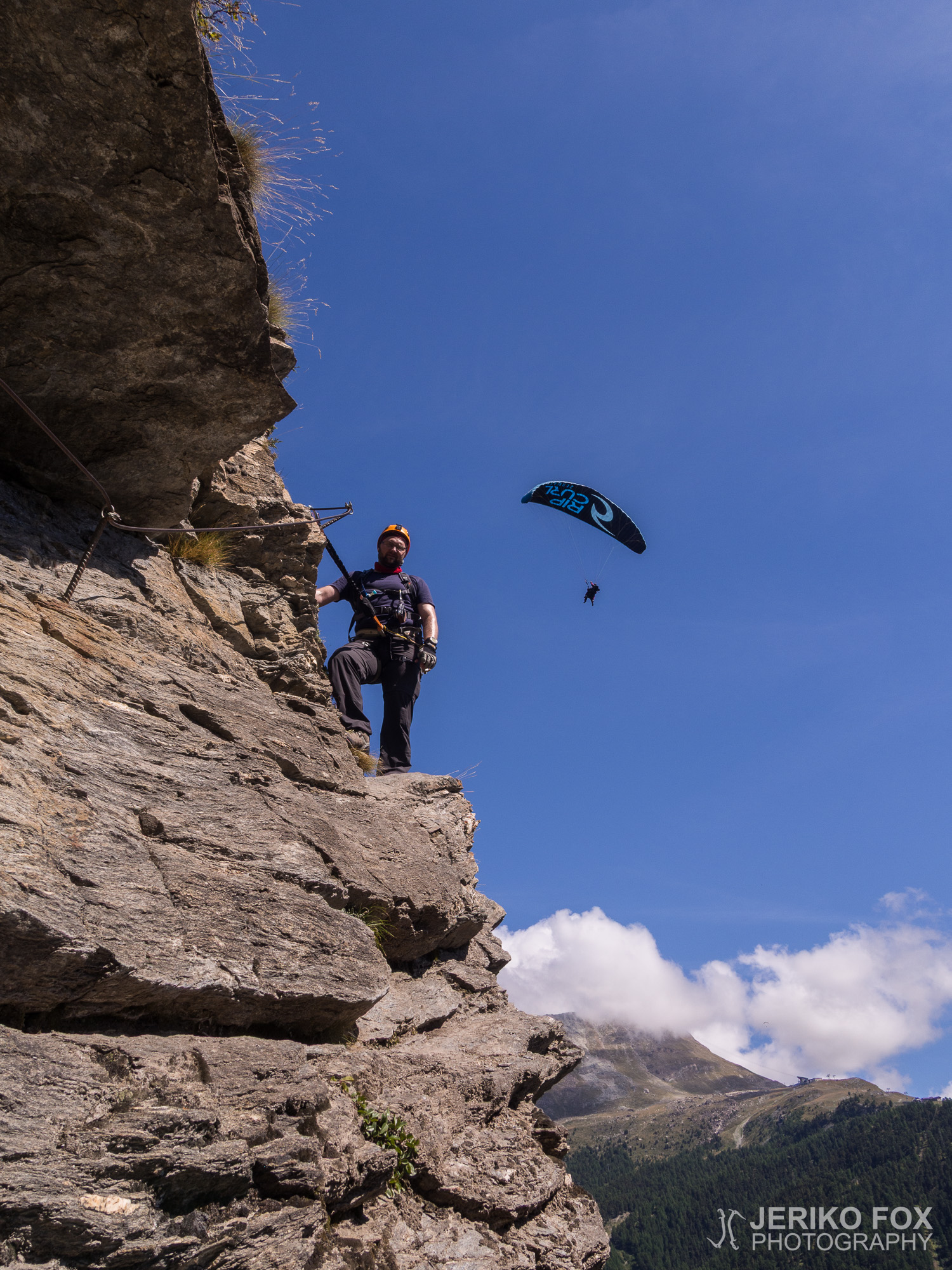
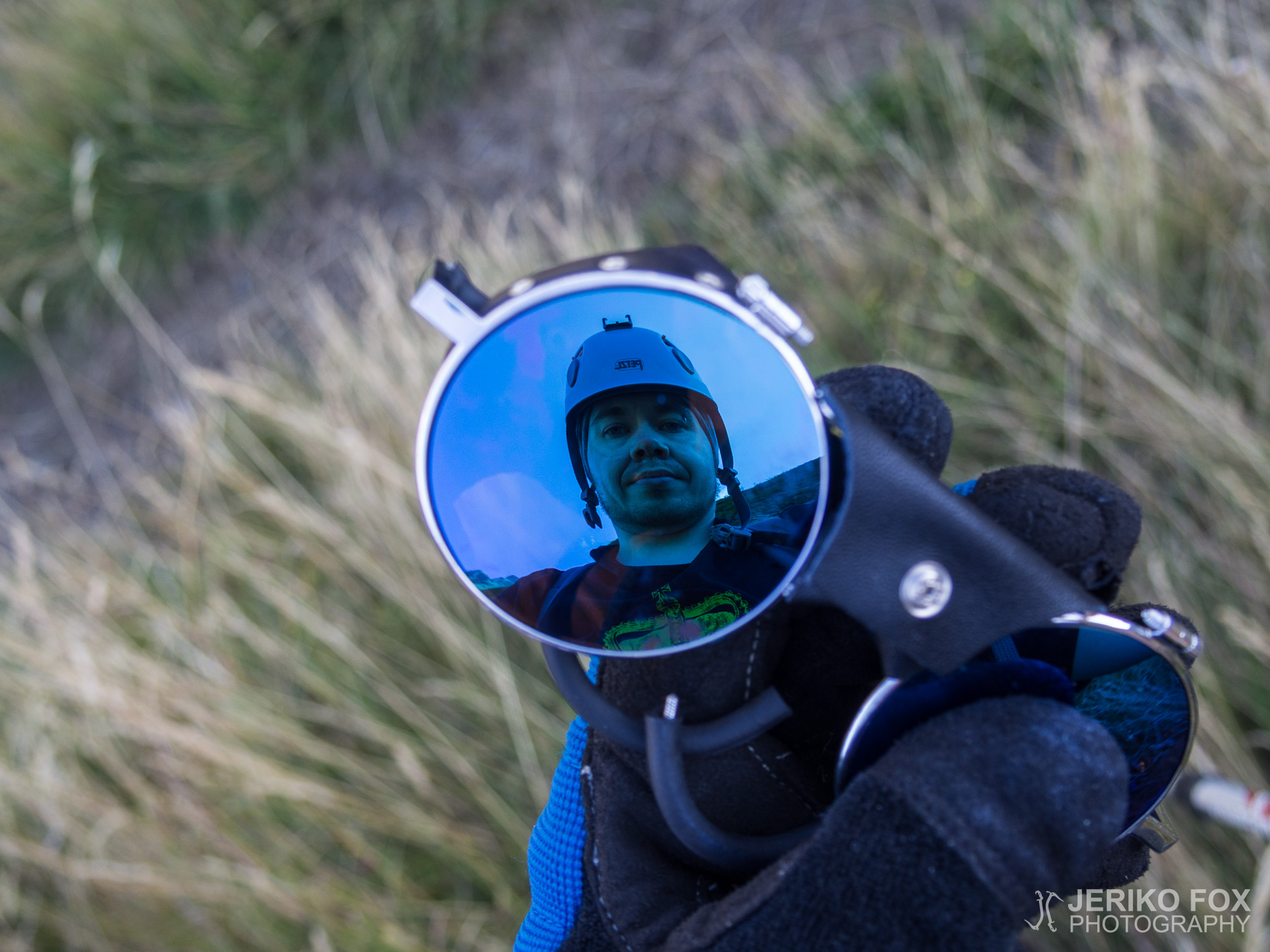
The first sunny day in Zermatt we decided to climb something fun and laid-back, since we didn’t quite succeed doing an alpine start. In addition I had burned my arms pretty badly while climbing the Jubiläumsgrat and my skin was full of small blisters from upper arms to wrists. I was a bit concerned that those might get infected, why staying near the human habitation was generally a good idea. On the rock face directly above our apartment is set probably the only (or at least one of the few) via Ferrata route in the area. It is a project that was originally sponsored by Mammut. It’s likely that the route was built the (non-climbing) tourists in mind, who usually hire a professional guide. Since for independent climbers there are plenty of mountains to go around.
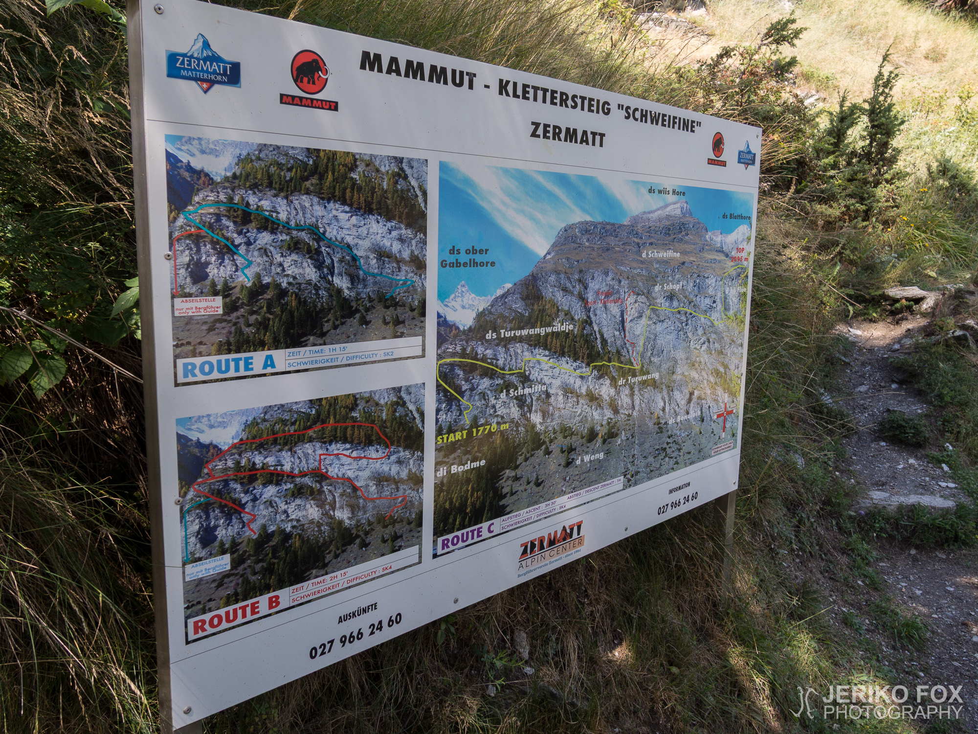
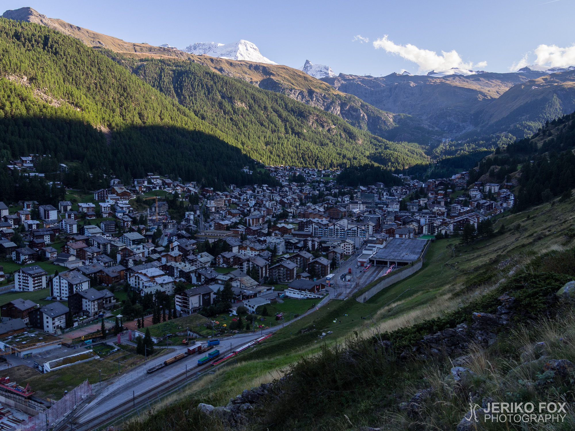
The trail that leads to the beginning of the actual climbing route starts from few blocks away from the train station, from the curve of the Bodmenstrasse. After a short hike the trail divides to the left, over the river Triftbach and to the Pension Edelweiss that stands on a cliff, and to the right towards the via Ferrata. There is a large sign that has all the three VF-routes drawn over the images of the rock face: the route A is graded as easy, and the route B and route C are medium difficulty (follow the links to get route descriptions in PDF format or routes as GPX/KML files for navigation). I will write more about the grades later. Route A has also an abseiling spot, where seems to be an auto-belay device, but it’s only allowed to use when accompanied by a guide. Since the route C was the longest and most difficult and covered the most of the routes A and B, it was the obvious choice for us.
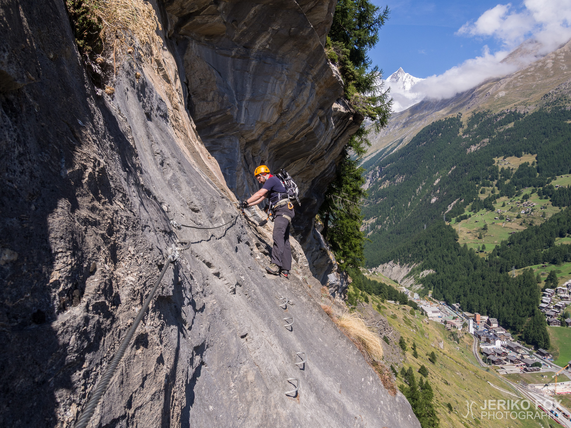
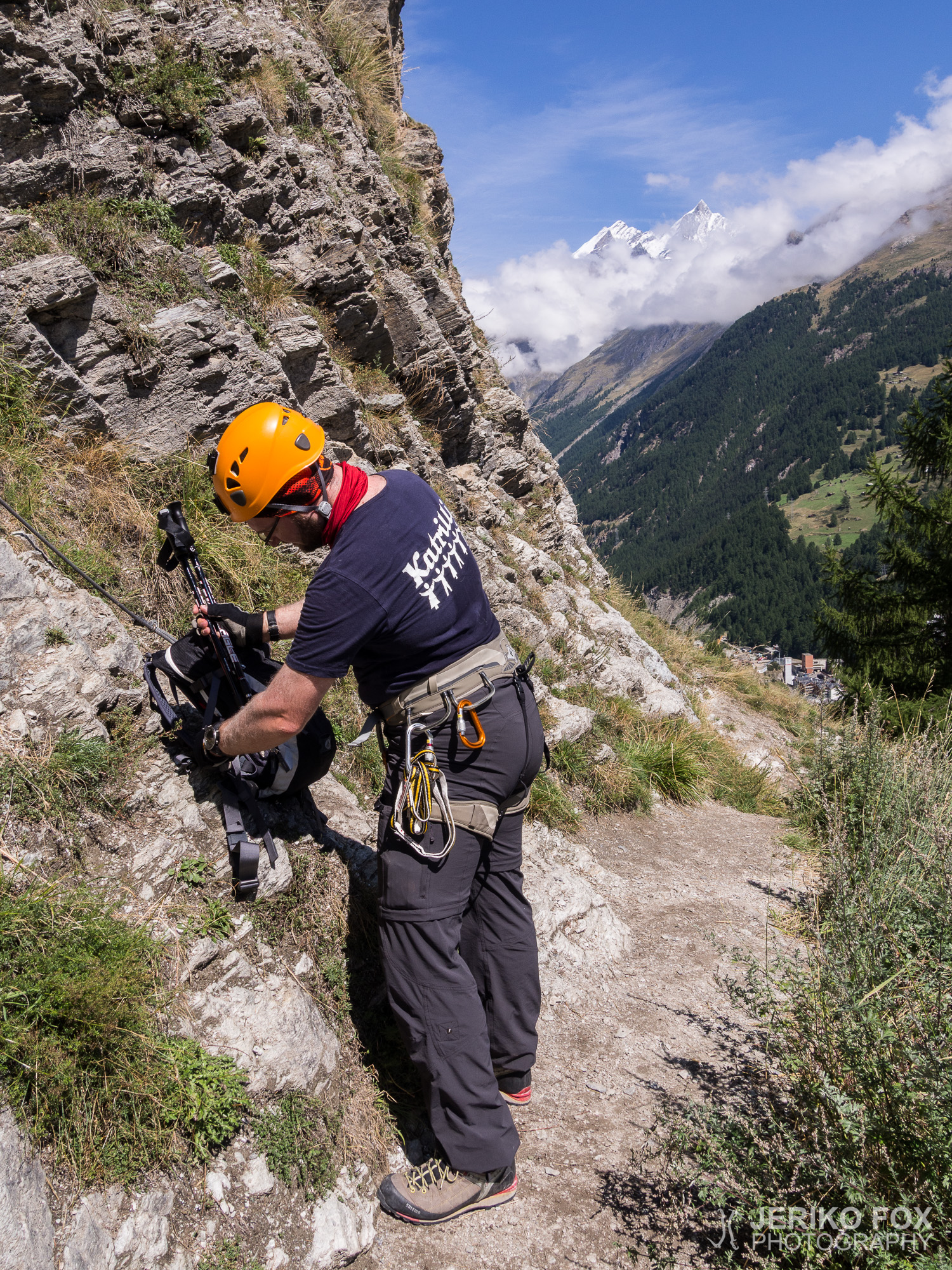
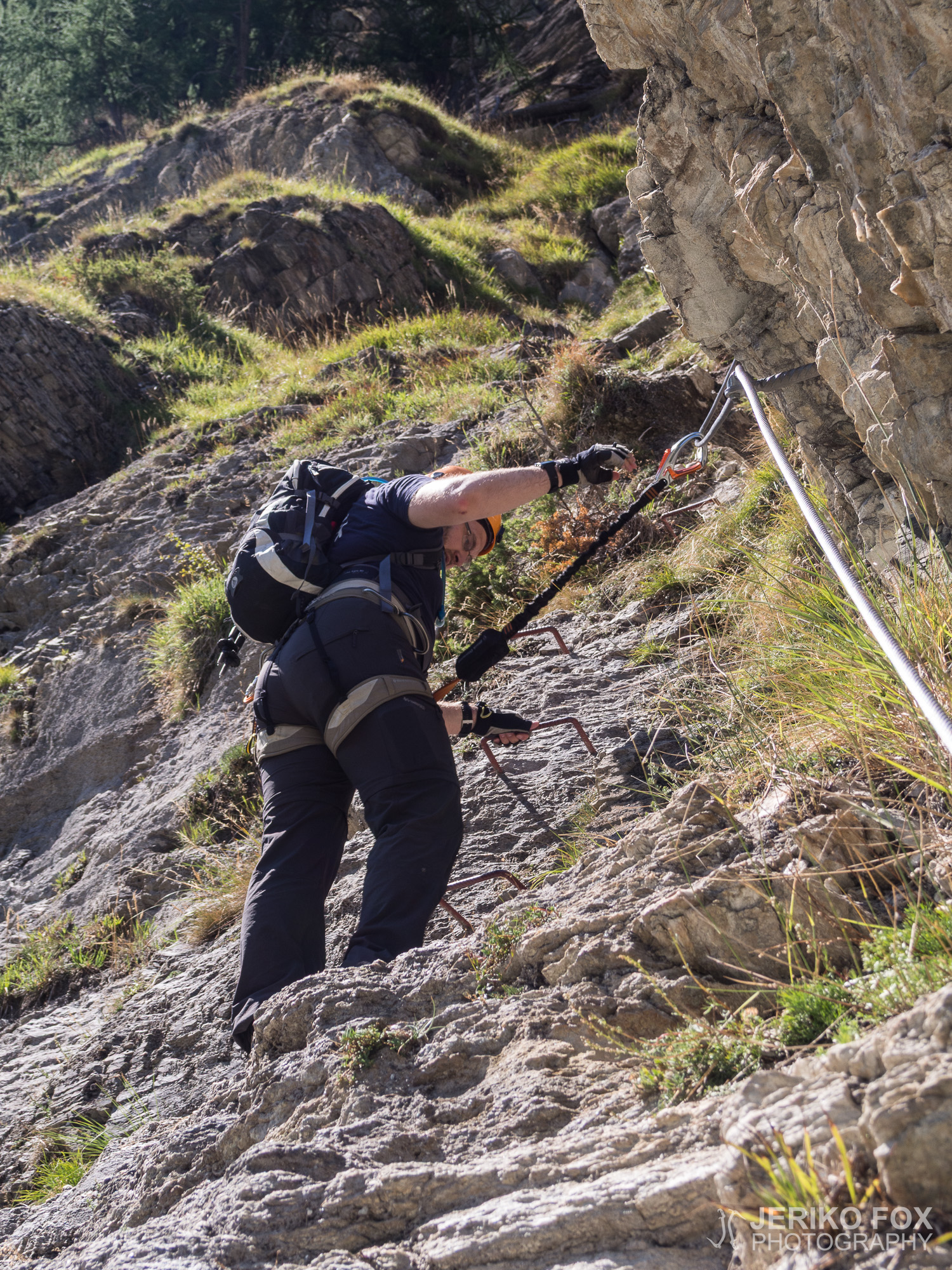
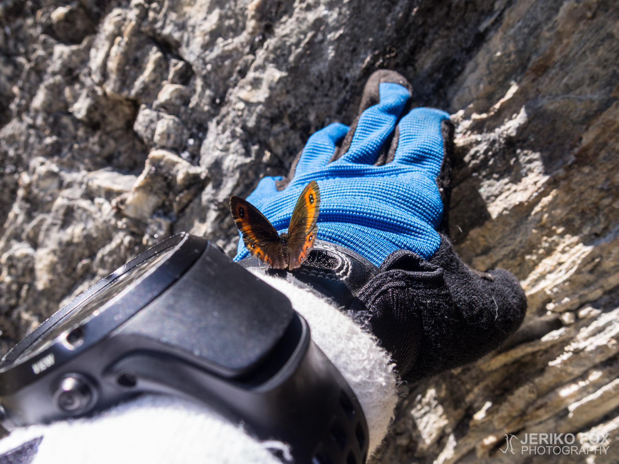
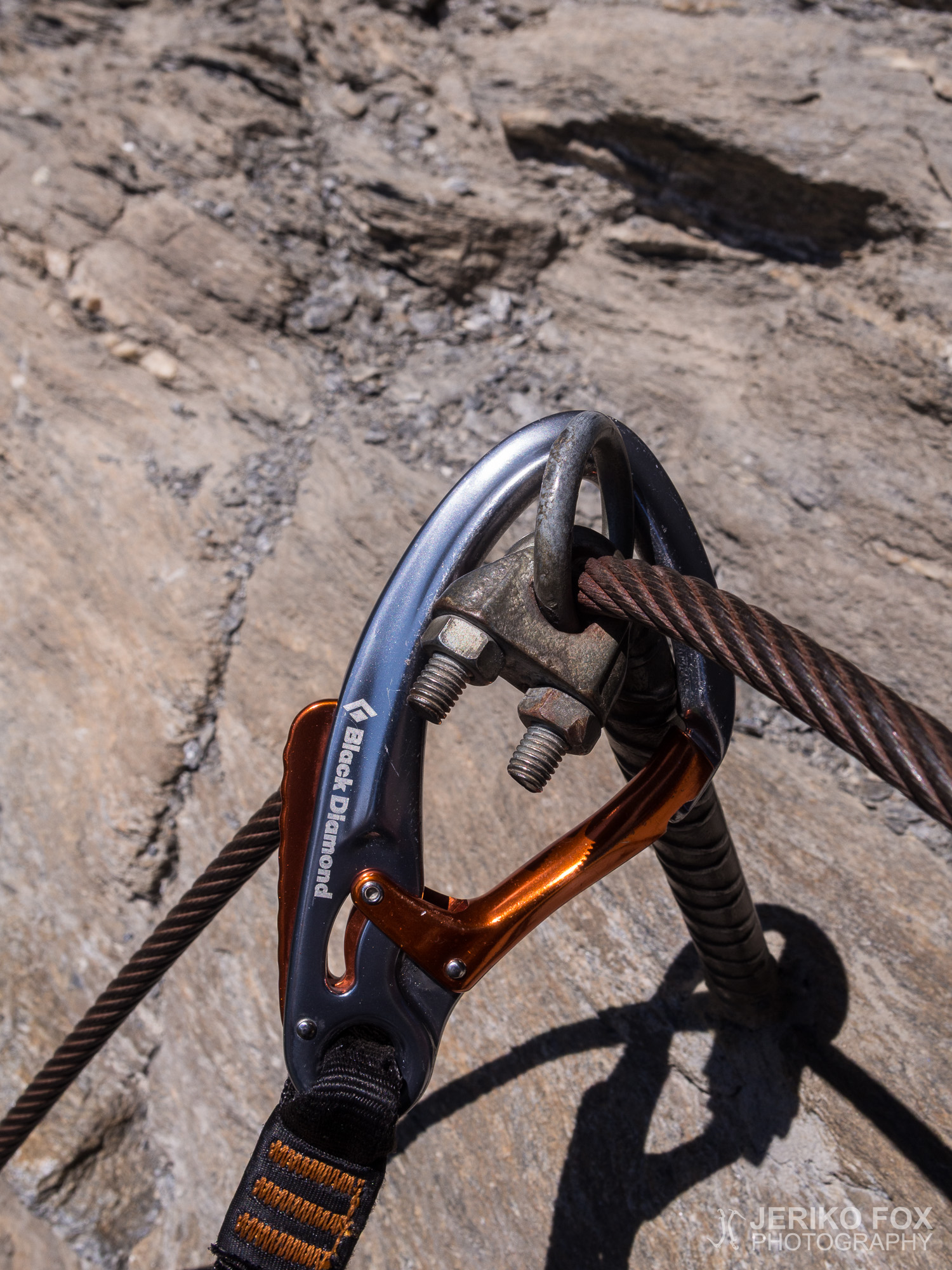
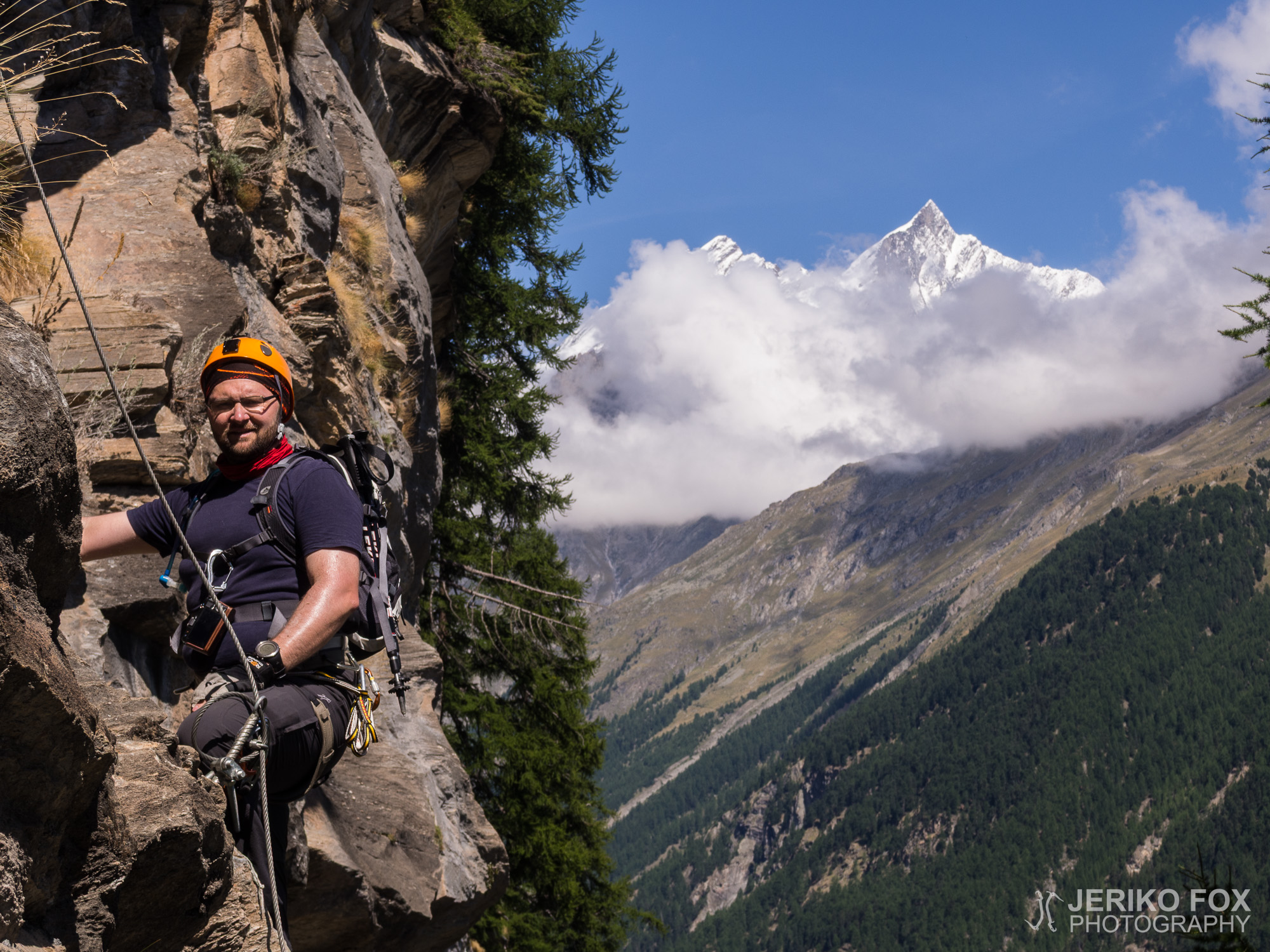
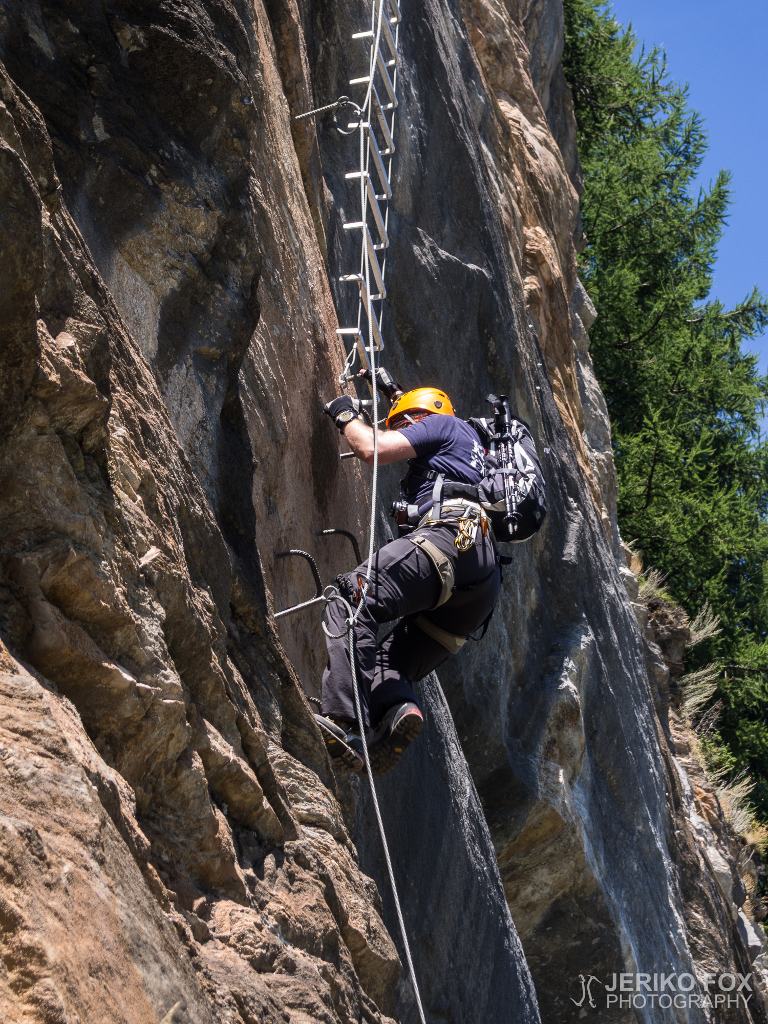
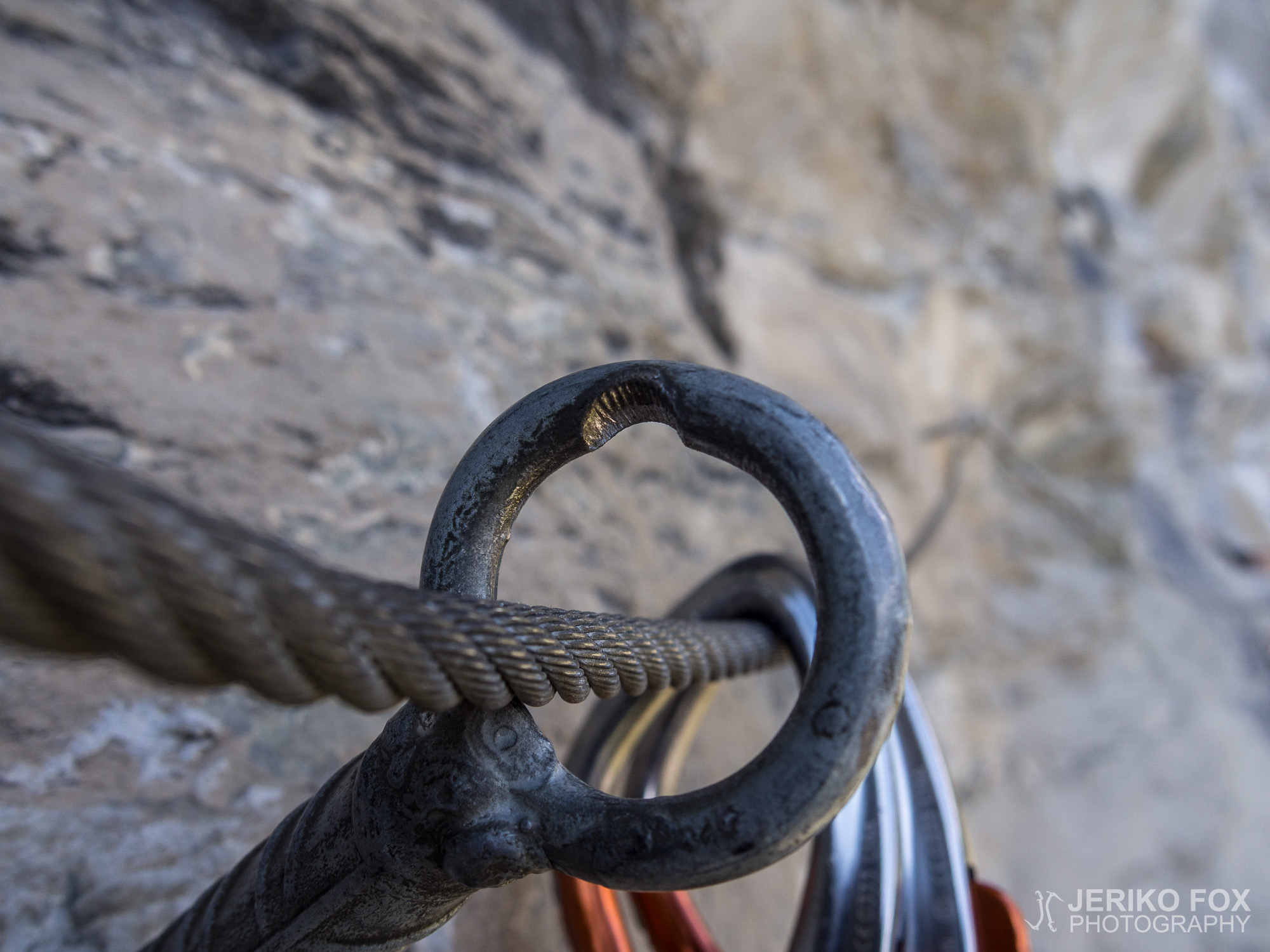
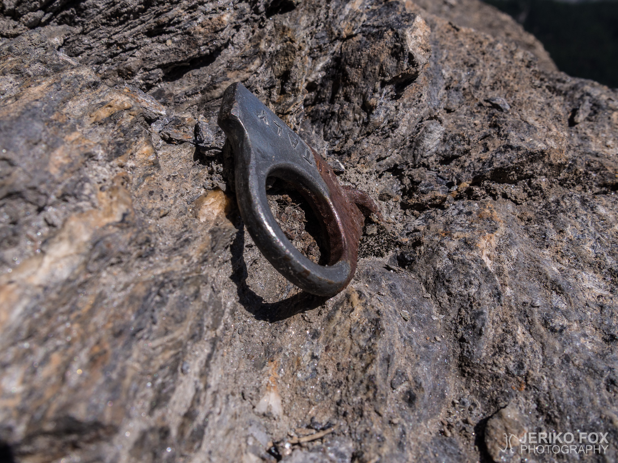
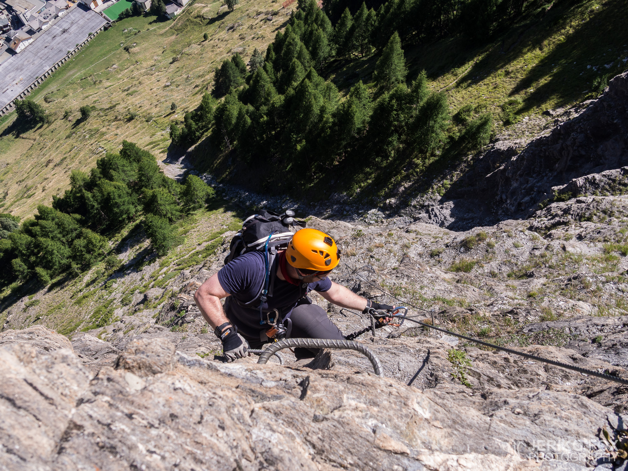
Surrounded by curious butterflies me and Dima started to climb the first wall. We paid attention to the detail that the wires were considerably thinner and looser than the ones we have seen in Germany. Loose wires are not necessarily a problem, but ill-stretched wires tend to move in quite unexpected manner. Another weakness of the construction was the anchor points that attach the wire to the rock. The ones in Austria and Germany are usually a simple thick iron bar with a loop where the wire runs through. This route has a thin rod with a some kind of tightener for the wire. During the day, especially on vertical sections, I got stuck with the anchor dozens of times (after already passing it). At least my Black Diamond Easy Rider (that I consider as the best VF kit) has large enough carabiners to slip over the anchor and stuck in it. Sometimes I was able to release it by yanking the strings or by nudging it with my foot, but often I had to down climb to the anchor and “escort” the carabiners until I was far enough from the anchor. Even though the carabiners have the safety lock, I wish not to kick them in order to be able to proceed.
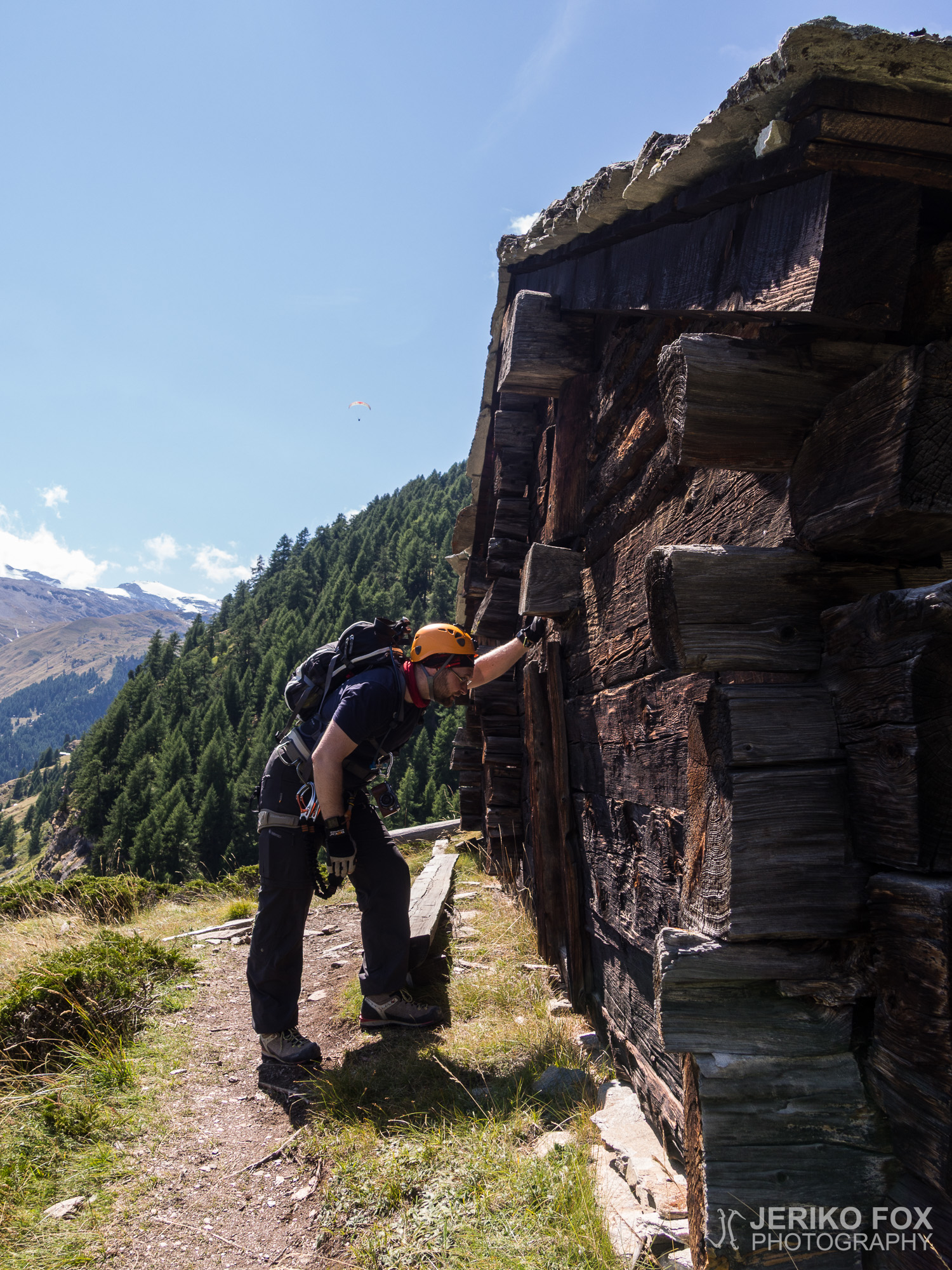
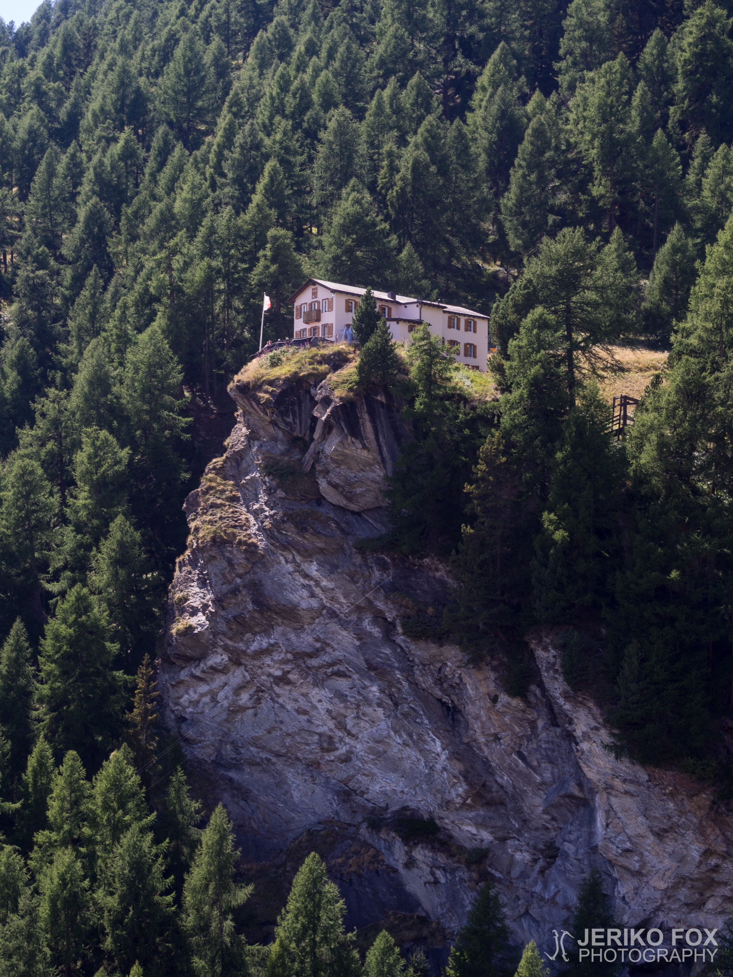
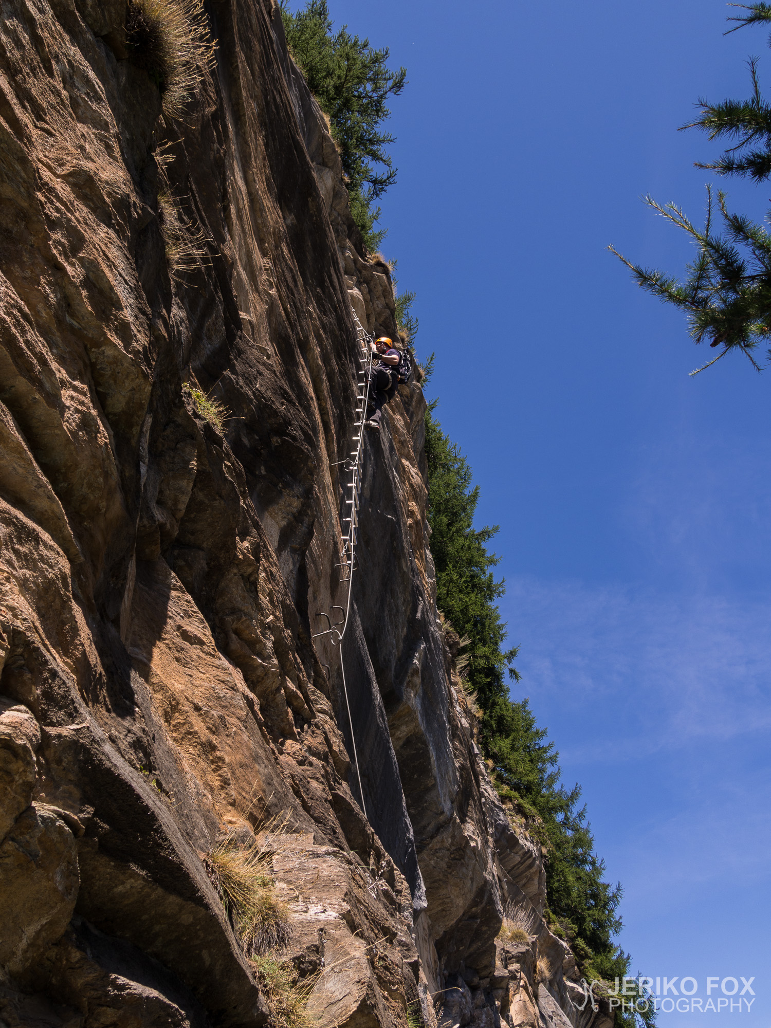
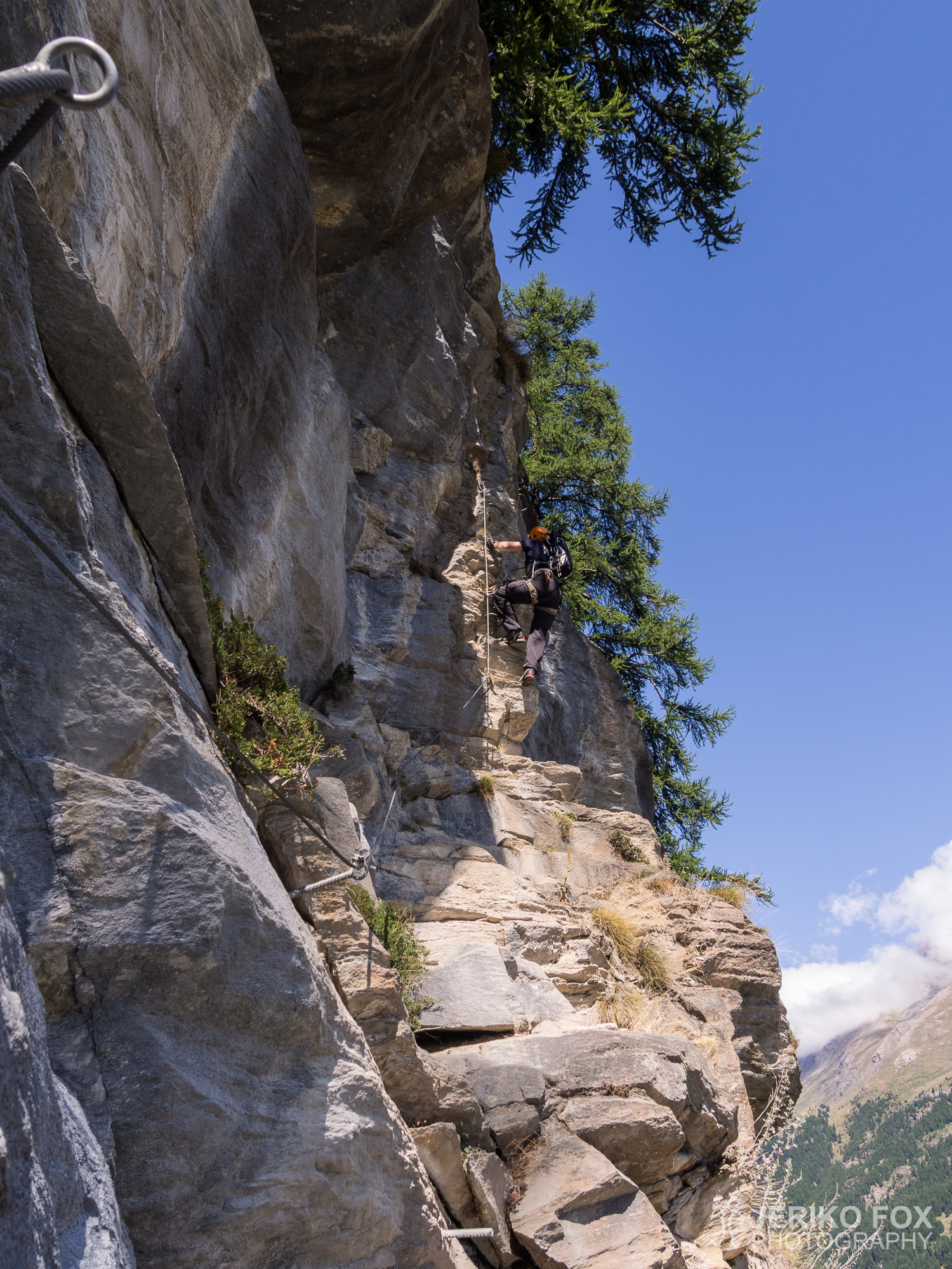
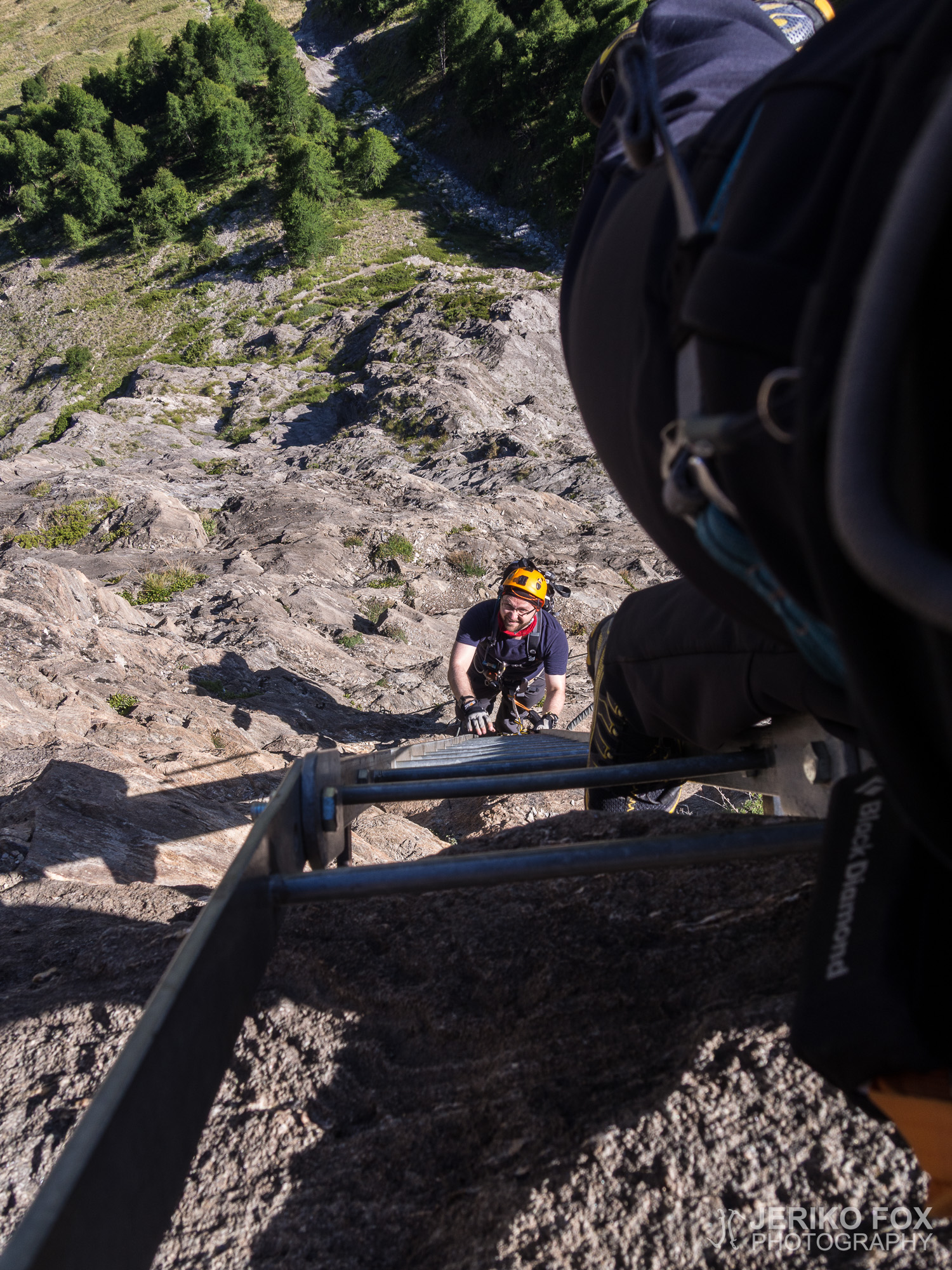
After the first section there was slope with loose dirt to walk. In a dry weather it is ok, but even a slightest rain changes it into a mud bath. We reached a flat meadow where there is the abseiling point that I mentioned earlier and Beresina-Haus that was built in 1811. This barn, built as a reward to a Napoleon’s soldier, still waits for its owner to return from war and is filled with miscellaneous junk. After a short walk in the forest we continued climbing. There is a traverse section that offers quite spectacular views. There is also a longer vertical climb secured with excitingly wobbly ladders.
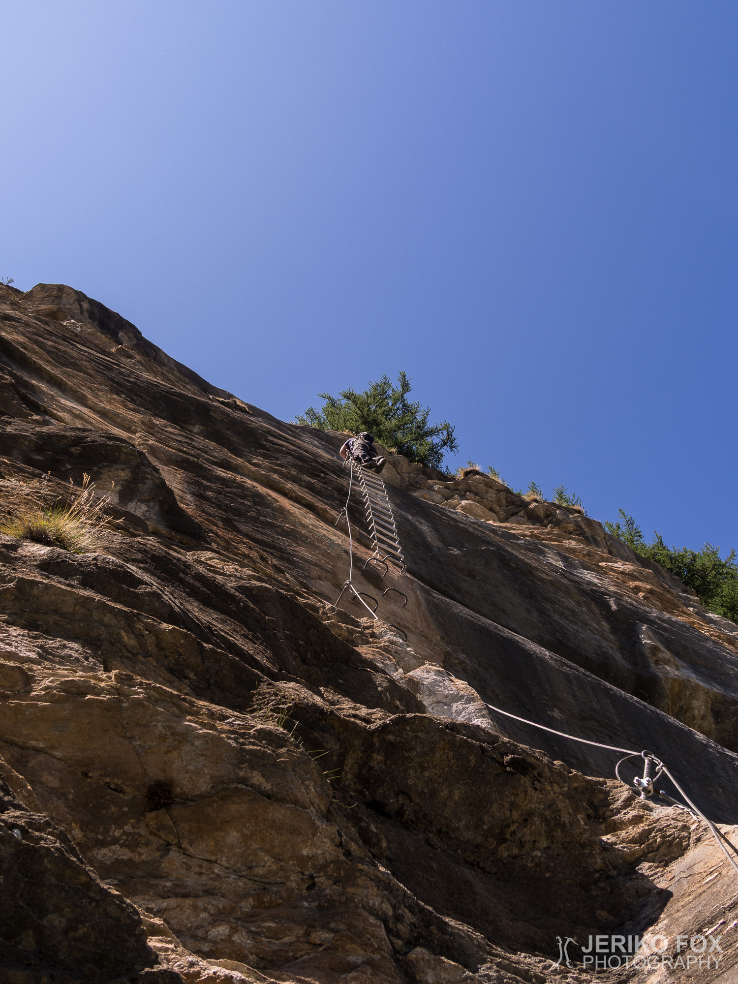
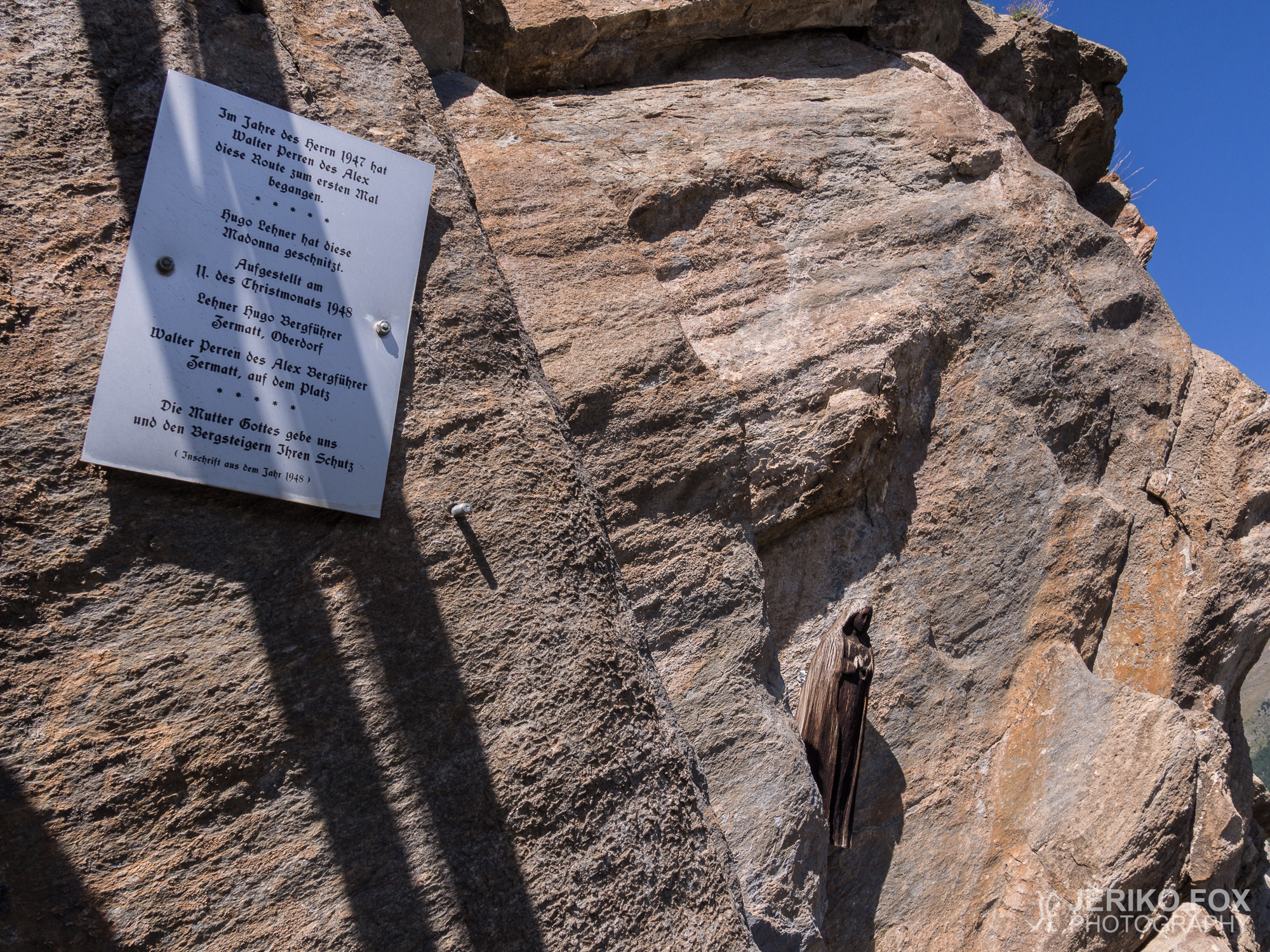
Finally we left the routes A and B behind, proceeding to the actual C route. Short walk in a forest and then in front of us raised the first step: a long vertical section. Climbing had been basic VF fun, but this step was clearly a bit more physical. Suddenly, while climbing the vertical wall, I saw the virgin Mary in front of me. This wasn’t a religious enlightenment, but a wooden statue attached to the rock. There was a sign saying that this statue was carved by a mountain guide called Hugo Lehner in 1948.
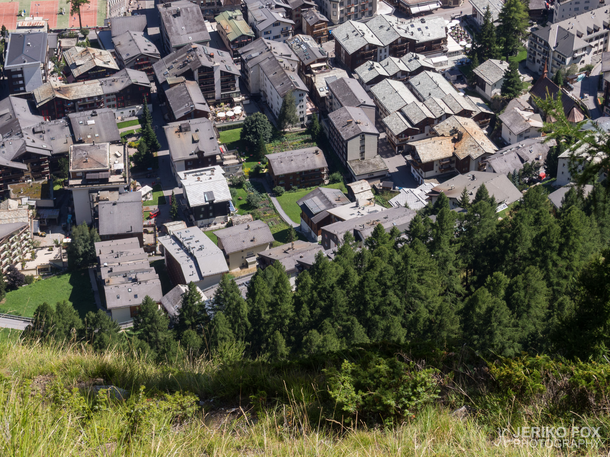
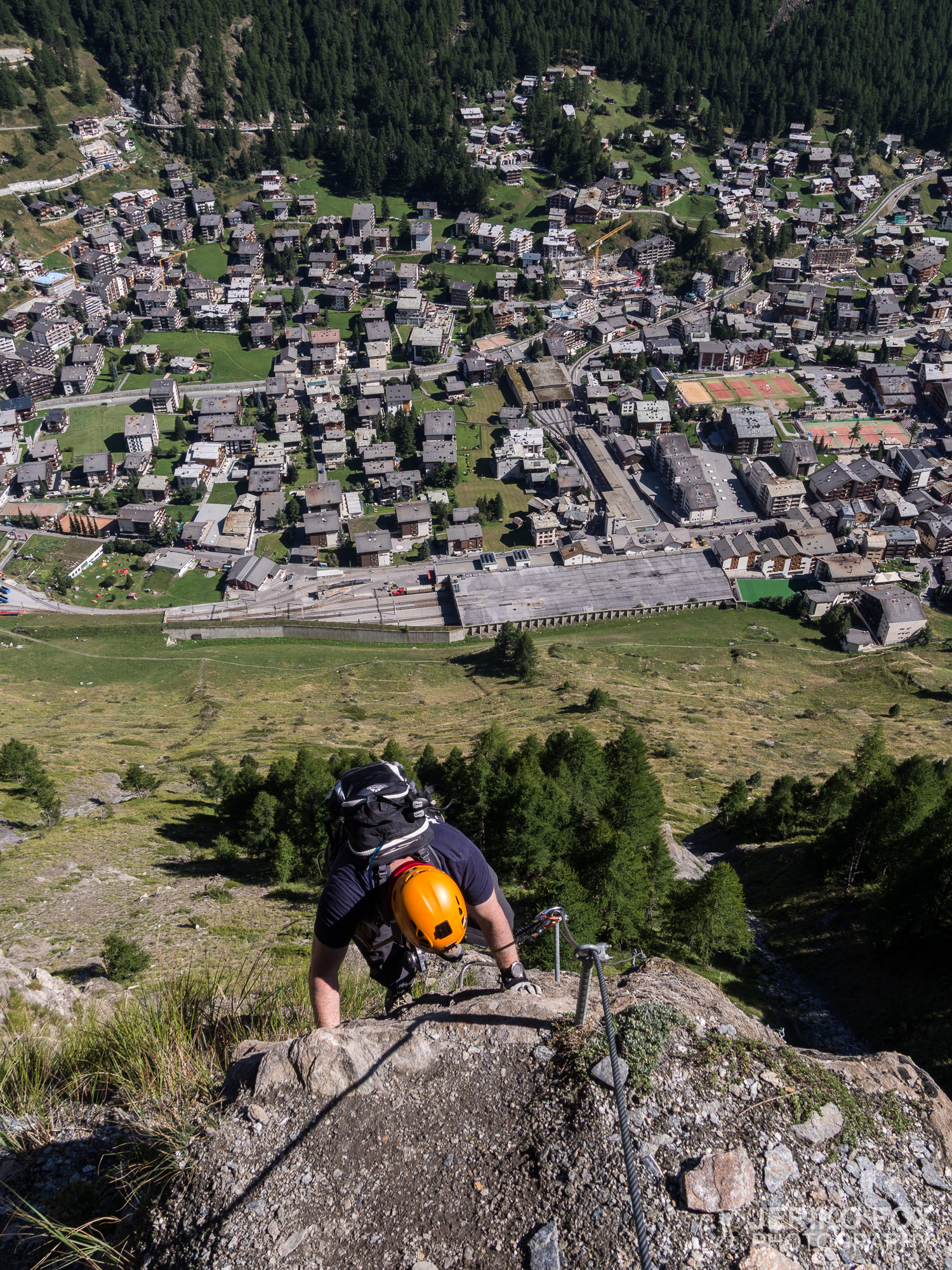
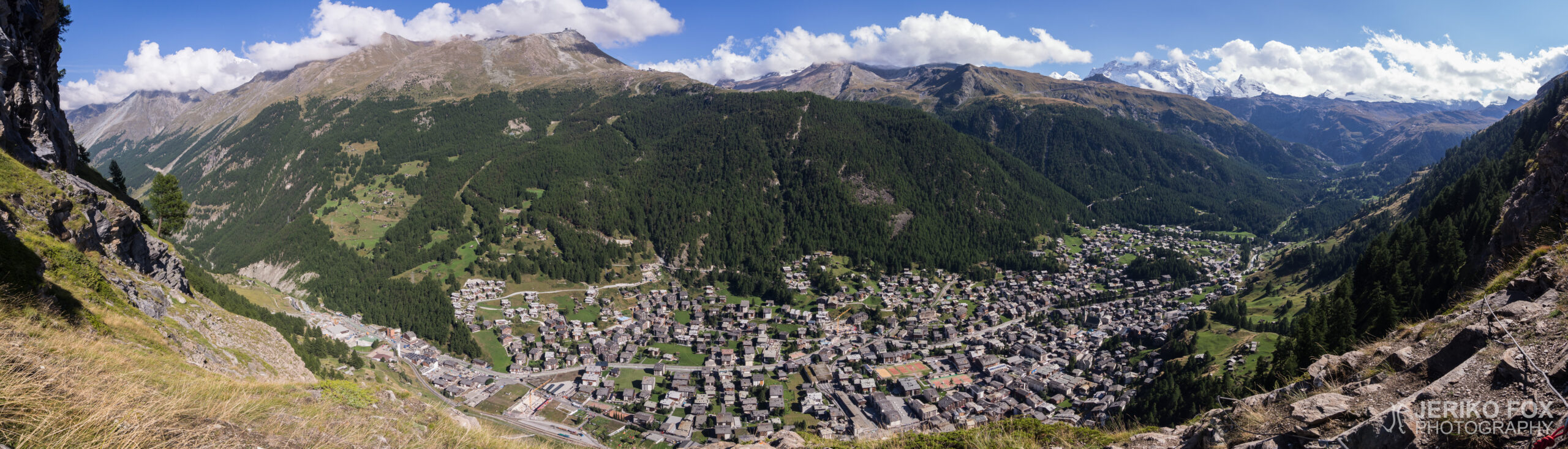
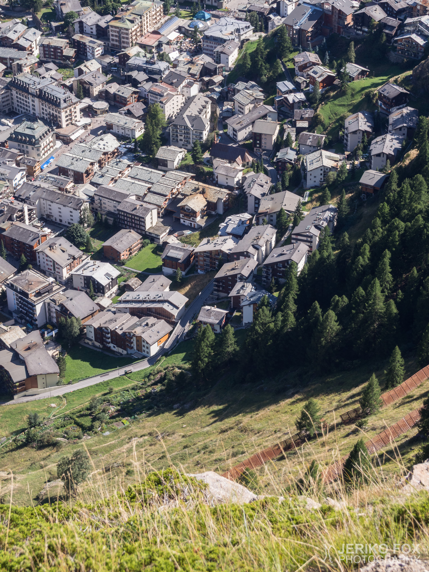
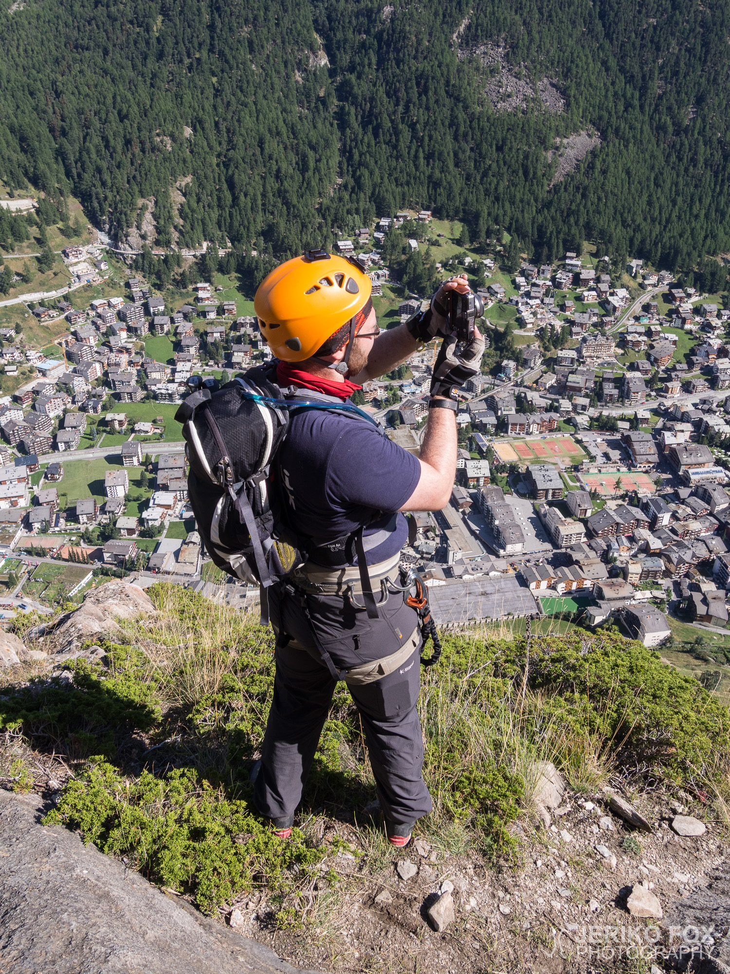
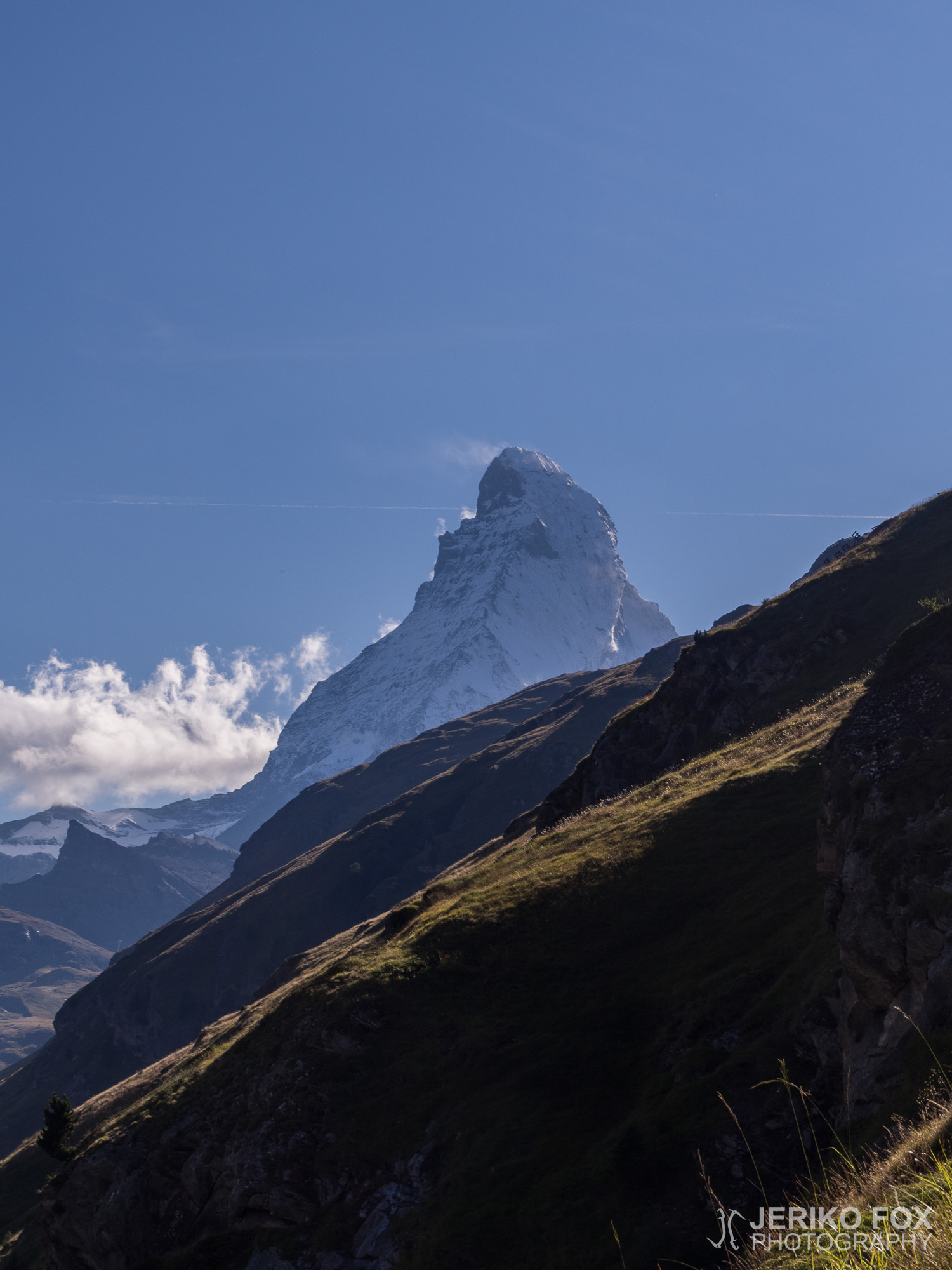
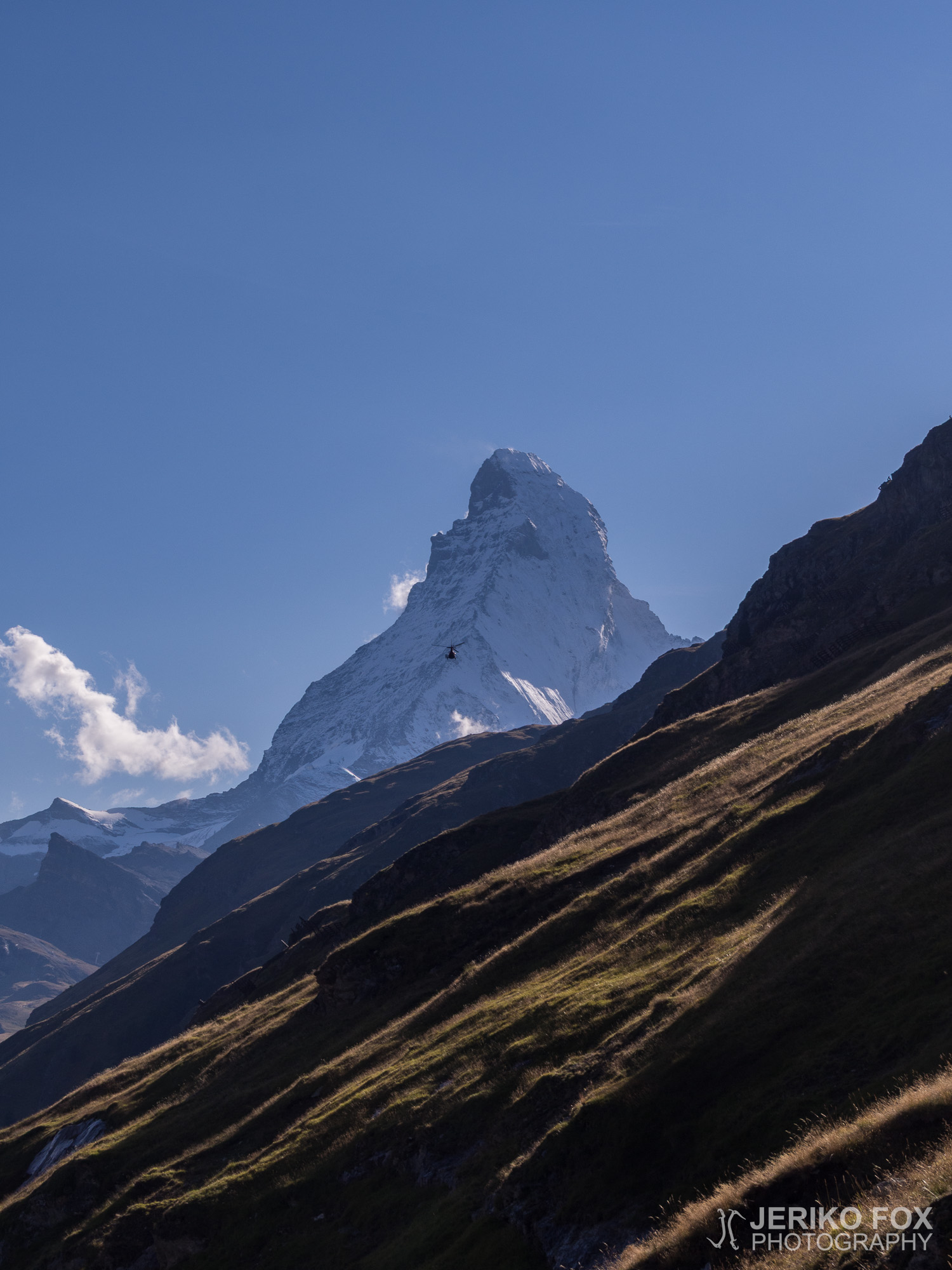
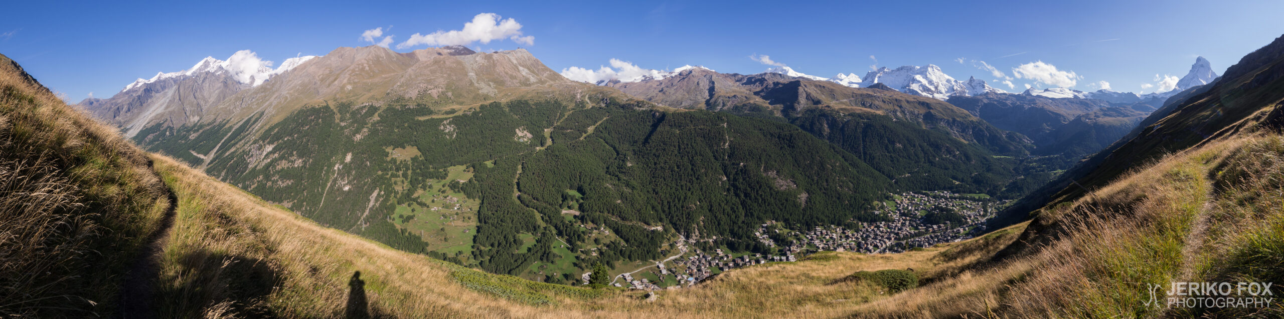
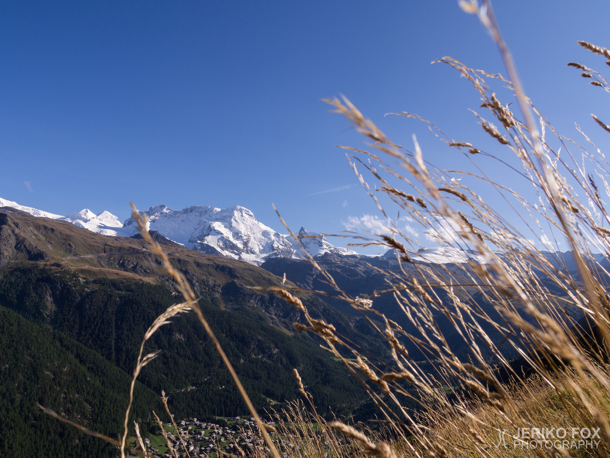
On the top of the first step we found a flat area that finally started to offer a nice panorama over Zermatt. Even though you can see Matterhorn from the village, the Monte Rosa massive and most of the summits of Breithorn are shaded by the other hills. Me and Dima took some panorama pictures, because we didn’t know that the view would still improve. There was the second step waiting for us.
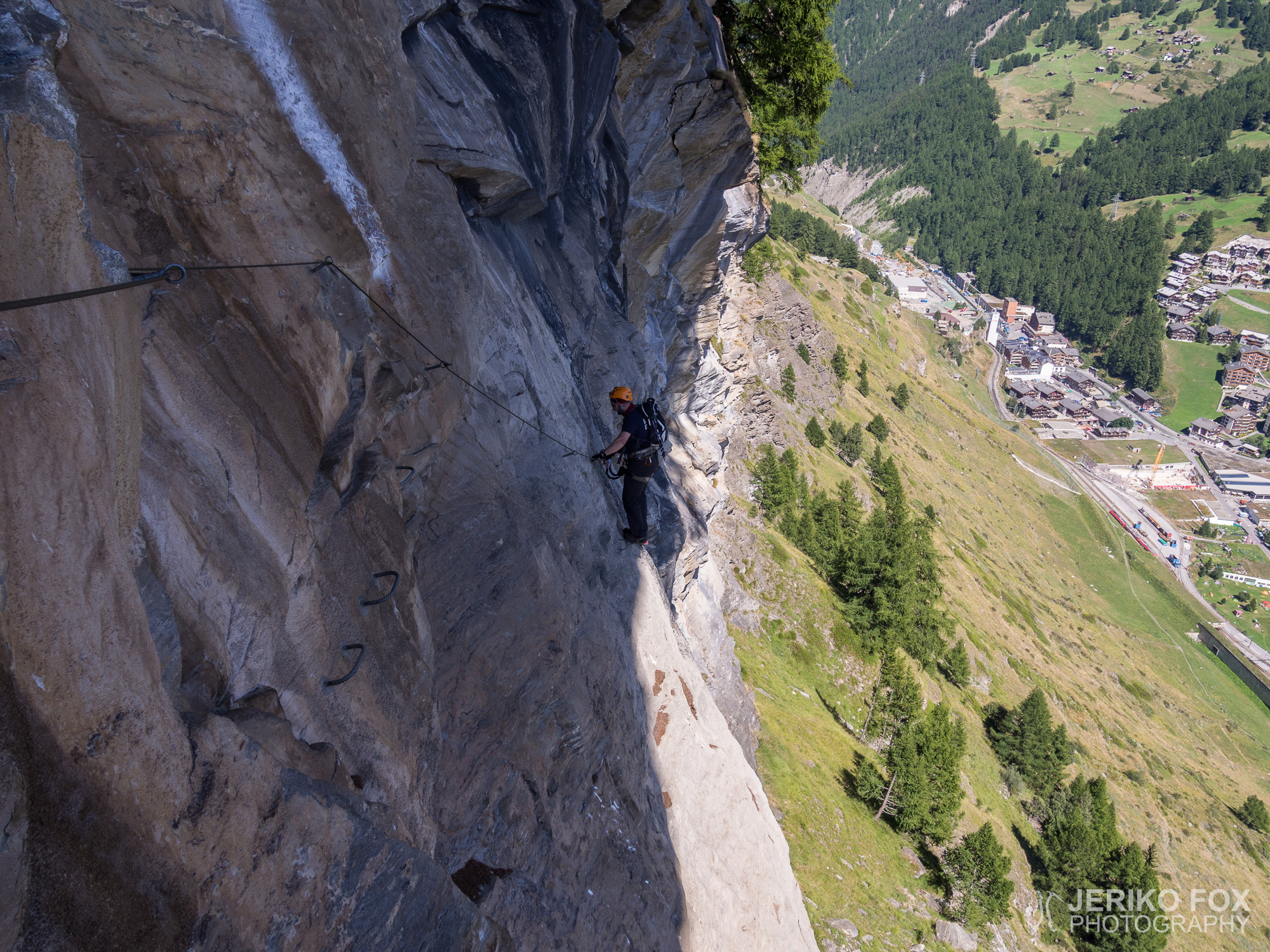
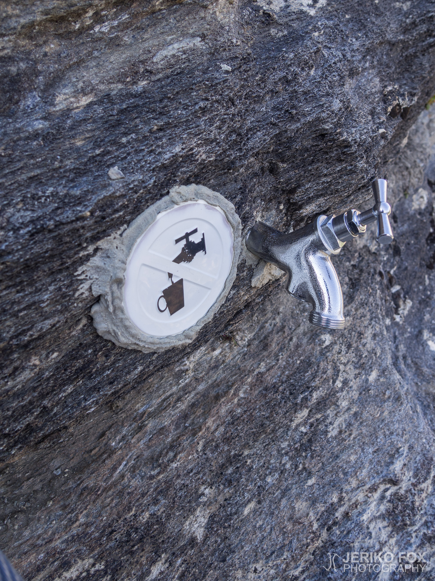
We continued climbing straight up and the houses of Zermatt were getting smaller and smaller beneath us. While climbing the second step, I found another surprise: a water tap on the rock wall. A sign indicated that this was no drinking water, but I couldn’t resist the temptation to try the tap. I opened the faucet, but nothing happened. Later we found out that this tap is not connected to a water line at all. Perhaps this is some weird Swiss sense of humour? The last section offered one more VF speciality: a wire ladder. Though this was more of a novelty than an actually convenient structure.
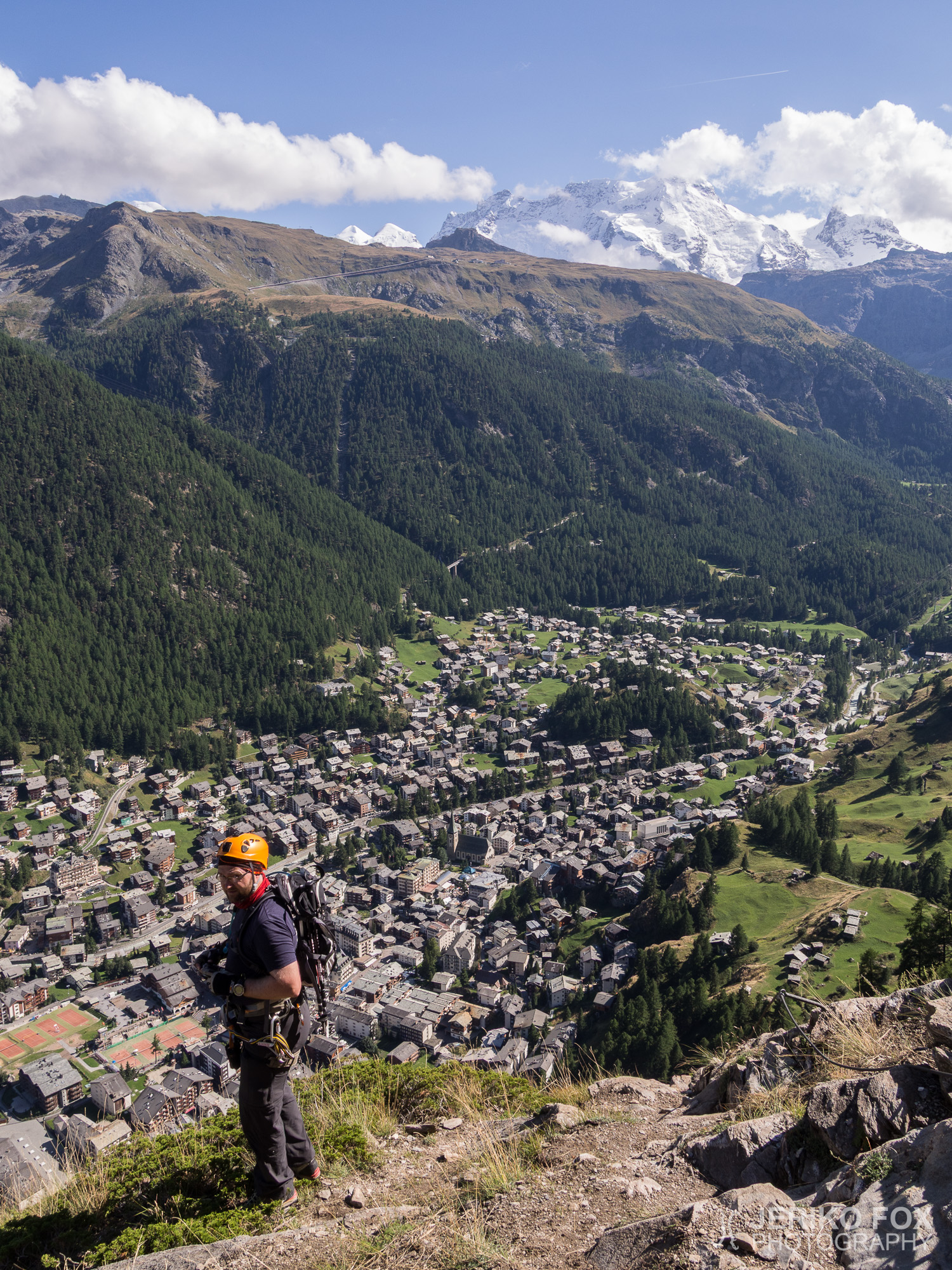
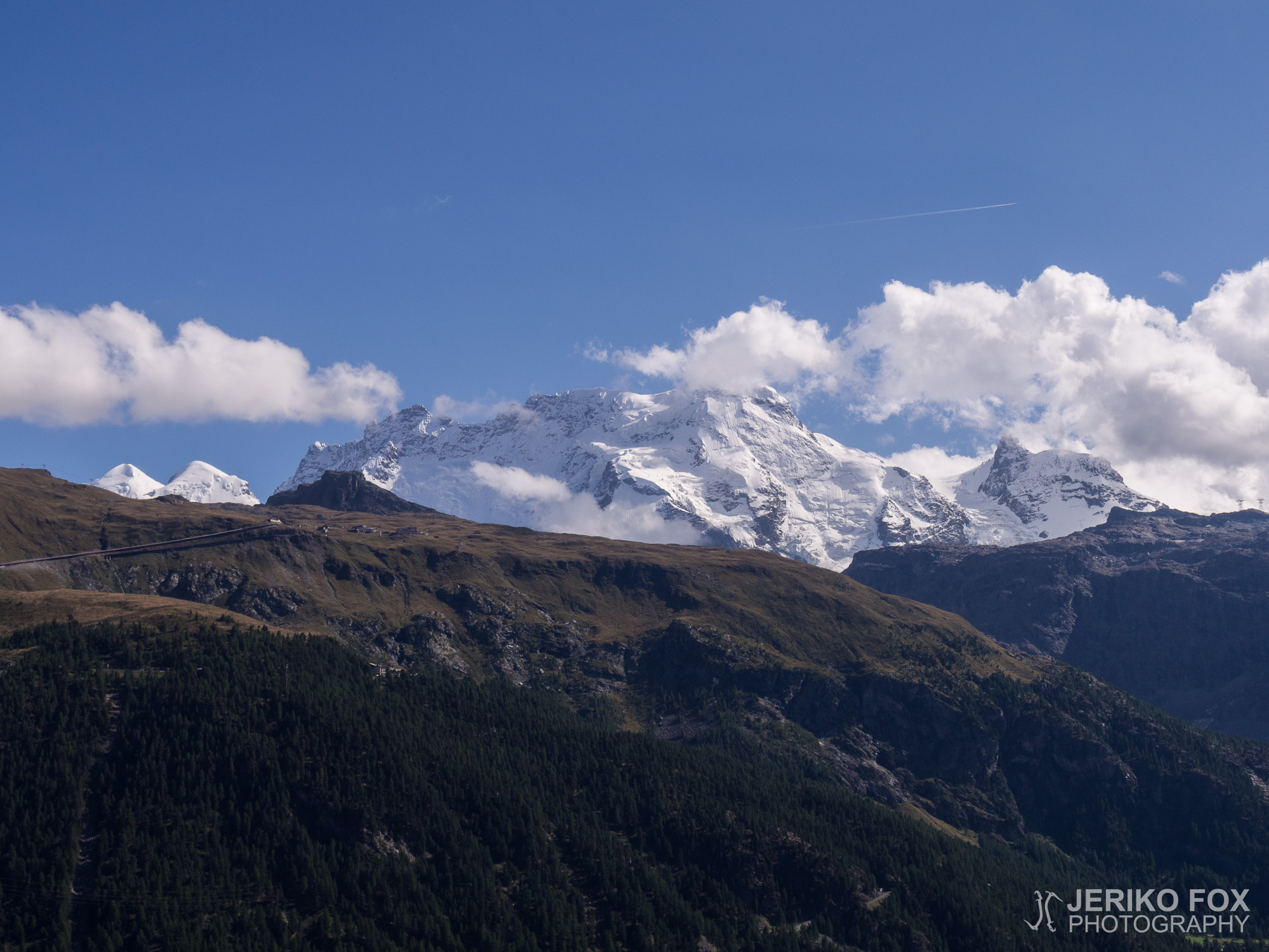
The beautiful mountain panorama really opened to us when we reached the top of the second step. We were able to see Dom, the summit of Dufourspitze, part of Lyskamm, “the twins” Castor and Pollux, the Breithorn massive in its full grace and of course Matterhorn. This meadow had a small cave kind of structure that would have been a great place to stay the night, if we weren’t planning to descend the same day. Though the route was constantly gaining elevation, we didn’t need to climb down. We hiked briskly down hill following the trail that leads behind the train station to get in time to Zermatt to get some evening snack from Coop.
The via Ferrata routes that I have climbed earlier have all been more about mountaineering. Those have led to a summit and the routes have included approach hiking, crossing glaciers and other essentials of mountaineering. This one was the first purely VF route and that mean a completely different nature. The route is not built to make some place more accessible, but just to create a low level climbing experience. Many sections of the route are airy, since there are several vertical ladders. These are not technically difficult, but need a bit strength. My own grading for this route in alphabetical VF scale would be that the A route is about B level, B is B/C and C is C. The guides from the Zermatt website state the grades as B, C/D and C/D, respectively. No section is truly hard to climb since there are plenty of wires and ladders. Still all the ladders are not bolted to the rock on their full length, making them more like a rope ladder. An important observation made while climbing the Mammut Klettersteig is that the VF is not maintained adequately. The condition of the VF is ok, but not good. The wire has eaten part of the anchors almost through and the wire is often loose and rusty. Some of the ladders have quite long span between the anchors meaning that you might take a long fall. I recommend taking a sling and a carabiner in addition to the VF kit. That allows you to rest and anchor yourself to take photos. The route is more about hanging on a wire than actually “pure” climbing, but still an entertaining alternative for a more relaxed climbing day.
The approach to VF is said to take a half an hour, climbing the C route 3 h 30 min and the hike back to Zermatt 1h 15 min. The was about our total time, but we hiked to valley in less than hour and spend a bit longer climbing, since we took a lot of photos. According the PDF guide route starts at 1603 m / 5259 ft and the highest point is in 2164 m / 7100 ft, making the elevation 791 m / 1841 ft. The descending trail is naturally also ascendable, if you want to get to the top by hiking to enjoy the view or to meet climbers at the end of the C route.


Ensimmäisen aurinkoisen päivän koittaessa Zermattissa emme saaneet aivan alppistarttia aikaiseksi, joten päätimme lähteä kiipeämään jotain hauskaa ja vaivatonta. Lisäksi olin polttanut käsivarteni pahasti Jubiläumsgratilla ja ihoni oli täynnä pieniä rakkuloita olkavarresta ranteisiin. Olin hieman huolissani niiden mahdollisesta tulehtumisesta, joten siinäkin mielessä oli hyvä pysytellä ihmisasutuksen lähistöllä. Asuntomme yläpuolella nousevassa kallionseinässä on ehkä alueen ainoa (tai ainakin yksi harvoista) via Ferrata -reitti, joka on Mammutin sponsoroima hanke. Reitti on luultavasti rakennettu mielessä oppaiden kanssa kulkevat (ei-kiipeilijä) turistiryhmät, koska itsenäisille kiipeilijöille ympäristö tarjoaa runsaasti vuoria.
Polku reitin alkuun lähtee muutaman korttelin päästä juna-asemalta, Bodmenstrassen mutkasta. Lyhyen nousun jälkeen polku haarautuu vasemmalle, Triftbach-joen yli kohti kallionnokassa tönöttävää Pension Edelweissia, ja oikealle kohti via Ferratan alkua. Polun varrella on kyltti, johon on havainnollisesti piirretty kolmen eri reitin kulku kalliolla: reitti A on määritelty helpoksi ja reitti B sekä reitti C ovat keskivaikeita (linkkien kautta on saatavilla reittitiedot myös PDF-muodossa sekä reitit GPX/KML-tiedostoina). Palaan greideihin vielä tämän tekstin lopussa. A-osuuden varrella on myös laskeutumispaikka, jossa on ilmeisesti itsevarmistava laite, mutta sitä on lupa käyttää vain oppaan kanssa. Koska reitti C oli pisin ja vaativin sekä kattoi myös suurelta osalta reitit A ja B, oli se meille ilmiselvä valinta.
Perhoset seuranamme lähdimme nousemaan Diman kanssa ensimmäistä seinämää. Heti alussa huomasimme, että saksalaisiin VF-rakennelmiin verrattuna vaijerit olivat selvästi ohuempia ja huomattavasti löysempiä. Löysyys ei välttämättä ole ongelma, mutta huonosti pingotettu vaijeri liikkuu melko arvaamattomasti. Toinen rakenteellinen haaste oli ankkuripisteet, joiden kohdalta vaijeri on kiinnitetty kallioon. Aiemmin tapaamani (Saksassa ja Itävallassa) ovat olleet usein mallia yksittäinen paksu rautatanko, jonka kolosta vaijeri menee läpi. Tällä reitillä ankkurissa oli ohuehko tanko, jossa oli jonkinlainen mutterikiristin vaijerille. Päivän kiipeilysession aikana jäin pystysuorilla osioilla ankkurin jo ohitettuani varmasti kymmeniä kertoja jumiin ankkuriin. Ainakin Black Diamondin Easy Riderin (joka on mielestäni paras VF-laite) sulkurenkaat ovat niin suuret, että ne helposti menevät puoliksi ankkuripisteen yli ja sitten jäävät siihen kiinni. Toisinaan sulkurenkaan sai irti heilauttamalla sen naruista tai tönäisemällä sitä kengällä, mutta usein piti kiivetä alaspäin ja “saatella” sulkurenkaita kädessään kunnes ne eivät enää roikkuneet yltäen ankkuriin. Vaikka sulkurenkaissa on turvalukitus, olisi tietysti toivottavaa, ettei niitä tarvitsisi potkia päästäkseen etenemään.
Ensimmäisen nousun jälkeen edessä oli hieman multaista rinnettä, joka oli kulunut hyvin irtonaiseksi. Kuivalla säällä se ei aiheuttanut ongelmia, mutta pienikin kosteus muuttaa rinteen varmasti mutavelliksi. Saavuimme tasaiselle töyräälle, jonka päällä on mainitsemani laskeutumispaikka ja 1811 rakennettu Beresina-Haus. Napoleonin sotilaalle palkkioksi rakennettu lato odottaa yhä palaamatta jäänyttä omistajaansa ja on täynnä sekalaista roinaa. Pienen metsäkierroksen jälkeen lähdimme poikkikulkemaan seinämää, jolta tarjoutui varsin kauniit näkymät. Reitiltä löytyi myös melko pitkä pystynousu jännittävän huteria tikkaita pitkin.
Tämän osion jälkeen erkanimme täysin A- ja B-reiteistä. Kuljimme taas hetken metsässä, kunnes edessämme näyttäytyi ensimmäinen porras: hieman pidempi suoraan ylös nouseva osio. Kiipeäminen oli tähän astikin ollut kivaa perus VF-menoa, mutta porrasmainen pätkä oli selvästi myös hieman fyysisempi kiivettävä. Yllättäen, kesken pystysuoran nousun, näin edessäni itse neitsyt Marian. Eikä kyseessä nyt ollut mikään uskonnollinen herääminen vaan kallioon oli kiinnitetty puinen patsas. Kyltin mukaan vuoristo-opas Hugo Lehnerin tekemä veistos on vuodelta 1948.
Päästyämme ensimmäisen portaan päälle saavuimme hieman tasaisemmalle aluellee, josta alkaa viimein avautua hienompi panoraama Zermattin yli. Vaikka Matterhorn näkyy kauniisti kylään niin Monte Rosan massiivi sekä Breithornin useimmat huiput jäävät rinteiden katveeseen. Innostuimme Diman kanssa ottamaan panoraamakuvia, koska emme tienneet maiseman vielä paranevan tästä pykälän verran. Edessä oli siis toinen porras.
Kiipesimme taas suoraan ylöspäin ja Zermattin talot muuttuivat kokoajan pienemmiksi allamme. Toista porrasta kiivetessäni löysin taas yllätyksen: vesihana kallion seinämässä. Kyltti kertoi, ettei hanasta saa juomavettä, mutta pitihän sitä kuitenkin kokeilla. Käänsin hanan auki, mutta sieltä ei tullut mitään. Myöhemmin meille selvisi, ettei koko hana ole edes liitetty minnekään. Sveitsiläisten outoa huumorintajua? Reitin VF-erikoisuuksista viimeisellä osuudella on tarjolla yhdet vaijeritikkaat, jotka ovat ehkä enemmän kuriositeetti kuin käytännölliset.
Noustuamme toisen portaan päälle näyttäytyi kaunis vuoristopanoraama meille entistä paremmin. Näimme nyt Domin, Dufourspitzen huipun, osan Lyskammia, “kaksoset” Castorin ja Polluxin, Breithornin massiivin kokonaisuudessaan ja tietysti Matterhornin. Niittytasanteelta löytyi pieni kalliosyvennys, joka olisi ollut mainio yönviettopaikka, jos meillä ei olisi ollut tarvetta palata vielä samana iltana takaisin laaksoon. Vaikka reitti oli ollut koko matkan nouseva, ei alas tarvitse kuitenkaan kiivetä. Reippailimme ripeään tahtiin aseman taakse johtavaa polkua pitkin takaisin Zermattiin ehtiäksemme käymään vielä iltapalaostoksilla Coopissa.
Aiemmat kiipeämäni via Ferrata -reitit ovat olleet kaikki jollain tapaa vuorikiipeilyllisiä. Ne ovat johtaneet huipulle ja reittiin on liittynyt myös lähtestymismarssia, jäätikön ylitystä ja muuta monimuotokiipeilyä. Tämä oli siis ensimmäinen puhtaasti pelkkä VF-reitti ja sen luonne on selvästi erilainen. Reitti ei ole rakennettu helpottamaan jonnekin pääsyä vaan pelkästään matalan kynnyksen kiipeilykierrokseksi. Monin paikoin reitti on hyvin ilmava, koska pystysuoria tikasosuuksia on useampi. Nämä eivät sinällään ole teknisesti vaikeita, mutta vaativat hieman voimaa. Oma arvioni reitistä olisi, että A- osio on ehkä B-tason reitti, B on B/C ja C on nimensä mukaisesti C. Zermattin sivuilta ladattavat oppaat antavat reiteille greidit B, C/D ja C/D. Kiipeilyllisesti kovin vaikeita kohtia ei ole, koska varmistuksia ja tikkaita on runsaasti. Toisaalta osa tikkaista ei ole pultattu koko matkaltaan kallioon eli toimivat enemmän köysitikkaiden tapaan. Merkittävä huomio Mammut Klettersteigista on, ettei sitä ole mielestäni huollettu aivan asianmukaisesti. Reitti on kuljettavassa, mutta ei hyvässä kunnossa. Vaijeri on syönyt osan ankkureista lähes puhki, vaijeri on monin paikoin löysä ja ruosteessa. Osassa tikkaita ankkureiden väli on pitkä eli putoamismatkat voivat olla suuria. VF-laitteen lisäksi mukana kannattaa olla slingi ja sulkurengas tai muunlainen lehmänhäntä, jolloin on helpompi levätä tai ankkuroitua valokuvaamaan. Reitti on selvästi enemmän vaijerissa roikkumista kuin “rehellistä” kiipeilyä, mutta aivan viihdyttävä vaihtoehto rennomman kiipeilypäivän ohjelmaksi.
C-reitin lähestymisnousun on reittiohjeessa arvioitu kestävän puoli tuntia, kiipeämisen 3 h 30 min ja laskeutumisen 1 h 15 min. Me käytimme suunnilleen tämän kokonaisajan, mutta laskeuduimme alle tunnissa ja käytimme kiipeämiseen enemmän aikaa, koska valokuvasimme runsaasti. Lähtökorkeus Zermattista on oppaan mukaan 1603 m ja korkein kohta reitillä on 2164 m eli korkeuseroa kertyy 791 m. Laskeutumispolkua voi toki myös nousta, jos haluaa päästä vaeltamalla C-reitin loppuun ihailemaan maisemia tai tulla vastaan kiipeilijöitä.
Max elevation: 2198 m
Total time: 05:45:42