
After reaching the summit of Großglockner in 2013, I have been dreaming about my next big mountain – the top of Switzerland, Dufourspitze. This was the mountain that brought us to Switzerland and finally we had the weather window: two days of sunshine. My skin that got sunburns at Jubiläumsgrat was starting to peel off and no issues had emerged, meaning we were ready to give this mountain a go.
We woke up early, ate a nice big breakfast and headed to the Gornergrat Bahn station to catch the 8 am train. Me and Dima got return tickets (76 CHF) to Rotenboden station and my father took a one-way ticket (38 CHF) since he wasn’t climbing the mountain, but planning to hike back to Zermatt. I had made a reservation for me and Dima at the Monte Rosa Hut – our first destination.
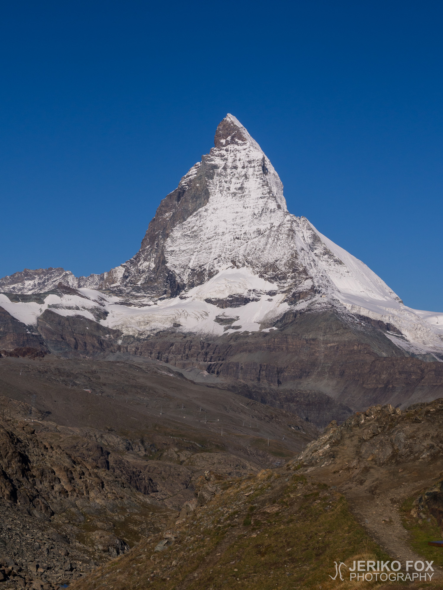
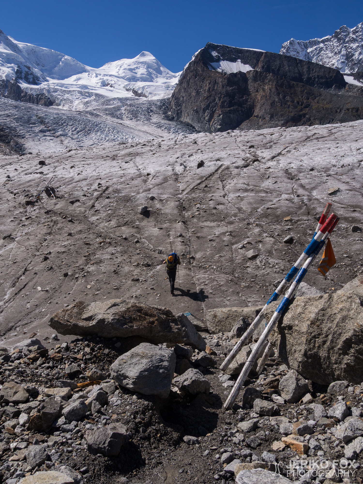
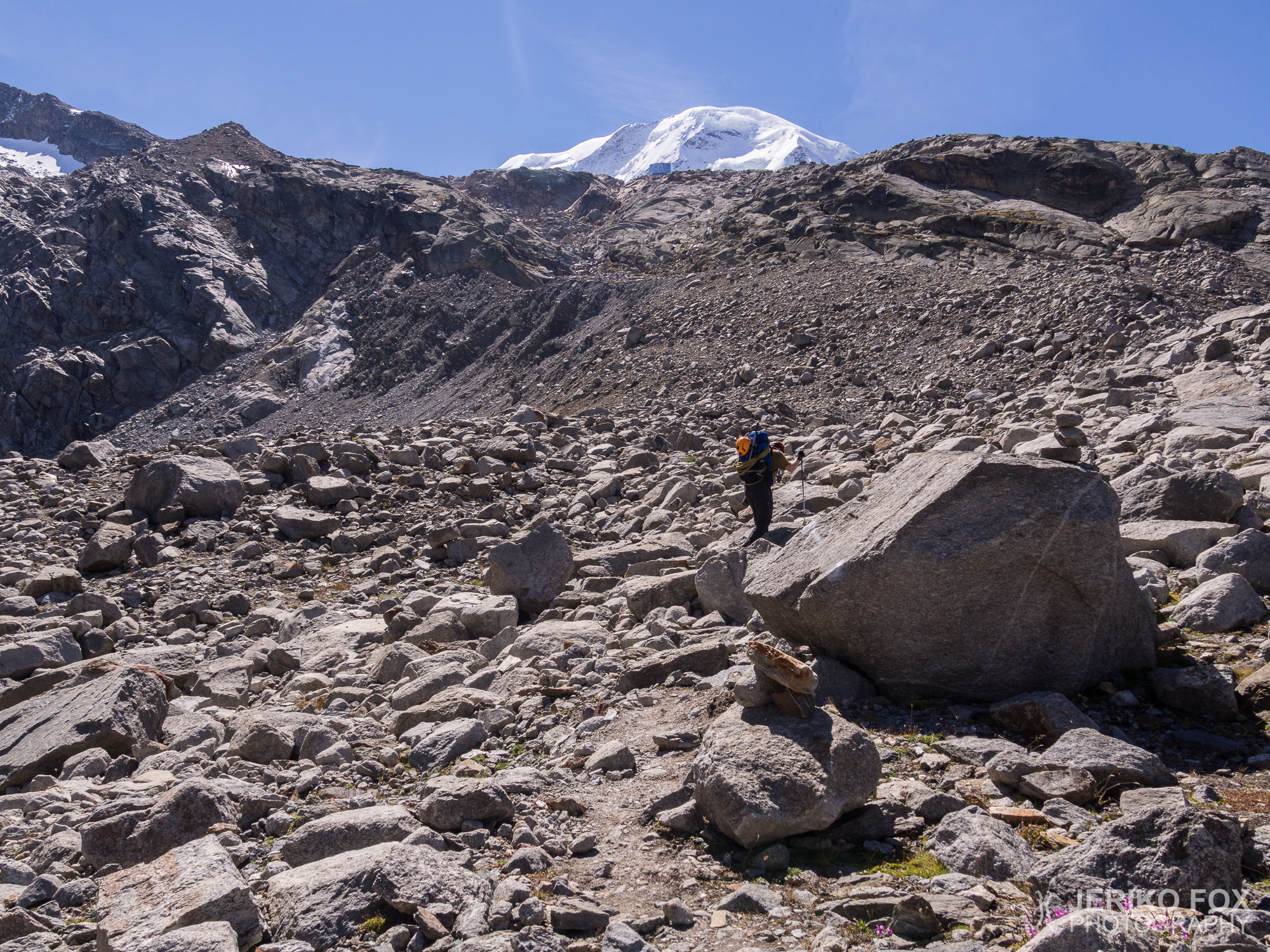
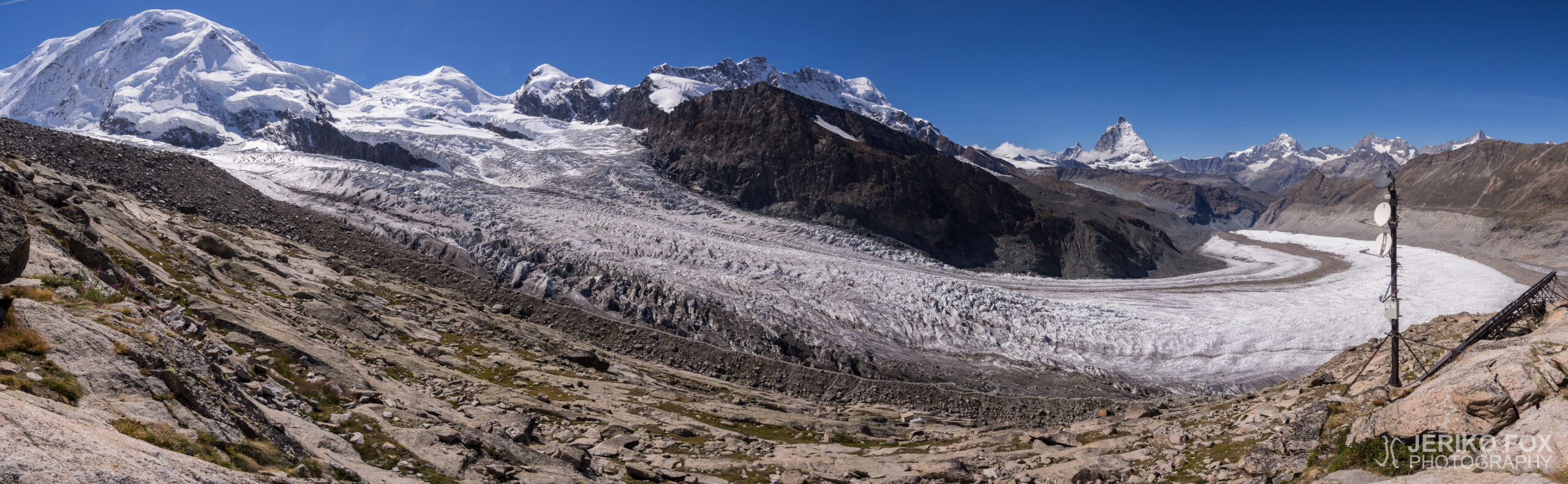
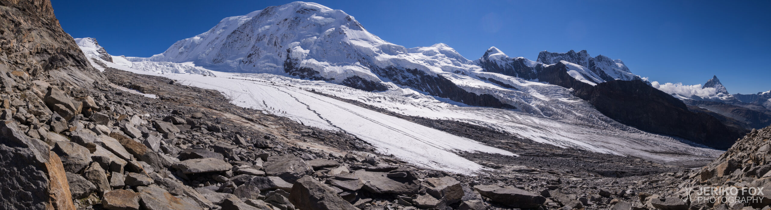
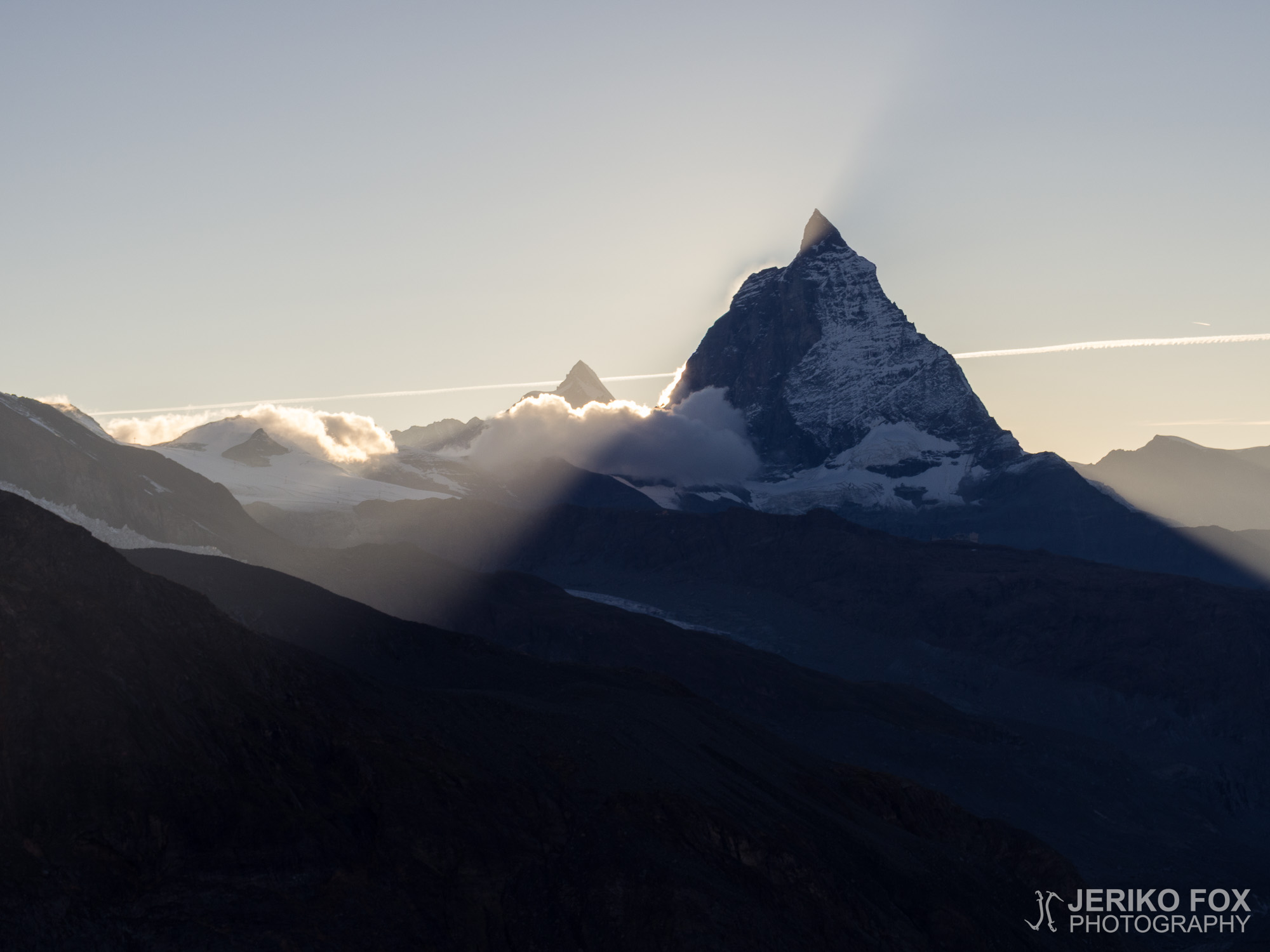
The train took us through the beautiful landscape to the Rotenboden station (2815 m / 9236 ft), where we jumped off with all our gear. From the station there is a stunning panorama over Breithorn massif and you can see Matterhorn in its full glory. Also we saw the first time the whole Monte Rosa massif and our final destination – Dufourspitze. At 9 am all three of us started to hike along the trail towards Monte Rosa. The trail that goes along the ridge follows Gorner Glacier and descends during the 3,5 km (2,2 miles) hike more than 200 altitude meters (600 ft) to the glacier.
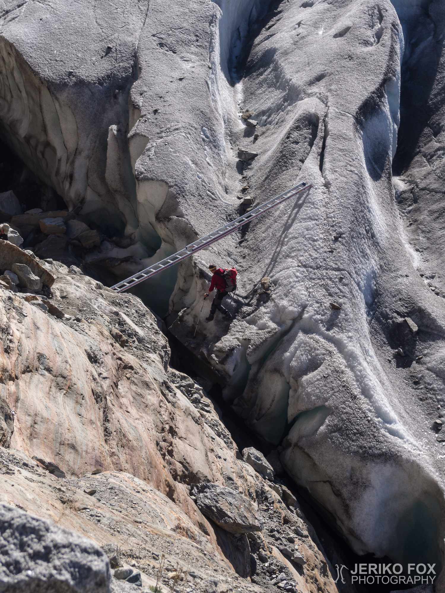
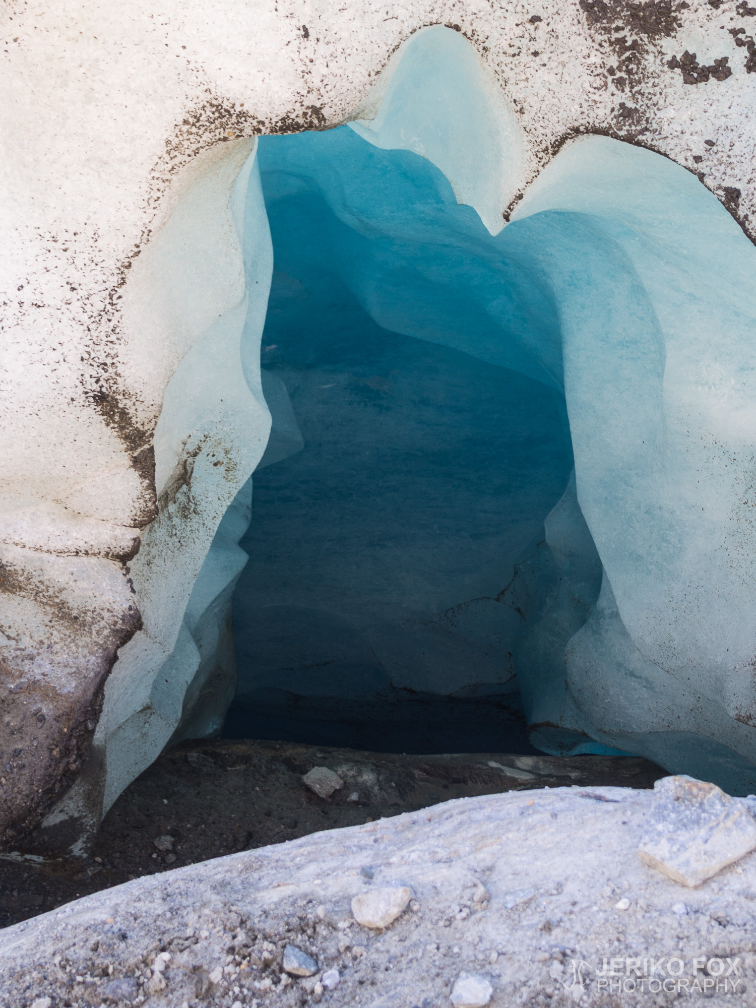
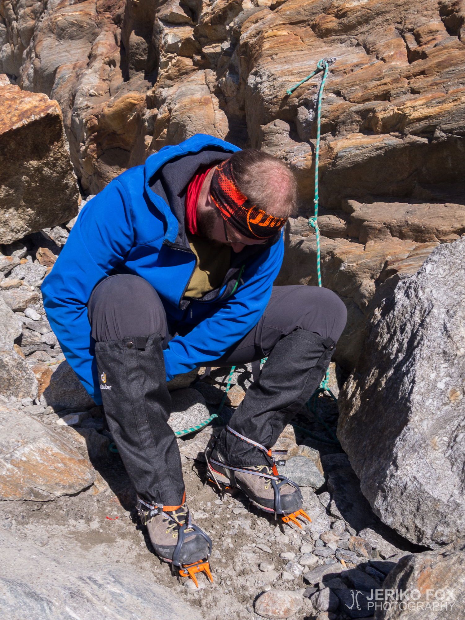
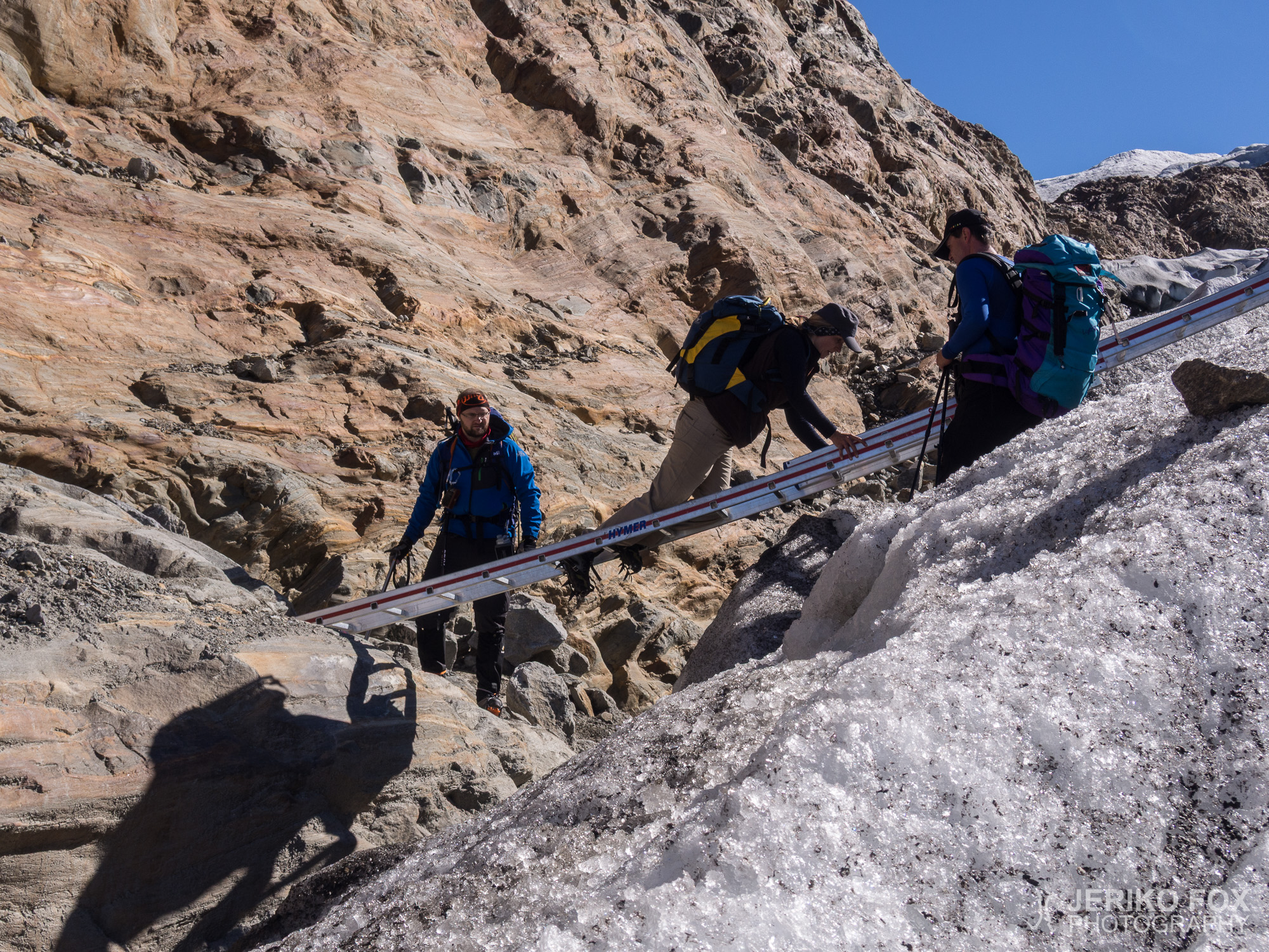
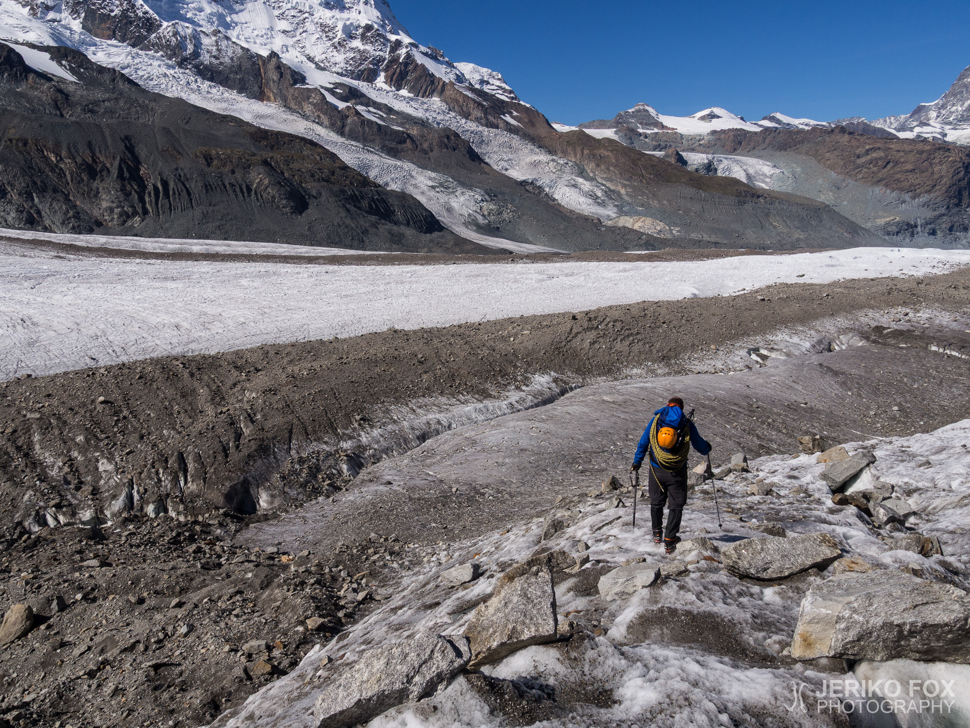
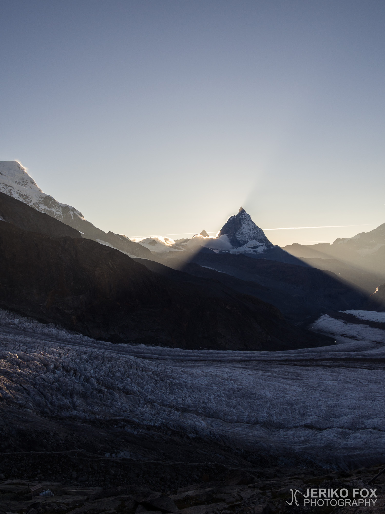
The sun was warming us when we arrived to the bergschrund at 11 am. The glacier was completely dry and full of crevasses. Me and Dima put on our crampons and dug out our ice axes, but since all the crevasses were clearly visible, we didn’t feel the need for a rope. We met a group of carefree tourists hiking the glacier wearing only trainers and without any gear, but the idea of slipping and sliding down into a crevasse is not that inviting for me. My father didn’t have any glacier gear so he headed back to Rotenboden and all the way down to Zermatt. There was a ladder laid over the bergschrund, but it was easier to reach the glacier by climbing under them. We were finding our way in the labyrinth of crevasses and having a good time crossing the glacier.
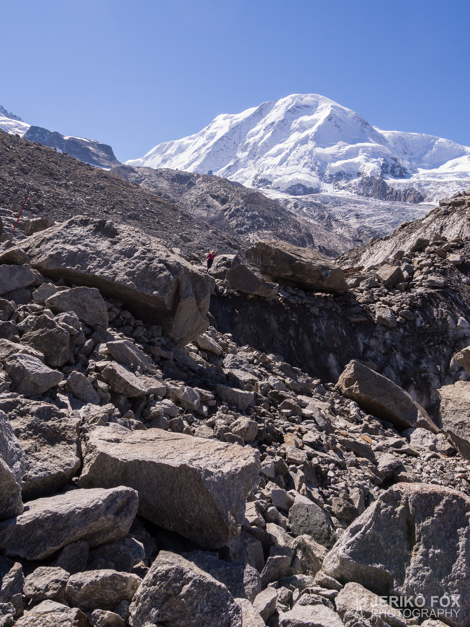
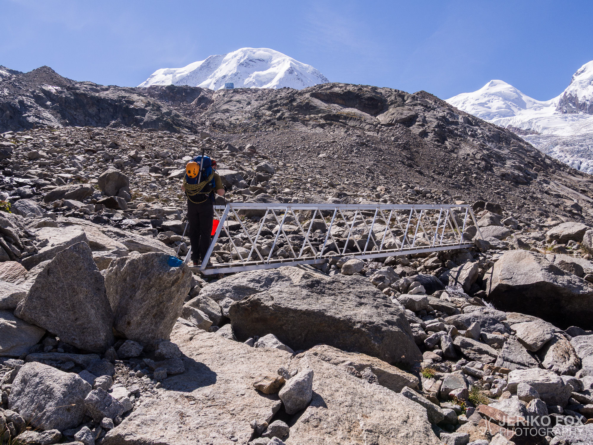
After we reached the moraine in between Gorner Glacier and Grenz Glacier, we took off our crampons. We reached the lowest part of the trail while circling boulders that were a size of a house to find the route. There are painted signs on the rocks, but the glacier lives all the time and the route keeps changing. We crossed a tiny part of Grenz Glacier, but it was smooth enough to travel without crampons. The rocks and the sand from the moraine also provided some extra friction on the ice.
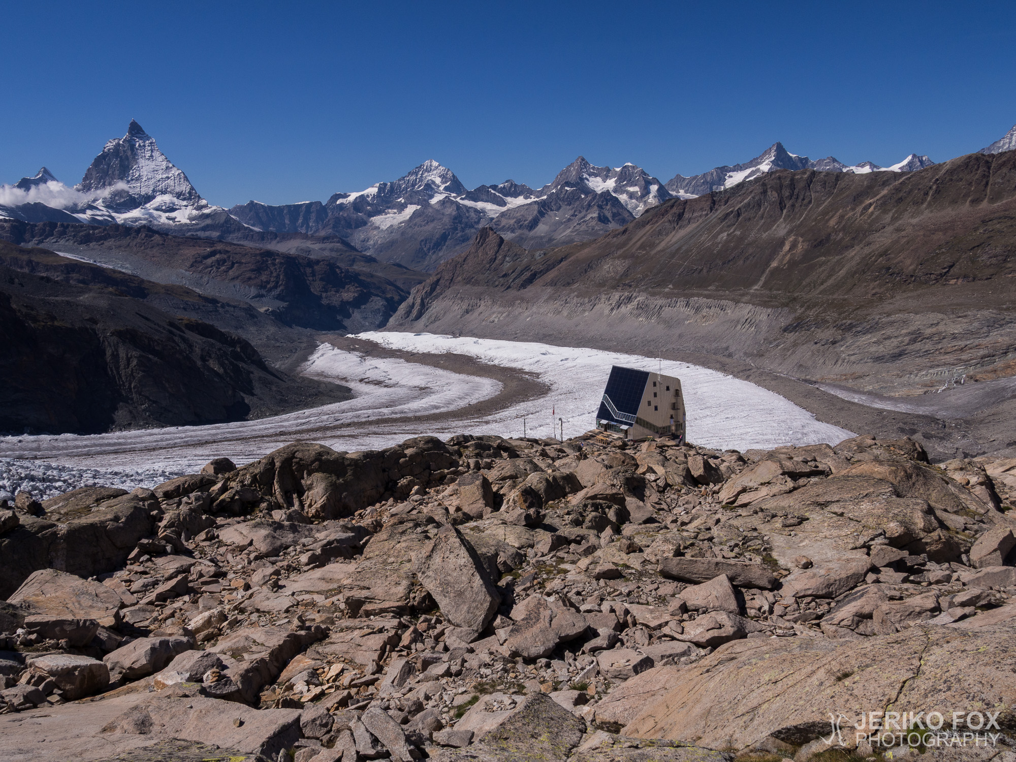
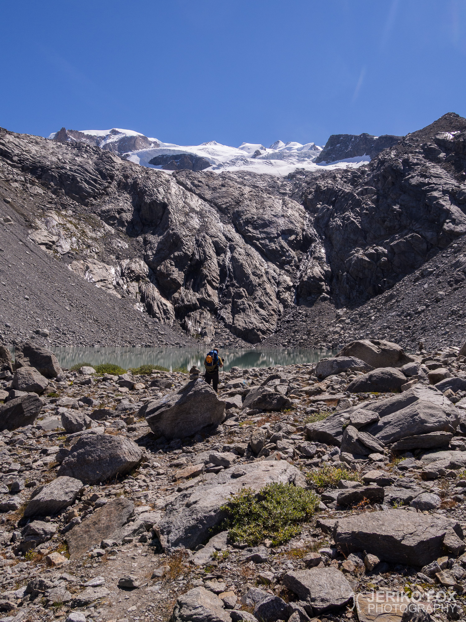
Finally at 2470 meters (8103 ft) we started to head towards Monte Rosa Hut, after leaving Grenz Glacier behind us. The hillside was eaten away by the erosion, but the trail got better when we got a bit higher. The weather was hot and while we hiked to the small lake Gornersee you really didn’t need anything more than a t-shirt (though I had long sleeves to protect my burned skin). With determination we kept on hiking uphill and after 1 pm the shining silver Monte Rosa Hut appeared behind the hill.
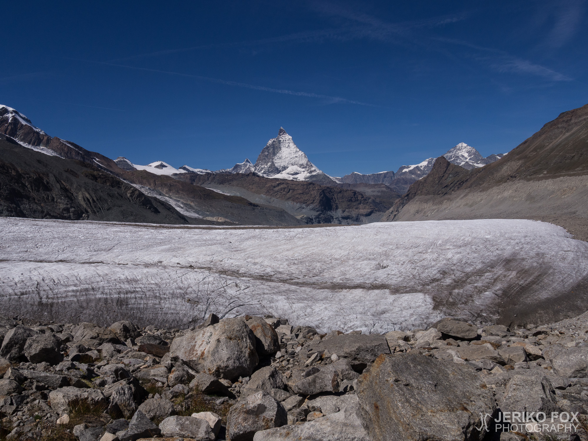
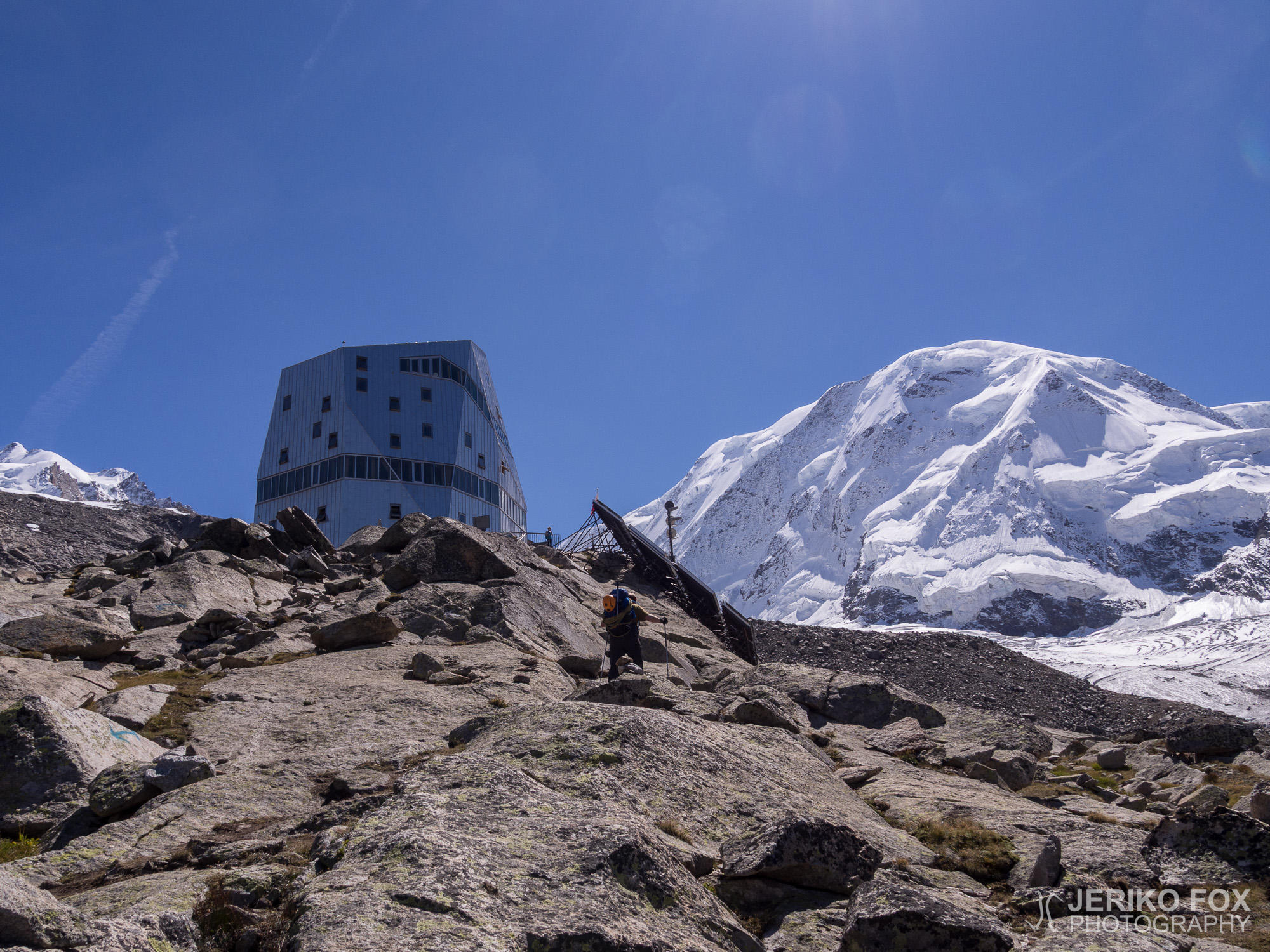
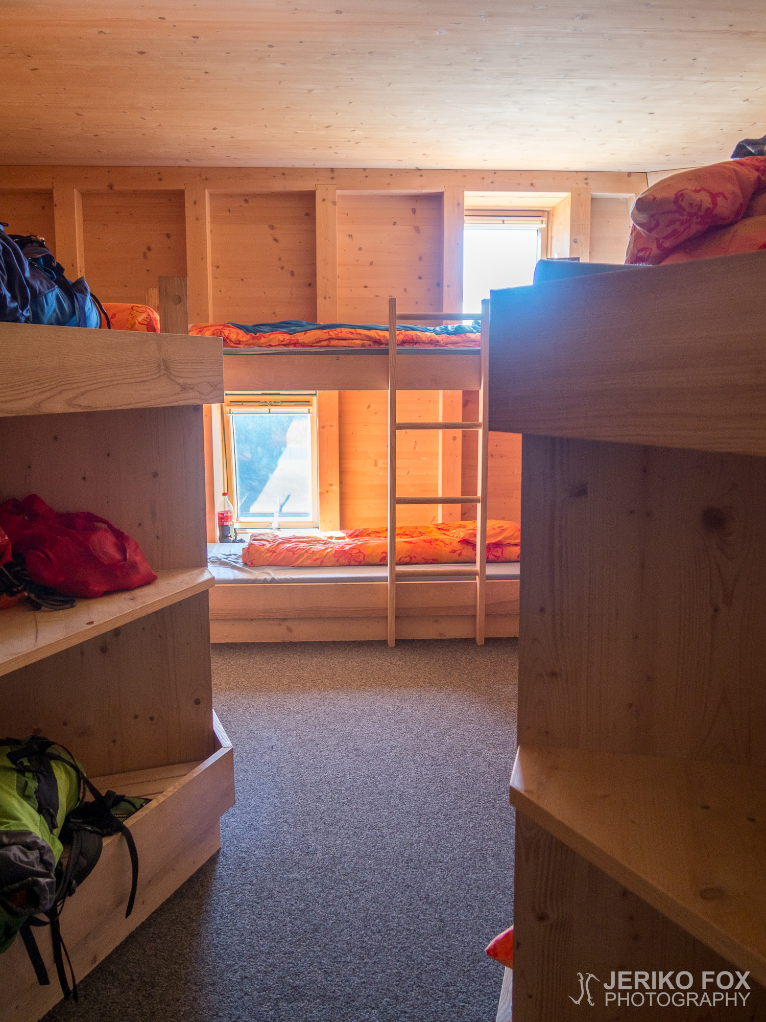
The new Monte Rosa Hut was built in 2009 and it obtains 90% of its energy needs with solar panels. The hut was planned to be as nature friendly as possible to avoid any harm to the delicate glacier environment. We left our backpacks to the gear room and went to upstairs to register ourselves. Even though the hut is maintained by the Swiss Alpine Club (SAC) we were allowed to stay and have a half-pension with the reduced (membership) price (30 + 40 CHF), since we are members of the German Alpine Association (DAV). We bought something to drink and sat down to the terrace that was bathing in sunlight at 2883 meters (9459 ft). Monte Rosa Hut offers a splendid view to Monte Rosa massif, Lyskamm, Breithorn and Matterhorn, not to mention all the surrounding glaciers. The glacier trek to the hut is a wonderful trip even for a non-climber, but one should have crampons and an ice axe for crossing the glacier. For unexperienced hikers hiring a mountain guide is a good idea.
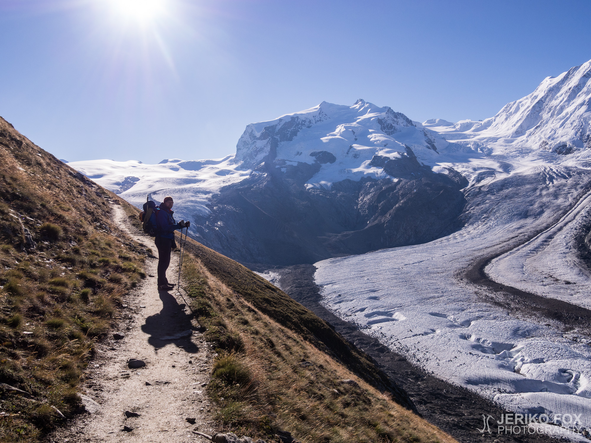
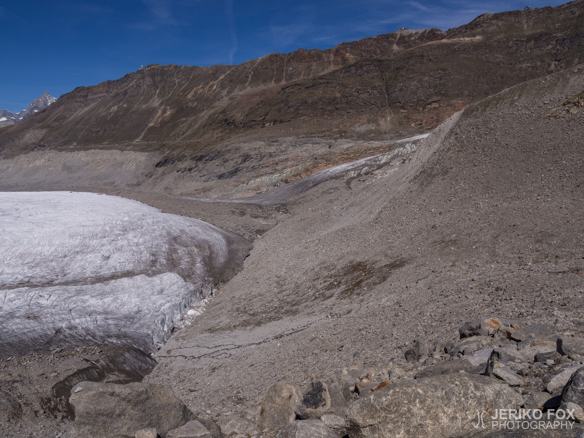
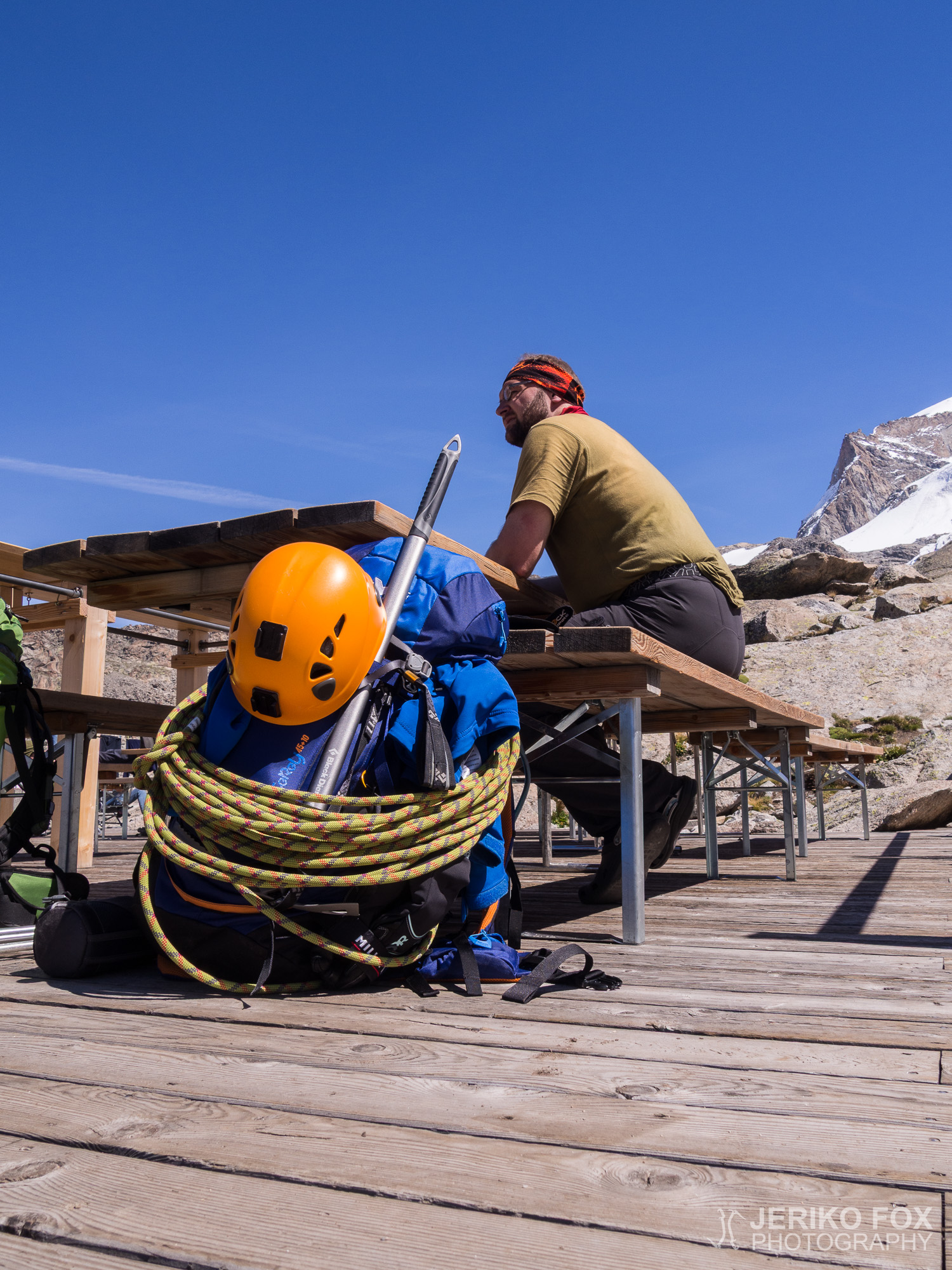
After resting for a while, we took our belonings to our room and headed once again uphill – now equipped only with our hiking poles. The article at the Summitpost recommends to check the route to the glacier during the daylight, so that no time would be wasted at the beginning of the summit day. We hiked to 3100 meters (10 170 ft) along the ridge and saw a route on our right hand side that leaded to the glacier. We went all the way to the edge of the glacier and there was a distinctive trail going up in the snow. The route seemed completely clear and the glacier didn’t look bad either. (We suffered from this misjudgement the next day.) We returned to the ridge and hiked our way back down to the hut.
The rest of the afternoon we had time to rest and wait for the dinner. We enjoyed the sun at the terrace. Even though it was very warm in the sunshine, if you stepped to the shade the temperature turned instantly freezing. At 7 pm we had a generous three course dinner and everyone hungry enough were allowed to have seconds. The sun disappeared behind the summit of Matterhorn creating magical shades. We went to bed early, since the wake-up would be before 2 am.
Dima’s photos (day 1 and 2 on Monte Rosa)


Saavutettuani Großglocknerin huipun vuonna 2013, olen tähyillyt seuraavaa isoa kohdettani – Sveitsin korkeinta huippua Dufourspitzeä. Tämä vuori oli tuonut meidät Sveitsiin ja nyt kovasti odotettu sääikkunakin näytti viimein aukeavan: kaksi päivää auringonpaistetta. Jubiläumsgratilla polttamani iho oli kuoriutunut ja ongelmia ei näyttänyt ilmenevän, joten olimme kaikin puolin valmiita lähtöön.
Heräsimme aikaisin, söimme tukevan aamupalan ja lähdimme reppuinemme kävelemään Gornergrat Bahnin asemalle ehtiäksemme kello kahdeksan junaan. Minä ja Dima ostimme meno-paluu -liput (76 CHF) Rotenbodenin asemalle ja isäni osti pelkän menolipun (38 CHF), koska hän ei ollut tulossa kanssamme vuorelle vaan suunnitteli vaeltavansa takaisin Zermattiin. Minun ja Diman ensimmäisenä kohteena oli Monte Rosa Hütte, josta olin varannut meille yöpaikat nettisivujen kautta.
Juna nousi kauniiden maisemien ympäröimänä 2815 metrin korkeuteen Rotenbodenille, jossa purkauduimme tavaroinemme pois kyydistä. Asemalta avautuu kaunis panoraama Breithornin massiivin suuntaan sekä myös Matterhorn näkyy koko komeudessaan. Saimme myös ensimmäistä kertaa kunnon näkymän Monte Rosan massiiviin ja kohteeseemme Dufourspitzeen. Yhdeksän aikoihin lähdimme kaikki kolme yhdessä vaeltamaan polkua pitkin kohti Monte Rosaa. Harjanteen reunaa kulkeva polku seuraa Gornergletscher-jäätikköä ja laskeutuu 3,5 km matkalla pikkuhiljaa reilun 200 korkeusmetriä jäätikön tasalle.
Aurinko paistoi lämpimästi saapuessamme puolen yhdentoista aikaan reunarailolle. Jäätikkö oli täysin kuiva ja railottunut. Aloimme pukemaan jäärautoja ja otimme jäähakut esiin, mutta köysi ei vaikuttanut tarpeelliselta, koska kaikki railot olivat selkeästi nähtävissä. Jäätiköltä kyllä tuli hieman epämääräisen näköisiä turisteja lenkkareissa ja ilman minkäänlaisia varusteita, mutta itseäni liukastuminen ja luisuminen railoon ei houkutellut. Isälläni ei ollut jäätikkövarusteita, joten hän lähti tässä vaiheessa takaisin kohti Rotenbodenia ja sieltä alas Zermattiin asti. Reunarailon yli oli laitettu tikkaat, mutta pääsimme helpommin jäätikölle kiipeämällä niiden alta. Kiertelimme railoja kuin labyrintissa ja tunnelma oli korkealla.
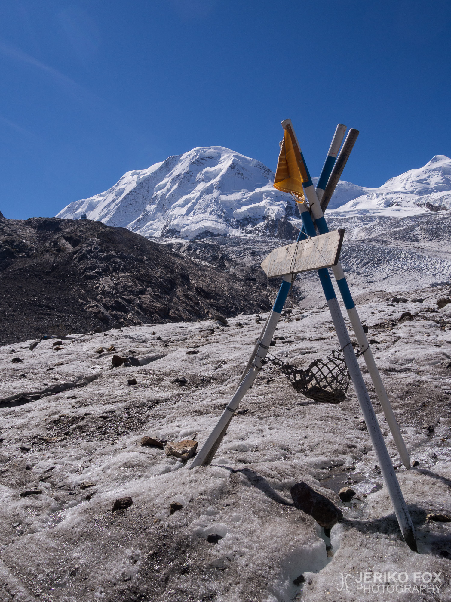
Gornergletscherin ja Grentzgletscher-jäätikön risteykseen muodostuneelle moreenille päästyämme riisuimme jääraudat ja jatkoimme taas matkaa vaeltaen. Olimme reitin matalimmassa kohdassa ja kiertelimme parhaimmillaan talon kokoisia kivenjärkäleitä etsien sopivaa reittiä eteenpäin. Matkalle on maalattu merkkejä ja pystytetty keppejä, mutta jäätikön eläessä jatkuvasti merkattu reitti on lähinnä suuntaa-antava. Ylitimme pienen alueen Grenzgletscheriä, mutta se ei tasaisuutensa ja moreenihiekoituksen ansiosta vaatinut jäärautoja.
Noin 2470 metrin korkeudesta, päästyämme Grenzgletscheriltä, lähdimme vihdoin nousemaan ylöspäin kohti Monte Rosa Hütteä. Rinne oli aluksi eroosion syömä ja irtonainen, mutta päästyämme hieman ylemmäs muuttui polku helpommin kuljettavaksi. Sää oli kuuma ja pienelle Gornersee-järvelle noustessa tarkeni aivan hyvin t-paidassa (tosin minulla oli pitkät hihat palaneen ihoni suojana). Jatkoimme määrätietoisesti matkaa ja kello yhden jälkeen ilmestyi mäen takaa hopeisena hohtava moderni Monte Rosa Hütte.
Vuonna 2009 valmistunut uusi Monte Rosa Hütte on 90%:sti omavarainen energian suhteen aurinkopaneeliensa ansiosta. Maja on muutenkin suunniteltu mahdollisimman ympäristöystävälliseksi, ettei sen asiakkaiden tuottamat jätteet vahingoittaisi herkkää jäätikköaluetta. Jätimme reput ja kengät alakerran varustehuoneeseen ja menimme ravintolan puolelle ilmoittautumaan majanpitäjälle. Vaikka maja on Sveitsin alppiklubin (SAC) ylläpitämä, niin saimme yöpymisen ja puolihoidon jäsenhintaan (30 + 40 CHF) Saksan alppiyhdistyksen (DAV) jäseninä. Ostimme samalla juotavaa ja istahdimme 2883 metrin korkeudessa auringonpaisteessa kylpevälle terassille. Monte Rosa Hütteltä on upea näkymä Monte Rosan massiivin lisäksi Lyskammille, Breithornille ja Matterhornille sekä sitä sitä ympäröiville jäätiköille. Vaellus majalle on hieno retki myös kiipeilytaidottomalle, mutta jäätikön ylittämiseen on syytä olla jääraudat ja hakku. Kokemattomille vuoristossa liikkujille on hyvä vaihtoehto palkata mukaan opas.
Levättyämme hetken ja vietyämme ylimääräiset tavarat huoneeseemme lähdimme pelkin vaellussauvoin varustettuna nousemaan moreeniharjannetta ylöspäin. Summitpostin artikkeli oli suositellut käymään tarkastamassa reitin jäätikölle päivänvalossa, jolloin aamuyöllä säästyisi aikaa. Nousimme noin 3100 metrin korkeuteen harjannetta pitkin ja näimme reitin kulkusuuntaamme katsoen oikealla menevän jäätikölle. Kävelimme jäätikön laitaan ja näimme selkeän polun nousevan jäätikköä ylös. Reitti näytti varsin selkeältä ja jäätikkö ongelmattomalta. (Tämä virhearvio kostautui meille seuraavana päivänä.) Palasimme harjanteelle ja kävelimme takaisin alas majalle.
Loppuiltapäivä meillä oli aikaa levätä ja odotella iltaruokaa. Nautiskelimme auringosta Monte Rosa Hütten terassilla. Vaikka auringonpaisteessa oli hyvin lämmin, varjoisissa paikoissa oli suoraansanoen kylmä. Seitsemän aikaan söimme täyttävän kolmen ruokalajin illallisen, jota sai halutessaan santsikierroksiakin. Aurinko katosi Matterhornin huipun taakse luoden maagisia varjoja ja me vetäydyimme hyvissä ajoin nukkumaan. Herätys olisi ennen kahta aamuyöllä.
Diman kuvat (1. ja 2. päivä Monte Rosalla)
Route to Monte Rosa Hütte
Max elevation: 2869 m
Total time: 04:33:23
Route to glacier and back
Max elevation: 3102 m
Total time: 02:01:05