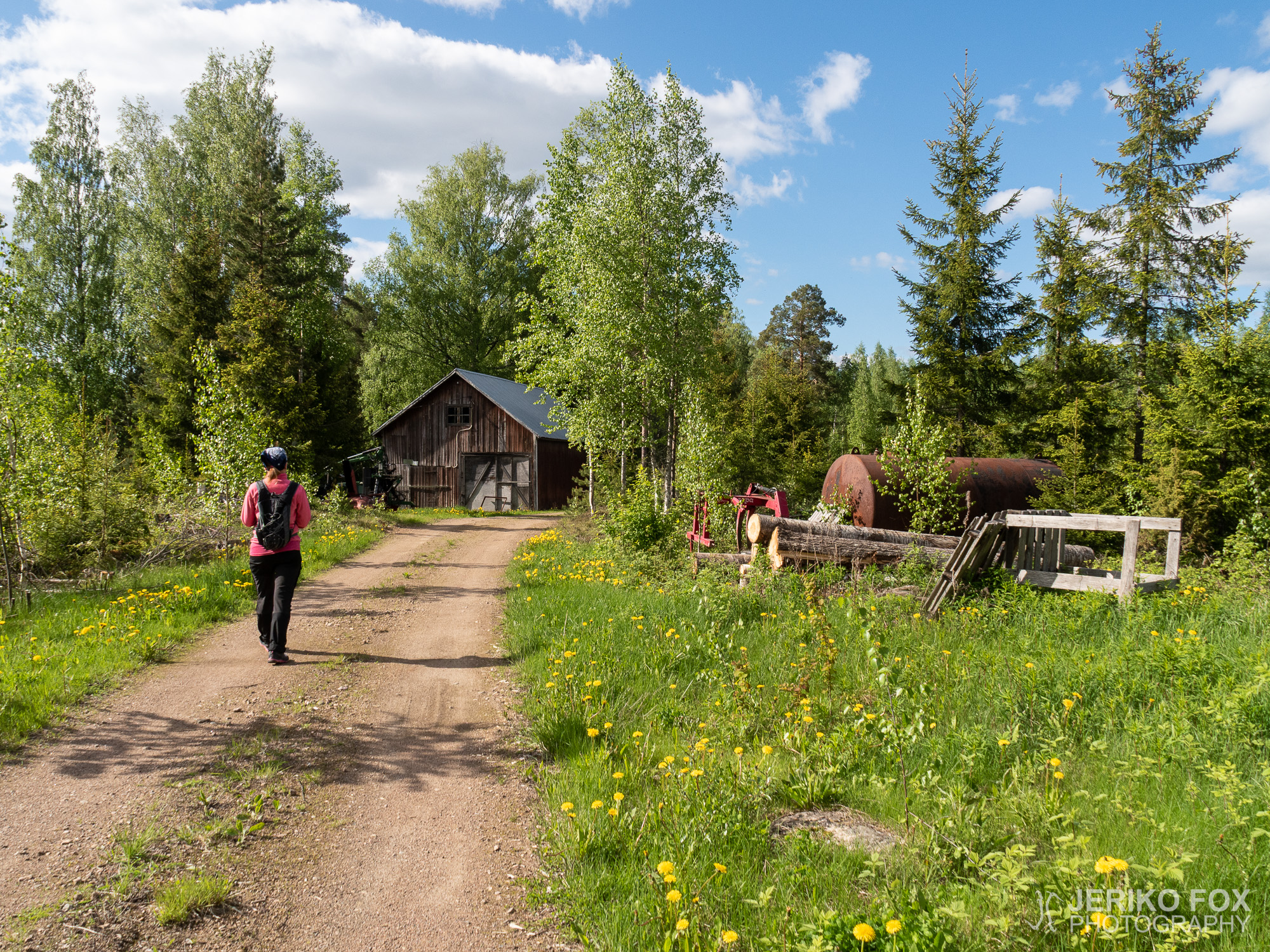
Tuohtjärvi Trail

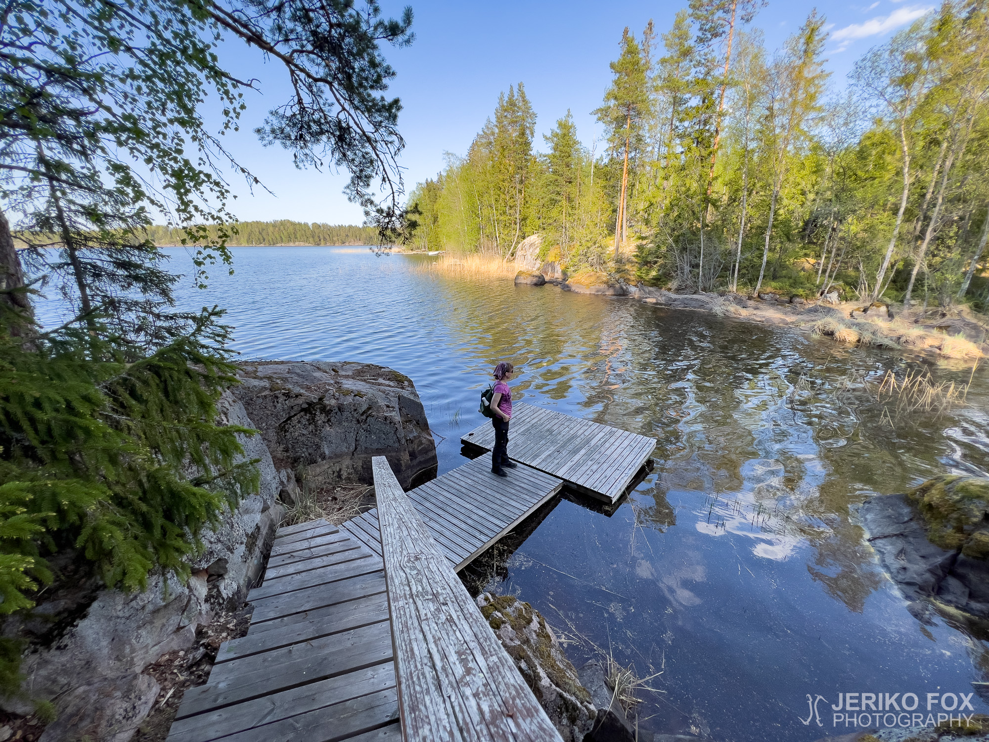
In the village of Peräkylä in Lemi there is a narrow and curved lake called Tuohtjärvi. Around that lake runs a 8 km (5 mi) long trail for hikers and MTBers – the Tuohtjärvi Trail. On one late-May day we decided to take a look what kind of a day hike destination it would be.

Finding the trail head is easy, when you follow Google Maps to Uimintie 677. In that address there is the Niittykulma shop and café – which looked pretty much abandoned. Anyway there was lot of space to park the car and thus me and Nina swung on our backpacks and started hiking along the dirt road. Because this trail is also a bike route, it follows mainly roads. The trail is marked well with small orange signs and blue sashes on the trees.

Walking along the roads was pretty uneventful from the hiking perspective, but on a sunny day we got to enjoy the countryside and the forest sounds. There were some mosquitoes, however not enough to be a trouble. Some change was offered by the roads changing from dirt roads to forest and field roads and then back again. There are few hills on the way, but generally the terrain suits for less stable walkers as well.

It was a slight anticlimax that the last two kilometres (1.2 mi) to the parking lot goes along a paved road with a narrow shoulder. Though this section offers one of the few views to the Lake Tuohtjärvi and landscape of rolling fields.

The Tuohtjärvi Trail is not the most surprising and exciting hiking destination – therefore possibly also little less known. One gets to enjoy the peaceful countryside and this is a good option, if you are looking for a bit longer day hike with easy terrain.

Total time: 17:55:49

Lemin Peräkylällä (kyllä sen nimi on oikeasti Peräkylä) sijaitsee pitkulainen ja kaareva Tuohtjärvi. Järven ympäri kulkee noin 8 km mittainen vaeltajille ja maastopyöräilijöille tarkoitettu Tuohtjärven reitti. Eräänä myöhäisenä toukokuun päivänä päätimme lähteä katsomaan millainen päiväretkikohde se olisi.

Perille löytää helposti ajamalla Google Mapsin avulla osoitteeseen Uimintie 677. Siinä osoitteessa sijaitsee Niittykulman kauppa ja kahvila, jotka kyllä näyttivät varsin autioituneilta. Pihaan sai kuitenkin auton hyvin parkkiin ja niinpä heitimme Ninan kanssa reput selkäämme ja lähdimme kulkemaan pitkin hiekkatietä. Koska kyseessä on myös pyöräreitti, polku kulkeekin pääasiassa teitä pitkin. Reitti on merkitty varsin hyvin pienillä oransseilla kylteillä sekä puissa olevilla sinisillä nauhoilla.

Teitä pitkin kävellen reitti oli vaeltamisnäkökulmasta melko yksitoikkoinen, mutta aurinkoisena päivänä saattoi silti nauttia mukavista maalaismaisemista ja metsän äänistä. Hyttysiäkin oli hieman, mutta ei vaivaksi asti. Vaihtelevuutta toi myös käveltävien teiden muuttuminen hiekkatiestä metsä- ja peltoteiksi. Joitakin mäkiä matkalla on, mutta yleisesti ottaen maasto soveltuu myös vähän huonompijalkaiselle kulkijalle.

Pieni antikliimaksi reitille on, että viimeiset noin kaksi kilometriä takaisin parkkipaikalle kuljetaan pitkin asfaltoitua tietä, jossa on melko kapea piennar. Toki tältä osuudelta tarjoutuvat liki ainoat näkymät itse Tuohtjärvelle sekä myös kumpuilevaa peltomaisemaa.

Tuohtjärven reitti ei ole yllättävimmästä ja jännittävimmästä päästä kohteita – siksi ehkä myös vähemmän tunnettu. Maaseudun rauhasta retkellä saa kyllä nauttia ja tämä on hyvä vaihtoehto helpossa maastossa hieman pidempää päiväretkeä kaipaavalle.

Lahnajärvi Trail

Lemi is located in Southern Karelia, northwest from Lappeenranta, and the main village sits on the shore of the lake Lahnajärvi. Locally Lemi is known from särä (a traditional food cooked in wooden trough from lamb and potatoes) and red potatoes – and more widely from the metal band Stam1na.

Around lake Lahnajärvi runs a 8,5 km (5,3 mi) long trail, that can be done either by hiking or by bike. The route starts from the church, which you can reach by bus. It’s not too far away from Lappeenranta to ride your bike there (about 25 km/15 mi one way) either. I chose to drive my car and found a parking place right next to the church, in front of the local bank.

On a bright spring day I started to hike this trail counter-clockwise, leaving the lake Lahnajärvi on my left hand side. I strolled along the sidewalk for a while, leaving the village behind, and then moved to the shoulder of the paved road. The route is marked with orange signs. There are not plenty of them, but all turns are indicated clearly. First of these turns was to Kesäniementie, which allowed me finally to tread an unpaved road.

On the north side of the lake the route changes once again from unpaved road to a forest road and the views were also getting nicer. There were really no views to the lake, but I enjoyed walking through the woods. When the trail turned to a land bridge that divides the Lake Lahnajärvi from the Kuuksenenselkä section of the Lake Kivijärvi, there is available an attraction. It’s a bit embarrassing to say that I was distracted enough to walk past it! There would have been an artillery pit, that is part of the Salpalinja (more about Salpalinja in my Salpapolku posts). But anything can happen when you are enjoying the great outdoors and perhaps it’s good to leave something for my readers to find, too.

Although the views to the lakes are limited, I think the Vuolteenkannas land bridge is the best part of the trail. The dirt road is peaceful enough and you get to enjoy the woods. At Papinoja (lit. priest’s ditch), that connects the two takes, there is a resting area with a table and benches – as well as the trail log.

After the land bridge I followed the dirt road for a while, until I turned to the paved Uimintie, that takes back to the village. Walking along the non-existent shoulder of the road wasn’t actually a pleasure cruise, when the cars keep rushing by, but fortunately this is only a small section of the trail.

Near the village, close to the shore, there is an artificial wetlands and a lean-to on the other side of it, if one wishes to have a break. Or then you can walk on the top of the hill, to the church, and stop at the local grocery store to get some ice cream. Generally I would recommend the Lahnajärvi Trail more for MTB than hiking, but it’s still an easy day trip – which ever way you choose to do it.

Total time: 18:04:14

Lemin kunta sijaitsee Etelä-Karjalassa, Lappeenrannan luoteispuolella, ja varsinainen kirkonkylä reilun kilometrin mittaisen Lahnajärven rannalla. Paikallisesti Lemi tunnetaan puukaukalossa valmistettavasta särästä (perinneruoka, johon tulee lammasta ja perunaa) ja punaisista perunoistaan – laajemmin ehkä metalliyhtye Stam1nasta.

Lahnajärven ympäri kulkee 8,5 km pitkä retkeilyreitti, joka soveltuu sekä kävelyyn että pyöräilyyn. Reitti alkaa siis Lemin kirkonkylältä, jonne pääsee linja-autolla – eikä pyörämatkakaan Lappeenrannasta (noin 25 km/suunta) ole mahdoton. Itse saavuin autolla, jonka parkkeerasin kirkon tuntumassa olevan Lemin Osuuspankin pihaan.

Kirkkaana keväisenä päivänä lähdin kulkemaan reittiä vastapäivään Lahnajärven jäädessä vasemmalle puolelleni. Hetken kävelin kevyen liikenteen väylää, mutta kylän jäädessä taakse kuljin asfaltoidun tien piennarta pitkin. Reitti on merkitty oranssein kyltein. Niitä ei ole jatkuvasti, mutta kaikki käännöspaikat on merkitty hyvin. Ensimmäinen tällainen käännös on Kesäniementielle, jolloin pääsee viimein kulkemaan päällystämätöntä tietä pitkin.

Lahnajärven pohjoispuolelta reitti siirtyy metsäautotielle ja maisematkin muuttuivat mielestäni mukavemmiksi. Järvelle asti ei tarjoutunut erityisemmin näkymiä, mutta metsässä oli miellyttävä kävellä. Reitin kaartuessa kulkemaan Lahnajärven ja Kivijärven Kuuksenenselän välistä kapeahkoa kannasta on polun varrella nähtävyytenä Salpalinjaan kuuluva tykkipatteri (enemmän Salpalinjasta Salpapolkua käsittelevissä teksteissäni). Kiusallista myöntää, mutta tohkeissani kävelin tästä huomaamattani ohi. No, retkillä tapahtuu kaikenlaista ja ehkä on hyvä jättää jotain lukijoidenkin löydettäväksi.

Vaikka näkymät järville ovat rajalliset, on Vuolteenkannas kuitenkin mielestäni reitin paras osuus. Hiekkatie on rauhallinen kulkea ja metsäluonnosta saa nauttia. Papinojan kohdalla, jossa on yhteys järvien välillä, on taukopaikka pöytineen ja reitin lokikirja.

Kannaksen jälkeen kuljin vielä tovin hiekkatietä, kunnes käännyin päällystetylle Uimintielle, joka vie takaisin kirkonkylälle. Olemattomalla pientareella kulkeminen ei ole pelkkää herkkua autojen suhahdellessa läheltä ohi, mutta tämä pätkä on onneksi melko pieni osuus koko reitistä.

Kirkonkylälle saapuessa on rannan läheisyydessä keinotekoinen kosteikko, jonka toisella puolella on laavu, jossa voi myös halutessaan pysähtyä. Tai sitten voi kävellä mäen päälle kirkolle ja hakea vaikka jäätelöt läheisestä kaupasta. Yleisesti suosittelisin Lahnajärven reittiä enemmän pyöräilyyn kuin vaeltamiseen, mutta helpon päiväretken siitä saa kulkuvälineestä riippumatta.

Repovuori Trail

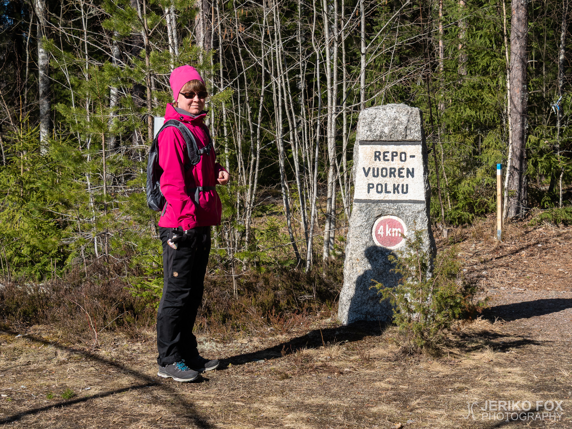
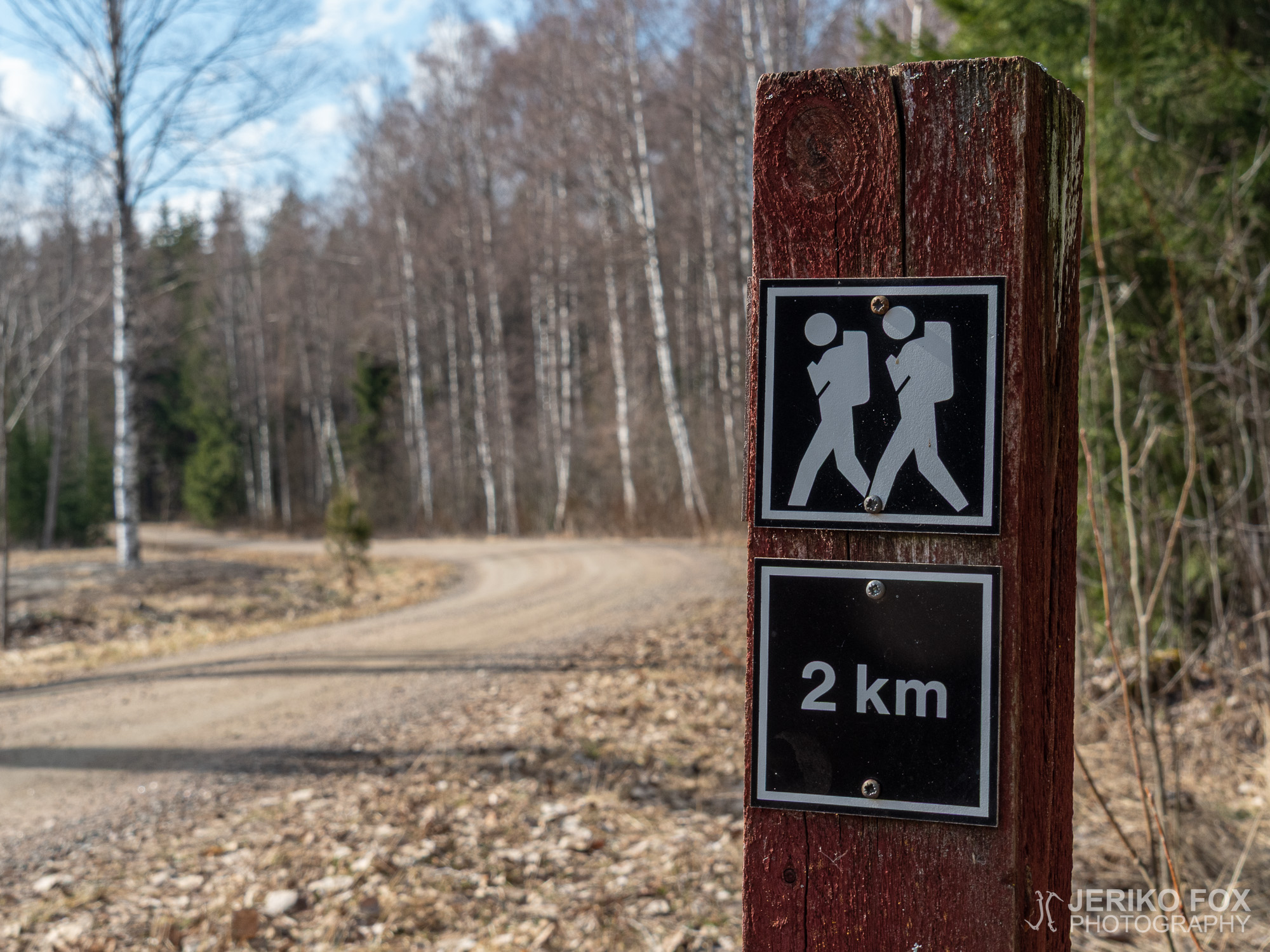
In the Lemi area there are quite a few hiking destinations and two of them are conveniently located right along the Mikkelintie. So, it’s easy approach them especially if you are driving from Lappeenranta to Savitaipale or to Mikkeli. Both of these two trails, the Repovuori Trail and Tuulimylly (Windmill) Trail, share the same trailhead in Huttula village, behind the ice hockey rink.

On a sunny day in April me and Nina decided to check the slightly shorter, 4,5 km (2.8 mi) long, Repovuori Trail. We drove from Lappeenranta towards Mikkeli and at the Tarmo general store we took a turn right, to the Salmentie, and once again right to arrive to the ice hockey rink. There is enough space to park your car there. Close to the rink there is also a lean-to and a goahti, where you may enjoy your snacks after the trip or why not before. (Good food is the main attraction of any trip.) The goahti is locked, but at the lean-to there are phone numbers of locals who have the code for the key deposit.

We started to hike along the mellow trail through the old spruce forest. There was still a bit of snow on the trail, but not too much to cause any issues. The trail signs were brand spanking new and these blue and white posts were easy to follow. There are grand glacial erratics in the woods and as we were approaching the Kilkinmäki Hill the rock faces were also rather bouldery. The moss covered rocks reminded me of the giant Antero Vipunen, who is a character in the Finnish mythology and national epic, Kalevala.

The first climb was to the Kilkinmäki Hill and from the top the trail forks towards Repovuori and to Tuulimylly Trail. The funny images in the sign are worth mentioning. Before arriving to the Repovuori the trail follows power lines for a while. Because the area had gone through some landscaping, we had to look for a while where the trail disappeared, but once we found it we were back on track.

At the Repovuori (lit. Fox Mountain) the hiker is greeted by magnificent rock walls with beautiful cracks. And to my surprise on the top of these walls I saw bolted anchor points. So, there is a trad climbing routes there at least to two anchors and I also saw one bolted sport climbing route. I wasn’t at all aware about this location and it’s not either listed to the 27 Crags database. Therefore I can’t say anything about grading.

There is some scramble to do on the trail, but not any hard climbing. We sat down on a steep hill close to the climbing place to have a break because there was a nice sunny spot. Although bit further along the trail there would have been a perfect lunch spot with a view and a bench. So, I recommend going there.

Once we had descended from the Repovuori we arrived to a clear cut area and then to a thinned area. There the trail was completely lost, but the route had been marked with yellow ribbons in the trees. A while later we met a local guy, who asked if we found the route through the woods. He told that it was due the thinning that required them to do some rerouting.

The loop trail leads back to the ice hockey rink. Our trip was by all means successful in the beautiful spring weather. I can warmly recommend the Repovuori Trail as a day hike to everyone, who is comfortable with small challenges in terrain and especially to trad climbers. The locals seem to take good care of the trail and quite often these kind of trails that are maintained by small communities are the best ones.

Total time: 18:50:09

Lemin alueella on useampikin retkikohde ja kaksi reittiä asettuu mukavasti Mikkelintien varteen. Niihin on siis helppo käydä tutustumassa, jos liikkuu Lappeenrannan ja Savitaipateen tai Lappeenrannan ja Mikkelin välillä. Nämä molemmat kaksi reittiä, Repovuoren luontopolku ja Tuulimyllyn luontopolku, alkavat samasta paikasta Huttulan kylän jääkiekkokaukalon takaa.

Otimme aurinkoisena huhtikuun päivänä Ninan kanssa ensimmäiseksi projektiksi hieman lyhyemmän, noin 4,5 km pitkän, Repovuoren reitin. Ajoimme autolla Lappeenrannasta Mikkeliin päin ja Tarmo-kaupan kohdalta käännyimme oikealle Salmentielle ja melkein heti taas oikealle jääkiekkokaukalon luokse. Sen vierustaan mahtui hyvin parkkiin. Kaukalon vieressä on myös laavu ja kota, joissa voi nauttia tauosta retken jälkeen tai miksi ei vaikka ennenkin. (Pääasiahan retkessä on tietenkin aina hyvät eväät.) Kota on lukossa, mutta laavun seinässä on yhteistiedot avaimia varten.

Lähdimme kävelemään hyvin hoidettua muhevaa polkua läpi vanhan kuusimetsän. Polulla oli vielä keväästä hieman lunta, mutta ei haitaksi asti. Reittimerkit olivat aivan uudet ja sinivalkoisin raidoin merkattuja tolppia oli helppo seurata. Maastosta löytyy näyttäviä siirtolohkareita ja Kilkinmäkeä lähestyessä kalliotkin ovat vaikuttavan louhikkoisia. Sammaleen peittämä maasto tuo jokseenkin kalevalalaisia mielikuvia nukkuvasta Antero Vipusesta.

Ensimmäinen nousu on Kilkinmäelle, josta reitti haarautuu Repovuorelle ja Tuulimyllyn luontopolulle. Tämä on merkattu hauskoilla kuvilla. Ennen Repovuorta reitti kulkee pienen matkan voimalinjoja pitkin ja siellä reittiä piti maaston parturoinnin jäljiltä aluksi etsiä, mutta selvä polku löytyi kuitenkin pian.

Repovuorella vaeltajaa tervehtii näyttävä kallionseimänä kauneine halkeamineen. Ja yllätyksekseni niiden yläpuolella näin seinään pultatut ankkurit. Alueella on siis trädikiipeilymahdollisuus ainakin kahdelle yläankkurille sekä yhden pultatun sporttireitin näin myös. En ollut itse tästä paikasta ollenkaan tietoinen ja sitä ei ole listattu ainakaan 27 Cragsissa. Greideistä en siten osaa sanoa mitään.

Reitillä on hieman könyämistä luvassa, mutta ei mitään mahdotonta kiipeilyä. Istahdimme hetkeksi pitämään taukoa kiipeilypaikkojen lähettyville jyrkähköön rinteeseen, koska siinä oli mukava aurinkoinen paikka. Tosin hieman eteenpäin kulkiessa Repovuoren laella on kunnon näköalapaikka penkkeineen, joten suosittelen sitä taukopaikaksi.

Laskeuduttuamme Repovuorelta tulimme avohakkuualueelle ja osittain kaadettuun metsään. Sieltä reitti oli kadonnut täysin, mutta puihin oli merkattu keltaisilla nauhoilla uusi reitti. Hieman myöhemmin törmäsimme paikalliseen mieheen, joka kyseli olimmeko löytäneet reitin hyvin metsässä. Hän kertoi, että juurikin harvennushakkuiden takia oli ollut tarpeen tehdä hieman uudelleenreititystä.

Rengasreitti tuo lopulta takaisin jääkiekkokaukalolle. Meidän retkemme oli erittäin onnistunut kauniissa kevätsäässä. Voin lämpimästi suositella Repovuoren luontopolkua päiväretkeksi kaikille, joita hieman vaativampi maasto ei haittaa ja ehdottomasti trädikiipeilijöille. Paikalliset vaikuttavat pitävän reitin hyvässä kunnossa ja yleensä tällaiset pienten paikallisyhteisöjen hoitamat reitit ovatkin niitä parhaimpia.