
14,46 km (9 miles)
2189.8 / 2189.8 miles
Appalachian Trail Lodge, Millinocket, ME
It was still dark, when I was waking up in my sleeping bag after 5 am. The bear bag down from the cable and into preparing my breakfast. There were sounds of people waking up from the other tents as I was packing up my things. At half past six I was trodding back to the AT from The Birches. I took plenty of water from the Katahdin Stream, because the ranger had told me yesterday that there would be no water on the uphill or the downhill.
Most of the thru-hikers borrow a daypack from the rangers and leave their own backpacks at the Ranger Station to be picked up when they return. That means it’s more common to slackpack than not on the Mount Katahdin and it’s actually recommended. I as a puritist had hiked every single meter of the trail and carried my backpack all the way. It was not like I was going to give up on the last day. In addition my plan was to traverse the Mount Katahdin, which wouldn’t make it very practical to leave anything to the Katahdin Stream Campground.
The sun was beginning to shine as I started to hike the gentle uphill to the Mount Katahdin. I had all sorts of mixed emotions that are difficult to put into words. I had waited for this day for six months. I had dreamed of this moment since I first heard of the Appalachian Trail.
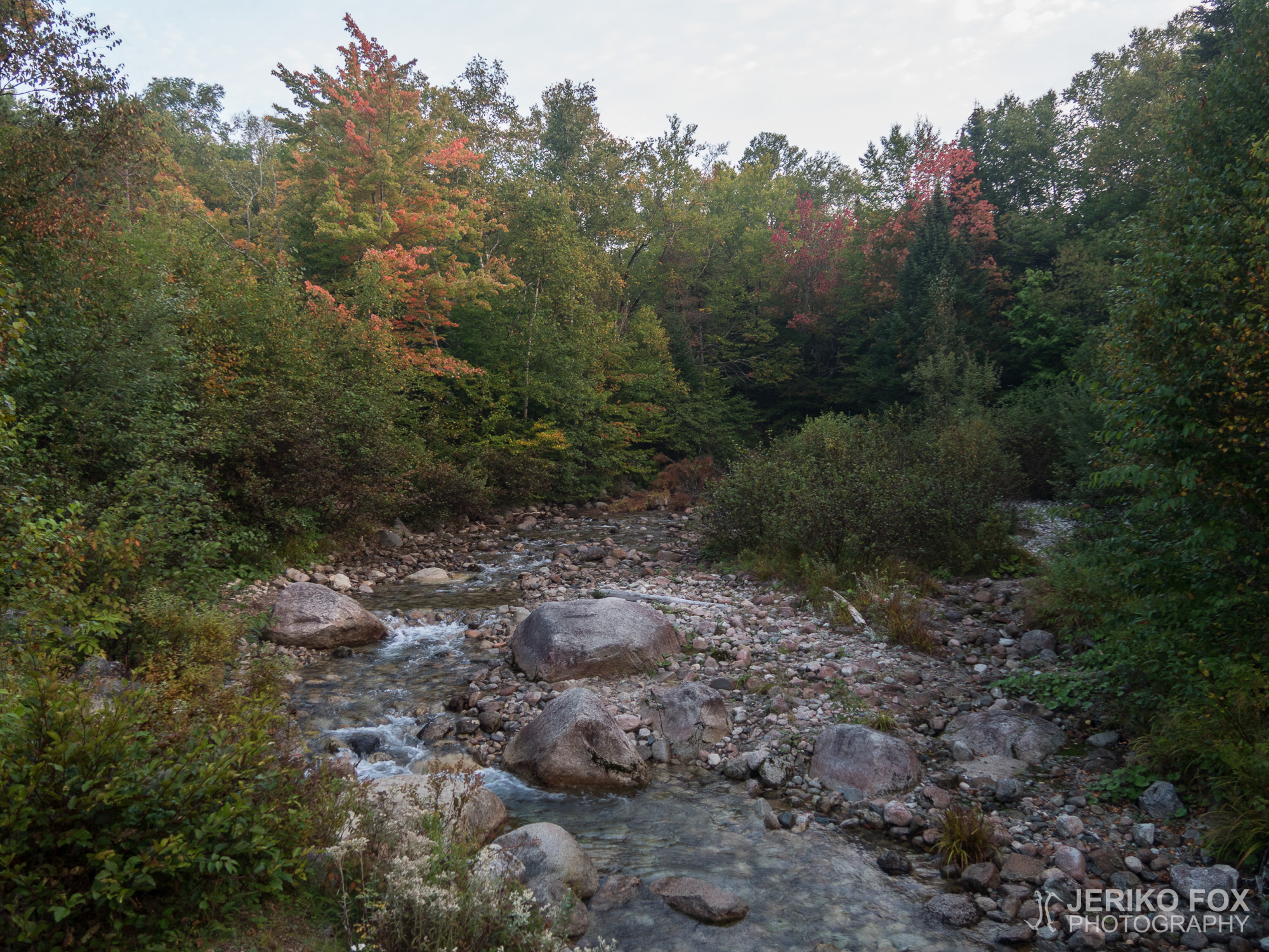
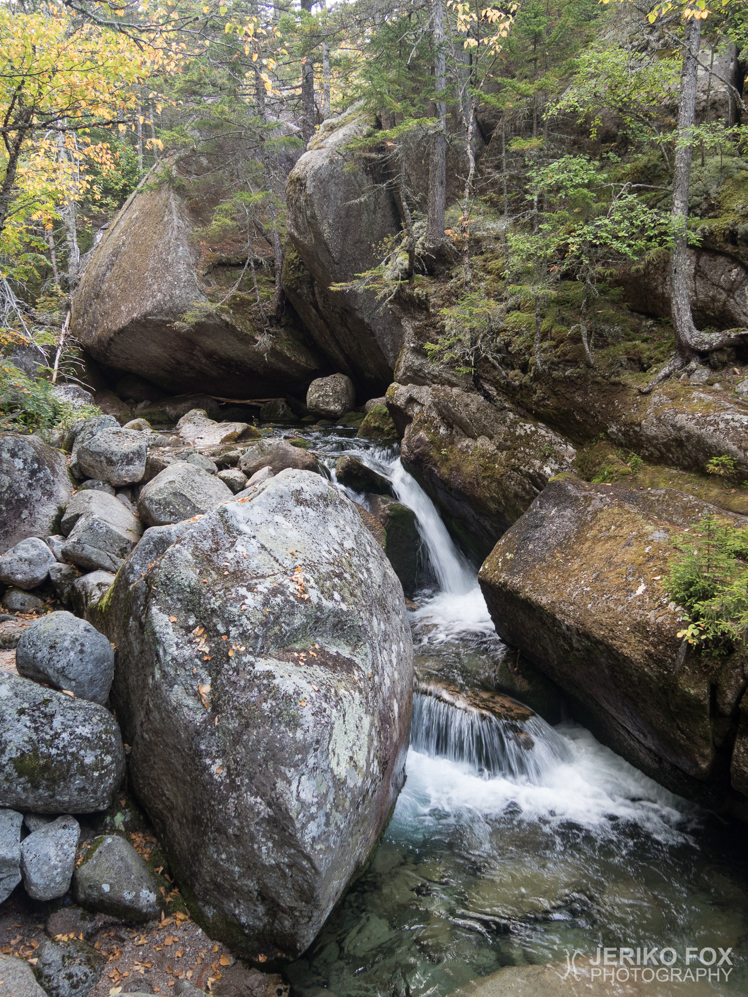
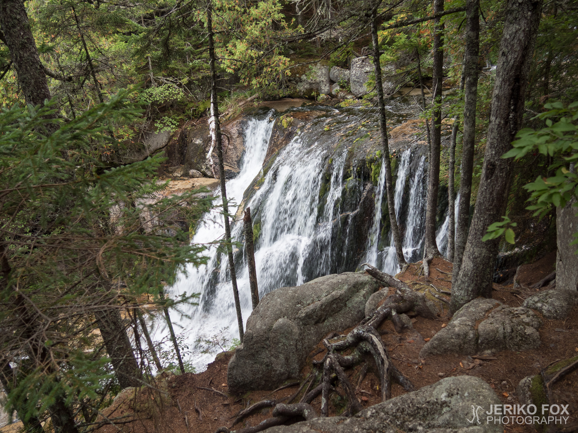
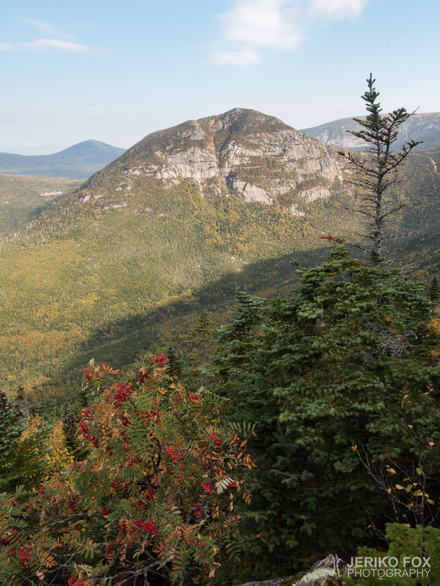
I passed day hikers in the fresh morning and every once in a while stopped to admire the Katahdin Stream that was intertwining with the trail and forming waterfalls. It seemed like there was lots of water above the campground. The trail was first very gentle and got slowly more steep. The beginning of the climb reminded me a lot about the Mount Moosilauke in New Hampshire.
I heard a friendly greeting behind my back as I was walking through the forest. I was delighted to see Papa John, who I got to know in the Roller Coaster in Virginia. He was accompanied by a young woman that he introduced as his daughter. She had wanted to join her father on his last hiking day. During the morning few other thru-hikers passed me, but save two men all of them were carrying only daypacks.
In the beginning of the climb my backpack didn’t cause any disadvantages, but as the trail got steeper the difficulty factor grew significantly. First there was the kind of scramble that I got very familiar with in the White Mountains, but soon it changed to actual climbing on the large boulders. Now my backpack was really making my progress more challenging and at one point I had actual difficulties to squeeze myself through a crack between two boulders. Anyway I set my mind into gathering enough force and pushed with all my might up and simultaneously squeezing into that crack. One more vigorous push and I popped out from the other side. If women give birth to people, I guess boulders give birth to thru-hikers.
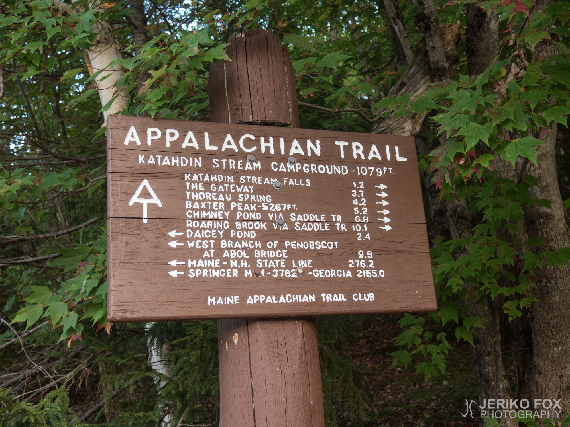
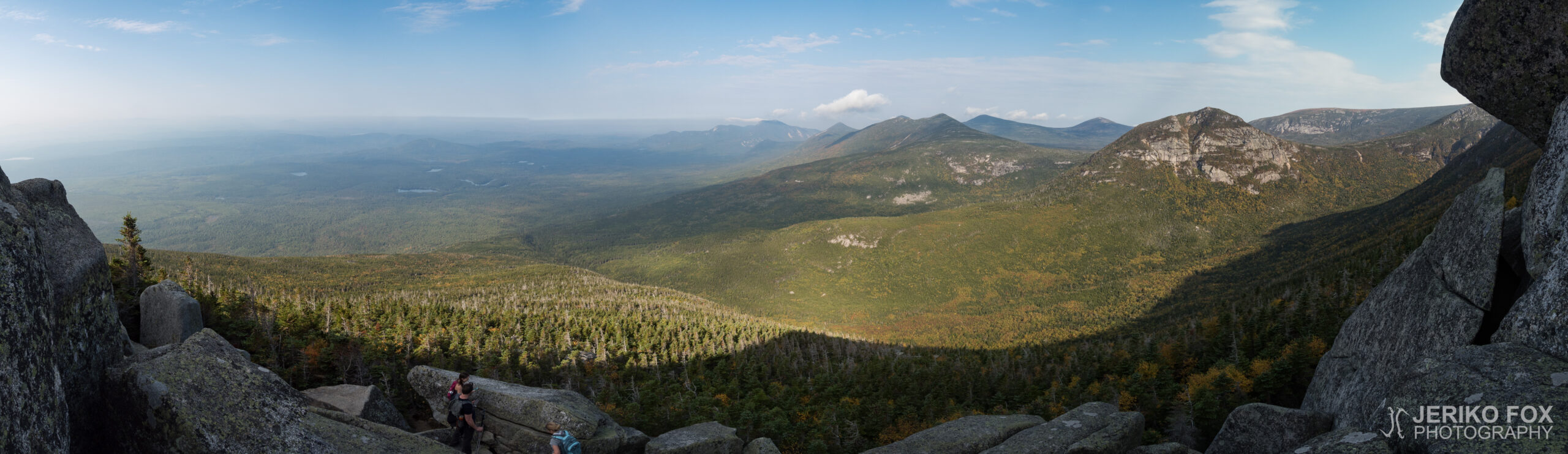
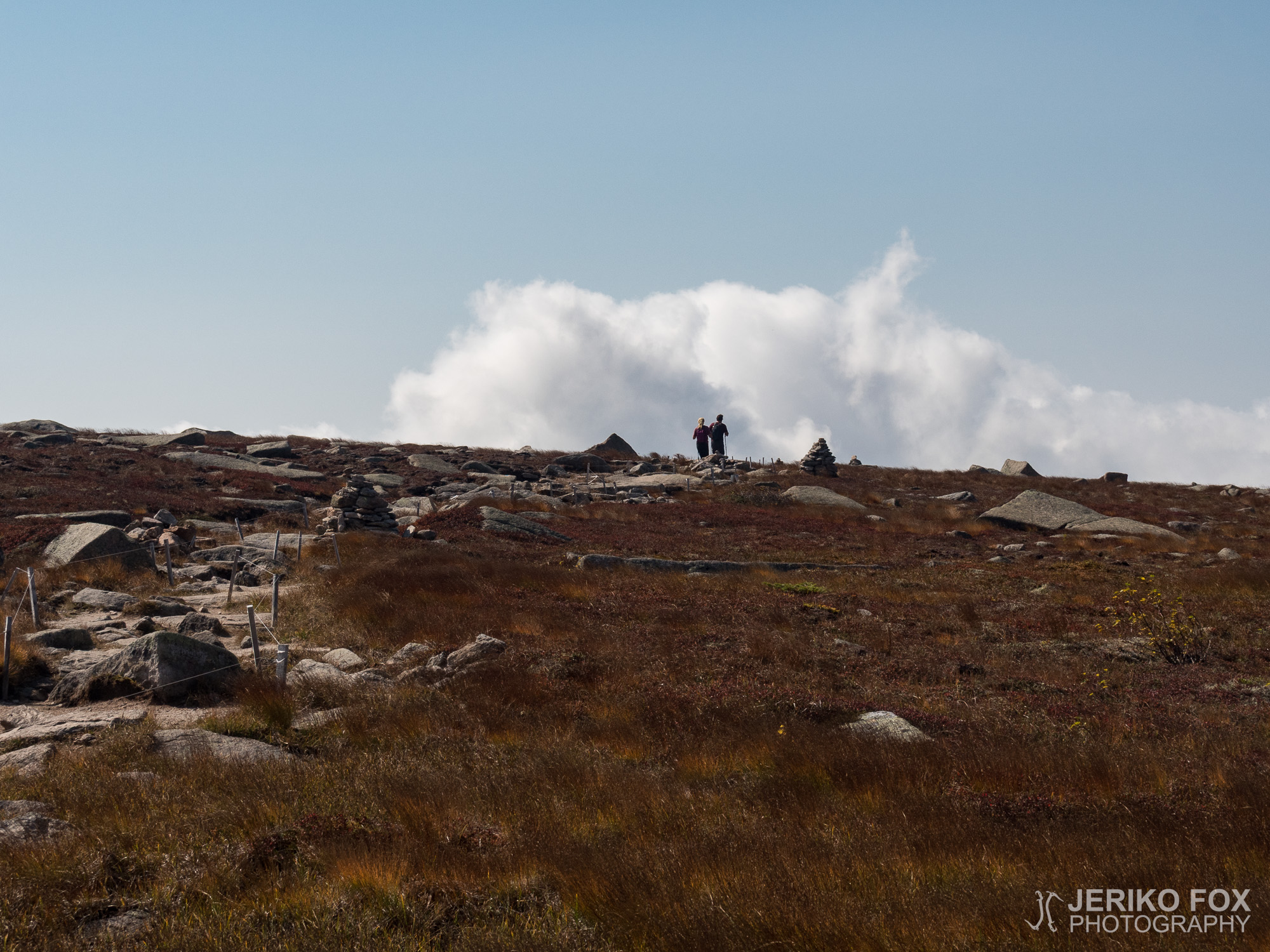
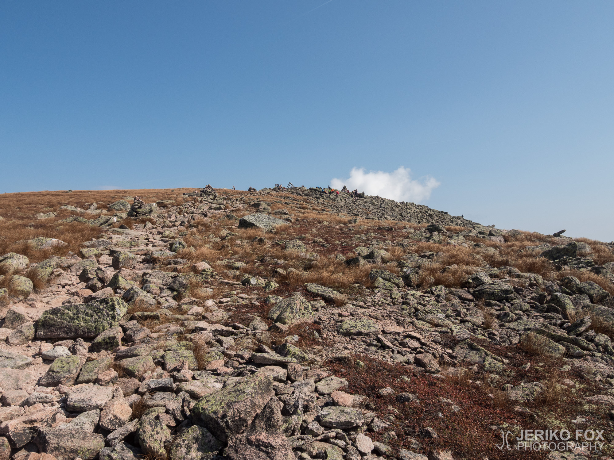
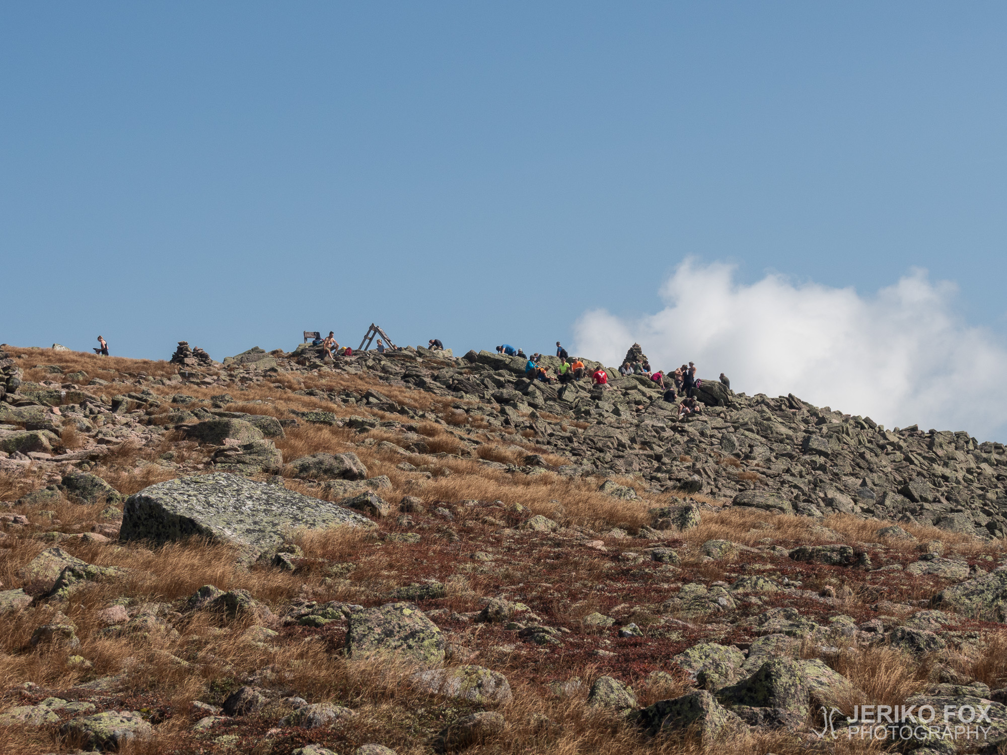
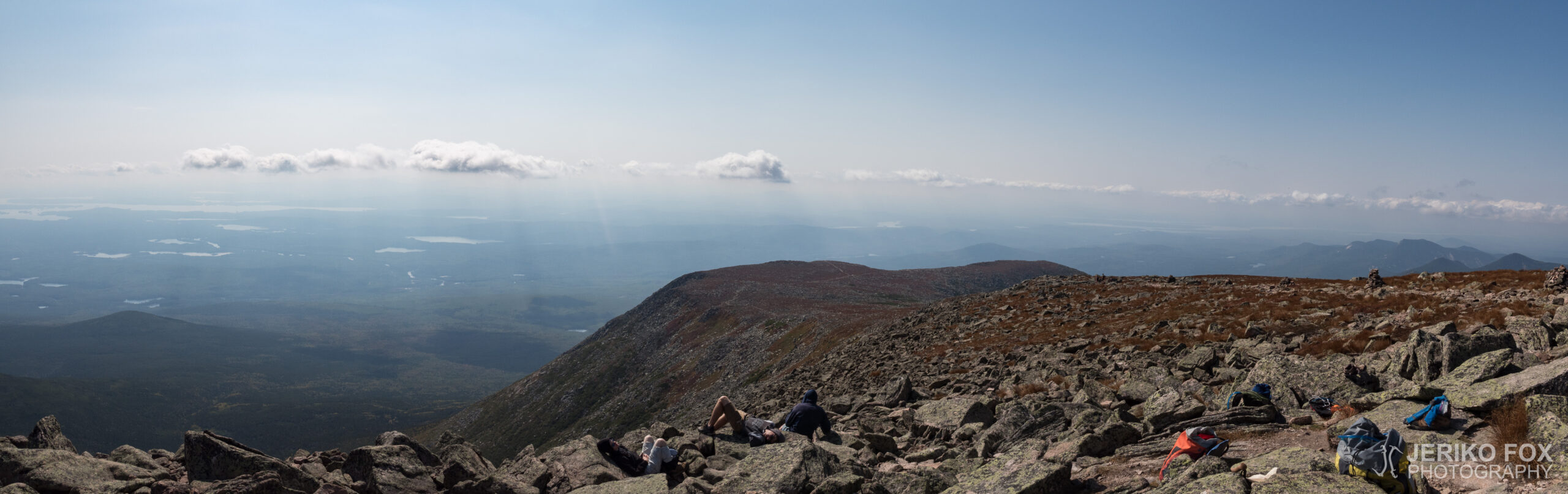
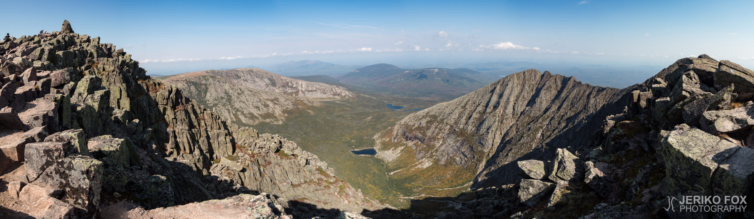
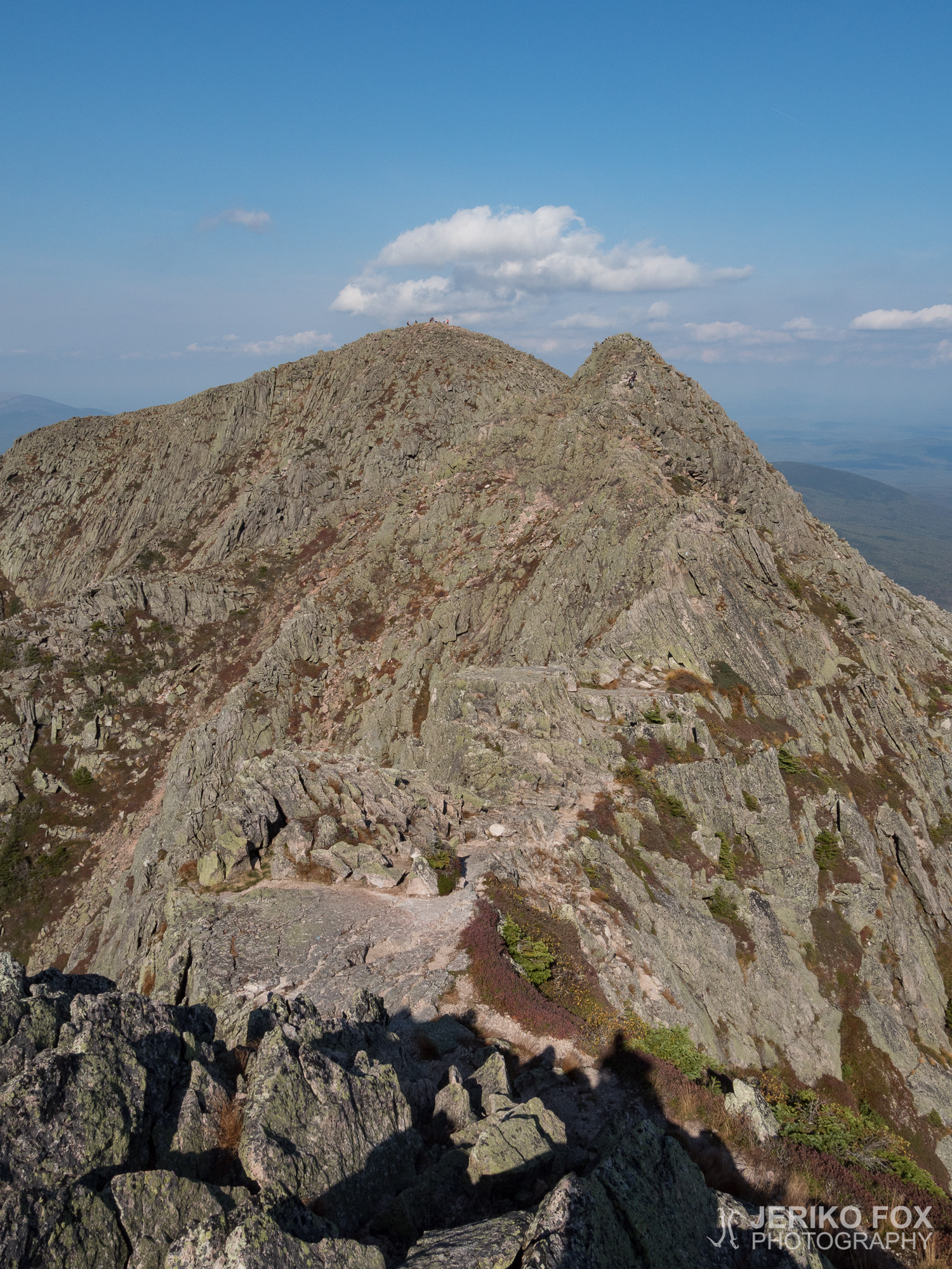
As I got higher the views kept getting better and on a clear day like this I could see very far. I felt happy with the great weather, because climbing Katahdin on a rainy day would have been awful. There was a small flat section on the uphill and I heard many day hikers saying that this is the first step, The Gateway, and the summit ahead of us would be the Baxter Peak. I checked the hiked distance from my sports watch and said to myself that there was no way this could be the first step. One tends to overestimate the hiked distance easily and that’s where I have found my GPS watch very useful. The kilometer count helps me to know my exact location on the trail. And now I knew that the summit I was seeing was actually the first step and many would encounter a bitter disappointment on the top.
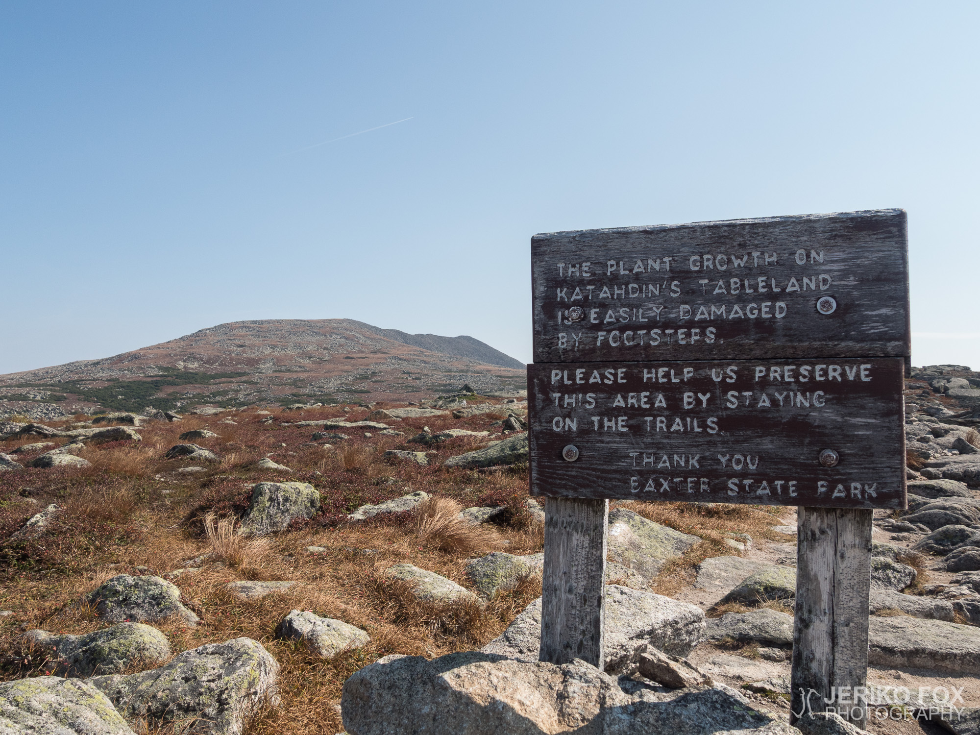
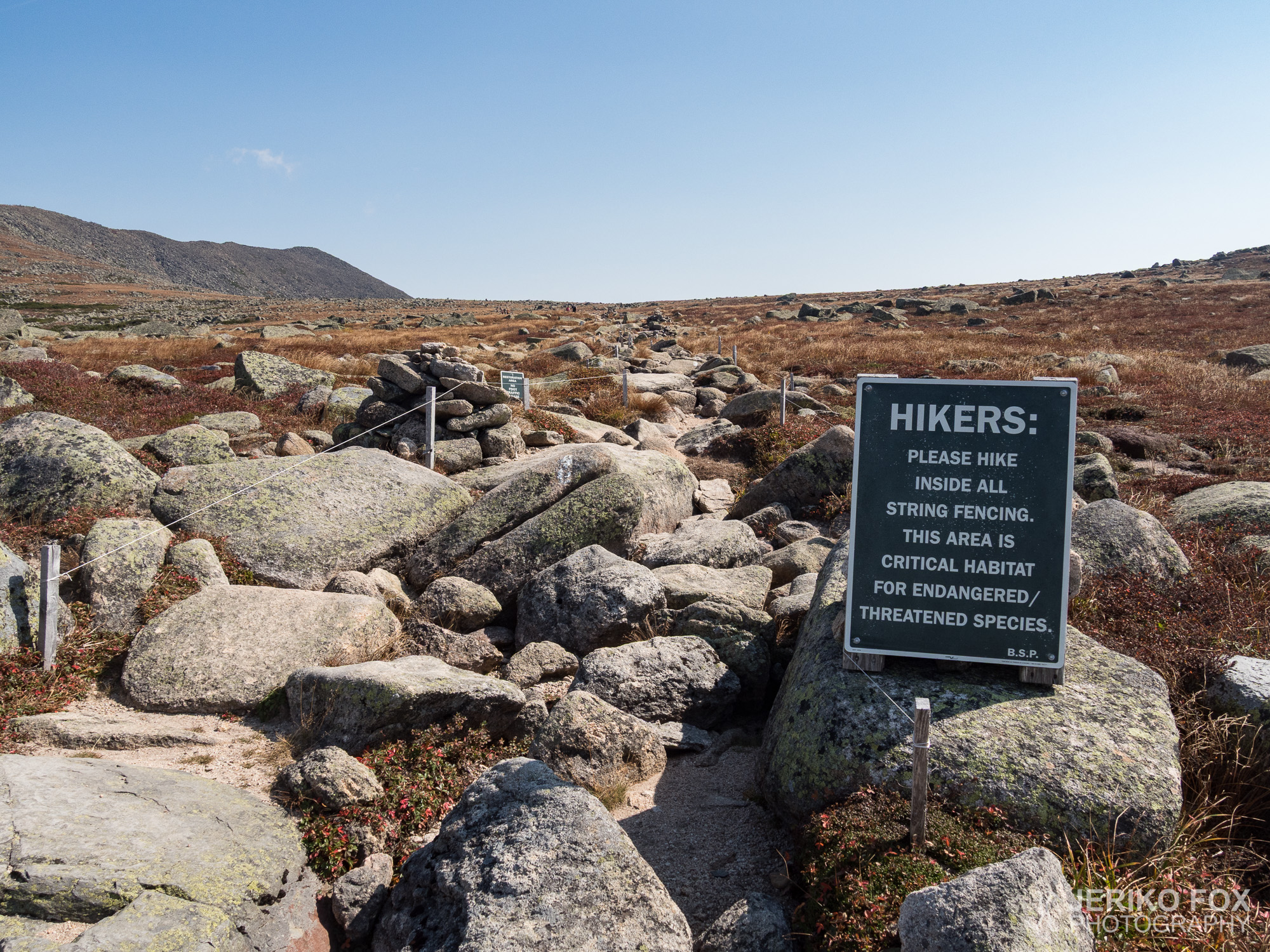
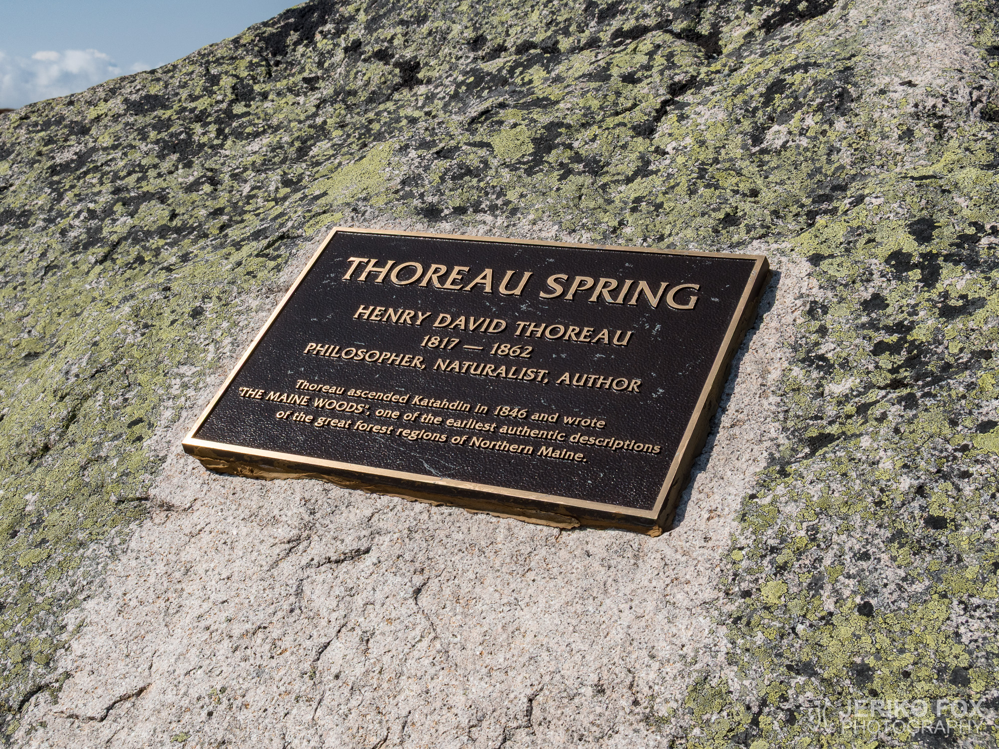
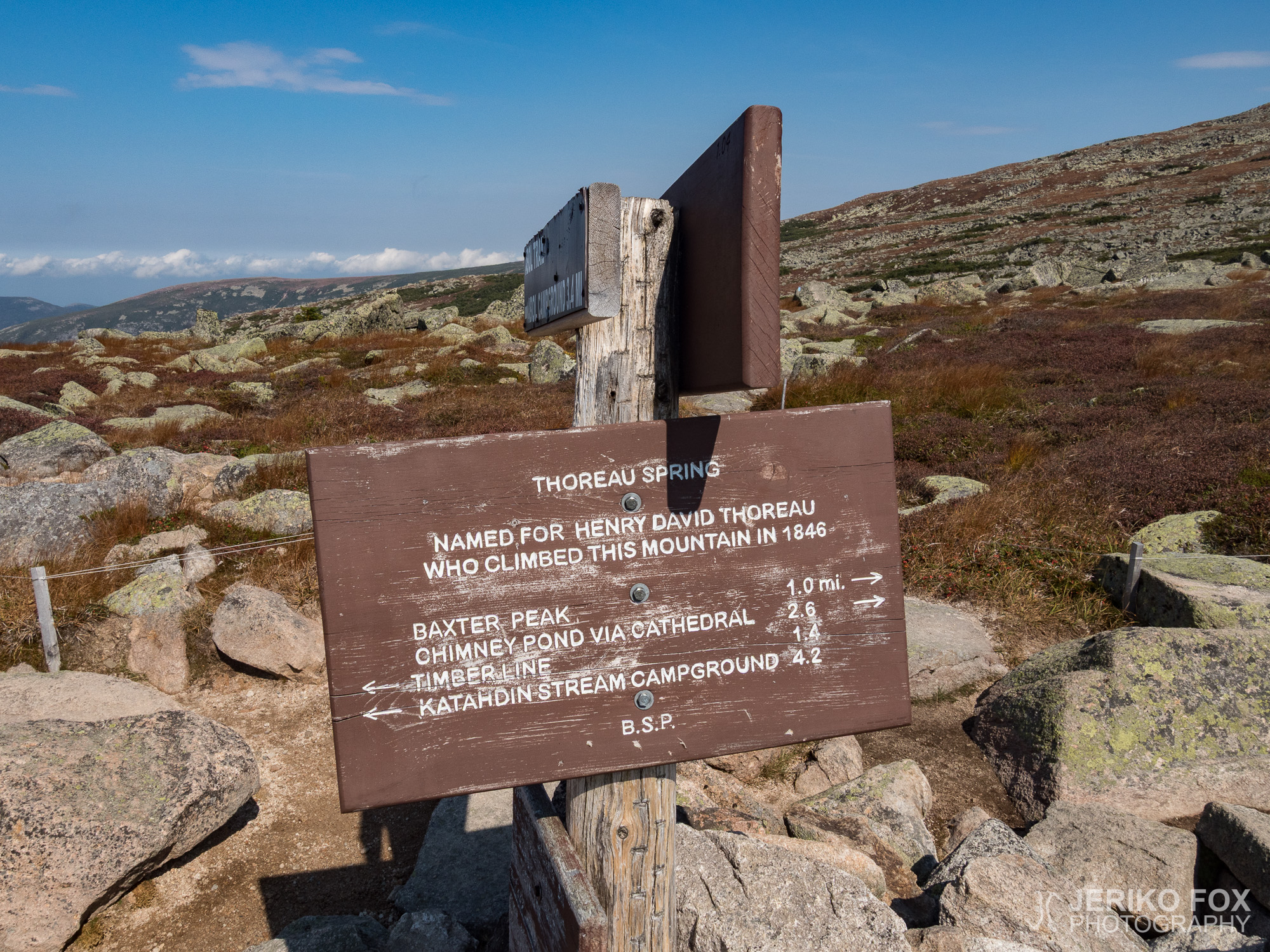
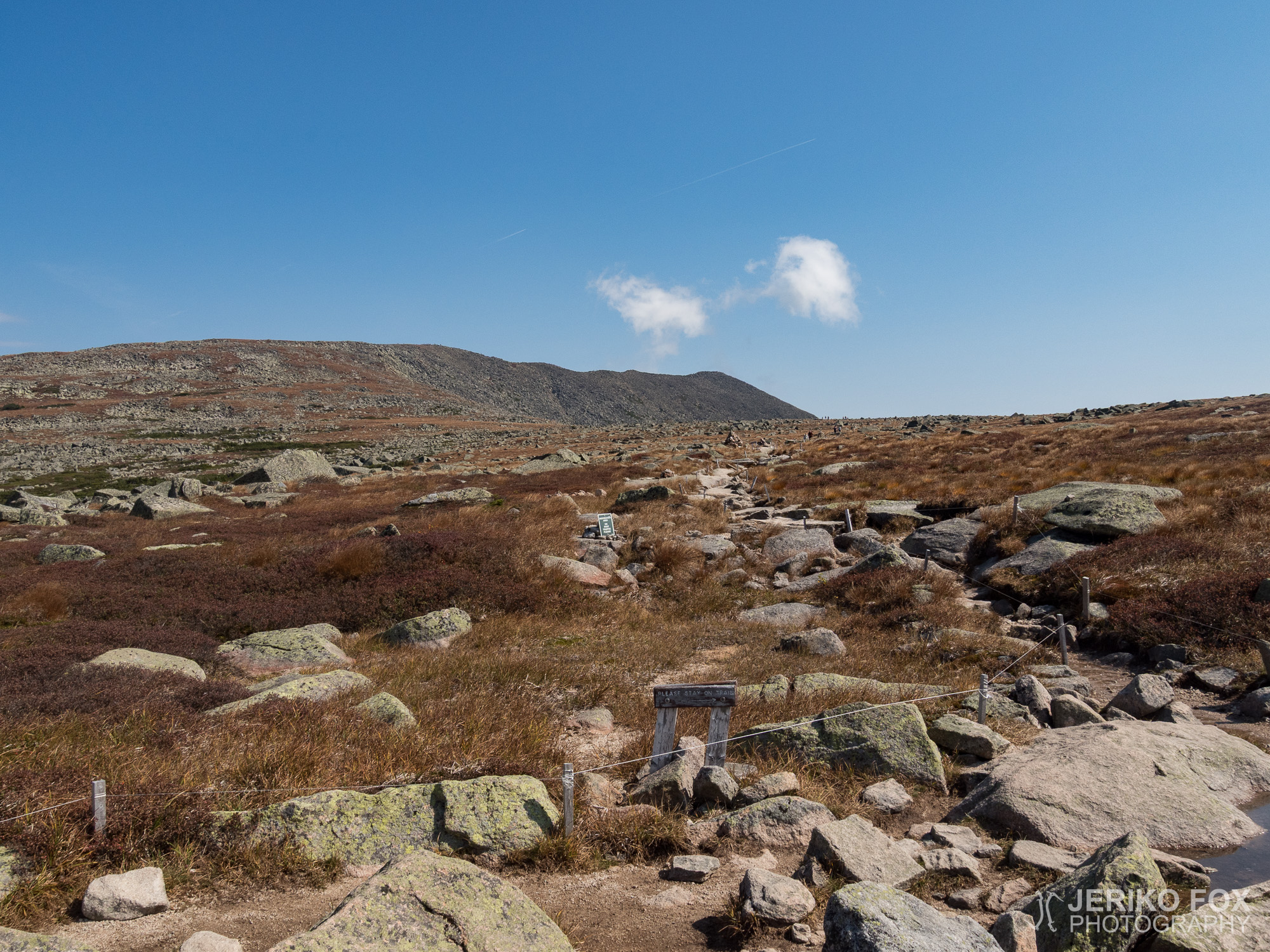
When I reached The Gateway or the first step I saw some clouds in the horizon and the wind was blowing more. Ahead of me was a relatively flat section, The Tableland, which also had the only spring in the area. Thoreau Spring is merely a puddle (and I’ve understood that it has been such for many years already), so one doesn’t want to count on that for water. The last water on Katahdin is below the treeline.
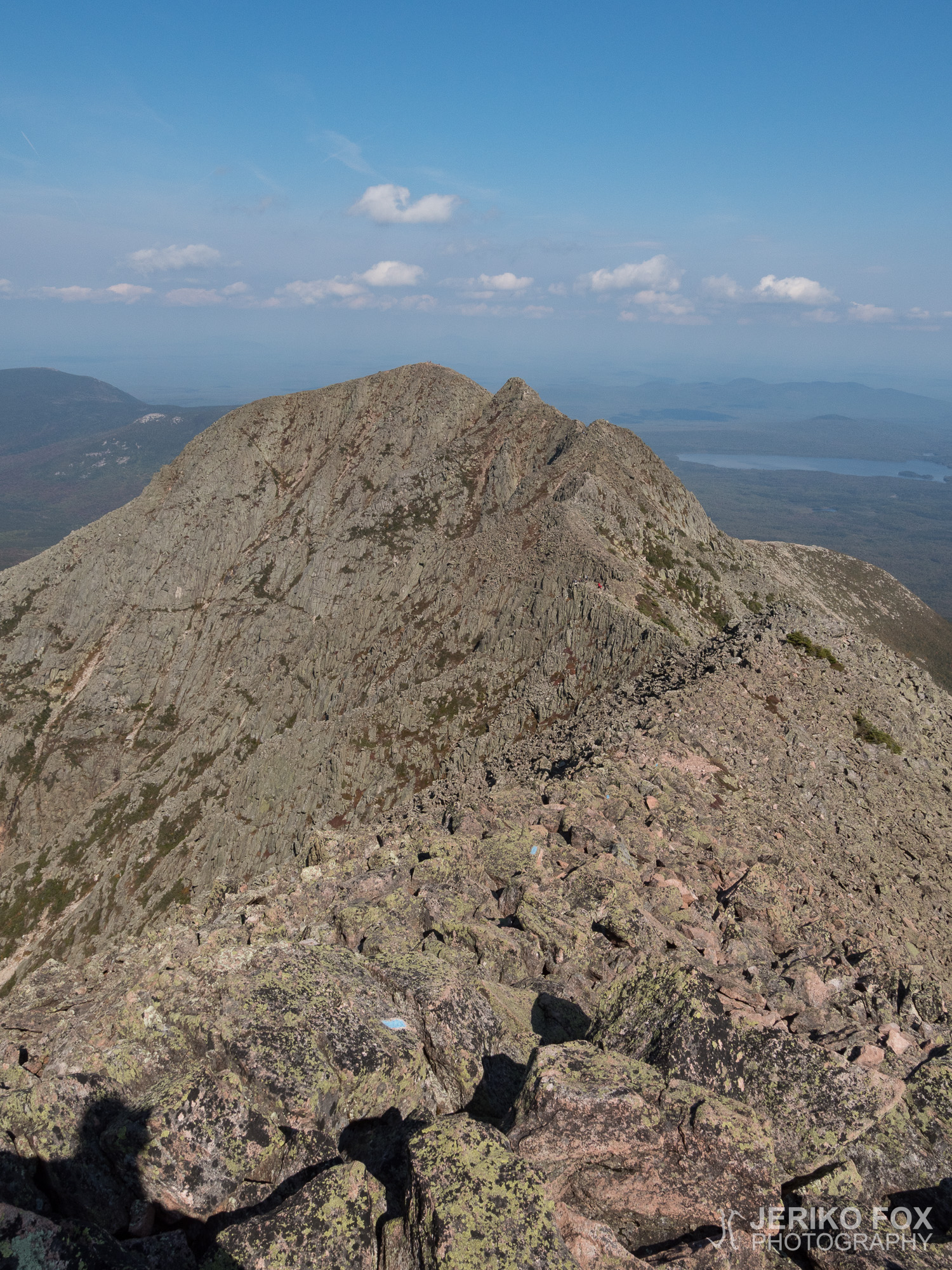
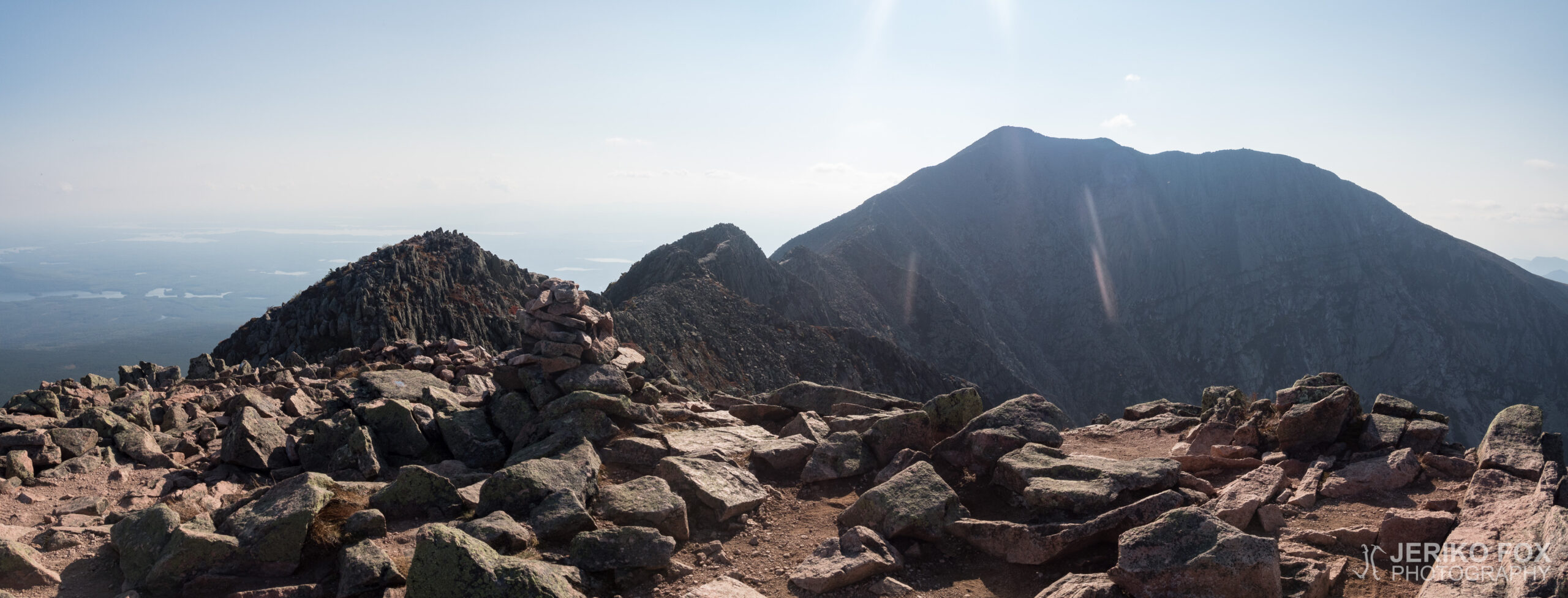
Further on the Tableland I saw Papa John and his daughter descending from the summit and heading down along the Abol Trail. It’s possible to descend from Katahdin along the Hunt Trail (that is the AT) back to the Katahdin Stream Campground or along the Abol Trail to the Abol Campground – these are on the south side of the mountain. Alternatively one can traverse the Mount Katahdin to the Roaring Brook Campground via Chimney Pond or along the Knife Edge. The last one was my choice.
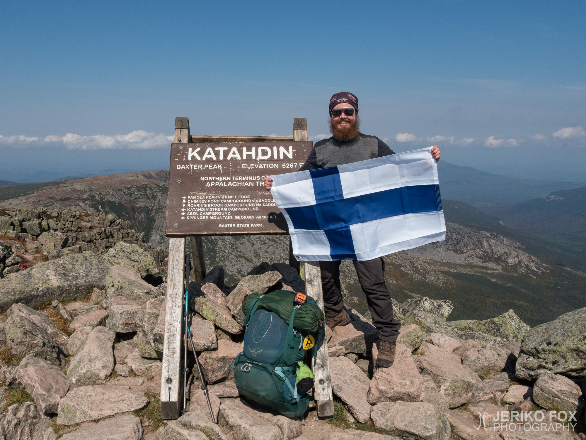
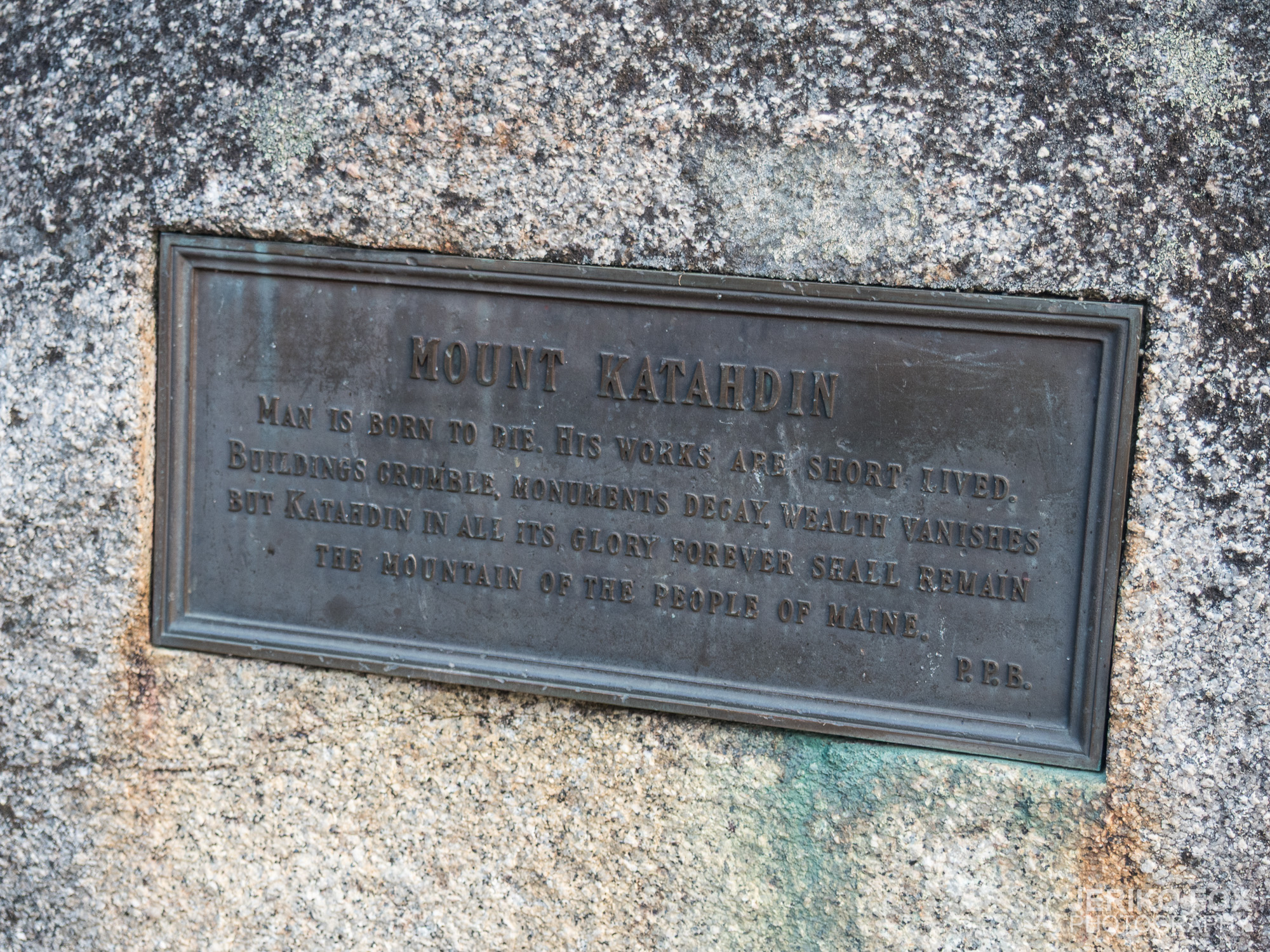
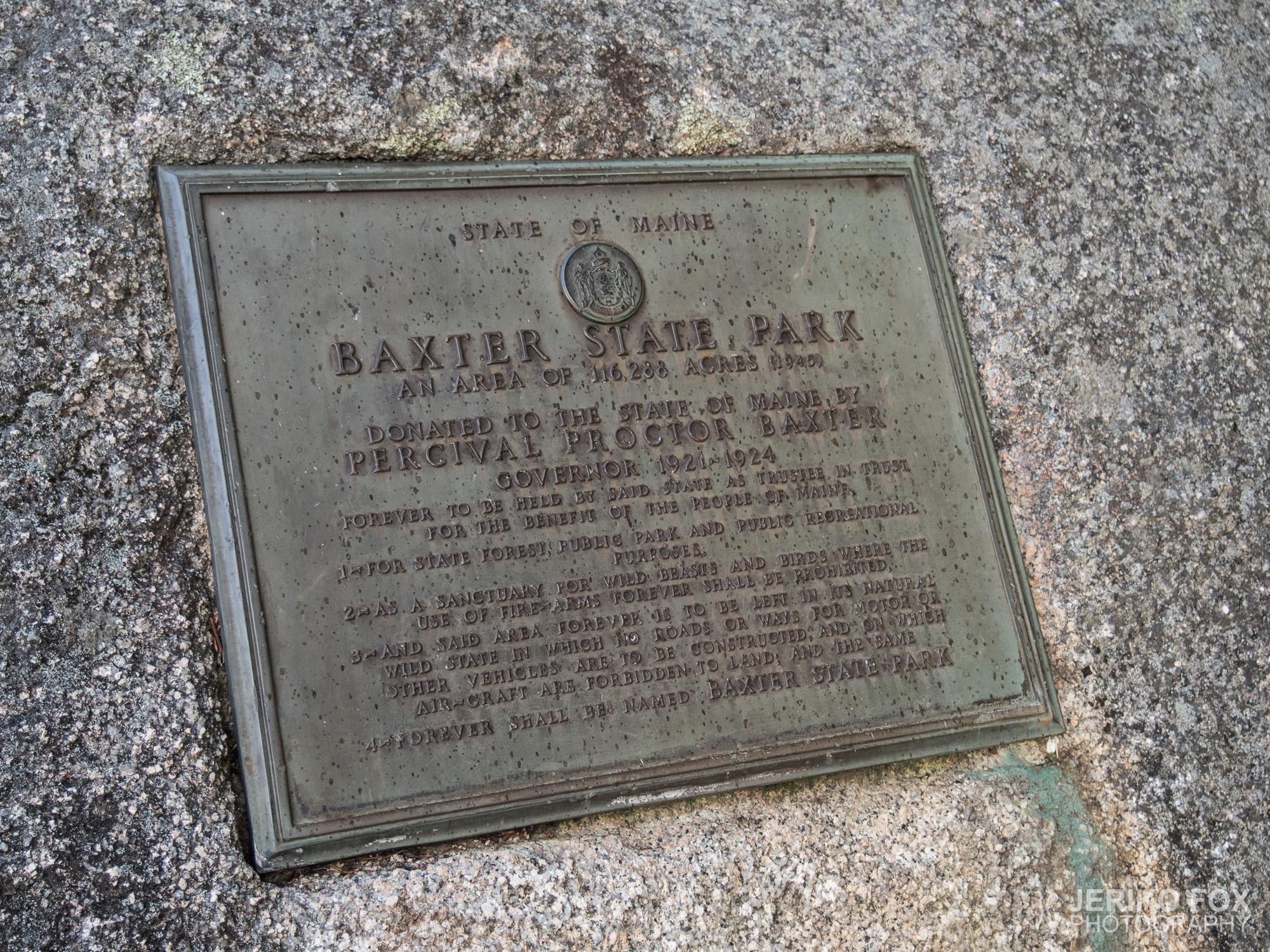
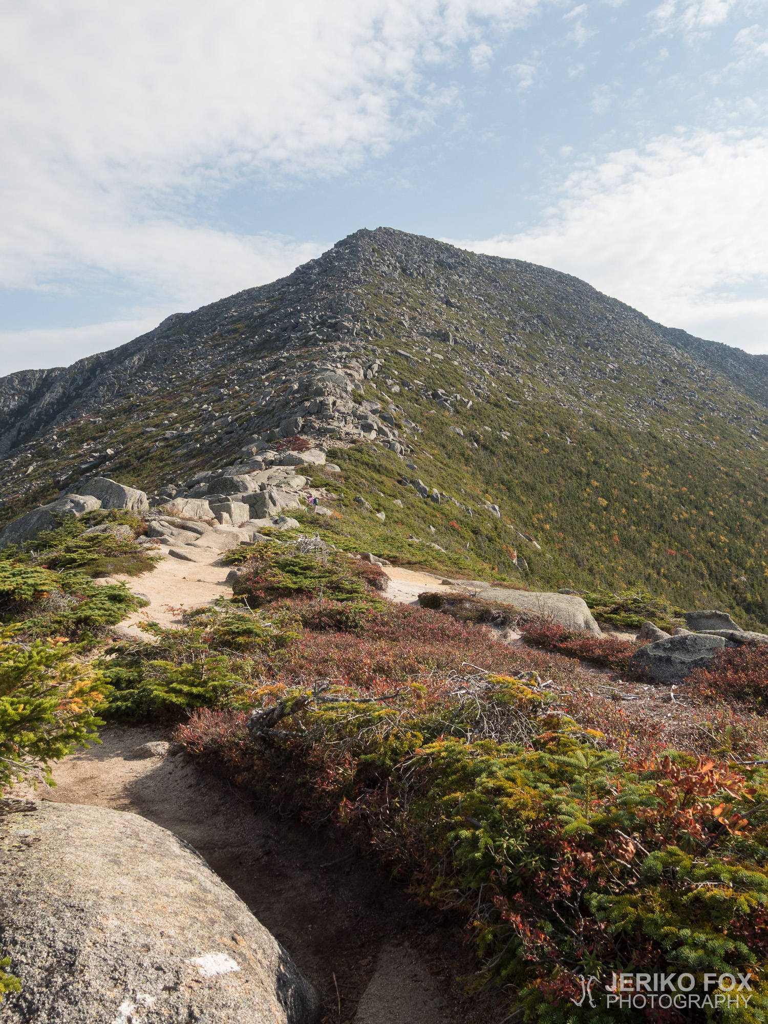
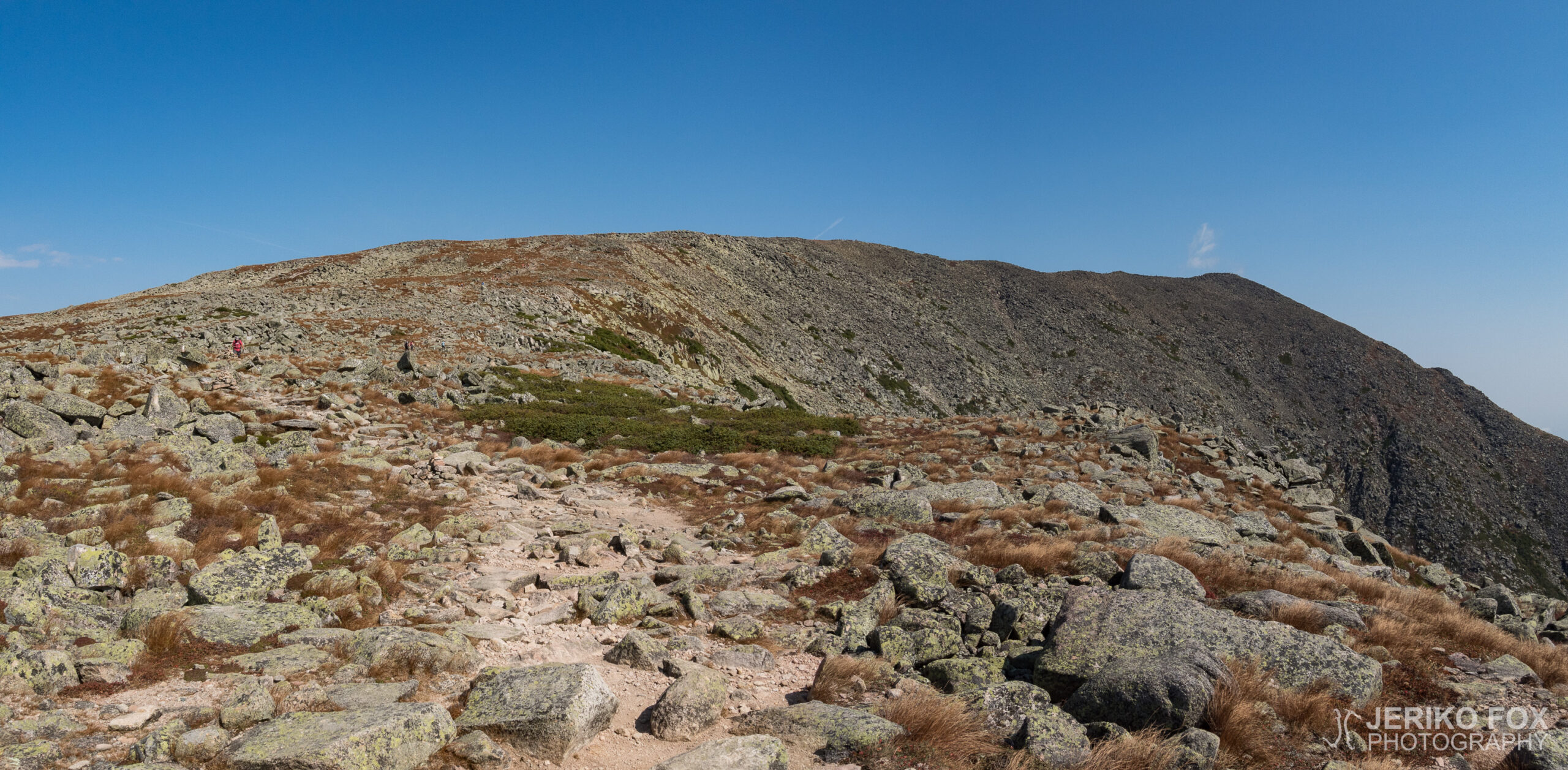
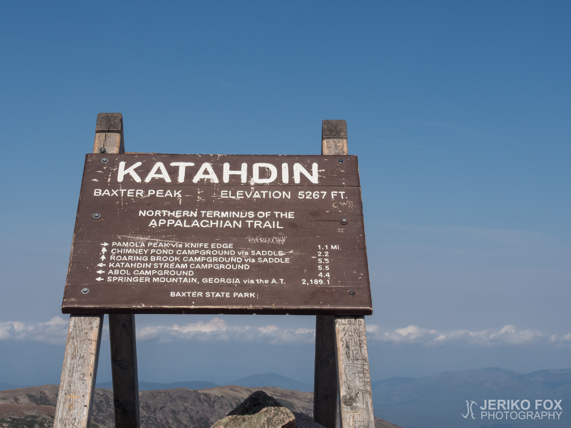
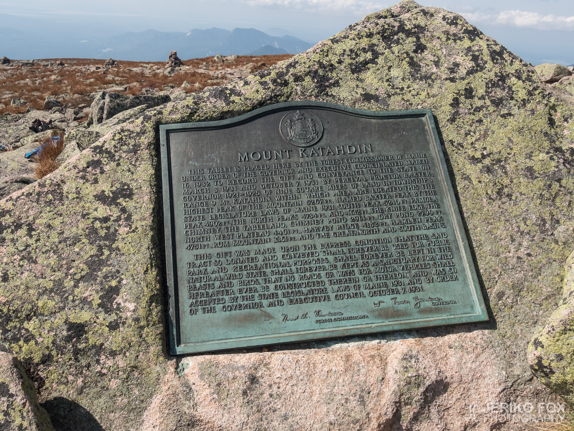
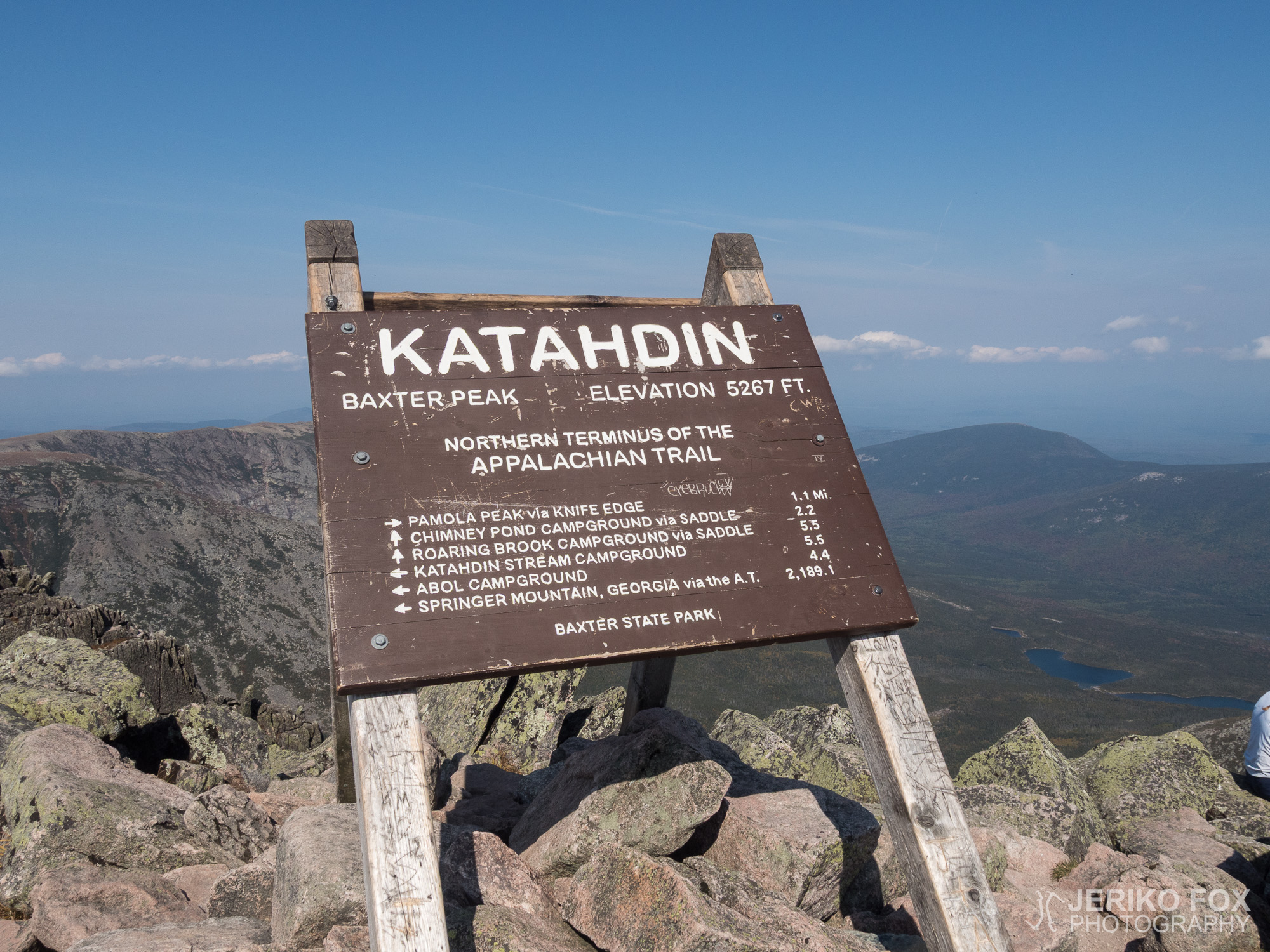
On the other end of the Tableland starts the uphill to the second step, that is the highest summit of the Mount Katahdin, the Baxter Peak. Looking at the elevation profile I expected that this climb would be similar with the first step, but actually this one was much easier. Honestly I was astonished, when I started to see the sign. That sign on the Baxter Peak is one of the most well known landmarks on the AT. A photo taken at the sign is the main prize of this 3500 km (2200 mile) hike.
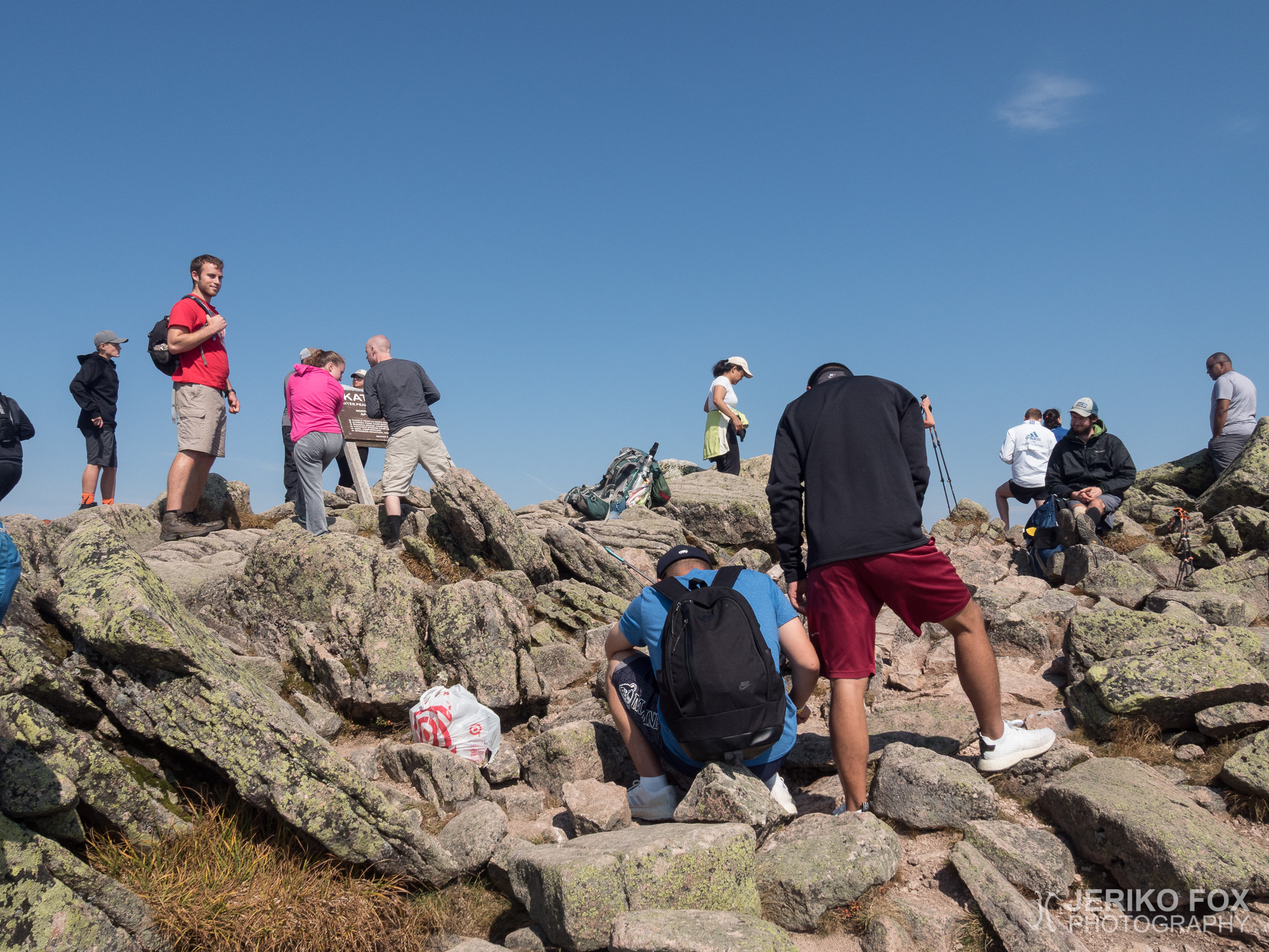
Around the summit was a flock of people – mainly day hikers. I stood still for a while, just watching the sign, and felt a need to touch it. Swallowing my tears I took the last few steps to the sign and pressed my palm on it. It’s done.
199 days, 3524,1 km (2189,9 mi), 4 pairs of hiking shoes, blood, sweat and tears. Bears, rattlesnakes, salamanders, frogs, deer and shoe-pooing mice. Trail, rocks, mud and highways covering you from the rain. Bars, nuts, chocolate, cold oatmeal and tuna tortillas. Strange encounters, impressing hospitality and surprising friendships. When I started on the 3rd of March in Georgia I truly and utterly had no idea what I would face before I could set my backpack on the ground in Maine on 17th of September.
I was relieved that I could finally just stop moving. I didn’t feel especially proud of my accomplishment, because the scale of it was completely incomprehensible even to myself. I felt a bit wistful that the life on the AT with all of my friends was now over. And most of them I might never see again, because I was living on a different continent.
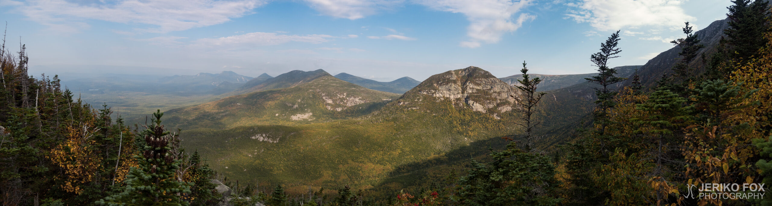
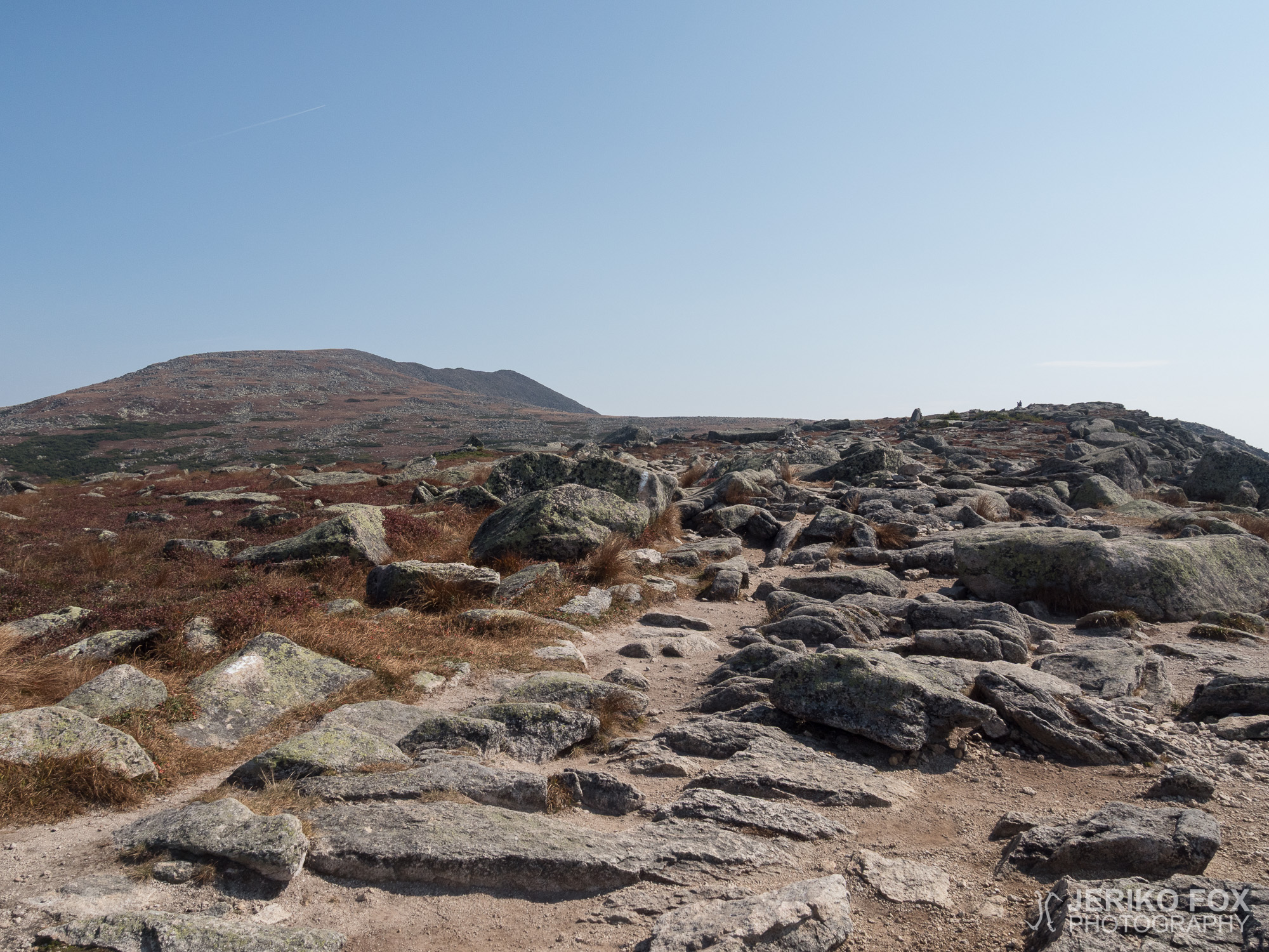
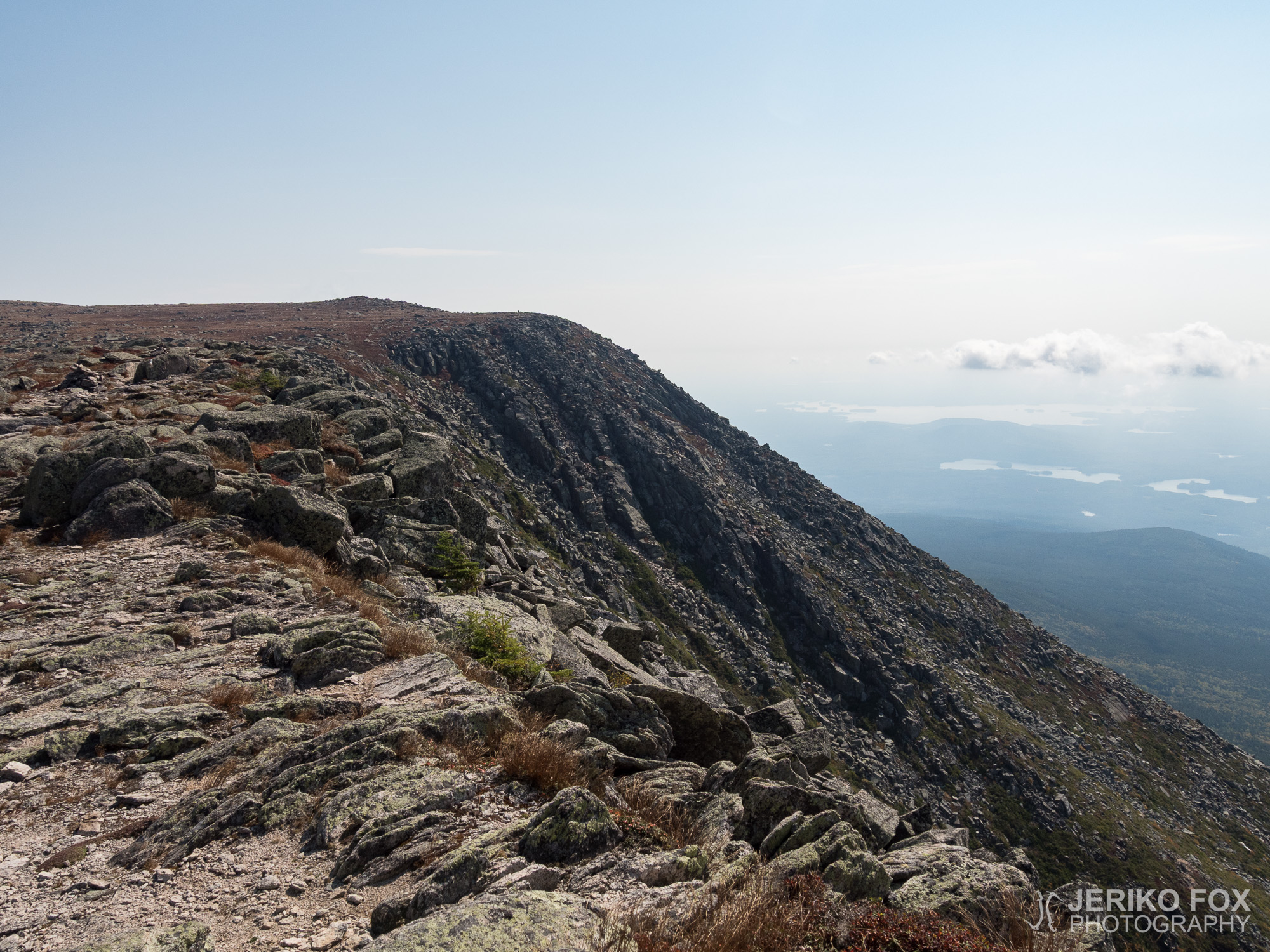
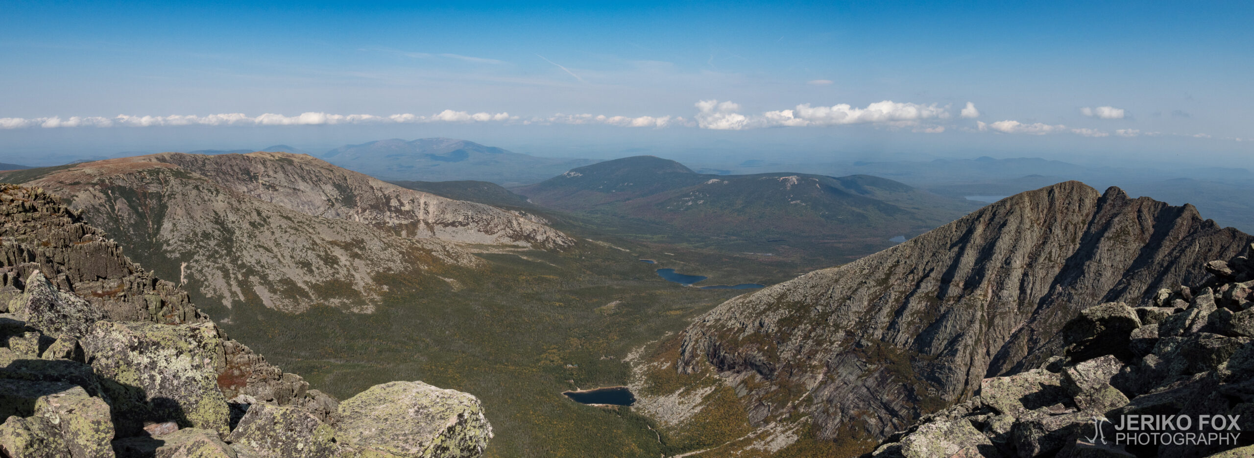
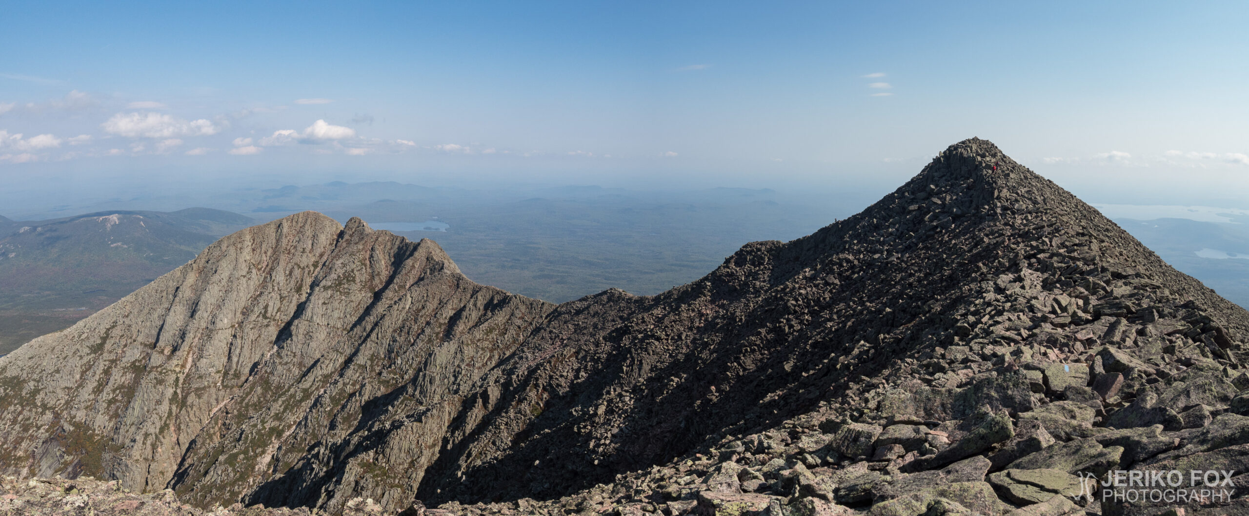
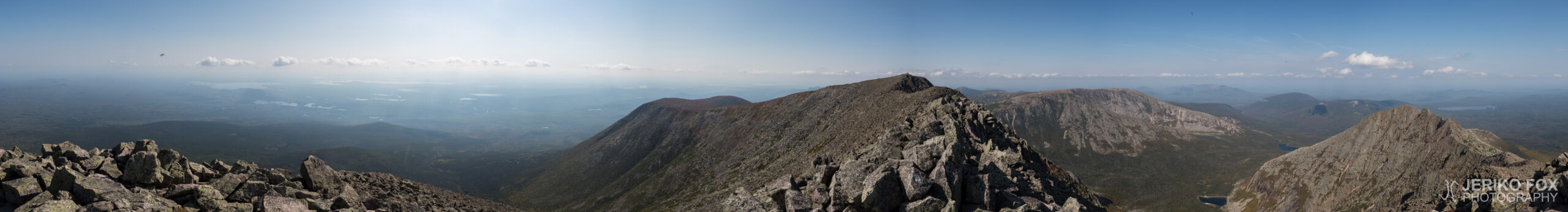
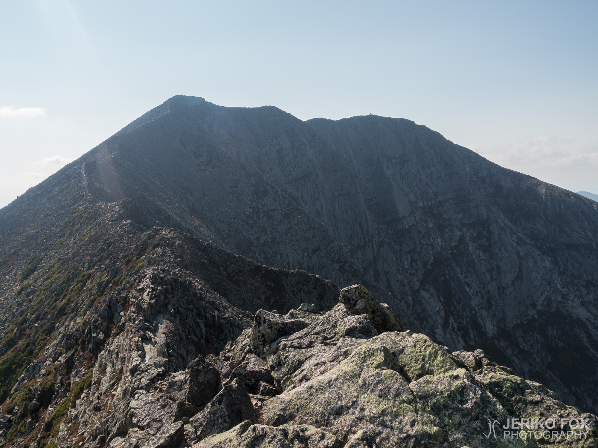
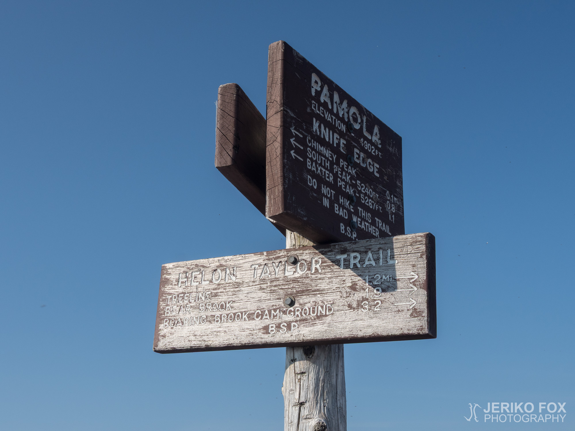
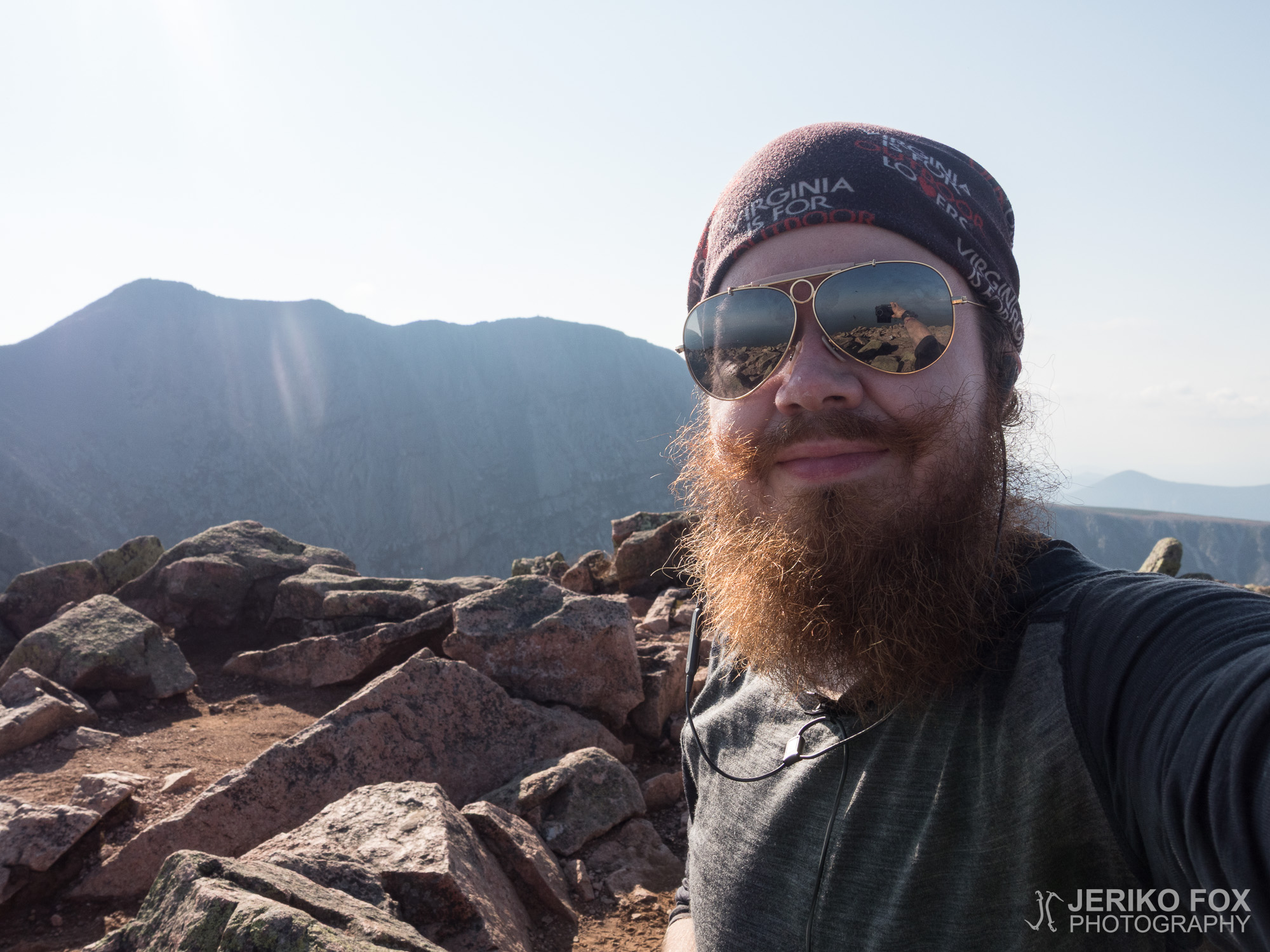
Although the thru-hike ends on the Baxter Peak of Mount Katahdin, that is the northern terminus of the Appalachian Trail, I still had to get down from the mountain. I had of course chosen the most challenging route, the Knife Edge. This rocky ridge goes from the Baxter Peak to South Peak and from there over the Chimney Peak to the Pamola Peak. From now on I didn’t have the elevation map of the guide book to help me and no map either. There was really no way to know what to expect. I had taken a photo of a map to my phone anyway, and thus had a some kind of idea what trail to follow on the downhill.
The Knife Edge is marked with blue blazes and the terrain is demanding. At times one must really climb there and the full backpack is not exactly helping. From the South Peak there was however a beautiful view to both the Baxter Peak and to the Pamola Peak – not to mention down to the Chimney Pond. Now the route changed even more challenging, because the Chimney Peak is very steep. The saddle between the Chimney Peak and the Pamola Peak, The Chimney, was according to its name a vertical pit and I got to truly use my climbing skills. Climb up to the Pamola Peak was in spite of the steepness more easy, because its generally easier to climb up than down.
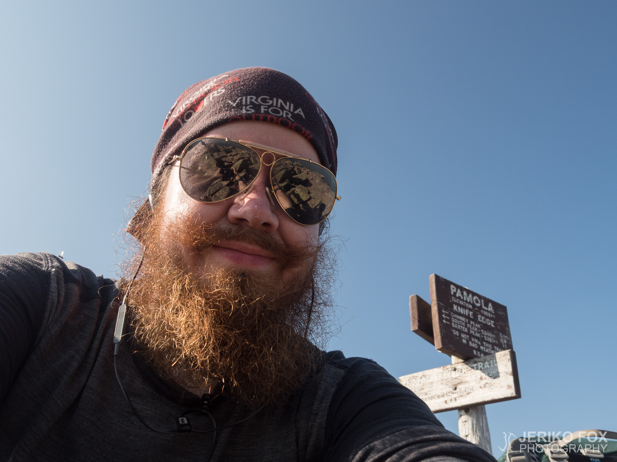
On the Pamola Peak I met a group of men that was partially geared up with mountaineering or rock climbing gear. They were wondering my technique of balancing in the rocky terrain with my hiking poles, and were clearly not sure if I was truly a pro or completely clueless. We kept passing each other on the downhill following the Helon Taylor Trail that descended along the Keep Ridge towards the Roaring Brook Campground.
When the downhill started to get more gentle, the trail crossed a small stream and I decided to one last time to filter some water, because I was almost out. The ranger had apparently been talking through his hat about the water sources. The trail kept on changing more smooth and my speed was getting faster. I was a bit concerned that it was soon 6 pm and after the dusk I would have zero chance to get a ride to town. The day hikers leave before the dark and anyway people rarely want to take hitch-hikers when it’s dark.
At the Roaring Brook Campground I stopped at the Ranger Station and asked them where should I look for a ride to town. They informed me that the parking lot was right next to the Ranger Station, but most of the day hikers were already gone. Well, I just had to give it a go, because Millinocket was 20 miles away and it didn’t sound like an evening stroll I was willing to take.
I saw a few cars on the parking lot and walked to the road that was leading out. As I set myself on the roadside I saw one car leaving the parking lot and hopefully flipped up my thumb. I felt inner rejoice, when the car turned to the shoulder and the guy riding shotgun opened his window: “Where are you going?” I told him that I needed a ride to Millinocket. “We are going there to eat at the McDonald’s! If that’s ok to you, we can take you there.” I said that I was happy getting anywhere in Millinocket. I hauled my backpack to the trunk and sat relieved to the backseat. On the front there were two young men and on the backseat there was the girlfriend of one of them. They had been doing a day hike and I got a quite a reaction when I told them that I had just finished my thru-hike from Georgia to Maine. The trip went in a joyful atmosphere and they dropped me off at the downtown Millinocket.
I figured that in the Sunday evening my dining options in this small village were limited and thus stopped at a small convenience store to collect a big can of sider and assortment of snacks for my victory celebration. I walked a few blocks to the Appalachian Trail Lodge, where I had booked a room. I spread all my things on the floor and popped open the can of sider. I was really ready to hit the sheets. This enormous six months project was now finally done and dusted, and that felt utterly incomprehensible.
Oli vielä pimeää, kun aloin viiden jälkeen heräillä makuupussissani. Ruokasäkki alas vaijerista ja aamupalan tekoon. Muistakin teltoista alkoi kuulua ääniä pakatessani tavaroita. Puoli seitsemältä tallustin Birchesiltä takaisin AT:n varteen Katahdin Streamille. Otin joesta runsaasti vettä, koska metsänvartija oli kertonut eilen, että vettä ei olisi ylämäessä eikä alamäessä.
Suurin osa läpivaeltajista lainaa metsänvartijoilta päivärepun ja jättää rinkkansa Ranger Stationille odottamaan paluuta. Mount Katahdinin slackpackaaminen on siis enemmän sääntö kuin poikkeus ja sitä jopa suositellaan. Minä olin tähän asti puritaanina vaeltanut jokaikisen metrin AT:sta ja kantanut reppuni koko ajan. En todellakaan aikonut luopua periaatteistani viimeisenä päivänä. Lisäksi suunnitelmissani oli ylittää Mount Katahdin, joten en käytännön syistäkään olisi voinut jättää tavaroitani Katahdin Stream Campgroundille.
Aurinko alkoi pikkuhiljaa paistaa lähtiessäni nousemaan loivasti ylöspäin viettävää polkua Mount Katahdinille. Koin monenlaisia tunteita, joita on vaikea pukea sanoiksi. Tätä päivää olin odottanut puoli vuotta. Tästä hetkestä olin unelmoinut siitä lähtien, kun ensimmäisen kerran kuulin Appalachian Trailista.
Ohitin raikkaassa aamussa päivävaeltajia ja välillä pysähdyin itsekin ihailemaan reitin kanssa risteilevää Katahdin Streamia ja sen muodostamia vesiputouksia. Vettä näytti kyllä olevan siis paljonkin leirintäalueen yläpuolella. Polku oli aluksi hyvin loivaa ja muuttui pikkuhiljaa jyrkemmäksi. Nousun alku oli itseasiassa mielestäni hyvin samanlainen kuin Mount Moosilauke New Hampshiressa.
Ystävällinen tervehdys kuului takaani kävellessäni metsäisen maiseman läpi. Ilahduin nähdessäni Papa Johnin, johon olin tutustunut rollercoasterissa Virginiassa. Hänen mukanaan oli nuori nainen, jonka Papa John esitteli tyttärekseen. Hän oli halunnut liittyä isänsä seuraan viimeisenä vaelluspäivänä. Aamupäivän aikana ohitseni kulki muutama muukin läpivaeltaja, mutta kahta miestä lukuunottamatta kaikilla oli selässään pelkkä päiväreppu.
Alkunousussa täydestä rinkastani ei ollut haittaa, mutta reitin muuttuessa jyrkemmäksi haastekerroin koveni minulla huomattavasti enemmän. Ensin edessä oli White Mountainsilta tuttua könyämistä jyrkkään ylämäkeen, mutta pian tämä muuttui varsinaiseksi kiipeämiseksi kallionlohkareiden päälle. Näissä kohdissa rinkka alkoi jo todella vaikeuttaa etenemistä ja yhdessä kohtaa minulla oli vaikeuksia pusertaa itseni kahden järkäleen välissä olevasta kolosta läpi. Otin kuitenkin määrätietoisesti vauhtia ja ponnistin kaikella voimalla ylöspäin tunkien itseni samalla koloon. Perään vielä toinen tiukka puserrus ja olin irti. Jos naiset synnyttävät ihmisiä niin ilmeisesti kallionjärkäleet synnyttävät läpivaeltajia.
Korkeammalle noustessa maisemat alkoivat avautua koko ajan paremmin ja pilvettömässä säässä näki todella pitkälle. Olin iloinen hyvästä kelistä, koska Katahdinille nousu sateisena päivänä olisi hyvin hankalaa. Rinteessä on pieni tasanne, jonka päällä kuulin useamman päivävaeltajan arvioivan olevansa ensimmäisellä portaalla, The Gatewaylla, ja edessä näkyvän huipun olevan Baxter Peak. Katselin kulkemaani matkaa urheilukellostani ja totesin itsekseni, että tämä ei millään voinut olla vielä ensimmäinen porras. Kulkemansa matkan yliarvioi helposti ja siinä minulle on ollut paljon apua urheilukellon GPS-ominaisuudesta. Kilometrien perusteella tiedän hyvin tarkkaan missä olen. Ja nyt tiesin, että edessä seisova huippu olisi vasta ensimmäinen porras ja moni kokisi karvaan pettymyksen sen laella.
Saavuttaessani The Gatewayn eli ensimmäisen portaan alkoi taivaanrannassa näkyä joitakin pilviä ja tuuli pääsi puhaltamaan vapaammin. Edessä oli tasaisehko alue, The Tableland, jolla on myös alueen ainoa lähde. Thoreau Spring on kuitenkin pelkkä lätäkkö (ja ilmeisesti ollut tällainen jo vuosia), joten sen varaan ei kannata laskea. Viimeiset vedet Katahdinin rinteillä ovat puurajan alapuolella.
Näin kauempana Papa Johnin ja hänen tyttärensä palaamassa huipulta ja suuntaavan alas pitkin Abol Trailia. Katahdinilta on mahdollista laskeutua Hunt Trailia eli AT:a pitkin takaisin Katahdin Stream Campgroundille tai Abol Trailia pitkin Abol Campgroundille, jotka ovat vuoren eteläpuolella. Vaihtoehtoisesti on mahdollista kulkea vuoren yli Roaring Brook Campgroundille joko Chimney Pondin kautta tai Knife Edgeä pitkin. Minun valintani oli jälkimmäinen.
The Tablelandin toiselta reunalta lähtee nousu toiselle portaalle, jonka laella on Mount Katahdinin korkein huippu, Baxter Peak. Korkeusprofiiln perusteella odotin tämän olevan samankaltainen kuin nousu ensimmäiselle portaalle, mutta itseasiassa se oli huomattavasti helpompi. Olin totta puhuen suorastaan hämmästynyt, kun huomasin jo edessäni häämöttävän kyltin. Baxter Peakia merkkaava kyltti on yksi AT:n tunnetuimmista maamerkeistä. Sen äärellä otettu valokuva on 3500 kilometrin vaelluksen pääpalkinto.
Huipun ympärillä parveili suuri lauma ihmisiä – pääosin päivävaeltajia. Pysähdyin hetkeksi katsomaan edessäni olevaa kylttiä ja tunsin tarvetta koskettaa sitä. Kyyneleitä niellen otin viimeiset askeleet kyltin eteen ja painoin käteni sen pintaan. Se oli siinä.
199 päivää, 3524,1 kilometriä, 4 paria vaelluskenkiä, verta, hikeä ja kyyneleitä. Karhuja, kalkkarokäärmeitä, salamantereita, sammakkoja, peuroja ja kenkiin kakkaavia hiiriä. Polkua, kivikkoa, mutaa ja sateensuojia moottoriteiden alla. Patukoita, pähkinöitä, suklaata, kylmää puuroa ja tonnikalatortilloja. Kummallisia kohtaamisia, vaikuttavaa vieraanvaraisuutta ja yllättäviä ystävystymisiä. Aloittaessani maaliskuun kolmas päivä Georgiasta en todellakaan tiennyt mitä kaikkea olisi edessäni ennen kuin laskisin reppuni maahan Mainessa syyskuun seitsemästoista päivä.
Olin helpottunut, että saatoin viimein lopettaa ja pysähtyä. En ollut vielä erityisen ylpeä saavutuksestani, koska sen mittakaavaa oli itsenikin aivan mahdotonta käsittää. Olin hieman haikea, että elämä AT:lla kaikkien ystävieni kanssa olisi nyt ohi. Ja suurinta osaa heistä en ehkä tapaisi enää koskaan uudestaan, koska asun eri mantereella.
Vaikka läpivaellus päättyykin Mount Katahdinin Baxter Peakille, joka on Appalachian Trailin pohjoinen päätepiste, oli minun vielä tultava alas vuorelta. Olin valinnut tietenkin reiteistä haastavimman eli Knife Edgen. Kivikkoinen harjanne kulkee Baxter Peakilta South Peakille ja sieltä Chimney Peakin yli Pamola Peakille. Tästä eteenpäin apunani ei ollut enää opaskirjan korkeuskäyrää eikä myöskään karttaa, joten en kovin tarkkaan tiennyt mitä edessä olisi. Olin toki ottanut valokuvan yhdestä kartasta kännykkääni, että tietäisin mitä polkua minun tulee seurata alamäessä.
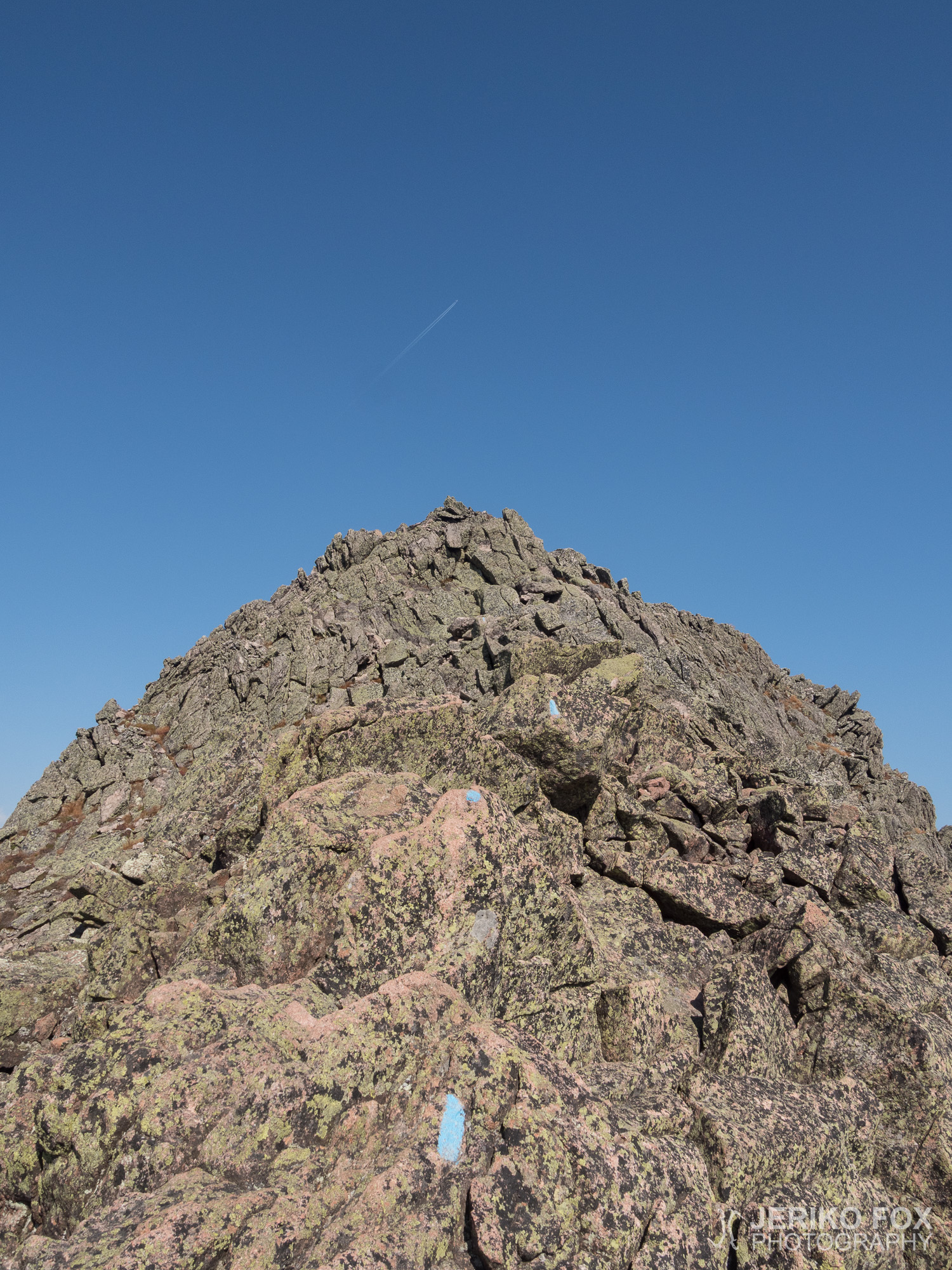
Knife Edge on merkattu sinisillä viivoilla ja harjanne on vaikeakulkuinen. Osittain siellä saa jopa kiivetä ja täysi rinkka ei varsinaisesti helpota asiaa. South Peakilta avautui kuitenkin kaunis maisema sekä Baxter Peakin että Pamola Peakin suuntaan ja lisäksi alas Chimney Pondille. Tästä eteenpäin reitti muuttui vielä haastavammaksi, koska Chimney Peak on hyvin jyrkkä. Chimney Peakin ja Pamola Peakin välinen satula, The Chimney, oli nimensä veroinen ja laskeutuessa tuohon pystysuoraan koloon sain todella käyttää kiipeilytaitojani. Nousu Pamola Peakille oli jyrkkyydestä huolimatta helpompi, koska ylöspäin on helpompi kiivetä kuin alaspäin.
Pamola Peakilla kohtasin joukon miehiä, joista osa oli varustautunut vuori- tai kalliokiipeilyyn soveltuvin välinein. He ihmettelivät hieman minun tekniikkaani, jolla tasapainoilin kivikossa vaellussauvojen avulla eivätkä ilmeisesti olleet aivan varmoja kuuluinko niihin, jotka tietävät aivan tarkkaan mitä ovat tekemässä vai niihin, jotka eivät tiedä ollenkaan mitä ovat tekemässä. Ohittelimme toisiamme alamäessä kulkiessamme Keep Ridgeä seurailevaa Helon Taylor Trailia pitkin kohti Roaring Brook Campgroundia.
Alamäen loiventuessa polku kulkee puron yli ja päätin viimeisen kerran suodattaa itselleni hieman vettä, koska olin juonut lähes kaiken. Metsänvartija oli siis puhunut läpiä päähänsä alamäenkin vesilähteiden osalta. Polku muuttui kokoajan helpompikulkuiseksi ja vauhtini kiihtyi sitä mukaa. Olin hieman huolissani siitä, että kello alkoi lähestyä kuutta ja hämärän tultua minulla ei olisi mitään mahdollisuuksia saada kyytiä kaupunkiin. Päivävaeltajat kuitenkin poistuvat ennen pimeää ja harva haluaa muutenkaan ottaa liftareita kyytiin pimeällä.
Roaring Brook Campgroundille tullessani pistäydyin Ranger Stationilla ja tiedustelin heiltä mistä kannattaisi etsiä kyytiä kaupunkiin. He kertoivat parkkipaikan olevan aivan vieressä, mutta suurimman osan päivävaeltajista jo lähteneen. No, yrittää täytyi kuitenkin, koska Millinocketiin oli noin 20 mailin matka ja se ei kuulostanut houkuttelevalta iltakävelyltä.
Näin muutaman auton parkkipaikalla ja kävelin ulos johtavalle tielle. Asettuessani tien reunaan näinkin yhden auton kaartavan pois parkkipaikalta ja iskin heti peukaloni toiveikkaasti pystyyn. Riemuitsin sisäisesti, kun auto koukkasikin heti luokseni ja apukuskin paikalla oleva mies rullasi ikkunan auki: “Minne olet menossa?” Kerroin tarvitsevani kyydin Millinocketiin. “Me ollaan menossa sinne McDonald’sille syömään! Jos se kelpaa niin pääset kyydissä.” Sanoin, että minulle riittäisi kun pääsisin minne tahansa päin Millinocketia. Lastasin rinkkani takakonttiin ja hyppäsin helpottuneena takapenkille. Etupenkillä istui kaksi nuorta miestä ja takana oli toisen tyttöystävä. He olivat olleet päivävaelluksella ja sain melkoisen reaktion aikaan kertoessani juuri päättäneeni läpivaelluksen Georgiasta Maineen. Matka sujui iloisissa tunnelmissa ja jäin kyydistä Millinocketin keskustassa.
Arvasin, että sunnuntai-iltana ruokamahdollisuuteni pikkukylässä olisivat rajalliset, joten pistäydyin pikkuisessa ruokakaupassa keräilemässä voitonjuhliini ison tölkin siideriä ja kaikenlaisia pikkuherkkuja. Kävelin muutaman korttelin päähän Appalachian Trail Lodgeen, josta olin varannut itselleni huoneen. Levitin tavarani lattialle ja korkkasin siiderin. Olin täysin kypsä nukkumaan. Valtava puolen vuoden projekti oli nyt saatettu päätökseen ja sitä oli aivan mahdotonta käsittää.
Max elevation: 1607 m
Total time: 12:10:05
[…] A year ago I climbed to the highest peak in Maine carrying my green Osprey backpack. Summiting the Baxter Peak of Mount Katahdin was the end of my 199 day journey of hiking more than 3500 km (2200 mi) over the Appalachian mountains. […]