
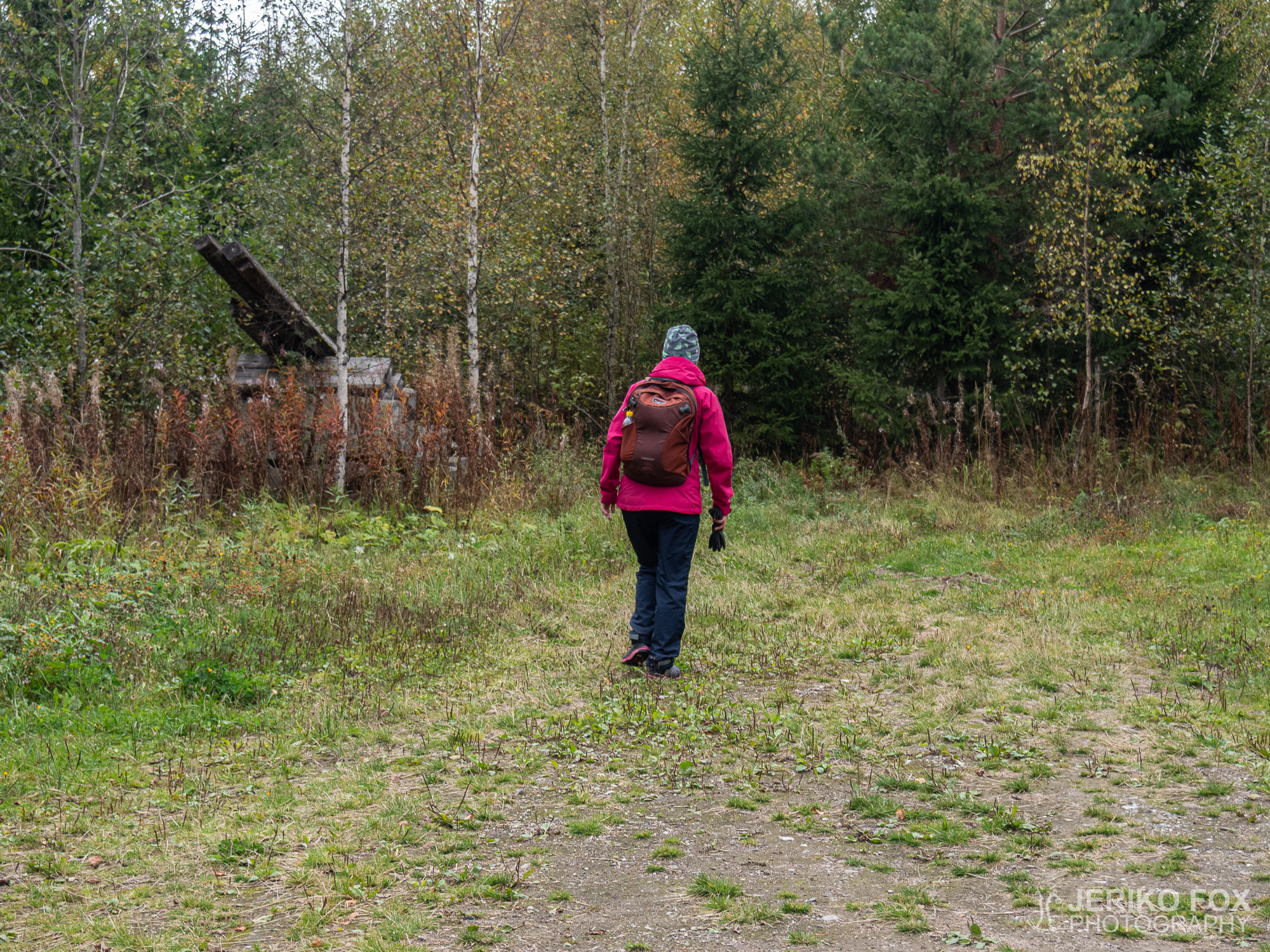
The afternoon was cloudy and the rain was around the corner. We had once before tried to find the Tupamäki Cave near the village of Sinkkola. Now me and Nina had decided to give it another try.
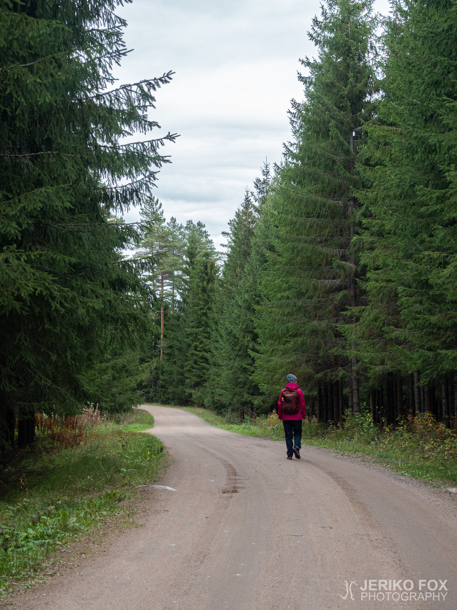
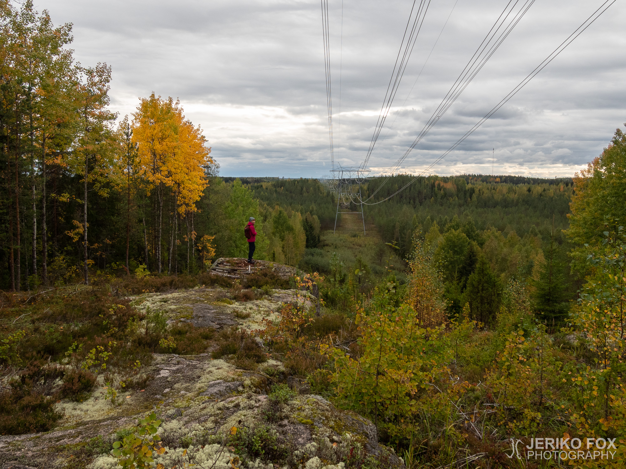
We drove to the parking lot of Hämmäauteensuo, which is south from Lappeenranta. There were plenty of cars. Others seemed to have headed to the wetlands (the Hämmäauteensuo fen), because no one seemed to move to same direction with us. We took Hämmäauteensuo trail until it turns from the road towards the fen. From there we took a turn to left across the road. I had read that you could follow the powerlines from the parking lot to the Tupamäki (which is the straightest route), but at least during the autumn it would have been hopeless bushwhacking. Possibly early in spring it might be doable. That’s why we chose this time a forest road that I found from the maps of Retkikartta.
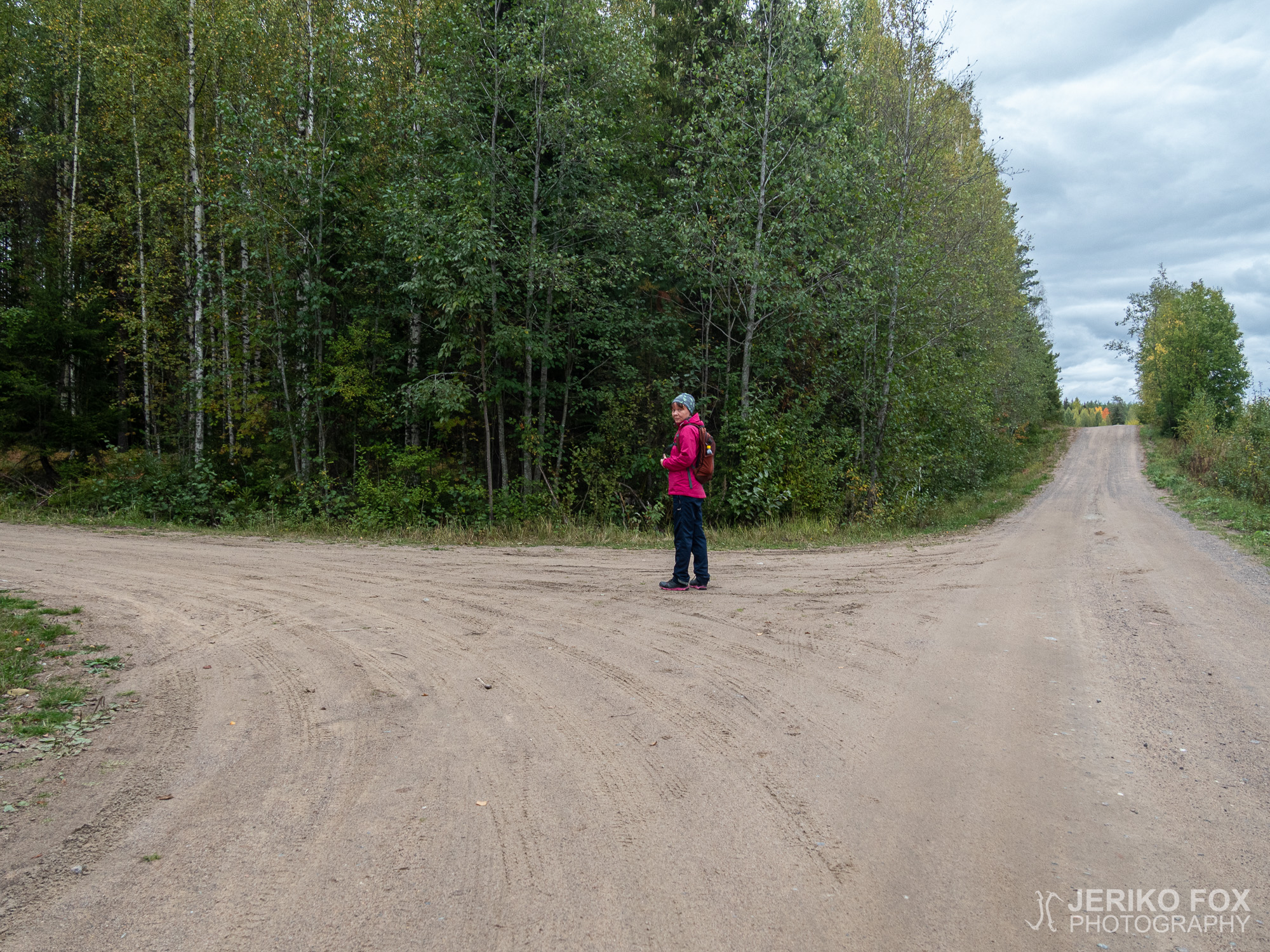
After crossing the Vanha Viipurintie we followed the dirt road on the other side. There was one intersection to the left that we passed and then a trail crossing a tall grass, but because we weren’t sure if this was going to correct direction, we continued to the second intersection and turned left towards Tupamäki hill. About two hundred meters (0.1 mi) later this road turns to right and there is an empty spot (that could be used as a parking lot). A good landmark here is a pile of rocks with long logs on top of it looking like a cannon. On the right hand side of this “cannon” starts a trail (that is a dashed line in Retkikartta) which is actually an overgrown forest road.
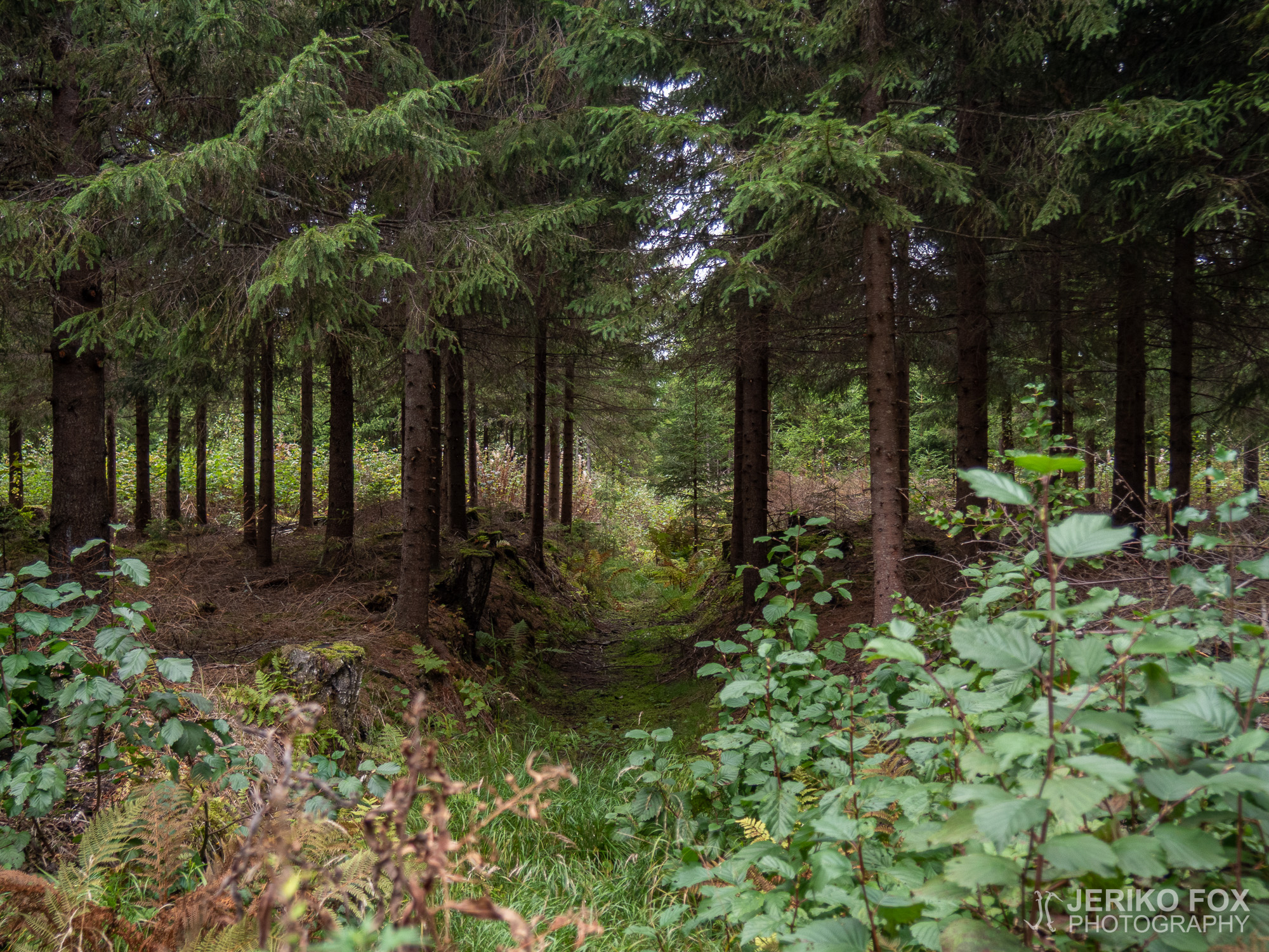
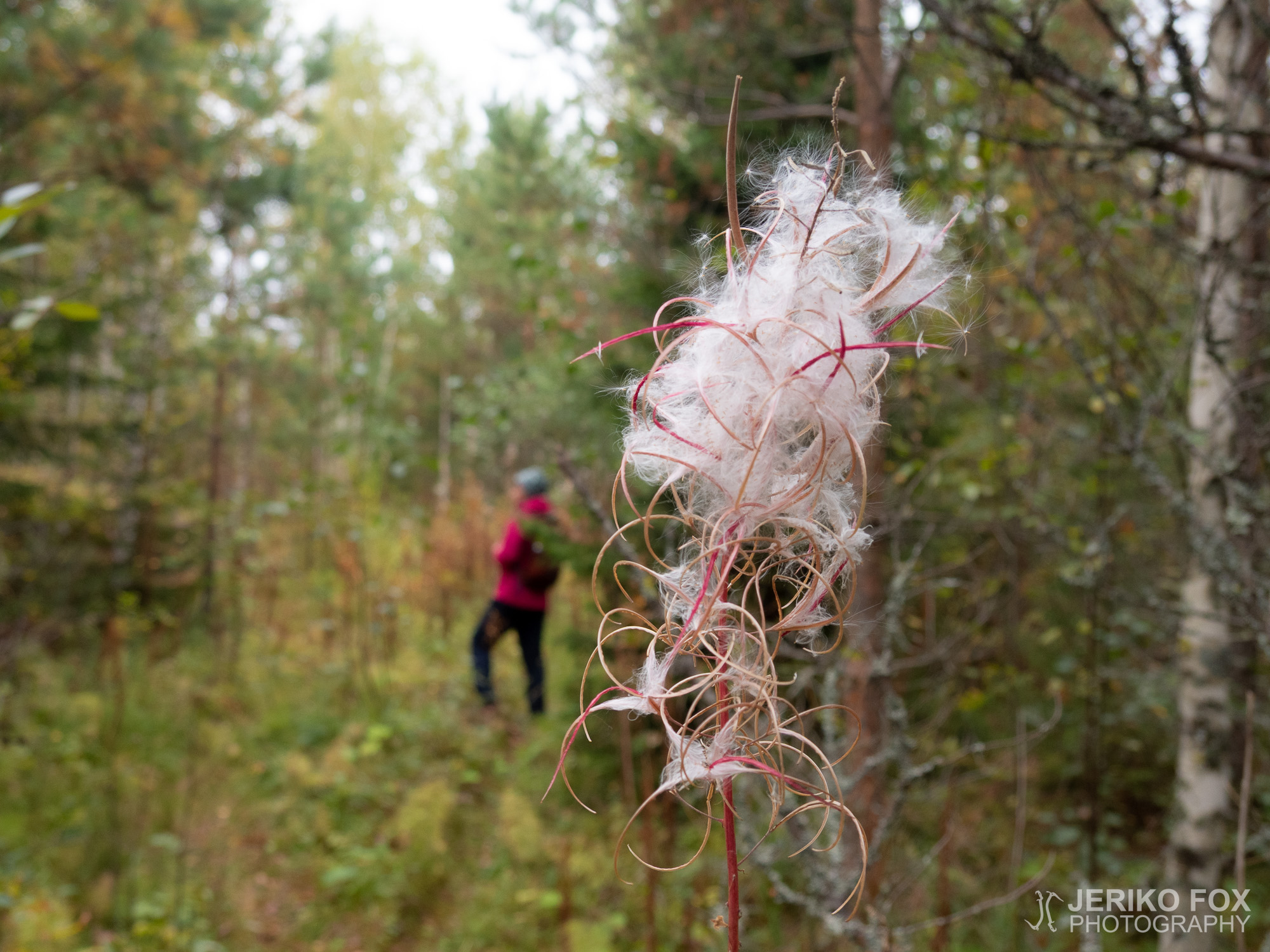
The trail was in decent condition and after another 200 meters (0.1 mi) it took a turn to right. Here it started to look more like an actual forest road. We didn’t walk very far from there when we saw on our left hand side a trail going uphill and a yellow ribbon on a tree. We decided to take this trail because it seemed to go to the right direction.
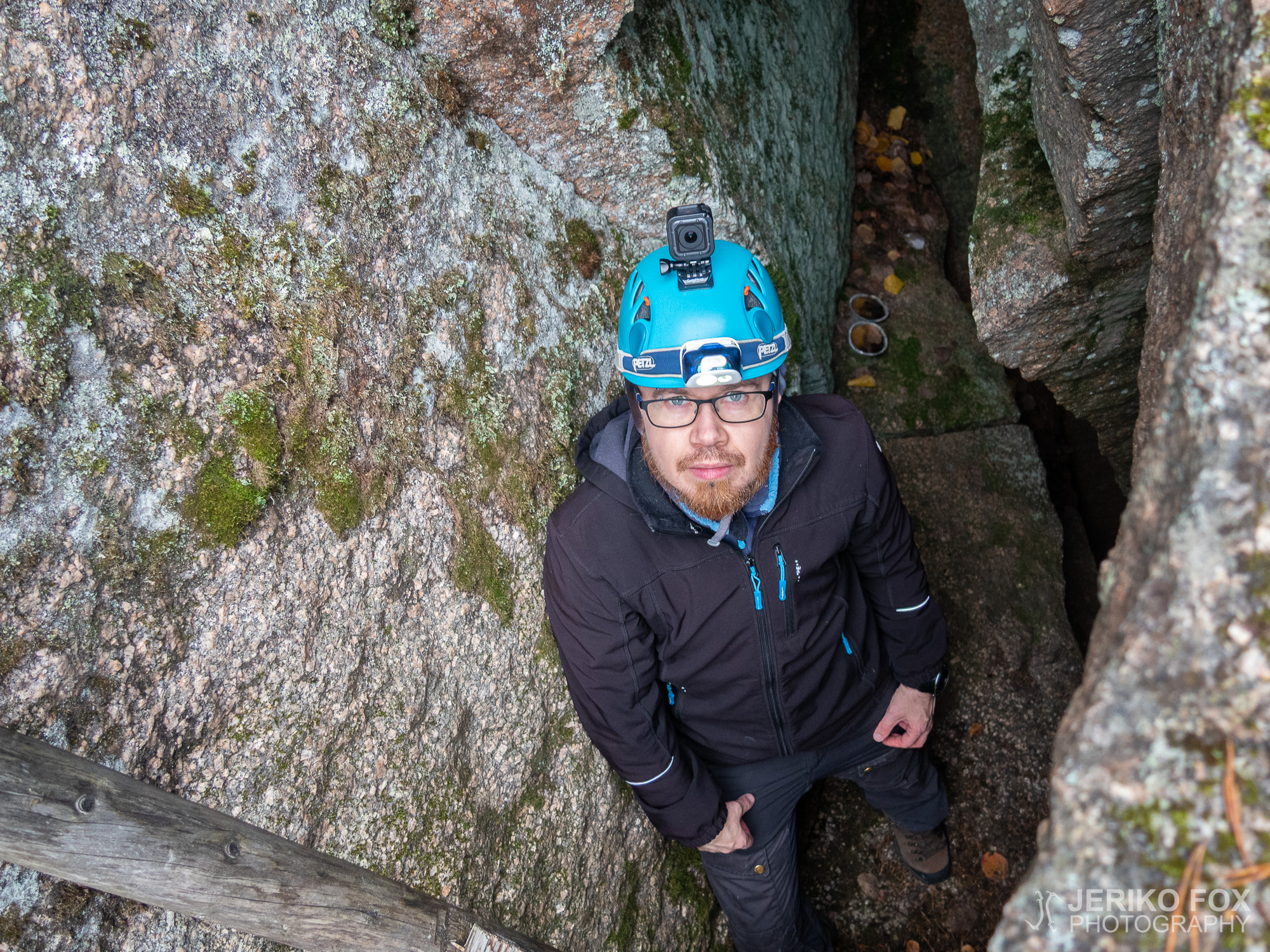
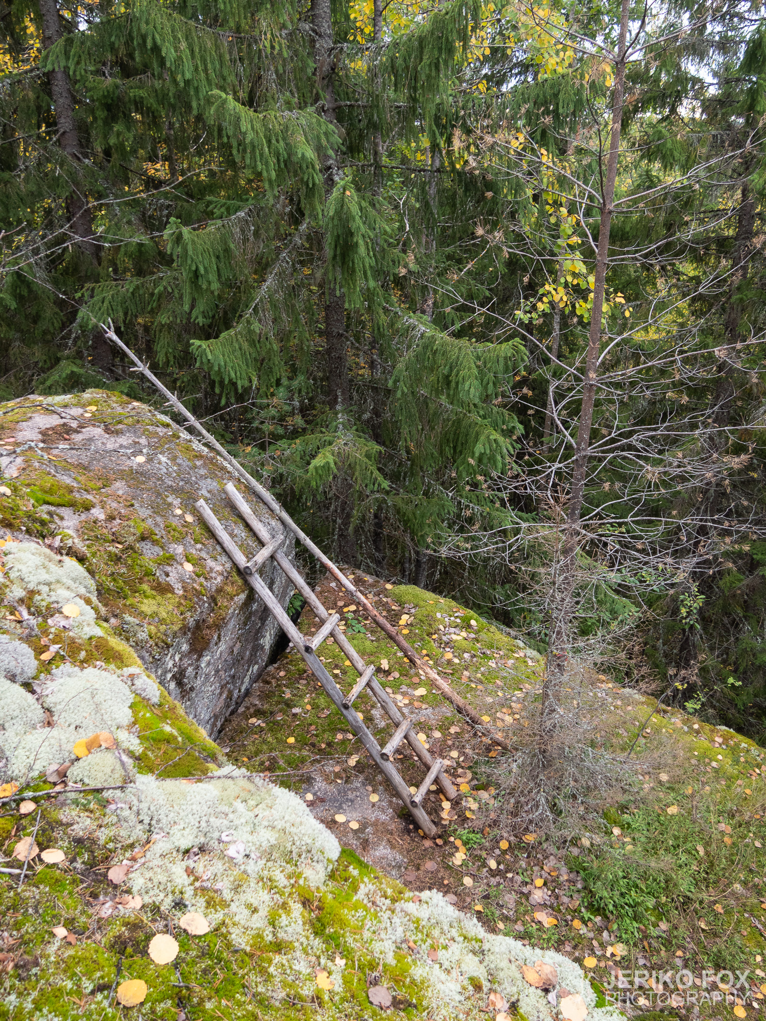
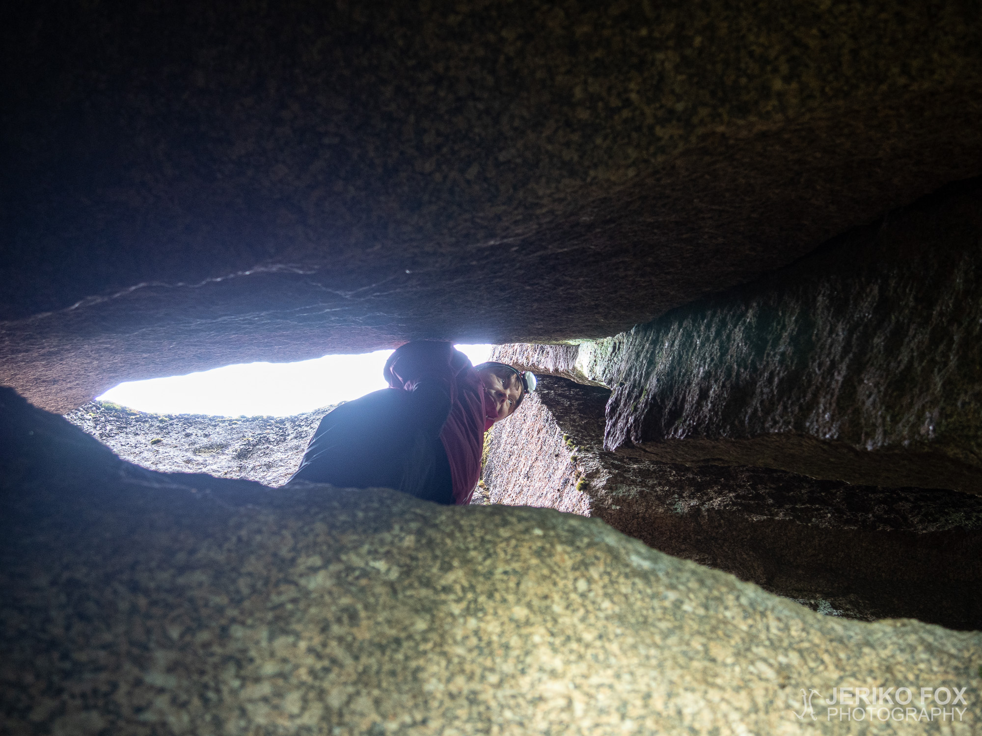
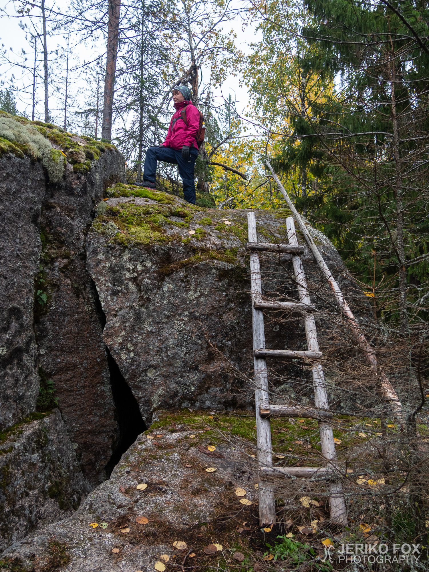
This indeed is the trail that one has to follow to find the cave. We took our share of detours on the hill and climbed over the huge boulders. Some had small spaces in between them where you could perhaps squeeze yourself into, if you happened to feel like that. Eventually we returned to the main trail and continued on until I saw an orange ribbon on a tree on my left hand side. I went to the direction of the ribbon – towards the edge – and behold, there was ladders! We had found the entrance to the cave!
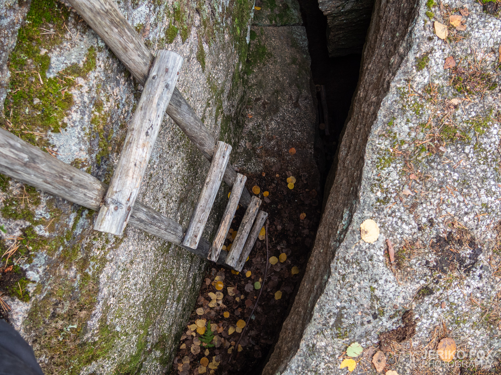
On the moss covered rocks one has to move carefully and also go slowly on the ladders so that they wouldn’t slip and fall. From this platform I peeked into the hole between the rock wall and the boulder – deep down there were another ladder. About three meters (9 feet) below was a flat surface, where one could access the other ladder. But climbing up from that place back to the upper ladder would be quite challenging – especially if you don’t have rock climbing skills. I was pondering for a while and realised that we could take the upper ladder and relocate them to access the lower ones. That would make climbing down and especially back up significantly easier.
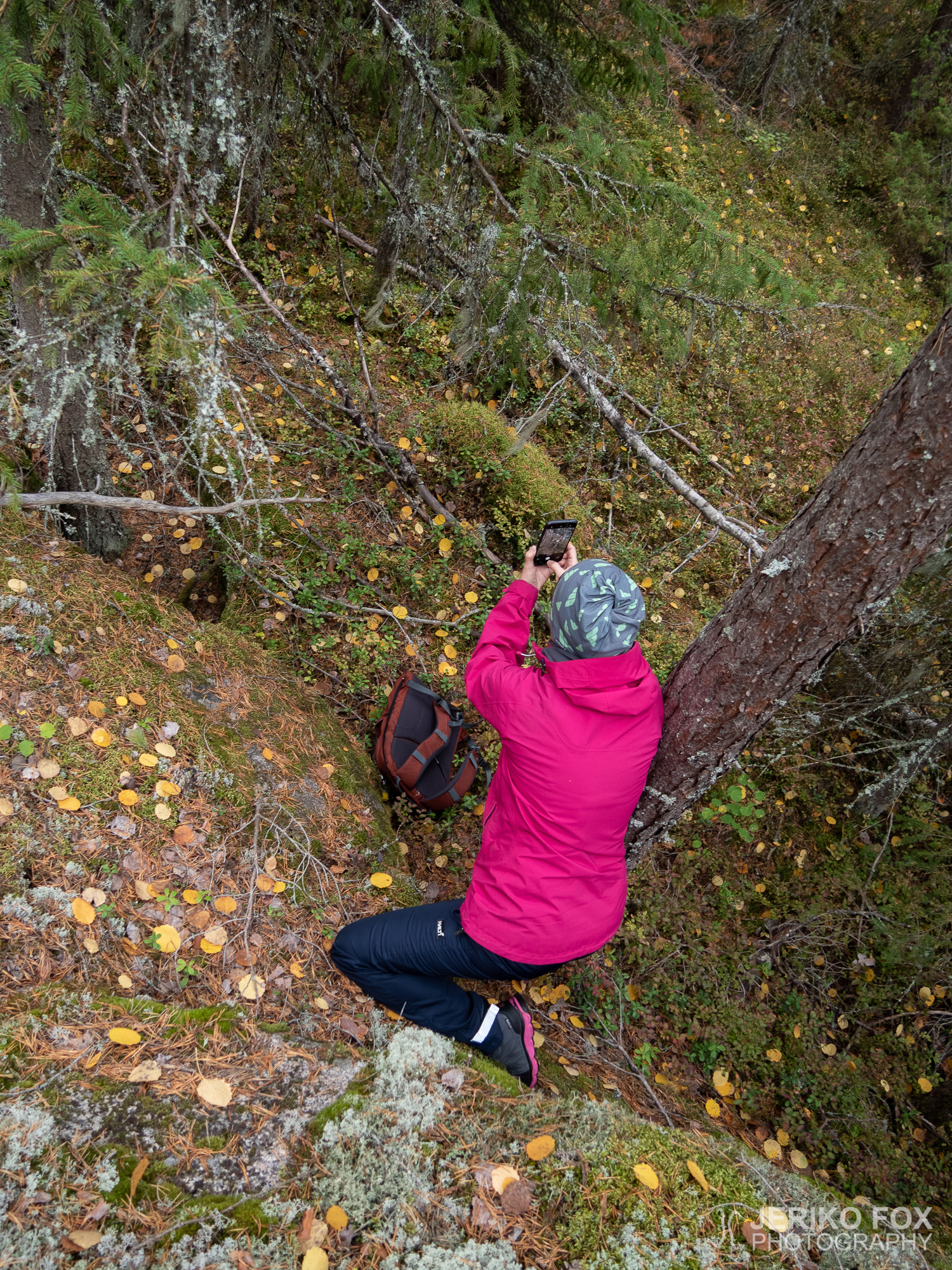
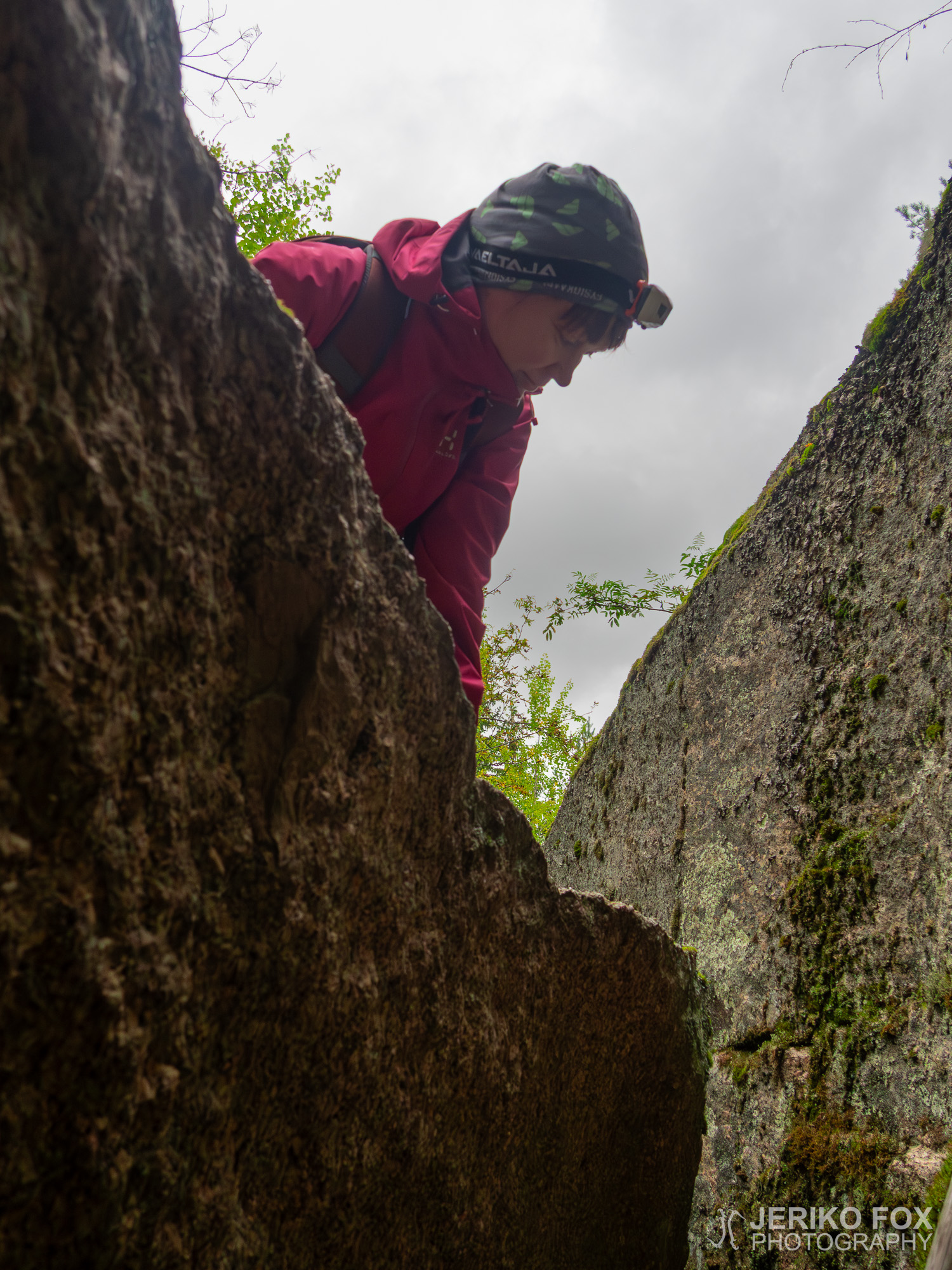
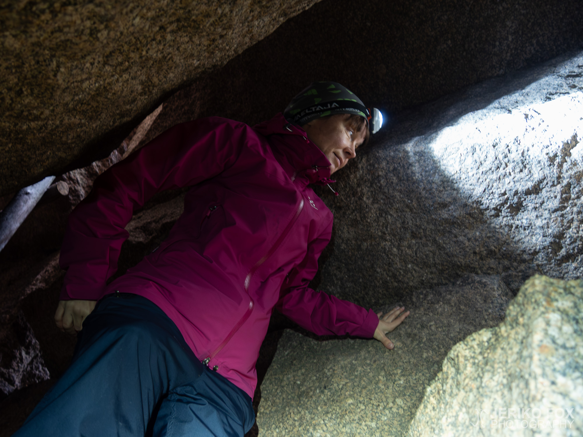
Me and Nina took hold of the ladder together and lowered them down into hole to meet the lower surface. The ladder seemed to sit there quite well and were perfect length. I climbed down and handed my backpack to Nina, because the lower parts of the cave seemed quite tight. I continued down first inching my feet on a small shelf and from there to the lower ladder. This place was not spacious and actually tight enough that a larger person might not even fit through. When I reached the second level I saw that there was one more down below, but I thought it wouldn’t be wise to go there alone in case I wasn’t able to climb up.
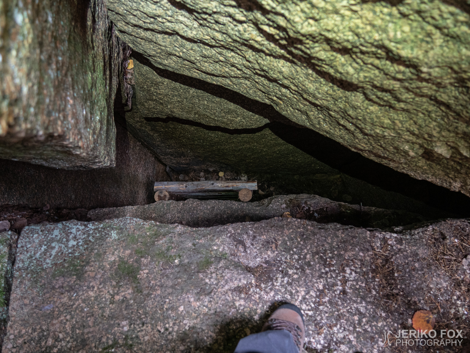
I climbed back up to the first level to inform Nina – who was slightly intimidated about all of this climbing business – what was down there. There has started a light drizzle up there, so we decided to lower our backpacks to the first level. Then Nina climbed down with my assistance. Together we continued to the second level and at this point I dropped myself to the third level. The cave continued a bit to my right and left and in front of me was a wide crack, where one might just be able to squeeze into. I succeeded to climb back to the second level to meet Nina by myself.
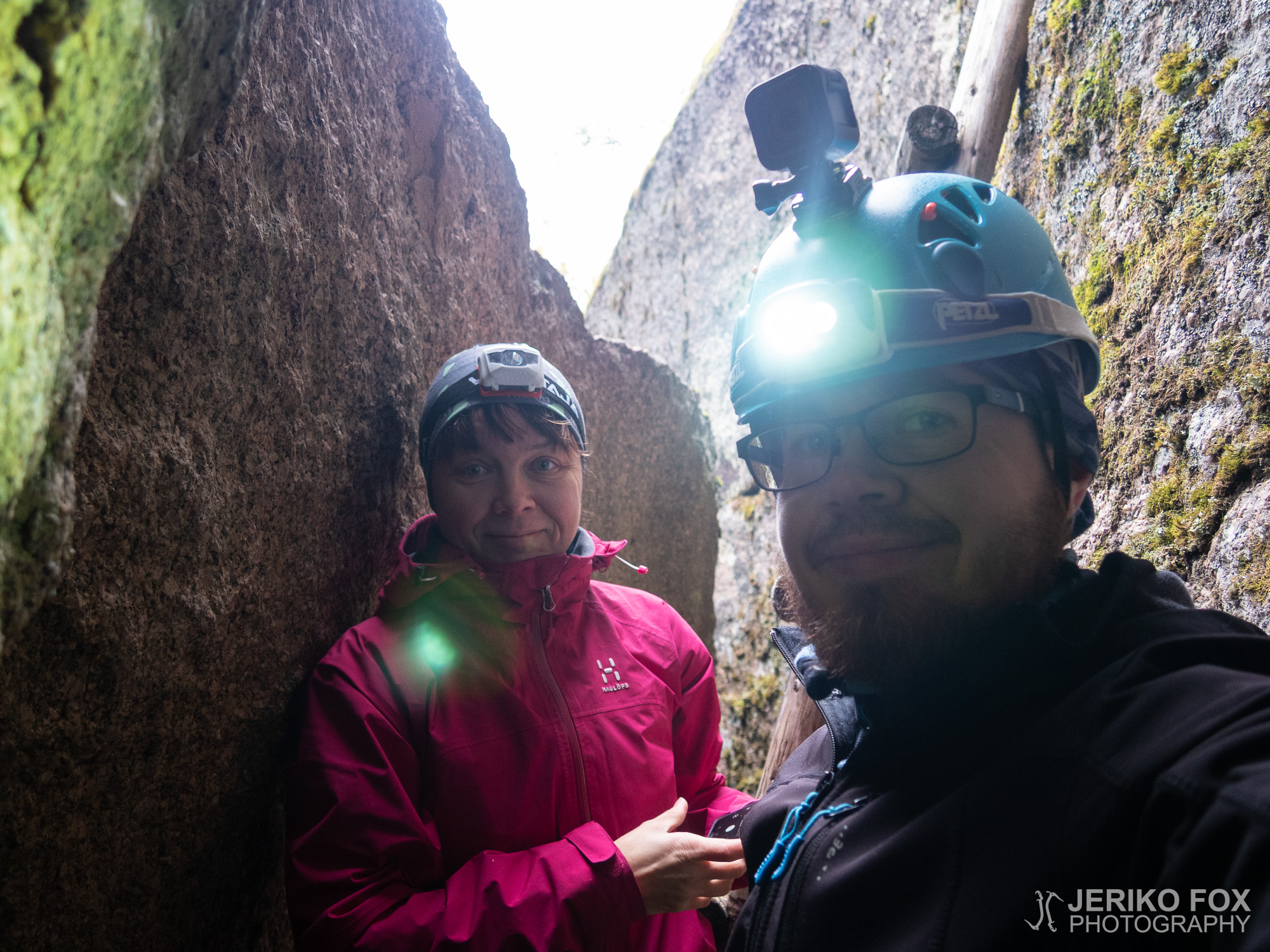
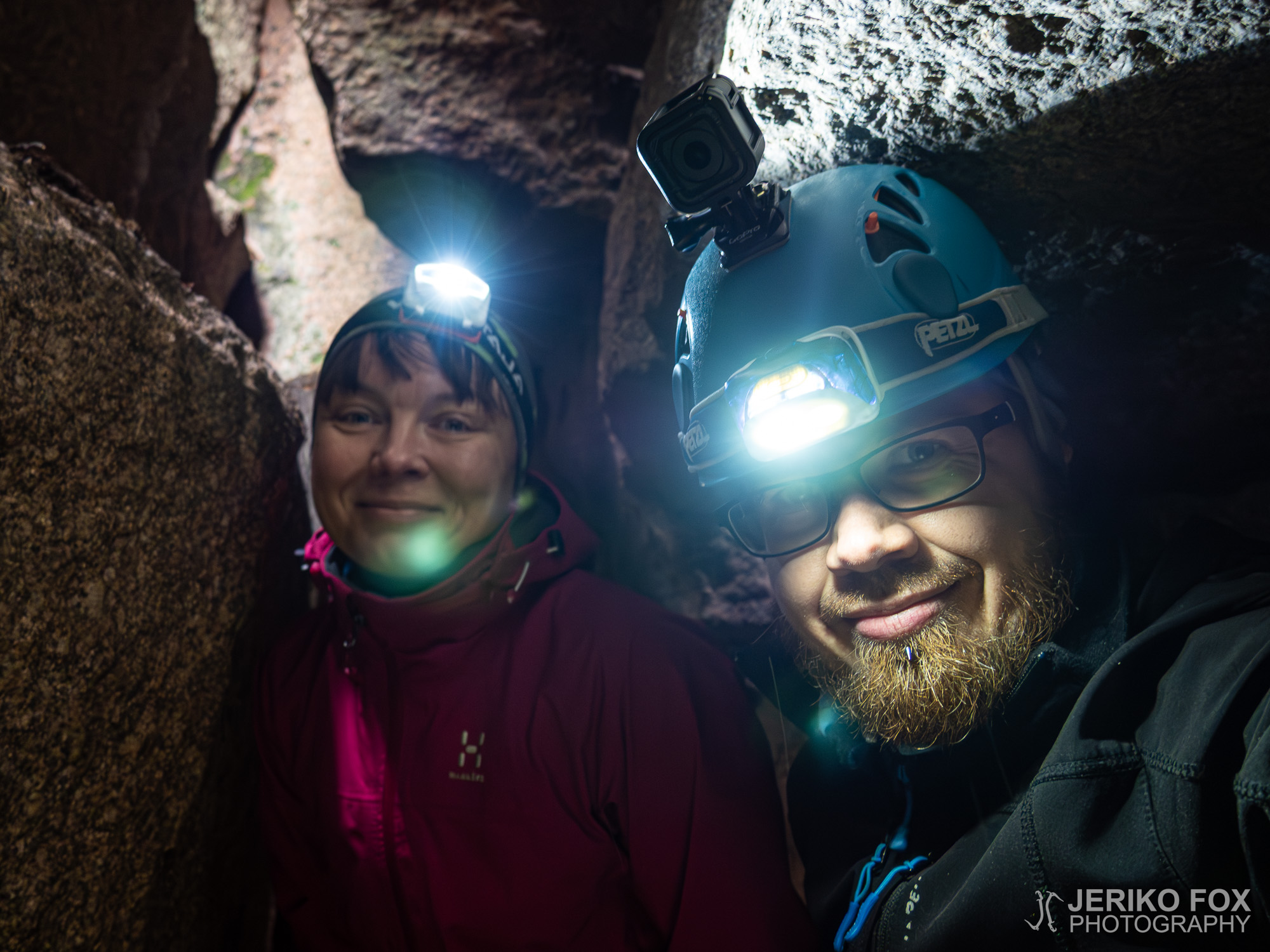
We both agreed that in all of its tightness and deepness the cave was fairly interesting place. We stood there in awe for a while and took some photos before we decided to climb back up. After climbing up from the first level on the top of the boulder, we took the ladder back up. That way we could climb back on the hill and the next ones could get down.
From the Hämmäauteensuo parking lot it was about 2 km (1.2 mi) one way to the Tupamäki Cave and it takes about half an hour to walk there. It’s possible to drive closer – to the beginning of the trail. But anyway it’s not that far from Hämmäauteensuo and one can easily see both of these places in one trip. The trail to the Tupamäki is not difficult, but in the cave and in that rock maze one must be very careful.
As we were returning to our car we saw lots of people coming from their own trips from Hämmäauteensuo. I was happy that our destination was less crowded – we didn’t meet anyone there. You don’t find the Tupamäki Cave accidentally, but the route description here should guide you there.
Iltapäivä oli pilvinen, mutta sade vielä pidätteli tuloaan. Olimme käyneet kerran aiemmin etsimässä Sinkkolan kylällä olevaa Tupamäen luolaa Ninan kanssa ja nyt olimme päättäneet tehdä uuden yrityksen.
Ajoimme auton Lappeenrannan eteläpuolella olevan Hämmäauteensuon parkkipaikalle, jossa oli runsaasti muidenkin retkeilijöiden menopelejä. Muut olivat kuitenkin ilmeisesti suunnanneet suolle, koska meidän reitillämme ei ketään muuta näkynyt. Kävelimme Hämmäauteensuon reittiä siihen asti, mistä polku kääntyy tien viereltä suolle päin. Tästä käännyimme vastakkaiseen suuntaan vasemmalle ja ylitimme Vanhan Viipurintien. Olin lukenut, että Tupamäelle pääsisi myös parkkipaikan läheisyydessä olevaa voimalinjaa pitkin (mikä onkin suorin reitti), mutta ainakin näin syksyllä se on umpeenkasvanutta ryteikköä. Ehkä aikaisin keväällä sitä kautta voisi olla jotain mahdollisuuksia. Siksi valitsimmekin tällä toisella yrittämällä Retkikartan avulla löytämäni metsäautotien.
Vanhan Viipurintien ylitettyämme lähdimme siis kävelemään toisella puolella olevaa hiekkatietä pitkin. Ensimmäisen vasemmalle kääntyvän tien jälkeen näimme hakkuuaukean heinikkoa halkovan polun, mutta päätimme varmuuden vuoksi mennä silti tietä pitkin. Hiekkatien toisesta vasemmalle kääntyvästä risteyksestä suuntasimme siis Tupamäkeä kohti. Pari sataa metriä risteyksestä tie kääntyy oikealle ja suoraan edessä on (parkkipaikaksikin soveltuva) tyhjä alue, jonka reunalla hyvänä maamerkkinä on pino kiviä ja niiden päällä pitkät hirret aivan tykin näköisenä muodostelmana. Tämän “tykin” oikealta puolelta lähti (Retkikartassa katkoviivana näkyvä) metsittyneen metsäautotien uomaa seuraava polku.
Polku oli hyvin kuljettavissa ja noin kahdensadan metrin päästä se teki mutkan oikealle. Tässä kohdin reitti alkoi näyttää jo selkeämmin metsäautotieltä. Lyhyen matkan kuljettuamme näimme vasemmalle, kallioiden päälle, lähtevän polun, joka oli merkitty keltaisella nauhalla. Päätimme lähteä seuraamaan tätä polkua, koska se vaikutti menevän oikeaan suuntaan.
Luolalle päästäkseen tulee seurata tätä polkua. Me seikkailimme kallioilla hieman enemmänkin ympäriinsä ja kiipelimme näyttävien kivenlohkareiden päälle. Joidenkin välissä oli koloja, jonne olisi ehkä juuri saattanut mahtua hivuttautumaan. Palasimme lopulta takaisin pääpolulle ja jatkoimme sitä eteenpäin, kunnes huomasin vasemmalla puolella puussa oranssin nauhan. Kävelin nauhan kohdalta pois polulta, vasemmalle kallion reunaa kohti, ja sieltä näinkin alempana olevat tikapuut. Olimme löytäneet luolan suulle!
Sammaloituneella kalliolla täytyi liikkua varovasti ja tikapuita myös laskeutua rauhallisesti, etteivät ne luistaisi alta. Tältä tasanteelta kurkkasin kallion ja lohkareen välissä olevaan aukkoon ja näin syvällä alhaalla toiset tikapuut. Noin kolme metriä alempana oli tasanne, josta pääsisi tikapuille, mutta tuolta tasanteelta nouseminen takaisin ylempien tikapuiden luokse olisi hankalaa ainakin ei-kalliokiipeilytaitoiselle. Pohdin tilannetta hetken ja totesin, että ylemmät tikapuut olisivat siirrettävissä alemmalle tasanteelle, jolloin sinne meno ja etenkin poistuminen olisi huomattavasti helpompaa.
Nostimme Ninan kanssa yhdessä tikapuut normaalilta paikaltaan ja laskimme ne alas luolan ensimmäiselle tasanteelle. Ne asettuivat siihen hyvin ja olivat juuri sopivan mittaisetkin. Laskeuduin ensimmäiselle tasanteelle ja päätin antaa reppuni Ninalle, koska luolan alemmat osat näyttivät sen verran ahtaille. Jatkoin matkaani alas hivuttautuen ensin pienelle hyllylle ja siitä alemmille tikapuille. Tämä väli on melko ahdas ja saattaa olla isommalle ihmiselle hieman tiukka paikka. Päästyäni toiselle tasanteelle näin luolan jatkuvan vielä yhden tason alemmas, mutta en uskaltautunut sinne aluksi yksin, jos en pääsisikään pois.
Palasin ensimmäiselle tasanteelle kertoakseni kiipeämistä hieman jännittävälle Ninalle mitä olisi luvassa. Maan pinnalla oli alkanut hieman tihkuttaa, joten laskimme reput ensimmäiselle tasanteelle sateelta suojaan. Sitten Nina laskeutui avustuksellani luolaan. Jatkoimme yhdessä toiselle tasanteelle ja tässä vaiheessa minä menin myös kolmannelle tasanteelle asti. Siellä luolaa oli lyhyen matkaa oikealle ja vasemmalle sekä edessäni oli leveä halkeama, jonne ehkä osittain voisi mahtuakin. Onnistuin nousemaan kolmannelta tasolta takaisin toiselle tasanteelle Ninan luokse omin avuin.
Olimme yhtä mieltä siitä, että luola oli kaikessa ahtaudessaan ja syvyydessään kiinnostava paikka. Ihmettelimme ja otimme kuvia hetken aikaa, kunnes päätimme kiivetä takaisin ylös. Päästyämme ylimmät tikapuut maan pinnalle asti, nostimme ne takaisin ylös ja nojalle isoa lohkaretta vasten, että pääsisimme itse pois ja seuraavatkin retkeilijät luolalle.
Matkaa Tupamäen luolalle Hämmäauteensuon parkkipaikalta kertyi noin 2km/suunta, jonka kävelemiseen menee reilu puoli tuntia. Auton voi ajaa halutessaan lähemmäksikin, vanhaa metsäautotietä seurailevan polun alkuun. Matka Hämmäauteensuoltakaan ei kuitenkaan ole pitkä ja halutessaan päiväreissuun pystyy helposti yhdistämään nämä molemmat mielenkiintoiset kohteet. Reitti Tupamäelle ei ole vaikea, mutta luolassa sekä kallionlohkareiden välissä täytyy liikkua varovaisesti.
Palatessamme autolle näimme useita ihmisiä tulossa Hämmäauteensuolta omilta retkiltään. Olin tyytyväinen, että meidän retkikohteemme oli selvästi rauhallisempi – emme tavanneet ketään. Tupamäen luolalle ei eksy vahingossa, mutta tässä kuvailemieni reittimerkkien avulla sinne haluava löytää kyllä helposti perille.
Max elevation: 95 m
Total time: 02:38:52