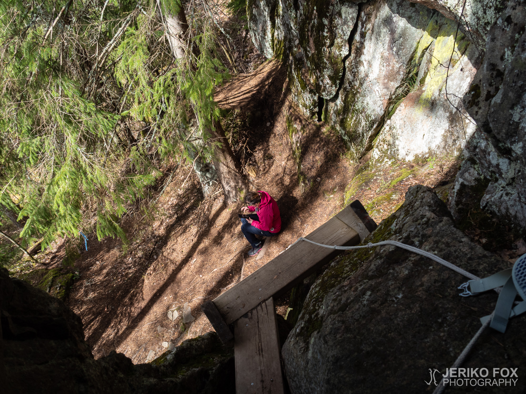
Lassila Hillfort

We had been checking the weather forecasts that were either showing all day rain or all day clear skies – try to figure that out! In the morning the weather seemed fine, hence me and Nina decided to pack our things and try our luck with the weather.

We drove east from Imatra and following the navigator all the way to the parking lot of Lassila hill fort, that has enough space for about four cars. There were some dark clouds and it was windy, but the chance of rain seemed low.

Right next to the parking lot is a trail heading into the woods and towards a high rock face. I didn’t have any idea, if there would be a marked trail or not, but I had read that there was some kind of trail to the top and also a narrow cave perforating the rock wall.

First we came to what was called “esikunta” according to the sign at the parking lot – a fire pit that is partially underneath a large boulder. From there we took a turn to right and started to follow a trail that was going along the rock wall. The trail was full of roots and rocks and fallen trees and fun to walk. About 500 m (0.3 mi) later the trail turned to uphill. It was steep and covered with moss, which could make it quite slippery when wet. Surprisingly fast we reached the top. After reading about the horrible climb, I had truly expected something much worse.

On the top of the hill there are few open spots from where there is a nice view over the lake Latvajärvi (and less nice over the clear cut forest). The wind had grown stronger, so we didn’t stay for long. We followed the trail that now turned to downhill and towards the parking lot.

As the trail changed steeper I saw a red rope that was tied on a tree. And from there was about 3 m (9 ft) almost vertical drop. The rope had frayed a bit against a rock, but was still good enough to use. It had evenly spaced knots and the other end was tied into a tree stump below the drop. I examined the drop and saw that rocks and roots had formed there steps that could be used for assistance. It shouldn’t be too difficult to climb down.

I got down without any problems – only in the lower part there is really nothing good to place your foot on. I left my backpack down and climbed back up to Nina. (Going up that lower part took some extra push.) Nina tried to climb down with my help, but with her fear for heights it was a no go. So, I climbed once more down to get my pack and then back up. We decided to return the same way we came.

The sun started to come out again and the wind was dying. On our way down we met an older couple. They told us that they were also here for the view and the cave. We informed them about the view and told that we were heading to search for the cave next. We moved on back to the “esikunta” and past it towards the rope cliff.

Quite soon, just before the rope cliff, we saw wooden staircase against the rock wall. We had found the cave. We climbed up, put our head torches on and I left my pack at the cave opening. The cave is high and narrow – from the inside it’s partially blocked by loose rocks. I had prepared myself to squeeze into really tight places based on what I had read. But to my surprise the cave wasn’t that cramped. One rock was kind of slanted and one had to pass that in a diagonal position, but there was far more space than in the Tupamäki Cave.

Right after passing that tight spot I could see light from the other end and that’s where I headed. The other end of the cave opens to a steep cliff, so there is no easy way out on that side. The sign at the parking lot said that the story tells that in 1700s – during the Great Northern War – this cave was used as a shelter of 40 people from the village. For that kind of crowd the cave would be really small. We returned to the staircase and sat down for a while to have some snacks.

The Lassila hill fort cave is an easy destination – with the less than 200 m (0.1 mi) walk from the parking lot. If you wish to climb to the top of the hill there are two alternative routes: left turn from the “esikunta” takes you to the rope cliff that requires climbing, but is shorter, and right turn allows you to follow the trail which is longer, but no climbing. The trail is steep though – which ever route you choose – and the trail can be rocky. Taking the longer and more gentle approach up and back down makes this less than 2 km (about 1 mi) hike. If you choose to go it as a loop trail, it’s about 1 km (0.6 mi). From the parking lot the trail takes you straight to the “esikunta” and the cave is located left from there – in between “esikunta” and the rope cliff.

Total time: 17:35:18

Olimme kyttäilleet sääennusteita, jotka lupasivat koko päiväksi sadetta tai poutaa – ota siitä sitten selvää. Aamun näyttäessä kirkkaalta päätimme Ninan kanssa pakata repun ja lähteä kokeilemaan onneamme sään suhteen.

Ajoimme Imatran itäpuolelle ja navigaattorin avustamana suoraan Lassilan linnavuoren parkkipaikalle, jonne mahtuu kerralla noin neljä autoa. Tummiakin pilviä kierteli yllä ja päivä oli tuulinen, mutta sateen uhka vaikutti vähäiseltä.

Suoraan parkkipaikkaa vastapäätä lähtee polku metsään kohti korkeaa kalliota. En tiennyt olisiko mitään merkattua reittiä tarjolla, mutta olin lukenut kallion päälle menevän jonkinlaisen polun sekä kapean luolan läpäisevän koko kallion.

Ensimmäisenä vastaan tuli opaskyltin mukaan “esikunnaksi” kutsuttu nuotiopaikka, joka sijaitsee osittain valtavan kivenlohkareen suojassa. Käännyimme tästä oikealle ja jatkoimme kallionseinämän viertä kulkevaa polkua pitkin. Maasto oli vaihtelevaa ja hauskaa kulkea. Noin puolen kilometrin päästä polku lähti nousemaan ylämäkeen. Rinne oli jyrkähköä ja sammaleista ja kosteammalla säällä mahdollisesti liukas. Yllättävän nopeasti olimme jo linnavuoren päällä. Luettuani vaivalloisesta nousemisesta olin odottanut paljon pahempaa.

Linnavuoren laella on muutama avoin kohta, josta avautuu kaunis näköala Latvajärvelle (ja vähemmän kaunis viereiselle avohakkuualueelle). Tuuli oli tässä vaiheessa melko kova, joten jatkoimme pian polkua, joka nyt kääntyi kohti alamäkeä ja parkkipaikan suuntaan.

Mäen muuttuessa selvästi jyrkemmäksi huomasin vähän matkan päässä puuhun sidotun punaisen köyden. Sen kohdalta näin noin kolmen metrin lähes pystysuoran pudotuksen. Köysi oli hieman hiulaantunut kiveä vasten juurestaan, mutta vielä ihan käyttökunnossa. Siihen oli laitettu solmuja tasaisin välein ja toinen pää alhaalla oli kiinnitetty kantoon. Katselin jyrkännettä ja huomasin köyden kohdalle muodostuneen kivistä ja juurakoista porrasmaiset tasanteet. Laskeutumisen ei siis pitäisi olla liian vaikeaa.

Itse pääsin ongelmitta alas – vain aivan köyden alapäässä on kohta, jossa ei ole erityisen hyvää jalkaotetta. Jätin reppuni alas ja kiipesin takaisin ylös Ninan luokse. (Ylösmennessä tuo alku vaatii pientä ponnistamista.) Nina kokeili lähteä avustuksellani laskeutumaan, mutta hänen korkeanpaikanpelolleen paikka oli liian haastava. Kiipesin siis itse vielä kerran alas hakemaan reppuni ja takaisin ylös. Sovimme palaavamme samaa reittiä kuin olimme tulleetkin.

Tuuli alkoi tässä vaiheessa vaimentua ja aurinkokin paistaa lämmittävästi. Matkalla alas kohtasimme vanhemman pariskunnan. Hekin kertoivat tulleensa katsomaan näköalaa ja luolaa. Sanoimme menevämme seuraavaksi etsimään luolan ja neuvoimme heidät näköalapaikan suuntaan. Jatkoimme itse alas “esikunnan” luokse ja sen ohi kohti köysipaikkaa.

Aivan pian, juuri ennen köysipaikkaa, rinteessä näkyikin pitkät puiset portaat. Olimme löytäneet luolan suuaukon. Kiipesimme portaat ylös, laitoimme otsalamput päähän ja jätin repun luolan suuaukolle. Luola on korkea ja kapea – aukkoa tukkii sisältä pari irtolohkaretta. Olin varautunut tunkeutumaan todella ahtaaseen koloon sen perusteella, mitä olin lukenut. Mutta yllätyksekseni luola ei niin kovin ahdas ollutkaan. Yhden lohkareen ja seinämän välistä joutuu kulkemaan hieman viistossa, mutta tilaa on kyllä enemmän kuin esimerkiksi Tupamäen luolassa.

Heti kapean kohdan ohitettua näkyikin jo toisesta päästä valoa ja sitä kohtihan toki mentiin. Luolan toinen suu avautuu jyrkkään pudotukseen. Sieltä ei siis aivan helposti pääse ulos. Opaskyltin mukaan tarina kertoo, että luola olisi toiminut 1700-luvulla ison vihan aikaan suojapaikkana 40 kyläläiselle. Tila oli sen verran kapea, että tuolla väkimäärällä olisi varsin tiiviit oltavat. Palasimme takaisin portaille ja istahdimme vielä hetkeksi ulos eväille.

Lassilan linnavuoren luola on helppo kohde, jonne ei ole parkkipaikalta kuin korkeintaan pari sataa metriä. Jos haluaa kavuta linnavuoren laelle ihastelemaan näköalaa, reittejä on kaksi: “esikunnalta” vasemmalle kääntyessä päätyy köysipaikalle, joka on lyhyt, mutta kiipeämistä vaativa reitti ja “esikunnalta” oikealle kääntyessä voi seurata polkua, joka on pidempi ja ei vaadi kiipeämistä. Rinne ylös on jyrkkä – meni mitä reittiä tahansa – ja kivikkoisessa maastossa kannattaa liikkua varovaisesti. Loivempaa reittiä ylös noustessa ja alas mennessä koko reitin pituudeksi tulee alle 2 km ja jos kiertää reitin luuppina niin matkaa tulee noin 1 km. Parikkipaikalta polku tuo suoraan “esikunnalle” ja luola sijaitsee siis siitä vasemmalle “esikunnan” ja köysipaikan välissä.

Tupamäki Cave

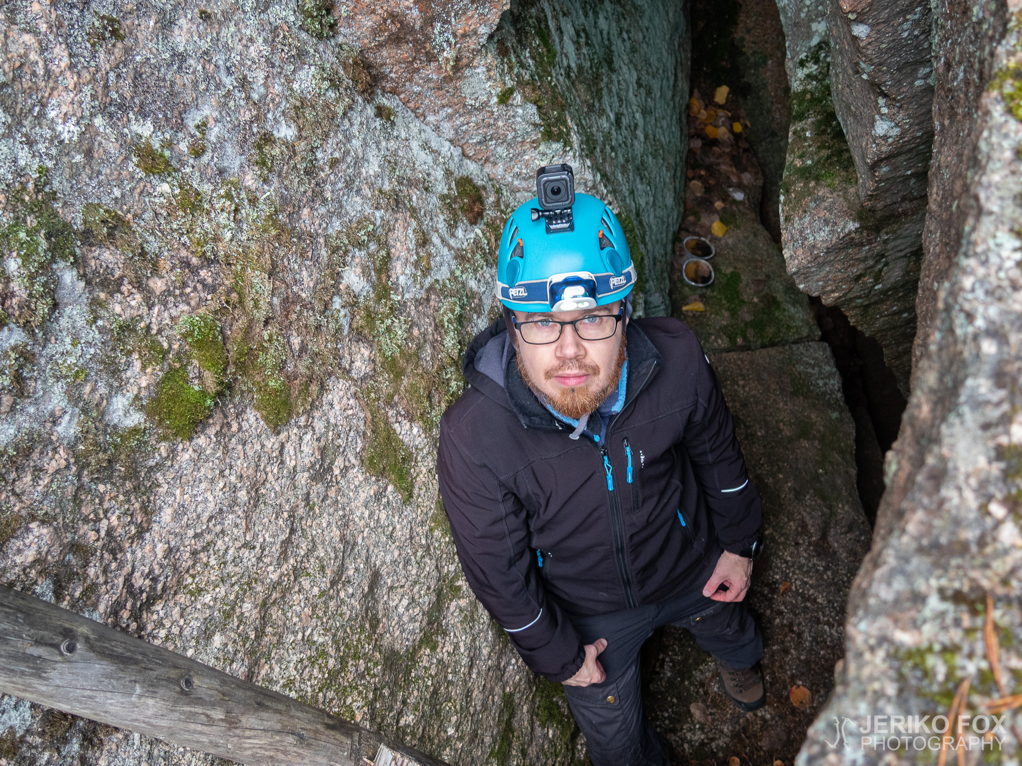
The afternoon was cloudy and the rain was around the corner. We had once before tried to find the Tupamäki Cave near the village of Sinkkola. Now me and Nina had decided to give it another try.

We drove to the parking lot of Hämmäauteensuo, which is south from Lappeenranta. There were plenty of cars. Others seemed to have headed to the wetlands (the Hämmäauteensuo fen), because no one seemed to move to same direction with us. We took Hämmäauteensuo trail until it turns from the road towards the fen. From there we took a turn to left across the road. I had read that you could follow the powerlines from the parking lot to the Tupamäki (which is the straightest route), but at least during the autumn it would have been hopeless bushwhacking. Possibly early in spring it might be doable. That’s why we chose this time a forest road that I found from the maps of Retkikartta.

After crossing the Vanha Viipurintie we followed the dirt road on the other side. There was one intersection to the left that we passed and then a trail crossing a tall grass, but because we weren’t sure if this was going to correct direction, we continued to the second intersection and turned left towards Tupamäki hill. About two hundred meters (0.1 mi) later this road turns to right and there is an empty spot (that could be used as a parking lot). A good landmark here is a pile of rocks with long logs on top of it looking like a cannon. On the right hand side of this “cannon” starts a trail (that is a dashed line in Retkikartta) which is actually an overgrown forest road.

The trail was in decent condition and after another 200 meters (0.1 mi) it took a turn to right. Here it started to look more like an actual forest road. We didn’t walk very far from there when we saw on our left hand side a trail going uphill and a yellow ribbon on a tree. We decided to take this trail because it seemed to go to the right direction.

This indeed is the trail that one has to follow to find the cave. We took our share of detours on the hill and climbed over the huge boulders. Some had small spaces in between them where you could perhaps squeeze yourself into, if you happened to feel like that. Eventually we returned to the main trail and continued on until I saw an orange ribbon on a tree on my left hand side. I went to the direction of the ribbon – towards the edge – and behold, there was ladders! We had found the entrance to the cave!

On the moss covered rocks one has to move carefully and also go slowly on the ladders so that they wouldn’t slip and fall. From this platform I peeked into the hole between the rock wall and the boulder – deep down there were another ladder. About three meters (9 feet) below was a flat surface, where one could access the other ladder. But climbing up from that place back to the upper ladder would be quite challenging – especially if you don’t have rock climbing skills. I was pondering for a while and realised that we could take the upper ladder and relocate them to access the lower ones. That would make climbing down and especially back up significantly easier.

Me and Nina took hold of the ladder together and lowered them down into hole to meet the lower surface. The ladder seemed to sit there quite well and were perfect length. I climbed down and handed my backpack to Nina, because the lower parts of the cave seemed quite tight. I continued down first inching my feet on a small shelf and from there to the lower ladder. This place was not spacious and actually tight enough that a larger person might not even fit through. When I reached the second level I saw that there was one more down below, but I thought it wouldn’t be wise to go there alone in case I wasn’t able to climb up.

I climbed back up to the first level to inform Nina – who was slightly intimidated about all of this climbing business – what was down there. There has started a light drizzle up there, so we decided to lower our backpacks to the first level. Then Nina climbed down with my assistance. Together we continued to the second level and at this point I dropped myself to the third level. The cave continued a bit to my right and left and in front of me was a wide crack, where one might just be able to squeeze into. I succeeded to climb back to the second level to meet Nina by myself.

We both agreed that in all of its tightness and deepness the cave was fairly interesting place. We stood there in awe for a while and took some photos before we decided to climb back up. After climbing up from the first level on the top of the boulder, we took the ladder back up. That way we could climb back on the hill and the next ones could get down.

From the Hämmäauteensuo parking lot it was about 2 km (1.2 mi) one way to the Tupamäki Cave and it takes about half an hour to walk there. It’s possible to drive closer – to the beginning of the trail. But anyway it’s not that far from Hämmäauteensuo and one can easily see both of these places in one trip. The trail to the Tupamäki is not difficult, but in the cave and in that rock maze one must be very careful.

As we were returning to our car we saw lots of people coming from their own trips from Hämmäauteensuo. I was happy that our destination was less crowded – we didn’t meet anyone there. You don’t find the Tupamäki Cave accidentally, but the route description here should guide you there.

Total time: 18:38:52

Iltapäivä oli pilvinen, mutta sade vielä pidätteli tuloaan. Olimme käyneet kerran aiemmin etsimässä Sinkkolan kylällä olevaa Tupamäen luolaa Ninan kanssa ja nyt olimme päättäneet tehdä uuden yrityksen.

Ajoimme auton Lappeenrannan eteläpuolella olevan Hämmäauteensuon parkkipaikalle, jossa oli runsaasti muidenkin retkeilijöiden menopelejä. Muut olivat kuitenkin ilmeisesti suunnanneet suolle, koska meidän reitillämme ei ketään muuta näkynyt. Kävelimme Hämmäauteensuon reittiä siihen asti, mistä polku kääntyy tien viereltä suolle päin. Tästä käännyimme vastakkaiseen suuntaan vasemmalle ja ylitimme Vanhan Viipurintien. Olin lukenut, että Tupamäelle pääsisi myös parkkipaikan läheisyydessä olevaa voimalinjaa pitkin (mikä onkin suorin reitti), mutta ainakin näin syksyllä se on umpeenkasvanutta ryteikköä. Ehkä aikaisin keväällä sitä kautta voisi olla jotain mahdollisuuksia. Siksi valitsimmekin tällä toisella yrittämällä Retkikartan avulla löytämäni metsäautotien.

Vanhan Viipurintien ylitettyämme lähdimme siis kävelemään toisella puolella olevaa hiekkatietä pitkin. Ensimmäisen vasemmalle kääntyvän tien jälkeen näimme hakkuuaukean heinikkoa halkovan polun, mutta päätimme varmuuden vuoksi mennä silti tietä pitkin. Hiekkatien toisesta vasemmalle kääntyvästä risteyksestä suuntasimme siis Tupamäkeä kohti. Pari sataa metriä risteyksestä tie kääntyy oikealle ja suoraan edessä on (parkkipaikaksikin soveltuva) tyhjä alue, jonka reunalla hyvänä maamerkkinä on pino kiviä ja niiden päällä pitkät hirret aivan tykin näköisenä muodostelmana. Tämän “tykin” oikealta puolelta lähti (Retkikartassa katkoviivana näkyvä) metsittyneen metsäautotien uomaa seuraava polku.

Polku oli hyvin kuljettavissa ja noin kahdensadan metrin päästä se teki mutkan oikealle. Tässä kohdin reitti alkoi näyttää jo selkeämmin metsäautotieltä. Lyhyen matkan kuljettuamme näimme vasemmalle, kallioiden päälle, lähtevän polun, joka oli merkitty keltaisella nauhalla. Päätimme lähteä seuraamaan tätä polkua, koska se vaikutti menevän oikeaan suuntaan.

Luolalle päästäkseen tulee seurata tätä polkua. Me seikkailimme kallioilla hieman enemmänkin ympäriinsä ja kiipelimme näyttävien kivenlohkareiden päälle. Joidenkin välissä oli koloja, jonne olisi ehkä juuri saattanut mahtua hivuttautumaan. Palasimme lopulta takaisin pääpolulle ja jatkoimme sitä eteenpäin, kunnes huomasin vasemmalla puolella puussa oranssin nauhan. Kävelin nauhan kohdalta pois polulta, vasemmalle kallion reunaa kohti, ja sieltä näinkin alempana olevat tikapuut. Olimme löytäneet luolan suulle!

Sammaloituneella kalliolla täytyi liikkua varovasti ja tikapuita myös laskeutua rauhallisesti, etteivät ne luistaisi alta. Tältä tasanteelta kurkkasin kallion ja lohkareen välissä olevaan aukkoon ja näin syvällä alhaalla toiset tikapuut. Noin kolme metriä alempana oli tasanne, josta pääsisi tikapuille, mutta tuolta tasanteelta nouseminen takaisin ylempien tikapuiden luokse olisi hankalaa ainakin ei-kalliokiipeilytaitoiselle. Pohdin tilannetta hetken ja totesin, että ylemmät tikapuut olisivat siirrettävissä alemmalle tasanteelle, jolloin sinne meno ja etenkin poistuminen olisi huomattavasti helpompaa.

Nostimme Ninan kanssa yhdessä tikapuut normaalilta paikaltaan ja laskimme ne alas luolan ensimmäiselle tasanteelle. Ne asettuivat siihen hyvin ja olivat juuri sopivan mittaisetkin. Laskeuduin ensimmäiselle tasanteelle ja päätin antaa reppuni Ninalle, koska luolan alemmat osat näyttivät sen verran ahtaille. Jatkoin matkaani alas hivuttautuen ensin pienelle hyllylle ja siitä alemmille tikapuille. Tämä väli on melko ahdas ja saattaa olla isommalle ihmiselle hieman tiukka paikka. Päästyäni toiselle tasanteelle näin luolan jatkuvan vielä yhden tason alemmas, mutta en uskaltautunut sinne aluksi yksin, jos en pääsisikään pois.

Palasin ensimmäiselle tasanteelle kertoakseni kiipeämistä hieman jännittävälle Ninalle mitä olisi luvassa. Maan pinnalla oli alkanut hieman tihkuttaa, joten laskimme reput ensimmäiselle tasanteelle sateelta suojaan. Sitten Nina laskeutui avustuksellani luolaan. Jatkoimme yhdessä toiselle tasanteelle ja tässä vaiheessa minä menin myös kolmannelle tasanteelle asti. Siellä luolaa oli lyhyen matkaa oikealle ja vasemmalle sekä edessäni oli leveä halkeama, jonne ehkä osittain voisi mahtuakin. Onnistuin nousemaan kolmannelta tasolta takaisin toiselle tasanteelle Ninan luokse omin avuin.

Olimme yhtä mieltä siitä, että luola oli kaikessa ahtaudessaan ja syvyydessään kiinnostava paikka. Ihmettelimme ja otimme kuvia hetken aikaa, kunnes päätimme kiivetä takaisin ylös. Päästyämme ylimmät tikapuut maan pinnalle asti, nostimme ne takaisin ylös ja nojalle isoa lohkaretta vasten, että pääsisimme itse pois ja seuraavatkin retkeilijät luolalle.

Matkaa Tupamäen luolalle Hämmäauteensuon parkkipaikalta kertyi noin 2km/suunta, jonka kävelemiseen menee reilu puoli tuntia. Auton voi ajaa halutessaan lähemmäksikin, vanhaa metsäautotietä seurailevan polun alkuun. Matka Hämmäauteensuoltakaan ei kuitenkaan ole pitkä ja halutessaan päiväreissuun pystyy helposti yhdistämään nämä molemmat mielenkiintoiset kohteet. Reitti Tupamäelle ei ole vaikea, mutta luolassa sekä kallionlohkareiden välissä täytyy liikkua varovaisesti.

Palatessamme autolle näimme useita ihmisiä tulossa Hämmäauteensuolta omilta retkiltään. Olin tyytyväinen, että meidän retkikohteemme oli selvästi rauhallisempi – emme tavanneet ketään. Tupamäen luolalle ei eksy vahingossa, mutta tässä kuvailemieni reittimerkkien avulla sinne haluava löytää kyllä helposti perille.