
When you are hiking, everything doesn’t always go with that Martha Stewart precision. And don’t we just love those great success stories…but perhaps the other kind of story is also worth telling. So, let’s start right from the beginning.
Salpalinja (lit. Bolt-line) is the last defence line through the eastern Finland that was built in the 40s. This 1200 km (750 mi) long defence line – from the Finnish bay in the south to the eastern arm (that was lost in the war) of Finland in the north – was never used because Finns were able to stop the Soviet troops further east. During the cold war era Salpalinja was quietly maintained, but later all the bunkers were left to rot. You can read more about the history in the Salpalinjan salat blog (in Finnish).
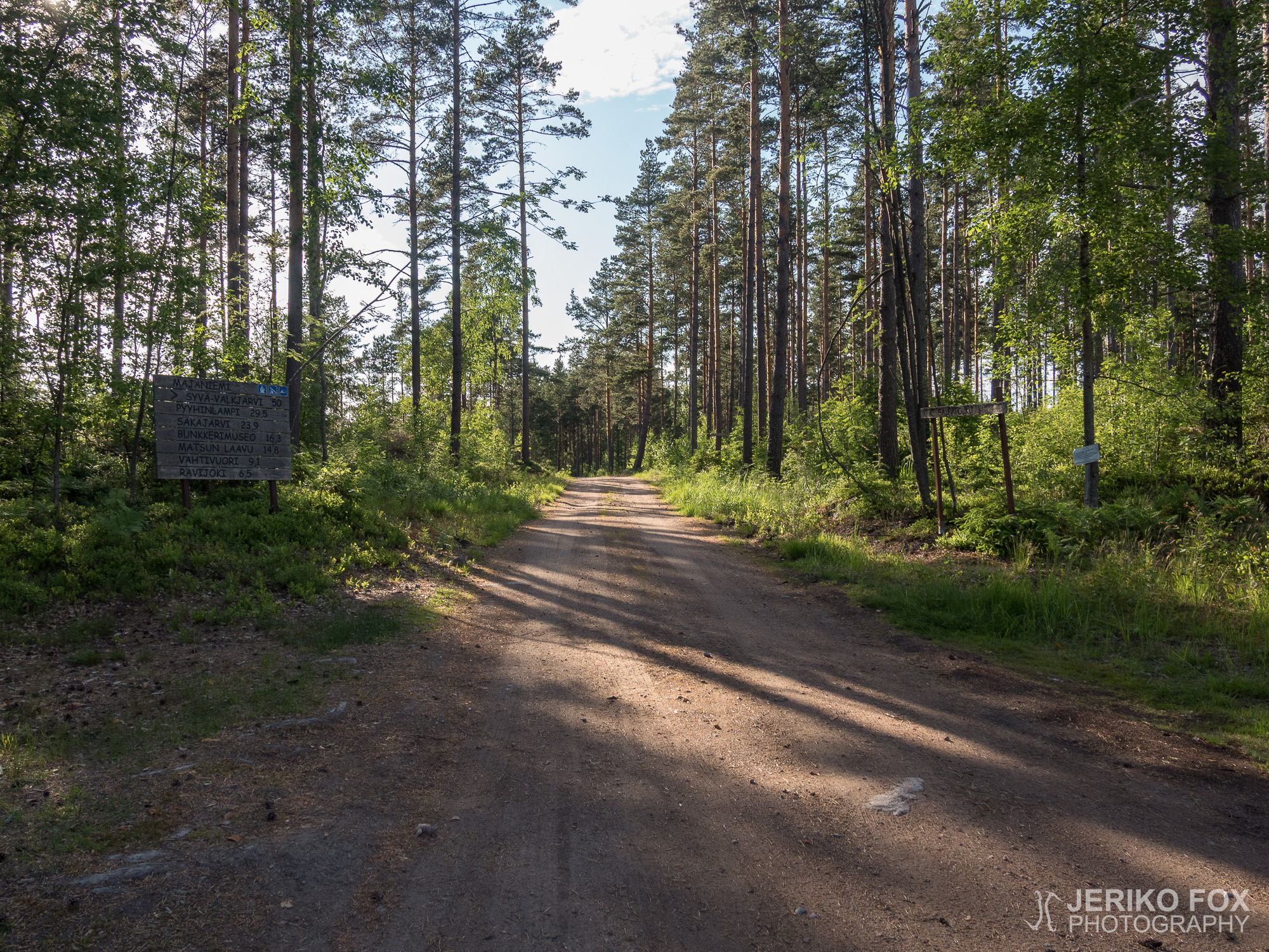
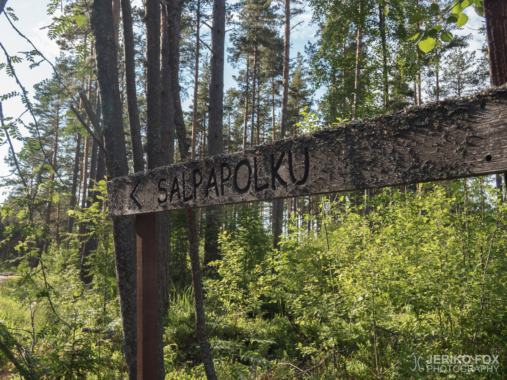
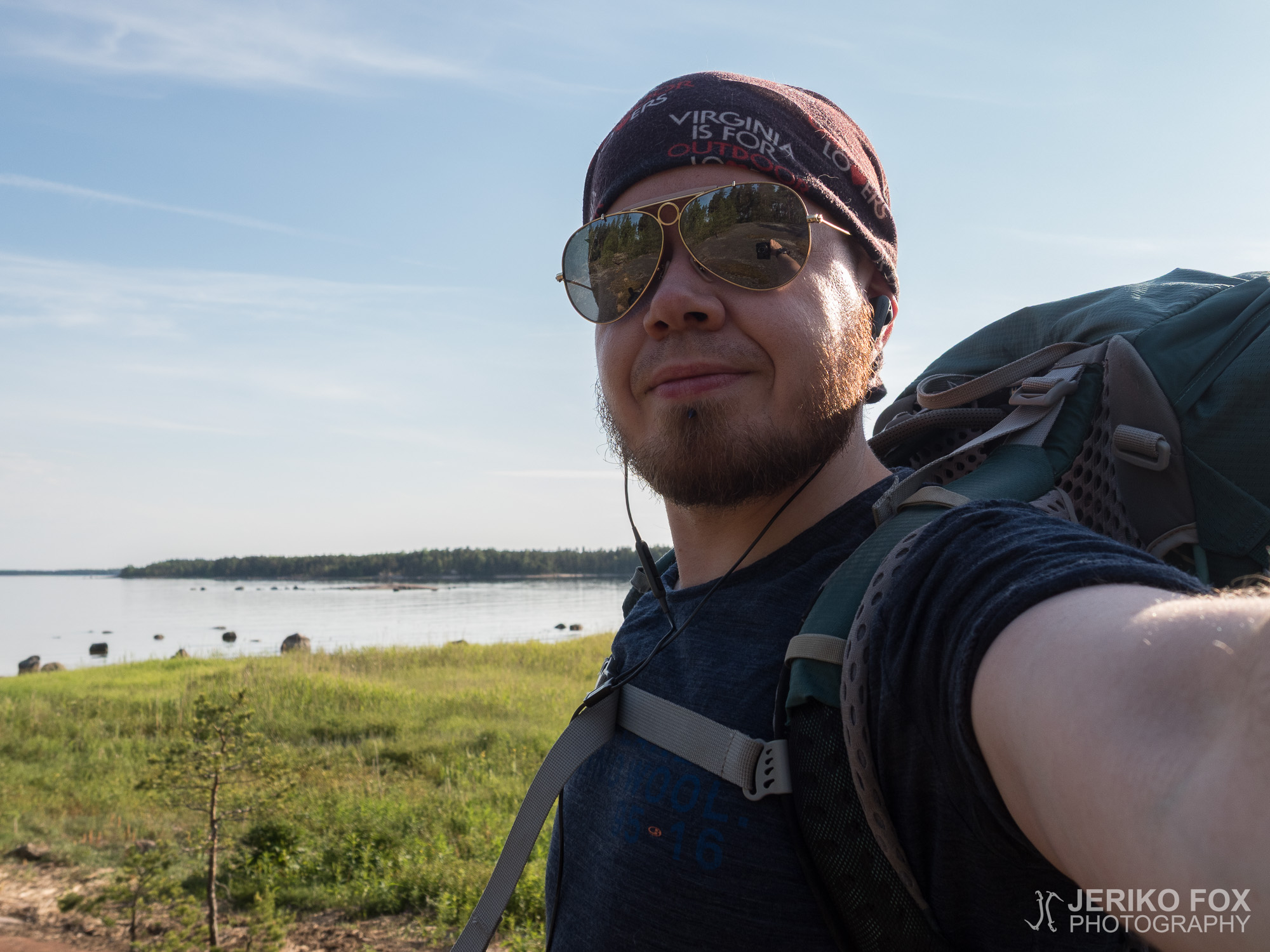
I was interested about Salpalinja mainly because the southernmost 50 km (30 mi) of it is covered by a hiking trail called Salpapolku (which I would like to translate to Salpalinja Trail). I have been thinking about the Salpalinja Trail every now and then, while I’ve been planning my future hikes. Now that I had about three days before my next work shift, the Salpalinja Trail seemed doable – though with a very tight schedule. Hence I packed my dear old green backpack with the familiar routine. I had most of my AT gear with me when my mother turned off from the driveway and towards the southern terminus in Majaniemi.
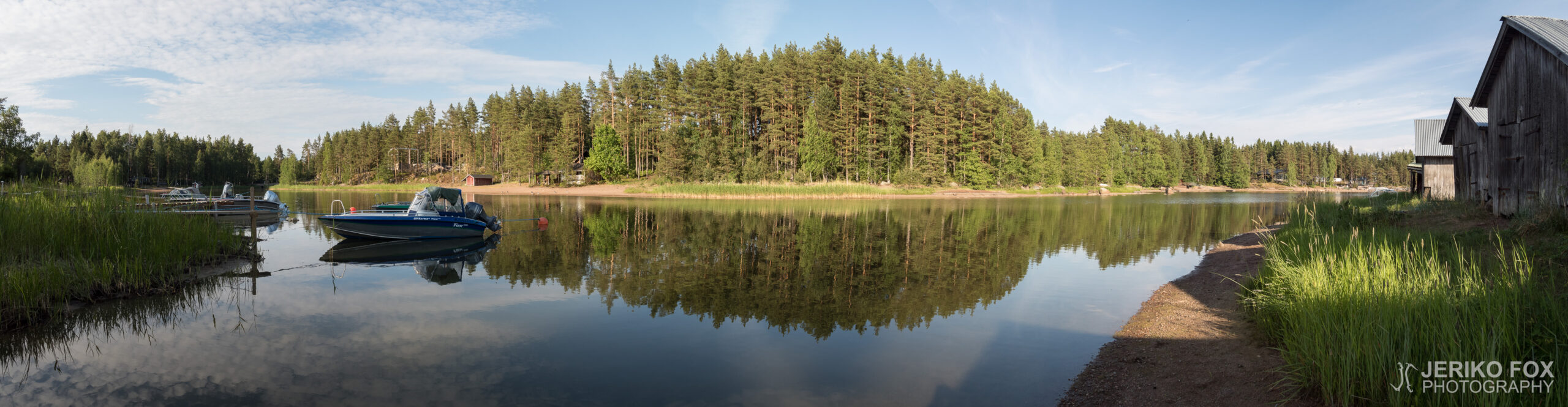
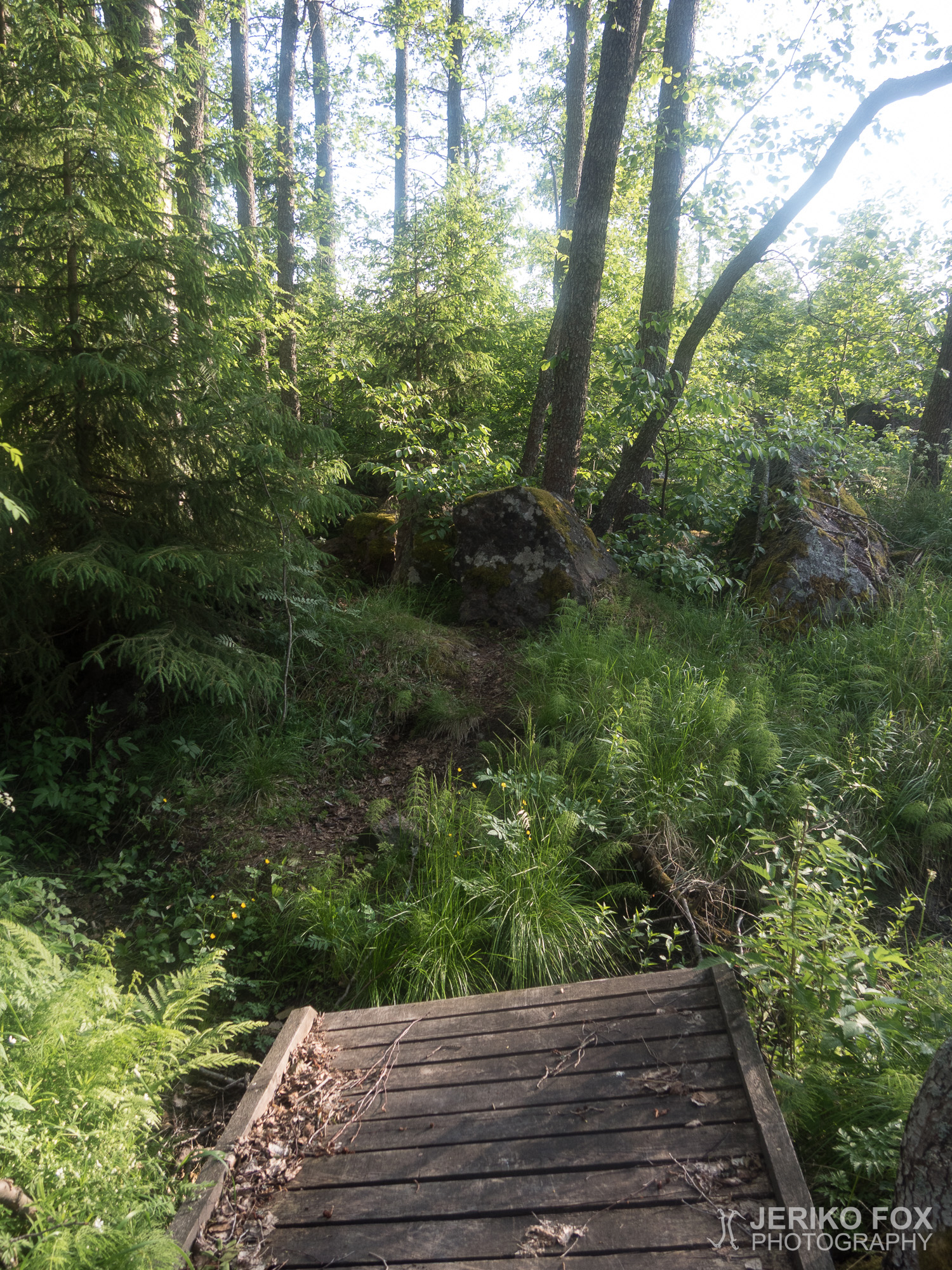
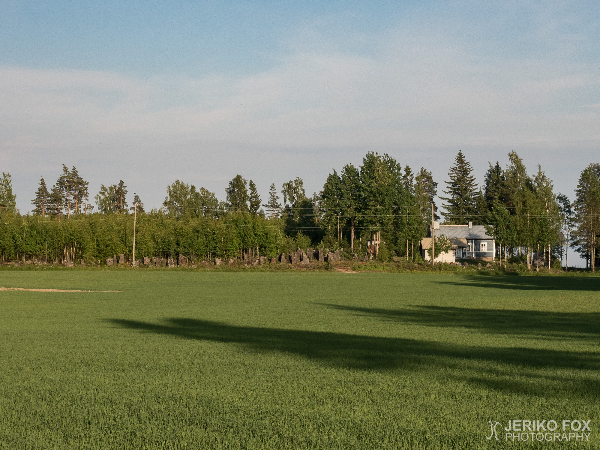
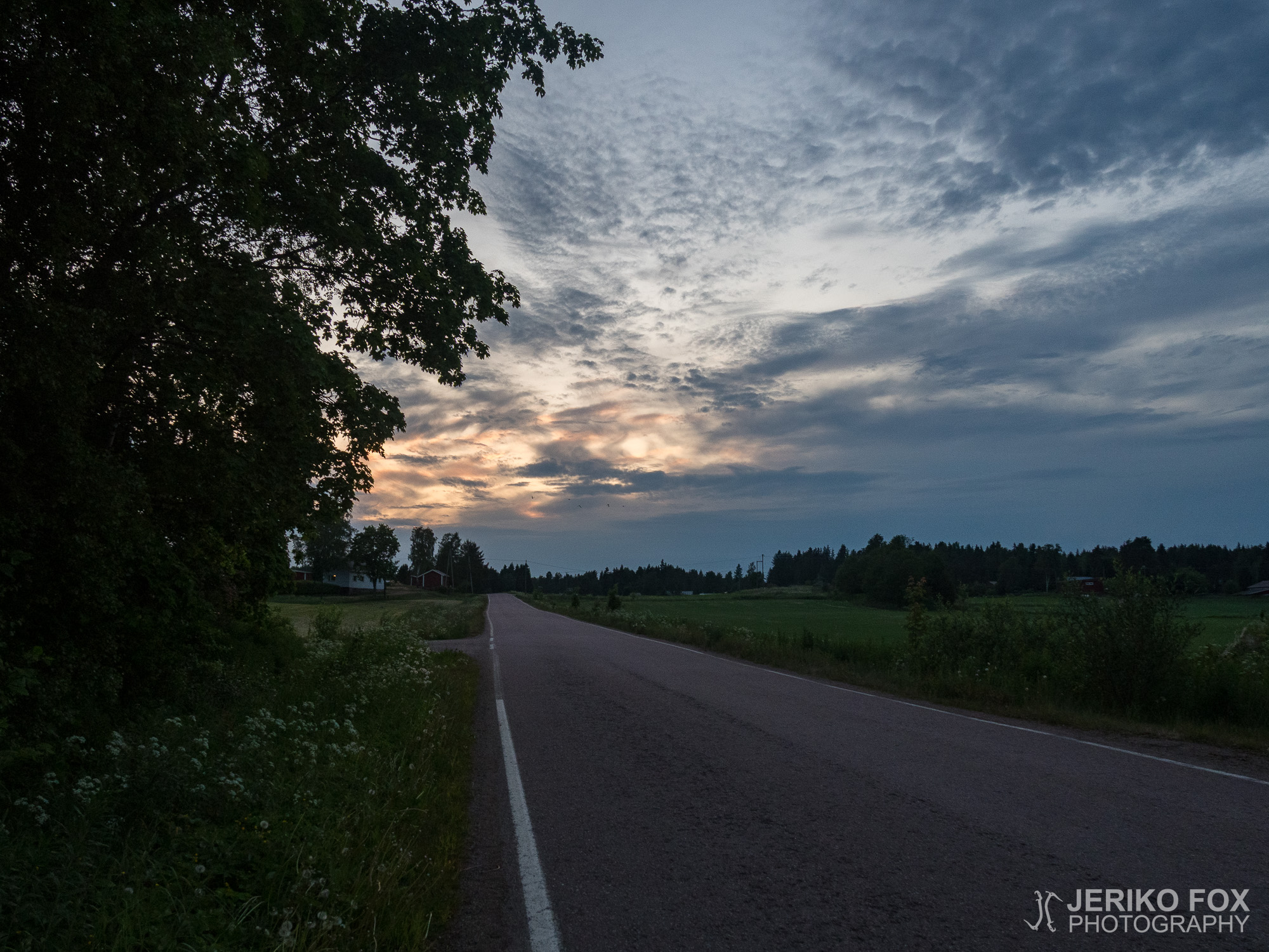
After more than an hour of driving the winding roads, we arrived to the sea shore. The lichen-covered trail sign and the privy that had long ago passed the need to be emptied didn’t feel very promising, but determinedly I put on my backpack. The beginning of the trail was following a gravel road, but soon I was allowed to dive into the mosquito filled forest.
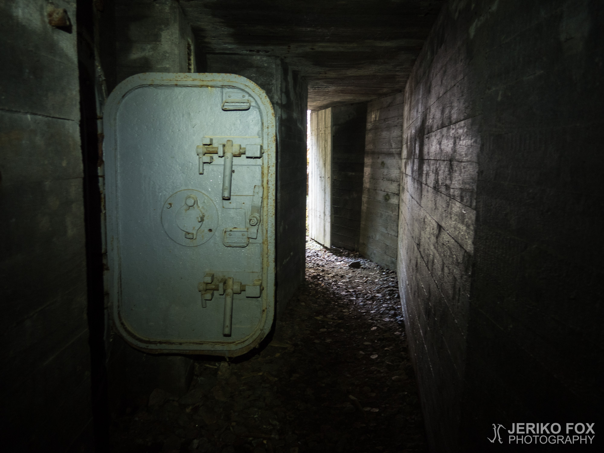
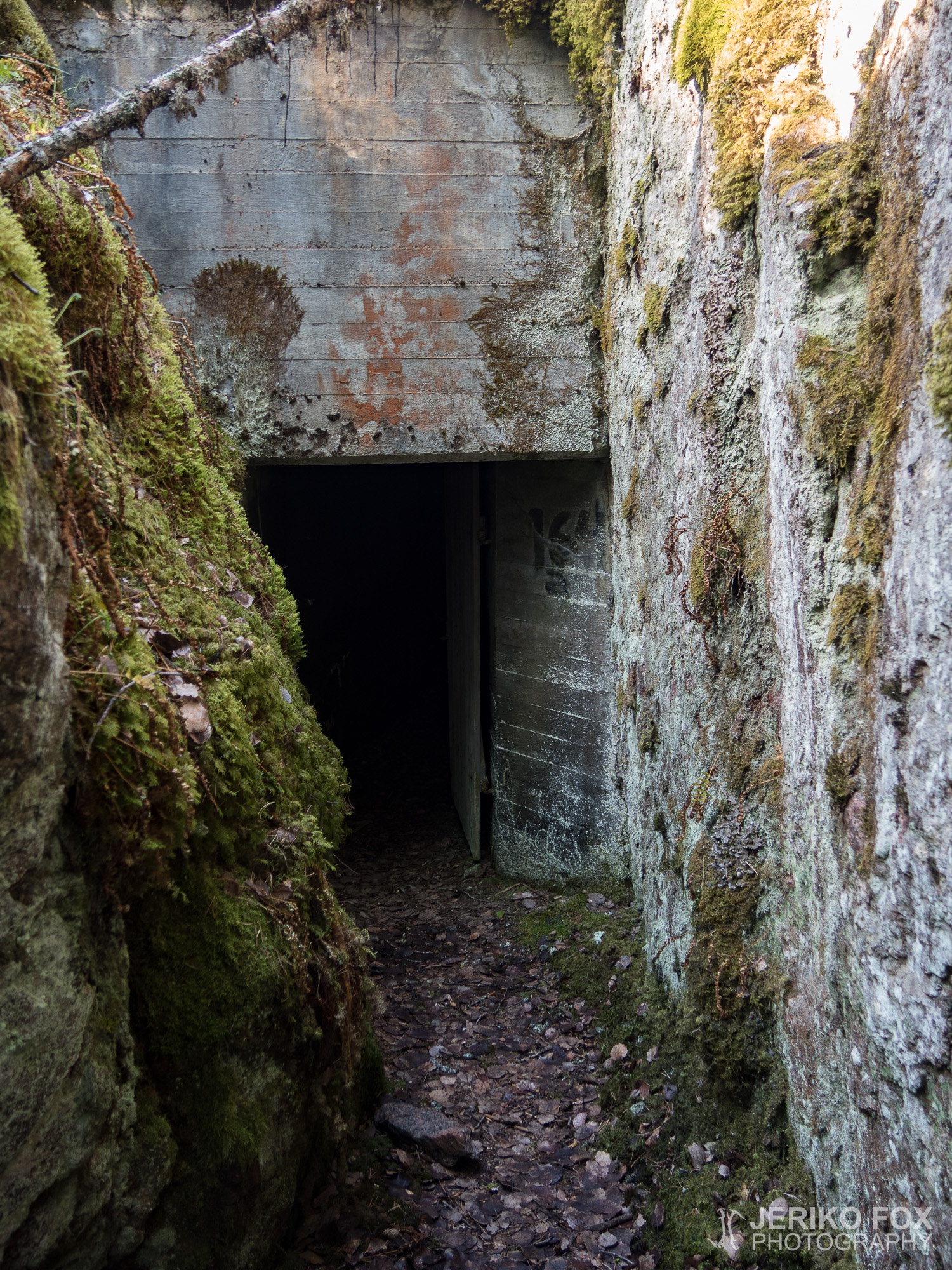
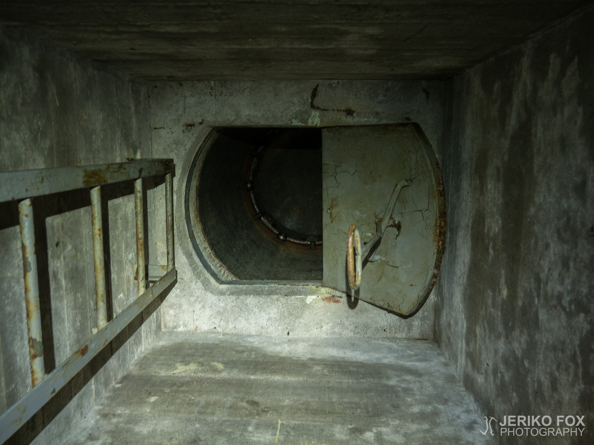
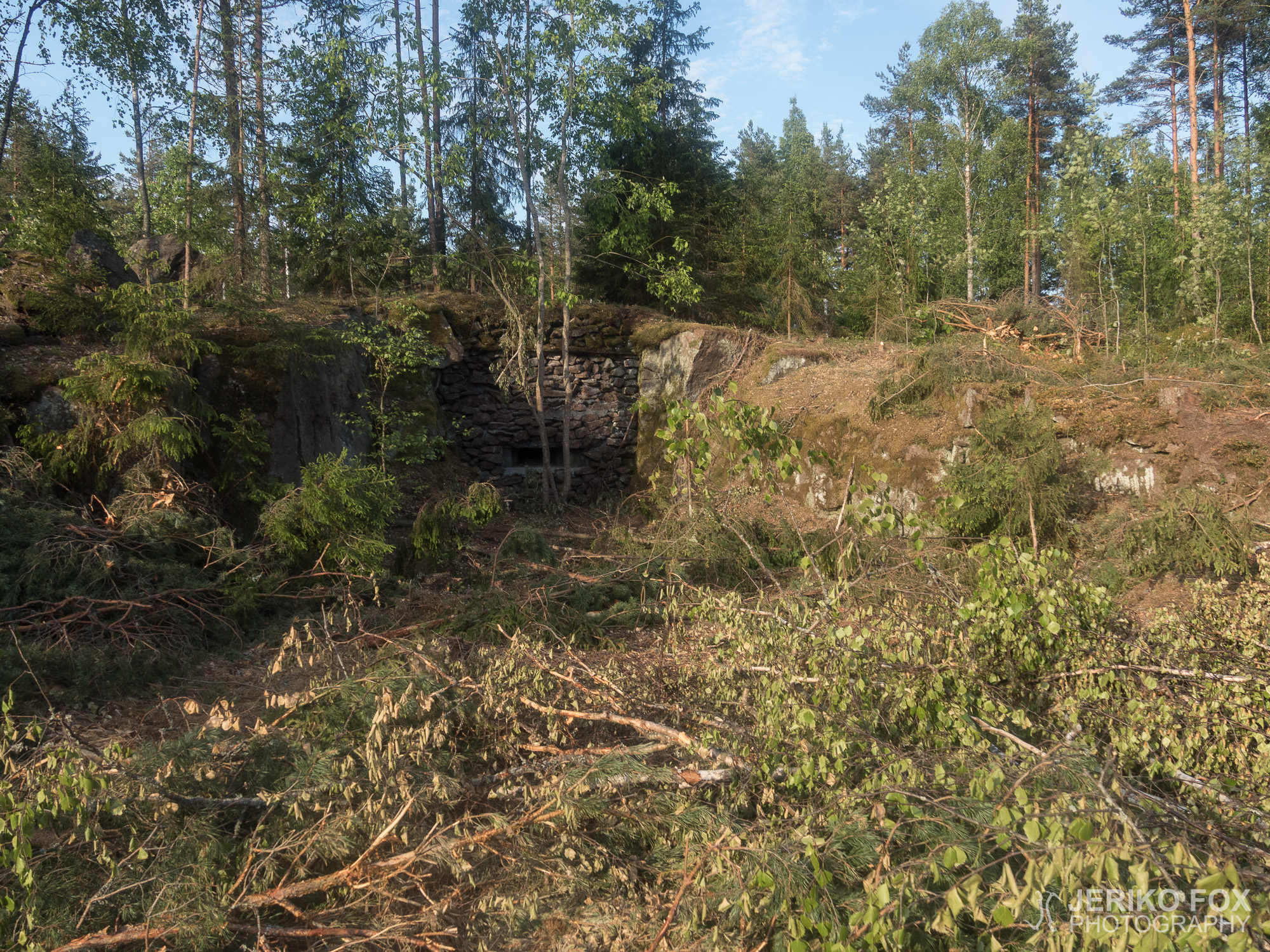
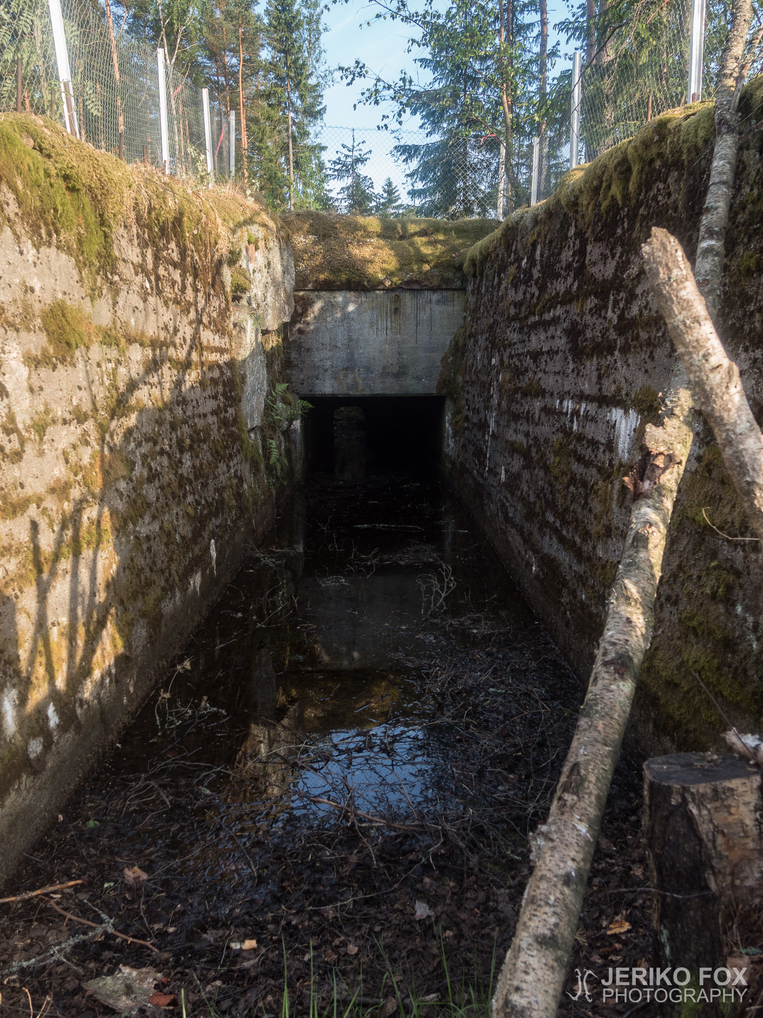
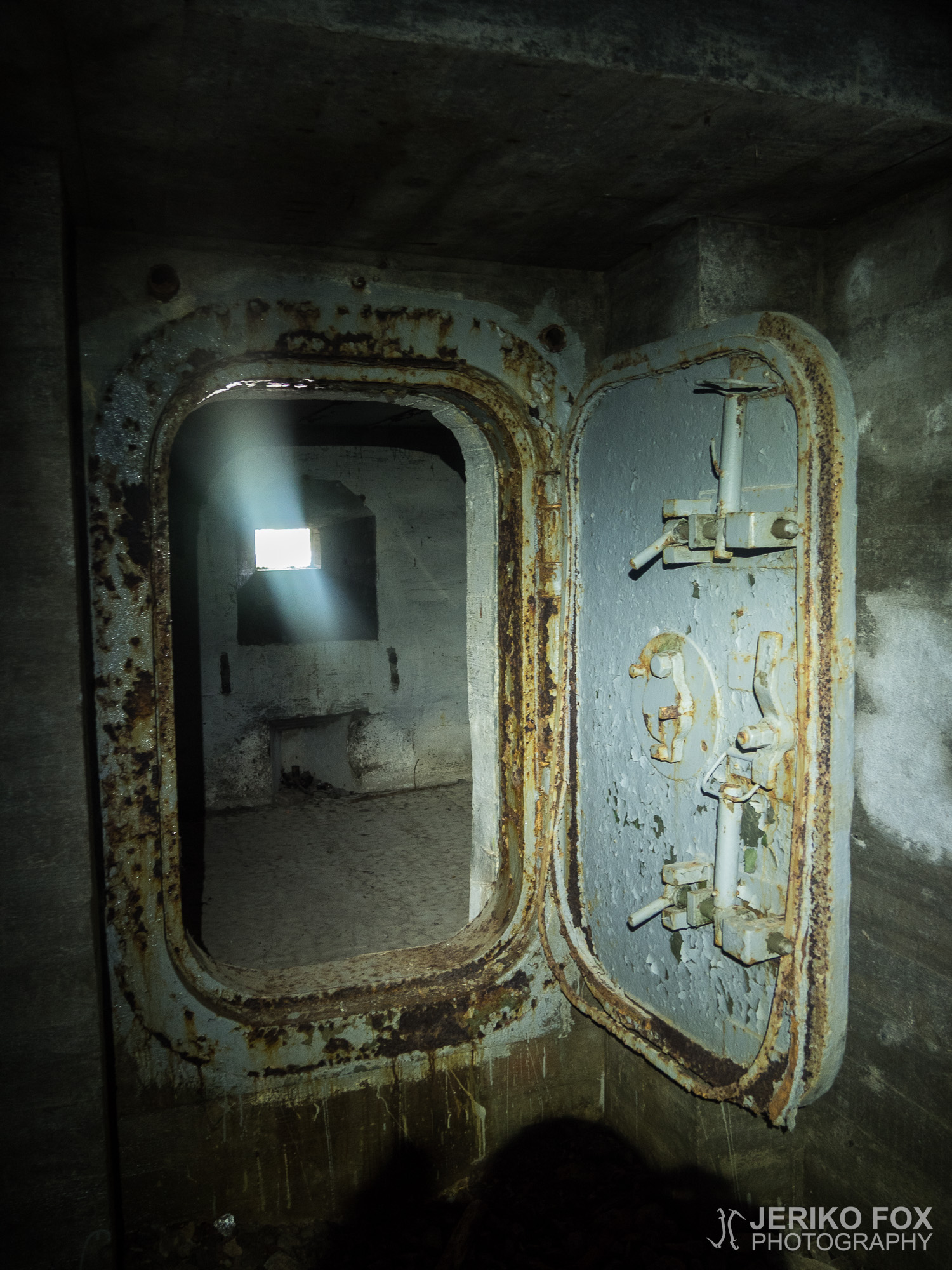
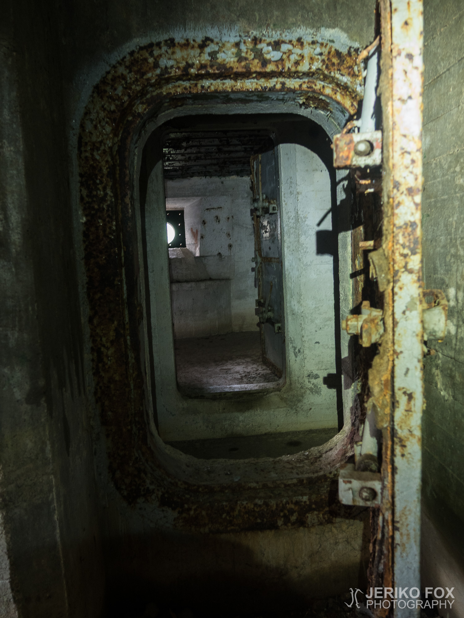
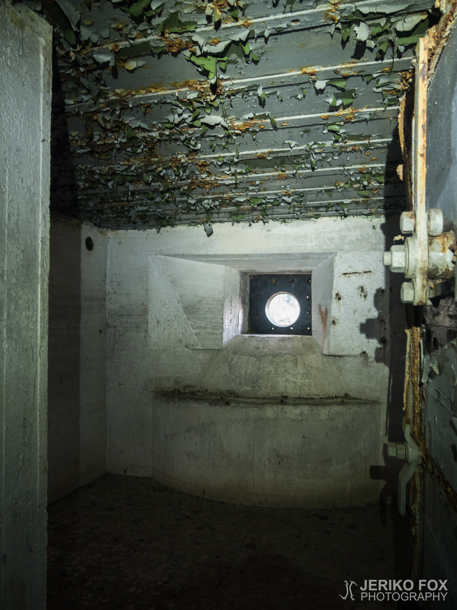
The first dugout came quite soon and I left my backpack on the trail to explore the bunker with my headtorch. Creeping through the deep trench to the dugout was exciting. I had been told that there might be holes in the floors and rebars in the ceilings, but I was moving possibly bit too confidently in the dark.
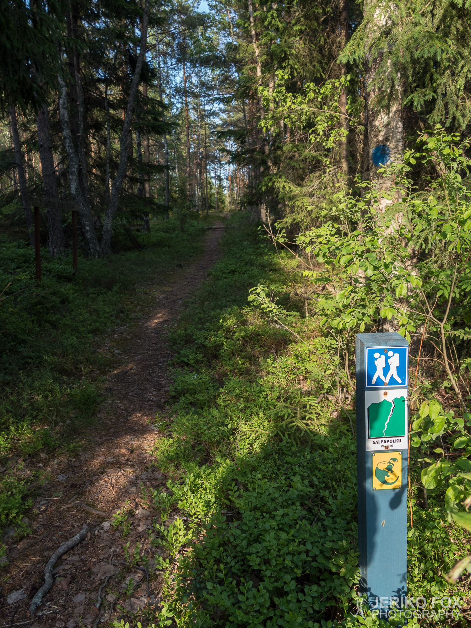
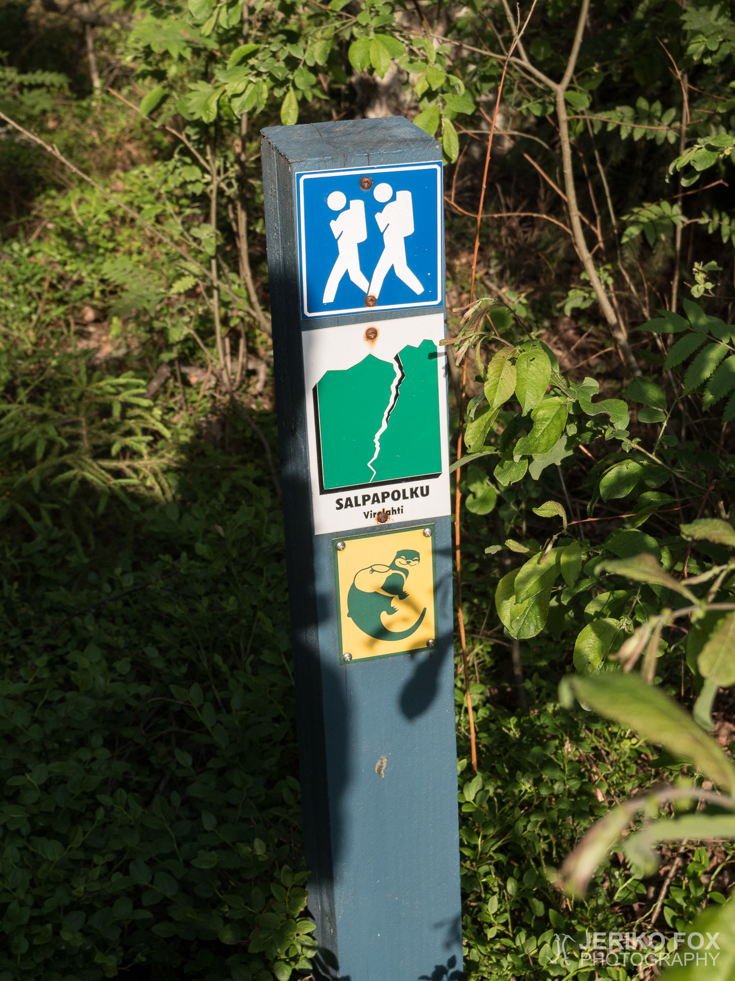
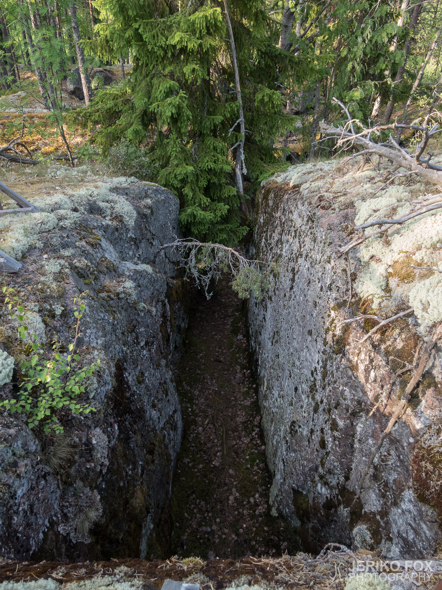
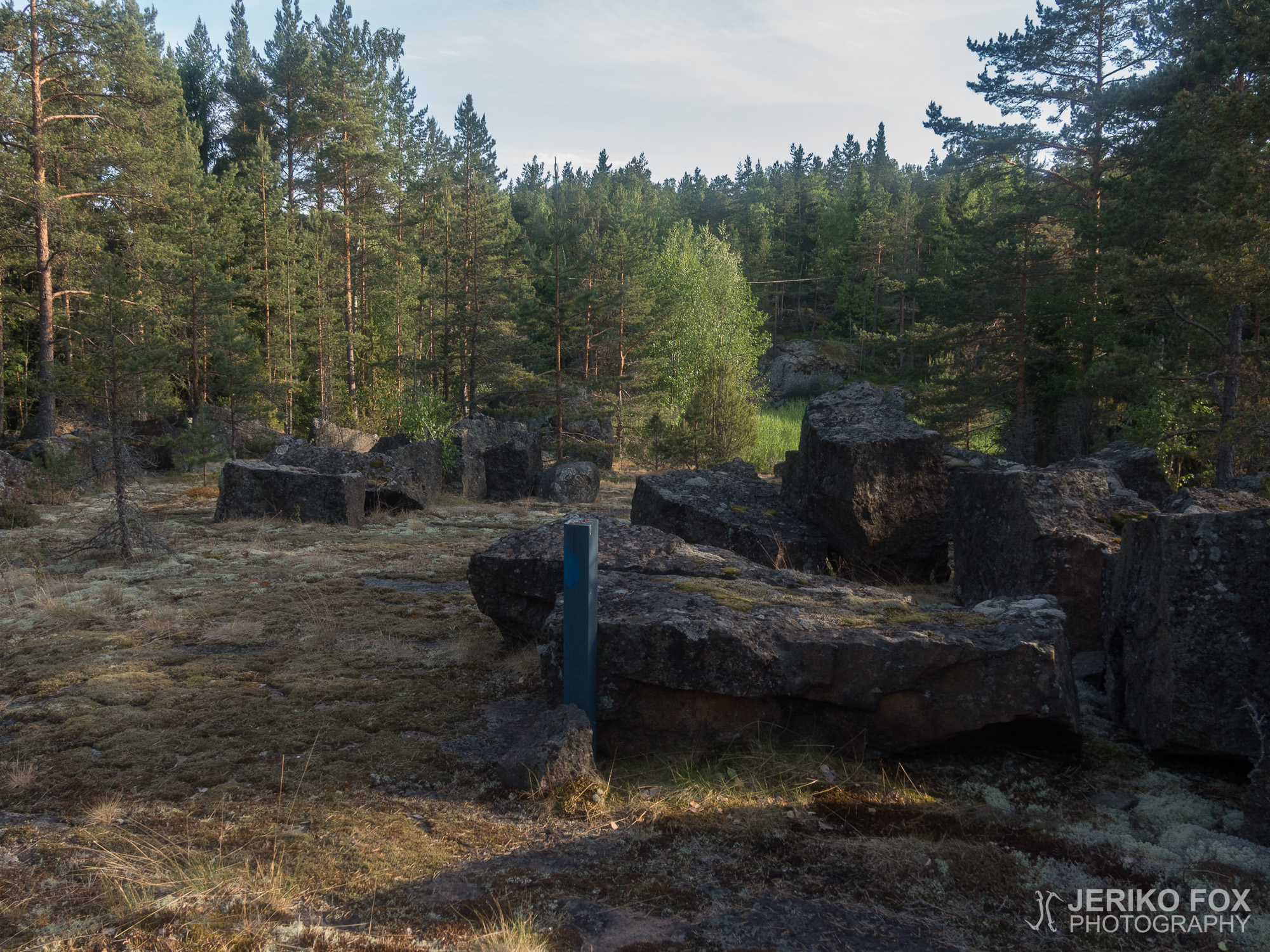
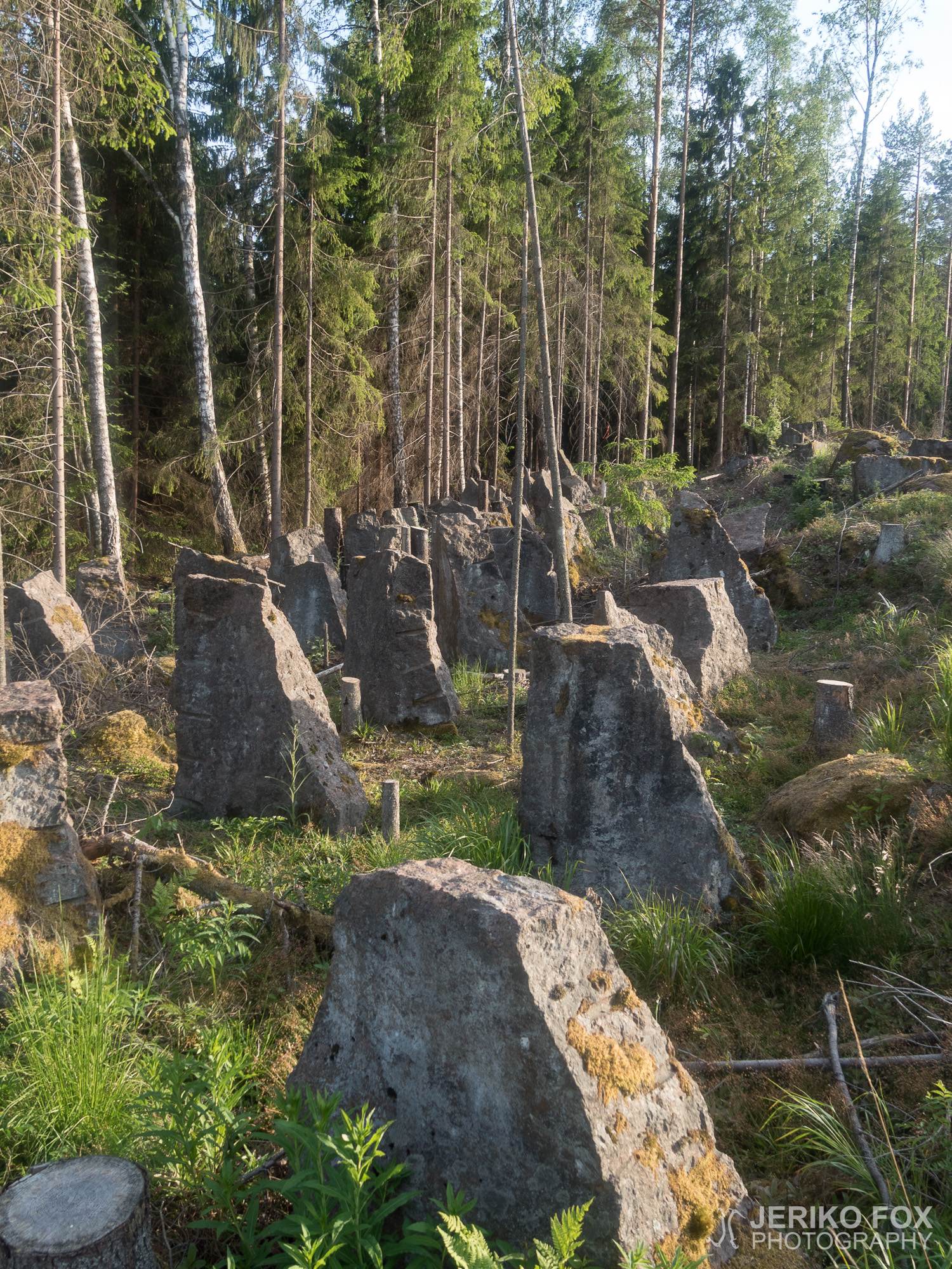
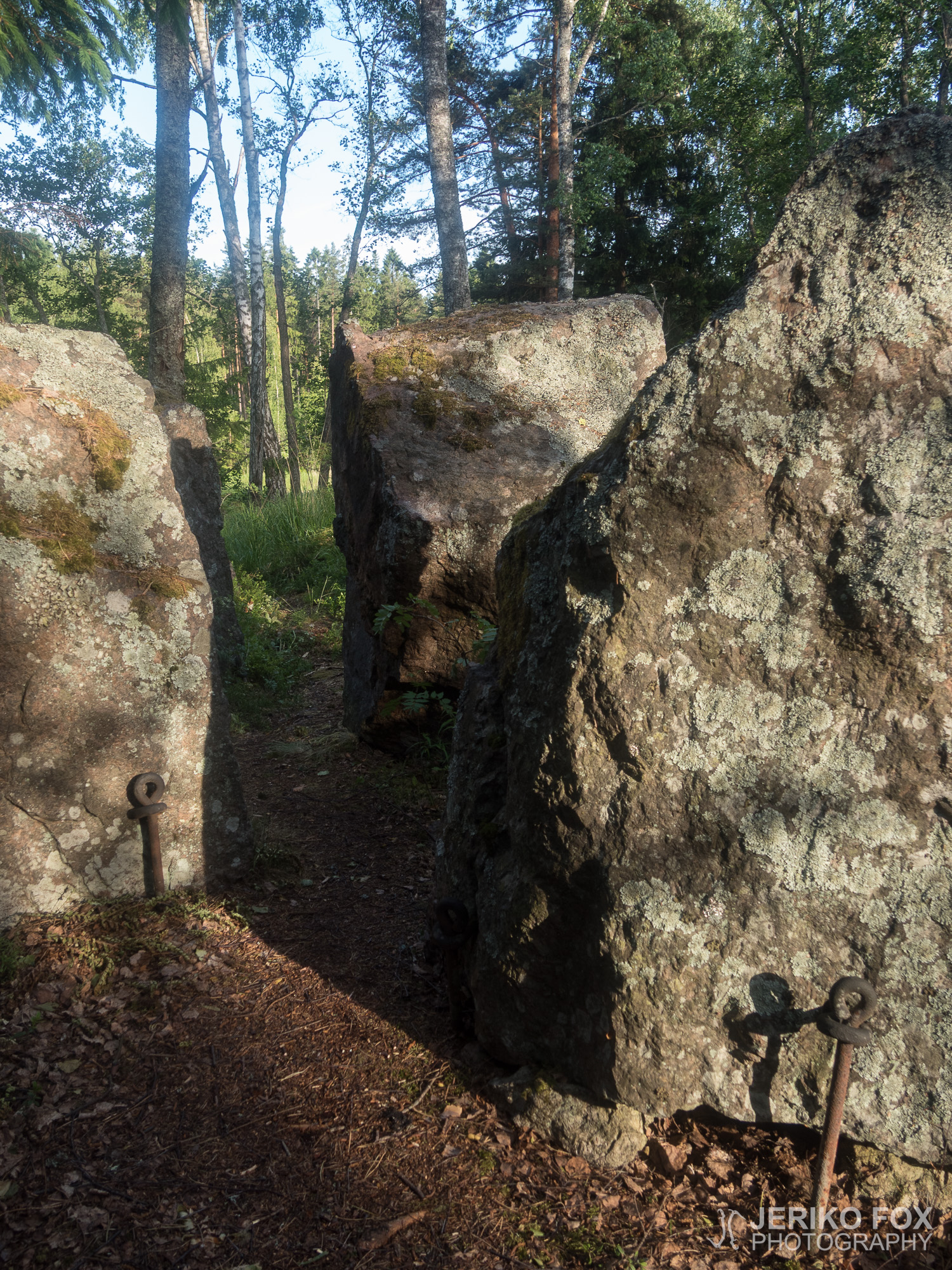
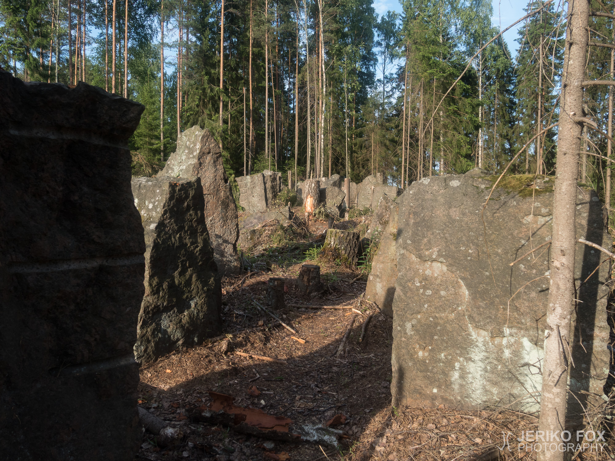
The doubts about the trail condition were slowly proven true. The trail was overgrown at places. The bushwhacking part wasn’t the problem, but finding the trail was. When I walked through the anti-tank fortifications towards the machine-gun nest I met another kind of challenge. A harvester had done a clearcut. There was no trail anywhere and nothing left of the trees that had the trail signs painted on them. Well, chance favors those in motion.
I leaped over the piles of branches to a dirt road, where I finally found a post with a familiar otter logo on it. I was still on the trail. Following a road might sound more pleasant than it is, because there you must keep watch when the trail is leaving the road again. Every once in a while I stopped to look at my map and got the ferocious air force all over me. The mosquitoes were circling my head and I easily killed five with a single slap on my head.
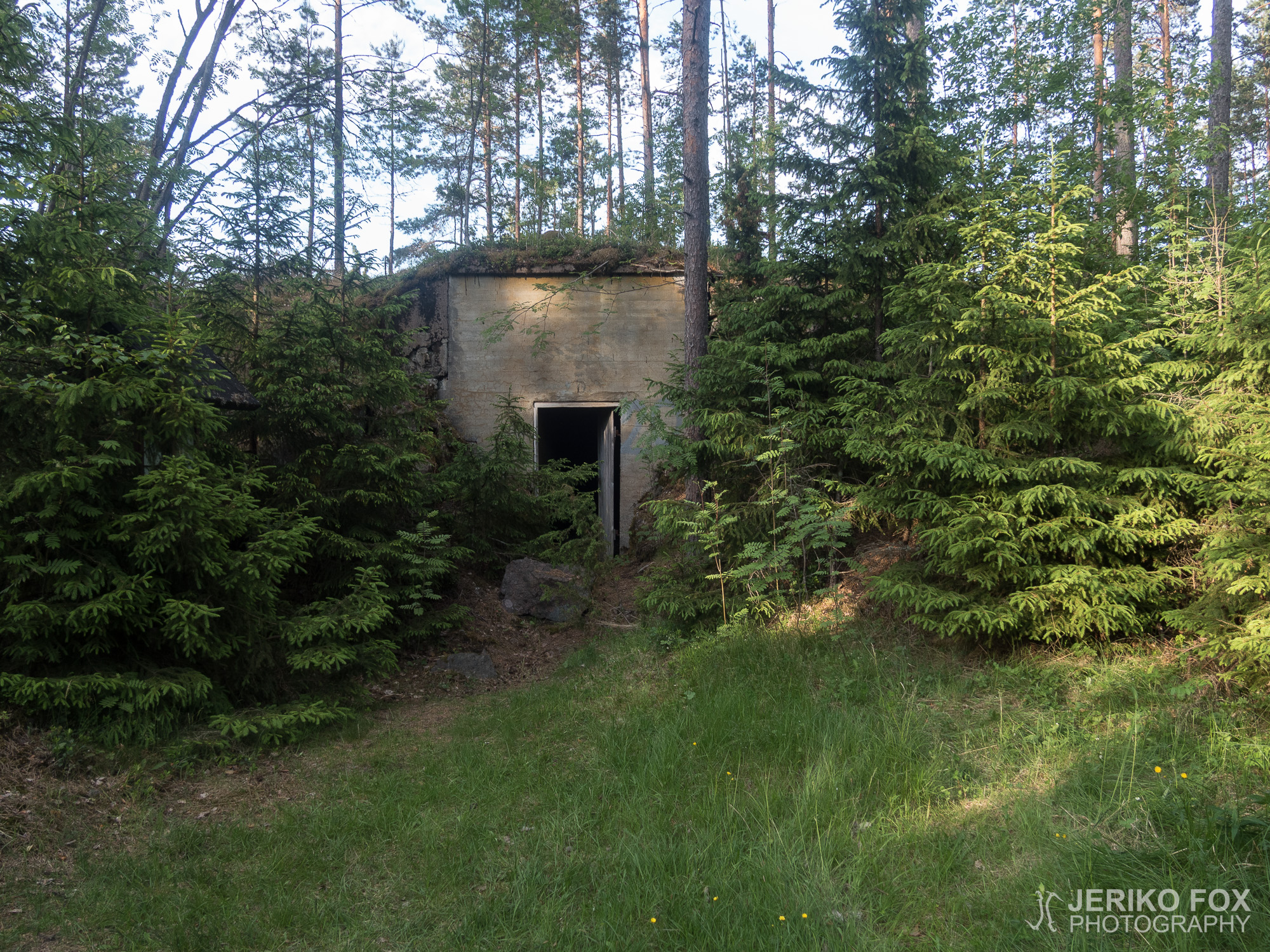
Later in the evening I visited two more bunkers. There were still no holes on the floor, but a good bunch of rebar sticking from the ceiling. Luckily my head has been mounted low to gain an aerodynamic profile familiar from the sports cars.
Just before arriving to the Harju Learning Center I made a significant mistake. I was standing at the crossroads and hesitant about which way to go to. For some unexplainable reason I didn’t look the map carefully enough and made a wrong turn. With a good pace I kept on going few kilometres and didn’t pay attention to the feeling of something being wrong. Not until I was way off the trail. I had to consider my options. I knew how to return and where I had gone wrong. Turning back would mean that I was likely going to be bushwhacking the overgrown trail in the dark before reaching any camp spot. I could also pitch my tent somewhere nearby in the woods and return to the trail in the morning. This would mean that it was unlikely that I could finish in time and I would anyway have to quit in order to be back in town for my next shift. Or I could just call me a ride and decide to give the Salpalinja Trail another try later.
Quitting is annoying, but the thing about thru-hiking for me is the possibility to do any trail from the beginning to the end in one trip. The idea of hiking the trail fast and not seeing all the bunkers was also everything but tempting. Hence I ended up calling a ride and thinking that I should try the Salpalinja Trail with a more relaxed schedule. Both the overgrown trail and all the sights to see would take some time. As the sun was setting I was walking down the country road. Before the familiar BMW appeared in the horizon, I was thinking that failing to reach your goals don’t necessarily mean that it was a bad trip.
Edit: Successful trip report from 2019 can be found here.


Aina retkeillessä kaikki ei mene ihan kuin Strömsössä. Hienoista onnistumisista saa upeita tarinoita, mutta ajattelen sen toisenlaisenkin tarinan olevan kertomisen arvoinen. Joten aloitetaanpa aivan alusta.
Salpalinja on koko itäisen suomen läpi 40-luvun alussa rakennettu viimeinen puolustuslinja. Tämä 1200 km pitkä, Suomenlahdelta menetettyyn käsivarteen ulottuva linja bunkkereineen ja panssariesteineen ei tullut koskaan kuitenkaan käyttöön, koska Neuvostoliiton joukot pysäytettiin sitä ennen. Kylmän sodan aikana linjaa vielä vaivihkaa pidettiin yllä, mutta sittemmin Salpalinjan bunkkerit on jätetty oman onnensa nojaan. Historiaan voi perehtyä yksityskohtaisemmin Salpalinjan salat -blogissa.
Minua Salpalinja kiinnostaa tietenkin pääasiassa siksi, että sen eteläisintä 50 kilometriä seurailee retkeilyreitti nimeltä Salpapolku. Olen katsellut toisinaan Salpapolkua vaelluskohteita pohtiessani ja nyt työvuorojen väliin jäi noin kolmen vuorokauden mittainen vapaajakso, joka mahdollistaisi vaelluksen – tiukalla aikataululla tosin. Niinpä latasin tottunein elein hieman muunnellun version AT-varusteistani rakkaaseen vihreään rinkkaani ja lähdin äidin kyyditsemänä kohti reitin eteläistä päätepistettä, Majaniemeä.
Toista tuntia ajettuamme mutkaisia teitä, saavuimme meren rantaan. Jäkälän peittämä reittikyltti ja tyhjennysrajan aikaa sitten ylittänyt huussi eivät luvanneet erityisen hyvää, mutta päättäväisesti nostin repun selkääni. Aivan reitin alku kulki hiekkatietä pitkin, mutta varsin pian sain sukeltaa hyttysten täyttämään metsään.
Ensimmäinen bunkkerikin tuli nopeasti vastaan ja jätin repun polulle lähteäkseni otsavalon avulla tutkiskelemaan paikkoja. Syvän juoksuhaudan kautta bunkkeriin könyäminen tuntui jännittävältä. Olin kuullut varoituksia lattioissa olevista reijistä ja katosta törröttävistä raudoista, mutta liikuin pimeässä ehkä vähän liiankin luottavaisesti.
Alussa heränneet epäilyni reitin kunnosta alkoivat pian saada vahvistusta. Polku oli paikoin umpeenkasvanut. Ryteikön läpi puskeminen ei itsessään ollut ongelmallista, mutta reitin löytäminen paikoin oli. Käveltyäni panssariesteiden välistä kohti konekivääripesäkettä tuli vastaan toisenlainen haaste. Metsäkone oli käynyt kaatamassa puut laajalta alueelta. Mitään polkua ei ollut eikä myöskään mitään tietoa puissa olleista reittimerkeistä. No, tuurillahan ne laivatkin seilaa.
Loikin oksakasojen yli hiekkatielle, jonka varrelta lopulta löysin tolpan, jossa oli tuttu saukon kuva. Olin siis yhä polulla. Tien seuraaminen kuulostaa tietysti helpolta ja mukavalta, mutta sielläkin sai olla tarkkana milloin polku taas poikkeaa tieltä. Pysähdyin tutkailemaan aina välillä karttaa, jolloin sain ärhäkät ilmavoimat kimppuuni. Hyttyset pyörivät pään ympärillä ja yhdellä iskulla kuoli helposti viisi kiusanhenkeä.
Illan edetessä pistäydyin taas parissa bunkkerissa. Aukkoja lattioista en löytänyt, mutta uhkaavasti törröttäviä betonin raudoituksia kylläkin. Onneksi pääni on asennettu urheilullisen profiilin saavuttamiseksi varsin matalalle.
Hieman ennen Harjun oppimiskeskusta tein merkittävän virheen. Olin eräässä risteyksessä epäileväinen oikeasta suunnasta, mutta jostain syystä en vaivautunut tutkimaan karttaa kunnolla ja lähdin väärään suuntaan. Etenin aika vauhdilla ja epäilyistäni huolimatta en varmistanut asiaa ennen kun olin kävellyt useamman kilometrin. Siinä vaiheessa tajusin olevani reilusti sivussa reitiltä. Pohdin eri vaihtoehtoja. Tiesin miten palata reitille ja mistä olin mennyt väärään. Tämä tarkoittaisi todennäköisesti umpeenkasvaneen reitin rämpimistä pimeässä ennen kuin saavuttaisin minkään järkevän yöpymispaikan. Voisin lyödä telttani johonkin lähimetsään nyt ja palata aamulla reitille. Tämä tarkoittaisi, että en luultavasti ehtisi reitin pohjoispäähän ennen kuin minun pitäisi palata töihin ja homma jäisi kuitenkin kesken. Tai sitten voisin soittaa itselleni kyydin ja yrittää uudestaan toisen kerran.
Keskeyttäminen on ärsyttävää, mutta minulle läpivaeltamisen ydin on reitin tekemisessä kerralla alusta loppuun. Eikä minua houkutellut myöskään vaihtoehto, että vaeltaisin kiireessä, enkä ehtisi tutustua polun varrella oleviin bunkkereihin. Niinpä päädyin soittamaan itselleni kyydin ja toteamaan, että Salpapolkua kannattaisi yrittää hieman rennommalla aikataululla. Sekä umpeenkasvanut ryteikkö että polun varrella olevat nähtävyydet vaativat aikaa. Auringon laskiessa kävelin maantietä pitkin ja ennen tutun BMW:n ilmestymistä horisonttiin pohdin, että ei tavoitteissa epäonnistuminen välttämättä tarkoita ollenkaan huonoa reissua.
Edit: Onnistunut reissukertomus vuodelta 2019 löytyy täältä.
[…] A year ago I tried to hike the Salpapolku (Salpalinja Trail) in southern Finland, but the tight schedule and a small detour forced me to quit. And perhaps that was a good decision, because now I knew to prepare better. I had thought that hiking a marked trail I would only need small maps. But hiking the not-that-well-marked trail using those was truly a mission impossible. […]