
Elevation: 2962 m
Prominence: 1746 m
Location: Garmisch-Partenkirchen/Grainau, Bavaria, Germany
Range: Wetterstein
Climb
Fox and Dima Tsvetkov
21.-22.08.2015
8 h 35 min + 8 h 11 min
Ridge climbing traverse
UIAA I-III
Osterfelderkopf (2033 m), Alpspitze via Ferrata: Alpspitze (2628 m), Vollkarspitze (2630 m), Äußere Höllentalspitze (2720 m), Jubiläumsgratbiwak (2684 m), Mittlere Höllentalspitze (2743 m), Innere Höllentalspitze (2741 m), Zugspitze (2962 m), Münchner Haus
Kompass Garmisch-Partenkirchen Mittenwald 1:35 000
Semi-rigid boots, soft shell, fleece shirt, gloves, buff, t-shirt, harness, slings and carabiners, prusiks, VF-kit, 30m dynamic rope, helmet, reverso, summer sleeping bag, 3 l hydration bladder
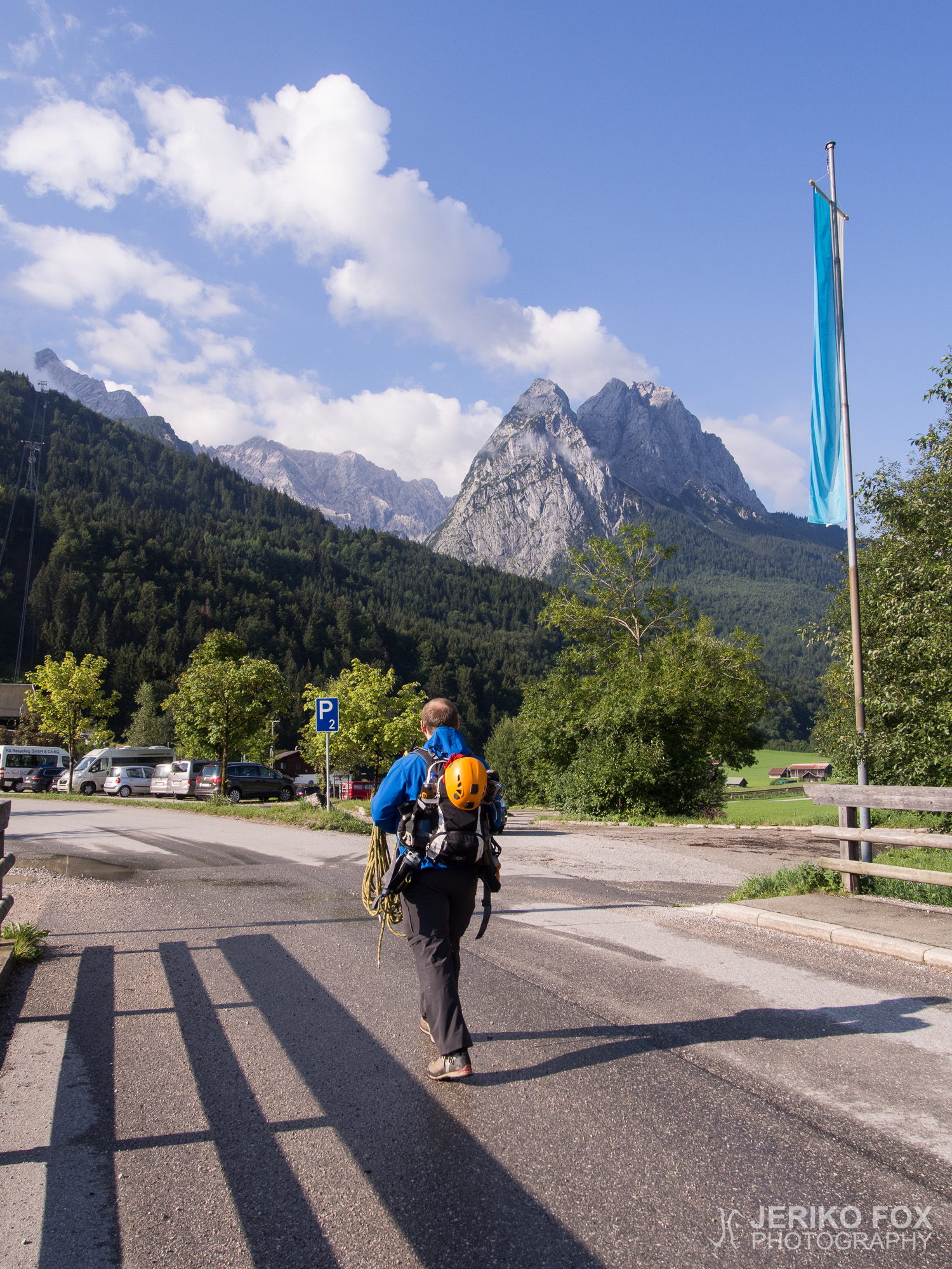
We had been waiting for a good weather window for our main goal, Jubiläumsgrat, and finally it seemed to be the time. Me and Dima packed our climbing gear in the evening and woke up early in the morning. The plan was to spend a night on the mountain so we were in no hurry.
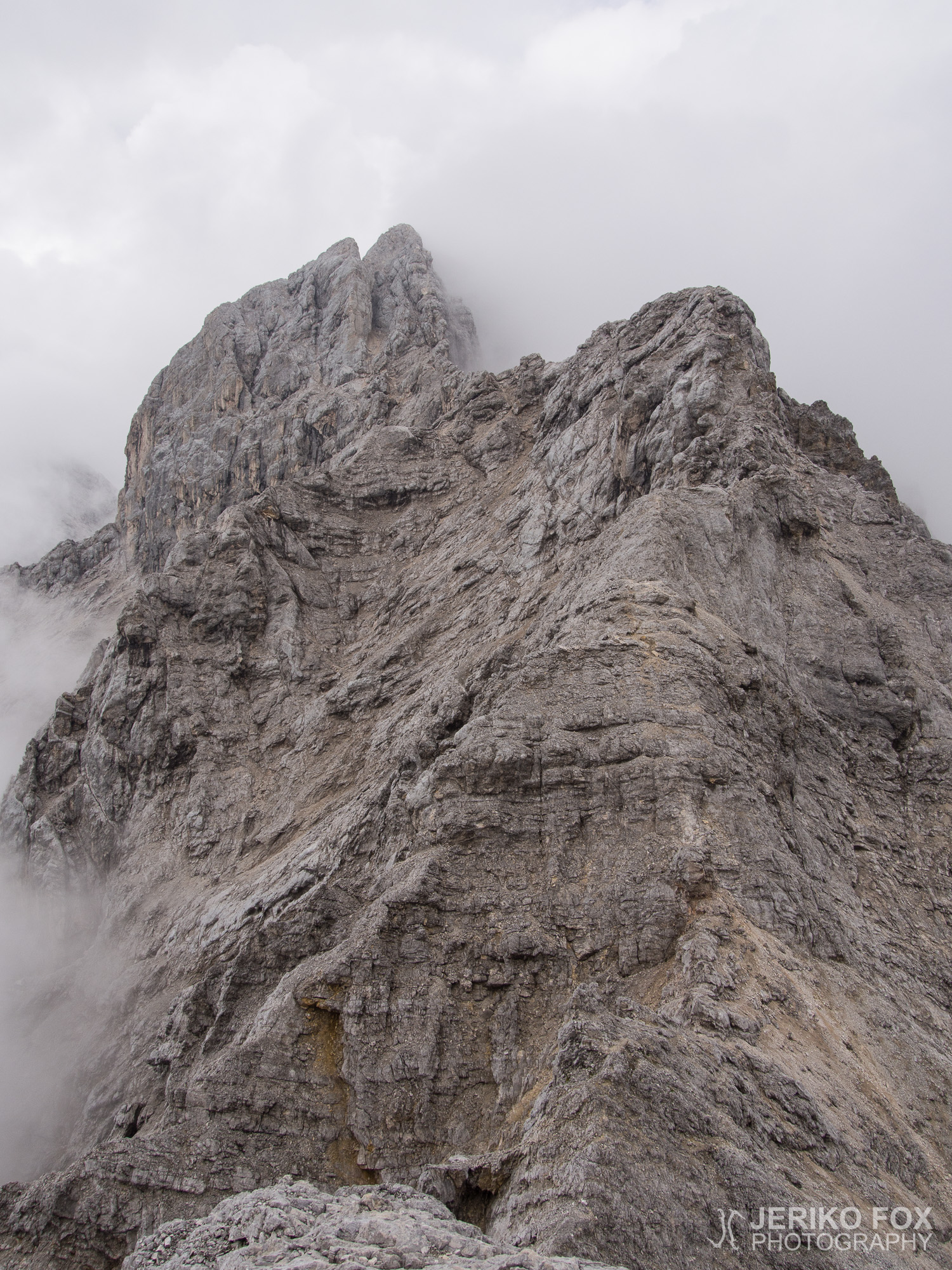
Jubiläumsgrat (Jubilee Arête) is about 5,3 km / 3,3 miles long (as the crow flies) mountain ridge more than 2000 m / 6500 ft over the sea level. The actual climbing distance is about 8,1 km / 5 miles. In the east end of the ridge is the summit of Alpspitze (2628 m / 8622 ft) and in the west end is the highest mountain in Germany, Zugspitze (2962 m / 9718 ft). In addition to these two, the route traverses over three Höllentalspitze summits – Äußere (2720 m / 8920 ft), Mittlere (2743 m / 8999 ft) and Innere (2741 m / 8993 ft) – and over Vollkarspitze (2630 m / 8630 ft). Geologically Jubiläumsgrat starts from Hochblassen (2706 m / 8878 ft) – that is a tad off from the route – but also the ridge between it and Alpspitze is a part of the Jubiläumsgrat route.
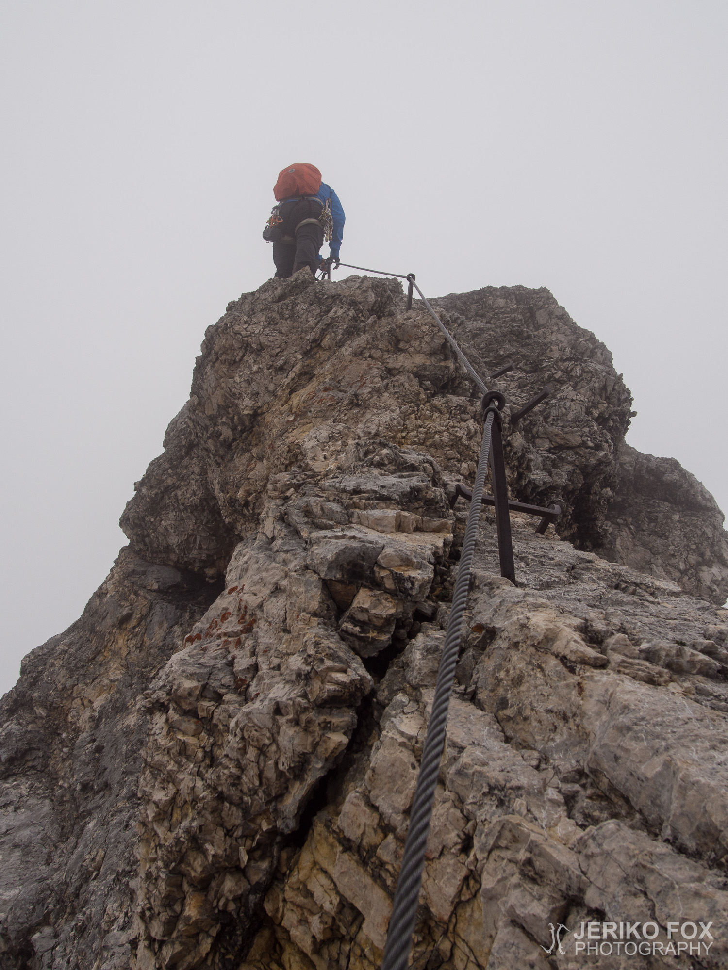
Most climb the ridge “downhill”, meaning in W-E direction, from Zugspitze to Alpspitze. Many sources state that the route is easier this way, especially for belaying some sections. We had decided to climb “uphill”, in E-W direction, from Alpspitze to Zugspitze. I can’t say any better reason for this than the gut feeling of liking the idea of going up instead of down. In any case climbing the Jubiläumsgrat means constantly climbing up and down, so the route is not easy whatever the direction. Part of the Jubiläumsgrat has via Ferrata cables, but the route is absolutely not a VF and it demands good skills in ridge climbing. The VF parts are graded to C/D and I find that being truthful. In UIAA grades Jubiläumsgrat is said to be I and II, partly III-.
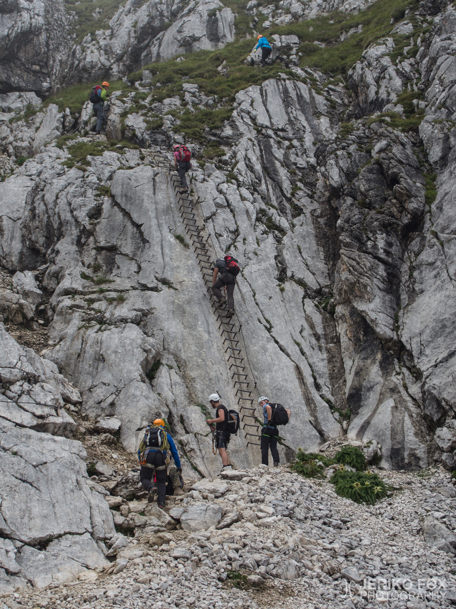
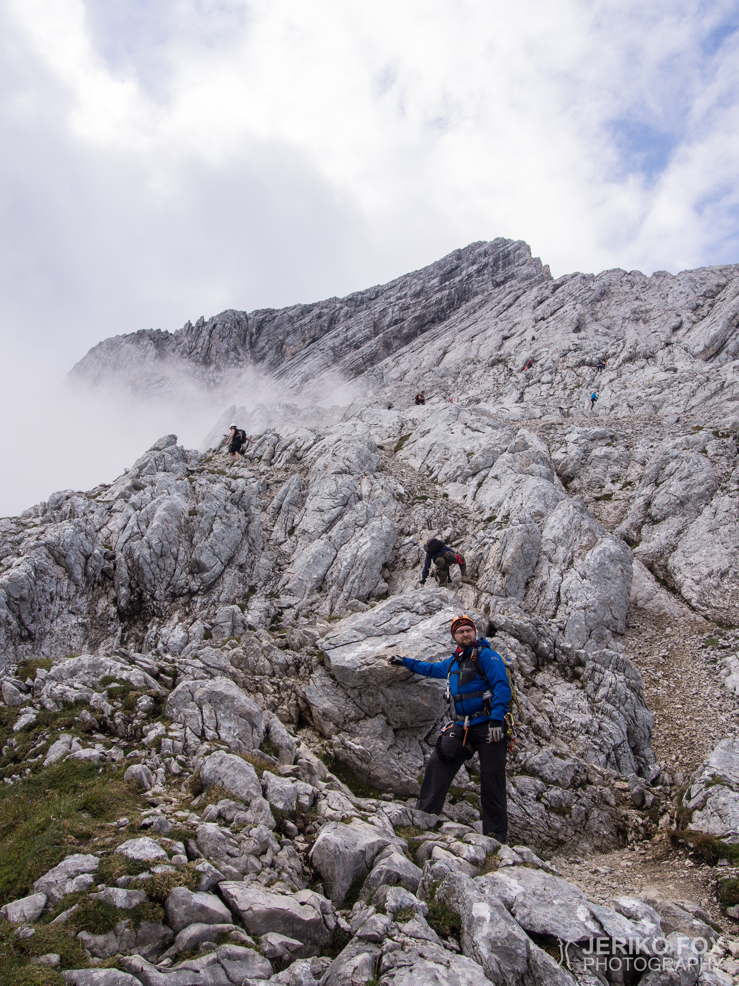
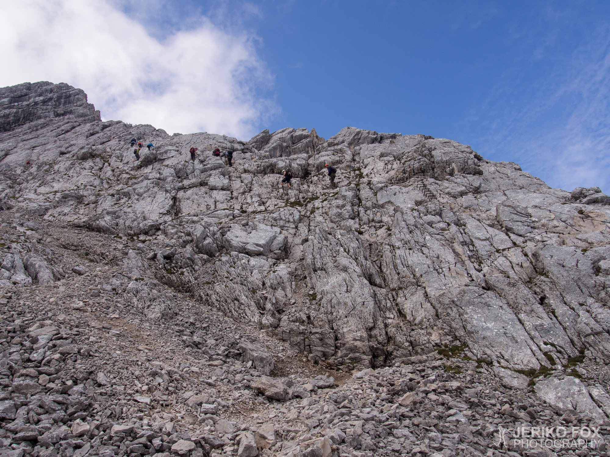
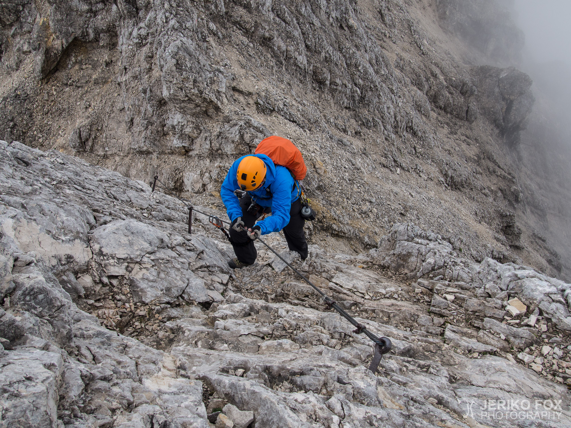
The first cablecar from GaPa to Osterfelderkopf left at 8 am, but we postponed the start with an hour to avoid the first overcrowded ride of the climbers heading to Alpspitze. One-way ticket for an adult during the summer season costs 17 €. After we reached the top in 2033 m / 6670 ft, we took our time to put on all climbing gear. Before 10 am we started to follow the big crowd climbing the Alpspitze via Ferrata. The weather was partly cloudy, but the visibility was still good. We have climbed the VF route with Dima in 2013 and now we moved considerably faster.
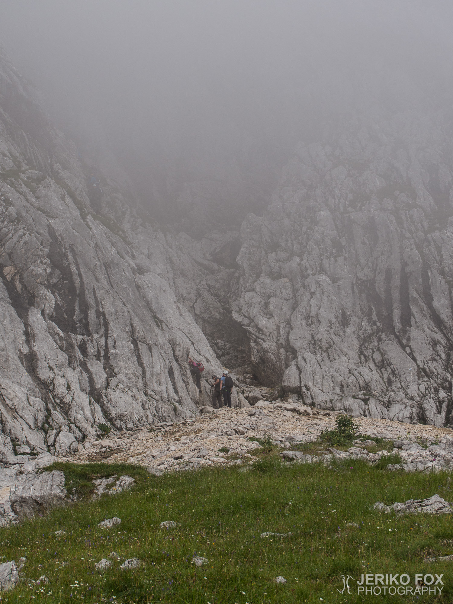
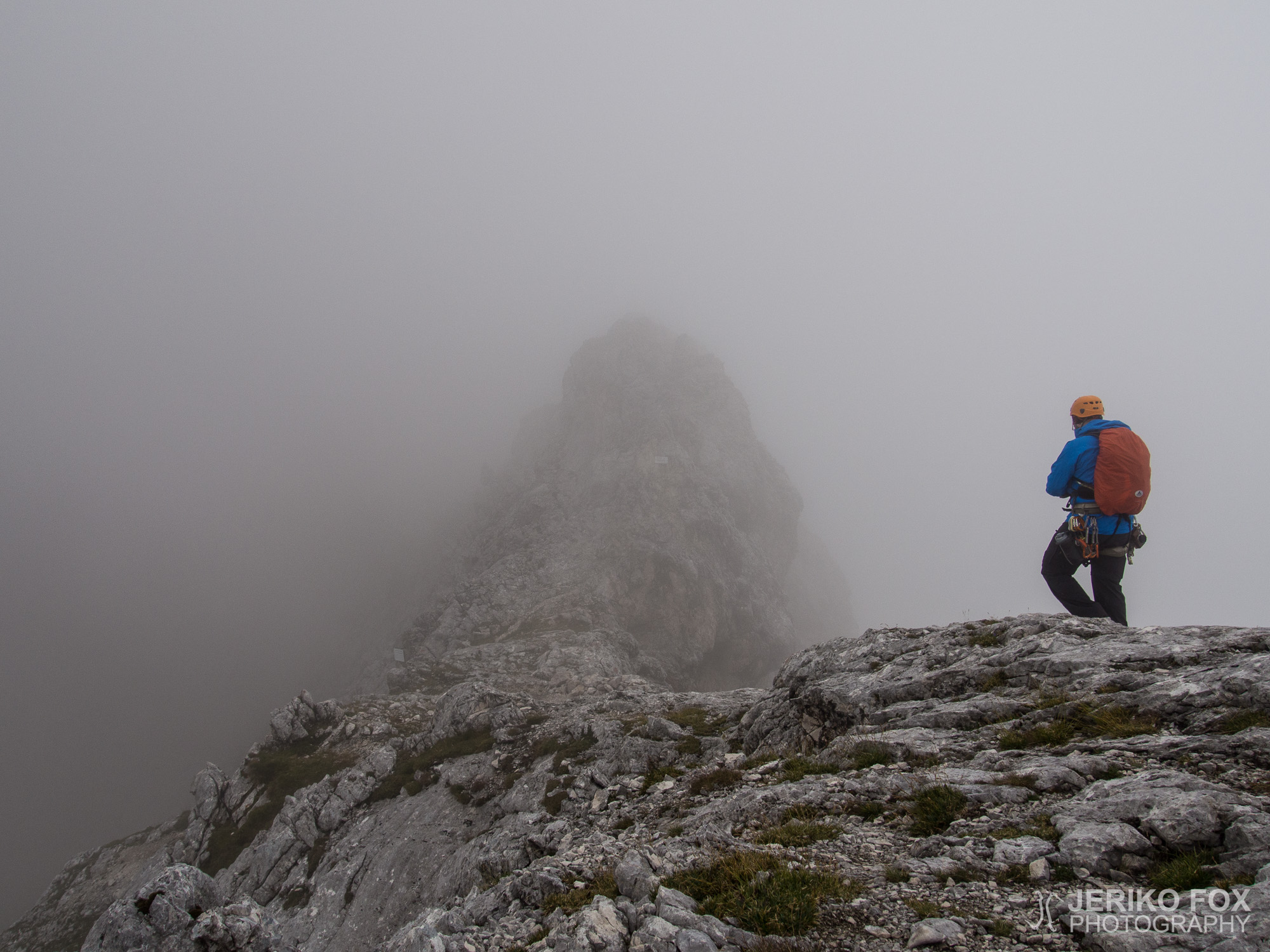
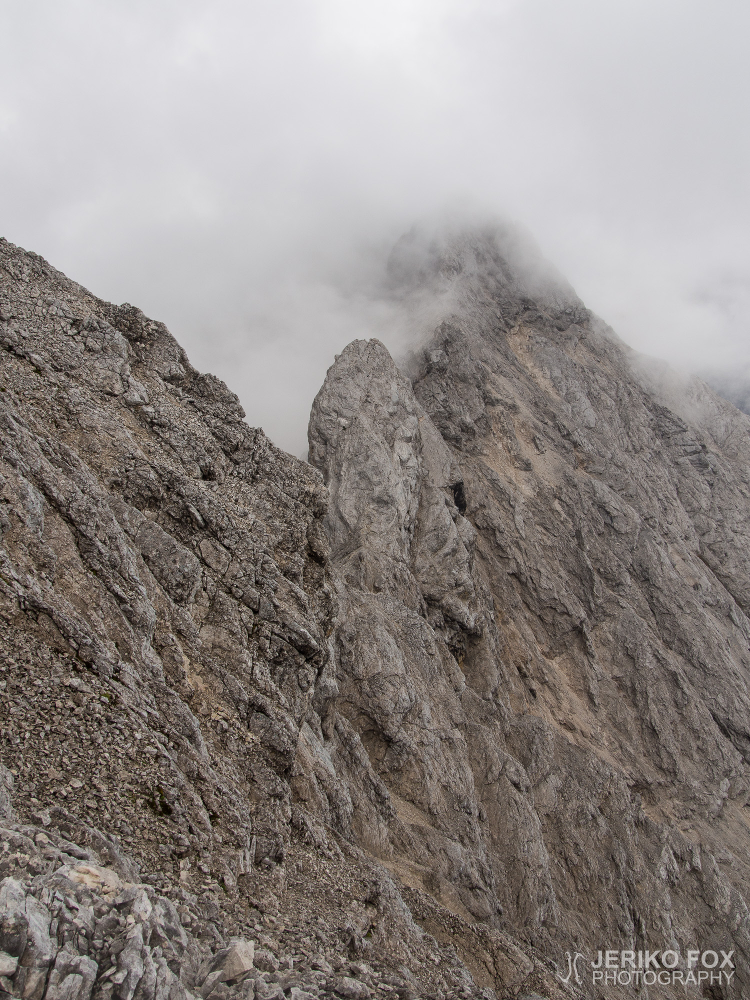
We passed several groups of slower climbers while ascending to Alpspitze. The route splits towards Jubiläumsgrat a bit before the summit, but since it wasn’t that far we decided to go with the flow and strut around the summit. We reached the summit of Alpspitze in 2628 m / 8622 ft at noon. The cloud that had been chasing us during the climb started to reach us now and the view to GaPa was poor. We enjoyed a quick snack in form of Corny muesli bars and continued straight over the summit towards the Jubiläumsgrat. The other route, that I mentioned before, joined to this one just below the summit. Now we finally left the big crowds behind us and saw only couple other climbers ahead of us: now starts the real climbing!
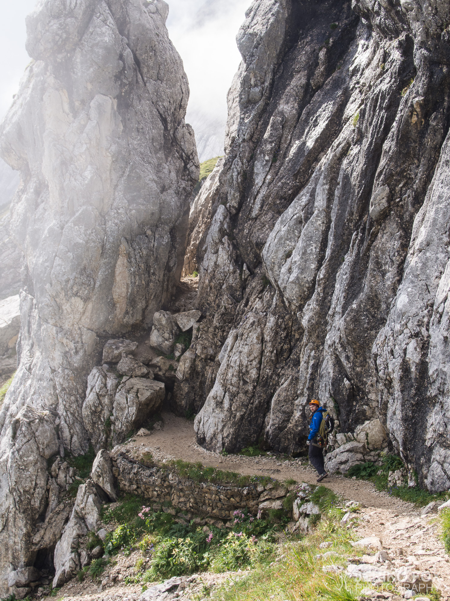
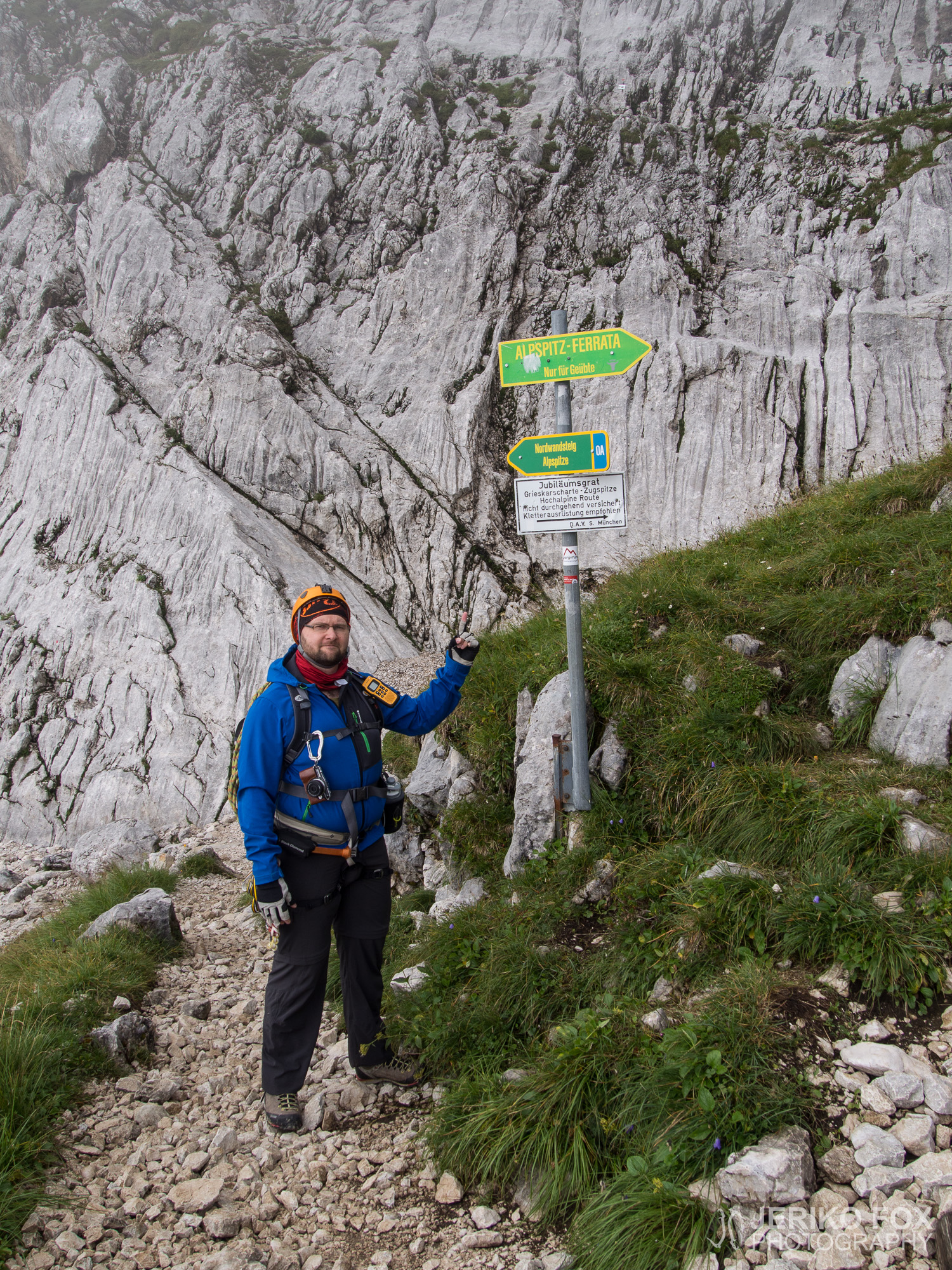
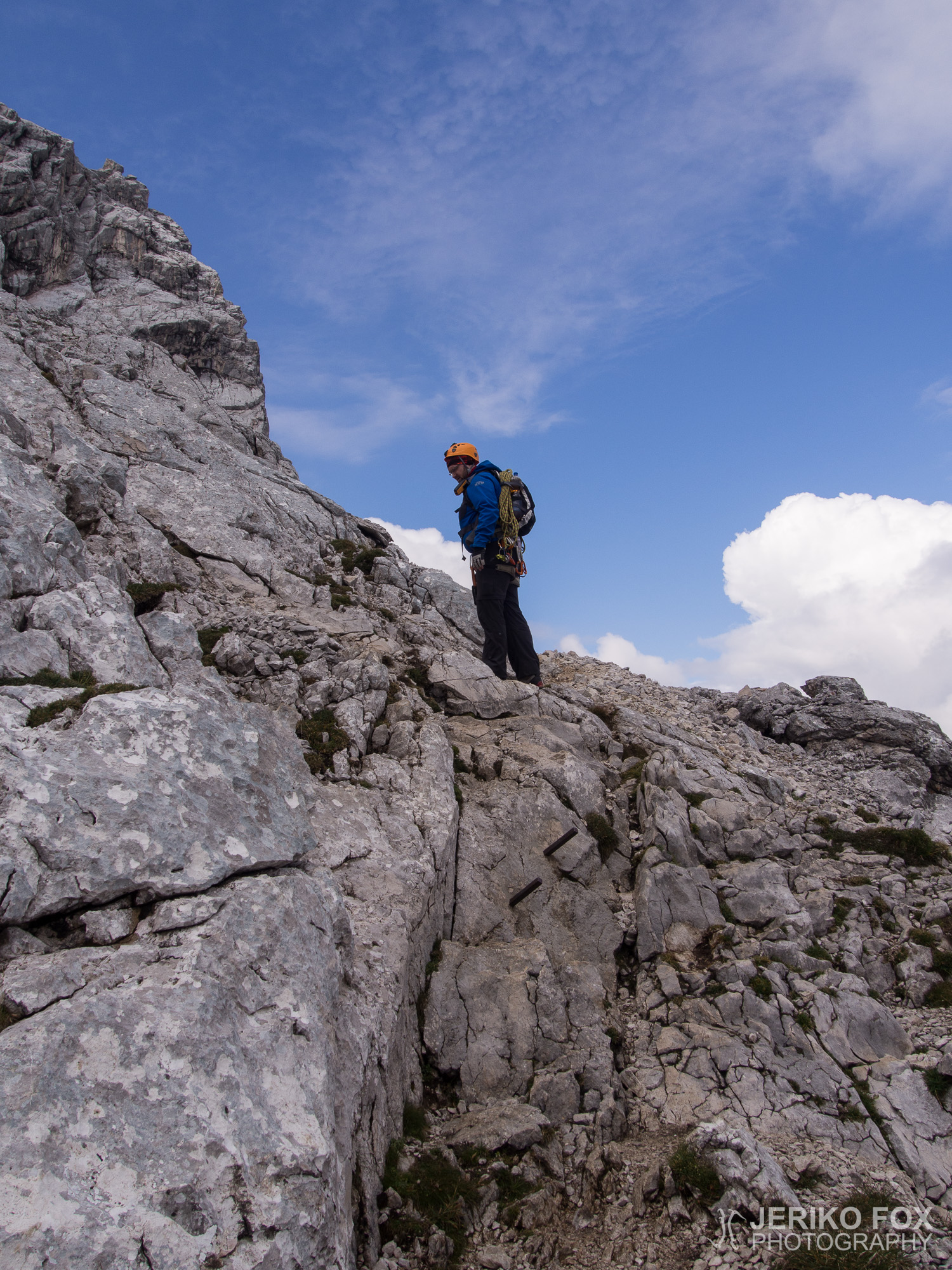
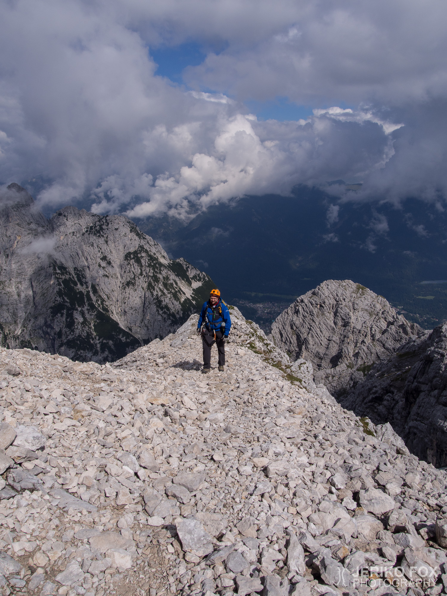
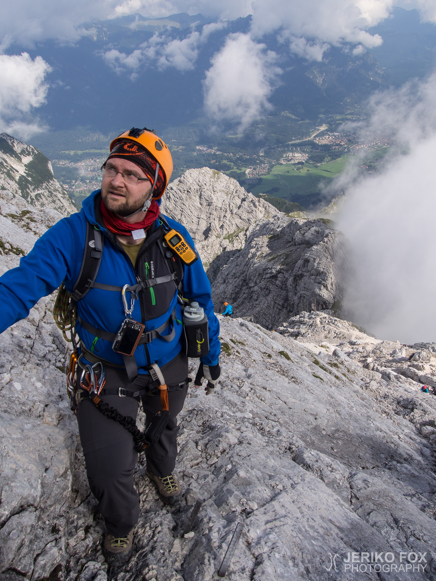
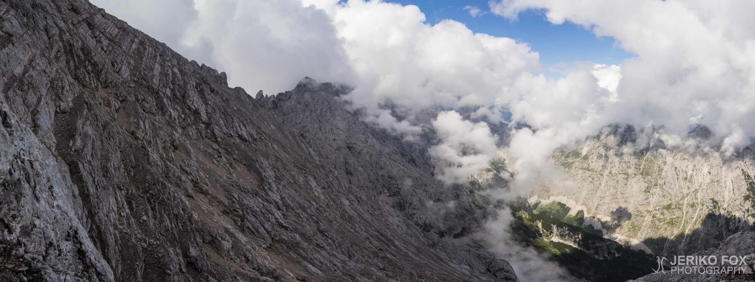
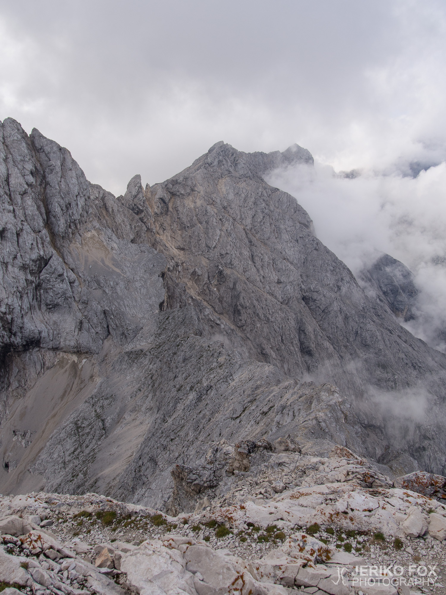
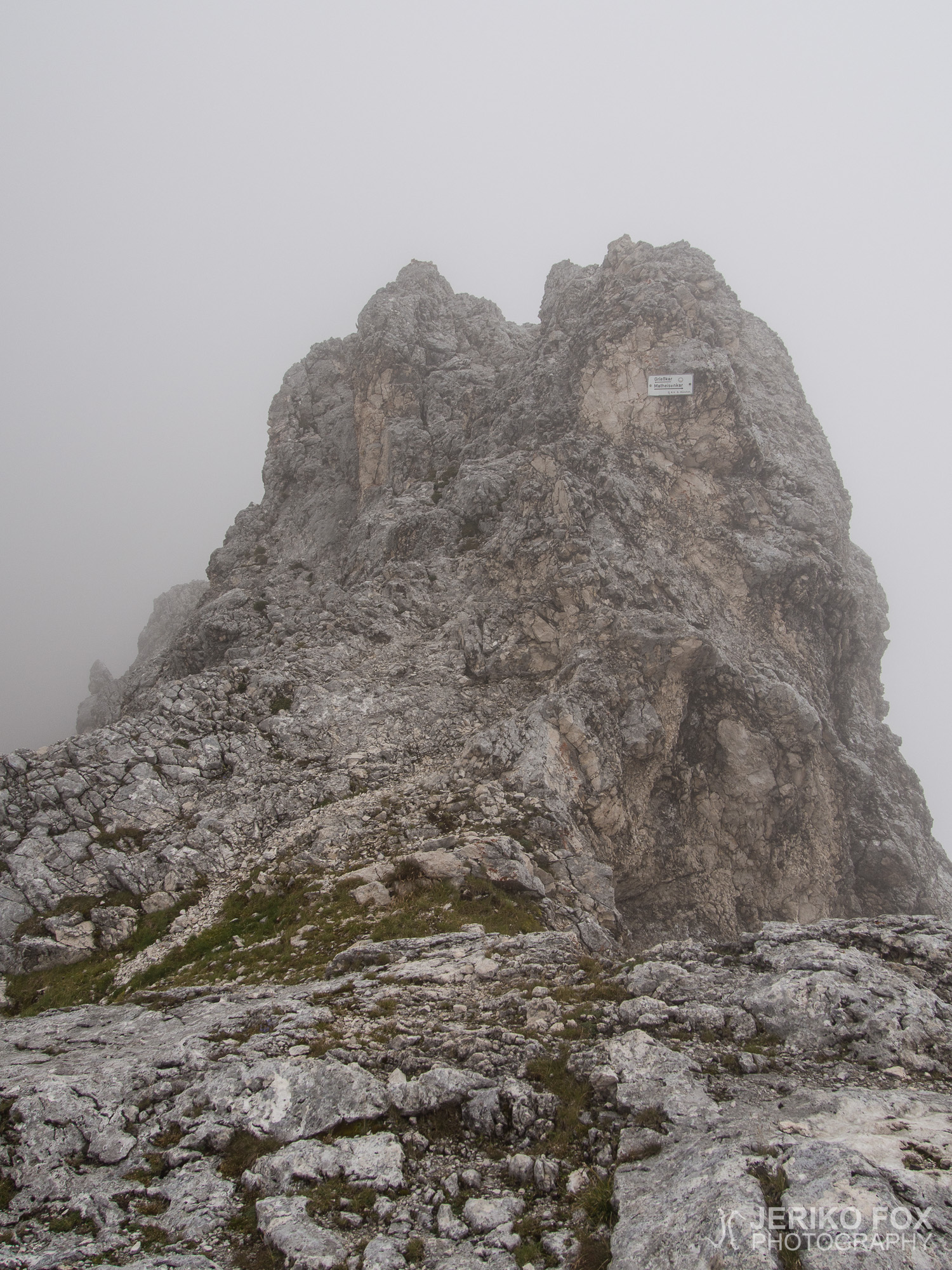
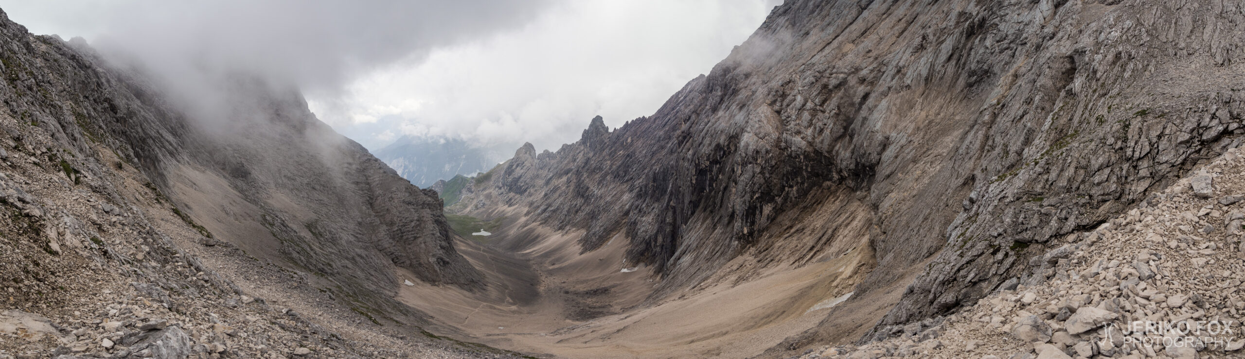
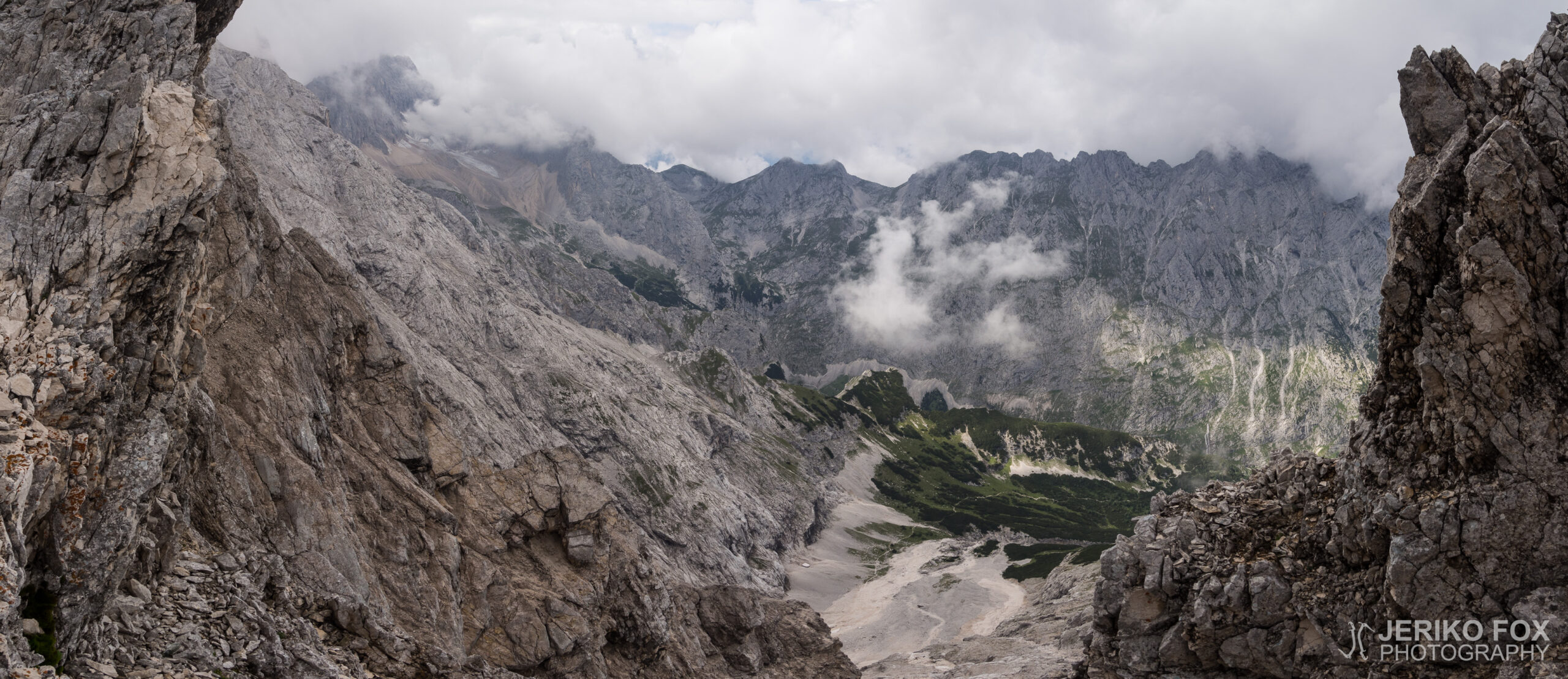
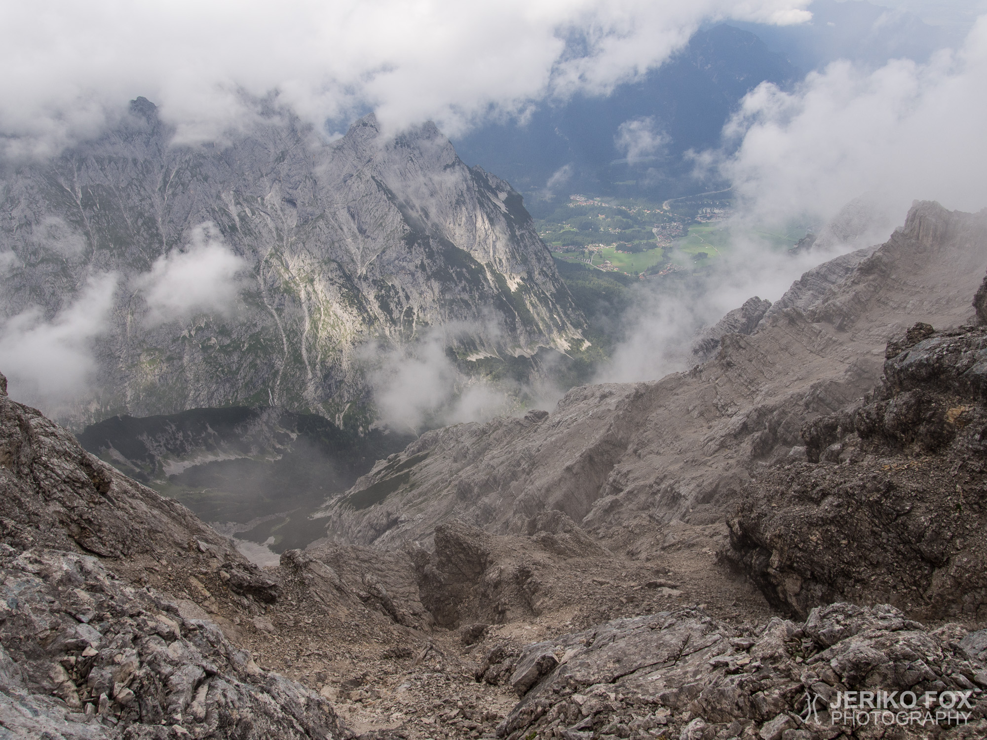
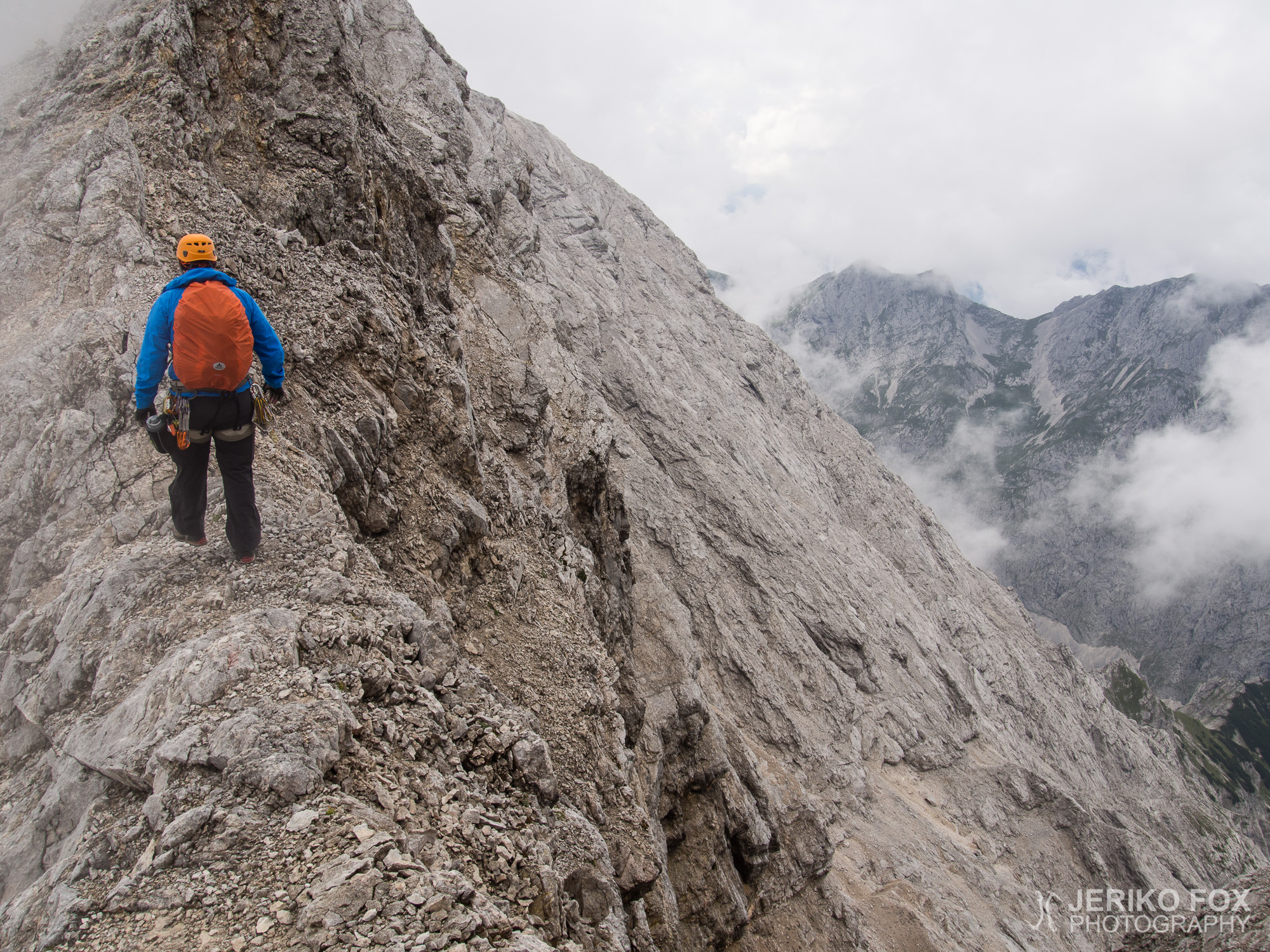
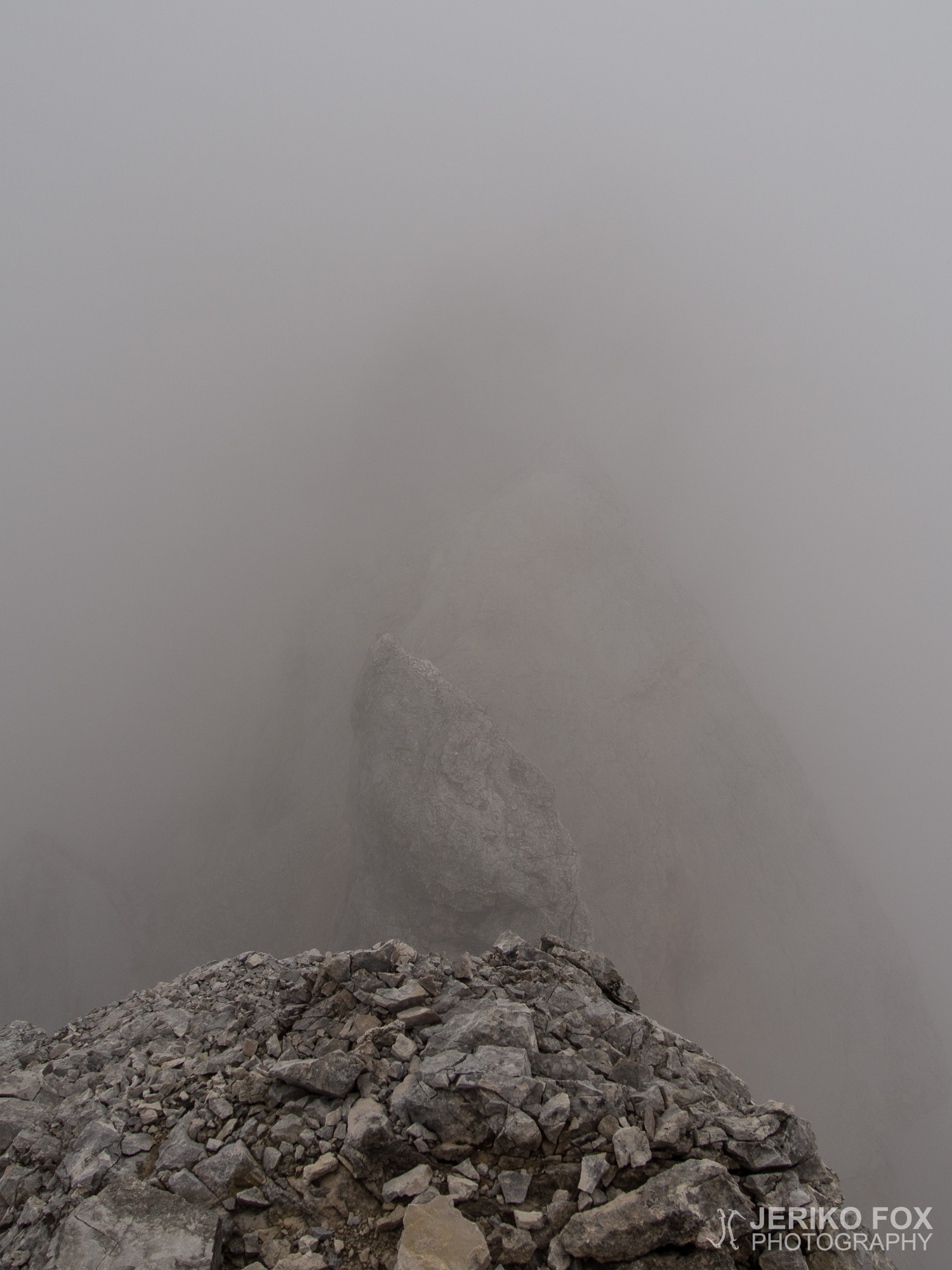
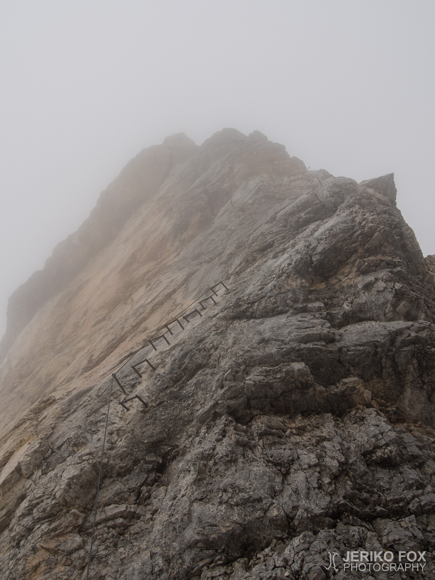
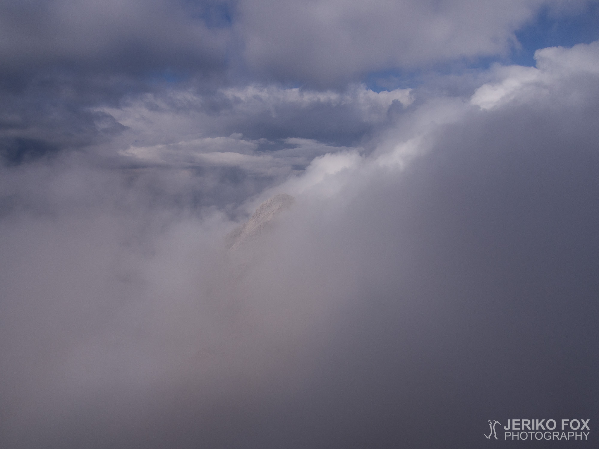
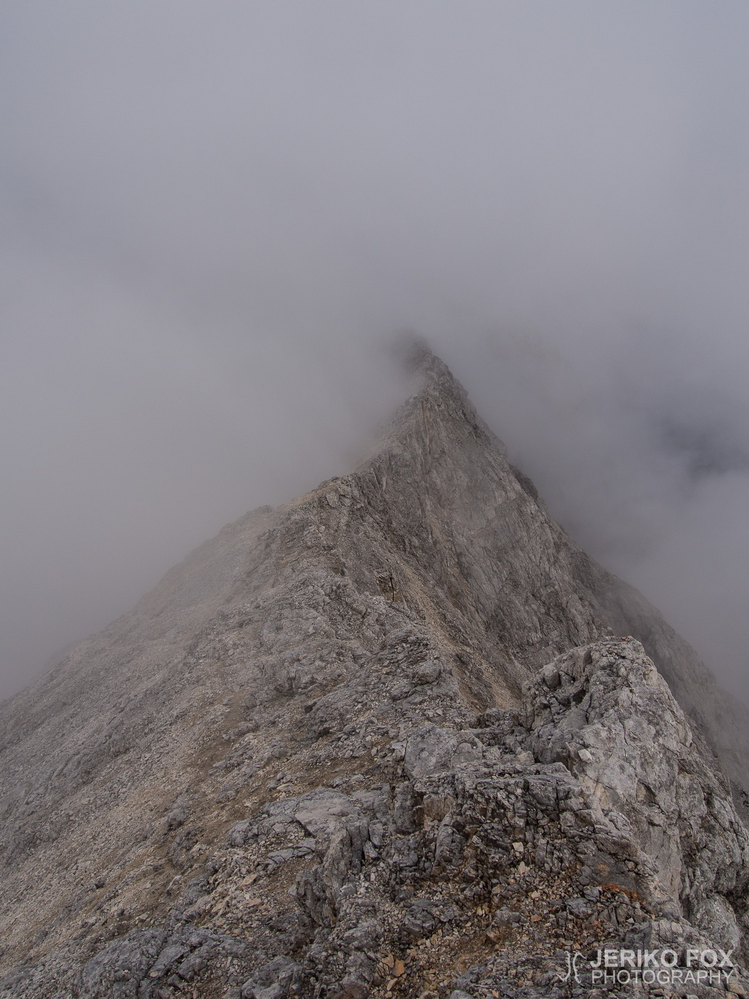
Even though we could every now and then see all the way to Zugspitze through the clouds, it was difficult to understand how massive the whole ridge was and distances were difficult to define. We were in good spirits and started to climb up and down. There was more VF cables than I had expected and all were in good condition. The clouds that were surrounding us started gradually condense and while it grew to a light rain, we pulled the rain covers over our backpacks. After 1 pm we arrived to the crossroads and studied the signs and our map for a little while. On the right side of the ridge was a trail descending to Matheisenkar and all the way to Höllental. On the left was our route to Jubiläumsgrat, to Hochblassen and an exit possibility by descending to Grießkar. We had thought about taking a detour to climb Hochblassen, but now we felt that Jubiläumsgrat alone would be enough.
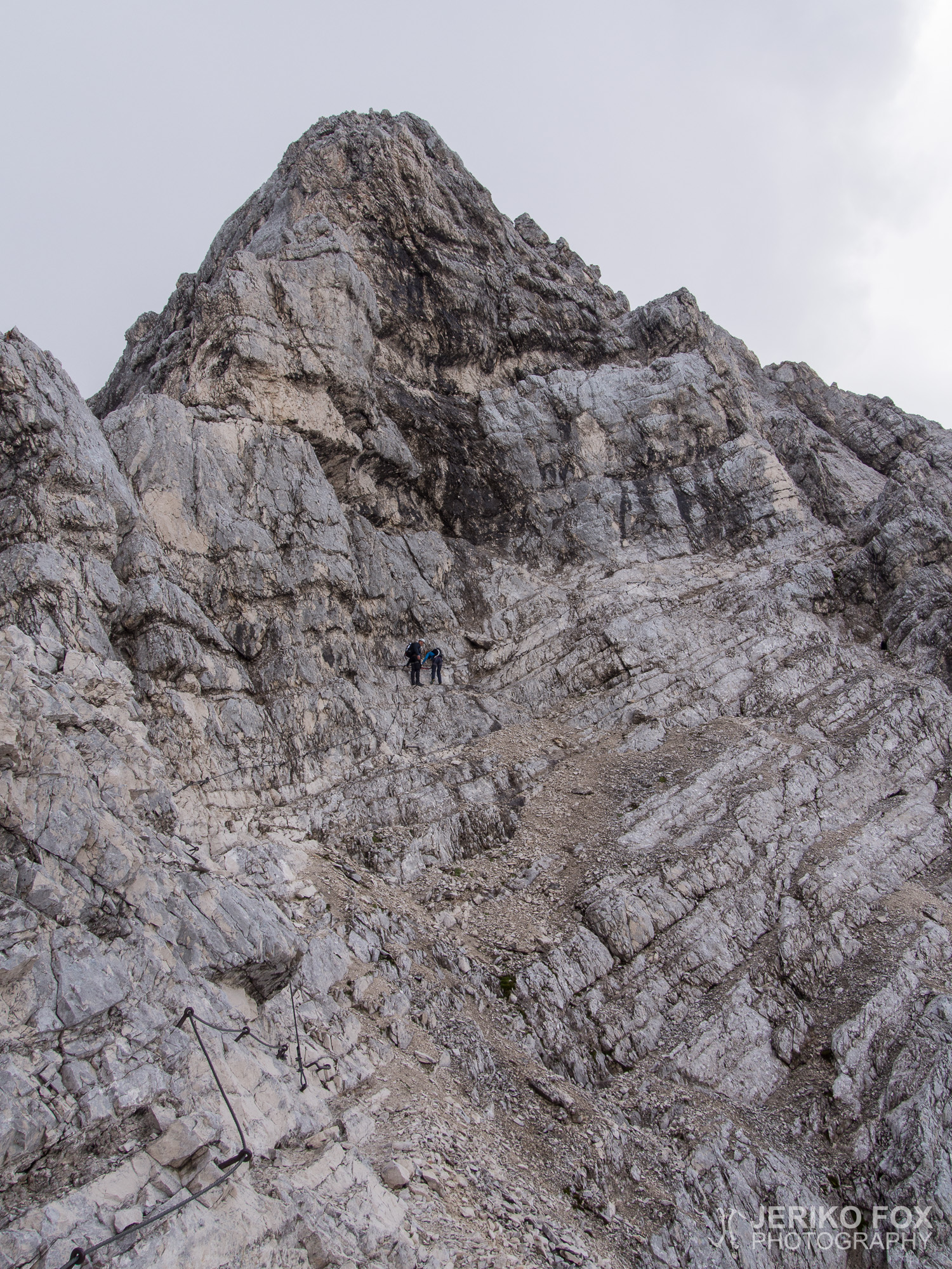
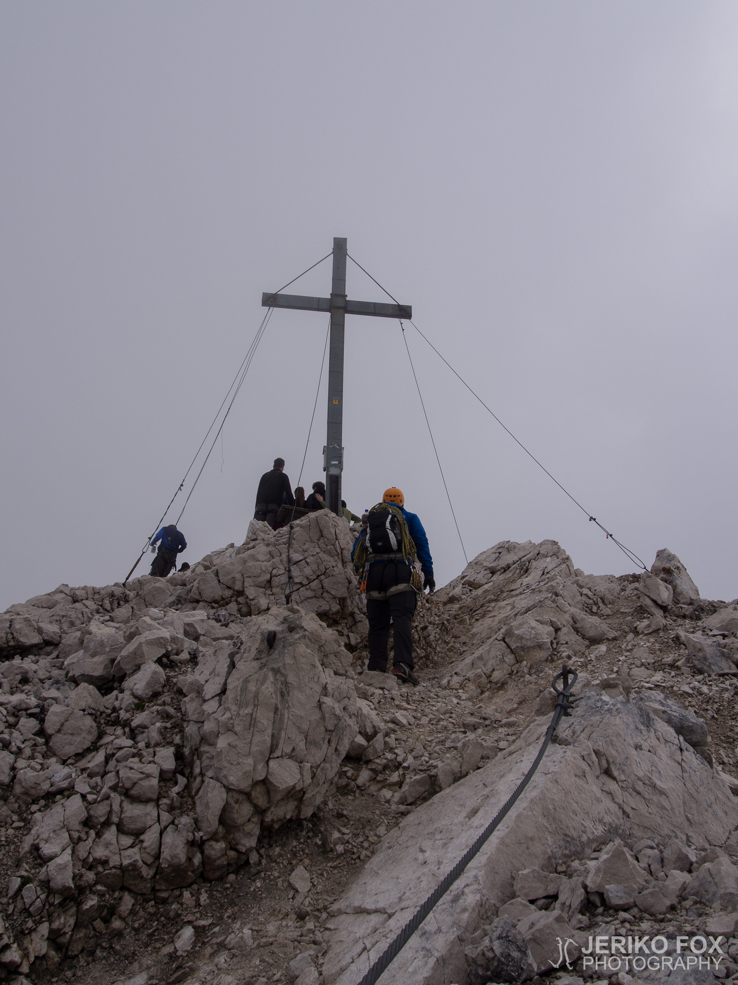
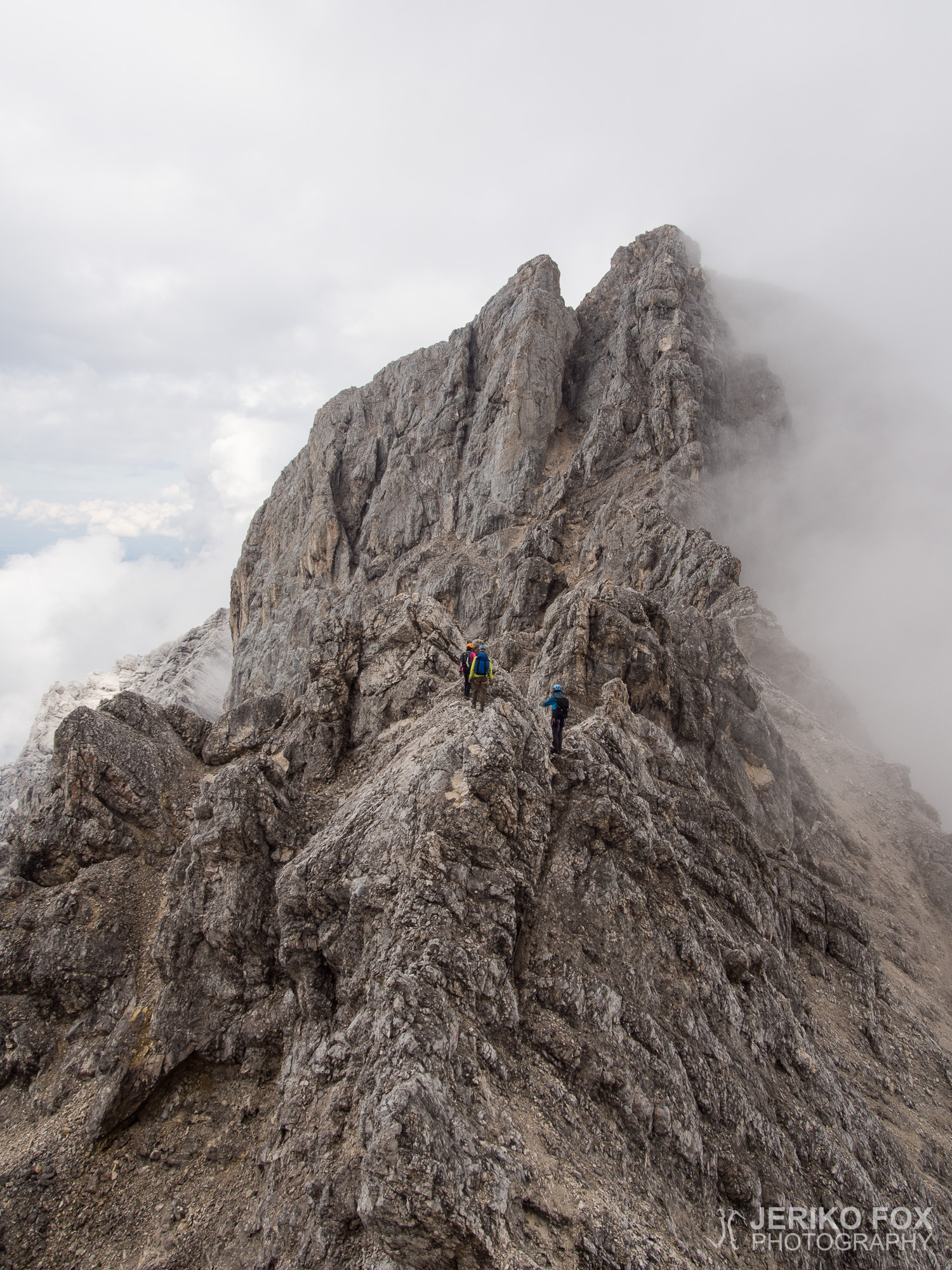
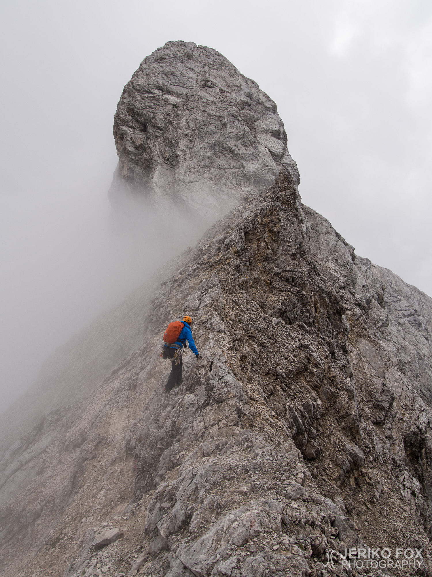
Little by little we began to meet people who were coming from Zugspitze and some of them asked about our plans. When I mentioned that we are going to spend the night at Jubiläumsgratbiwak, one climber told that we wouldn’t be alone and pondered that the bivy might even be full. In that case we would have to bivy out in the open, which would be doable in this weather. We reached the summit of Vollkarspitze in 2630 m / 8630 ft at 15:30, but to tell the truth we weren’t at that moment aware of it. The summit doesn’t have any kind of sign on it and while climbing inside a cloud, it didn’t really stand out of all the high points on the ridge that we climbed.
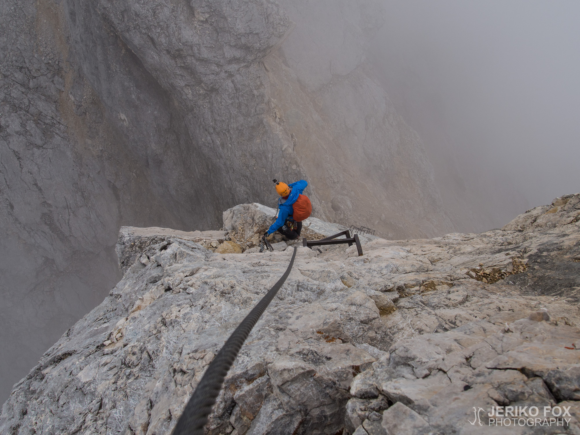
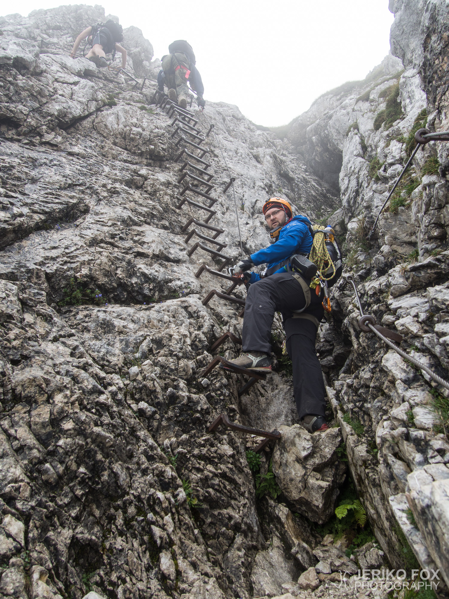
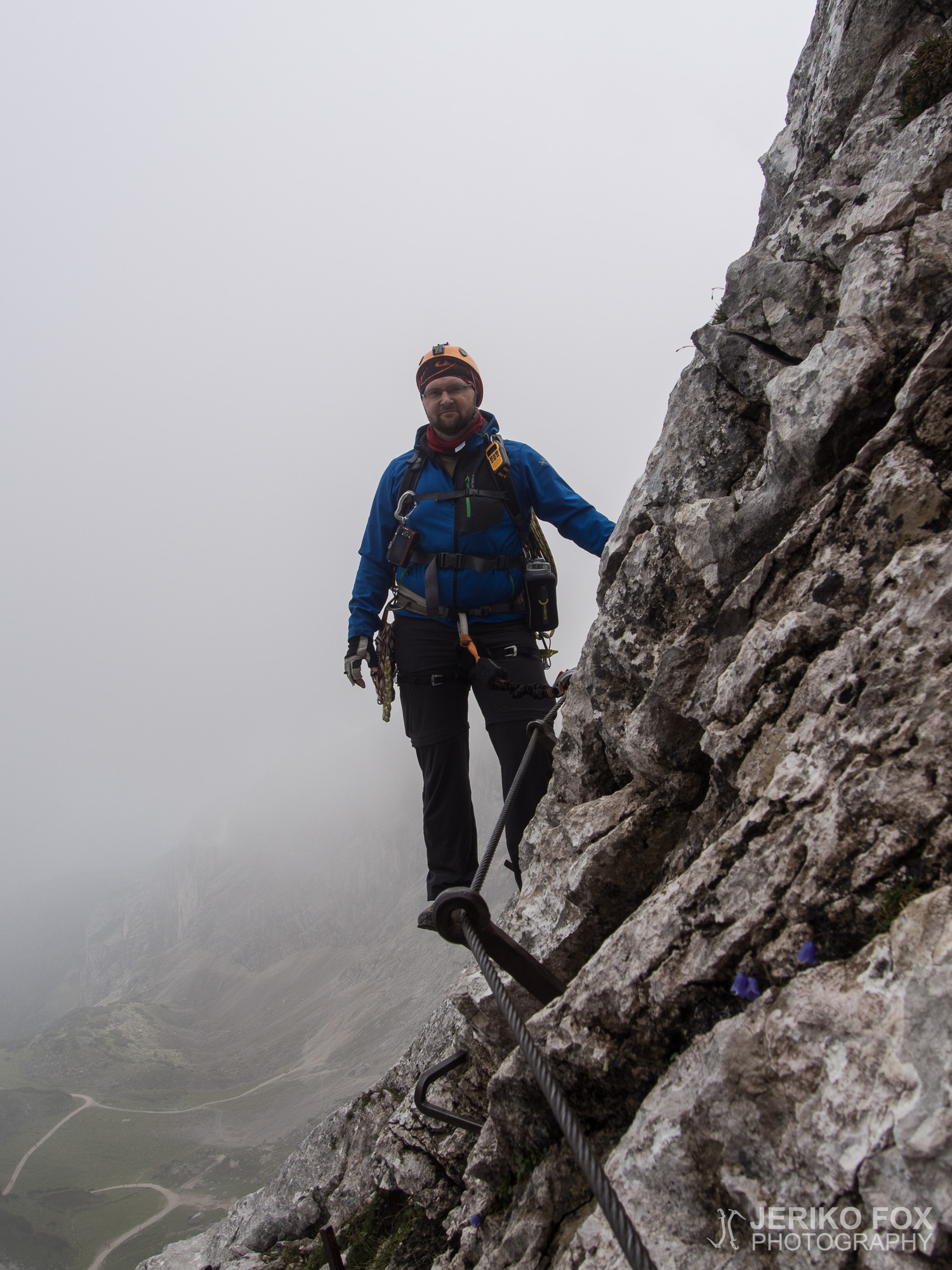
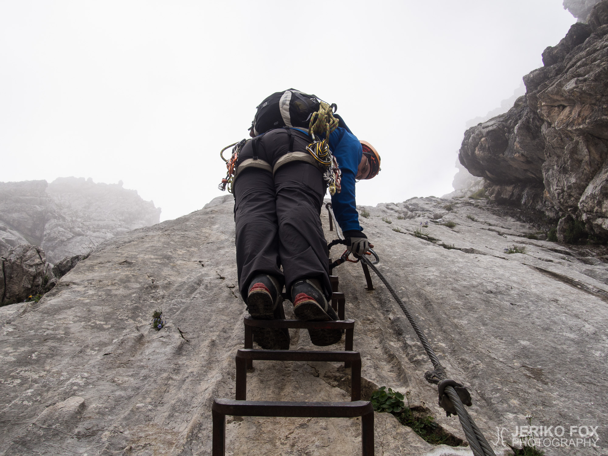
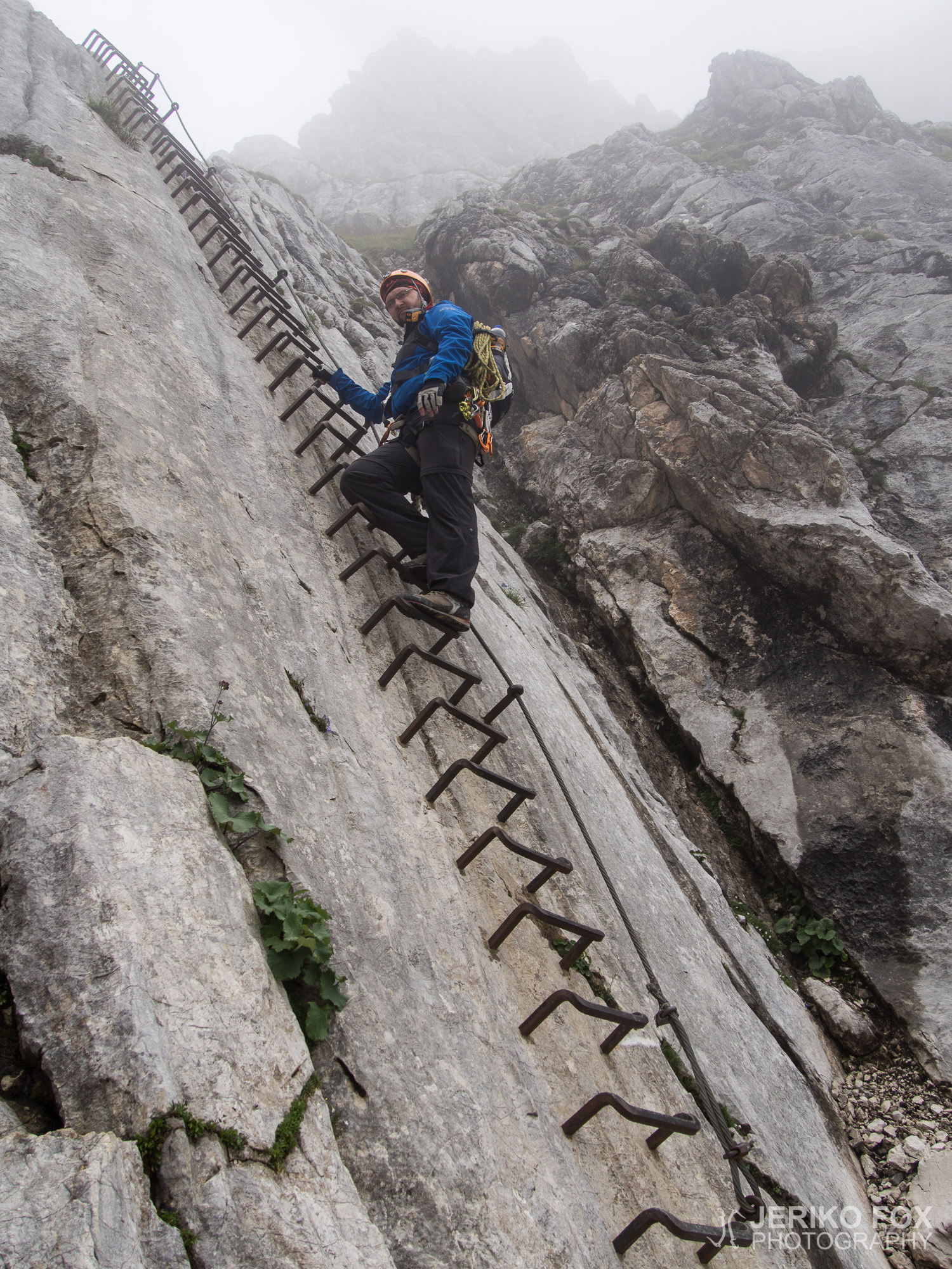
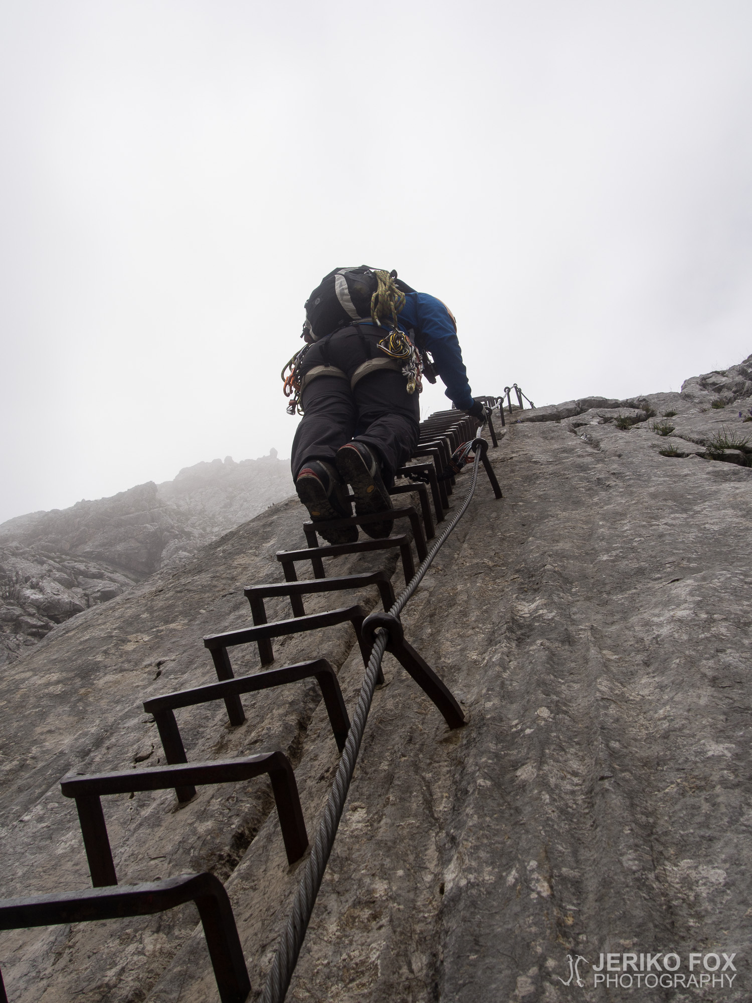
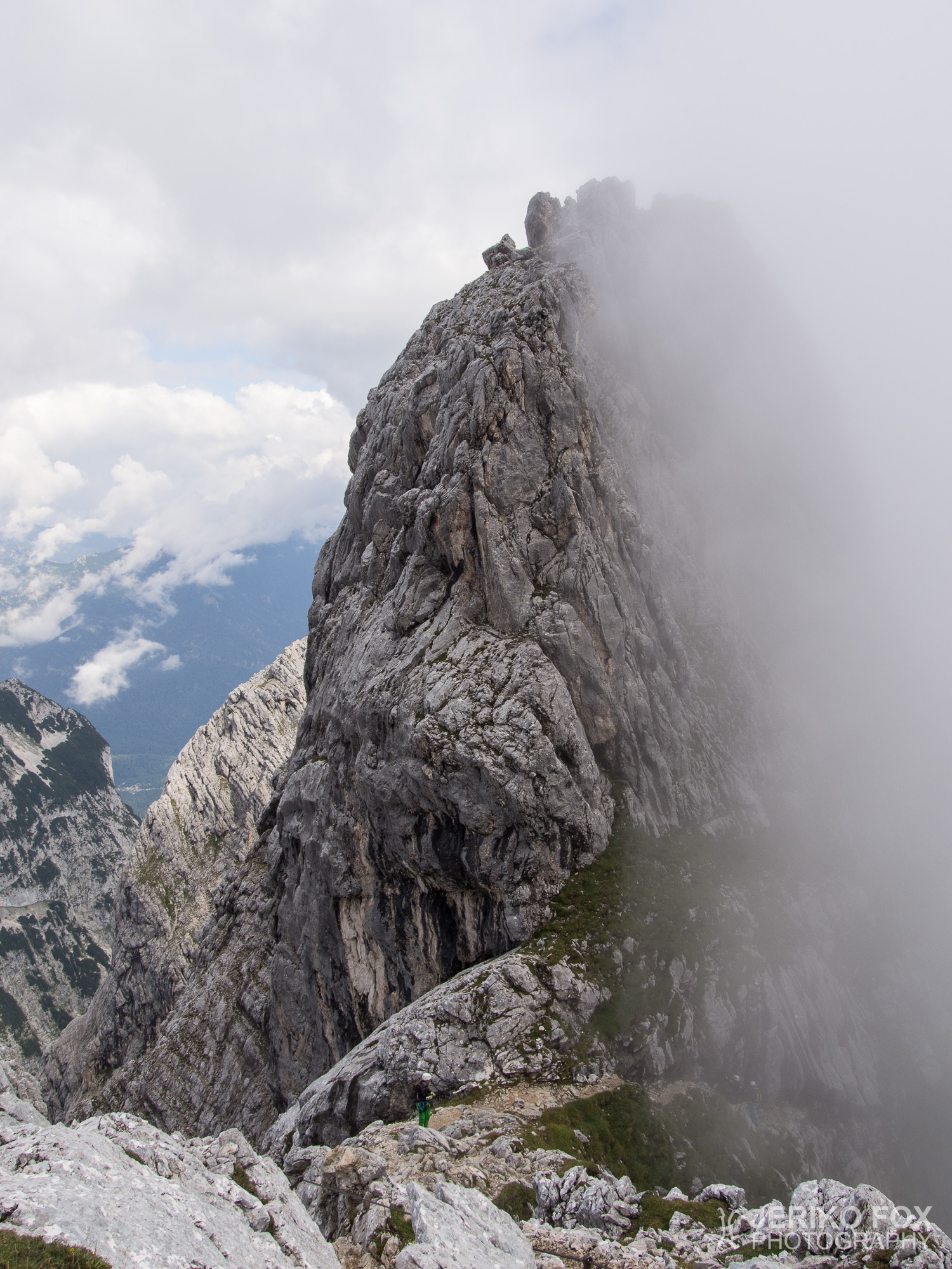
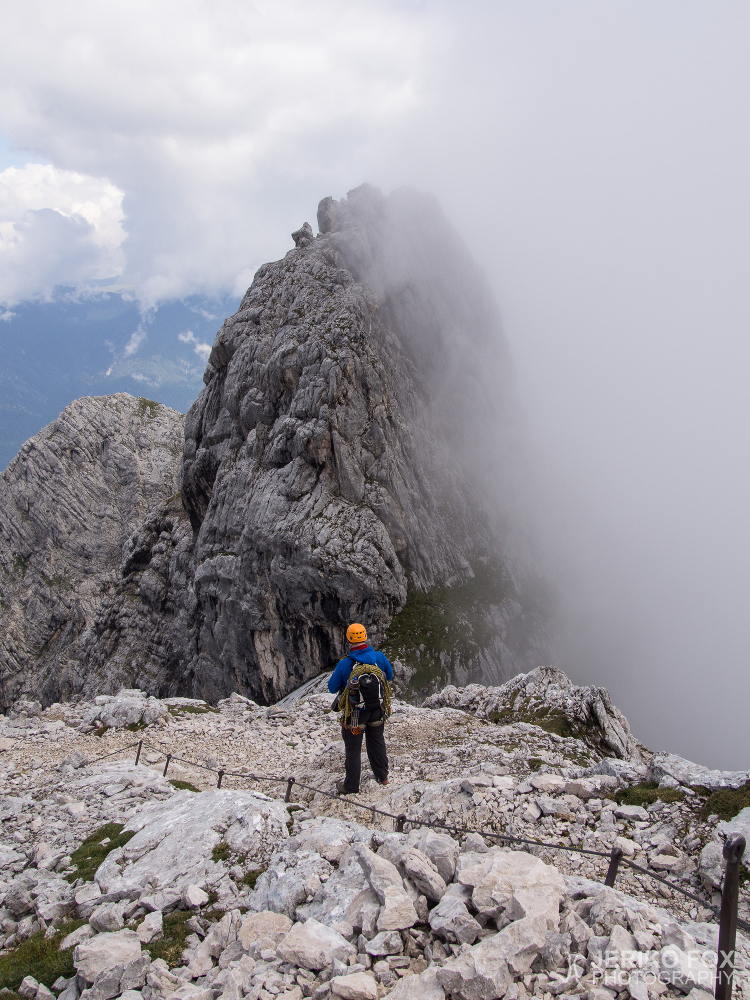
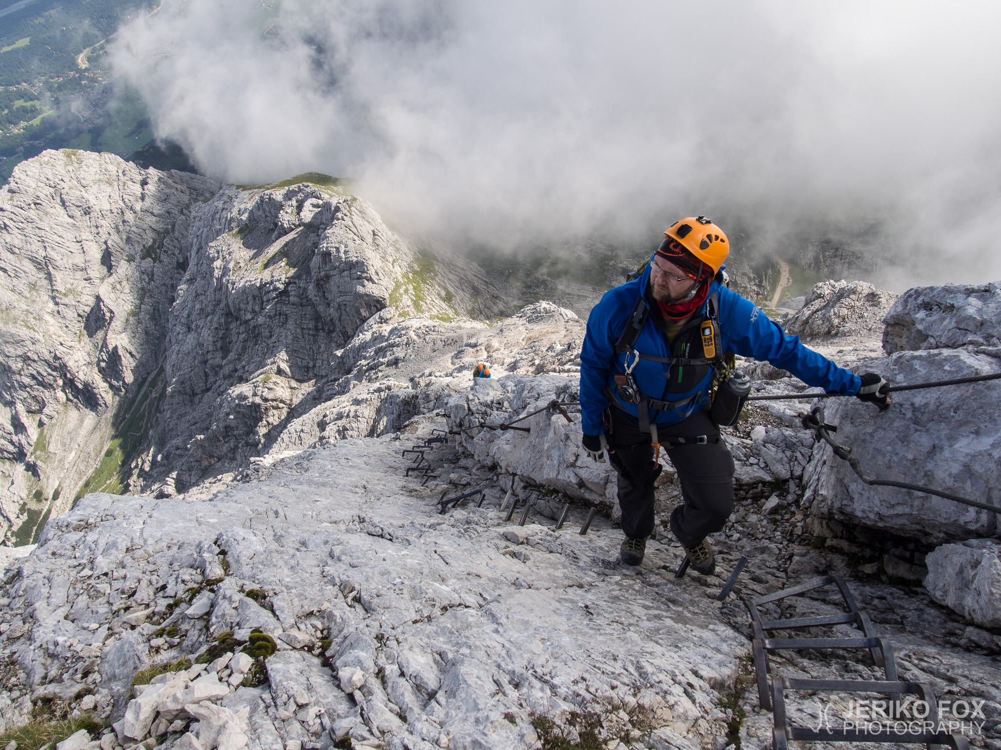
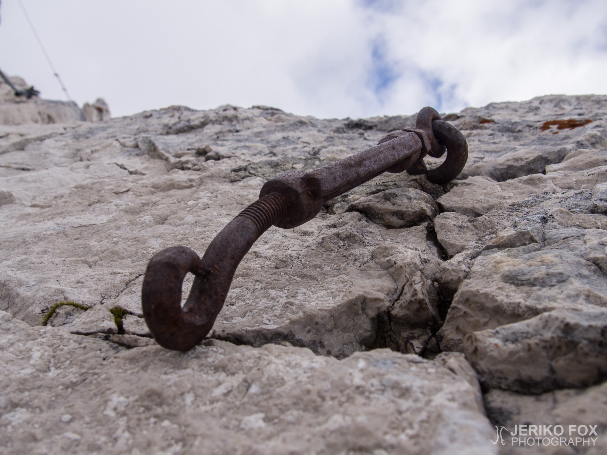
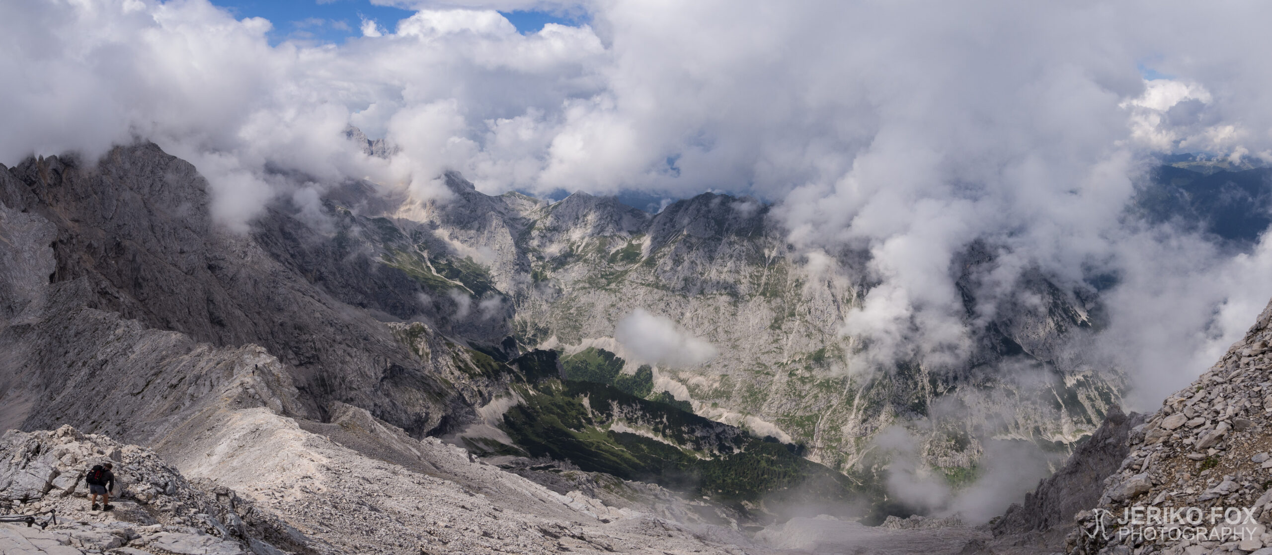
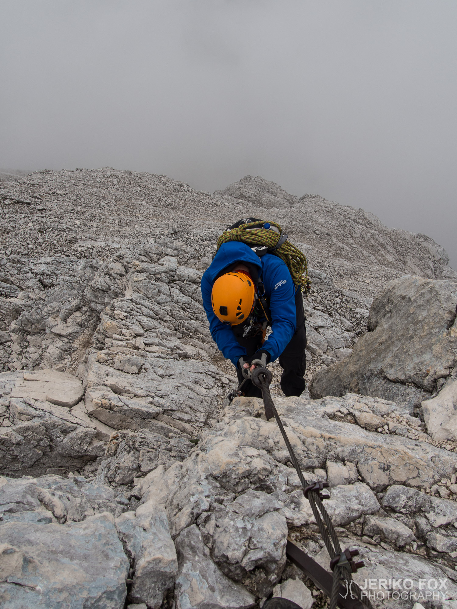
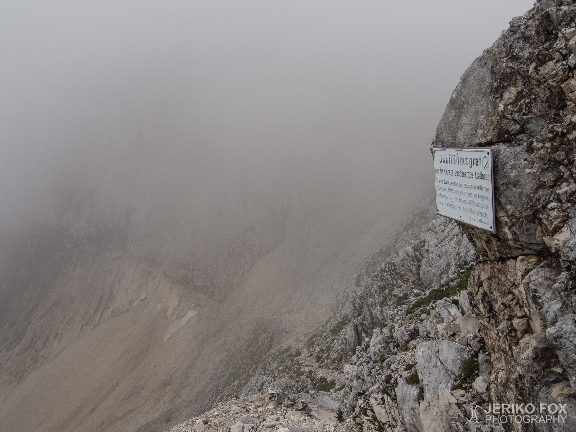
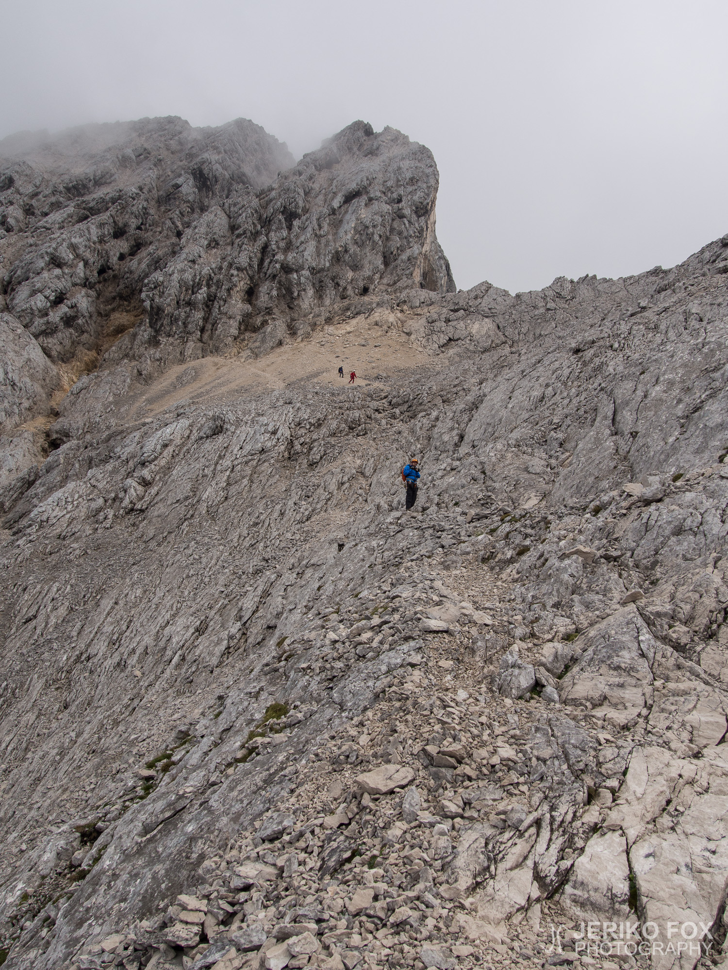
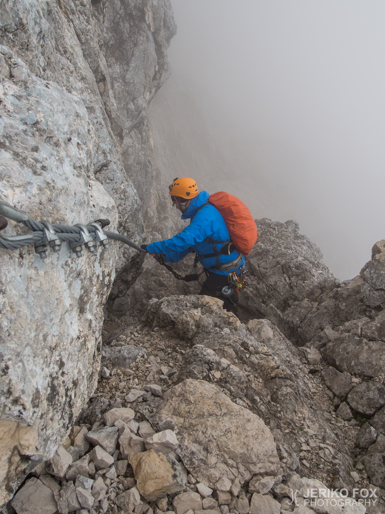
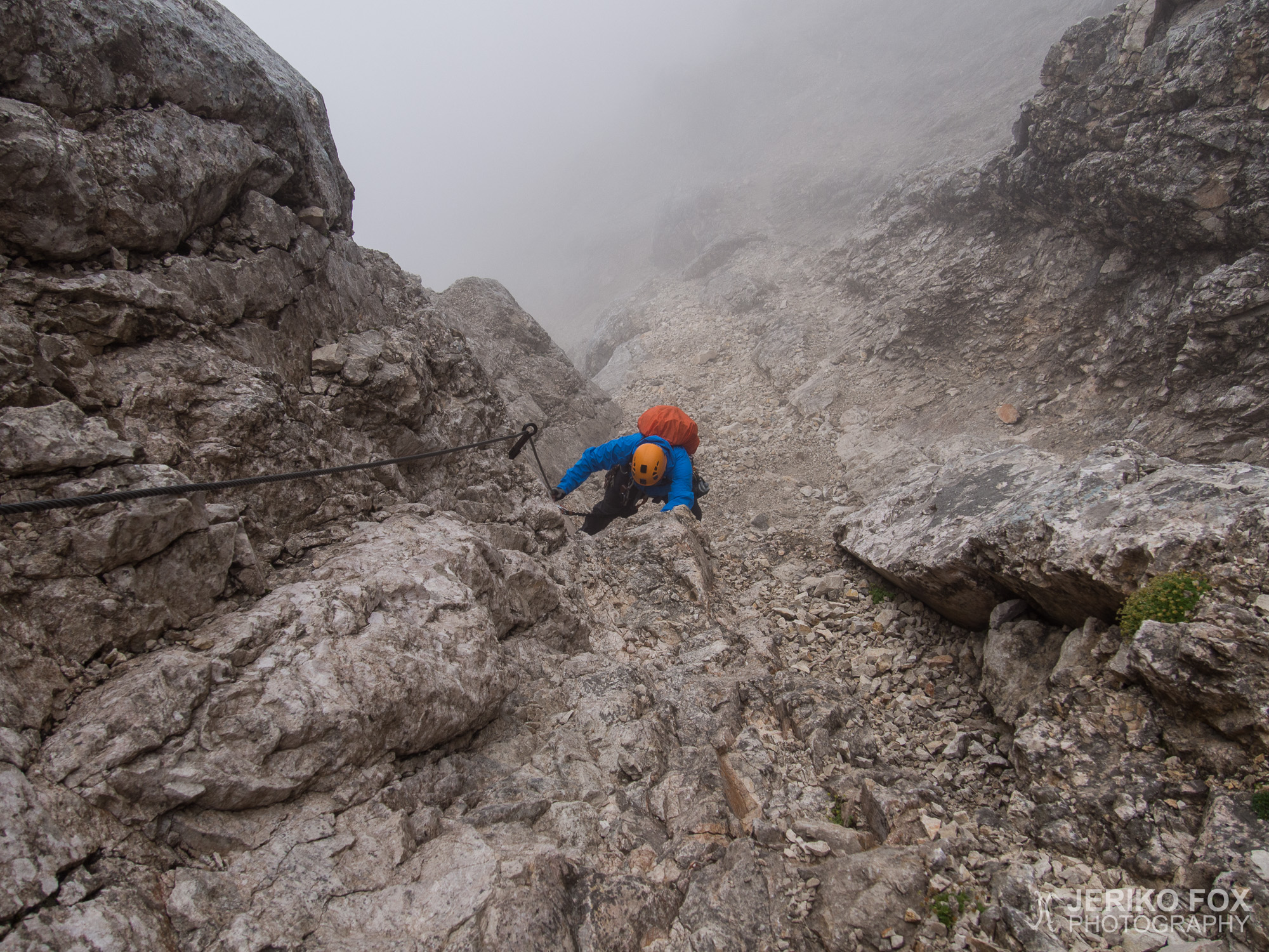
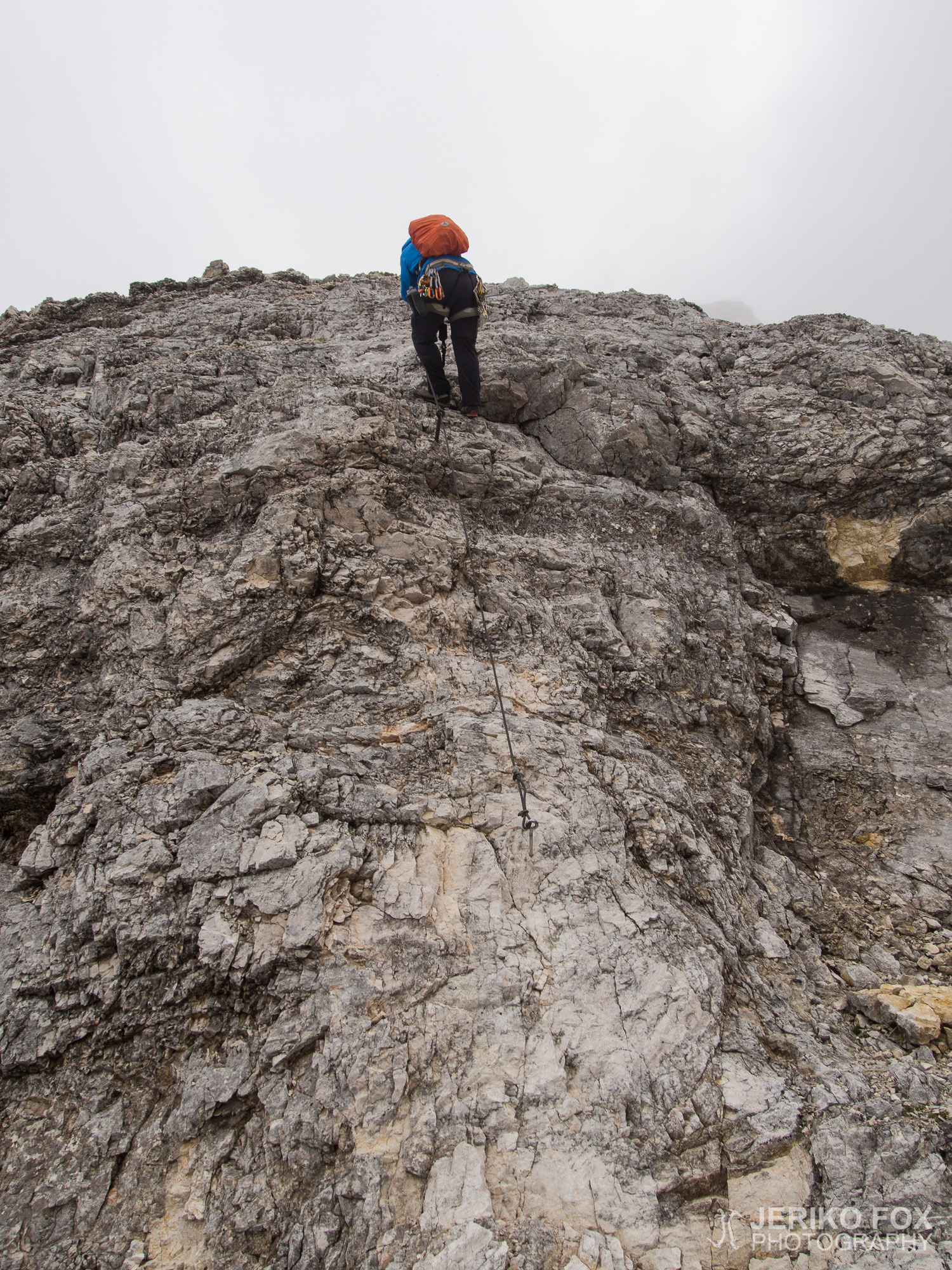
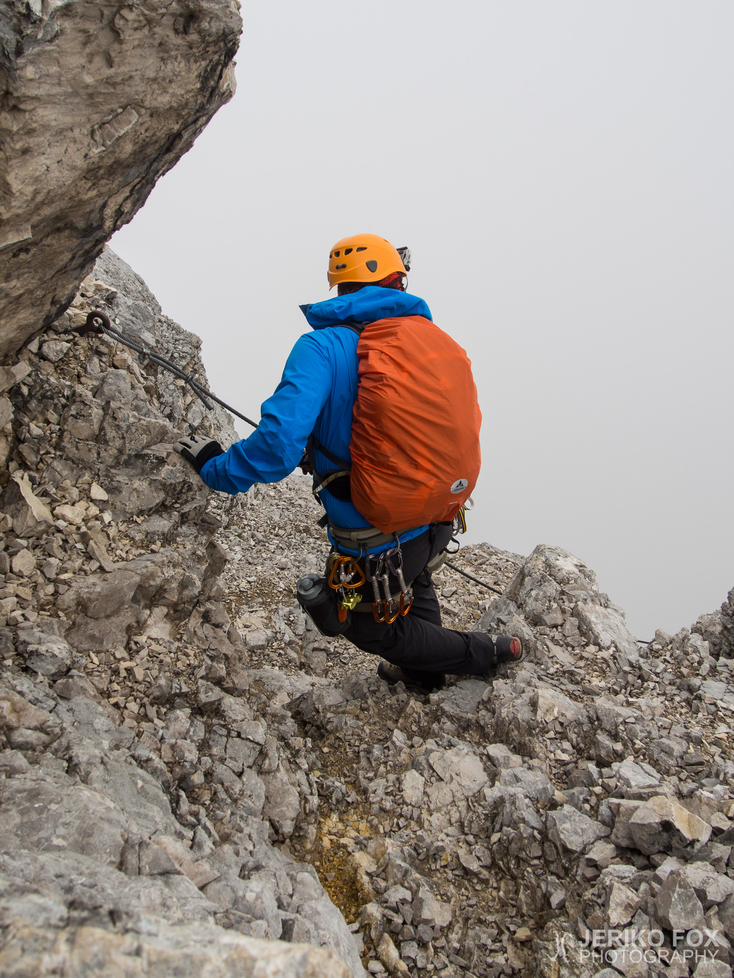
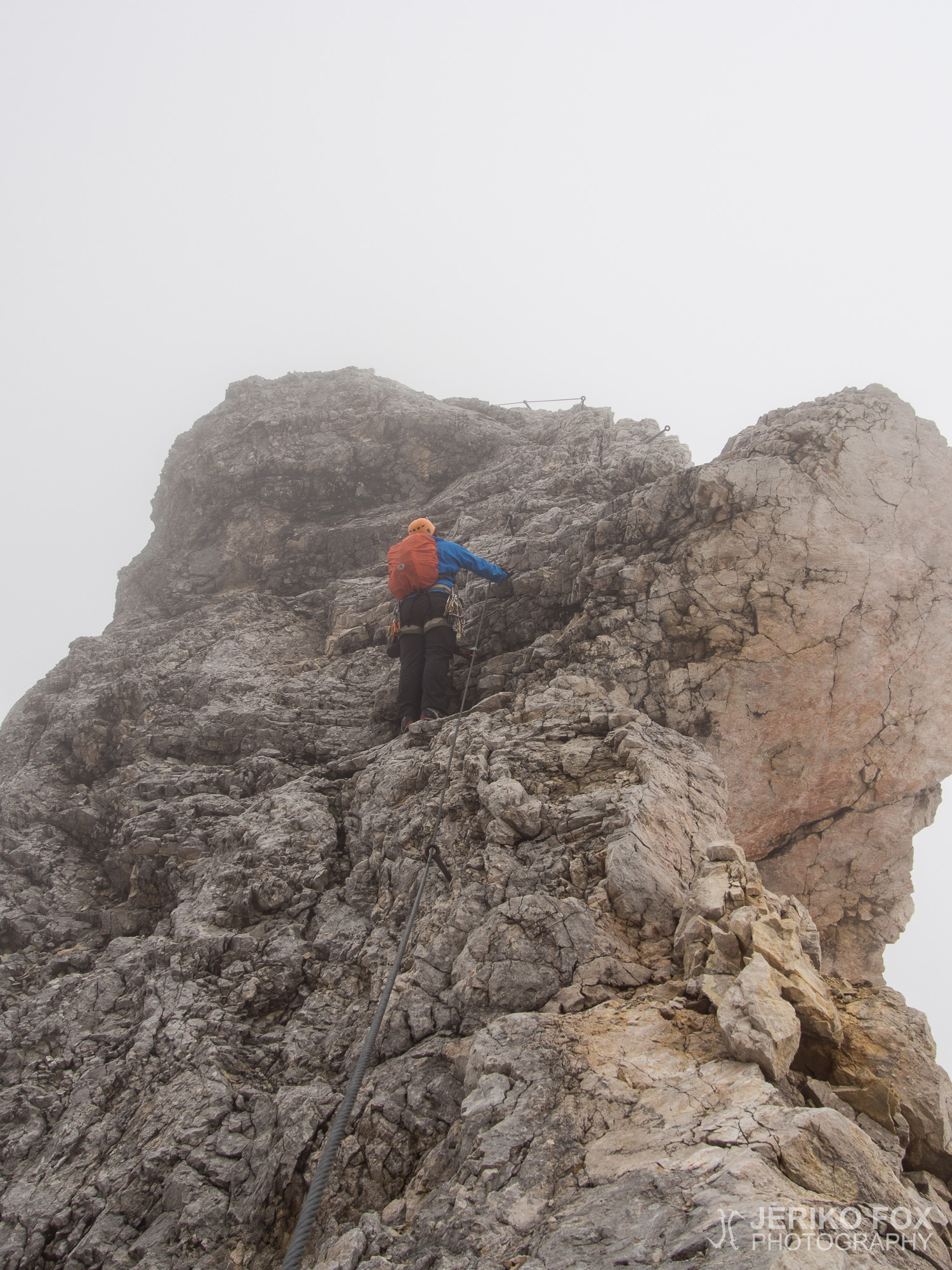
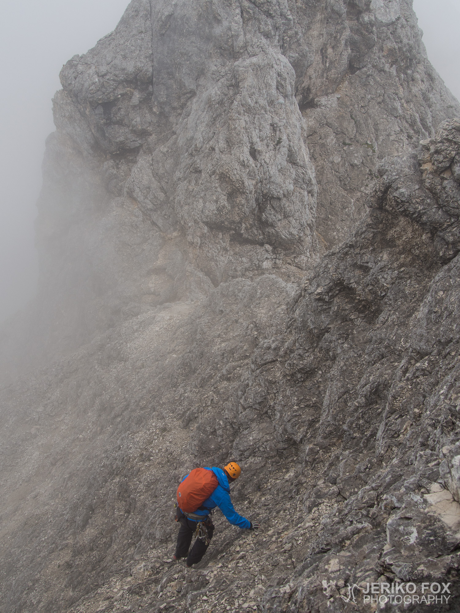
During the day it became very clear to us that even though the grade wasn’t by no means too difficult, the route is very exhausting to climb. When you are not climbing up, you’re climbing down – there is virtually no flat parts. Every once in a while the ridge might be little wider and the next moment it turns to be as sharp as a knife. You don’t always know are you actually climbing, walking or going on all fours. The most steepest sections are secured with VF cabels, which makes you feel more safe. But on the other hand we discussed about this when descending from Vollkarspitze: There is the most difficult VF section of the route, a D-grade vertical wall. The cable prevents a lethal fall, but it doesn’t take away the risk of getting major injuries. The free fall would still be several meters (more than 10 ft) and even with the shock-absorber the fall would end smashing against the rock wall.
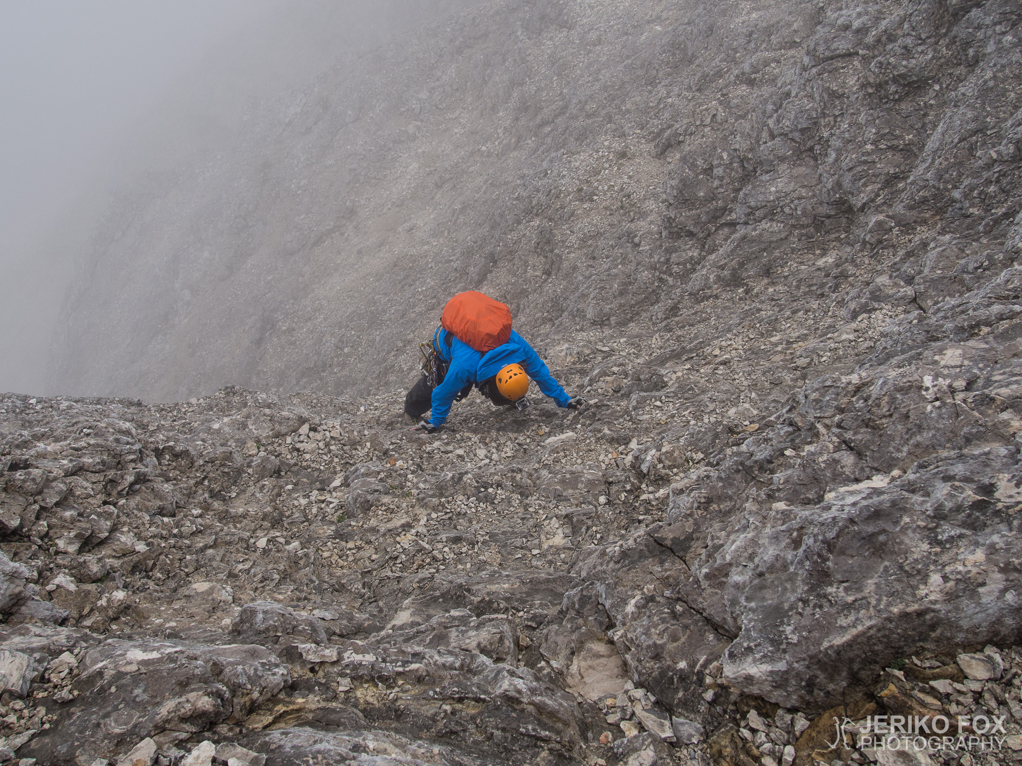
In addition to the steep sections, many places covered with loose rocks are dangerous. You end up often climbing or traversing a steep slope that ends to a ravine. Losing the balance might easily lead to an unstoppable slide towards the void. We didn’t feel the need to rope up, since when climbing simul, one might drag another with him when falling. Belaying all the time would have slowed us down considerably. We decided to move carefully through difficult passages and that seemed to suit us well.
For me the crux of the route was before Äußere Höllentalspitze, on a steep slope with loose rocks as described earlier. At the end of the slope we had to climb around a large smooth boulder to be able to continue climbing up. Dima went first and waited for me on the other side. I started to inch myself against the surface of the rock and pushed my other leg in an uncomfortable in-rotated position to maintain the balance. I reached far around the boulder and got my hand on a small edge. In that moment I realised that I got myself into a position where it would be very hard to move to any direction. And if I would lean back a slightest bit, I would lose my grip from the edge and fall all the way to the valley. I froze completely and the paralysing fear of the death seemed to last forever. I said to Dima: “Now it’s a really bad place.” Dima instructed me to reach a little bit further of the small edge: “There is a jug!” Desperately I stretched my arm a wee bit more and felt the blissful moment of my fingers digging into a perfect jug type hold. I was able to drag myself past the boulder, but the moment of horror didn’t want to leave my head. We continued climbing and I kept on feeling the disturbing fear in my mind, until I decided that I just have to get over it. Somewhere from the dusty basement of my memories I dug out the Bene Gesserit litany against fear, from the Dune trilogy that I red perhaps 15 years ago:
I must not fear. Fear is the mind-killer. Fear is the little-death that brings total obliteration. I will face my fear. I will permit it to pass over me and through me. And when it has gone past I will turn the inner eye to see its path. Where the fear has gone there will be nothing. Only I will remain.
–Frank Herbert (Dune)
Only I will remain. For some reason this helped me to focus on climbing and let go of the fear. In hindsight it might have been a good idea to climb that section with a belayer, because the consequences of a fall would have been catastrophic. But the boulder didn’t seem that difficult to pass, until you realised that you hang on a sloper ball. Dima asked me a while later if I want to rope up. I told him that I don’t feel the need anymore, since the hardest part seems to be behind us.
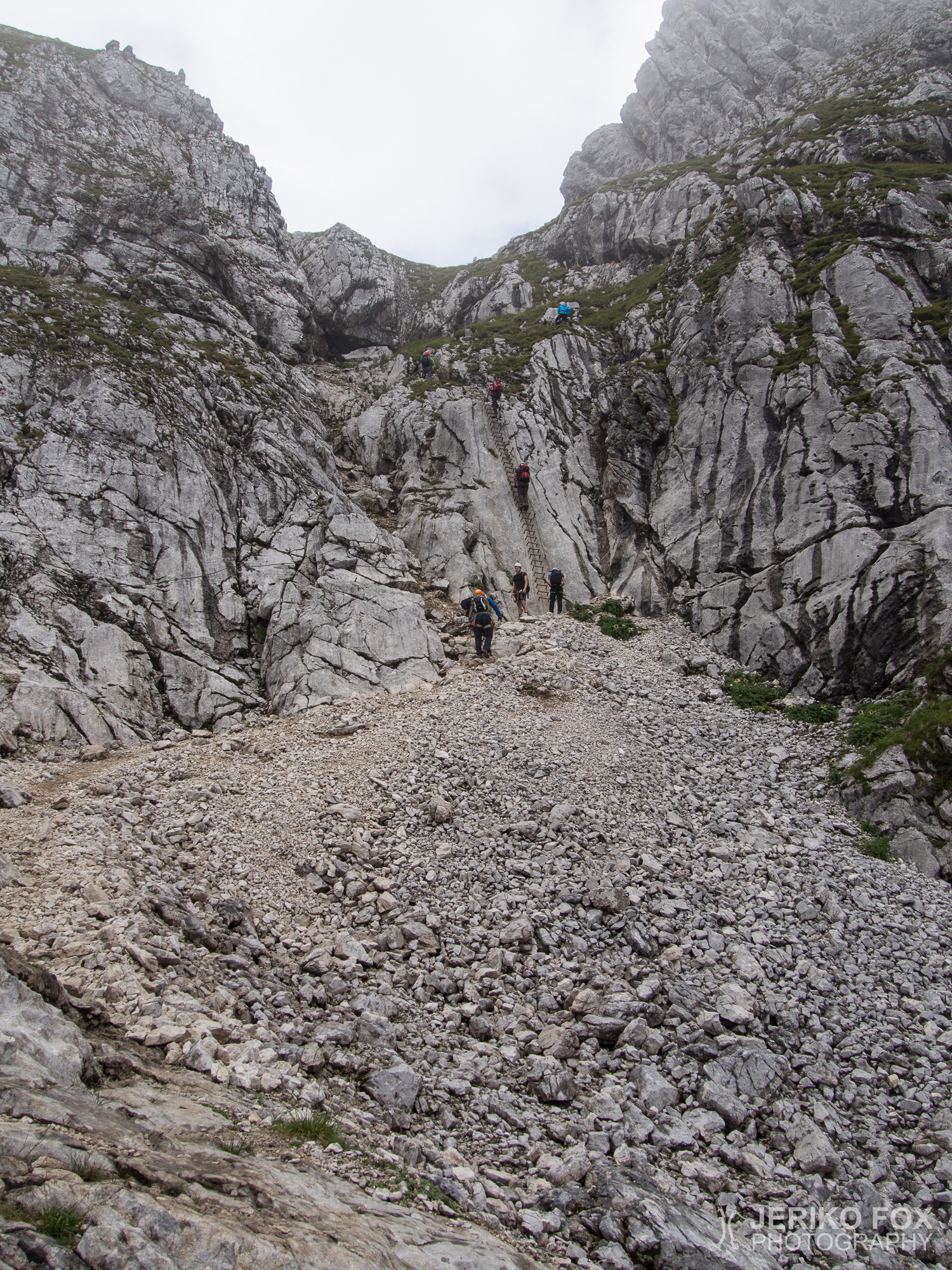
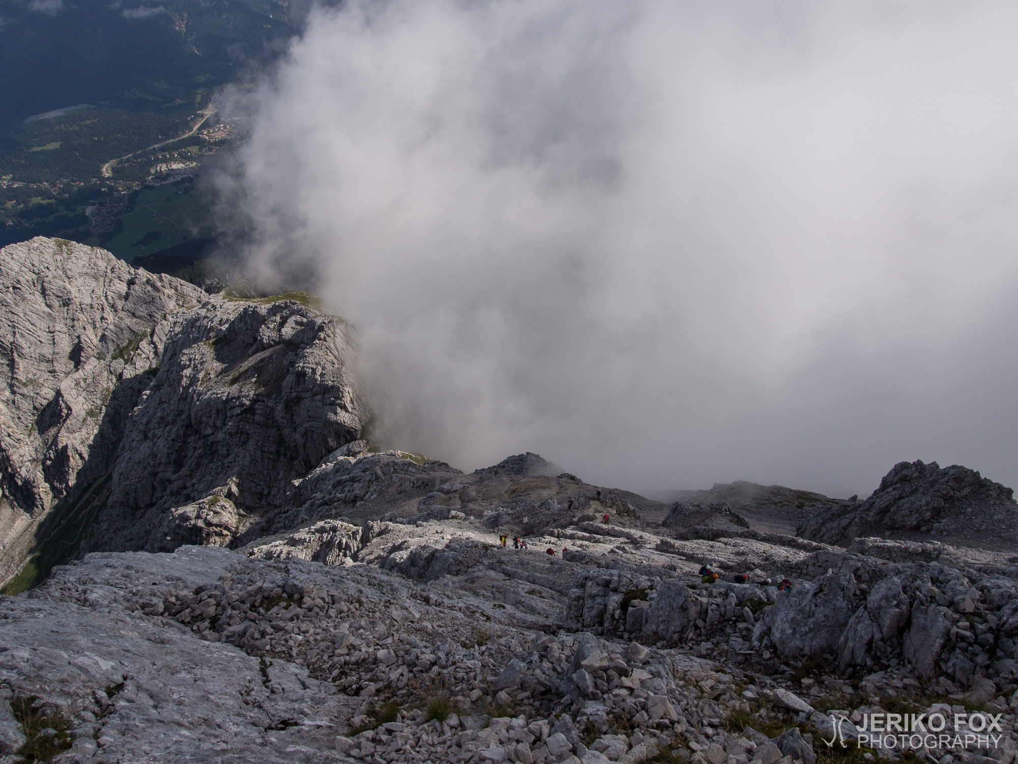
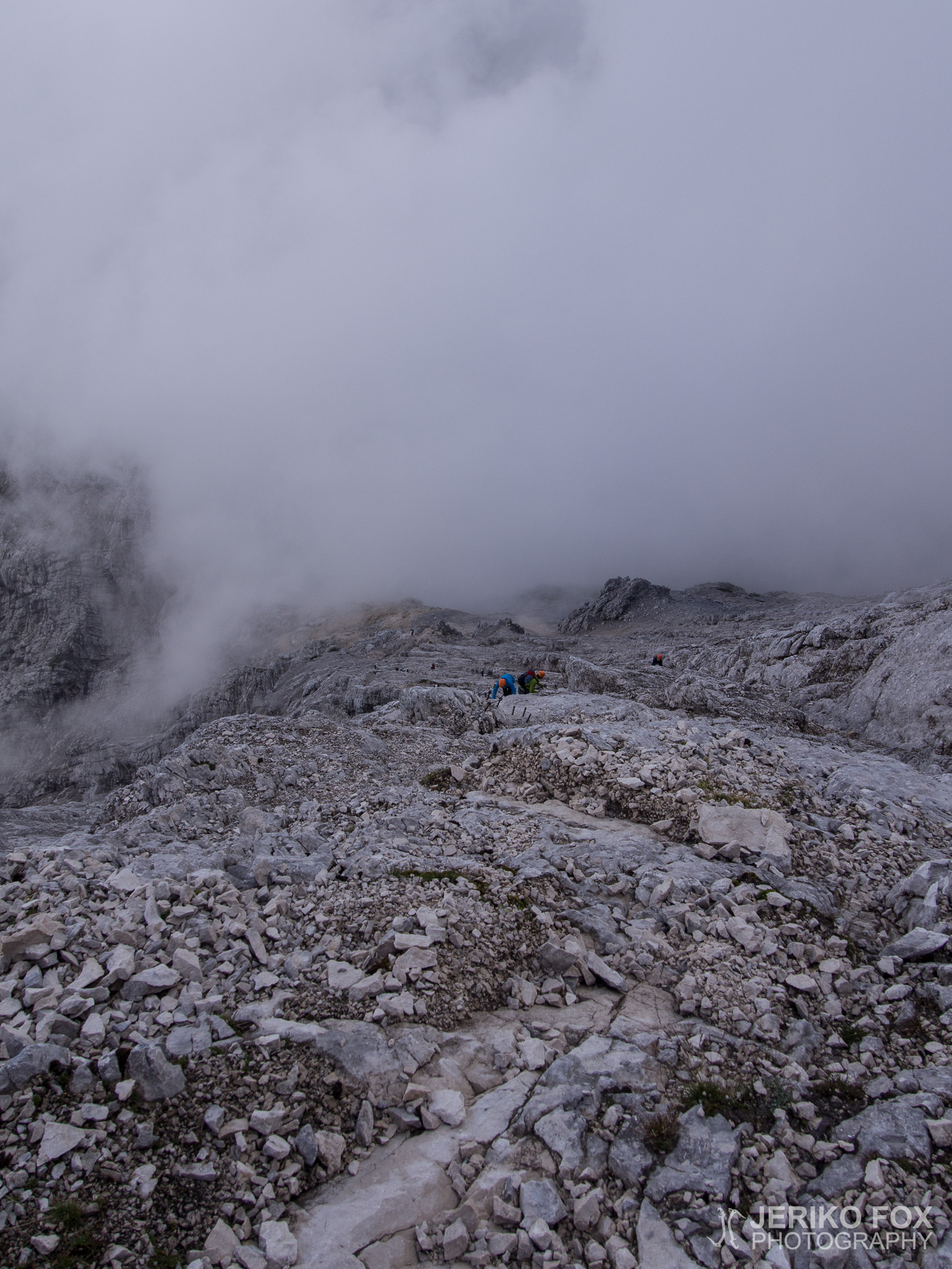
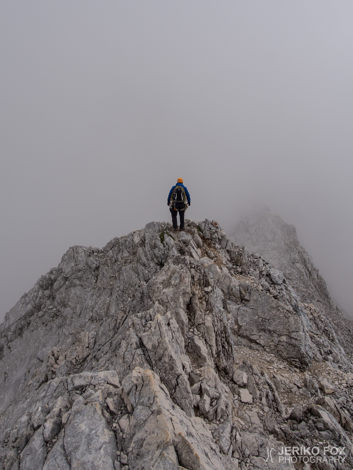
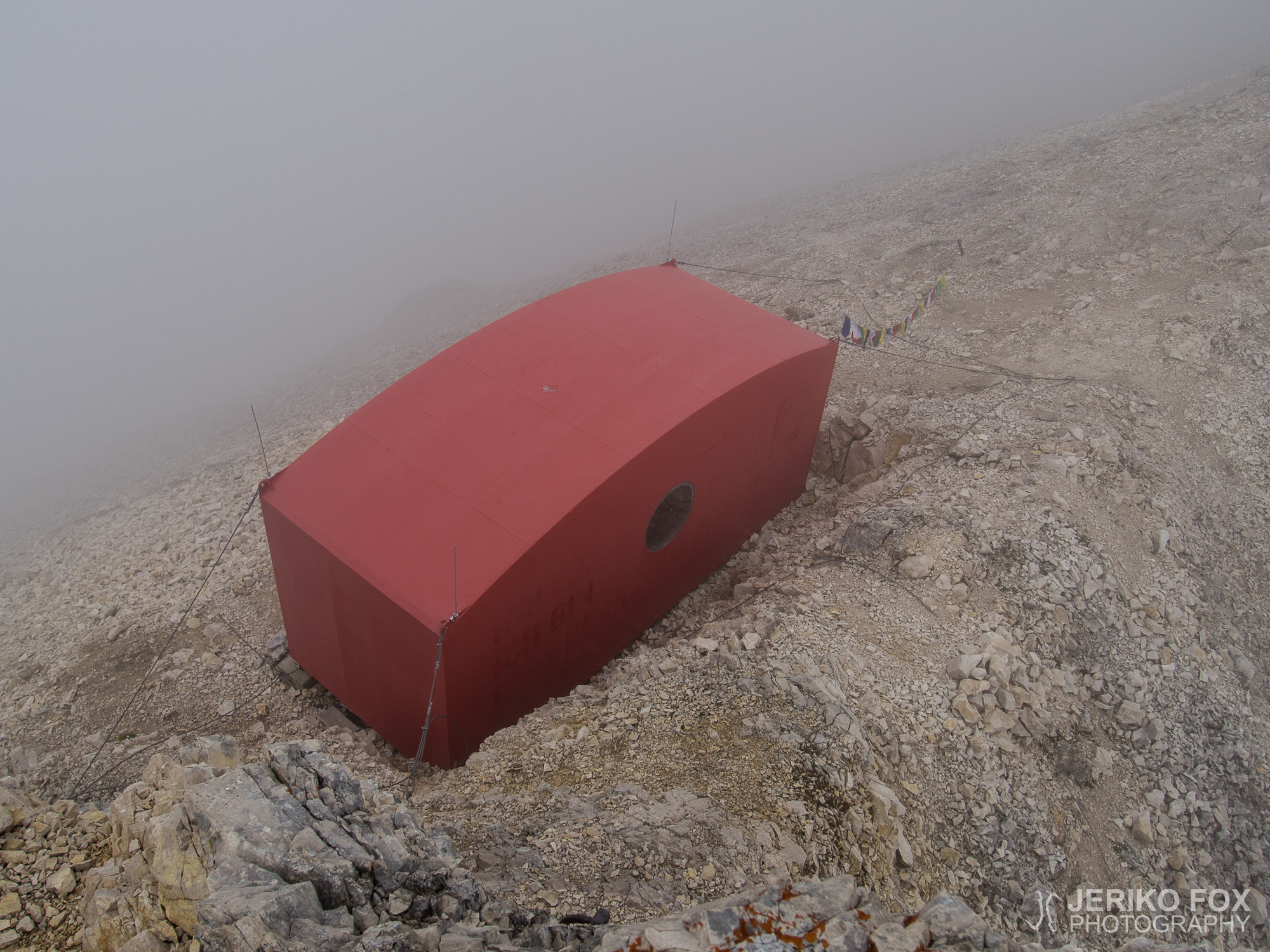
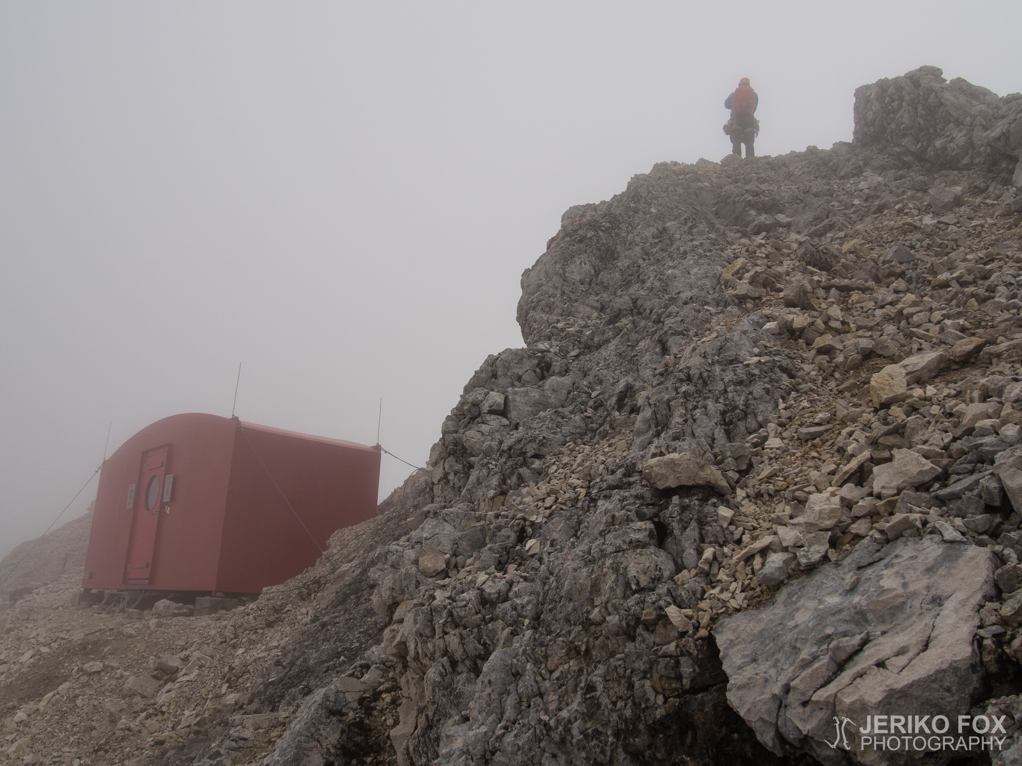
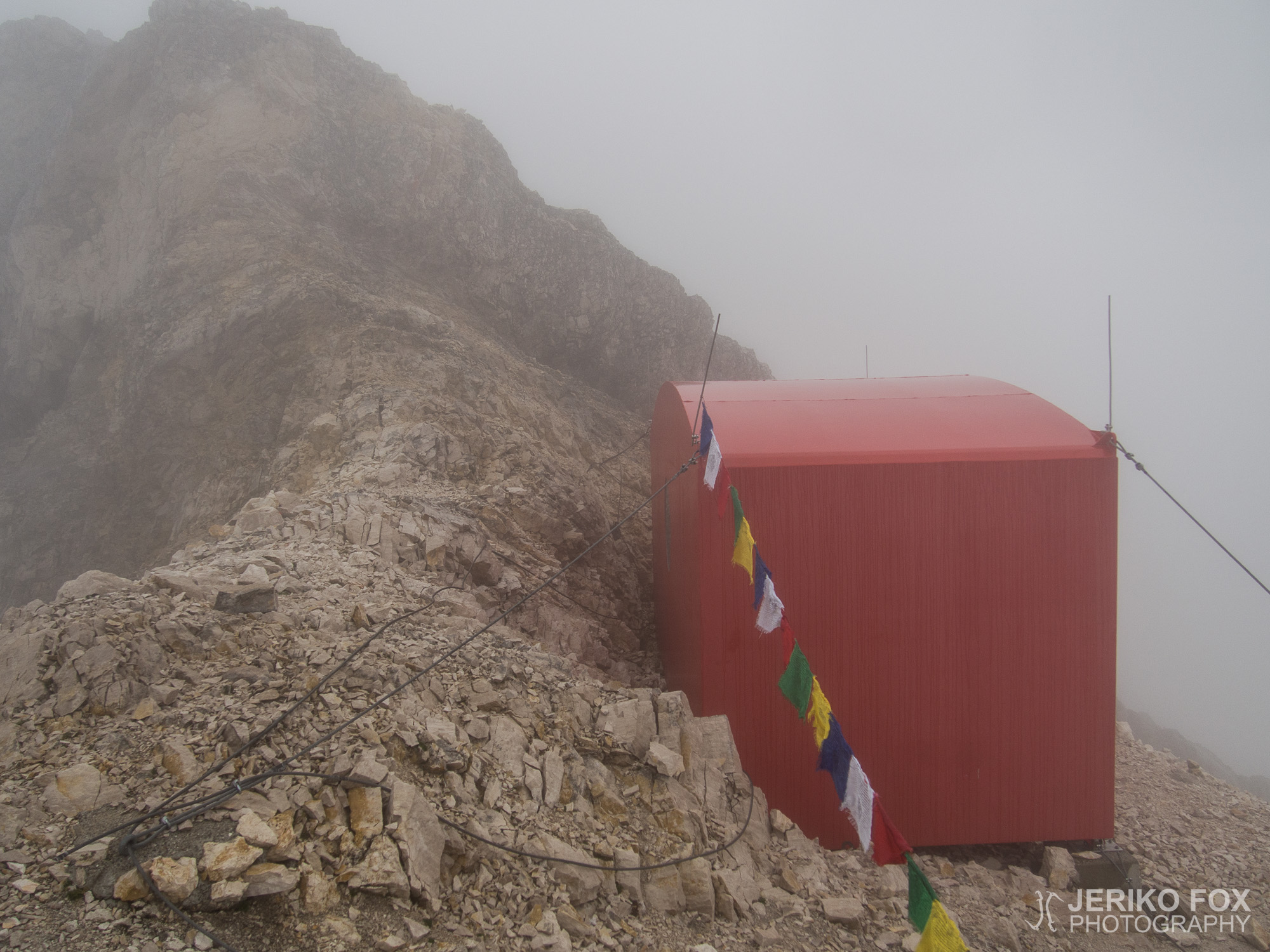
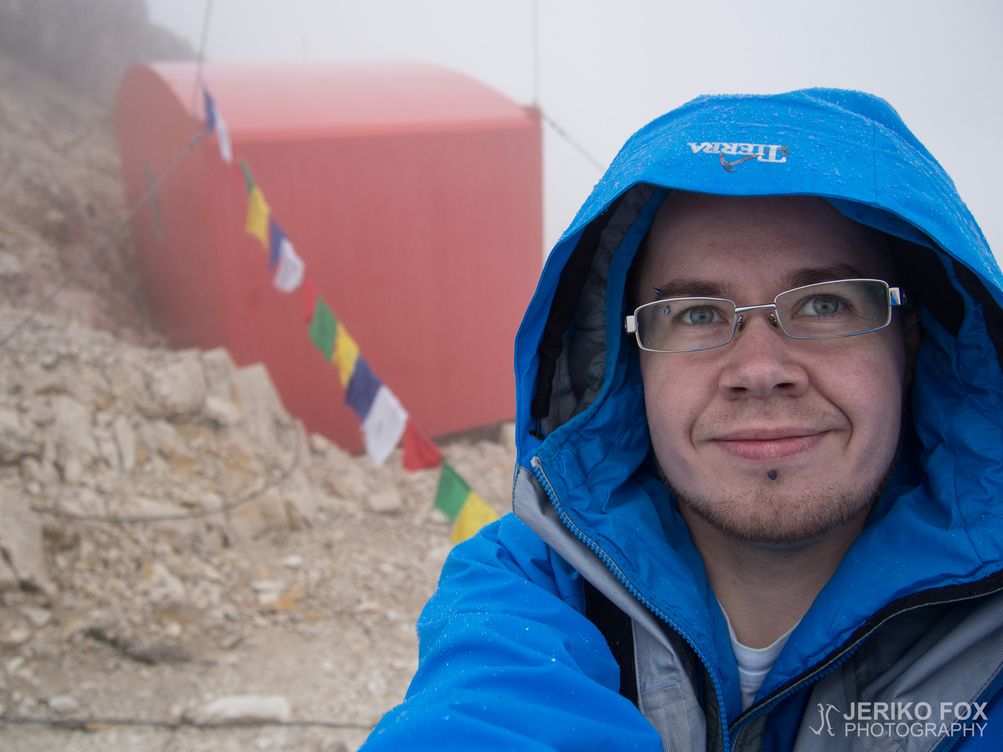
We climbed on, up and down, and the bivy was nowhere to be seen. Every time when we climbed on a spike we wished to see the bivy, but there was nothing. At 6 pm we summited Außere Höllentalspitze in 2720 m / 8920 ft, once again unaware of it happening. A while after that I climbed on a small hillock and looked at the ridge ahead of me. I was starting to feel little desperate since we were quite tired. Nothing, only rocks. Then I turned my head down to see where to climb next and there it was! Right below my feet was a small red cabin. I shouted to Dima that I found the bivy, but he was unable to hear me. He was as surprised as I was, when he looked down.
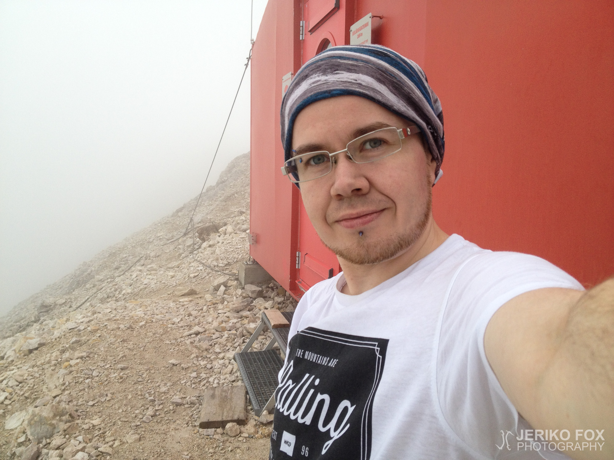
I walked to the bivy, nervously thinking if there will be room for us, and opened the door. In the cabin there was two men with their excessive supper. They greeted me friendly. I told that I was a Finnish climber and my friend was about to join us. These two men were from Dresden and they had also come from Alpspitze. They had taken much more food with them than we did and they offered chocolate crackers for us.
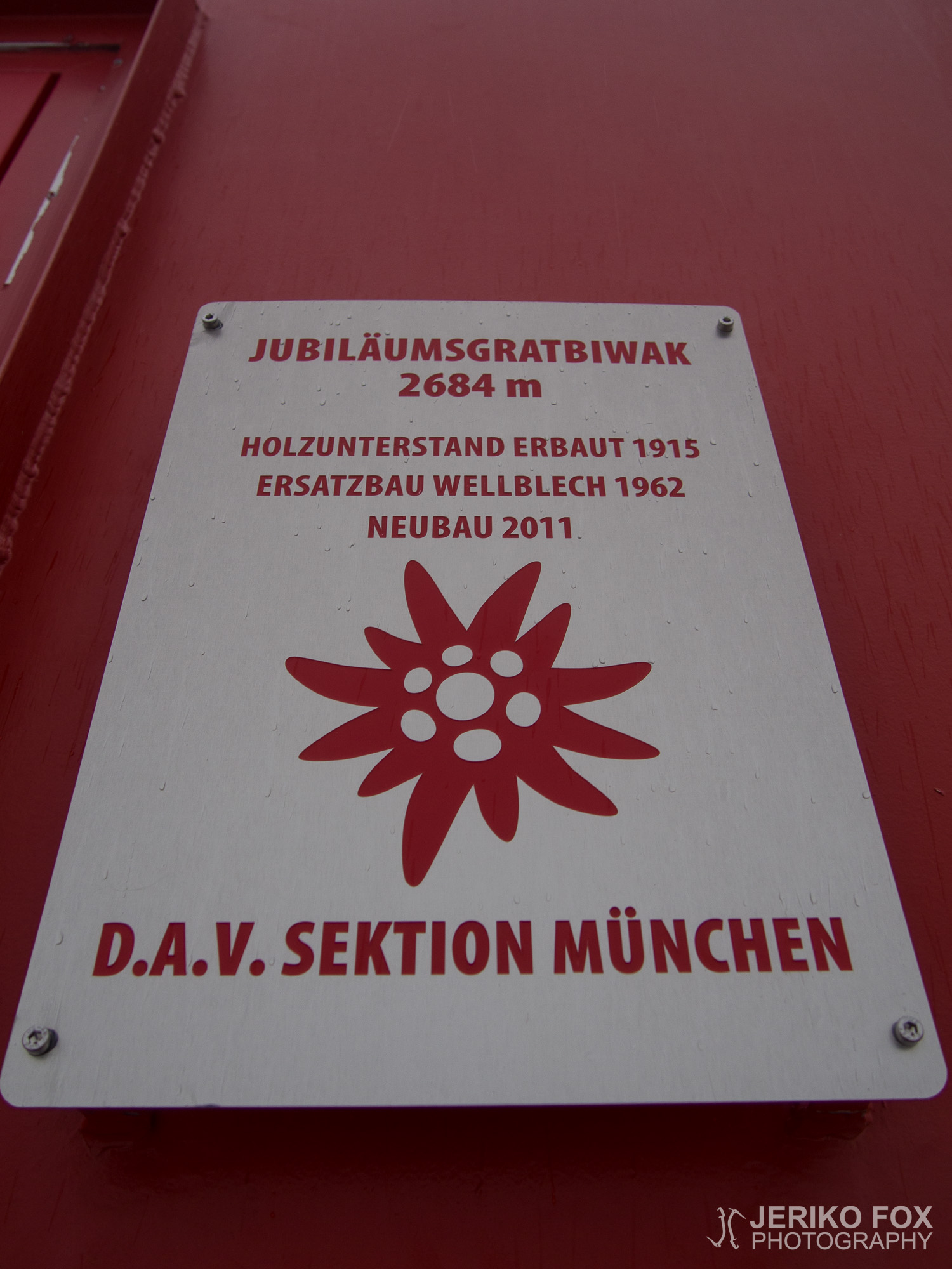
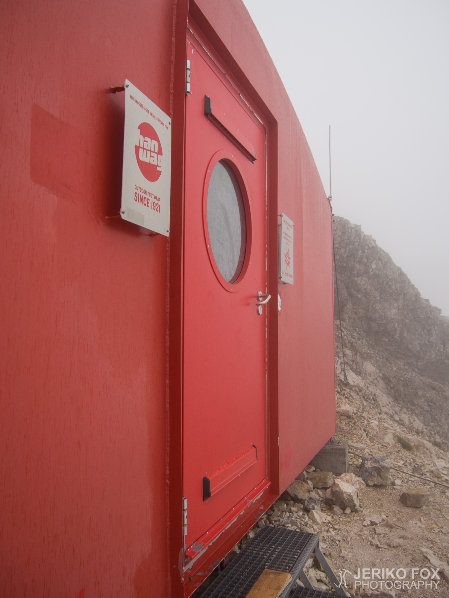
Grathütterl or officially Jubiläumsgratbiwak is 2684 m / 8805 ft above the sea level and about the halfway of the ridge. The bivy was rebuilt in 2011 and it’s maintained by DAV Munich. There are giro transfer papers in the bivy that you can use to pay the 3 € fee for DAV Munich. They use the money to cover the maintenance expenses of the bivy. Cell phones don’t work inside the cabin, but you are able to call when you go outside. Jubiläumsgratbiwak is primarily an emergency bivouac, but it’s allowed to use it for planned bivy if there are no emergencies. We ended up having plenty of space in the 12 bed bivy, because it was just us four spending the night there. We fell asleep content after over 8 hours of climbing.
Olimme odottaneet hyvää sääikkunaa pääkohdettamme, Jubiläumsgratia, varten ja viimein se näytti koittavan. Pakkasimme Diman kanssa kiipeilyvälineet edellisenä iltana valmiiksi ja heräsimme aamulla aikaisin päästäksemme hyvissä ajoin liikkeelle. Olimme suunnitelleet viettävämme yötä harjanteella, joten varsinaista kiirettä ei ollut.
Jubiläumsgrat on linnuntietä mitattuna noin 5,3 km pitkä vuorenharjanne yli 2000 m korkeudessa, mutta kiipeilymatkaa reitillä kertyy noin 8,1 km. Harjanteen itäpäässä on Alpspitzen (2628 m) huippu ja länsipäässä Saksan korkein vuori, Zugspitze (2962 m). Reitti kulkee näiden kahden huipun lisäksi kolmen Höllentalspitzen – Äußere (2720 m), Mittlere (2743 m) ja Innere (2741 m) – sekä Vollkarspitzen (2630 m) yli ja sivuaa Hochblassenia. Geologisesti Jubiläumsgrat alkaa Hochblassenilta (2706 m), mutta sen ja Alpspitzen välinen harjanne kuuluu myös reittiin.
Suurin osa kiipeää harjanteen “alamäkeen” eli länsi-itä -suunnassa Zugspitzeltä Alpspitzelle. Reitin sanotaan myös olevan näinpäin hieman helpompi joidenkin paikkojen varmistamisen osalta. Me kuitenkin olimme päättäneet kiivetä harjanteen “ylämäkeen” eli itä-länsi -suunnassa Alpspitzeltä Zugspitzelle. En osaa tälle päätökselle sen parempaa syytä sanoa kuin että jostain syystä nousujohtoinen reitti kuullosti houkuttelevammalta. Jokatapauksessa Jubiläumsgratilla joutuu kiipeämään toistuvasti ylös ja alas, joten kevyttä kulku ei ole kumpaankaan suuntaan. Osa Jubiläumsgratista on varmistettu via Ferrata -vaijerein, mutta kyseessä ei missään nimessä ole pelkkä VF vaan reitti vaatii myös harjannekiipeilytaitoja. Via Ferratan vaikeusaste on luokiteltu useimmissa lähteissä C/D-tasolle, mikä pitää mielestäni paikkansa. UIAA-asteikolla Jubiläumsgratin sanotaan sisältävän kiipeilyä vaikeusasteilla I, II ja osittain III-.
Ensimmäinen hissi GaPasta Osterfelderkopfille lähti kahdeksalta, mutta vältimme Alpspitzelle nousijoiden aamuruuhkan saapumalla hissille hieman yhdeksän jälkeen. Yhdensuuntainen hissimatka maksaa kesäkaudella aikuiselta 17 €. Puettuamme kiipeilykamppeet päällemme hissin yläasemalla 2033 m korkeudessa, lähdimme ennen kymmentä seuraamaan kiipeilijöiden valtavirtaa Alpspitzen via Ferratalle. Sää oli osittain pilvinen, mutta näkyvyys oli tässä vaiheessa vielä hyvä. Olimme kiivenneet kyseisen VF-reitin Diman kanssa vuonna 2013 ja nyt etenimme huomattavasti edellistä kertaa nopeammin.
Ohitimme useita joukkoja hitaampia kiipeilijöitä noustessamme Alpspitzelle. Reitti haarautuu Jubiläumsgratin suuntaan hieman ennen huippua, mutta tästä kohdasta on niin lyhyt matka huipulle, että päätimme kuitenkin käydä valtavirran kanssa patsastelemassa Alpspitzellä. Saavutimme Alpspitzen huipun 2628 metrin korkeudessa puolenpäivän aikaan. Tässä vaiheessa meitä koko nousun ajan tasaisesti jahdannut pilvi alkoi saavuttaa meidät ja näkyvyys GaPan suuntaan oli huono. Söimme nopeasti yhdet Cornyt ja jatkoimme suoraan huipun yli kulkevaa reittiä kohti Jubiläumsgratia. Aiemmin mainitsemani alempaa haarautunut reitti yhdistyy tähän reittiin melko pian huipun alapuolella. Tässä vaiheessa kiipeilijöiden ruuhka jäi taaksemme ja näimme edessämme vain pari muuta ihmistä: vihdoin päästään tositoimiin!
Vaikka pilvien välistä ajoittain näki Zugspitzelle asti, oli harjanteen massiivisuutta vaikea käsittää ja etäisyydet tuntuivat hyvin epämääräisiltä. Tunnelma oli kuitenkin korkealla ja lähdimme kiipeämään vuorotellen alas ja ylös. VF-vaijereita oli enemmän kuin olin odottanut ja ne olivat hyvässä kunnossa. Pilvet ympärillämme alkoivat pikkuhiljaa tiivistyä ja kevyen sateen alkaessa vedimme suojat reppujen päälle, mutta olosuhteet olivat yhä varsin hyvät. Saapuessamme ensimmäiseen risteyspaikkaan yhden jälkeen jouduimme hetken tutkimaan kylttejä ja karttoja. Harjanteen oikeaa puolta pääsee laskeutumaan Matheisenkarin suuntaan ja sitä kautta Höllentaliin, vasempaa puolta lähtee reitti Jubiläumsgratille ja Hochblassenille sekä poistumisreitti Grießkarin kautta itään. Olimme pohtineet myös Hochblassenilla käymistä, mutta Jubiläumsgratissa on jo yksinäänkin paljon kiivettävää.
Aloimme pikkuhiljaa kohdata myös vastaantulijoita, jotka toisinaan tiedustelivat suunnitelmiamme. Kun mainitsin aikovamme viettää yötä Jubiläumsgratbiwakilla, eräs kiipeilijä kertoi, ettemme olisi bivillä yksin ja epäili siellä mahdollisesti olevan jopa täyttä. Siinä tapauksessa joutuisimme bivittämään ulkona, mikä sään puolesta oli kyllä mahdollista. Saavutimme Vollkarspitzen huipun 2630 metrissä noin puolen neljän aikaan, mutta totta puhuakseni emme edes tienneet sitä kiivetessämme, koska huippua ei ole mitenkään merkitty eikä se pilven seassa kulkiessa kummemmin erottunut muista harjanteen kohoumista.
Päivän aikana tuli hyvin selväksi, että vaikka reitin vaikeustaso ei ollut mitenkään mahdoton, se todellakin on fyysisesti raskas. Jos et ole kiipeämässä ylös niin kiipeät alas – tasaista ei ole juuri ollenkaan. Toisinaan harjanne on hieman leveämpi ja välillä se on veitsenterävä. Aina ei itsekään tiedä onko senhetkinen kulku enemmän kiipeilyä, kävelyä vai konttaamista. Jyrkimmät paikat ovat varmistettu VF-vaijerein, mikä tuo turvallisuudentunnetta. Toisaalta vaikeimmassa VF-kohdassa, laskeutuessamme D-tason jyrkännettä Vollkarspitzeltä, pudotessa vaijeri pelastaisi kuolemalta, mutta siitä huolimatta vakavan loukkaantumisen riskiä se ei poista. Vapaata pudotusta tulisi jokatapauksessa useita metrejä ja nykäyksenvaimentajasta huolimatta lopussa iskeytyisi kiviseinämään.
Jyrkkien kohtien lisäksi haastavia paikkoja ovat monet irtokivien peittämät alueet. Usein joutuu kiipeämään tai sivuttaiskulkemaan jyrkkää rinnettä, joka päättyy ammottavaan rotkoon. Horjahtaminen voi siis helposti johtaa pysäyttämättömissä olevaan luisuun kohti tyhjyyttä. Emme kuitenkaan kokeneet tarpeelliseksi käyttää köyttä, koska simulina kulkiessa pudonnut vetäisi toisen mukanaan ja varmistaminen olisi hidastanut tarpeettomasti etenemistä. Päätimme vain liikkua varovaisesti vaikeissa kohdissa ja ratkaisu sopi meille hyvin.
Minulle reitin kruksi tuli vastaan ennen Äußere Höllentalspitzeä erään tällaisen viettävän irtokivisen rinteen alareunassa, jonka päätteeksi piti kiivetä ison sileähkön kiven ympäri päästäkseen jatkamaan ylöspäin. Dima ohitti kiven ensin ja jäi odottamaan minua toiselle puolelle. Minä hivuttauduin kiven pintaa pitkin työntäen toisen jalan epäkiitolliseen asentoon sisäkierrossa, koska näin pääsin jotenkin tasapainoon. Kurotin pitkälle kiven ympäri ja tavoitin listamaisen otteen. Siinä vaiheessa tajusin olevani asennossa, josta on vaikea liikkua oikealla tai vasemmalle ja jos nojaan yhtään taakse pettää otteeni listasta ja putoan laakson pohjalle asti. Lamaannuttava kuolemanpelko ja täydellinen jäätyminen tuntui kestävän ikuisuuden ja sanoin Dimalle: “Nyt on tosi paha paikka.” Dima neuvoi minua kurottamaan vielä hieman pidemmälle listaotetta pitkin: “Siinä on kahva!” Epätoivoisesti venytin kättäni hieman pidemmälle ja koin autuaan tunteen sormieni upotessa täydelliseen kahvaotteeseen. Sain vedettyä itseni kiven turvalliselle puolelle, mutta juuri koettu kauhunhetki ei ottanut lähteäkseen. Jatkoimme matkaa eteenpäin ja pelko pyöri häiritsevästi mielessäni, kunnes päätin, että nyt tästä täytyy päästä yli voidakseni jatkaa. Jostain muistin kätköistä aivoni tarjoilivat minulle ehkä 15 vuotta sitten lukemastani Dyyni-trilogiasta Bene Gesserit -järjestön pelonhallintamantran:
En saa pelätä. Pelko on mielen tappaja. Pelko on pikku kuolema, joka tuo täydellisen sammumisen. Katson pelkoani suoraan. Annan sen kulkea ylitseni ja lävitseni. Ja kun se on mennyt ohi, käännän sisäisen silmäni näkemään sen tien. Mistä pelko on kulkenut, siinä ei ole mitään. Vain minä pysyn.
–Frank Herbert (Dyyni) suom. Anja Toivonen
Vain minä pysyn. Jostain syystä tämä auttoi kääntämään tietoisuuteni takaisin kohti meneillään olevaa tehtävää ja pois pelosta. Jälkeenpäin ajatellen tuo kohta olisi kannattanut ohittaa köyden kanssa ja varmistaen, koska putoamisen seuraukset olisivat olleet katastrofaaliset. Kuitenkin paikka näytti lähestyttäessä helpommalta kuin se oli ja vaikeus selvisi vasta huomatessaan roikkuvansa sloupperipallossa. Dima kysyi vähän ajan kuluttua, että haluaisinko kulkea köydessä. Sanoin kuitenkin, että en kaipaa sitä enää, kun vaikein paikka taisi jo mennä.
Kiipeily jatkui ylös ja alas, eikä biviä näkynyt missään. Aina noustessamme vähän korkeammalle toivoimme näkevämme bivin, mutta mitään vihjettäkään ei ollut havaittavissa. Kuuden aikaan ylitimme Außere Höllentalspitzen 2720 metrissä, mutta tämäkin huiputus tapahtui autuaan tietämättömänä. Hieman sen jälkeen kiipesin taas yhden pienen töytäreen päälle ja katselin jo hieman toivottomana eteenpäin, koska aloimme olla melko väsyneitä. Ei mitään, pelkkää kiveä. Sitten käänsin katseeni alas nähdäkseni mistä kiipeän eteenpäin ja siinä se oli! Jalkojeni juuressa muutaman metrin alempana törötti pieni punainen mökki. Hihkuin iloisesti Dimalle löytäneeni bivin, mutta hän ei kuullut mitä sanoin ja tuli väsyneen näköisenä kohti. Yllätys oli yhtä suuri hänen katsahtaessa alaspäin.
Kävelin biville ja jännittäen olisiko meille tilaa, avasin oven. Majassa istui kaksi miestä runsaiden eväiden äärellä ja tervehti minua ystävällisesti. Kerroin olevamme suomalaisia kiipeilijöitä ja ystäväni olevan tulossa perässä. Miehet olivat Dresdenistä ja kiipeämässä Jubiläumsgratia kanssamme samaan suuntaan. He olivat ottaneet huomattavasti enemmän ruokaa mukaansa ja tarjosivat meille keksejä.
Grathütterl eli virallisesti Jubiläumsgratbiwak sijaitsee 2684 metrin korkeudessa suunnilleen puolivälissä harjannetta. Maja on uusittu vuonna 2011 ja sitä ylläpitää DAV:n Münchenin osasto. Bivillä on maksulappuja, joilla voi suorittaa 3 € suuruisen yöpymismaksun, jolla DAV München kattaa ylläpitokuluja. Kännykkäverkko ei toimi bivin sisällä, mutta ulkopuolelta voi soittaa. Ensisijaisesti kyseessä on hätäbivi, mutta majalla saa yöpyä myös suunnitellusti jos hätäyöpyjiä ei ole. Yöpymistilaa 12 hengen bivissä oli siis kaikille runsaasti, koska meidän neljän lisäksi muita ei sinä yönä tullut. Nukahdimme tyytyväisinä yli kahdeksantuntisen kiipeilyn päätteeksi.
Max elevation: 2709 m
Total time: 08:34:20
[…] the summit ridge of Grossglockner, the Watzmann traverse, climbing to Hoher Göll and especially traversing the Jubiläumsgrat. The Franconia Ridge was not technically difficult like these ones, but still a scenic ridge […]