

19,04 km (11.8 miles)
1693.3 / 2189.8 miles
Unofficial campsite, VT
The tree didn’t fall on me in the night, and I ate my cold instant oatmeal in the warm morning. As I packed my things I noticed a lot of little beetles on the surface of a nearby snag. I went to look at them closer and I noticed a Mr. Beetle trying somewhat desperately to copulate with a Ms. Beetle. I stayed to watch this performance for such a long time that I started to feel myself to be a bit weird.
I had about a 14 mile trek in my sights to the peak of Killington mountain. Even though the morning’s first hiking hour went swiftly, after that the pace seemed to congeal relatively in correlation with the increasing temperature of the day. The air was moist and heavy. Hiking was sticky.
Since my camera had broken in Kunkletown I had experienced issues with my new camera as well. The shutter would often get stuck when turning it on, and getting just one photograph became an arduous process. Every so often I had to disassemble the camera into pieces and sometimes that helped and sometimes it didn’t. When I finally got decent service on my cell phone I messaged with my cousin about my problems, and she promised to look into the warranty. Most likely I would be looking at buying a new camera again.
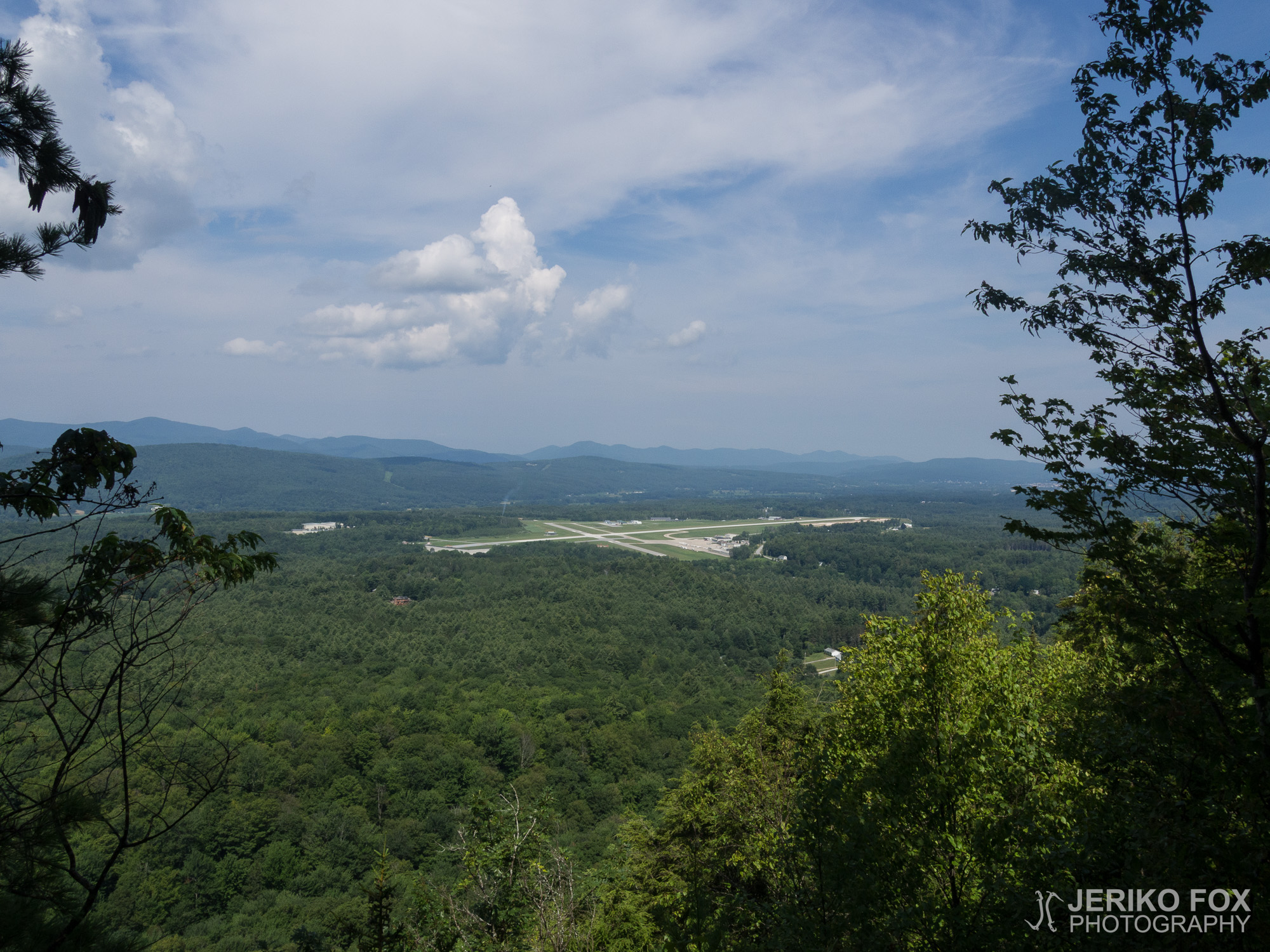
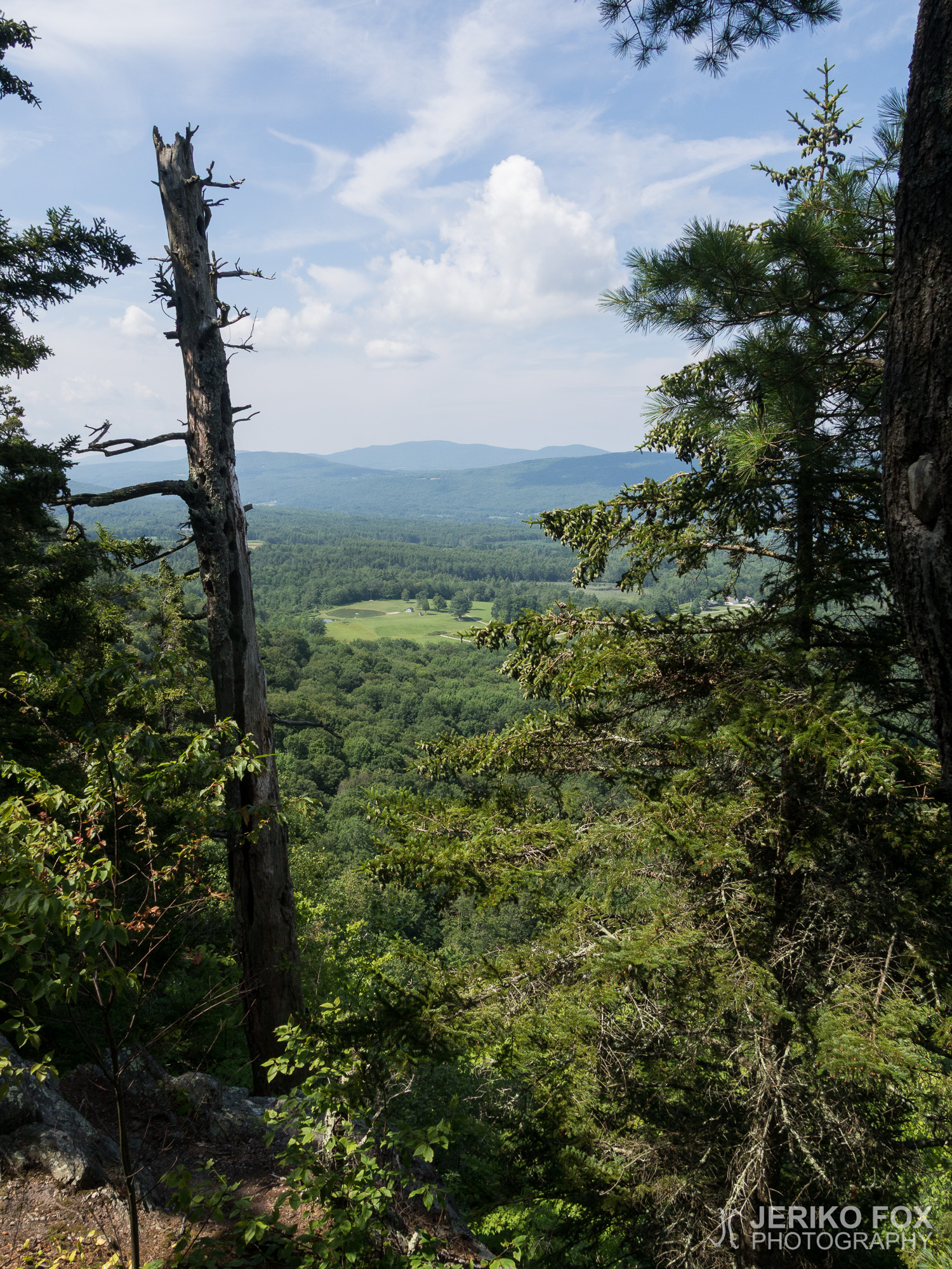
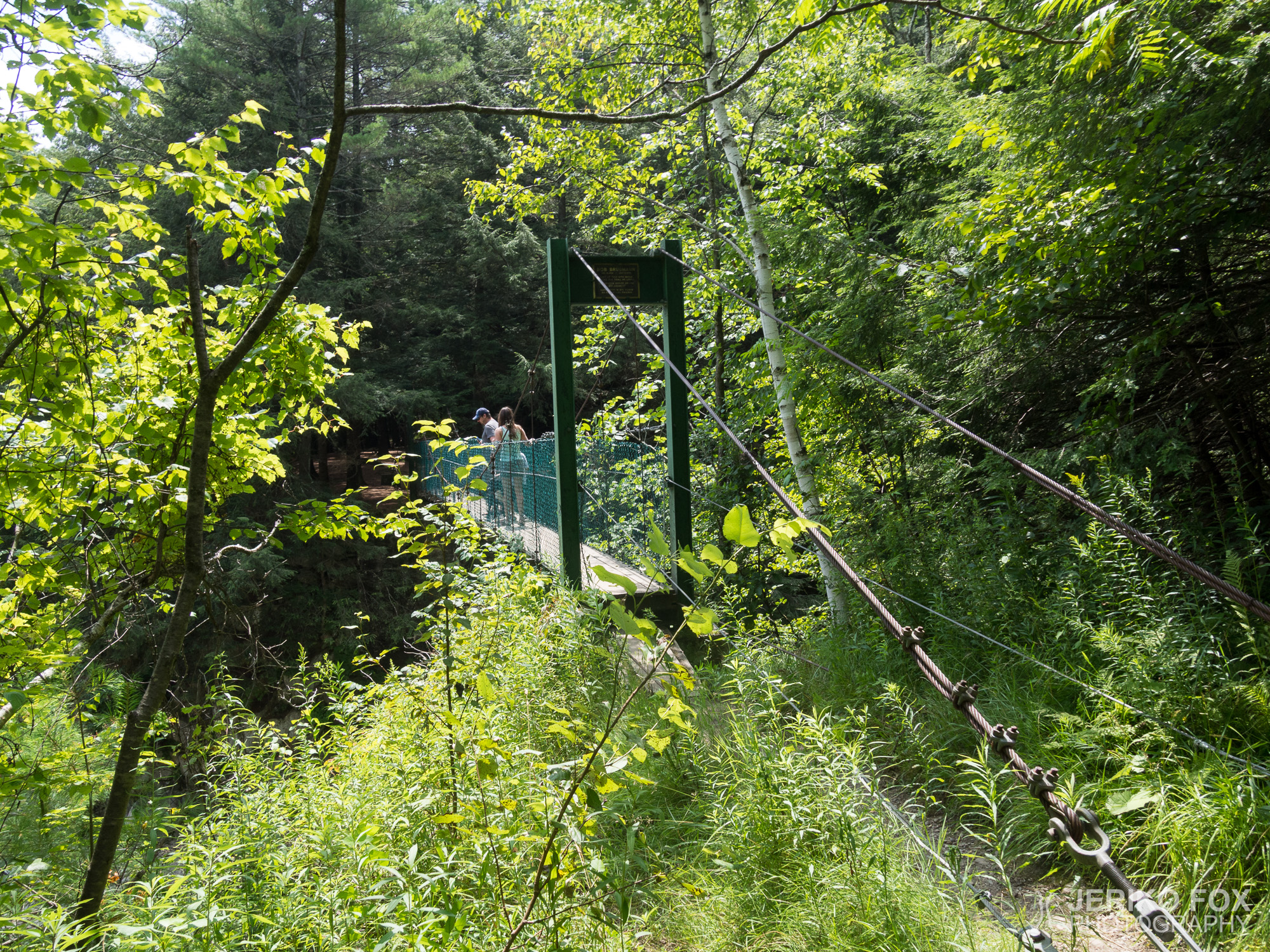
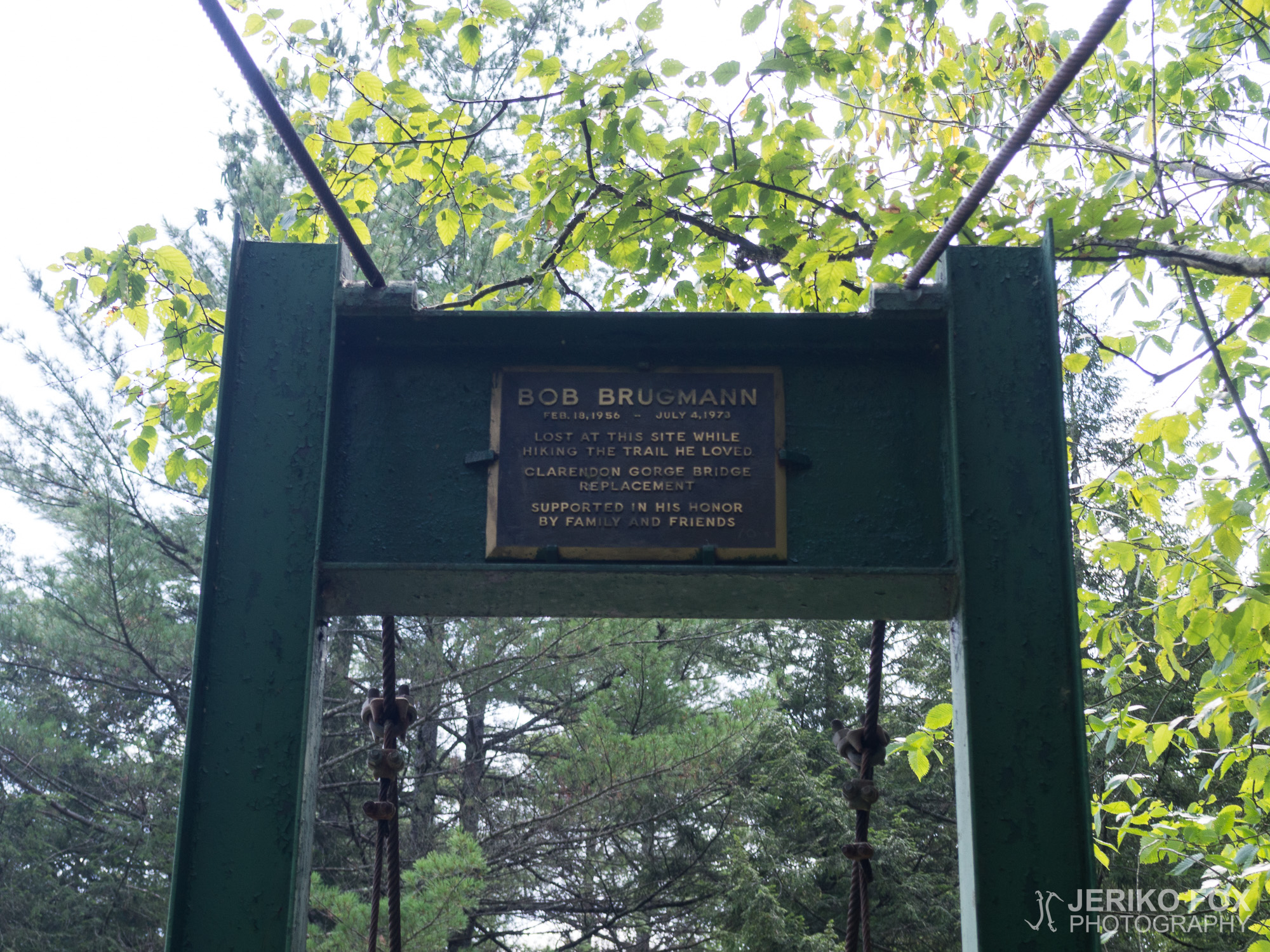
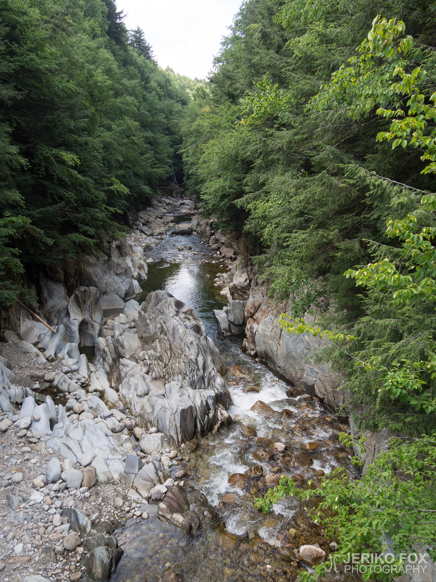
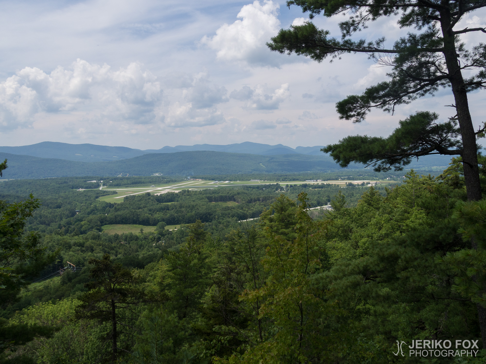
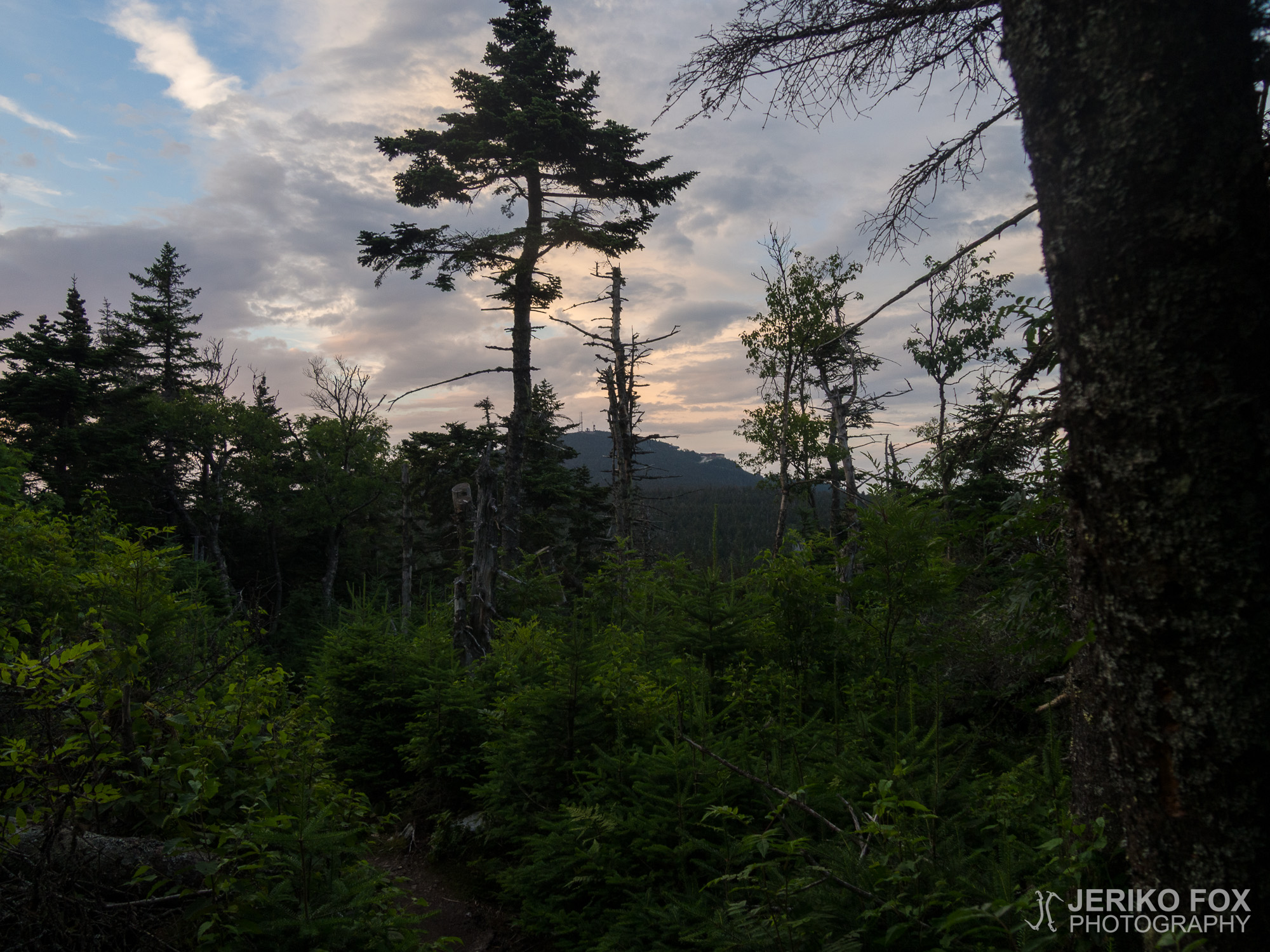
Before my descent to Clarendon Gorge a beautiful view opened up from the outcrop to Rutland airport. This view was repeated later from another angle as I climbed back up. Clarendon Gorge itself was an impressive place. A delicate, and thus very shaky bridge crossed Mill River. Below among the rocks the river flowed with strength, while still leaving a calm pocket under the bridge. A woman with two children was down there swimming and they waved at me. I would have wanted to take a dip in the increasing heat myself, but as it’s often said on the AT “the trail is not going to hike itself”.
So ahead of me was a day that kept getting more and more sweaty, and mainly uphill. My hope in climbing Killington started to fade or at least I suspected that I would have to hike in the dark. My progress was slow and tired.
I was surprised to see Delicate Flower coming toward me. He said he had spent the night in Rutland at a religious community run Yellow Deli, and had decided to do slack packing – hiking south with an empty backpack. He had taken a bus north and was now returning to Rutland for the next night. Well, a moment later Blue Ray came down the trail and I heard the same story. He also mentioned going to Killington’s village tomorrow for a zero, where I was also aiming for. So we would meet there.
I stopped on the edge of a charming stream – or rather on a sand bar in the middle of it – to have lunch. During lunch I was passed by southbound heading Bottles, Human, and Wild Flower. They all had the same story about Yellow Deli. Now this isn’t uncommon in any way that hikers practice slack packing and/or travel a portion in the opposite direction. To me, however, it is important on principle to carry all my stuff, and I consider it reasonable to go in the same direction the whole time.
I stopped for a short bit at Governor Clement Shelter at the base of Killington mountain. I had heard from my soutbound friends that the climb would be arduous and that’s what it looked like on the contour map too: five kilometers and 600 vertical meters. After that would be another couple of kilometers to the peak shelter. I wasn’t convinced that I would make the entire climb before dark, not to mention all the way to the shelter.
As I left the shelter the AT showed its tendency to offer solutions to problems again. I had lost a carabiner yesterday, because my food bag rope had gotten stuck. This carabiner had served not only on my food sack, but also to hold my camera during the day. Now I saw a carabiner on the ground that someone had dropped, and I picked it up.
The cooling temperature of the evening helped in my climb. The slope wasn’t quite as steep as I had expected either. Of course the path was narrow and in many places a mess of rocks and roots. But in the end I was surprised at how easy the climb up was, even though I was quite drained from the heat during the day.
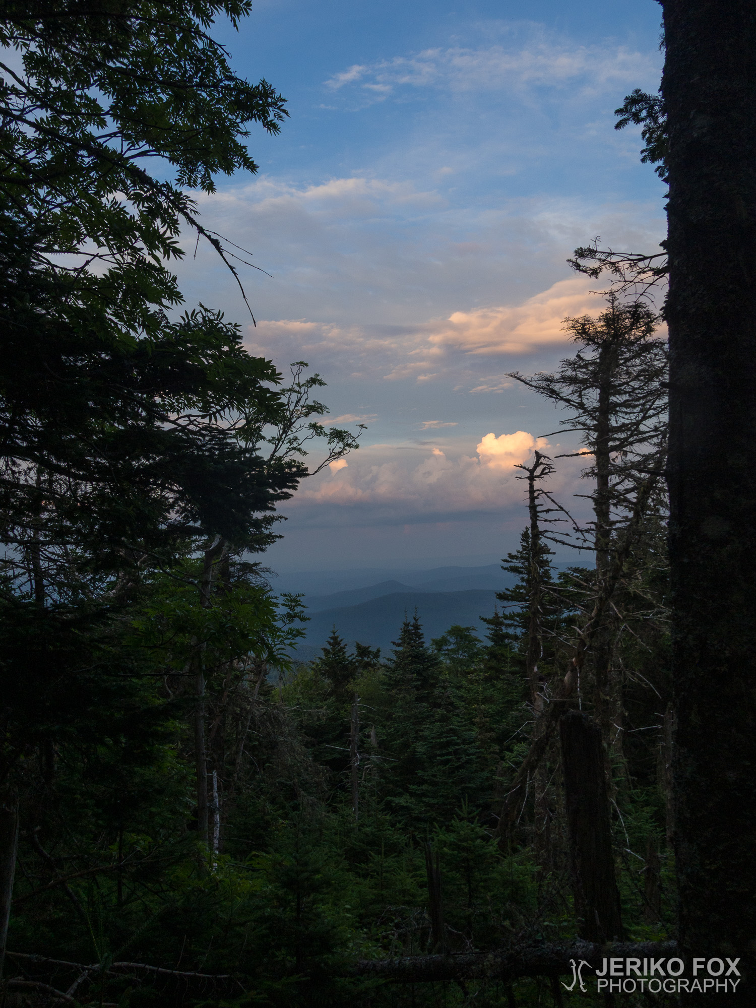
Exactly at eight I came to the summit and saw a very cozy tent spot next to me. There was about fifteen minutes to susnset, so I had defeated the uphill just in time. There was no reason to start walking to the shelter two kilometers away, so I decided with a good conscience to leave that until tomorrow. I thought that the contentment in the achievements of the day weren’t as much in the number of miles, as in beating oneself. It feels the best when one realizes having achieved something thought to be unachievable.
As I sat down to dinner I heard the same crunching sound as last night. Like someone eating a carrot. There were all kinds of tree carcasses around me, so I pondered whether the bugs’ tree disintegration work would really make this loud of a sound, that a human clearly hears it, or whether it was actually some kind of a small mammal.
Puu ei ollut kaatunut yöllä päälleni ja söin kylmää pikapuuroani lämpimässä aamussa. Pakatessani tavaroitani huomasin lähellä olevan pystyyn kuolleen puun pinnalla paljon pieniä kovakuoriaisia. Menin katselemaan niitä lähempää ja huomasin erään herrakuoriaisen yrittävän jokseenkin epätoivoisesti päästä parittelemaan rouvakuoriaisen kanssa. Jäin seuraamaan tätä näytelmää niin pitkäksi ajaksi, että aloin tuntea itseni lopulta vähän oudoksi.
Tähtäimessä oli noin 14 mailin matka Killington-vuoren laelle. Vaikka aamun ensimmäinen vaellustunti meni reippaasti, sen jälkeen tahti alkoi hyytyä kääntäen verrannollisesti suhteessa päivän kuumenemiseen. Ilma oli nihkeä ja painostava. Vaeltaminen tahmeaa.
Edellisen kamerani mentyä rikki Kunkletownissa olin kohdannut ongelmia myös uuden kamerani kanssa. Sulkija jäi usein kameran käynnistyessä jumiin ja yhden valokuvan saaminen muuttui työlääksi prosessiksi. Aina välillä piti purkaa kamera osiin ja joskus se auttoi ja joskus ei. Saadessani viimein kännykkään hieman paremmin kenttää viestittelin serkkuni kanssa ongelmasta ja hän lupasi selvittää reklamointia. Todennäköisesti edessä olisi taas uuden kameran hankinta.
Ennen laskeutumistani Clarendon Gorgeen avautui kalliolta upea näkymä Rutlandin lentokentälle. Tämä näköala toistui myöhemmin toisesta kuvakulmasta noustessani taas ylös. Clarendon Gorge itsessään oli näyttävä paikka. Mill Riverin yli kulki hentorakenteinen ja siten reilusti keinahteleva riippusilta. Alhaalla kallioiden välissä joki virtasi voimakkaana jättäen kuitenkin sillan alle tyynen taskun. Siellä oli uimassa nainen kahden lapsen kanssa ja he vilkuttivat minulle. Olisin kuumenevassa säässä halunnut itsekin pulahtaa uimaan, mutta kuten AT:lla usein sanotaan “the trail is not going to hike itself”, polku ei vaella itse itseään.
Niinpä edessäni oli aina vain hikisemmäksi muuttuva päivä ja pääasiassa ylämäkeä. Uskoni Killingtonin nousemisesta alkoi hiipua tai ainakin epäilin joutuvani vaeltamaan pimeässä. Kulkuni oli hidasta ja väsynyttä.
Yllätyin kun näin vastaani tulevan Delicate Flowerin. Hän kertoi olleensa yötä Rutlandissa uskonnollisen yhteisön ylläpitämässä Yellow Delissä ja päättäneensä tehdä slack packingia eli vaeltaa tyhjällä repulla eteläänpäin. Hän oli siis mennyt bussilla pohjoisemmas ja nyt palasi seuraavaksi yöksi Rutlandiin. No, hetkeä myöhemmin vastaan tuli Blue Ray ja sain kuulla saman tarinan. Lisäksi hän mainitsi olevansa menossa huomenna zerolle Killingtonin kylään, jonne olin itsekin tähtäämässä huomenna yöksi. Tapaisimme siis siellä.
Jäin erään viehättävän virran rantaan – tai oikeammin sen keskellä olevalle hiekkasärkälle – pitämään lounastaukoa. Sen aikana ohitseni eteläänpäin kulkivat vielä Bottles, Human ja Wild Flower. Kaikilla sama tarina Yellow Delistä. Tämä ei siis ole mitenkään poikkeuksellista, että vaeltajat harrastavat slack packingia tai/ja kulkevat osion vastakkaiseen suuntaan. Itselleni on kuitenkin periaatteen tasolla tärkeää kantaa kaikki tavarani ja pidän mielekkäänä edetä koko ajan samaan suuntaan.
Pysähdyin lyhyesti Governor Clement Shelterillä Killington-vuoren juurella. Olin kuullut etelään kulkevilta ystäviltäni, että nousu olisi työläs ja siltä se näytti korkeuskäyrälläkin: viisi kilometriä ja 600 metriä vertikaalia. Sen perässä oli vielä parin kilometrin huippuharjanne shelterille. En ollut vakuuttunut, että pääsisin koko ylämäkeä ennen pimeää, saati sitten shelterille asti.
Lähtiessäni shelteriltä AT osoitti taas taipumustaan tarjota ratkaisuja ongelmiin. Olin eilen menettänyt sulkurenkaan, kun ruokasäkkini naru jäi jumiin puuhun. Tämä sulkurengas oli palvellut sekä iltaisin ruokasäkin ripustamiseen että päivisin kameran kiinnitysvälineenä. Nyt näin polulla jonkun pudottaman sulkurenkaan ja poimin sen mukaani.
Illan viileneminen auttoi nousussa. Eikä rinnekään ollut aivan niin jyrkkä kuin olin odottanut. Toki polku oli kapea ja monin paikoin kivien ja juurakoiden muodostama sotku. Lopulta yllätyin miten hyvin nouseminen onnistui, vaikka olin ollut aika uupunut kuumuudesta päivällä.
Tasan kahdeksalta tulin huippuharjanteelle ja näin vieressäni todella viihtyisän telttapaikan. Auringonlaskuun oli noin vartti aikaa, joten olin selättänyt ylämäen juuri ideaalissa ajassa. Ei ollut mitään syytä lähteä kävelemään kahta kilometriä shelterille, joten jätin sen hyvällä omatunnolla huomiselle. Ajattelin, että tyytyväisyys päivän saavutuksiin ei ole niinkään mailimäärässä kuin itsensä ylittämisessä. Parhaalta tuntuu kun huomaa pystyneensä johonkin, mihin ei odottanut pystyvänsä.
Istuessani illallisen ääreen kuulin taas tuon saman narskutuksen kuin eilenkin. Sellainen ääni kuin joku söisi porkkanaa. Lähellä oli kaikenlaisia puun raatoja, joten jäin pohtimaan voisiko ötököiden puunhajoitustoimista oikeasti kuulua niin voimakas ääni, että sen ihminenkin selvästi kuulee, vai oliko kyseessä kuitenkin joku pikkunisäkäs.
Max elevation: 1179 m
Total time: 09:57:29