
10,45 km (6.5 miles)
1915.5 / 2189.8 miles
Stealth campsite, ME
As I was taking down the tent a group of young adults came to the state line. They stayed to have a break and one of them came to ask me if the trail was going to this direction. I found the question a little bit strange, because the AT continued clearly completely straight. I pointed him the right way.
After hiking a while I met a SOBO, who asked with a foreign accent if the last shelter was far. I said that I didn’t spend the night at the shelter and passed it yesterday, so I didn’t pay much attention to it. “One mile, two miles?” he kept on asking. “Certainly more.” This conversation seemed somehow strange too, but it got even stranger when I hiked on and saw a sign saying that the shelter was more than five miles away. Either he didn’t pay any attention to the signs or he had very poor sense of distance.
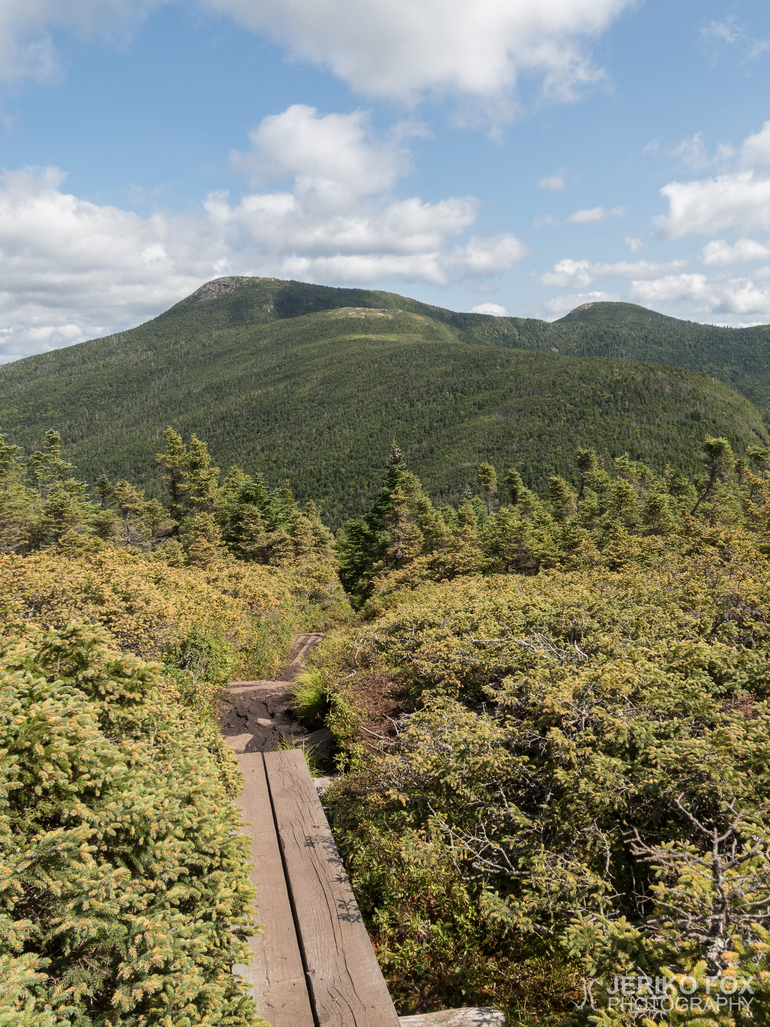
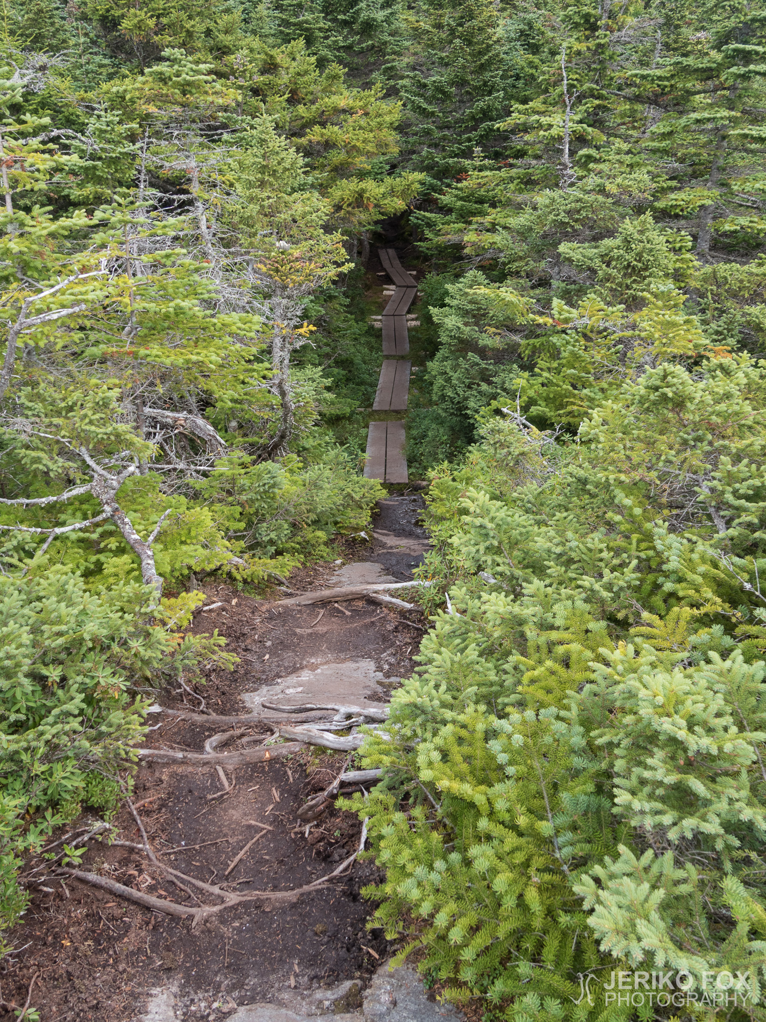
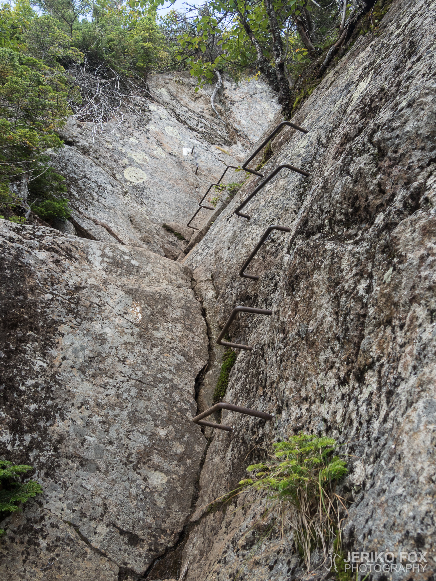
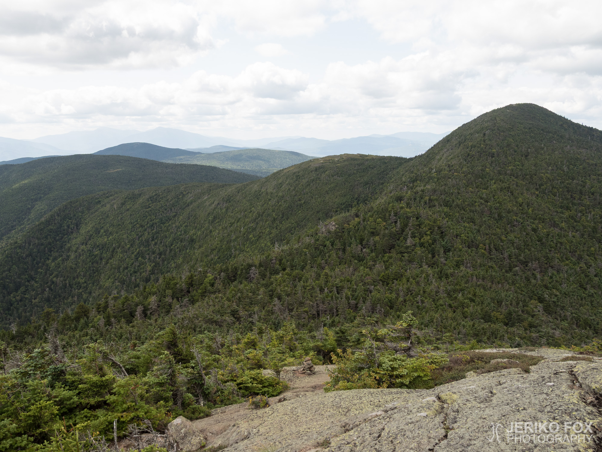
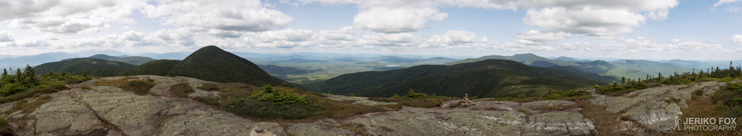
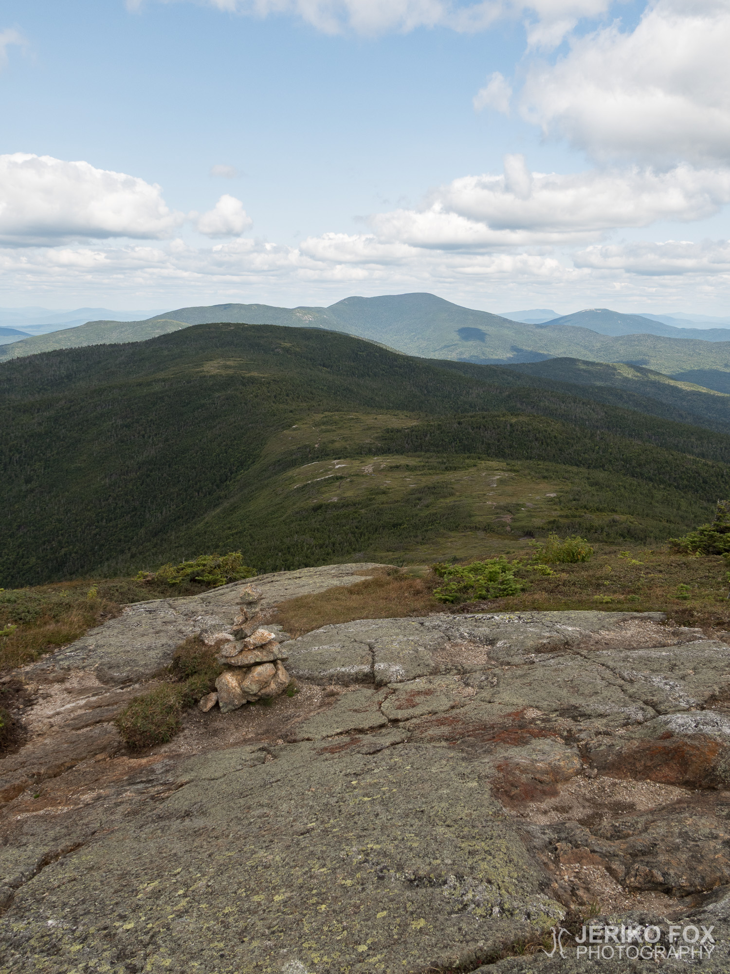
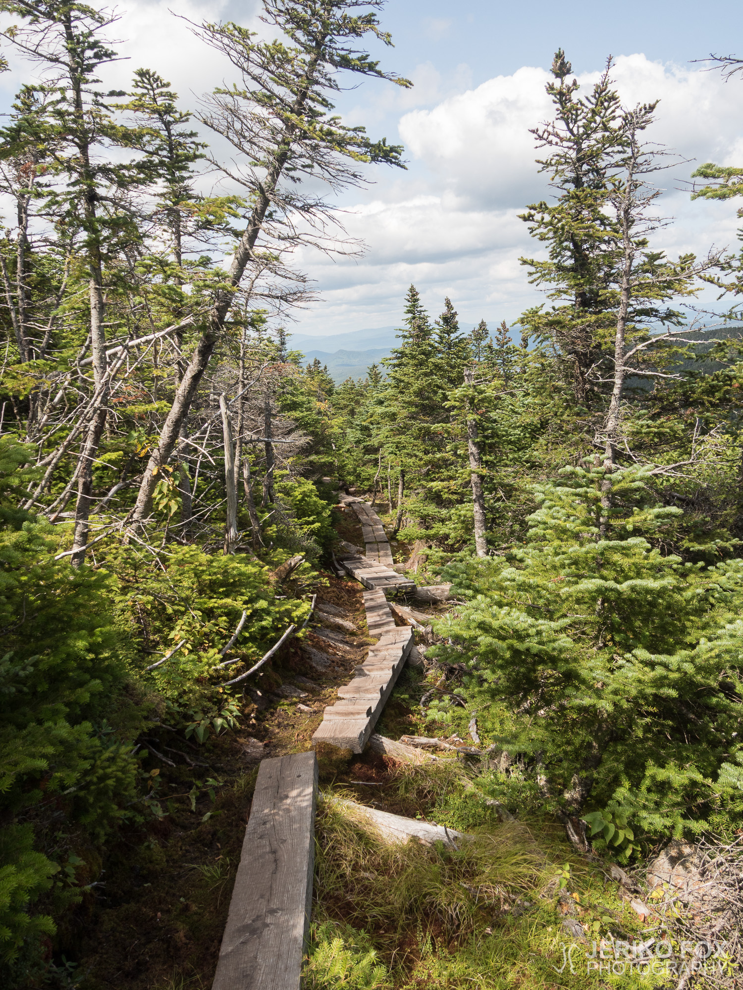
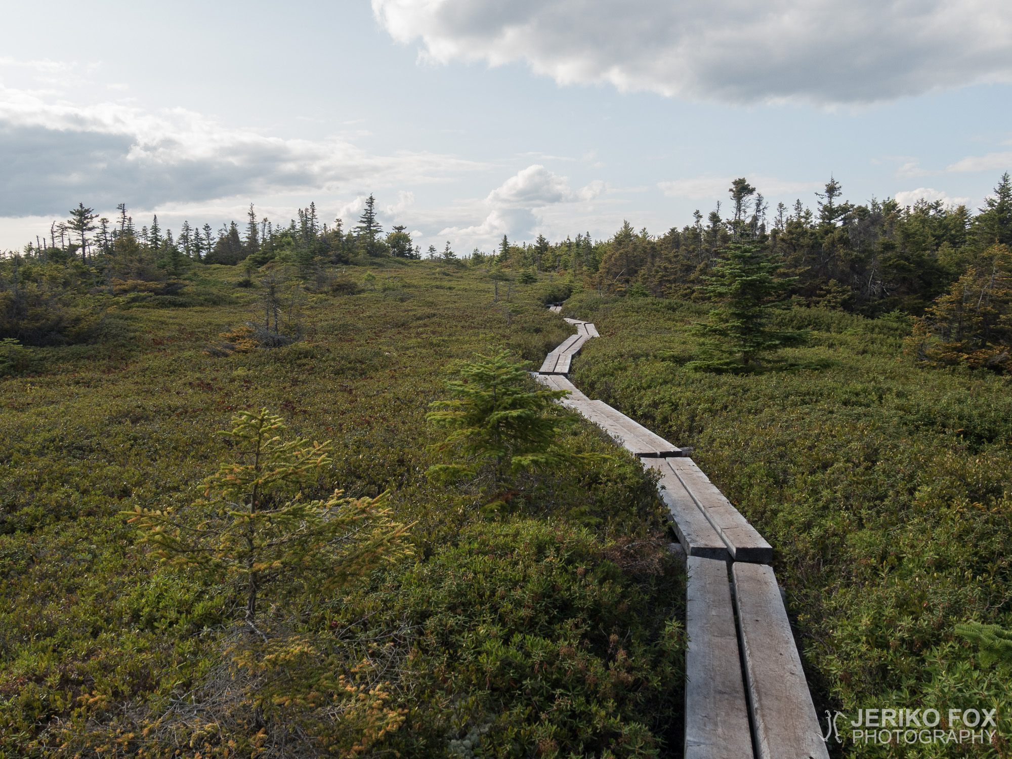
The day was getting warmer as I first traversed the Mount Carlo and then the three summits of Goose Eye Mountain. The terrain kept changing between wetlands and steep rock. This combination made hiking very slow. When you first walk in the mud and then try to climb up or down a steep rocky slope, there is no space for errors with the muddy shoes. I was trying to move very carefully, because slipping would have had me falling several meters (more than 10 ft) and there were more rocks beneath me. In some places there was rebar bolted in the rock like in via ferrata routes. Even on those I had to mind my muddy and thus slippery shoes.
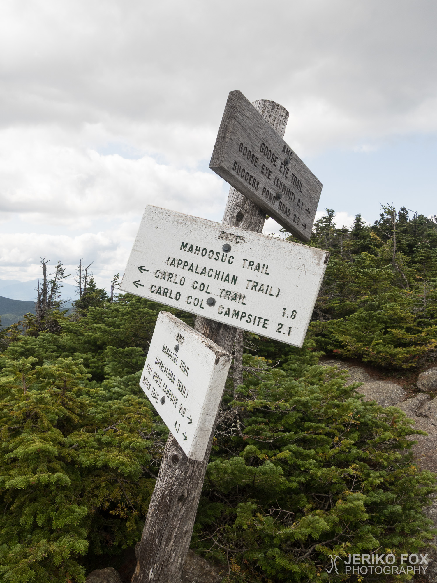
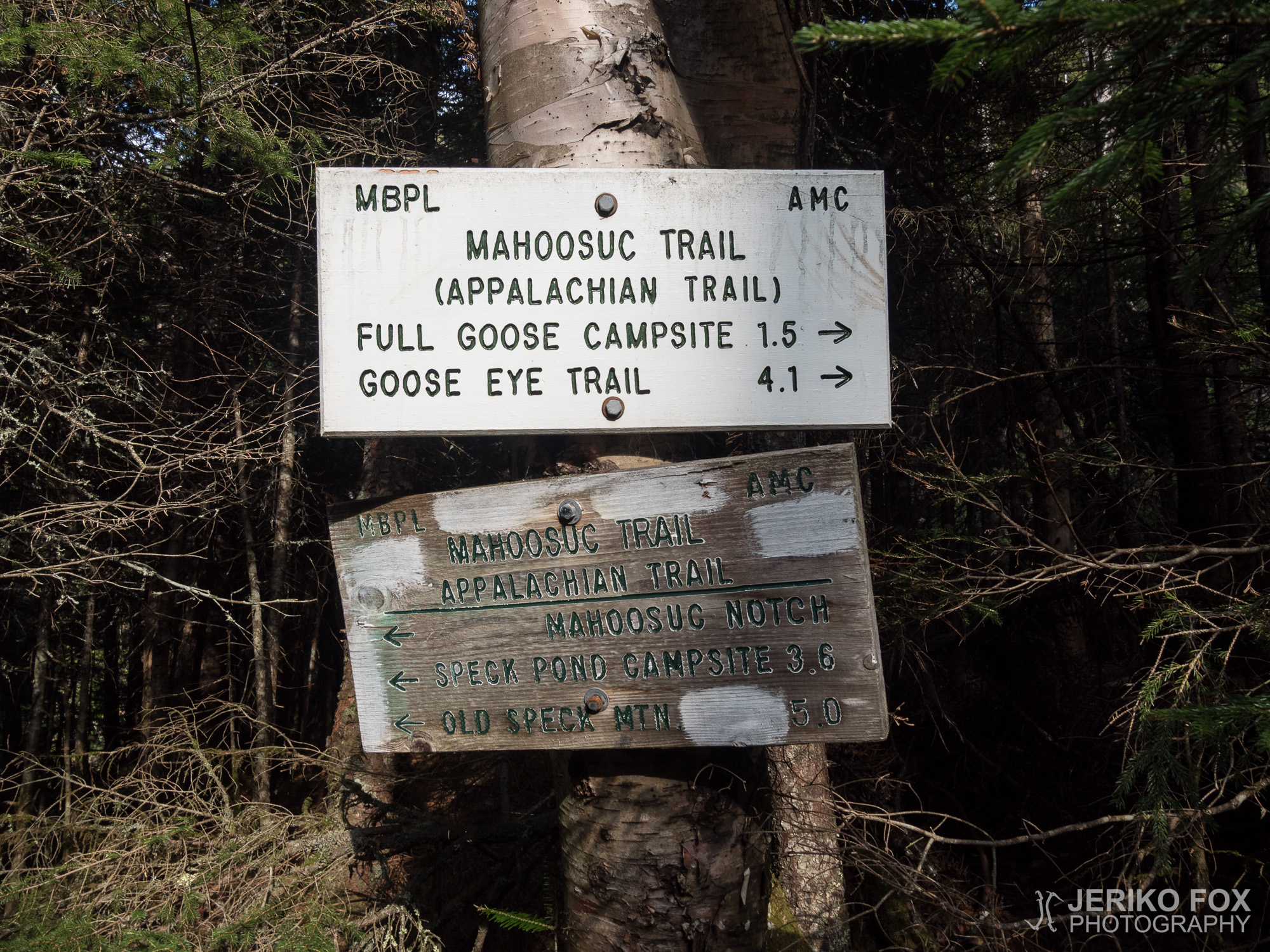
As I came to the Full Goose Shelter I saw an older couple putting up their tent. They told me that they decided to camp already, because they wanted to be well rested before the Mahoosuc Notch that was ahead of us. I went to get some water and found Kickstand filling his bottle. As he was already straddling the stream, he took my bladder too and filled it.
We sat for a while at the shelter to talk while I was eating my lunch. Kickstand said that he was heading to the tent site that was south from Mahoosuc Notch and going through the Notch first thing in the morning. Some SOBOs had told him that passing the Notch had taken them two hours and they had had to take off their packs eight times. Kickstand has a prosthetic leg and he suspected that he might need even more time. And very understandably he didn’t want to get stuck somewhere in the middle of the Notch when it comes dark.
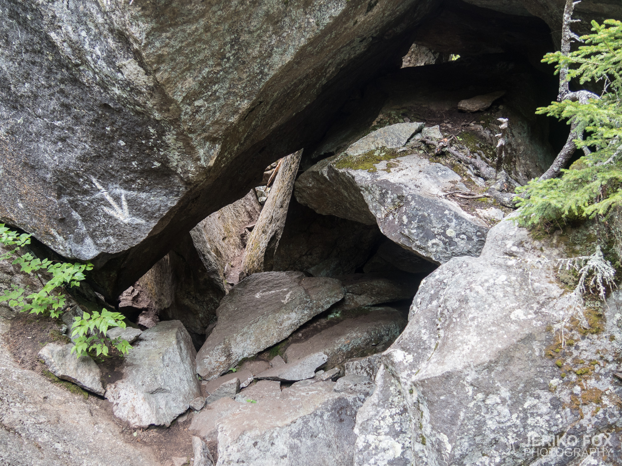
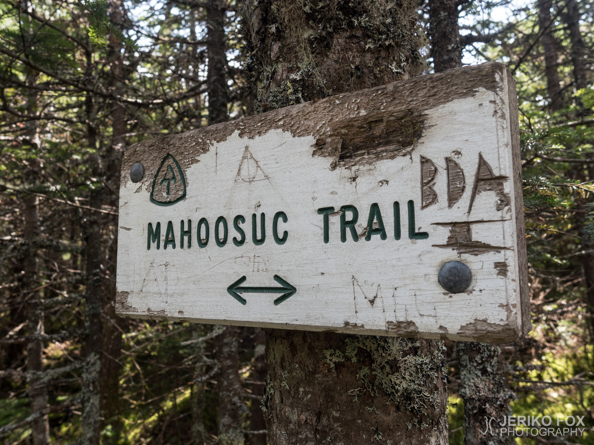
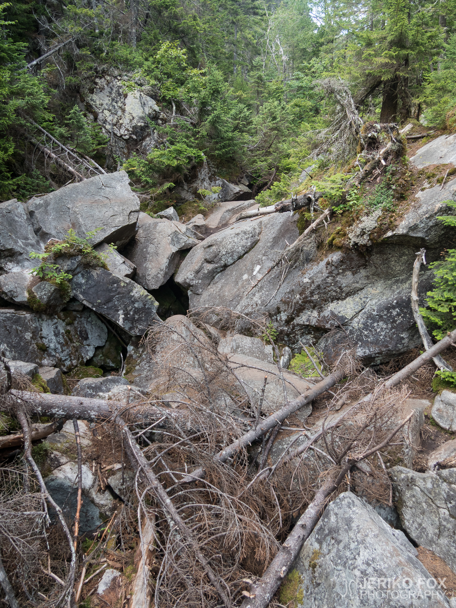
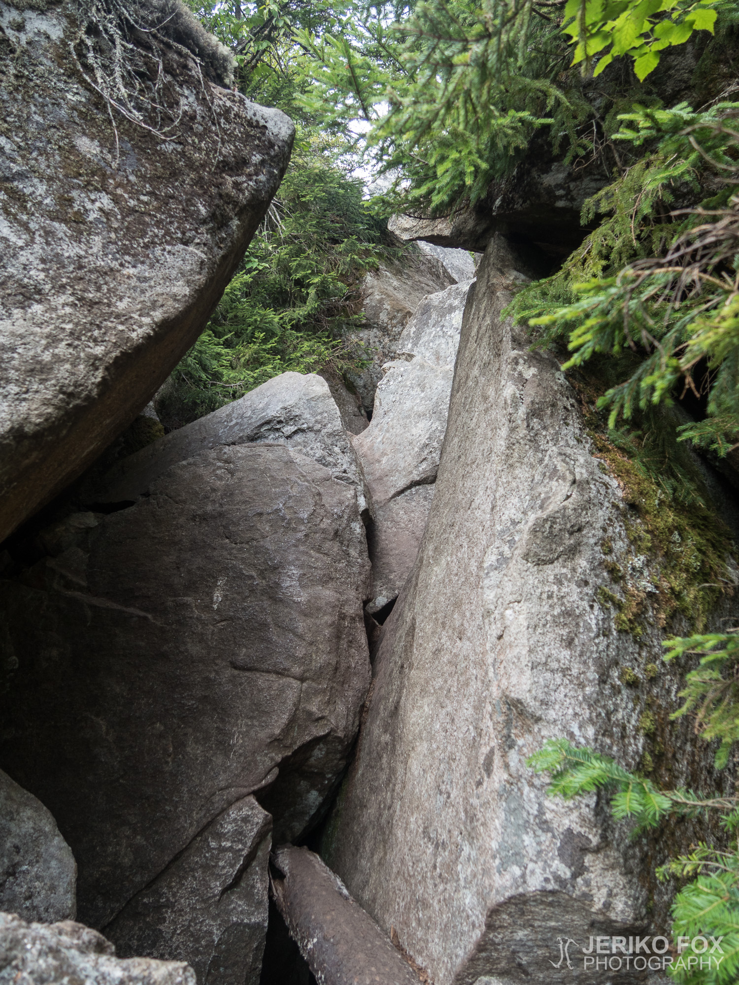
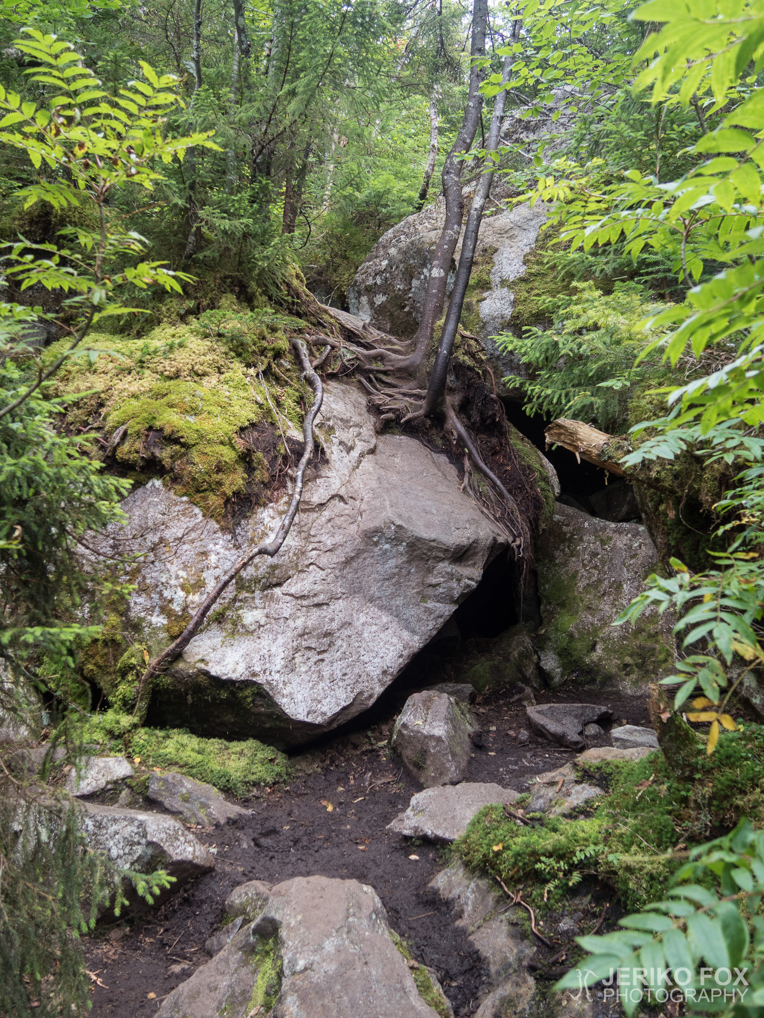
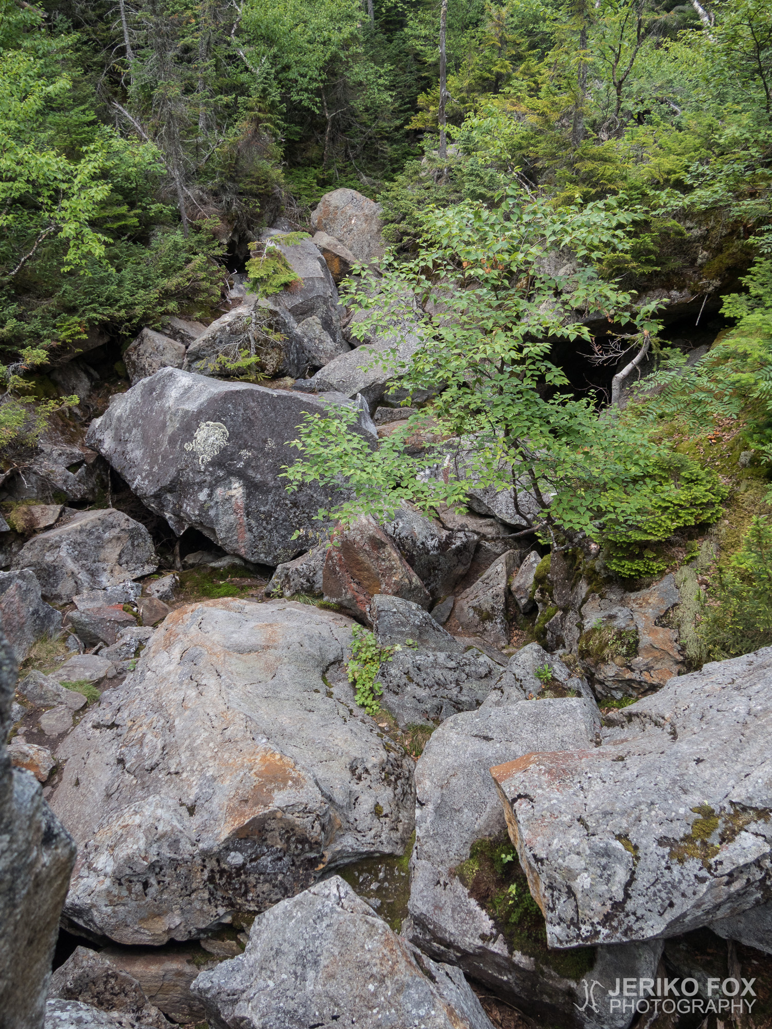
The Mahoosuc Notch is a mile long gorge that is full of huge boulders. Thru-hikers know it as “the most difficult mile” or as “the most fun mile”. The reason for this is that there really is no trail through this boulder maze, but the whole Mahoosuc Notch means just climbing up and down the boulders and squeezing through very narrow tunnels.
I had decided to go through the Notch in the evening and when I came to the beginning it was 5 pm. I would have three hours of light and I presumed that it should be enough.
I found out soon enough that the Mahoosuc Notch truly deserves its nicknames. I really got to climb and scramble and balance and reach in order to move forward. Between the boulders there were deep voids, where I didn’t want to fall. The progress was difficult, but also fun. Even though climbers always claim that being tall has its pros and cons, but I’m still quite convinced that longer limbs would really help.
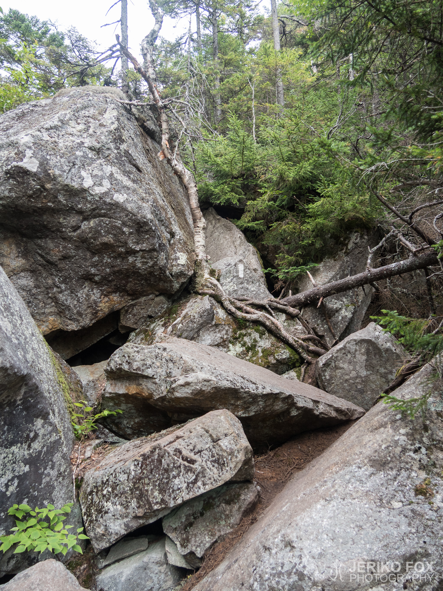
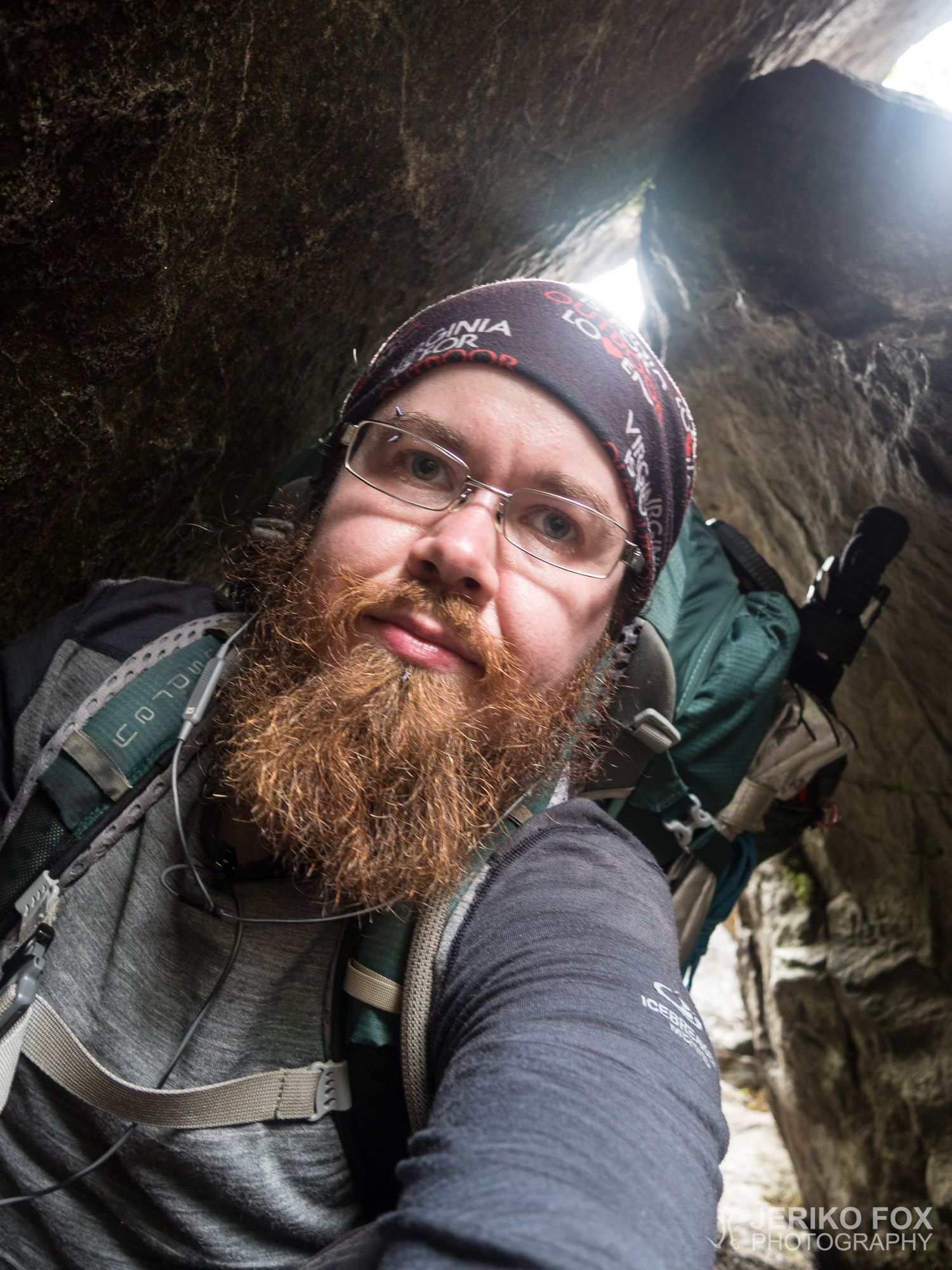
But there was something good about being short, too. The Mahoosuc Notch has three or four really tight tunnels. Even a slightly larger person can fit through without a backpack, but with the pack on it’s a whole different game trying to push through. I had decided to try to get through every tunnel with my pack on and if I got stuck, then I would take it off. And though my pack is not the smallest one (and the tent on top of it adds some width), my petite frame and flexibility compensated enough that I was able to squeeze myself through every tunnel with my backpack and everything. It made me feel triumphant in a silly way.
Because this day seemed to be all about strange conversations, I got to have one more in the Mahoosuc Notch, too. After an hour in the Notch I met two SOBOs with a dog. One of these young women was wondering how I’m starting the Notch so late in the evening. First I didn’t understand the question, but then I realised that they thought that they were already through it all. The women said that they had been in the Notch already at least two and half hours. I found it somehow tragicomical that SOBOs who weren’t quite sure of their own location were concerned of my schedule.
I reached the north end of the Mahoosuc Notch just in time when it was coming dark. I knew that there was a small tent site right after the Notch and a larger one couple hundred meters (about 0.2 mi) further. First I was thinking going to the second one, but as the first one seemed to have space, I thought that it would be nicer to have my tent set before it was completely dark.
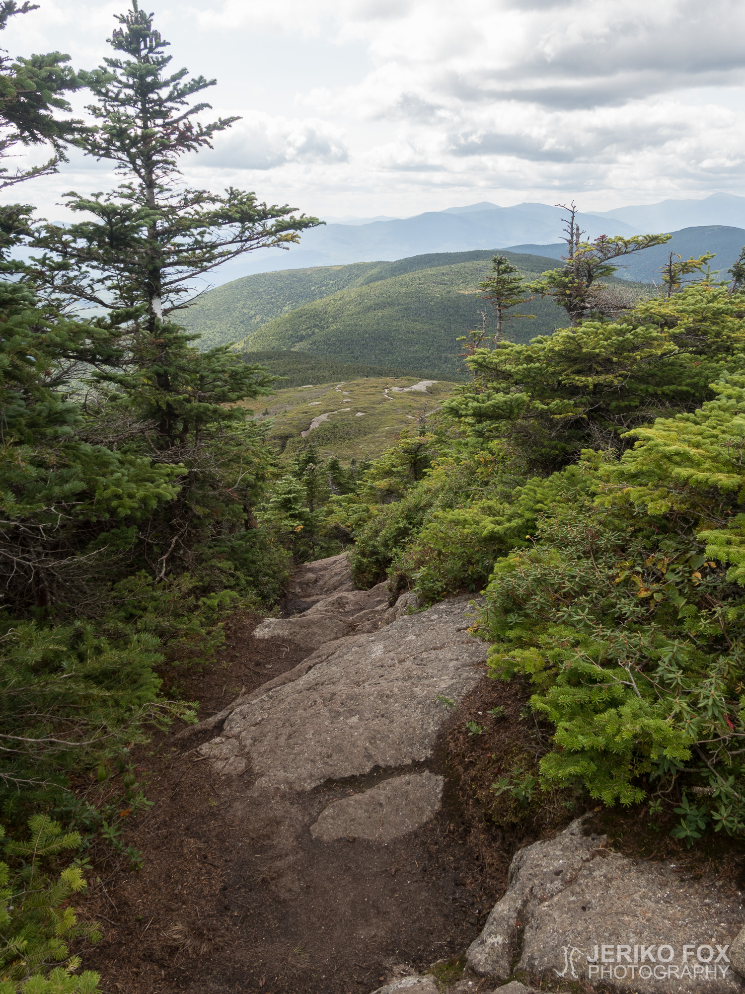
Past few days haven’t offered very significant mileages. I had expected to be able to hike faster after leaving the big mountains behind, but the challenging terrain has kept my pace quite moderate. In northern Maine, at least according to the elevation map, the trail should be more flat, so maybe I will still have the time to do the big miles.
Purkaessani telttaa ilmestyi vieressä olevalle osavaltion rajalle joukko nuoria aikuisia. He jäivät pitämään taukoa ja yksi tuli kysymään minulta, että meneekö polku tänne. Kysymys oli mielestäni kummallinen, koska AT jatkui täysin suoraan ja hyvin selkeänä. Osoitin hänelle polun suunnan.
Hetken vaellettuani tuli vastaan SOBO, joka kysyi ulkomaisella aksentilla oliko edellinen shelter kaukana. Sanoin, etten yöpynyt shelterillä eli ohitin sen eilen ja en siten kovin tarkkaan muista. “Maili? Kaksi mailia?” mies jatkoi kyselyään. “Varmasti enemmän.” Tämäkin keskustelu oli jokseenkin outo ja vielä oudommaksi se muuttui, kun hetken päästä näin kyltin, jossa luki edelliselle shelterille olevan yli viisi mailia. Joko mies ei lukenut kylttejä tai hänellä oli hyvin vääristynyt kuva kulkemastaan matkasta.
Kuljin lämpenevässä päivässä ensin Mount Carlon yli ja sitten kolmen Goose Eye Mountainin huipun yli. Maasto oli vaihtelevasti joko kosteikkoa tai jyrkkää kalliota. Tämä yhdistelmä teki etenemisestä todella hidasta. Kun ensin kävelee mudassa ja sitten pitäisi kiivetä ylös tai alas jyrkkää kalliota, ei mudan liukastamilla kengillä ole varaa virheisiin. Liikuin hyvin varovaisesti, koska pudotukset olisivat olleet useita metrejä ja alla oli kivikkoa. Parissa kohdassa oli kallioon pultattu rautatangosta tehdyt tikkaat via ferrata -tyyliin. Niidenkin kohdalla piti tosin varoa mudassa liukkaaksi muuttuneita kenkiä.
Tullessani Full Goose Shelterille näin vanhemman pariskunnan teltanpystytyspuuhissa. He sanoivat päättäneensä leiriytyä jo nyt, koska halusivat lähteä levänneenä edessä olevaan Mahoosuc Notchiin. Mennessäni vedenottopaikalle kohtasin siellä pulloaan täyttävän Kickstandin. Seisoessaan jo valmiiksi virran yllä hän täytti samalla myös minun vesipussini.
Istuimme juttelemassa shelterillä hetken minun syödessä lounastani. Kickstand sanoi aikovansa vaeltaa Mahoosuc Notchin eteläpäässä olevalle teltta-alueelle ja menevänsä Notchin läpi aamulla. Hän oli kuullut SOBOilta, että he olivat kulkeneet Mahoosuc Notchia kaksi tuntia ja joutuneet ottamaan reput pois kahdeksan kertaa. Kickstandilla on sääriproteesi, joten hän epäili tarvitsevansa enemmän aikaa ja ymmärrettävästi ei halunnut jäädä jumiin Notchiin pimeällä.
Mahoosuc Notch on siis mailin pituinen sola, joka on täynnä valtavia kivenjärkäleitä. Se tunnetaan läpivaeltajien keskuudessa nimillä “the most difficult mile”, vaikein maili, tai “the most fun mile”, hauskin maili. Tämä johtuu siitä, ettei tuon boulderisokkelon läpi kulje juurikaan minkäänlaista polkua, vaan koko Mahoosuc Notchin läpi pitää kiivetä ylös ja alas kivenjärkäleitä sekä tunkea läpi hyvin ahtaista tunneleista.
Olin itse päättänyt lähteä Mahoosuc Notchiin vielä illalla ja saapuessani solan alkuun kello oli vähän yli viiden. Minulla olisi noin kolme tuntia valoisaa aikaa, minkä arvelin riittävän.
Mahoosuc Notch osoittautui hyvin nopeasti nimitystensä arvoiseksi. Sain todellakin kiivetä ja kavuta ja tasapainotella ja kurotella päästäkseni etenemään. Lohkareiden välissä näkyi syviä aukkoja, jonne en halunnut pudota. Eteneminen oli vaikeaa, mutta myös hauskaa. Vaikka kiipeilyssä aina väitetään, että pituudesta voi olla sekä hyötyä että haittaa niin nyt kuitenkin väittäisin paremman ulottuvuuden helpottavan kummasti.
Jotain hyötyä oli kuitenkin pienuudestanikin. Mahoosuc Notchissa on kolme tai neljä todella tiukkaa tunnelia. Vähän isompikin ihminen mahtuu niistä kyllä ilman reppua, mutta repun kanssa läpi tunkeminen onkin aivan toinen juttu. Olin päättänyt yrittää mennä kaikista tunneleista läpi reppu selässä ja irroittavani sen jos jäisin jumiin. Vaikka reppuni ei ole pienimmästä päästä (ja ulkopuolelle kiinnitetty teltta tuo vähän lisäleveyttä), oma pienikokoisuuteni ja toisaalta joustavuuteni kompensoi siinä määrin, että pääsin kuin pääsinkin joka paikasta läpi reppuineni kaikkineni. Tunsin tästä jotenkin hupsua voitonriemua.
Koska päivään kuuluivat kummalliset keskustelut, sain käydä vielä yhden sellaisen Mahoosuc Notchissakin. Kuljettuani vajaan tunnin Notchia tuli vastaan kaksi SOBOa koiran kanssa. Nuorista naisista ensimmäinen ihmetteli miten aloitan Notchin näin myöhään. En ensiksi ymmärtänyt kysymystä, mutta sitten tajusin heidän luulevan olevansa jo läpi. Naiset sanoivat kulkeneensa Notchia jo ainakin kaksi ja puoli tuntia. Minusta oli hieman surkuhupaisaa, että omasta sijainnistaan tietämättömät SOBOt olivat huolissaan minun aikataulustani.
Tulin Mahoosuc Notchin pohjoispäähän juuri sopivasti hämärän alkaessa laskeutua. Tiesin heti Notchin jälkeen olevan pienen telttapaikan ja muutaman sadan metrin päässä isomman. Ajattelin aluksi mennä jälkimmäiselle, mutta kun ensimmäiselläkin oli tilaa niin päätin kuitenkin olevan mukavampi pystyttää teltta ennen kuin olisi täysin pimeää.
Lähipäivät eivät ole tarjonneet kovin kummoisia mailimääriä. Olin odottanut vähän parempaa vauhtia isoimpien vuorien jäätyä taakse, mutta maaston haasteellisuus on pitänyt tahtia hyvin maltillisena. Pohjoisemmassa Mainessa ainakin korkeuskäyrän perusteella on kuitenkin tasaisempaa, joten ehkä niitä isoja maileja ehtii vielä tehdä.
Max elevation: 1176 m
Total time: 10:03:15
[…] that has created a steep scarp into a rocky gorge. The landscape beneath me reminded me from the Mahoosuc Notch in the AT. Fortunately I didn’t have to go down there, because the trail took an easier route […]