

Elevation: 3798 m
Prominence: 2423 m
Location: Carinthia / East Tyrol, Austria
Range: Hohe Tauern
Climb
Fox and Dima Tsvetkov
30.-31.07.2013
7 h 59 min + 12 h 14 min
Ascent and descent hiking, glacier traveling, via Ferrata climbing, snow climbing and ridge climbing
PD, glacier 35°, UIAA II
Lucknerhaus (1924 m), Lucknerhütte (2242 m), Ködnitzkees glacier, Burgwartscharte via Mürztalersteig, Erzherzog Johann Hütte (3454 m) / Classic route, Bahnhof (3560 m), Glocknerleitl, Sattele (3680 m), Kleinglockner (3783 m), Großglockner (3798 m)
Classic route, Großglockner (3798 m), Kleinglockner (3783 m), Sattele (3680 m), Glocknerleitl, Bahnhof (3560 m), Erzherzog Johann Hütte (3454 m), Ködnizkees glacier, Stüdlhütte (2802 m), Lucknerhütte (2242 m), Lucknerhaus (1924 m)
ÖAV Alpenvereinskarte 40 Glocknergruppe, 1:25 000
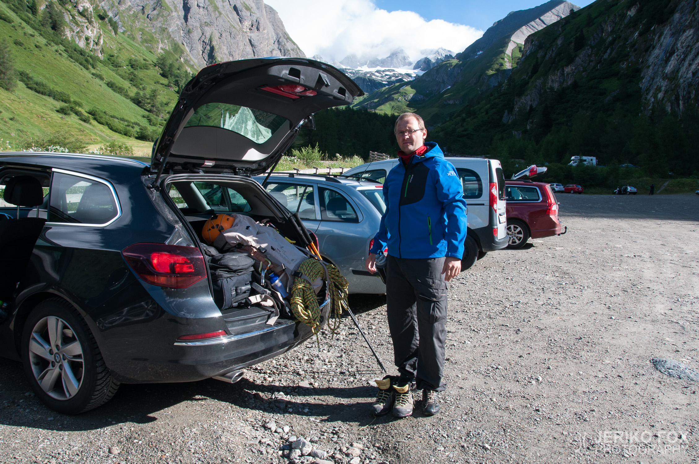
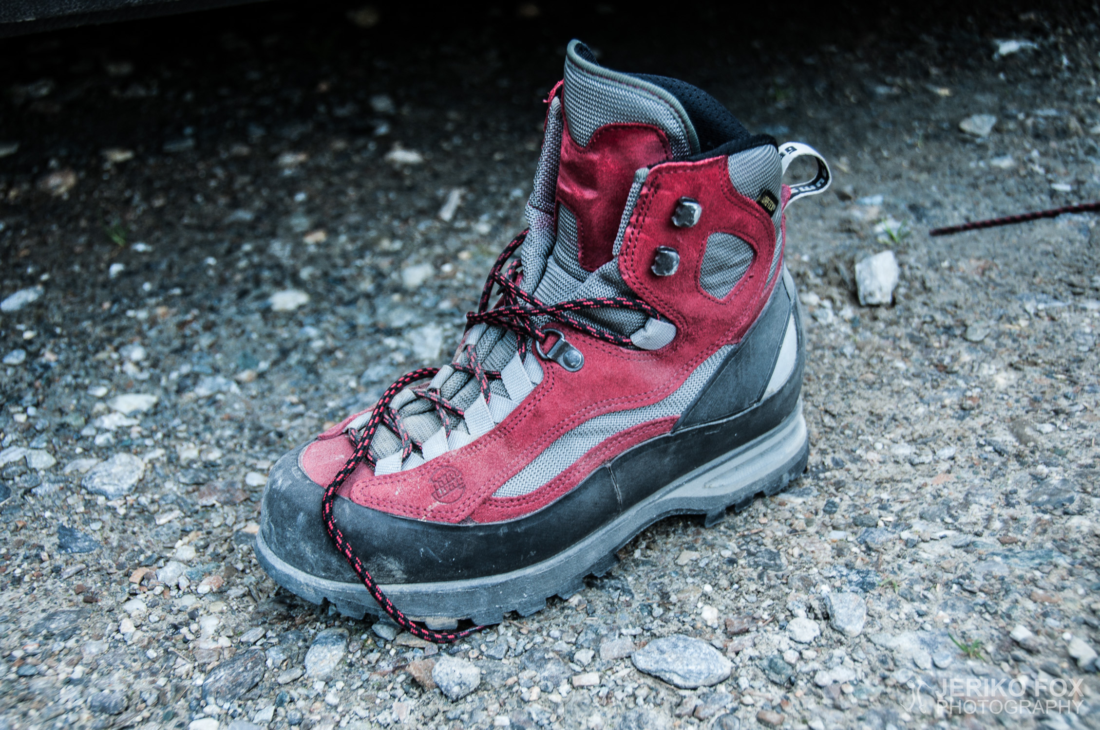
Semi-rigid boots, synthetic base layer, fleece shirt, soft shell, hard shell jacket (not used), warm gloves, skull cap, harness, slings and carabiners, grigri (not used), 50m dynamic rope, helmet, trekking poles, crampons, ice axe
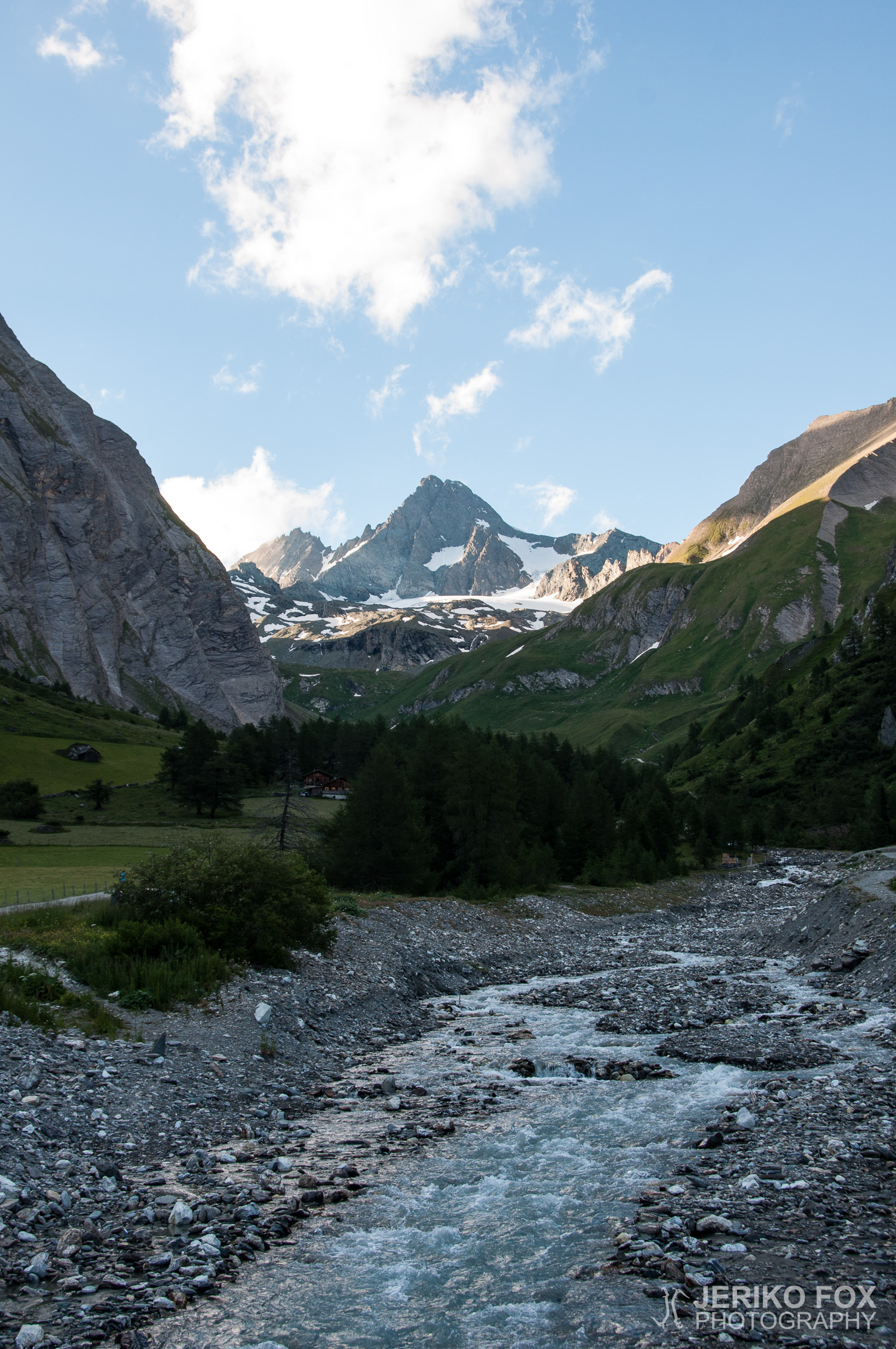
Großglockner is Austria’s highest mountain, which can be approached from the west via the village of Kals am Großglockner or from the east via Heiligenblut am Großglockner. The former route includes the easiest and most commonly used normal route, while the latter requires crossing the vast Pasterze Glacier, which is not recommended in summer due to large crevasses. Considering these factors, it was clear that our route would go through Kals am Großglockner. I had never climbed above 3000 m (10 000 ft) before, nor tackled a mountain of this difficulty, so this was a significant experience for me. Additionally, the risk of altitude sickness increases noticeably above 3000 m (10 000 ft), and from there on it is generally recommended not to increase sleeping altitude by more than 500 m (1600 ft) per day. Sensitivity to altitude sickness varies greatly between individuals, and the only way to find out is by ascending to high altitudes. For this reason, this was an important trial for the future of my climbing pursuits.
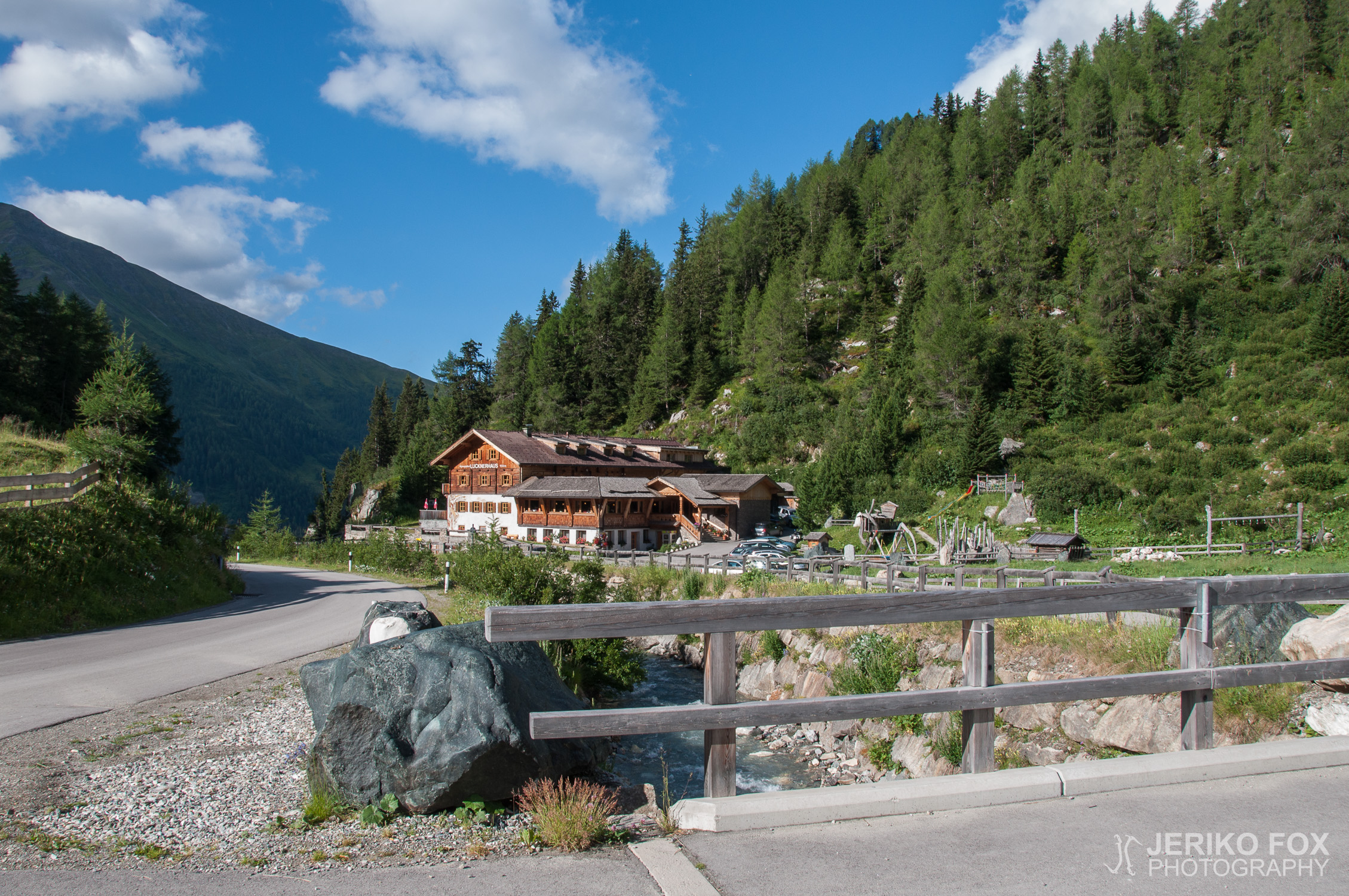
Driving south from Kitzbühel towards Kals requires passing through the long Felbertauernstrasse Tunnel. At the tunnel’s southern exit, there is a toll fee of 10 € for cars. Turning east towards Kals, the road ascends steeply, as the village itself sits at an elevation of 1324 m (4343 ft). A few kilometers before the village, there is a small rest area by a waterfall, where we spent the night in our car. In the morning, we drove a short distance to Kals and continued directly along the Kalser Glocknerstrasse towards Lucknerhaus at 1924 m (6312 ft). This road also has a 10 € toll fee. Lucknerhaus is a small hotel and the starting point for the Großglockner route. There is a large free parking lot next to the hotel, with a designated long-term parking area at the back.
We started hiking around 9:00 AM, carrying our gear uphill towards Lucknerhütte at 2242 m (7355 ft), where we had breakfast. Below Lucknerhütte, the path is more like a nature trail with information boards, but after that, it narrows into a smaller track as we entered the Hohe Tauern National Park. Shortly after, at 11:00 AM, we turned off the normal route onto a steeper trail leading partly along the southern Burgwartscharte ridge, known as Mürztalersteig. Traffic on this route was much lighter, and we only occasionally encountered other climbers. A woman we met informed us that there had been a storm the previous night, with fresh snow falling near the summit. We continued our climb, crossing a rocky section before reaching the edge of the Ködnitzkees Glacier sometime between 13:00 and 14:00. We put on our climbing gear and crampons and roped up for safety in case of crevasses.
We traversed close to Burgwartscharte, where the glacier initially ascends steeply before leveling out slightly. At this point, breathing became noticeably heavier, and we progressed in short bursts, stopping occasionally to catch our breath. Trekking poles were extremely useful, and the slope was not yet steep enough to require ice axes. The glacier was mostly covered in soft snow, with only a small area of bare ice visible near the southern rock wall.
The transition onto the ridge was initially difficult to locate, as part of the slope below the via Ferrata cables had collapsed. We confirmed the correct spot when we saw a yellow route sign high up on the rock face. At around 15:00, we removed our crampons and unroped at the glacier’s edge. There was no typical crevasse between the glacier and the rock, but the collapsed slope made the transition challenging. After the first few meters, climbing became easier with the support of via Ferrata cables. We had not brought our actual via Ferrata kits, but we improvised safety attachments using slings and carabiners. A proper via Ferrata set would have been safer, but fortunately, we had no issues.
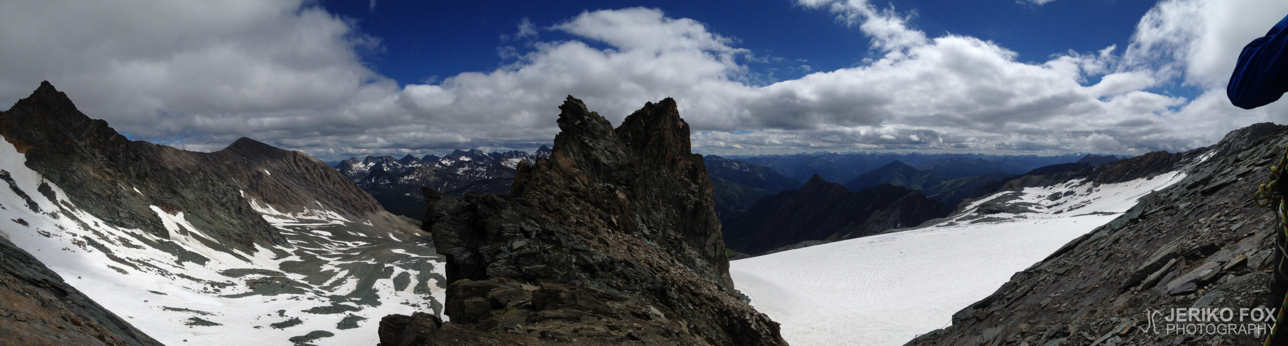
The climb was challenging in an enjoyable way, and the route was not fully equipped with cables. The view from the ridge was spectacular, with sheer drops on both sides. The normal route across the glacier joins this ridge route slightly below Erzherzog Johann Hütte – we reached this point at 16:25. From this point onward, traffic was significantly heavier.
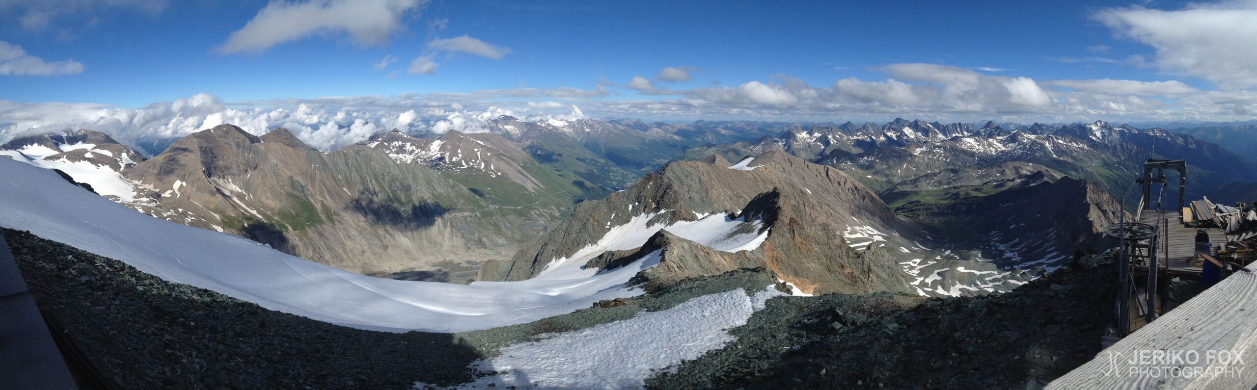
We arrived at Erzherzog Johann Hütte in 3454 m (11 332 ft) at 17:10. This is Austria’s highest mountain hut and possibly its highest building. There are no showers or running water, but drinking water can be purchased, and there is a bio toilet with undeniably the best view in the country. Since there are no handwashing facilities, bringing a small bottle of hand sanitizer is recommended. I had reserved our accommodation by phone the previous day, and upon arrival, we decided to opt for the half-board option. A night’s stay costs 21 € for non-members of the ÖAV, and half-board (which includes a three-course dinner and breakfast) costs 48 €. Sleeping spaces were wider than at Höllentalangerhütte, with two blankets and a pillow provided. A personal sleeping bag is required, and we used lightweight sleeping bag liners, which are compact and fulfill the hygiene requirements of mountain huts.
We woke at sunrise, ate a quick breakfast, and packed our gear. Our backpacks had been in the dormitory, while our climbing gear and boots were left in the drying room as required by the hut rules. Slightly behind the main crowd, we departed Erzherzog Johann Hütte at 07:00 towards Großglockner’s summit. Initially, we walked across snow and rock, but as the slope steepened, we put on our crampons and roped up as a two-man team. The snow path traversed diagonally across the slope, so the best technique was to use a trekking pole on the downhill side and an ice axe on the uphill side. At turns, we had to switch hands for the tools. The snow was firmer than the previous day and mixed with patches of ice and rock.
The snowy slope led to a flatter area called Bahnhof (railway station) at 3560 m (11 679 ft). From there, we ascended a mix of snow and rock towards the narrow Glocknerleitl couloir at 08:00. Before reaching Glocknerleitl, we had to climb past a large rock. It’s not an impossible feat, but footholds were worn down from frequent use and there is always someone “busy” pushing through. The couloir itself was about 40° steep and narrow, and although it could theoretically be climbed directly, the easiest way was to follow the existing zigzag path. The steepness made an ice axe particularly useful for balance. At this time of day, the snow was still firm enough to provide good support and the ice axe can be jammed between rocks.
At the upper end of Glocknerleitl, there was a completely dry rock section about 2–3 m (6.6–9.8 ft) high, which I found easiest to climb using my hands. A small plateau at the top of Glocknerleitl, at 3680 m (12 073 ft), is called Sattele (saddle), and it serves as a good resting spot and gear-switching area. Like the other climbers, we took off our crampons at this point and left them, along with our poles and ice axes, in a crevice to wait for our return.
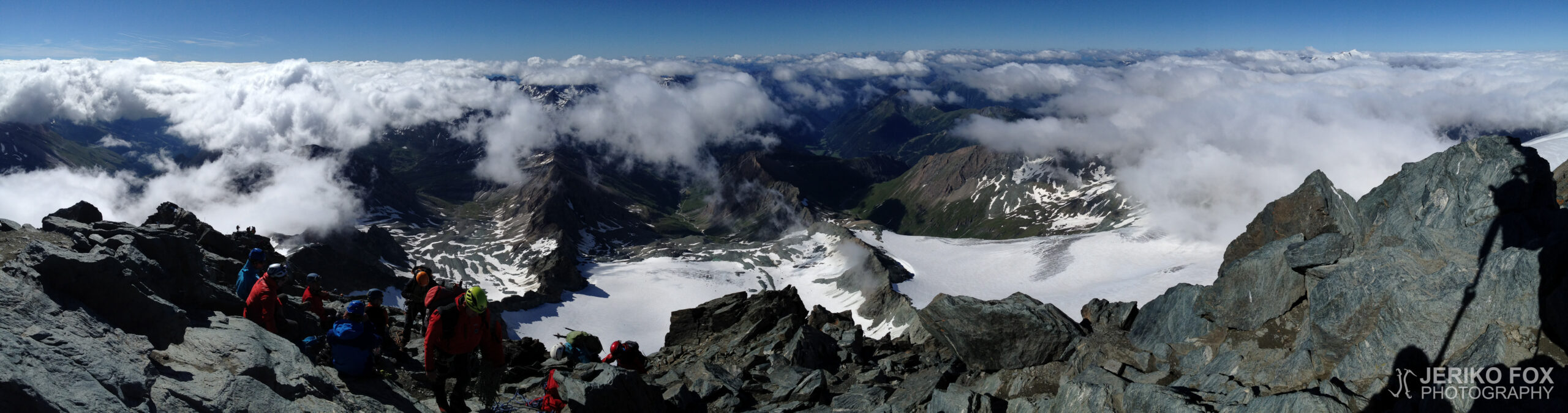
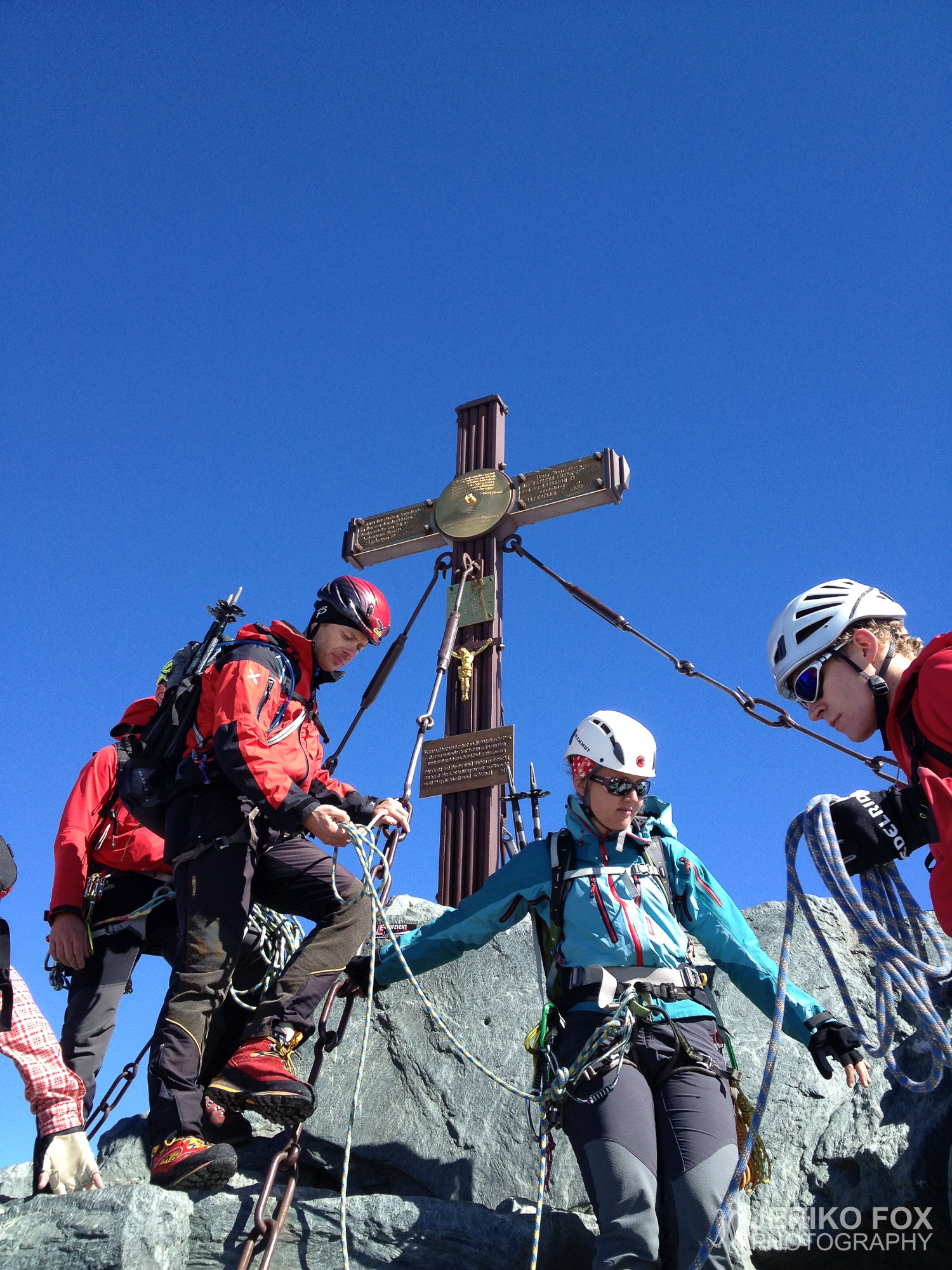
From the saddle, we continued at 08:45 in bright sunshine on completely dry rock, scrambling along the ridge towards the first summit, Kleinglockner. The scenery was stunning, and the mood was high. Whenever we found a good spot, we let faster climbers pass or overtook other groups ourselves. There were many groups of three to five people accompanied by mountain guides, and despite occasional congestion, people generally behaved well and moved carefully without causing danger to others.
Along the Großglockner ridge there are numerous 1–2 m (3.3–6.6 ft) high vertical metal rods embedded in the rock. These provide quick safety assistance, as the rope can be looped around the rod to create an anchor in case of a slip. Dima and I climbed mostly in simul-climbing style, frequently looping the rope around these rods as a precaution. The ridge provides enough space for one person (with occasional passing spots), but there is a drop of over a kilometre (0.6 mi) on both sides, so a steady step is essential. Just before Kleinglockner, there is an especially impressive view of deep chasms on both sides.
We reached the 3783 m (12 411 ft) summit of Kleinglockner at 09:14 and immediately started descending to the saddle between the peaks. As I was climbing down, I stopped for a moment to find a good foothold when a guide from behind started pressuring me, asking if I was moving or not. I asked him to wait a moment, but he then grabbed the hand I was using to support myself on the rock. Perhaps he intended to help, but I would never pull a climber off the rock without their permission. This was the only unpleasant experience with guided groups on the mountain, but in my opinion, it was incredibly reckless of the guide to interfere without even asking if I needed help. The situation was partially recorded on video, showing that I hesitated for about 10 seconds – hardly an unreasonable delay. After this, the guide led his group past us by moving underneath our rope, which, in a worst-case fall scenario, could have taken both rope teams down with it.
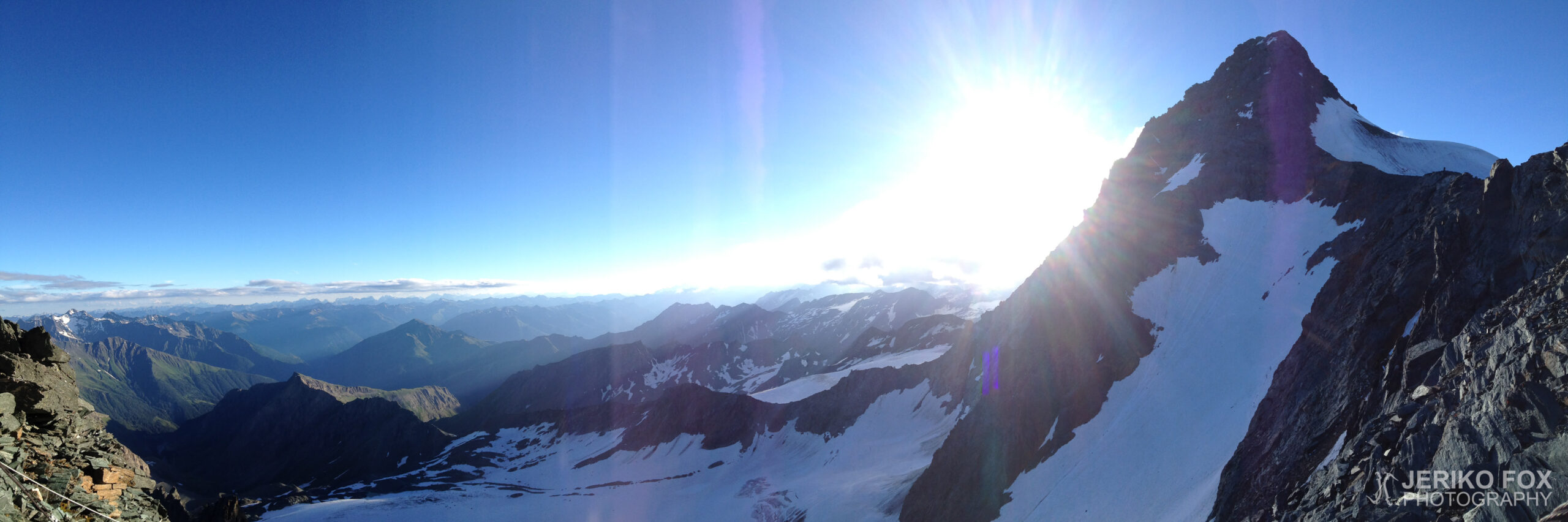
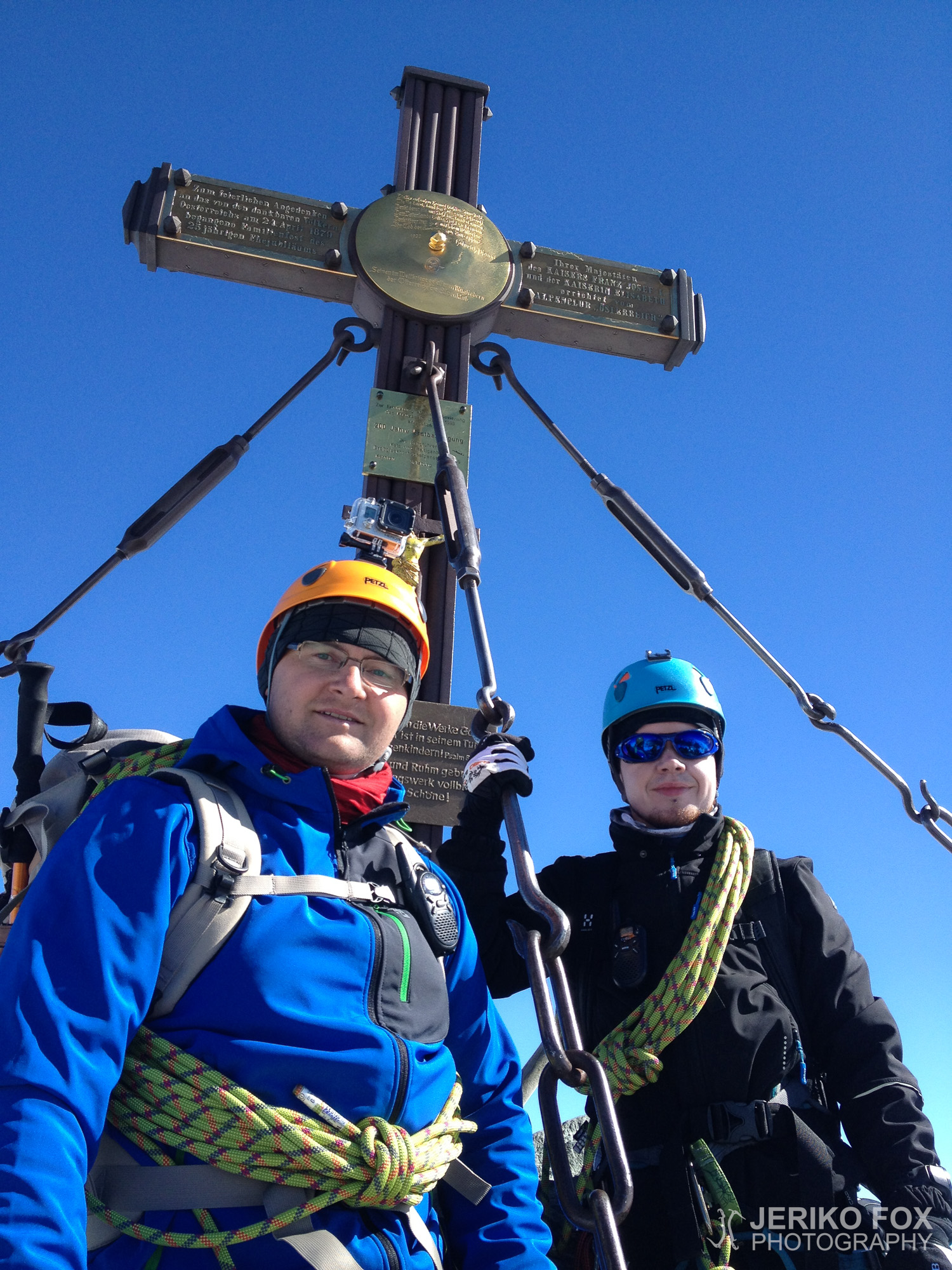
The descent from Kleinglockner includes a short section with via ferrata cables, which provide some support even if you’re not using VF gear. From a small dip, the final ridge leads up to Austria’s highest peak, the 3798 m (12 461 ft) Großglockner, which we reached at 09:43. The weather on the summit was perfectly clear, though clouds could be seen below. From the region’s highest peak, the perspective is somewhat surreal, as the surrounding mountains appear rather small. Through gaps in the clouds, we could see all the way back to our starting point at Lucknerhaus, as well as across to the massive Pasterze Glacier. There is plenty of space around the summit for a break, so we had a snack before starting our descent back down.
Our descent followed the classic route the entire way, whereas on the way up, we had taken some variations. We returned via Kleinglockner (10:25) and reached the saddle above Glocknerleitl (11:15), where we retrieved our gear from the rock crevice and put our crampons back on. Shortly before this, I had a chance to test the rope when I was climbing down a large rock. My foot was in an unstable position, so I asked Dima, who was above me, to take in the slack. As I moved downward, my foot slipped, and I briefly hung in the air before Dima gently lowered me a bit further. The fall wouldn’t have been huge, but I might have hit sharp rocks on the way down.
At Glocknerleitl, we saw the consequences of our non-alpine start time – the snowy couloir had turned into slushy mush in the morning sun. There were bolted rings in the rock for abseiling, but as novices, we didn’t have the proper setup for rappelling with a doubled rope. Instead, Dima belayed me from above while I descended into the slush. When it was his turn to climb down, I set up an ice axe belay from below – not enough to stop a fall, but at least enough to assist with self-arrest. Once he reached me, he belayed my next section, and we repeated this process a few times. The slush kept sliding and disappearing beneath our feet, making the couloir extremely unstable. Looking back, rappelling – even without dedicated gear – might have been the safer and faster option.
Eventually, we made it safely down Glocknerleitl but had to navigate around the rock I had mentioned earlier to exit the couloir. By now, the terrain was even more unstable, so Dima belayed me with his ice axe as I went ahead. Once I was across, I radioed him that I was in position, and he started making his way around the rock. When he appeared to my side I asked if he was stable, and he confirmed that he was. The moment I pulled my ice axe from the crevice, the ground gave way beneath Dima, and he started falling. I quickly jammed the axe back into the rock, and a few metres (10 ft) below, his fall was stopped – partly by the rope and partly by his self-arrest. The moment of terror was over quickly, but if we hadn’t been able to stop the fall, he would have tumbled a couple of hundred metres (656 ft) down the rocky slope.
From the Bahnhof (12:30), we descended smoothly walking in soft snow towards Erzherzog Johann Hütte. The morning’s snow slope had melted, and in many places, clear streams were running. We removed our crampons again when we reached the rocky section before the hut, arriving at Erzherzog Johann Hütte just after 13:00. After a short break, we continued downward.
This time we descended using via ferrata route below the hut straight to the Ködnitzkees Glacier (14:25), which we crossed diagonally following the classic route. Following good practice, we roped up and kept our crampons on, though considering the conditions, we probably could have managed without them. In the middle of the glacier, we met a Finnish couple living in Germany, hiking with their children and dog, and we had a brief chat. The sun was blazing, and the surface of the glacier was very soft despite the deep snow cover.
Once off the glacier (15:30), we packed our crampons and rope into our backpacks and hiked to the sun-soaked Stüdlhütte at 2802 m (9193 ft), arriving at 16:30. There, we enjoyed well-earned beers and soft drinks. The technical challenges were behind us, though in terms of elevation loss, we were only halfway to the car. At this point, however, we could already celebrate, as the “getting down is mandatory” section was successfully completed.
The rest of the journey was a relaxed but knee-punishing hike down well-trodden paths. We rejoined our ascent route near Lucknerhütte (18:25) and, after a quick toilet break, covered the final 300 vertical metres (984 ft) down to Lucknerhaus and the car, where we arrived, exhausted but satisfied, at 19:15.
Großglockner on Itävallan korkein vuori, jota voi lähestyä lännestä Kals am Großglockner -kylän kautta tai idästä Heiligenblut am Großglocknerin suunnalta. Ensinmainittu suunta pitää sisällään helpoimman ja eniten kuljetun normaalireitin ja jälkimmäisen kohdalla joutuu ylittämään suuren Pasterze-jäätikön, jonka yli kulkemista ei kesällä suurien railojen takia suositella. Nämä asiat huomioiden oli hyvin selvää, että meidän reittimme kulkisi Kals am Großglocknerin kautta. En ole aiemmin noussut yli kolmetonniselle tai muutenkaan näin vaativalle vuorelle, joten kyseessä oli kaikinpuolin merkittävä kokemus. Lisäksi vuoristotautiin sairastumisen mahdollisuus nousee selvästi 3000 m yläpuolella ja sen jälkeen ei yleisesti suositellakaan yöpymispaikan nostamista kuin korkeintaan 500 m päivässä (vaikka muuten kävisi kiipeämässä korkeammalla). Herkkyys sairastua vuoristotautiin on erittäin yksilöllinen ja se selviää vasta korkealle noustessa. Siitäkin syystä tämä oli erittäin tärkeä kokeilu kiipeilyharrastuksen jatkoa ajatellen.
Pohjoisesta, Kitzbühelin suunnasta, Kalsin suuntaan ajaessa täytyy kulkea Felbertauernstrassen pitkän tunnelin kautta. Tunnelin eteläpäässä on tiemaksu, joka on henkilöautolta 10 €. Käännyttäessä itään kohti Kalsia tie nousee jyrkästi ylöspäin, koska itse kyläkin sijaitsee jo 1324 m korkeudella. Joitakin kilometrejä ennen kylää on vesiputoksen luona pieni levähdyspaikka, jossa yövyimme autossa. Aamulla ajoimme lyhyen matkan Kalsiin ja jatkoimme siitä suoraan Kalser Glocknerstrassea pitkin kohti 1924 m korkeudessa sijaitsevaa Lucknerhausia. Tälläkin tiellä on 10 € tiemaksu henkilöautoille. Lucknerhaus on pieni hotelli, jonka luota lähtee reitti kohti Großglockneria. Hotellin vieressä on iso ilmainen parkkipaikka, jonka perimmäinen osa on varattu pitkäaikaispysäköintiin.
Lähdimme yhdeksän aikoihin kävelemään tavarat selässämme mäkeä ylös kohti 2242 m korkeudessa olevaa Lucknerhütteä, jossa söimme aamupalaa. Lücknerhütten alapuolella tie on luontopolkumaista esitetauluineen, mutta sen jälkeen tie vaihtui kapeammaksi poluksi ja saavuimme Hohe Tauernin kansallispuistoon. Pian tämän jälkeen, kellon tullessa 11, käännyimme risteyksestä pois normaalireitiltä jyrkemmin nousevalle polulle, joka johtaa osittain eteläistä Burgwartscharte-harjannetta pitkin kulkevalle Mürztalersteigille. Liikenne tällä reitillä oli selvästi vähäisempää ja vain harvakseltaan kohtasimme vastaantulijoita. Eräs nainen kertoi edellisenä yönä olleen myrskyn ja huipun lähellä sataneen uutta lunta. Jatkoimme nousua vaeltaen kunnes kivikkoisen alueen ylitettyämme saavuimme joskus yhden ja kahden välillä Ködnitzkees-jäätikön reunalle.
Puimme kiipeilyvarusteet ja jääraudat sekä kiinnitimme itsemme toisiimme köydellä railojen varalta. Kuljimme lähellä Burgwartschartea jäätikön noustessa ensin jyrkemmin ja sitten hieman loivemmin. Hengityksen raskaus alkoi tässä vaiheessa tuntua selvemmin ja liikuimmekin pieniä pätkiä kerrallaan aina välillä pysähtyen hetkeksi hengähtämään. Sauvat ovat merkittävä apu noustessa ja tässä vaiheessa rinne ei ollut niin jyrkkää, että jäähakulle olisi ollut tarvetta. Jäätikkö oli lähes kokonaan pehmeän lumen peittämä ja vain kaukana eteläseinämän lähettyvillä näkyi pieni kuivan jäätikön alue.
Harjanteelle siirtymisen paikkaa oli ensin vaikea havaita, koska via Ferrata -vaijerien alapuolelta rinne oli osittain sortunut. Varmistuimme oikeasta paikasta nähdessämme melko korkealla kalliossa keltaisen reittikyltin. Riisuimme jääraudat ja luovuimme köydestä jäätikön reunalla 15:00 aikoihin. Jäätikön ja kallion välissä ei ollut tyypillistä railoa, mutta harjanteelle siirtymistä vaikeutti sortunut rinne. Ensimmäisten metrien jälkeen nousu helpottui, kun VF-kaapeleista sai tukea. Emme olleet ottaneet varsinaisia via Ferrata -laitteita mukaan, mutta käytimme varmistuksena slingeistä ja sulkurenkaista tehtyä viritelmää. VF-laite toki olisi ehkä ollut parempi ja turvallisempi vaihtoehto, mutta kiipeäminen sujui onneksi ongelmitta.
Reitti oli mielekkäällä tavalla haasteellinen ja VF-varmistuksia ei ollut koko matkalla. Näköala harjanteelta oli myös upea avautuessaan parhaimmillaan jyrkkänä pudotuksena molemmille puolille. Jäätikön halki kulkeva normaalireitti yhdistyy tähän harjannetta pitkin kulkevaan reittiin jonkinverran Erzherzog Johann Hütten alapuolella – saavuimme risteykseen 16:25. Liikennettä siten oli enemmän loppunousun ajan.
Tämä pätkä oli lähes kokonaan varustettu kaapelein. Saavutimme 17:10 kohteemme Erzherzog Johann Hütten 3454 m korkeudessa. Se on Itävallan korkeimmalla sijaitseva maja ja luultavasti myös rakennus. Suihkua tai muutakaan juoksevaa vettä majalla ei ole, mutta juomavettä voi ostaa ja huussityyppinen vessa valtakunnan parhaalla näköalalla löytyy. Koska käsienpesumahdollisuutta ei ole, pieni käsidesipullo kannattaa ottaa mukaan. Olin tehnyt varauksen yöpaikoista edellisenä päivänä puhelimitse ja paikanpäällä päädyimme vielä ottamaan puolihoidon. Pelkkä majoitus maksaa ÖAV:n kuulumattomilta 21 € ja puolihoito 48 € (sis. yöpyminen, kolmen ruokalajin illallinen ja aamupala). Nukkumapaikat ovat leveämpiä kuin Höllentalangerhüttellä ja yöpyjille on käytössä kaksi vilttiä ja tyyny. Oma makuupussi pitää olla. Me käytimme ohuesta kankaasta tehtyjä linereita eli makuupussin lakanoita, jotka ovat hyvin kevyet ja menevät pieneen pakettiin. Se on periaatteessa kuin pussilakana, jonka sisään pujahdetaan (jolloin tulee kunnioittaneeksi majojen hygieniasääntöjä) ja lämmikkeenä käytetään majan vilttejä.
Heräsimme auringonnousun aikaan ja söimme nopean aamupalan. Reput meillä oli mukana makuusalissa, mutta kiipeilyvälineet ja kengät olimme jättäneet kuivaushuoneeseen (kuten majojen säännöissä yleensä vaaditaankin). Kasasimme tavaramme lähtökuntoon ja jonkinverran suurimman joukon jäljessä kello seitsemän lähdimme Erzherzog Johann Hütteltä kohti Großglocknerin huippua. Lyhyen matkan kuljimme kävellen lumen ja kivikon yli, mutta rinteen muuttuessa jyrkemmäksi laitoimme jääraudat ja jatkoimme matkaa kahden miehen köysistönä. Lumessa kulki viistottain rinteeseen nähden polku, joten kulku oli sujuvinta sauva alarinteen puolella ja jäähakku ylärinteen puolella. Mutkan kohdalla täytyi vaihtaa välineet eri käsiin. Lumi oli kovempaa kuin edellisenä päivänä alhaalla ja paikottain jään ja kiven sekoitusta.
Luminen rinne päätyy tasaisemmalle, Bahnhofiksi (rautatieasemaksi) kutsutulle, paikalle 3560 m korkeudessa. Tästä jatkoimme nousua lumista ja kivistä rinnettä Glocknerleitlin lumiränniä kohti kellon tullessa kahdeksan. Ennen Glocknerleitliin pääsyä täytyy kiivetä tai ennemminkin hivuttautua ison kiven ohi. Paikka ei ole mitenkään mahdoton, mutta ruuhkaisena perusreittinä jalansijat ovat kuluneet olemattomiin ja jollain on aina kiire ohi. Glocknerleitl on noin 40° jyrkkä kapea lumiränni, jota teoriassa voi edetä kiipeämällä, mutta käytännössä helpointa on mennä muun liikenteen mukana siksakkia kulkevaa polkua. Jyrkkyys on kuitenkin sitä luokkaa, että jäähakusta on iloa, koska sillä voi tasapainottaa kulkua. Tässä vaiheessa päivää lumi oli vielä tarpeeksi kovaa, että siitä sai tukea ja lisäksi tarjolla oli erinäisiä kallionkoloja, jonne hakun sai tungettua tarvittaessa.
Glocknerleitlin yläreunassa oli ehkä 2-3 m korkuinen täysin kuivan kiven alue, jonka totesin helpoimmaksi kiivetä ihan käsiä käyttäen. Pieni tasanne Glocknerleitlin päällä 3680 metrissä kulkee nimellä Sattele (satula) ja se toimii hyvänä tauko- ja kamojenvaihtopaikkana. Muiden kiipeilijöiden tapaan riisuimme tässä vaiheessa jääraudat ja jätimme ne sekä sauvat ja jäähakut kivenkoloon odottamaan paluuta.
Satulalta matka jatkui 08:45 auringon paisteessa täysin kuivalla kalliolla harjannekiipeilemällä kohti ensimmäistä huippua, Kleinglockneria. Maisemat olivat upeat ja tunnelma korkealla. Sopivan paikan tullen päästimme nopeampia kiipeilijöitä ohi tai ohitimme itse muita seurueita. Liikkeellä oli paljon 3-5 hengen ryhmiä oppaiden kanssa ja ajoittaisesta ruuhkasta huolimatta ihmiset käyttäytyivät pääasiassa hyvin ja osasivat liikkua vaarantamatta muita.
Großglocknerilla on pitkin matkaa kallioon upotettuja 1-2 m korkuisia pystysuoria metallitankoja. Näistä saa nopeasti varmistusapua, kun köyden kiepauttaa kulkemaan tangon ympäri. Kiipesimme Diman kanssa pääasiassa simulina, kiepauttaen köyden usein kulkemaan tangon kautta horjahduksen varalta. Harjanteella on hyvin kulkutilaa yhdelle (ja ajoittain sopivia ohituspaikkoja), mutta molemmilla puolilla avautuu yli kilometrin pudotus, joten askeleen on syytä olla vakaa. Erityisesti hieman ennen Kleinglockneria pääsee ihastelemaan vaikuttavaa rotkoa molemmilla puolillaan.
Saavutimme 3783 metrin korkeudessa olevan Kleinglocknerin huipun kello 09:14 ja jatkoimme samantien kiipeämällä alaspäin huippujen väliseen satulaan. Kiivetessäni alaspäin pysähdyin hetkeksi katsomaan minne saan asetettua jalkani, kun takaamme tuleva opas alkoi hiillostaa minua kyselemällä olenko menossa vai en. Pyysin häntä odottamaan hetken ja opas alkoi tarttua kiinni kalliosta tukea ottavaan käteeni. Tarkoituksensa oli ehkä auttaa, mutta en lähtisi repimään ketään kiipeilijää irti kalliosta ilman tämän lupaa. Tämä oli ainoa ikävä kokemus opastettujen ryhmien käytöksestä vuorelta, mutta kyseisen oppaan kohdalta mielestäni typerää puuttua toisen kiipeämiseen kysymättä edes tarvitseeko tämä apua. Tilanne tallentui osittain videolle, josta näkyy että pohdin reittiä noin 10 sekuntia – kyse ei siis ollut siitä, että olisin jäänyt kohtuuttoman pitkäksi aikaa jumittamaan. Tämän jälkeen opas vei ryhmänsä ohitsemme kulkien köytemme ali. Köysistön keskeltä ohittaminen vie pahimmassa putoamistilanteessa molemmat köysistöt mennessään.
Kiivetessä alas Kleinglocknerilta on reitillä lyhyen matkaa via Ferrata -vaijerit, joista saa tukea, vaikka ei VF-varmistusta käyttäisikään. Pienestä notkelmasta noustaan loppuharjanne Itävallan korkeimmalle huipulle, 3798 m korkealle Großglocknerille, jonka saavutimme kello 09:43. Sää huipulla oli täydellisen kirkas, vaikka alempana näkyi pilviä. Alueen korkeimmalta huipulta perspektiivi on hieman erikoinen, koska muut vuoret näyttävät aika mitättömiltä. Näimme pilvien välistä lähtöpaikallemme Lucknerhausille asti ja myös toiselle puolelle valtavalle Pasterze-jäätikölle. Huipun ympärillä on hyvin tilaa pitää taukoa, joten söimme hieman eväitä ennen lähtöä laskeutumaan koko matka alas asti.
Laskeutumisemme noudatti koko matkalta perusreittiä, jota olimme nousun osalta siis hieman soveltaneet. Palasimme samaa tietä Kleinglocknerin (10:25) kautta Glocknerleitlin yläpuolella olevaan satulaan (11:15), josta keräsimme tavaramme kivenkolosta ja laitoimme jääraudat takaisin jalkaan. Hieman ennen tätä tuli kokeiltua köyttäkin, kun olin laskeutumassa isohkolta kiveltä alas. Jalkani oli huonosti otteella, joten pyysin perässäni tulevaa Dimaa ottamaan köyden tiukalle. Ja niin kävikin, että liikahtaessani alaspäin jalkani lipesi otteelta ja jäin kevyesti killumaan hetkeksi köydessä, kun Dima laski minut hieman alemmas. Suurta pudotusta en olisi muutenkaan kärsinyt, mutta ehkä kolhinut itseäni teräviin kiviin.
Glocknerleitl’lla huomasimme ei-ihan-alppistarttimme seuraukset, koska luminen ränni oli aamuauringossa sulanut valuvaksi sohjoksi. Kalliossa olisi ollut pultatut renkaat köydellä laskeutumista varten, mutta noviiseina meillä ei ollut mukanamme kaksinkertaisella köydellä laskeutumiseen sopivaa laitetta. Niinpä Dima varmisti minua ylhäältä osan matkaa laskeutuessani lumisohjon keskelle ja hänen kiivetessään alas varmistin alhaalla hakun kautta, jolloin en pystyisi estämään putoamista, mutta voisin auttaa self-arrestissa. Diman saavuttaessa minut hän taas varmisti alas kiipeämistäni hakun kautta ja toistimme saman kuvion pari kertaa. Sohjoksi muuttunut lumi valui ja katosi jalkojen alta kokoajan, joten rännissä liikkuminen oli todella epävakaata. Jälkeenpäin ajateltuna köydellä laskeutuessa vaikka ilman välineitä olisi päässyt helpommin, nopeammin ja turvallisemmin.
Pääsimme kuitenkin turvallisesti Glocknerleitlin alas ja jouduimme taas kiertämään aiemmin mainitsemani kiven päästäksemme pois rännistä. Nyt maa oli entistäkin epävakaampaa jalkojen alla, joten Dima varmisti tätä lyhyttä traversea hakun kautta mennessäni edeltä. Päästyäni toiselle puolelle ilmoitin radiopuhelimella olevani varmistamassa ja Dima hivuttautui kiven ympäri luokseni. Hänen tullessa viereeni kysyin onko hän hyvällä paikalla ja hän vastasi olevansa. Vedin varmistusvälineenä käyttämäni hakun varren pois kiven kolosta ja juuri samalla hetkellä maa petti Diman jalkojen alta ja hän lähti putoamaan. Löin hakun nopeasti takaisin kivenkoloon ja muutamaa metriä alempana Diman vauhti pysähtyi osittain köyden asiosta ja osittain self-arrestin avulla. Kauhun hetket jäivät siis onneksi lyhyeen. Jos pysäytys ei olisi onnistunut, olisi Dima kierinyt reipasta vauhtia kivikkoista rinnettä pari sataa metriä alemmas.
Matka Bahnhofilta (12:30) alas Erzherzog Johann Hüttelle meni mukavasti kävellessä pehmeässä lumessa. Aamun lumirinne oli sulanut ja monissa paikoissa meni aivan selkeitä puroja. Jääraudat riisuimme taas tullessamme kivikkoiselle alueelle ennen majalle saapumista. Olimme yhden jälkeen Erzherzog Johann Hüttellä ja lyhyen pysähdyksen jälkeen jatkoimme matkaa alas.
Nyt siis laskeuduimme majan alla kulkevaa via Ferrataa suoraan Ködnitzkees-jäätikölle (14:25) ja kuljimme diagonaalissa sen yli perusreitin mukaisesti. Hyvän tavan mukaan kuljimme jäätikön köysistönä ja käytimme jäärautoja, mutta olosuhteet huomioiden olisimme pärjänneet ilmankin. Kohtasimme keskellä jäätikköä Saksassa asuvan suomalaispariskunnan lapsineen ja koirineen ja keskustelimme lyhyen hetken heidän kanssaan. Aurinko porotti lämpimästi ja jäätikön pintakin oli hyvin pehmeää, vaikka lunta oli kuitenkin runsaasti.
Päästyämme pois jäätiköltä (15:30) pakkasimme jääraudat ja köyden reppuihin. Kävelimme 2802 m korkeudessa sijaitsevalle auringossa kylpevälle Stüdlhüttelle (16:30) nauttimaan hyvin ansaitut oluet ja limpparit. Vaikeat osiot olivat takanapäin, mutta korkeuseron suhteen olimme vasta puolimatkassa autolle. Tässä vaiheessa saattoi kuitenkin viettää jo voitonjuhlia, koska periaatteessa “getting down is mandatory” -osio oli suoritettu.
Loppumatka oli leppoisaa (mutta polvia kuluttavaa) vaellusta pitkin polkuja alaspäin. Liityimme takaisin nousureittiimme Lucknerhütten paikkeilla (18:25) ja jatkoimme vessatauon jälkeen viimeiset 300 korkeusmetriä Lucknerhausille ja autolle, jonne saavuimme väsyneinä ja tyytyväisinä kello 19:15.
Route map
Day 1
Max elevation: 3454 m
Total time: 07:57:07
Day 2
Max elevation: 3791 m
Total time: 12:13:20