Mellonlahti Trail

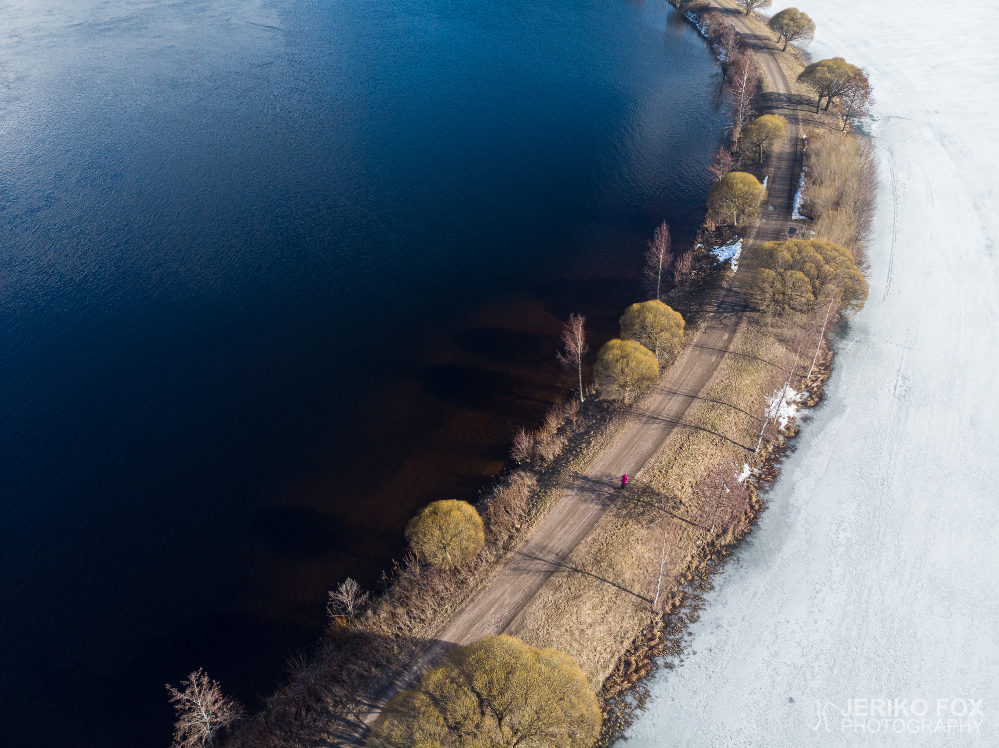
In Imatra, nearby the River Vuoksi, there are quite a few nature trails of different lengths. These are easy to approach, because the trail heads are in the middle of the town, which also allows taking public transport. From this selection we picked the Mellonlahti Trail, which was described to be about 3,6 km (2.2 mi). We parked our car close to the State Hotel of Imatra and from that century old jugend castle we took the stairs down to the River Vuoksi.

The Mellonlahti Trail goes down the river and the rugged river bed is a magnificent sight. Most of the snow was gone thank to the sunny days, but some of the sections in the woods had still a bit of snow. The trail passes by the outdoors theatre, which was due the corona restrictions serving as a practice area for kick scooters doing their stunts.

Before arriving to the Mellonlahti Bay, there is a small cove with a lean-to on the right hand side. Apparently one can cross the waters to the lean-to along the fishing dock during the summer, but it was still waiting on the shore for the ice to melt. The bay itself is one of the most interesting parts of the trail, because the bay is separated from the River Vuoksi by a narrow isthmus. This scenic land bridge takes you to the other side of the bay, where is the turnaround point.

Crossing the isthmus once again takes you back to the vicinity of the lean-to, where you turn away from the river. The other end of the trail (the route itself is actually shaped like letter Y upside down) leads to the top of the Mellonmäki Hill. This section of the trail was more icy and had more snow in early April, so at places we really had to watch our steps. Especially as we climbed on the top of the hill there was bit challenges to find a route that wouldn’t be too icy to climb on a steep hill. During the summer the hill is not a bad climb at all and there are several routes to the top.

There used to be a ski slope at the Mellonmäki and this area seems to lay on the other side of the hill. In addition there is a ski jumping hill, which is apparently still in active use, and a small lean-to. The view to the slopes is not as attractive as the one towards the River Vuoksi. As the weather was clear, the pulp and paper mill on the other side of the border – in Svetogorsk, Russia – could be seen.

The 3,6 km (2.2 mi) mentioned in the trail description is done on the top of the hill. One can return the same route along the river, but we ended up taking a bit of a shortcut and walking along the Viipurintie back to the State Hotel. That made the distance about 6 km (3.7 mi). It is possible to visit only one end of the trail – Mellonlahti or Mellonmäki – if one wishes to do a bit shorter trip. The shelters at the bay or on the hill are perfect places for a little break with snacks. If one wishes to finish the hike with more glamour, there is nothing to stop you to eating at the State Hotel restaurant.

Total time: 17:54:48

Imatralla Vuoksen ympäristössä kulkee useampikin eri mittainen luontopolku. Näitä on helppo lähestyä, koska ne alkavat keskeltä kaupunkia, jonne pääsee myös julkisilla. Me otimme keväisen päivän ohjelmaan kohdetiedoissa noin 3,6 km mittaiseksi mainitun Mellonlahden luontolenkin. Auton parkkeerasimme Imatran valtionhotellin lähelle ja tuon yli satavuotiaan jugendlinnan pihapiiristä suuntasimme portaita alas kohti Vuoksen uomaa.

Mellonlahden lenkki kulkee alajuoksulle päin ja jylhä jokiuoma on näyttävä nähtävyys. Aurinko oli sulattanut jo reitin suurelta osin kuivaiksi, mutta metsäisimmillä pätkillä oli vielä hieman lunta. Polku kulkee kesäteatterin takaa, joka näytti palvelevan näin korona-aikana pääasiassa nuorten skuuttaajien temppupaikkana.

Ennen Mellonlahdelle saapumista, on reitin oikealla puolella pieni poukama, jossa on laavu. Laavulle pääsee ilmeisesti kesäaikana kulkemaan kalastuslaituria pitkin, mutta nyt se odotti vielä rannassa lahden sulamista. Itse Mellonlahti onkin reitin kiinnostavimpia kohteita, koska lahden erottaa Vuoksesta kapea kannas. Tätä maisemallista maasiltaa pitkin pääsee kulkemaan lahden toiselle puolelle, jossa on polun kääntöpaikka.

Kannasta pitkin palataan siis takaisin laavun lähettyville, josta käännytään poispäin Vuokselta. Reitin toinen pää (reitti itsessään on ylösalaisen Y-kirjaimen muotoinen) johtaa nimittäin lähellä olevalle Mellonmäelle. Tämä osuus polusta oli vielä huhtikuun alussa selvästi lumisempi ja jäisempi, joten paikoin sai kulkea melko varovaisesti. Erityisesti lähtiessämme nousemaan Mellonmäen laelle oli pieniä haasteita löytää reitti, joka ei olisi liian jäinen kuljettavaksi jyrkässä rinteessä. Kesäolosuhteissa mäki siis ei ole mitenkään mahdoton noustavaksi ja reittejä laelle on useampia.

Mellonmäellä on aiemmin ollut laskettelukeskus, jonka rinteet näyttäisivät laskeutuvan poispäin Vuokselta. Lisäksi paikalla on hyppyrimäki, joka on ilmeisesti yhä aktiivisessa käytössä, sekä pieni laavu. Näköala laskettelukeskuksen suuntaan ei ollut erityisen kaunis, mutta Vuokselle päin avautuva maisema puolestaan oli viehättävämpi. Sään ollessa varsin kirkas, saattoi nähdä hyvin Venäjän puolella Svetogorskissa olevan sellutehtaan.

Reittiselosteessa mainittu 3,6 km matka tulee täyteen Mellonmäen huipulla. Sieltä voi halutessaan palata samaa reittiä rantaa pitkin lähtöpisteeseen. Me päädyimme oikaisemaan hieman ja kävelemään Viipurintietä pitkin takaisin valtionhotellille. Näin kokonaismatkaksi tuli suunnilleen 6 km. Mellonlahden reitin voi helposti kulkea käyden vain toisessa päätepisteessä – Mellonlahdella tai Mellonmäellä – jos haluaa tehdä hieman lyhyemmän lenkin. Evästauon voi pitää hyvin Mellonlahden tai Mellonmäen laavulla tai hieman enemmän glamouria kaipaavalle soveltuu retken lopuksi vaikka valtionhotellin ravintola.

Näträmälä Quarry

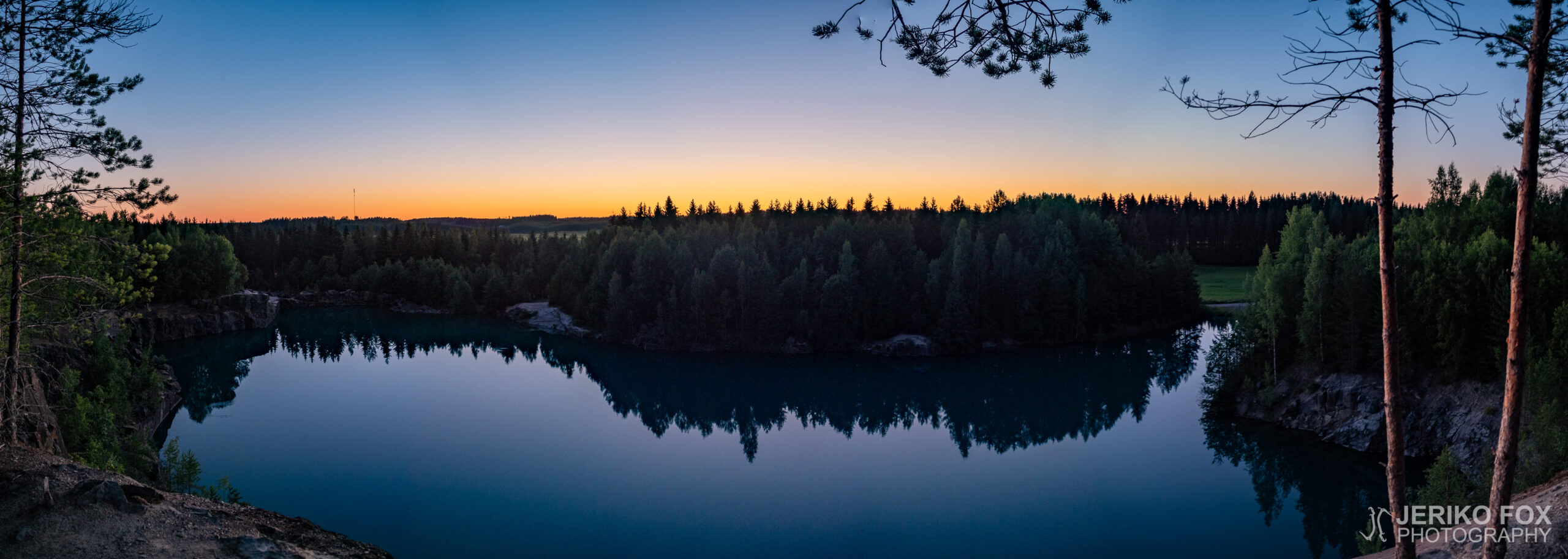
South from Imatra, in the village of Näträmälä, is an open quarry owned by Paroc. It was used in 1985-1998 to mine minerals for rock wool. After mining a 570 000 metric tons what was left was an enormous hole in the ground, which later started to fill with water. The minerals caused the water to get a very unique turquoise tone and for this reason (also) the location quick became a public secret and a popular swimming place.

Paroc has been retaining the quarry – though unused – until now. For this reason they have been responsible for the security of the location, hence the quarry pond has a fence around it and there are signs saying that trespassing is prohibited. Though no-one really seems to care about it.

The future of the Näträmälä quarry is though a question mark, because Paroc didn’t gain extension for its rights for the quarry in 2020. Early in 2020 the South Karelia fire department checked the condition of the quarry by diving and didn’t find anything alarming.

I have had the quarry on my bucket list for a while and today I decided to take my drone and head to Imatra. Näträmälä is about 5 km (3 mi) south from Imatra. From Viipurintie there are two roads that go right next to the quarry, but the Jokimäentie is closed for vehicles and the one north from there, an unnamed road that connects to the Raatesuontie, was so overgrown that I didn’t want to risk it with my low ground clearance.

The most convenient is to drive along the Viipurintie to Einolan talli, where there is a small space for parking on the other side of the road. From there one can continue walking along the Jokimäentie to the Raatesuontie, which takes you to the quarry. There are several trails through the woods to the different sides of the quarry. It’s a 800 m (0.5 mi) walk one way.

There was few cars parked there and as I came to the quarry there was one diver returning, couple of swimmers in the pond and a mother with two children by the pond. People kept passing me by going both directions. In the milk-like turquoise water there were small fishes and a crayfish rummaging around the bank.

This time I came only for photography. I don’t want to take any stance what it comes to the safety of swimming there. Though its apparent that people are not going to leave the quarry.

Imatran eteläpuolella Näträmälän kylässä sijaitsee Parocin avolouhos, josta kaivettiin vuosien 1985-1998 aikana vuorivillan materiaaliksi sarvivälkegabroa. 570 000 tonnin kaivuut jättivät jälkeensä suuren kuopan, joka täyttyi vedellä. Kivilajista johtuen vesi on turkoosin väristä ja tästä(kin) syystä alueesta on tullut julkinen salaisuus ja suosittu retki- ja uintikohde.

Paroc on kuitenkin pitänyt aluetta omistuksessaan – vaikkakin käyttämättömänä – tähän asti. Koska he ovat siten olleet vastuussa myös alueen turvallisuudesta, on louhoslampi aidattu ja alueella liikkuminen kielletty kyltein. Näitä kieltoja ei kuitenkaan ole erityisemmin kunnioitettu.

Näträmälän louhoksen tulevaisuus on tällä hetkellä kysymysmerkkinä, koska Paroc ei saanut jatko-oikeuksia kaivosalueeseen 2020. Alkuvuodesta Etelä-Karjalan pelastuslaitos kävi sukeltamassa lammessa ja sortumisvaaraa tai muuta huolenaihetta ei ilmennyt.

Itselläni louhos on ollut kohdelistalla jo jonkin aikaa ja tänään päätin lähteä lennättämään dronea alueelle. Näträmälä sijaitsee siis noin 5 km Imatran eteläpuolella. Viipurintieltä menee kaksikin tietä aivan louhoksen viereen, mutta Jokimäentie on suljettu moottoriajoneuvoilta ja sen pohjoispuolella oleva Raatesuontiehen yhdistyvä tie oli sen verran korkeakasvustoista, etten lähtenyt matalalla maavaralla yrittämään.

Kauempaa tulevan on siis käytännöllisintä ajaa Viipurintiellä sijaitsevan Einolan tallin kohdalle, koska tätä vastapäätä on pieni parkkitila. Tästä voi jatkaa kävellen Jokimäentietä pitkin Raatesuontielle, joka tulee louhoslammen nurkalle. Metsän läpi kulkee useita polkuja eri puolille louhosta. Matkaa tulee noin 800 m yhteen suuntaan.

Autoja oli nytkin parkissa useampia ja saapuessani louhokselle oli sieltä poispäin tulossa sukeltaja, lammen rannalla äiti lapsineen, pari uimaria vedessä ja väkeä muutenkin liikkui molempiin suuntiin. Turkoosissa maitomaisessa vedessä uiskenteli pieniä kaloja ja yksi rapukin tonki rantatöyrästä.

Itse kävin tällä kertaa vain kuvausretkellä louhoksella. Uimisen turvallisuuteen en ota kantaa. Ilmiselvää kuitenkin on, että ihmiset eivät ole louhosta hevillä jättämässä.