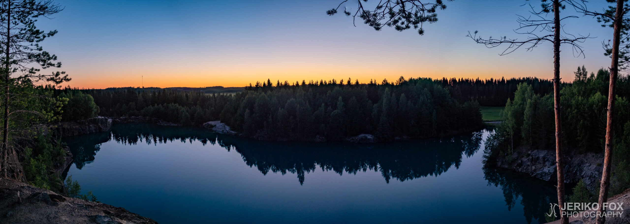
South from Imatra, in the village of Näträmälä, is an open quarry owned by Paroc. It was used in 1985-1998 to mine minerals for rock wool. After mining a 570 000 metric tons what was left was an enormous hole in the ground, which later started to fill with water. The minerals caused the water to get a very unique turquoise tone and for this reason (also) the location quick became a public secret and a popular swimming place.
Paroc has been retaining the quarry – though unused – until now. For this reason they have been responsible for the security of the location, hence the quarry pond has a fence around it and there are signs saying that trespassing is prohibited. Though no-one really seems to care about it.
The future of the Näträmälä quarry is though a question mark, because Paroc didn’t gain extension for its rights for the quarry in 2020. Early in 2020 the South Karelia fire department checked the condition of the quarry by diving and didn’t find anything alarming.
I have had the quarry on my bucket list for a while and today I decided to take my drone and head to Imatra. Näträmälä is about 5 km (3 mi) south from Imatra. From Viipurintie there are two roads that go right next to the quarry, but the Jokimäentie is closed for vehicles and the one north from there, an unnamed road that connects to the Raatesuontie, was so overgrown that I didn’t want to risk it with my low ground clearance.
The most convenient is to drive along the Viipurintie to Einolan talli, where there is a small space for parking on the other side of the road. From there one can continue walking along the Jokimäentie to the Raatesuontie, which takes you to the quarry. There are several trails through the woods to the different sides of the quarry. It’s a 800 m (0.5 mi) walk one way.
There was few cars parked there and as I came to the quarry there was one diver returning, couple of swimmers in the pond and a mother with two children by the pond. People kept passing me by going both directions. In the milk-like turquoise water there were small fishes and a crayfish rummaging around the bank.
This time I came only for photography. I don’t want to take any stance what it comes to the safety of swimming there. Though its apparent that people are not going to leave the quarry.
Imatran eteläpuolella Näträmälän kylässä sijaitsee Parocin avolouhos, josta kaivettiin vuosien 1985-1998 aikana vuorivillan materiaaliksi sarvivälkegabroa. 570 000 tonnin kaivuut jättivät jälkeensä suuren kuopan, joka täyttyi vedellä. Kivilajista johtuen vesi on turkoosin väristä ja tästä(kin) syystä alueesta on tullut julkinen salaisuus ja suosittu retki- ja uintikohde.
Paroc on kuitenkin pitänyt aluetta omistuksessaan – vaikkakin käyttämättömänä – tähän asti. Koska he ovat siten olleet vastuussa myös alueen turvallisuudesta, on louhoslampi aidattu ja alueella liikkuminen kielletty kyltein. Näitä kieltoja ei kuitenkaan ole erityisemmin kunnioitettu.
Näträmälän louhoksen tulevaisuus on tällä hetkellä kysymysmerkkinä, koska Paroc ei saanut jatko-oikeuksia kaivosalueeseen 2020. Alkuvuodesta Etelä-Karjalan pelastuslaitos kävi sukeltamassa lammessa ja sortumisvaaraa tai muuta huolenaihetta ei ilmennyt.
Itselläni louhos on ollut kohdelistalla jo jonkin aikaa ja tänään päätin lähteä lennättämään dronea alueelle. Näträmälä sijaitsee siis noin 5 km Imatran eteläpuolella. Viipurintieltä menee kaksikin tietä aivan louhoksen viereen, mutta Jokimäentie on suljettu moottoriajoneuvoilta ja sen pohjoispuolella oleva Raatesuontiehen yhdistyvä tie oli sen verran korkeakasvustoista, etten lähtenyt matalalla maavaralla yrittämään.
Kauempaa tulevan on siis käytännöllisintä ajaa Viipurintiellä sijaitsevan Einolan tallin kohdalle, koska tätä vastapäätä on pieni parkkitila. Tästä voi jatkaa kävellen Jokimäentietä pitkin Raatesuontielle, joka tulee louhoslammen nurkalle. Metsän läpi kulkee useita polkuja eri puolille louhosta. Matkaa tulee noin 800 m yhteen suuntaan.
Autoja oli nytkin parkissa useampia ja saapuessani louhokselle oli sieltä poispäin tulossa sukeltaja, lammen rannalla äiti lapsineen, pari uimaria vedessä ja väkeä muutenkin liikkui molempiin suuntiin. Turkoosissa maitomaisessa vedessä uiskenteli pieniä kaloja ja yksi rapukin tonki rantatöyrästä.
Itse kävin tällä kertaa vain kuvausretkellä louhoksella. Uimisen turvallisuuteen en ota kantaa. Ilmiselvää kuitenkin on, että ihmiset eivät ole louhosta hevillä jättämässä.
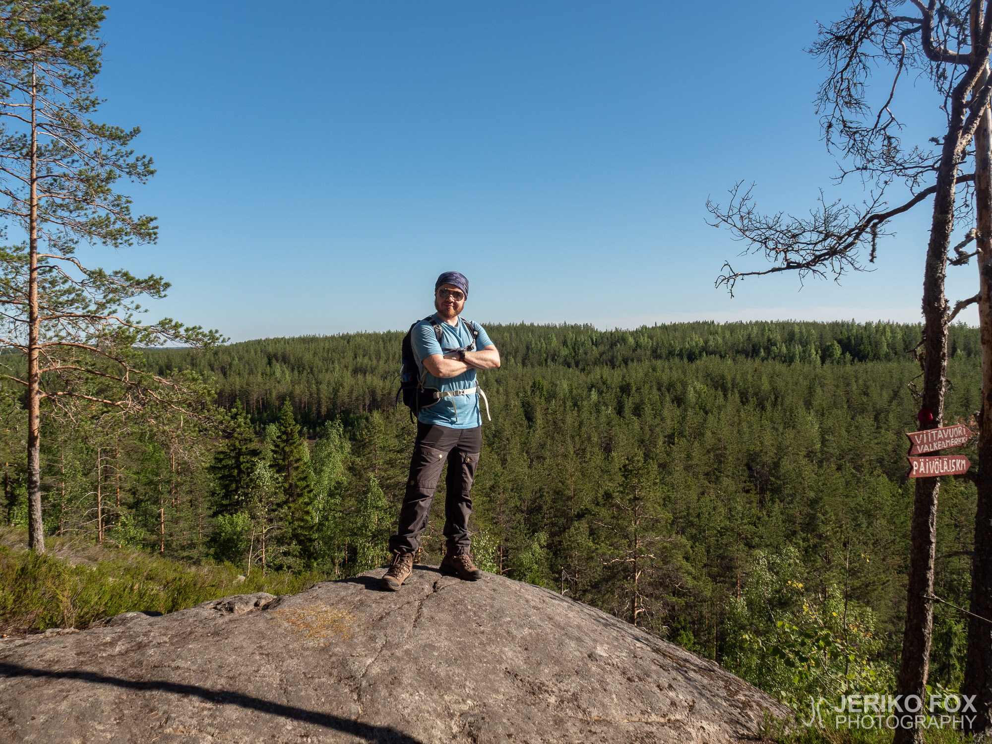
On the midsummer eve me and Nina were on our way to Mikkeli, but decided to take the scenic route via Puumala to visit the most interesting nature sight in Ruokolahti – Kummakivi (lit. Strange Rock).
It’s easy to find there using any navigator app, because Kummakivi parking lot and trail head is located at the clearly named Kummakiventie. Though it’s worth mentioning that this road is very bumpy one and potentially muddy when wet, so one should think what kind of vehicle is appropriate (if any). Kummakiventie splits into two and both ends have separate parking lots. I would anyway recommend taking the right turn, because there is more spacious parking lot with trail signs.
The heat rising from our car seemed to excite every single buzzing bug and there were everything from wasps to horse flies. Hence we went lickety split from the parking lot into the woods.
The trail to the Kummakivi is about 500 meters (0.3 mi). Although being short, it’s very enjoyable to walk through the old forest. The trail meets the Kummakivi from it’s rear side – if you think about the most photogenic side as its facade. You get to see the rock in all its glory when you have passed it.
Kummakivi is a glacial erratic that was left balancing on another rock about 11 000 years ago. Only about 0,5 m2 (about 5 square feet) of the 500 metric tons weighing boulder is touching the rock underneath it. There are similar erratics that swing a bit when pushed, but Kummakivi stands quietly and still on its designated place. There is even a pine tree that has grown on top of it.
If one wishes to hike a bit further, another trail takes you from Kummakivi to Sammalsilta (moss bridge). In past there apparently was an actual bridge made of moss over the nearby Lake Pitkäjärvi, but nowadays there is a bit more sturdy bridge available. One can continue across the bridge and follow a trail along the shore of Pitkäjärvi to hike to the other parking lot – this is about 700 m (0.4 mi) from Kummakivi. From there we continued along the gravel road back to the first parking lot, which finished about 2 km (1.2 mi) loop trail.
In this wet environment there were lots of mosquitoes in June, so hiking the trail might be more comfortable out of the highest mosquito season. The trail itself is so short that it can be easily done even with small children and the erratic is really worth seeing. The road to the parking lot might be in bad condition at times, so I would consider the ground clearance of the car before heading there.
Juhannusaattona olimme Ninan kanssa matkalla Mikkeliin, mutta päätimmekin ajaa maisemareittiä Puumalan kautta käydäksemme samalla katsomassa Ruokolahden kenties tunnetuinta luontokohdetta – Kummakiveä.
Paikalle löytää helposti navigaattorin avulla, koska Kummakiven parkkipaikka sijaitsee selkeästi nimetyllä Kummakiventiellä. Huomionarvoista kuitenkin on, että kyseinen tie on varsin kuoppainen ja märällä kelillä varmasti myös mutainen, joten kannattaa miettiä millaisella autolla sinne ajaa (vai ajaako). Kummakiventie haarautuu kahtia ja molempien haarojen päissä on parkkipaikat. Suosittelisin kuitenkin valitsemaan oikeanpuolisen haaran, koska sieltä löytyy tilavampi parkkipaikka ja opasteet.
Auton lämpö tuntui saaneen jokaisen metsän pörriäisen villiintymään ja parkkipaikalla pyöri melkoinen joukko ampiaisia, paarmoja ja ties mitä. Livahdimme siten varsin liukkaasti parkkipaikalta metsään, jonne johtaa selkeä polku.
Kummakivelle on matkaa noin 500 metriä, mutta lyhykäisyydessään reitti on silti mukava kulkiessaan vanhojen metsämaisemien läpi. Polku lähestyy Kummakiveä takaapäin, jos ajattelee sen valokuvauksellisinta puolta. Kiven näkee siis kunnolla koko komeudessaan käveltyään sen ohi.
Kummakivi on jääkauden aikainen siirtolohkare, joka on jäänyt noin 11 000 vuotta sitten tasapainottelemaan toisen kiven päälle. Kosketuspintaa alempaan kiveen arviolta 500 tonnisella lohkareella mainitaan olevan alle neliömetrin verran. Vaikka jotkin tällaiset lohkareet ovat heiluteltavissa niin Kummakivi seisoo järkähtämättömänä paikallaan ja sen päällekin on ehtinyt kasvaa korkea mänty.
Jos haluaa tehdä hieman pidemmän lenkin, voi kiveltä jatkaa Sammalsillan suuntaan. Lähettyvillä olevan Pitkäjärven yli on siis ilmeisesti aikanaan kulkenut sammalesta tehty silta, mutta nykyään paikalla on hieman tukevampi rakennelma. Sillan yli kuljettuaan voi jatkaa vasemmalle järven rantaa seuraillen, jolloin pääsee Kummakiveltä mitattuna noin 700 metrin matkan kuljettuaan toiselle parkkipaikalle. Tästä jatkoimme tietä pitkin takaisin ensimmäiselle parkkipaikalle, jolloin saimme käveltyä noin kahden kilometrin luupin.
Kosteassa metsässä oli kesäkuussa paljon hyttysiä, joten miellyttävämpää polulla kulkeminen on ehkä muuhun aikaan. Reitti on sen verran lyhyt, että pienetkin lapset jaksavat sen kulkea ja Kummakivi on varsin hämmästyttävä nähtävyys. Tie parkkipaikalle voi kuitenkin olla ajoittain huonossa kunnossa, joten pienellä maavaralla en lähtisi sinne yrittämään.
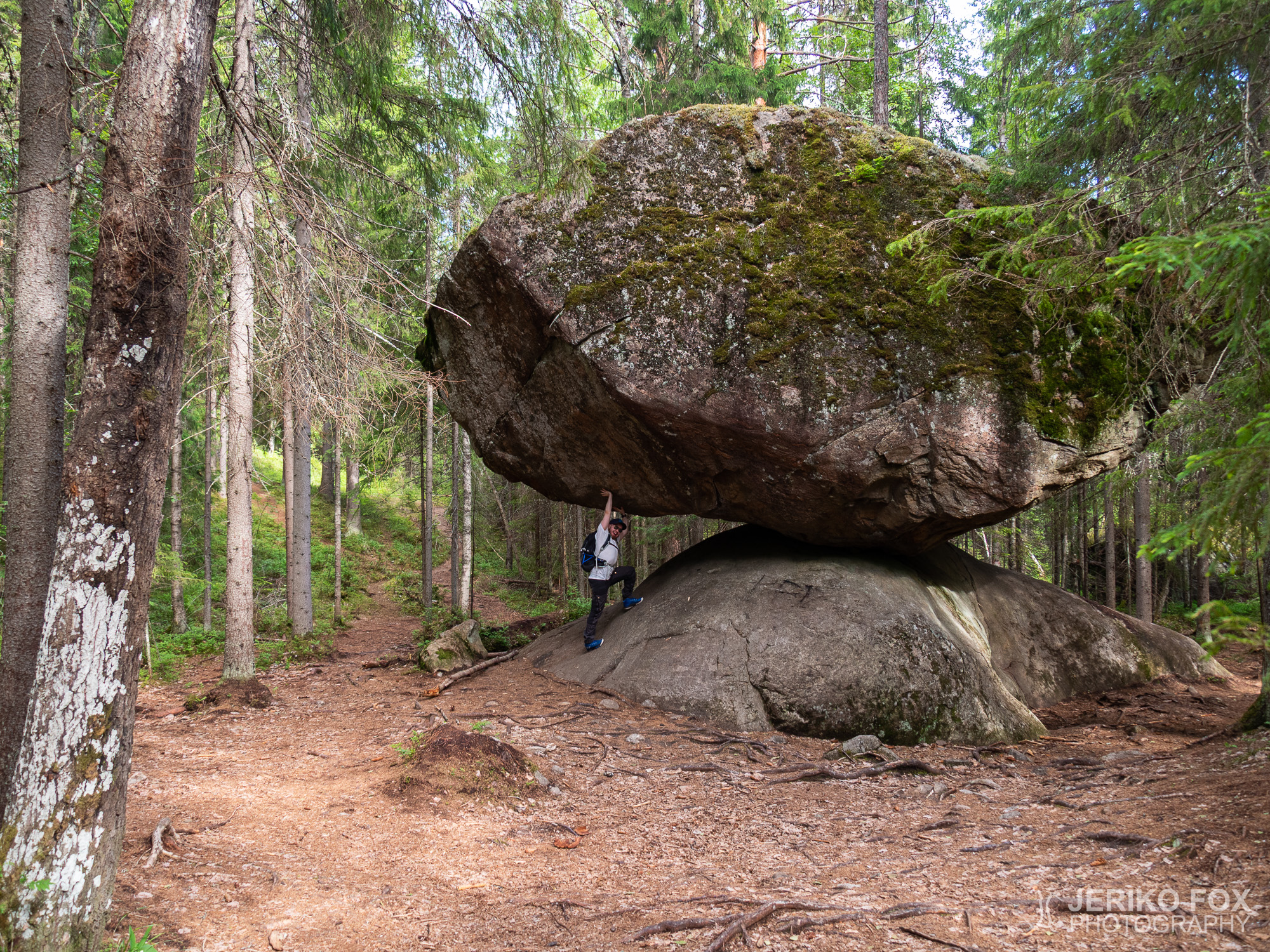
In the far end of Ruokolahti – right next to the province border of Southern Karelia and Southern Savonia – is the Hukkavuori (Wolf Mountain) with its majestic rock walls. There is an exceptional set of nature trails, from which we can thank one nature lover – Matti Päivinen. I have understood that this kind of privately maintained trails are less common, but what it comes to the quality, the Hukkavuori Trail doesn’t have anything to shame compared to the trails maintained by counties and other communities.
The trail head and the parking lot is located at the front yard of a private property. You find there driving along the route 6 past Imatra and turning left to road 4063 towards Pohja-Lankila. About 6 km (about 4 mi) after the said village there are signs on the left hand side indicating the parking lot. From Lappeenranta it takes about an hour to drive there, from Imatra about half an hour one way.
There are four variations of the Hukkavuori Trail. The whole trail is covered by a 10 km loop, but one can also choose to take 8 km, 5 km or 2 km trails. Right at the parking lot there is all kinds of activities available that are especially suitable for families with children. In the barn there is also space for eating and one can book guided trips for the trail. More information can be found from the Facebook page.
Me and Nina decided to take the 10 km trail. It starts by following a dirt road and in the beginning the forest is mainly dry and full of pine trees, but along the trail terrain keeps changing. The whole trail is well marked – only in the beginning I was confused if we were following the 8 km or 10 km trail. Though I presume that these are otherwise the same trail, but 10 km trail goes around the Kaunitlampi pond. (Sometimes referred as Kaunislampi, but it seems to be Kaunitlampi officially.)
There are plenty of signs on the trail and also fun little sculptures made of roots and branches that are resembling animals. Also geocaching enthusiasts will find some treasures and in general there are delighting surprises throughout the trail.
Along the trail there are huge ant nests and according to the signs collecting ant’s eggs used to be a thing in the 50s. Eggs were used to produce protein powder. One could collect 20 kg (44 lbs) of ant’s eggs in a day, which after drying would be 5 kg (11 lbs) of powder.
While I was wondering a badger’s nest, Nina was moving on, but soon returned running. She shouted at me that there is something. First I told her not to run. If it’s a bear, in no circumstances should you run, because bear will run faster (a brown bear can run 60 km/h (37 mph)). Nina described that she saw something large and brown rampaging in the woods. I thought it could possibly be either a moose or a bear. Rampaging sounds more like the animals of the deer family, based on my experiences. Bears shuffle along surprisingly quietly.
Carefully observing our surroundings we continued our hike. I didn’t see any animals. Apparently something has ran across the trail and moved on to take care of its own business.
The sun was shining when we reached the top of the Hukkavuori, where there was quite a nice view. There had been some mosquitoes in the woods, but higher up was windy enough to keep these blood suckers away. This allowed us to sit down in peace and enjoy some snacks.
On the steep rocky face of the Hukkavuori are wooden ladders called the Jacob’s Ladders. I wasn’t quite sure how I should approach them from the 10 km trail, but my choice ended up being a good one. We continued straight on from the top of the Hukkavuori (passed the trail turning to left towards Kaunitlampi) and soon came to the descending place.
With the help of a rope one has to descend 30 vertical meters (100 ft). Nina found this too intimidating with her fear for heights, and I ended up going alone. When I got to the bottom I followed the rock face back to the Jacob’s Ladder. These wooden ladders are sturdy and good to climb. When I reached once again the top of Hukkavuori, Nina was already there waiting for me.
Then we continued taking the left turn from the Hukkavuori and followed the trail that descended to the wetlands. This change of scenery caused an ever growing army of mosquitoes attacking us. When we arrived to the Kaunitlampi, we dived head first into a small tarpaulin shelter. We sat there for a while safe from the tiny bloodsuckers. There was two rafts on the shore that one can use to paddle on the pond, but at this point we were already so eaten that I decided just to move on.
We hiked around the pond briskly, though the scenery would have been worth enjoying. Continuing hiking double time out of the wetlands didn’t do much keeping the mosquitoes away. From the pond the trail comes back to the Hukkavuori and there is also a small cave on the way there. Soon I started to see some familiar places and realised that we had reached the rope descending place. The same trail underneath the Hukkavuori that takes you to the Jacob’s Ladder.
Here is another chance to to climb the Jacob’s Ladder during the 10 km trail, but then one has to be sure that one can also descend (or be ready to take a longer trail out). That’s why I would recommend my strategy on the Jacob’s Ladder.
From beneath the Jacob’s Ladder it’s not a long way back to the parking lot. With our heads full of mosquito bites, we continued without really being anymore able to enjoy the landscape. Quite close to the parking lot there is a small spring. I scooped the ice cold water to wet my buff, which I offered to Nina to cover her head with to alleviate the itching.
General impression of the Hukkavuori Trail was very positive. These trails are rather unique with all the funny signs, which are even more hilarious for their complete lack of grammar. There is much to see and experience throughout the trail and the effort put to the maintenance of the trail is admirable. We happened to be there at the worst mosquito season, so hiking might be more enjoyable in the spring or fall. In the midsummer one might want to wear a mosquito net on their head. Including the breaks it took us less than five hours to hike the 10 km trail.
Ruokolahden perukoilla – aivan Etelä-Karjalan ja Etelä-Savon rajan tuntumassa – sijaitse hienojen kallioseinämien Hukkavuori. Alueella on poikkeusellinen luontopolkuverkosto, josta on kiittäminen yhtä ahkeraa luonnonystävää – Matti Päivistä. Ymmärtääkseni tällaiset yksityisesti ylläpidetyt reitit ovat harvinaisempia, mutta Hukkavuoren reitistö ei ainakaan laadultaan häviä pätkääkään kuntien ja muiden yhteisöjen ylläpitämistä reiteistä.
Reittien alku ja parkkipaikka sijaitsee yksityisessä pihapiirissä. Perille löytää ajamalla kuutostietä Imatran ohi ja kääntymällä tielle 4063 kohti Pohja-Lankilaa. Noin 6 km kyseisen kylän jälkeen on kylteillä merkitty parkkipaikka tien vasemmalla puolella. Matka-aikaa autolla Lappeenrannasta tulee noin tunti ja Imatralta noin puoli tuntia yhteen suuntaan.
Hukkavuoren luontopolusta on neljä erilaista variaatiota. Koko lenkin kattaa 10 km mittainen reitti, mutta siitä voi kulkea myös 8 km, 5 km tai 2 km mittaiset osat. Jo parkkipaikan ympäristössä on paljon mukavaa puuhaa, joten kohde sopii hyvin myös perheille. Navetassa on lisäksi ruokailutila ja reitille on saatavissa opastus. Etukäteen aiheeseen voi tutustua mm. Facebook-sivulta.
Lähdimme Ninan kanssa kulkemaan 10 km lenkkiä. Reitti alkaa hiekkatietä pitkin ja on alkuun kuivaa kangasmetsää, mutta monenlaista maastoa ehtii tulla vastaan. Reitti on koko matkaltaan hyvin merkitty – tosin alussa oli hieman epäselvää ollaanko 10 vai 8 km lenkillä. Ymmärtääkseni nämä ovat kuitenkin muilta osin samaa reittiä, mutta 10 km reitti kiertää Kaunitlammen kokonaisuudessaan. (Joissain yhteyksissä lampeen viitataan Kaunislampena, mutta ilmeisesti se kuitenkin virallisesti on Kaunitlampi.)
Reitille on tehty paljon kylttejä ja eräänlaisia eläimiä muistuttavia taideteoksia juurakoista ja oksista. Geokätköilijöillekin löytyy kohteita ja ylipäänsä polun varrelle on ripoteltu paljon hauskoja yllätyksiä.
Alueella on valtavia muurahaispesiä ja kylttien mukaan muurahaisten munia on kerätty, jotta niistä kuivattuna saataisiin proteiinijauhetta. Päivässä pystyi kuulemma keräämään 20 kg muurahaisen munia, josta sai valmistettua 5 kg jauhetta.
Ihmetellessäni mäyrän pesäkoloa Nina jatkoi matkaa eteenpäin ja pian hän tuli juosten takaisinpäin huutaen minulle, että siellä on jotain. Ensimmäisenä sanoin hänelle, että älä juokse. Jos se on karhu niin missään nimessä ei pidä juosta, koska karhu juoksee kuitenkin kovempaa. (Ruskeakarhu voi juosta 60 km/h.) Nina kuvaili nähneensä metsässä jotain isoa ja ruskeaa rymistelemässä. Ajattelin kyseessä olevan todennäköisesti joko hirven tai karhun. Rymistely sopii oman kokemukseni pohjalta enemmän hirvieläimille. Karhut kulkevat yllättävän hiljaisesti.
Jatkoimme varovaisesti matkaa eteenpäin ja yritin katsella ympäristöön näkyisikö missään mitään, mutta en havainnut eläimiä. Ilmeisesti jokin eläin oli juossut polun poikki ja jatkanut omia menojaan.
Aurinko paisteli kauniisti saapuessamme Hukkavuoren laelle, josta avautui hieno maisema. Metsässä oli ollut jonkin verran hyttysiä, mutta Hukkavuorella oli sen verran tuulisempaa, että saatoimme pitää rauhassa tauon ja nauttia eväistä.
Hukkavuoren jyrkkää seinämää nousee pitkät tikapuut – Jaakobin portaat. En ollut ihan varma mitä kautta niille kannattaisi kulkea 10 km reitillä, mutta valitsemani vaihtoehto osoittautui hyväksi. Jatkoimme Hukkavuoren laelta siis suoraan eteenpäin (ohi vasemmalle kääntyvän Kaunitlammelle vievän polun) ja pian tulimme laskeutumispaikalle.
Jyrkkää rinnettä laskeudutaan köyden avulla noin 30 korkeusmetriä. Nina ei halunnut lähteä tätä korkeanpaikankammoisena yrittämään, joten menin yksin. Pohjalle päästyäni lähdin kulkemaan seinämän viertä takaisin Jaakobin portaita kohti. Kallioseinämällä olevat tikapuut ovat tukevat ja niitä pitkin oli hyvä kiivetä takaisin Hukkavuoren laelle, jossa Nina odotteli minua.
Nyt jatkoimme kääntyen Hukkavuorelta siis vasemmalle menevää polkua ja laskeuduimme kosteikkoisempaan maastoon. Tämän seurauksena saimme tietenkin kimppuumme alati kasvavan armeijan hyttysiä. Kaunitlammen rantaan saapuessamme sukelsimme pää edellä rannassa seisovaan pressukoppiin, jossa istuimme hetken rauhassa verenimijöiltä. Lammella on pari lauttaa, joilla voi meloa, mutta olimme jo tässä vaiheessa niin paukamilla, että päätimme vain määrätietoisesti jatkaa matkaa.
Lampi oli kierretty nopeasti, vaikka mielellään olisi maisemista nauttinut kauemminkin. Jatkoimme juoksumarssia pois kosteikosta, mutta hyttyset pysyivät riesana. Lammelta lenkki kiertää taas lähelle Hukkavuorta ja polun varrella on pieni luolakin. Pian maisemat alkoivat näyttää jotenkin tutuilta ja huomasinkin meidän tulleen köysilaskeutumispaikalle. Siis samalle polulle, joka vei Hukkavuoren alla Jaakobin portaille.
Tässäkin vaiheessa 10 km lenkkiä voisi siis nousta Jaakobin portaat, mutta sitten pitää varmuudella pystyä myös laskeutumaan kalliolta (tai kiertämään pidempi reitti pois). Siten suosittelen ehkä mielummin omaa strategiaani.
Jaakobin portaiden alta ei ole enää pitkä matka takaisin parkkipaikalle. Päät täynnä itikanpuremia jatkoimme matkaamme kummemmin enää maisemia ihastelematta. Parkkipaikan jo näkyessä polun vieressä on pieni lähde. Nappasin kauhalla jääkylmää vettä kastellakseni buff-huivini, jonka Nina sitten vetäisi päähänsä helpottamaan kutinaa.
Kokonaisfiilis Hukkavuoren luontopolusta oli varsin positiivinen. Reitistö on varsin uniikki hauskoine kyltteineen, joiden kielioppisääntöjä vieroksuva kirjoitusasu vain lisää viehätystä. Nähtävää ja koettavaa on paljon ja reitistön ylläpitoon on nähty ihailtavasti vaivaa. Satuimme itse paikalle ehkä pahimpaan hyttysaikaan, joten miellyttävämpää retkeilyä on ehkä luvassa aikaisin keväällä tai myöhemmin syksyllä. Keskikesällä kannattaa varustautua päähän puettavalla hyttysverkolla tai -hatulla. Käytimme 10 km reitin kulkemiseen taukoineen vajaan viisi tuntia.