
10,03 km (6.2 miles)
1908.0 / 2189.8 miles
NH-ME state line, NH/ME
The morning was chilly. For the first time after the spring I put on a long sleeve shirt and would have also needed gloves while taking down the tent. I just had them already packed in the bottom of my pack. My body warmed up when I started hiking and in the afternoon it was even hot for a while. The weather anyway seems to have taken the turn towards the autumn.
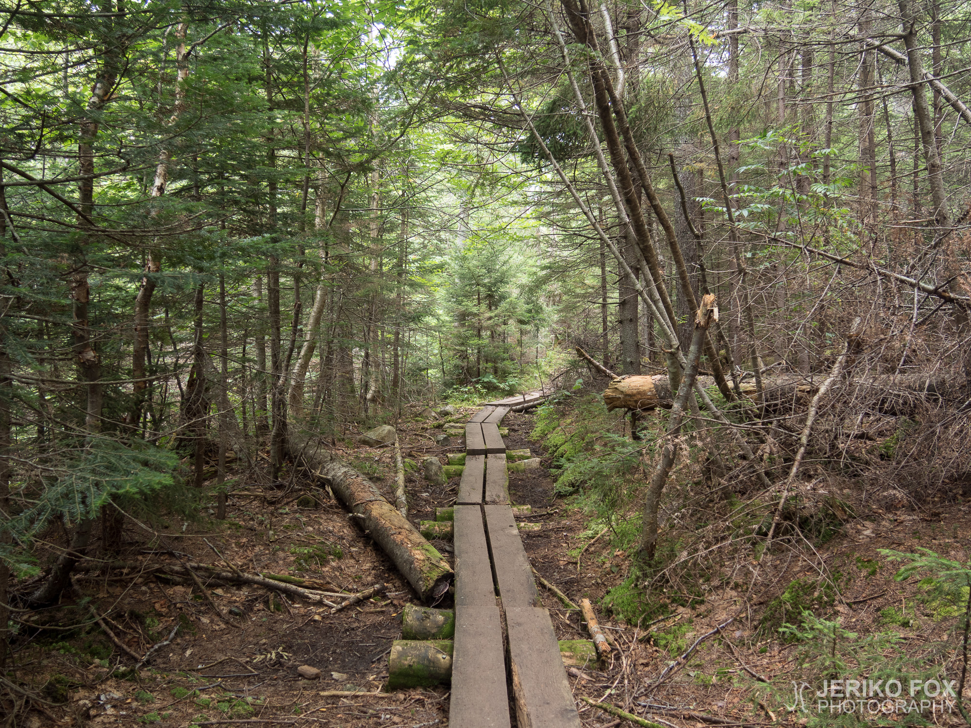
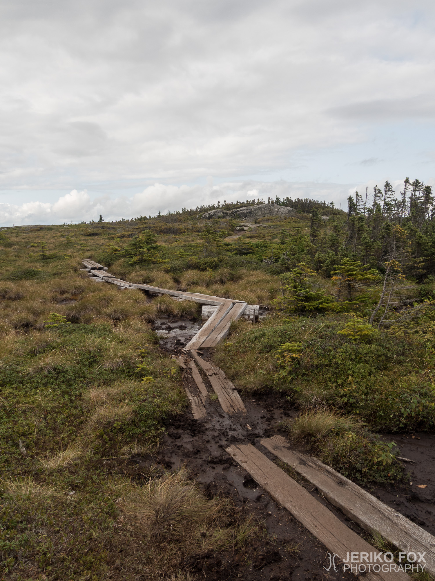
All day my hiking was afflicted by some sort of slowness. The trail was rocky and rooty or in the wetlands the bog bridges had broken or completely sunk. Hence I had to keep on hopping and inching and trying to find a route where I wouldn’t sink in the mud. Once I thought that I stepped on a rock, but the ground beneath me was completely squashy. Rapidly I pulled my foot from the submerging sludge – just in time that my hiking boot did not get that muddy stuff in it.
When I was going uphill towards the Mount Success I saw a hiker coming to my way. This was not anyhow unusual, but this man looked familiar. And also he was looking at me with a strange expression on his face. When we met, both stopped and then I realised that he was Hodge Podge. I got to know him in the Smokies when I returned to the trail after getting sick and the last time I saw him was in Erwin, Tennessee. The reunion was as jubilant as it was unexpected. He told me that he had injured his ankle near the midpoint of the AT and had to get off the trail for ten weeks. Then he had returned to the trail to finish the hike as a flip-flop, because he wouldn’t have had enough time to reach the Katahdin going NOBO (Baxter State Park doesn’t let overnight hikers in after mid-October). That meant Hodge Podge was hiking the northern half of the AT going south.
Two years ago I had seen a thru-hiker video of a plane fuselage near the Mount Success and since then wanted to visit the site. And today, climbing up the Mount Success, I was trying to find a certain side trail. I hadn’t found the coordinates, but in many blog posts people had described the route.
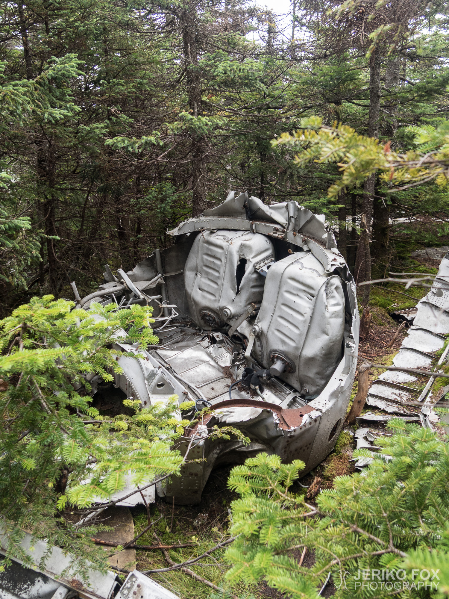
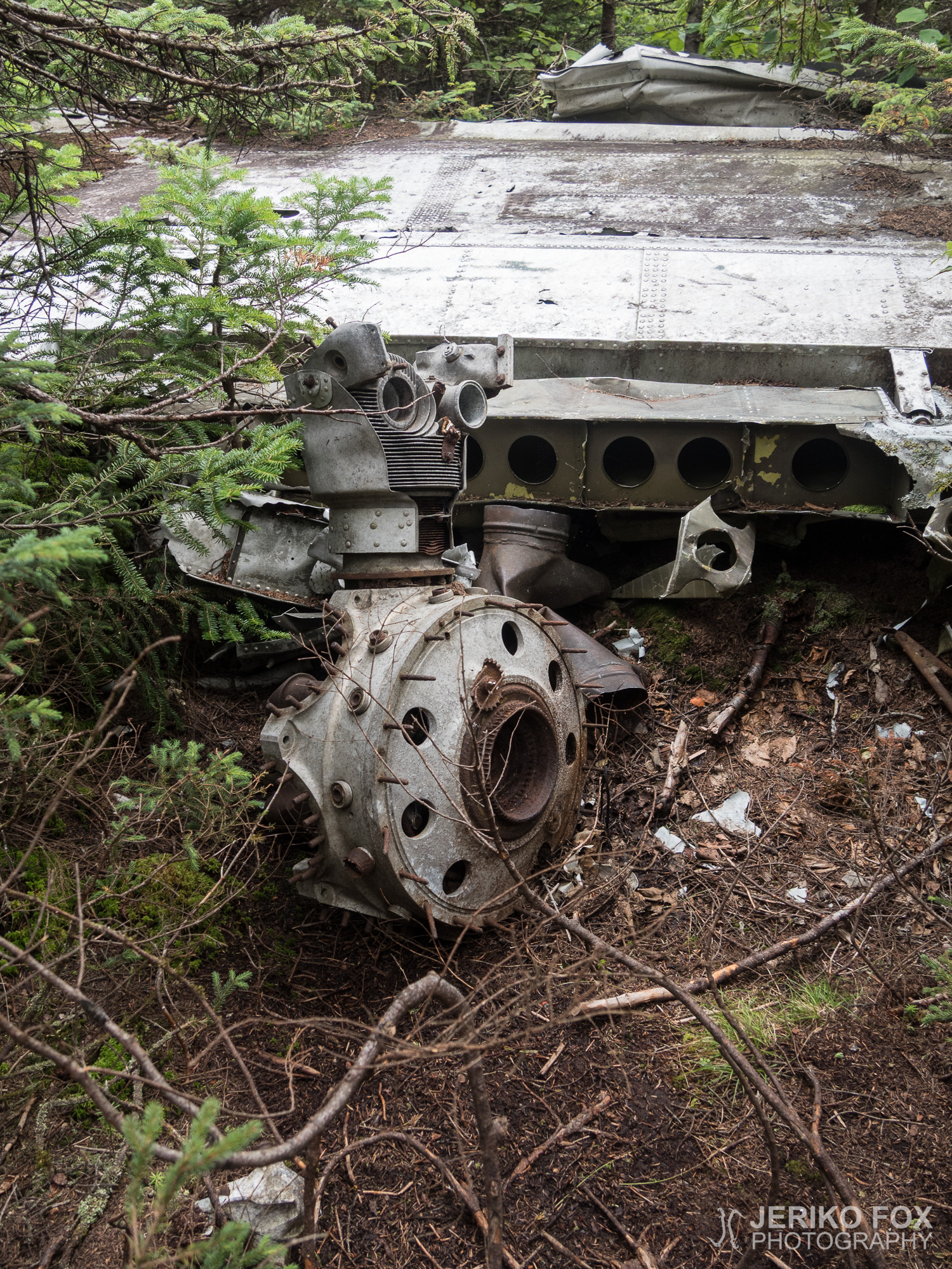
On November 30th in 1954 the Northeast Airlines flight 792 from Boston to Berlin (in New Hampshire, not in Germany) got into a blizzard and crashed to the southern slope of the Mount Success. The twin-engine Douglas DC-3 was carrying four crew members and three passengers. Everyone survived the crash, but two of the crew members died for their injuries while waiting to be rescued. The survivors had to sit and wait in bad weather until December 2nd before they were found.
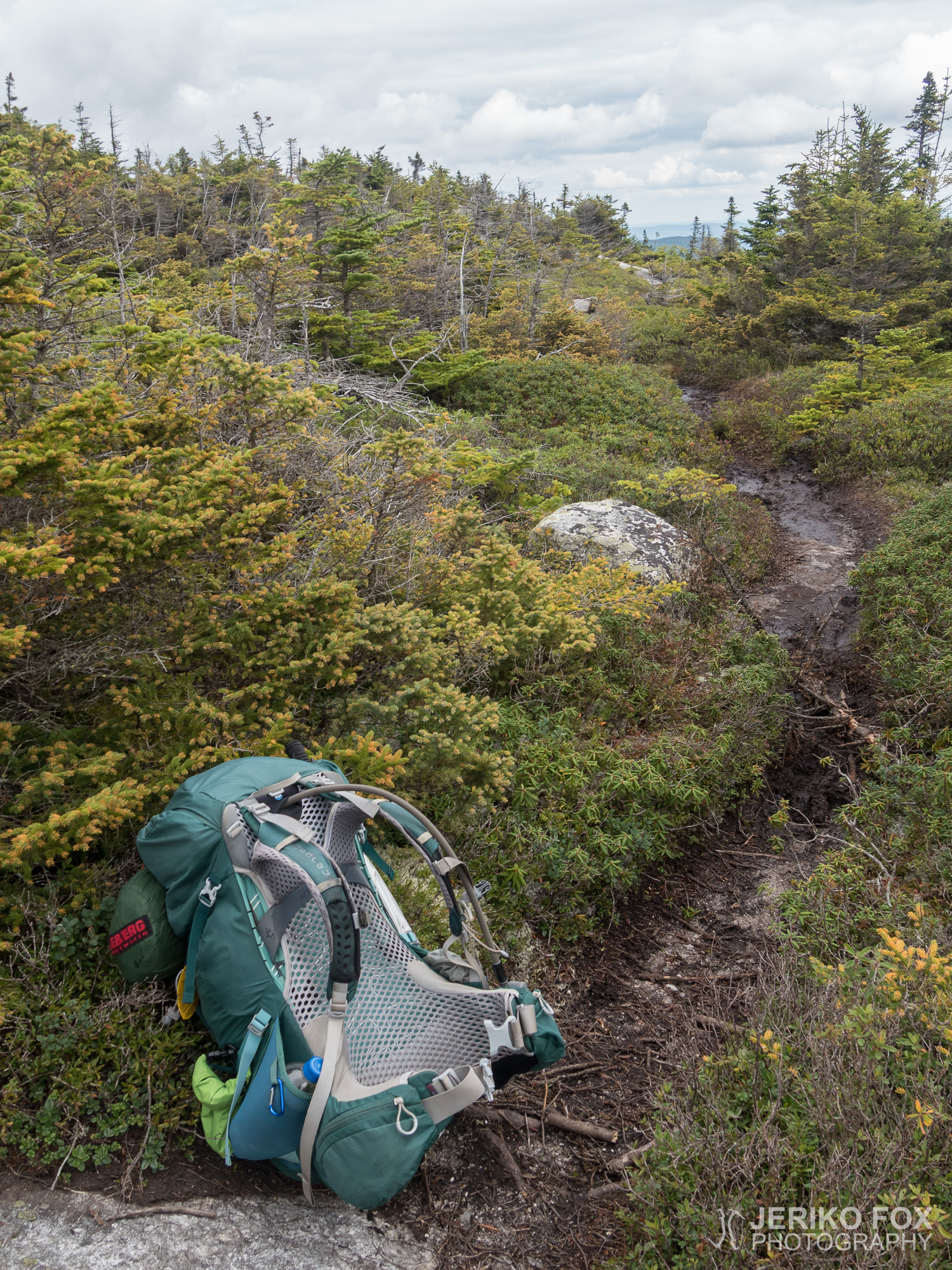
South from the southern summit of Mount Success there is an unmarked side trail on the right hand side (trail east), when going NOBO. I left my backpack to the AT, when I was sure that this indeed was the trail that I was looking for. Close to this trail there is a boulder about the size of a fridge on an open rocky slope. This was the sign that many blogs described as the indicator of being on the right trail. The trail went first straight and then turned right and downhill. Soon after that I came to a T-intersection with a yellow blazed trail. I had red about this too, but didn’t know which way to go. First I went left, but I soon realised that I was going the wrong way. I returned to the intersection and followed the branch of the trail that was going right. I started to hesitate if I was on the right place at all, when I had to push through the spruce trees that were growing over the trail.
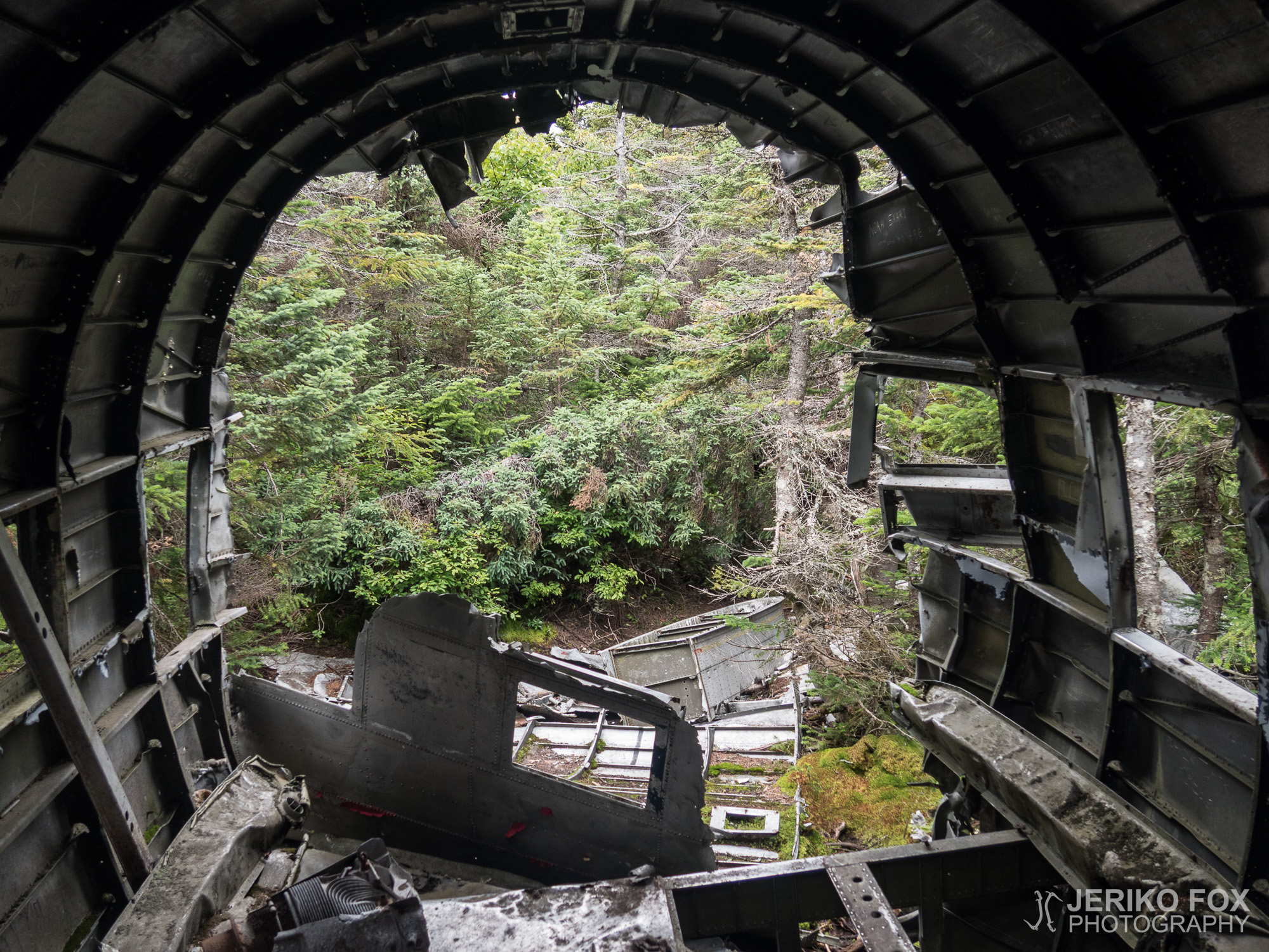
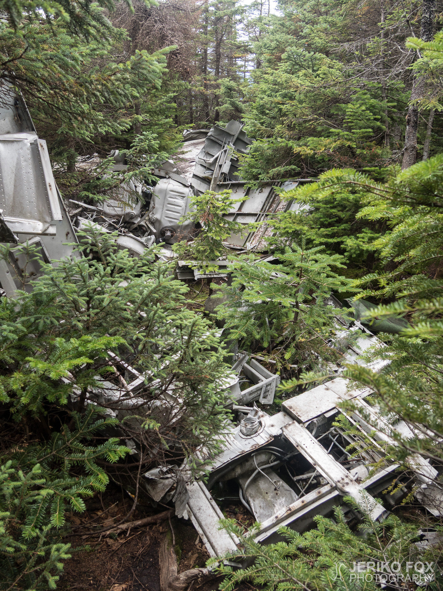
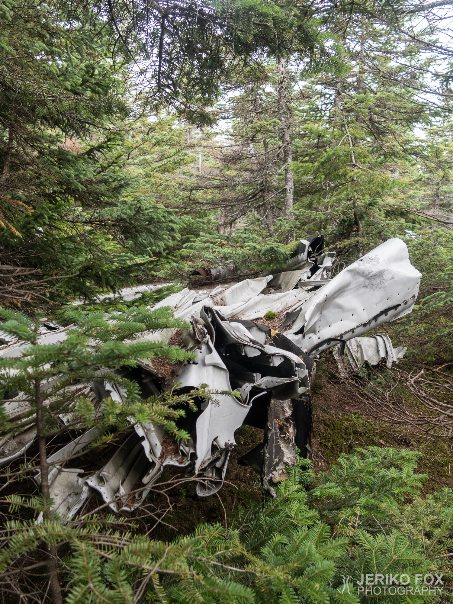
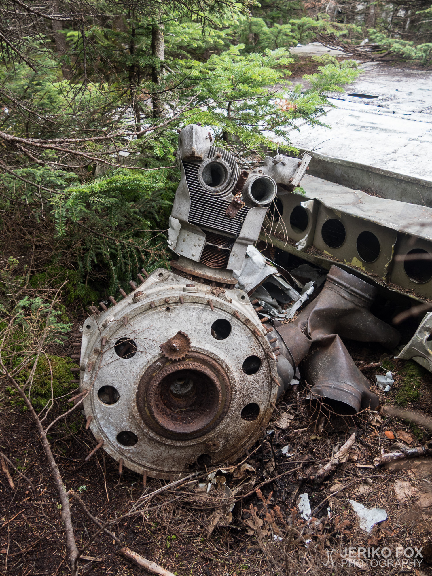
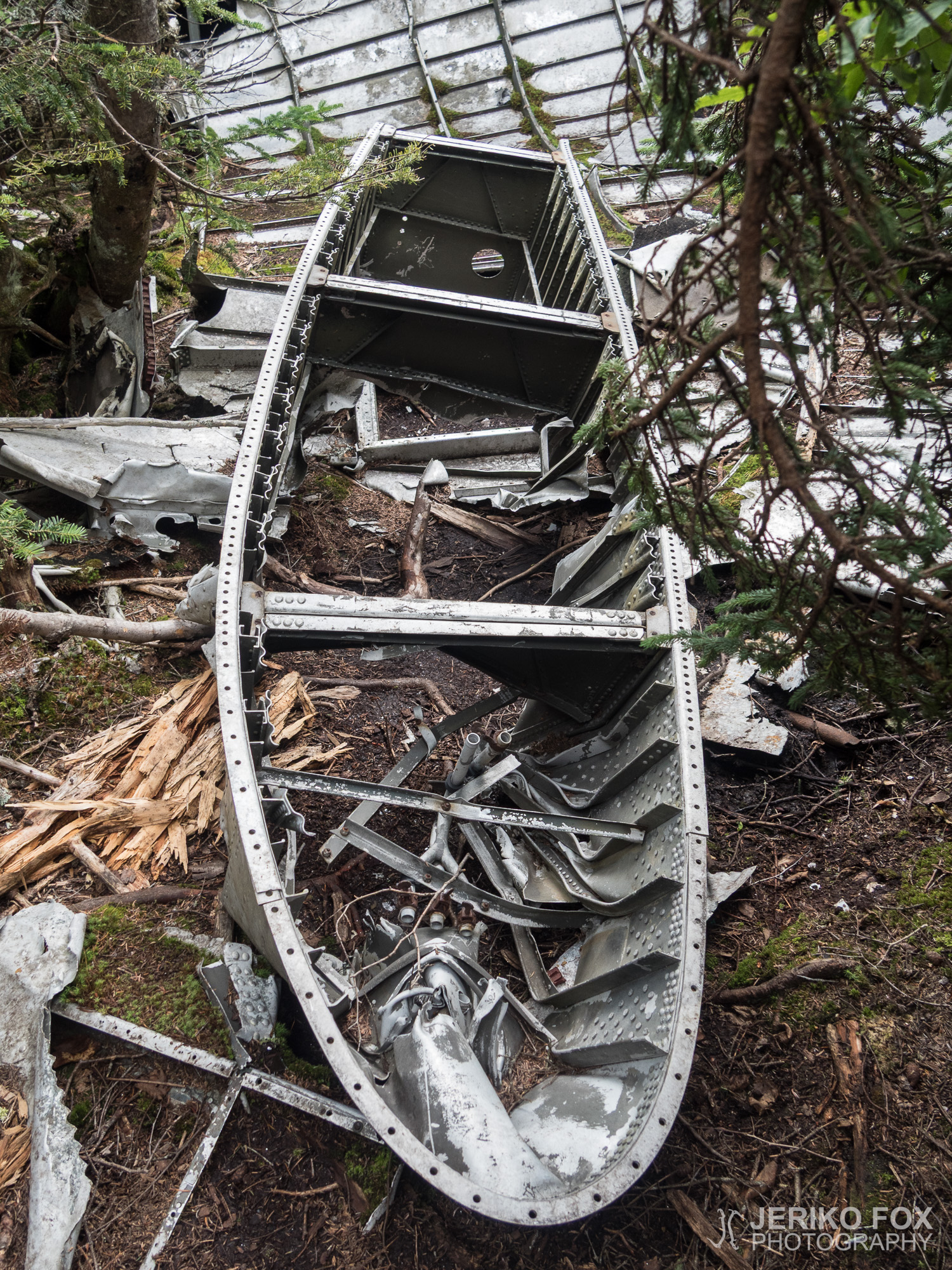
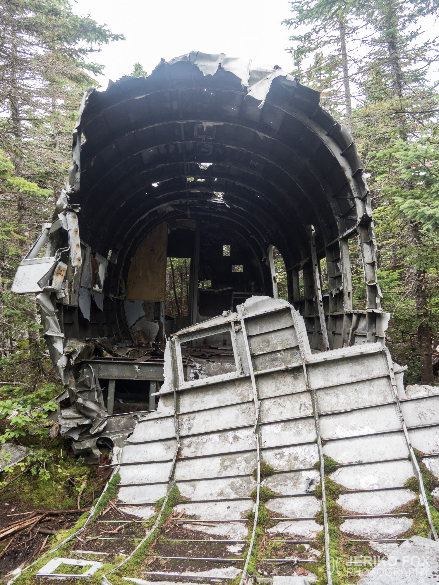
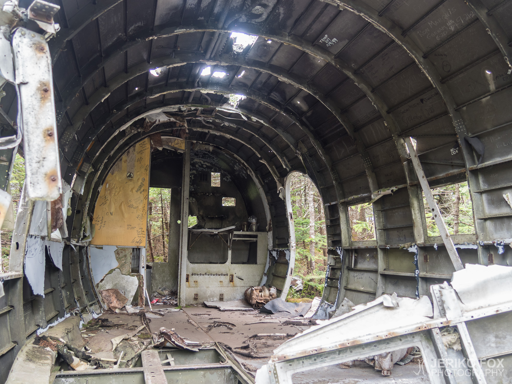
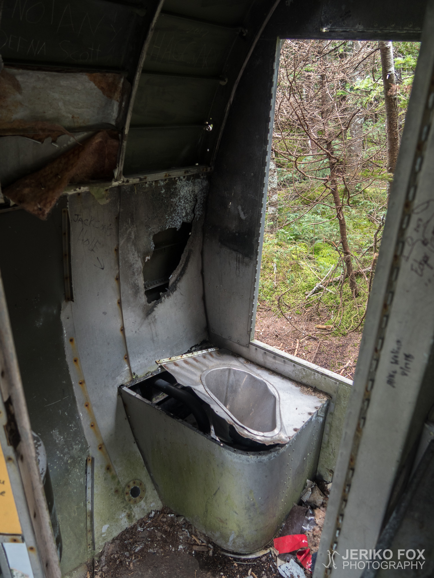
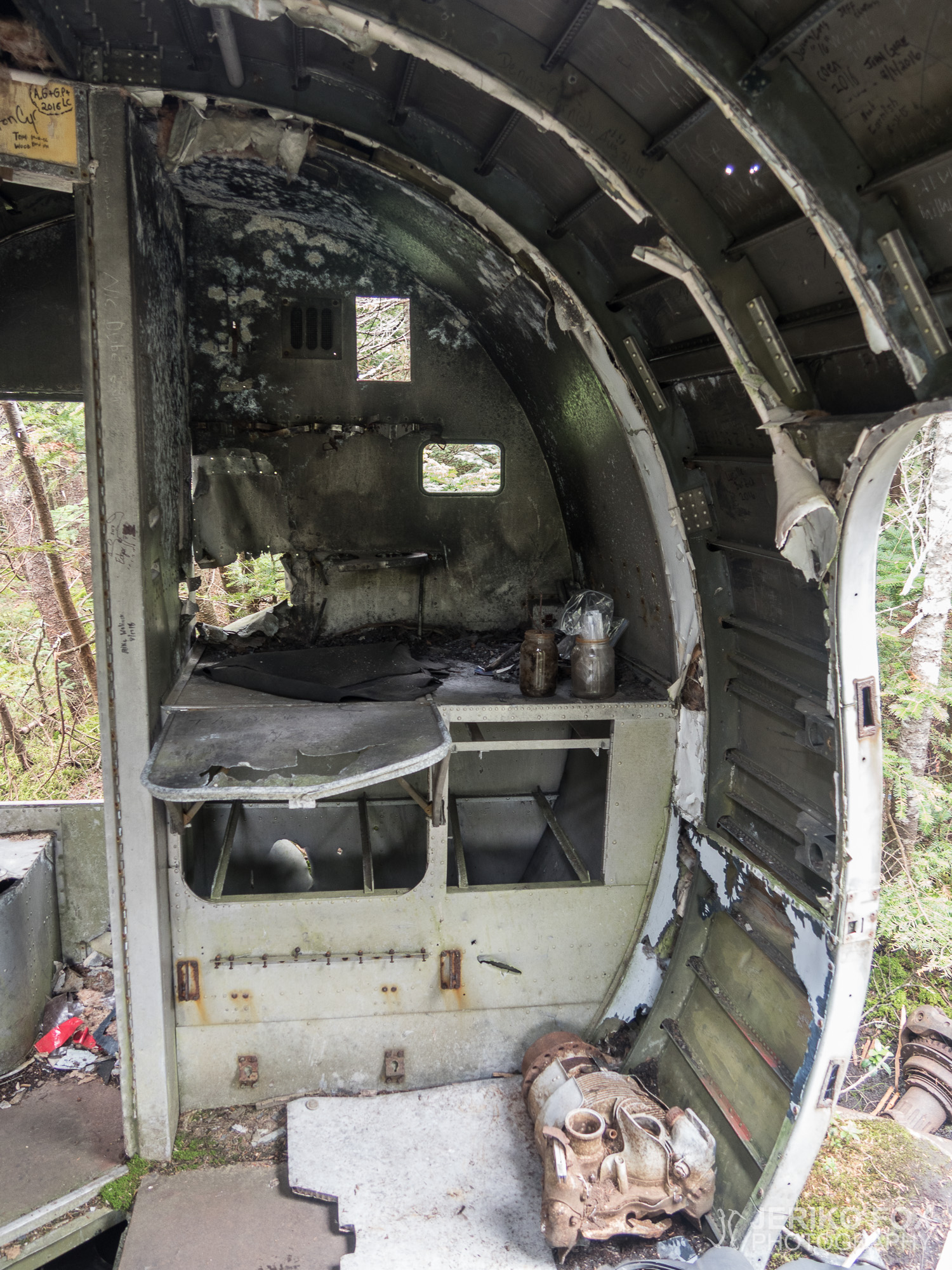
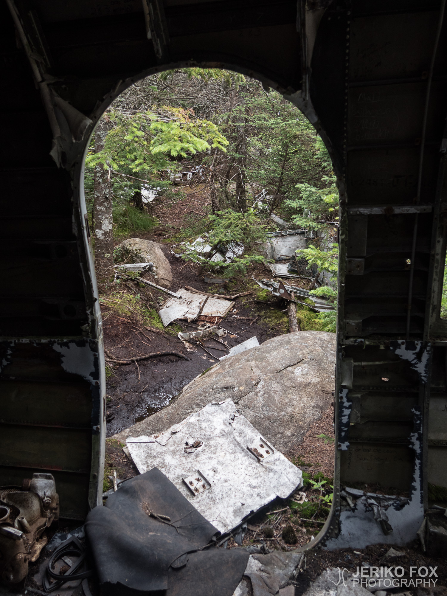
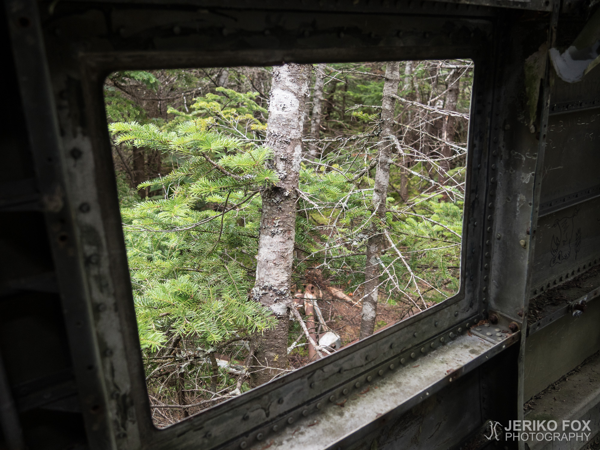
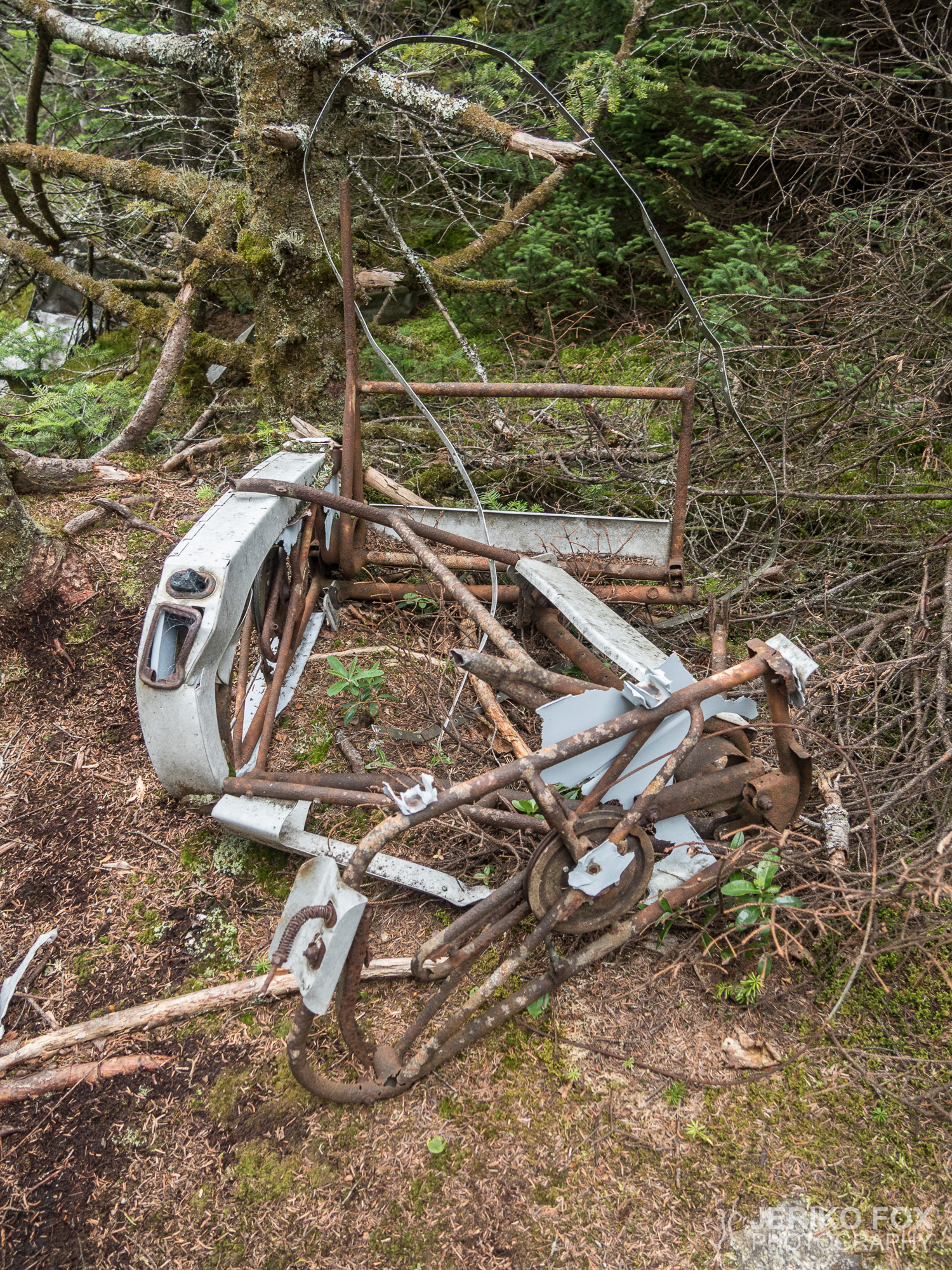
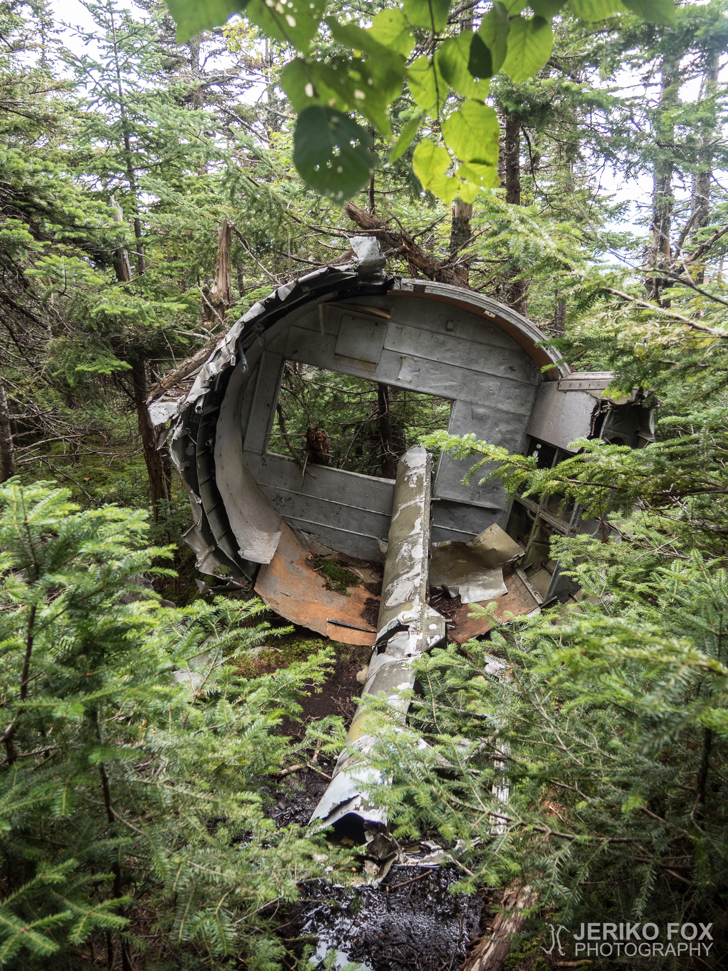
Finally I saw something white behind the trees. And there it was: a huge pile of aeroplane aluminium. I was circling this first pile, that seemed to have parts of the fuselage, the engines and apparently parts of a wing. Then next to this site I found the largest part – a segment of the fuselage. I walked over the moss covered wreck and climbed inside the plane. In the rear part of the fuselage there was a kitchenette and a toilet. The ceiling and the walls were full of tasteless engravings made by the people who had visited the site. I really don’t care about the graffitis and engravings in shelters or privies, but in this kind of place it’s destroying a historical site. I stepped out from the door and found one more part of the fuselage. Altogether there were plane parts everywhere, but walking in the dense forest and in the middle of the wreckage was a bit challenging. I was happy that I had decided to leave my backpack to the AT.
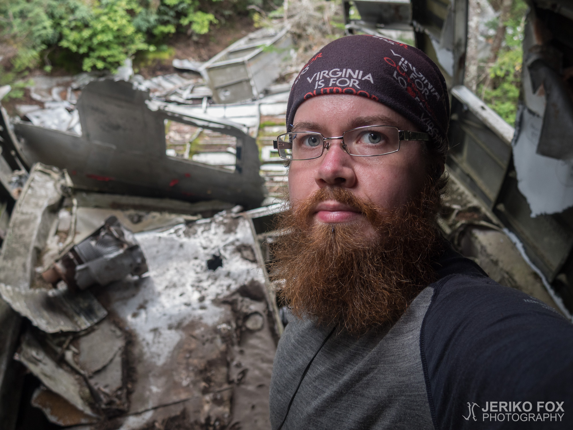
Visiting the crash site had took quite a while, but I think that this little adventure was well worth doing. As a child of the president of an aviation museum society I had seen my share of plane wrecks, but this might have been the best one of them. It reminded me of the TV show Lost, that starts with a plane crashing to (what is presumed to be) a deserted island.
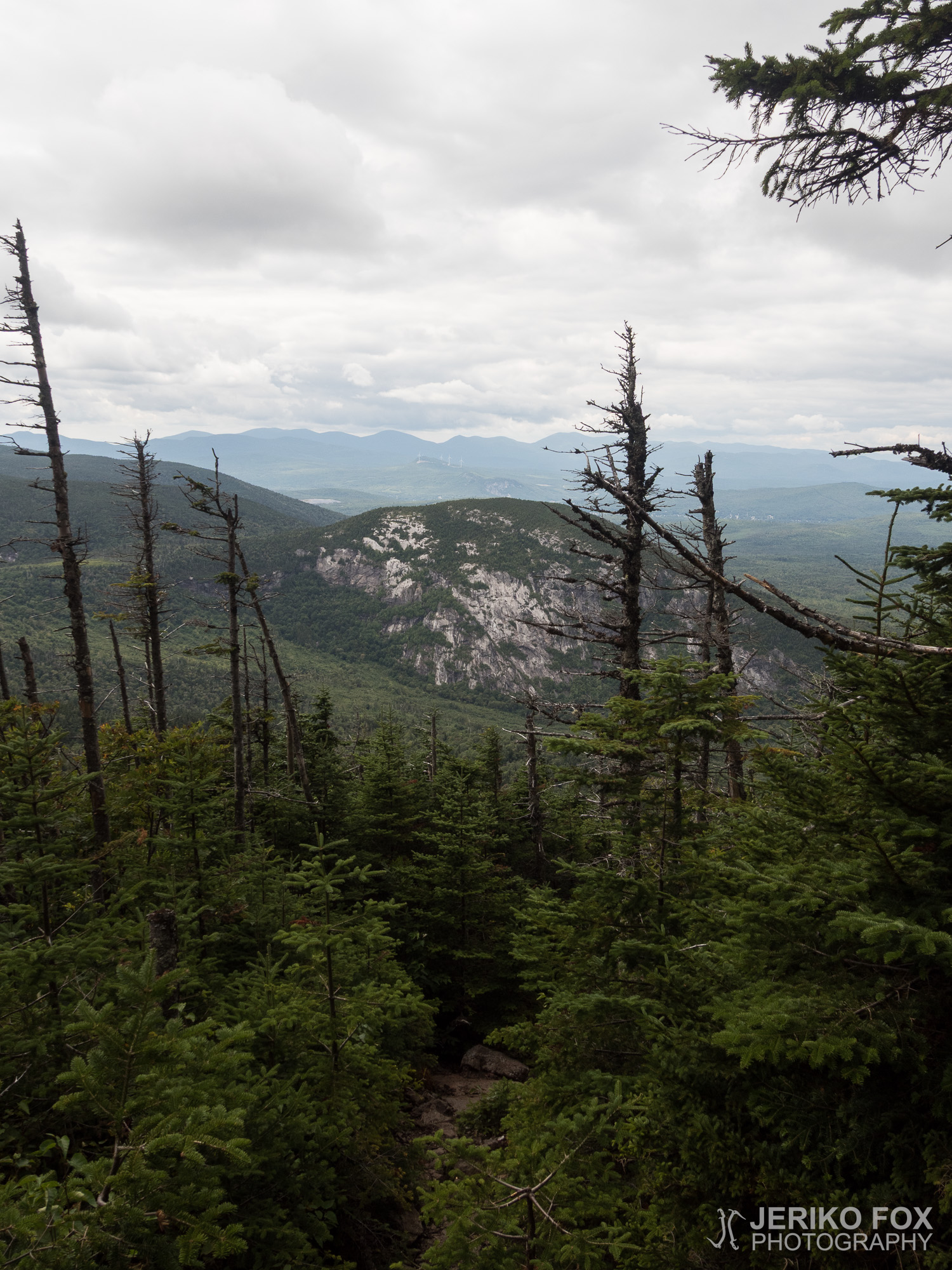
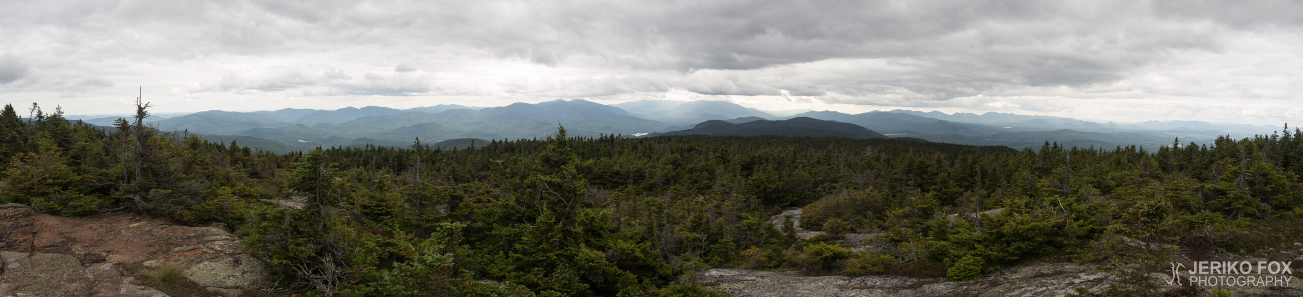
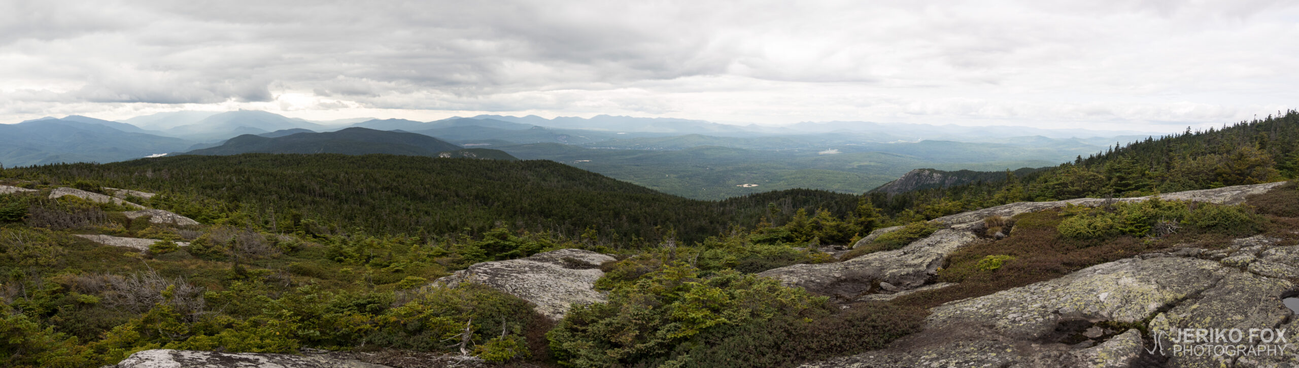
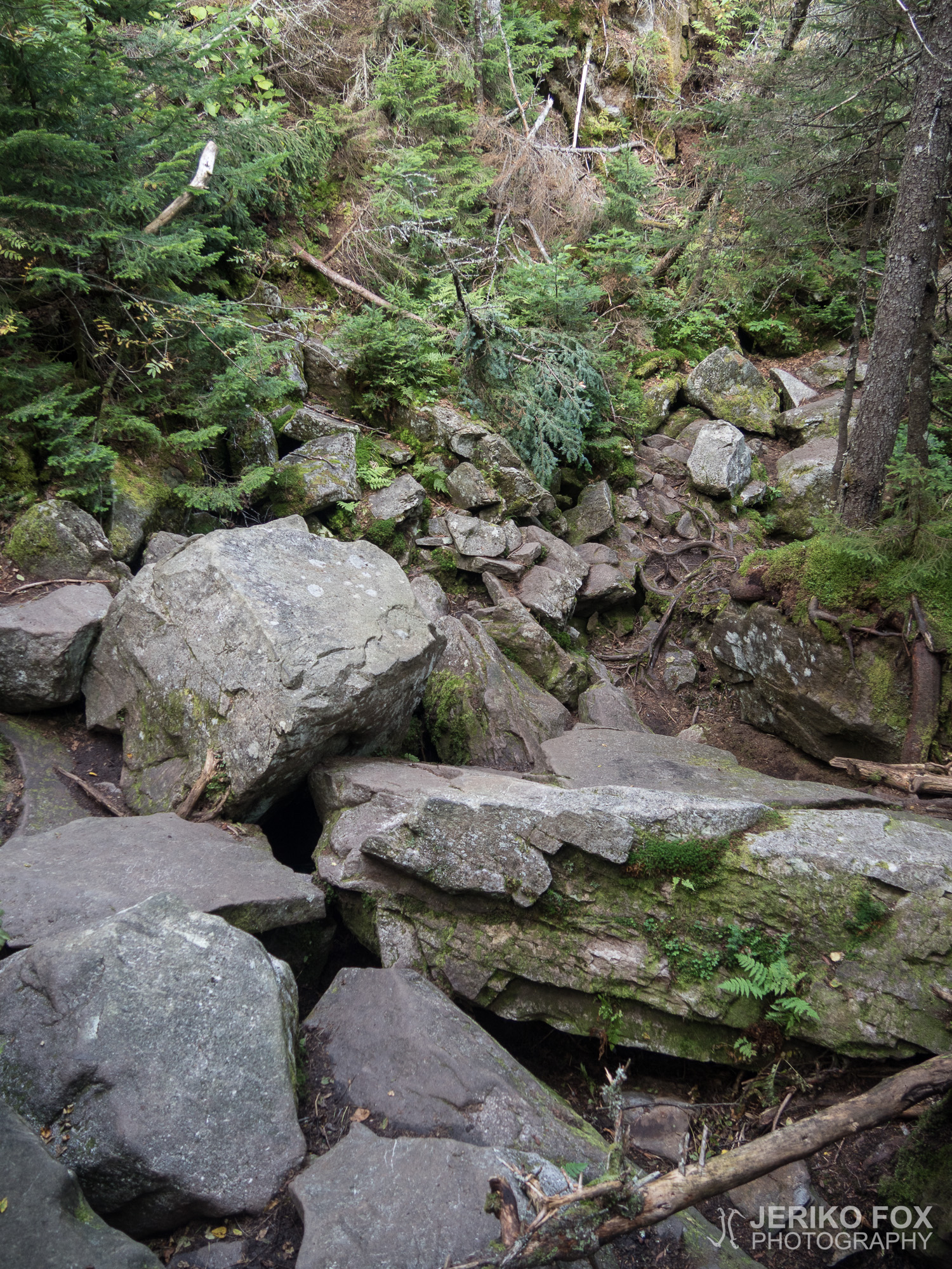
As I continued my hike my speed didn’t really get any better, but quite the opposite. When I was descending from the Mount Success the soles of my feet started to be in pain and the downhill was steep at times. In one place it was not just steep, but the whole trail was just huge boulders with their surfaces worn to smooth and slippery. In between there were empty voids. I was climbing down first using a root as my support and then inching myself down sitting on my butt and sliding towards a fallen tree that I could use to walk across. Sliding even a small amount to the wrong direction would have had me falling several meters (more than 10 ft) into a void between the boulders.
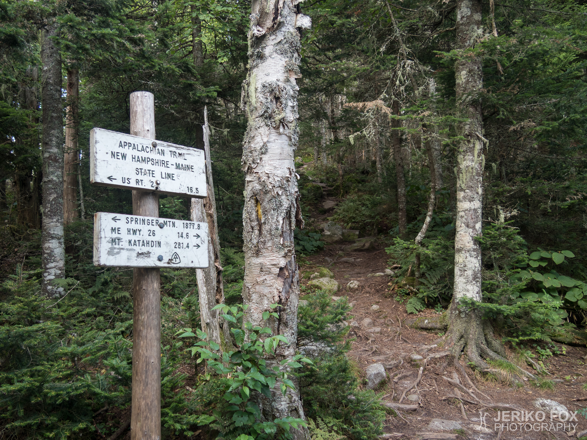
At six I arrived to the place that I had dreamed of for such a long time: the state line of New Hampshire and Maine. I had walked through 13 states from Georgia to Maine, the last state of the AT. Now there was only 280 miles to the Mount Katahdin, the northern terminus of the AT.
The moment was less emotional than I had expected, because my feet were in pain. I started to think if should just call it a day. I hadn’t done very big miles and I had still couple hours of daylight left. But then again my feet felt awful and for some reason I was surprisingly tired. I sat down for a while and thought that dammit, isn’t this an accomplishment to celebrate. I could afford to give my feet some slack. So, I put up my tent to an excellent spot at the state line and as a cherry on the top, ate the salmiakki (salty Finnish candy) that Noora had sent me.
(In the end of this post are the detailed directions how to find the plane crash site, the coordinates and a map with a downloadable GPX file of the route from the AT to the fuselage.)
Aamu oli viileä. Puin ensimmäistä kertaa pitkästä aikaa päälleni pitkähihaisen paidan ja hanskatkin olisivat olleet telttaa purkaessa tarpeen. Olin vain ehtinyt jo pakata ne reppuun. Lämpenin toki päästyäni liikkeelle ja keskipäivällä oli hetken aikaa kuumakin. Sää on kuitenkin selvästi muuttunut syksyisemmäksi.
Koko päivän tuntui vaellusta vaivaavan hidas eteneminen. Polku oli kivistä ja juurakkoista tai kosteikkojen kohdalla pitkospuut olivat usein poikki tai uponneet. Niinpä jouduin loikkimaan ja etsimään reittiä ollakseni uppoamatta mutaan. Yhden kerran luulin astuvani kiven päälle, mutta siirsinkin painoni täysin löysään kohtaan. Ripeästi kiskoin jalkani irti upottavasta liejusta ja ehdin juuri estää vaelluskenkää hörppäämästä mutaa sisäänsä.
Kulkiessani ylämäkeen kohti Mount Successia tuli minua vastaan toinen vaeltaja. Tämä ei itsessään ollut mitenkään poikkeuksellista, mutta mies näytti jotenkin tutulta. Ja myös hän tuijotti minua erikoinen ilme kasvoillaan. Tullessamme toistemme kohdalle pysähdyimme ja tajusin vaeltajan olevan Hodge Podge. Olin tutustunut häneen palattuani AT:lle mahataudin jälkeen Smokiesilla ja olimme nähneet viimeeksi Erwinissä, Tennesseessä. Jälleennäkeminen oli yhtä yllättävä kuin iloinenkin. Sain tietää, että Hodge Podge oli loukannut nilkkansa AT:n puolivälissä ja joutunut parantelemaan vammaa kymmenen viikkoa. Siten hän oli päätynyt jatkamaan vaellusta filp-flop -tyyliin, koska ei olisi enää ehtinyt Katahdinille ajoissa (Baxter State Park sulkee porttinsa yön yli vierailevilta talvikaudeksi lokakuun puolivälissä). Nyt siis Hodge Podge oli vaeltamassa tämän pohjoisen puolikkaan päinvastaiseen suuntaan.
Kaksi vuotta sitten olin nähnyt AT-vaeltajan videon Mount Successin lähellä olevasta lentokoneen hylystä ja olin päättänyt haluavani käydä paikalla. Niinpä tänään noustessani Mount Successia etsin erästä tiettyä sivupolkua. En ollut löytänyt koordinaatteja, mutta useasta blogista löysin kuvailuja reitistä.
Marraskuun 30. päivä vuonna 1954 Northeast Airlinesin lento 792 Bostonista Berliniin (New Hampshireen, ei Saksaan) joutui lumimyrskyyn ja iskeytyi Mount Successin etelärinteeseen. Kaksimoottorisen Douglas DC-3:n kyydissä oli neljä miehistön jäsentä ja kolme matkustajaa. Kaikki selvisivät hengissä putoamisesta, mutta kaksi miehistön jäsentä ehti kuolla vammoihinsa pelastusta odottaessa. Huonossa säässä eloonjääneet joutuivat odottamaan joulukuun toiseen päivään asti ennen kuin heidät löydettiin.
Mount Successin etelähuipun eteläpuolelta lähti kulkusuuntaani nähden oikealle merkkaamaton sivupolku. Jätin reppuni risteykseen varmistuttuani kyseessä olevan oikea polku. Sen lähellä kallion päällä oli noin jääkaapin kokoinen lohkare, jonka useampi blogi oli kuvaillut merkiksi. Polku kulki ensin suoraan ja kaartoi sitten oikealle alamäkeen. Pian tämän jälkeen edessäni oli keltaisilla merkitty risteävä polku. Olin lukenut myös tästä, mutta en ollut varma kumpaan suuntaan minun pitäisi mennä. Lähdin ensin vasemmalle, mikä osoittautui vääräksi suunnaksi. Palasin risteykseen ja menin oikealle kääntyvää haaraa. Aloin jo epäillä olinko edes oikeassa paikassa, kun jouduin puskemaan polkua peittävien kuusien läpi.
Lopulta näin kuitenkin jotain vaaleaa pilkottavan puiden takaa. Ja sieltä se sitten löytyi: valtava kasa lentokonepeltiä. Kiertelin tätä ensimmäistä läjää, jossa näytti olevan jotain osia rungosta, moottorit ja ilmeisesti osa siivestä. Sitten sitten löysin hieman sivummalta isoimman yhtenäisen osan eli pätkän koneen runkoa. Kävelin sammaloituneiden rojujen yli ja kiipesin sisälle koneeseen. Rungon perällä oli ilmeisesti keittiönurkkaus ja vessa. Seiniin ja kattoon ihmiset olivat kaivertaneet mielestäni varsin mauttomasti merkkejä käynnistään. Minua eivät seinäkirjoitukset sheltereillä tai huussissa vaivaa, mutta tällaisessa paikassa tuhotaan mielestäni historiallista ympäristöä. Menin ulos koneen sivuovesta ja löysin vielä pienen osan runkoa. Ylipäänsä metsässä oli siellä tällä koneen osia, mutta kulkeminen tiiviin metsän ja romun keskellä oli paikoin haastavaa. Olin tyytyväinen, että jätin reppuni AT:lle.
Lentokoneella käymiseen oli kulunut melko paljon aikaa, mutta tämä sivuretki oli mielestäni tekemisen arvoinen. Lentomuseon museomestarin lapsena olen nähnyt muitakin lentokoneen raatoja, mutta tämä oli ehkä parhaiten säilynyt. Mieleeni tuli muutamien vuosien takainen tv-sarja Lost, jossa lentokone putoaa oletetusti autiolle saarelle.
Jatkaessani matkaa tahtini ei ainakaan nopeutunut vaan pikemminkin päin vastoin. Mount Successilta laskeutuessani alkoivat jalkapohjat tuntua kipeiltä ja ajoittain rinne oli jyrkkä. Yhdessä kohdassa itseasiassa ei pelkästään jyrkkä vaan koko reitti muodostui suurista kivenjärkäleistä, joiden pinnat olivat kuluneet sileiksi ja väleissä oli ammottavia tyhjiä aukkoja. Kiipesin ensin puun juuresta tukea ottaen alaspäin, sitten istuin hivuttautuen takapuolellani kohti kaatunutta puuta, jota pitkin onnistuin kävelemään hieman tasaisemmalle kohdalle. Pienikin luisuminen olisi saattanut pudottaa useita metrejä syvään koloon kivien välissä.
Kuuden aikaan tulin pitkään odottamaani paikkaan: New Hampshiren ja Mainen osavaltioiden rajalle. Olin kävellyt 13 osavaltion kautta Georgiasta Maineen, viimeiseen osavaltioon. Nyt edessäni olisi enää 280 mailia Mount Katahdinille, AT:n pohjoiselle päätepisteelle.
Hetki oli vähemmän tunteikas kuin olin odottanut, koska jalkojani särki. Aloin miettiä, että jos lopettaisinkin tältä päivältä tähän. En ollut tehnyt kovin suurta mailimäärää ja ehtisin vielä vaeltaa pari tuntia ennen pimeää. Mutta kuitenkin toisaalta jaloissa tuntui pahalta ja olin jostain syystä yllättävän väsynyt. Istuin hetken ja päätin, että hitto vie eiköhän tässä saavutuksessa ole syytä juhlaan sen verran, että voin antaa vähän armoa jaloilleni. Iskin teltan pystyyn osavaltion rajalla olevalle hyvälle paikalle ja kruunasin illan syömällä Nooran minulle lähettämät salmiakit.
(Tämän postauksen lopussa on yksityskohtaiset ohjeet miten löytää koneen hylyn luokse, koordinaatit sekä kartta ja ladattava GPX-tiedosto reitistä AT:lta hylylle.)
Max elevation: 1113 m
Total time: 08:11:47
Directions and coordinates to the Douglas DC-3 crash site
Hiking the Appalachian Trail northbound there is a side trail (44°28’6″ N 71°2’28” W) on the right hand side (“trail east”) right before the south summit of Mount Success. After a short walk on this trail you see a boulder about the size of a fridge on your left hand side. The trail turns right and downhill and then meets a yellow blazed trail. Turn right and follow the yellow blazes. This trail is very overgrown, so you can’t see the fuselage before you get there (44°28’1″ N 71°2’33” W). The distance from the AT is about 300 m (0.2 mi). Below the map is a download link to get the GPX file.
Kulkiessa Appalachian Trailia pohjoiseen päin (NOBO) on juuri ennen Mount Successin etelähuippua oikealle (“trail east”) menevä sivupolku (44°28’6″ N 71°2’28” W). Lyhyen matkan tätä polkua kuljettua näkyy vasemmalla kallion päällä noin jääkaapin kokoinen irtolohkare. Polku tekee mutkan oikealle ja alamäkeen, jonka jälkeen se tulee keltaisella merkitylle polulle. Käänny oikealle ja seuraa keltaisia merkkejä. Polku on umpeen kasvanut, joten näet lentokoneen vasta, kun saavut aivan sen lähelle (44°28’1″ N 71°2’33” W). Matka AT:lta on noin 300 m. Kartan alla on latauslinkki GPX-tiedostoon.
Max elevation: 1083 m
Total time: 00:48:00