

21,62 km (13.4 miles)
2118.5 / 2189.8 miles
Logan Brook Lean-to, ME
I woke up to a pleasantly warm morning. I was thirsty, but I drank only a little bit of water (in addition to my dish washing water) to save some for hiking. The next water was about 3 km (2 miles) away and I had a doubt that the downhill might continue as a difficult one.
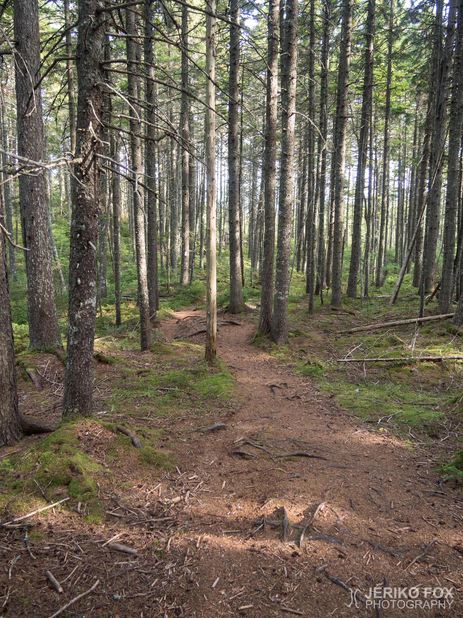
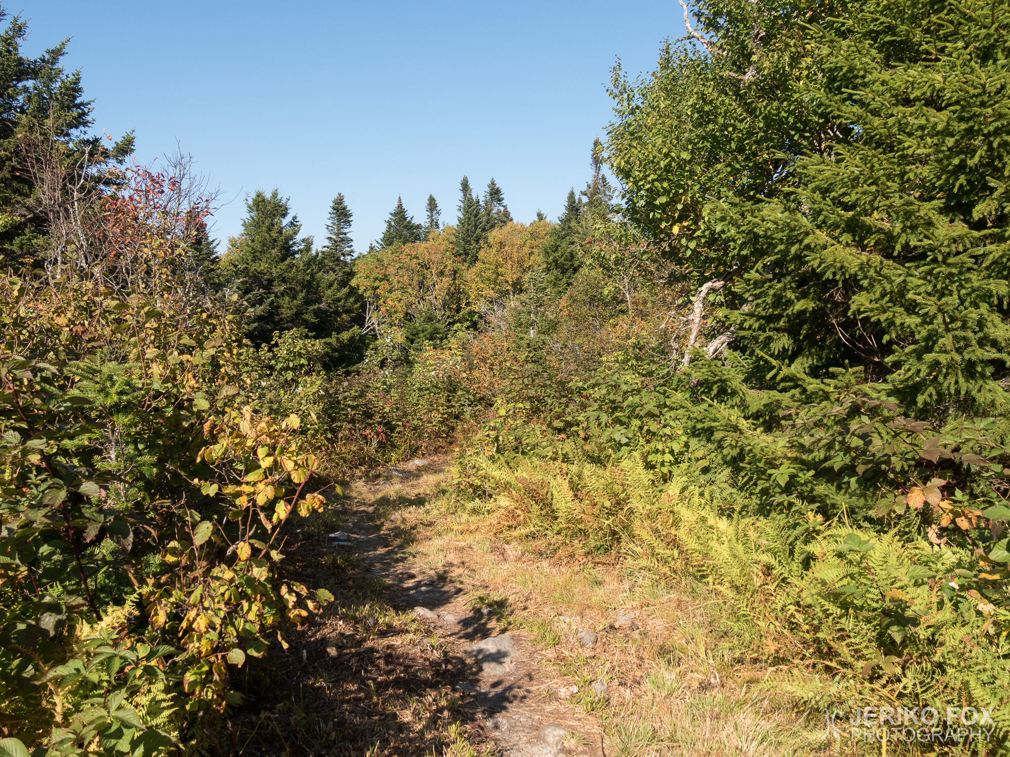
I got a very welcome surprise, when the trail changed considerably better soon after my tent spot. Or maybe my hiking strength was better after the rest. Anyhow I was going with a good speed towards the West Branch Pleasant River, where I had wanted to get yesterday.
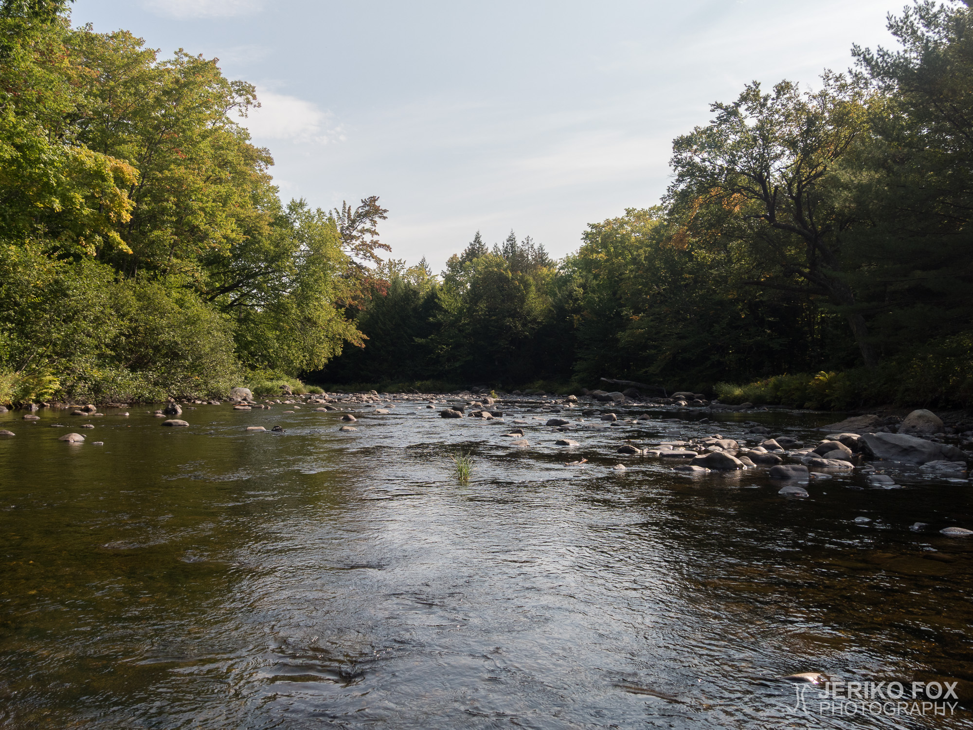
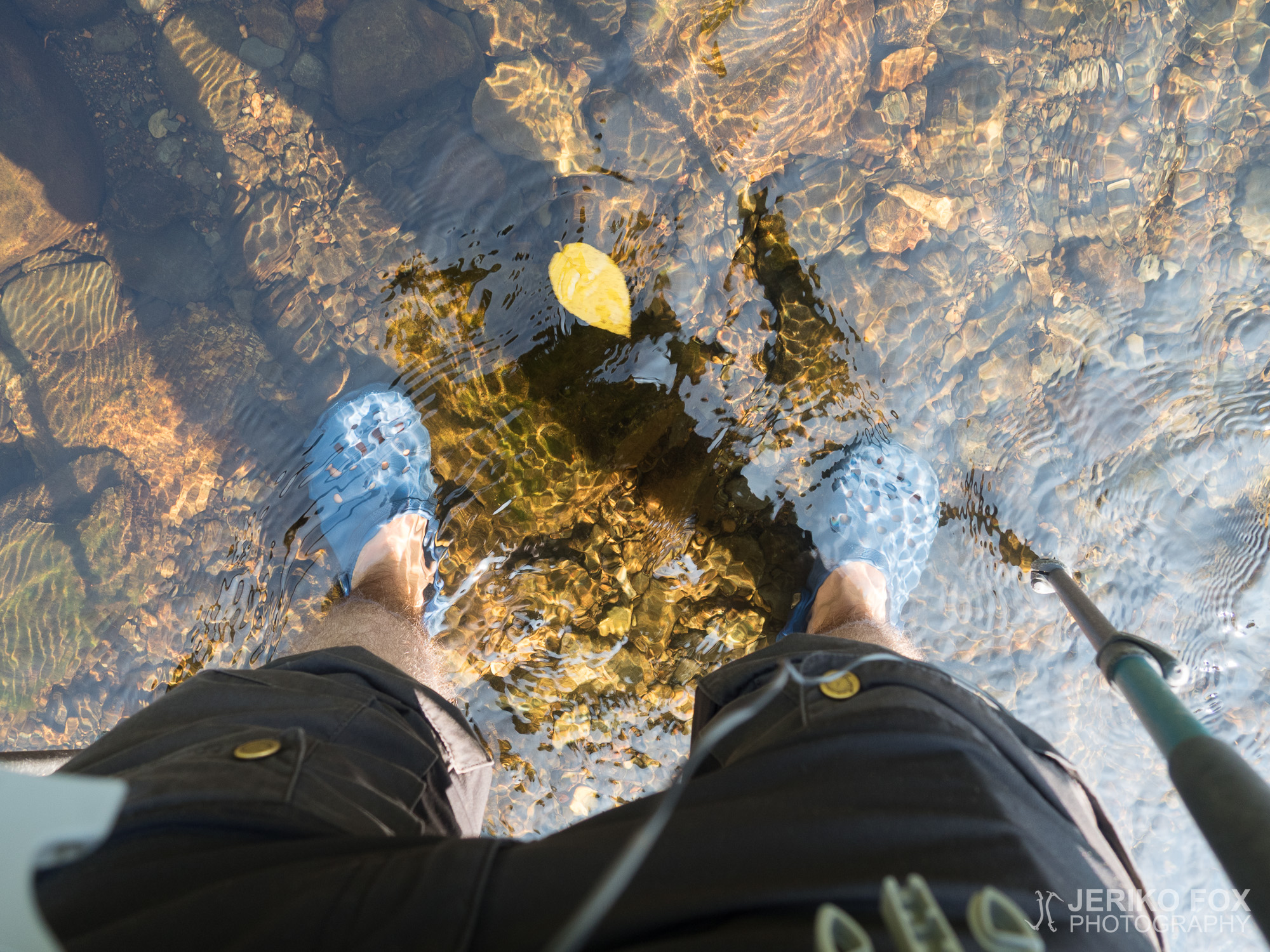
The river was wide, but shallow and the water was flowing very gently. As I was fording I saw small fishes swimming around me. When I reached the other side I filled up my water and drank a lot. The cold water felt heavenly both on the inside and on the outside of my body. My feet were refreshed by this little bath.
I started to climb the uphill that was very gentle for the first 9 km (5,6 miles). I had a lunch break at the Carl A. Newhall lean-to and as I moved on there was already someone putting up their tent. I honestly don’t understand these short days of the early birds, but as well they don’t seem to understand me hiking late in the evening. Well, whatever tickles your fancy.
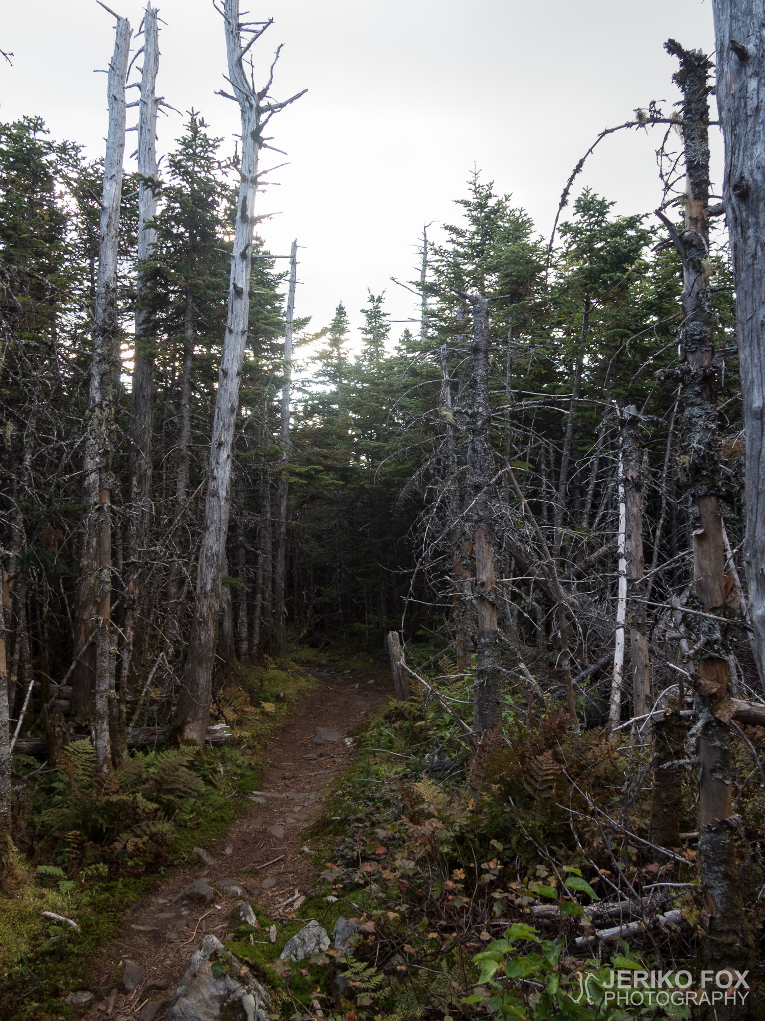
The climb to the Gulf Hagas Mountain was downright criminally easy. The AT was getting more steep, but the trail was good and easy to hike. This enjoyable hiking lifted up my moods and I pressed on briskly towards the next summit. The West Peak took more effort to ascend, but even in this steep uphill I felt content. When I reached the Hay Mountain, I really started to feel that I could do the whole cluster of summits before dark. Otherwise this wasn’t important, but I really wanted to reach the summit of the White Cap Mountain before dark. That was the place where a NOBO could very first time see the northern terminus of the AT, the Mount Katahdin.
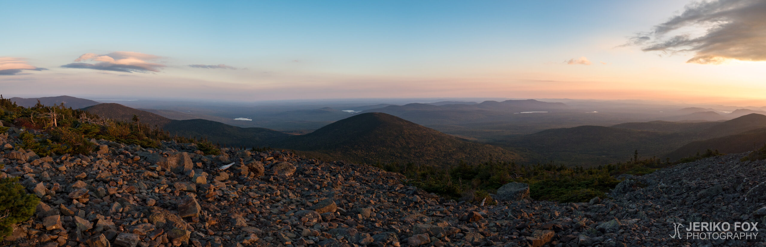
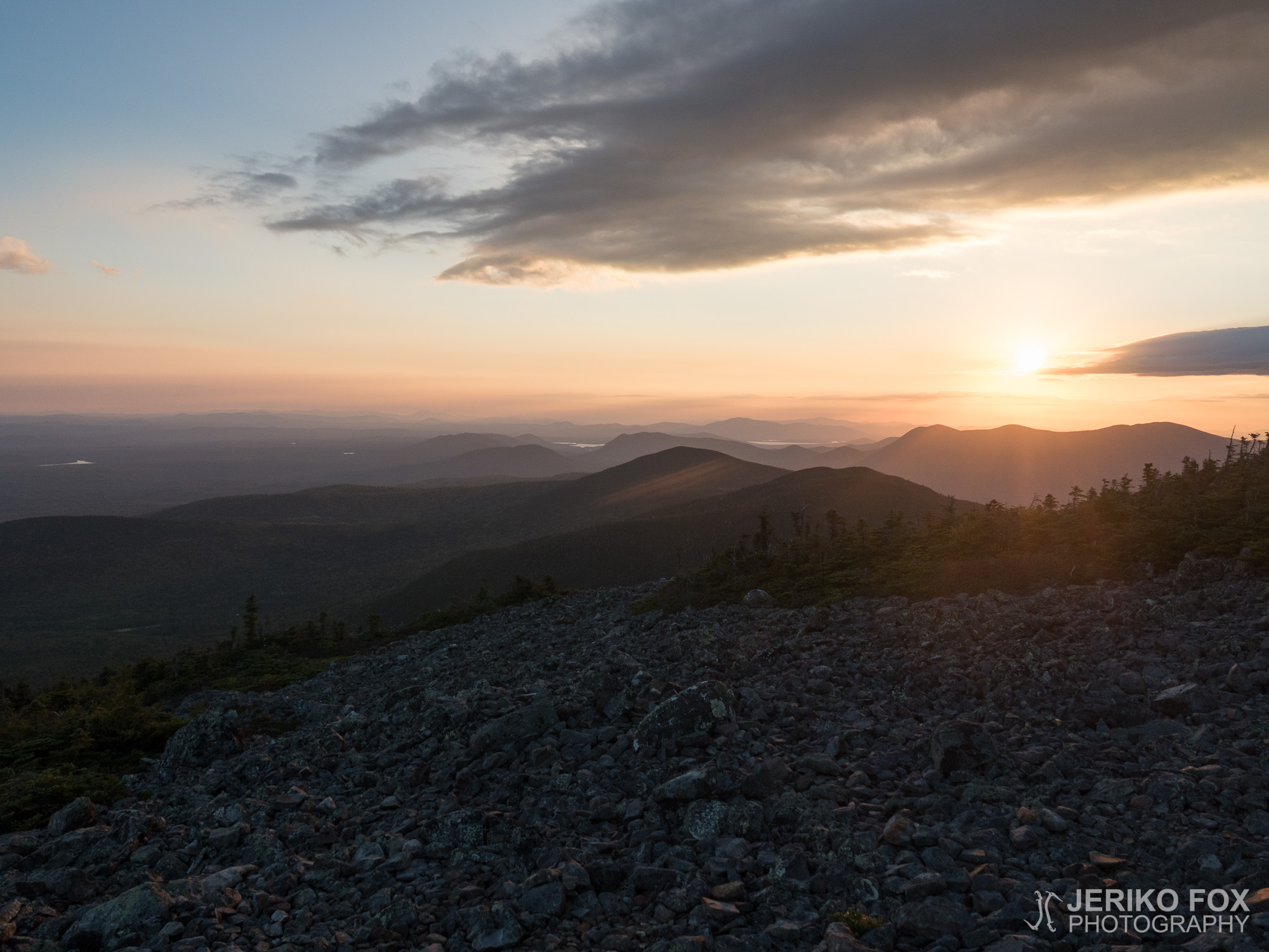
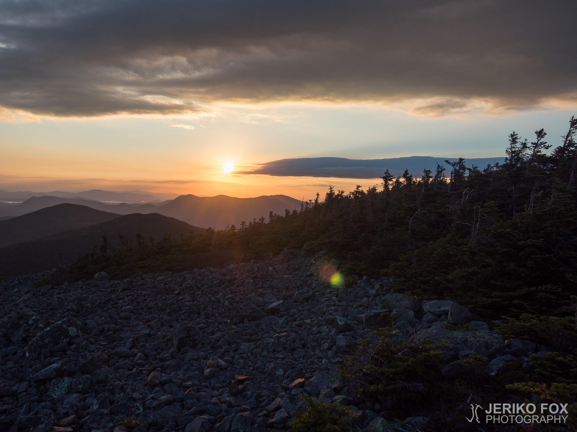
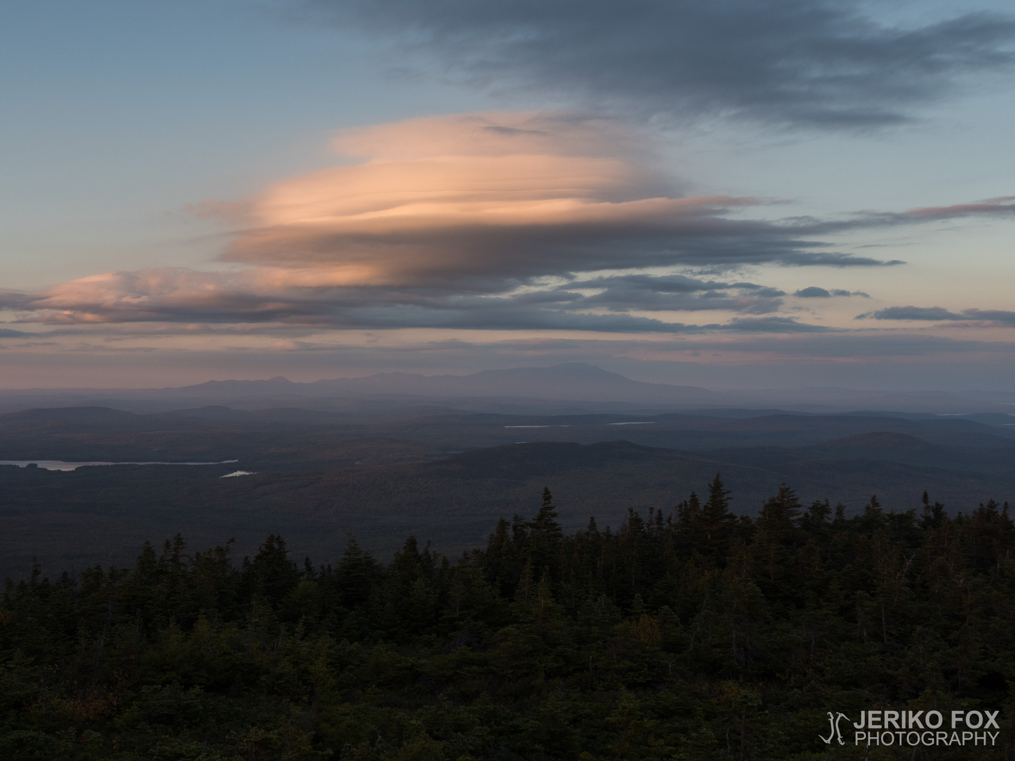
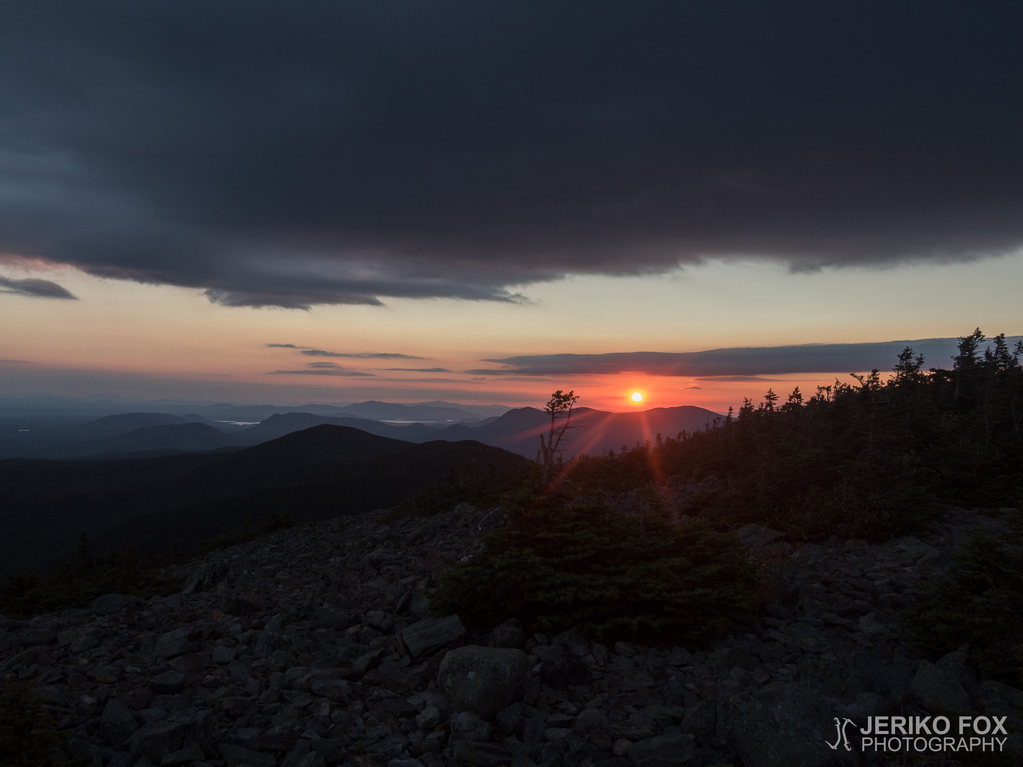
The last peak in the row, the White Cap Mountain, was treeless and as I was approaching the summit the a strong and chilly evening wind was blowing. When I stood on the summit I saw a stunningly beautiful view opening below me. The sun was starting to set and the horizon being painted with its colours. All around me were mountains sinking into deepening shades of blue. I walked through small shrubs to the other side and there it was. That view that I had been walking for the last six months: the Mount Katahdin. Far in the horizon I could see this distinctively higher mountain, and as I stood there watching it there was nothing to do to stop the tears from flowing. That is IT. The northern terminus of the Appalachian Trail – close enough to see.
The sunset developed to the most gorgeous shades of red, but it was time for me to start the descent. I put the head torch ready for the action and begun my climb down the rocky hillside as the cold wind was blowing. When I reached the treeline the conditions got much nicer and I gladly rolled on to downhill. I stopped at the Logan Brook lean-to for water and hiked on. I knew that there were tent sites north from the lean-to, but I had prepared that these might be full. I succeeded to find an empty spot a bit further from the AT and put up my tent. I did still have energy to hike further, but maybe one doesn’t need to go for such an overkill level on daily basis. I had reached my goal anyway and was very happy with the day.
“Story of your life
Time of solitude and strife
Freedom of an open road
Hope and many miles to go
Promises to keep
Countless gold fields to reap
To be rich is to seek
To relive a memory”
-Tuomas Holopainen
(A Lifetime of Adventure, 2014)
Heräsin miellyttävän lämpimään aamuun. Minulla oli jano, mutta join vain vähän vettä tiskiveteni lisäksi säästääkseni pienestä määrästä jotain aamun vaellukseenkin. Seuraavalle varmalle vedelle olisi matkaa kolmisen kilometriä ja epäilin alamäen olevan eilisen mukaan vaikeakulkuista.
Yllätyin kuitenkin iloisesti alamäen muuttuessa pian telttapaikkani jälkeen huomattavasti eilistä polkua paremmaksi. Tai ehkä voimanikin olivat paremmat saatuani levätä. Joka tapauksessa kuljin vauhdilla kohti West Branch Pleasant Riveriä, jonka varrelle olin eilen tavoitellut pääseväni.
Joki oli leveä, mutta matala ja rauhallisesti virtaava. Kahlatessani sen yli uivat pienet kalat jalkojeni ympärillä. Toiselle rannalle päästyäni täytin vesivarastot ja join runsaasti. Eilisen jälkeen kylmä vesi tuntui taivaalliselta niin sisäisesti kuin ulkoisestikin. Jalkaterät tuntuivat virkistyneen tästä pienestä kylvystä.
Lähdin nousemaa ylämäkeen, joka osoittautui ensimmäisen 9 km matkalta hyvin loivaksi. Pidin lounastauon Carl A. Newhall -laavulla ja lähtiessäni oli joku vaeltaja jo teltanpystytyspuuhissa. En käsitä näiden aamuvirkkujen aikaisin päättyviä päiviä, mutta eivät hekään aina ymmärrä minun iltaan asti jatkuvaa vaeltamistani. Jokainen tyylillään.
Gulf Hagas Mountainille nousu oli suorastaan rikollisen helppo. Reitti toki jyrkkeni, mutta polku oli hyvässä kunnossa ja helppokulkuista. Ilahduin tästä hyvältä tuntuvasta etenemisestä ja painelin reippaasti kohti seuraavaa huippua. West Peak oli työläämpi nousu, mutta mielialani pysyi jyrkässäkin mäessä hyvänä. Tullessani tämän jälkeen Hay Mountainille minusta alkoi vaikuttaa, että ehtisin todellakin vetää kaikki huiput läpi ennen pimeää. Tällä ei muuten olisi ollut suurta merkitystä, mutta halusin päästä White Cap Mountainille ennen pimeää, koska huipulta voisin nähdä ensimmäisen kerran AT:n pohjoisen päätepisteen, Mount Katahdinin.
Jonon viimeinen huippu, White Cap Mountain, oli puuton ja lähestyessäni korkeinta kohtaa illan viilenevä tuuli puhalsi melko voimakkaasti. Huipulle päästyäni avautui eteeni huikean kaunis näköala. Aurinko alkoi juuri laskeutua ja taivaanranta saada värejään. Joka puolella oli sinisiksi tummenevia vuoria. Kävelin matalan pusikon läpi toiselle puolelle ja siellä oli viimein edessäni tuo puolen vuoden ajan tavoittelemani maisema: Mount Katahdin. Aivan kaukaisuudessa erottui tämä muita selvästi korkeampi huippu, eikä sitä katsellessa voinut estää kyyneliä valumasta. Siinä se nyt on. Appalachian Trailin pohjoinen päätepiste näköetäisyydellä.
Auringonlasku kehittyi upean punaiseksi, mutta minun oli aika lähteä vuorelta alas. Laitoin otsalampun valmiiksi päähän ja ryhdyin kulkemaan kivikkoista rinnettä tuulen puhaltaessa kylmästi. Päästyäni puurajan ohi olosuhteet muuttuivat mukavammiksi ja rullasin iloisena alamäkeen. Pysähdyin Logan Brook -laavulla ottamassa vettä ja jatkoin matkaa. Tiesin laavun pohjoispuolella olevan telttapaikkoja, mutta olin varautunut näiden mahdollisesti olevan täynnä. Löysin kuitenkin hieman peremmältä tyhjän paikan ja pystytin telttani. Olisin jaksanut vielä pidemmällekin, mutta ehkä itseään ei tarvitse joka päivä ajaa ihan loppuun. Olin kuitenkin päässyt tavoitteeseeni ja päivästä jäi hyvä mieli.
“Story of your life
Time of solitude and strife
Freedom of an open road
Hope and many miles to go
Promises to keep
Countless gold fields to reap
To be rich is to seek
To relive a memory”
-Tuomas Holopainen
(A Lifetime of Adventure, 2014)
Max elevation: 1126 m
Total time: 11:00:27