
16,43 km (10.2 miles)
1827.2 / 2189.8 miles
Stealth campsite, NH
In the White Mountains there are two sections where one would wish for a good weather: Franconia Ridge and Mount Washington. Both are of course more scenic on a sunny day, but both can be dangerous on a bad weather.
My wish was about to come true considering Franconia Ridge. When I woke up in the morning after a restless night, the mountains were covered with clouds, but the weather forecast was showing clear skies for the afternoon. I took a shuttle with few other hikers from The Notch Hostel back to the AT and started the long uphill.
I was sitting on a rock having a break when a day hiker passed me. The man stopped to ask if I was a thru-hiker. He told me that he would like to do some trail magic, but he didn’t have any food with him. To my big surprise he then dug out his wallet and handed me a $20 bill. Astonished I thanked the man and decided to use the money for food – in the spirit of trail magic.
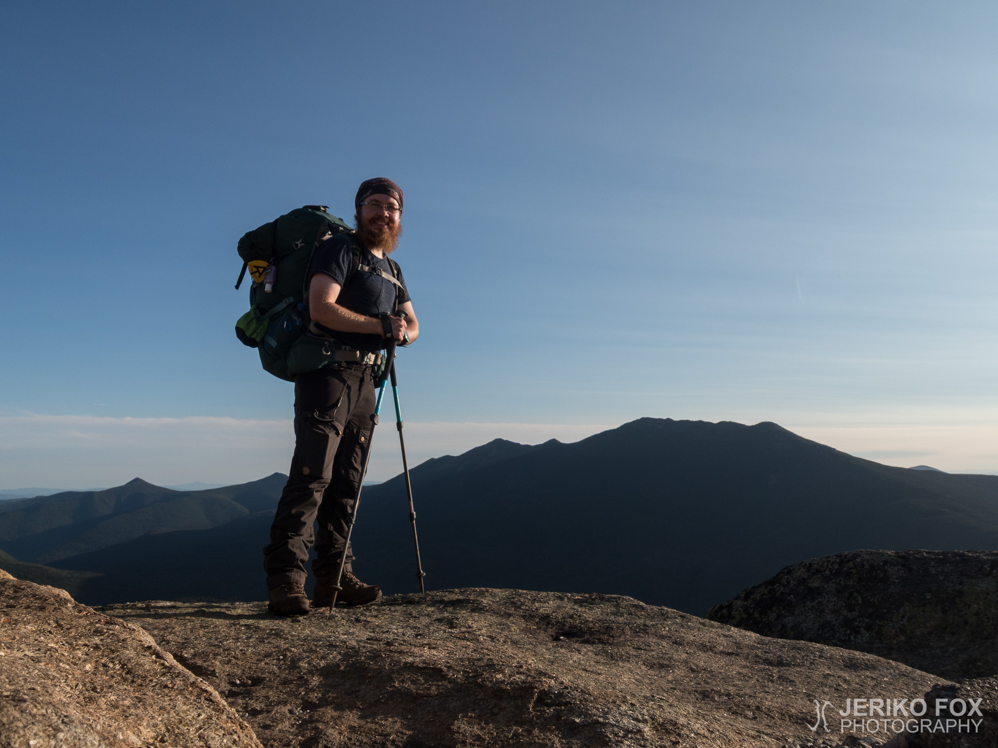
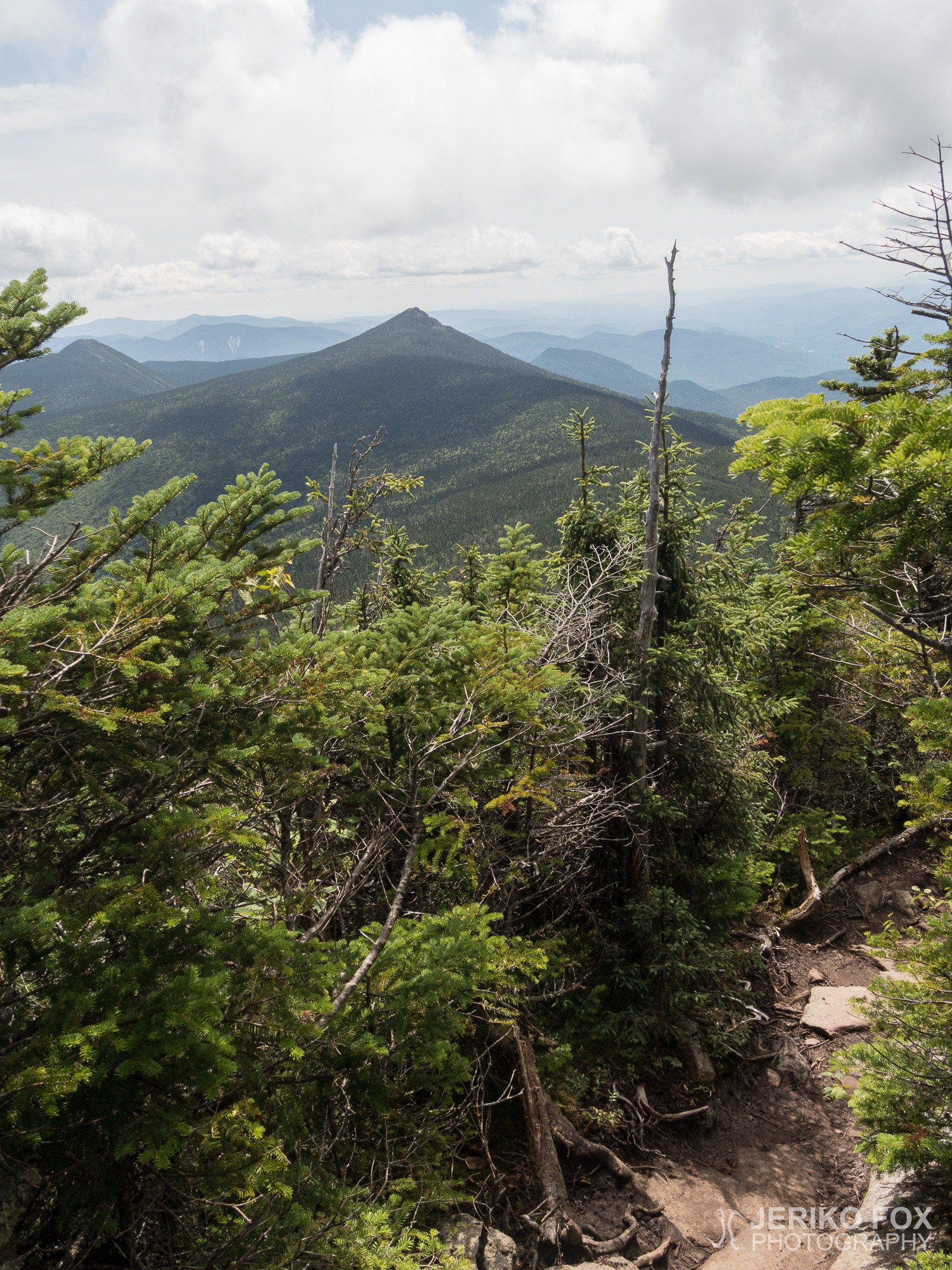
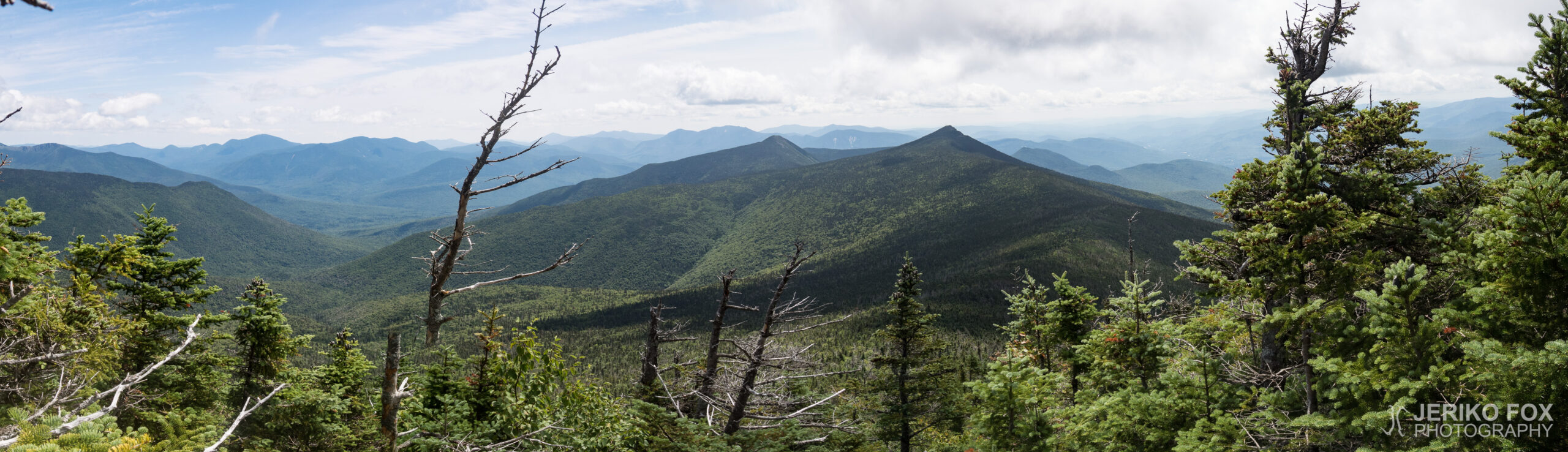
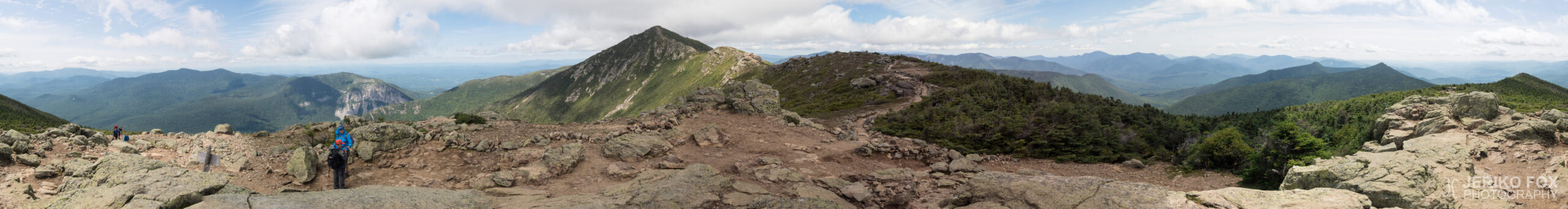
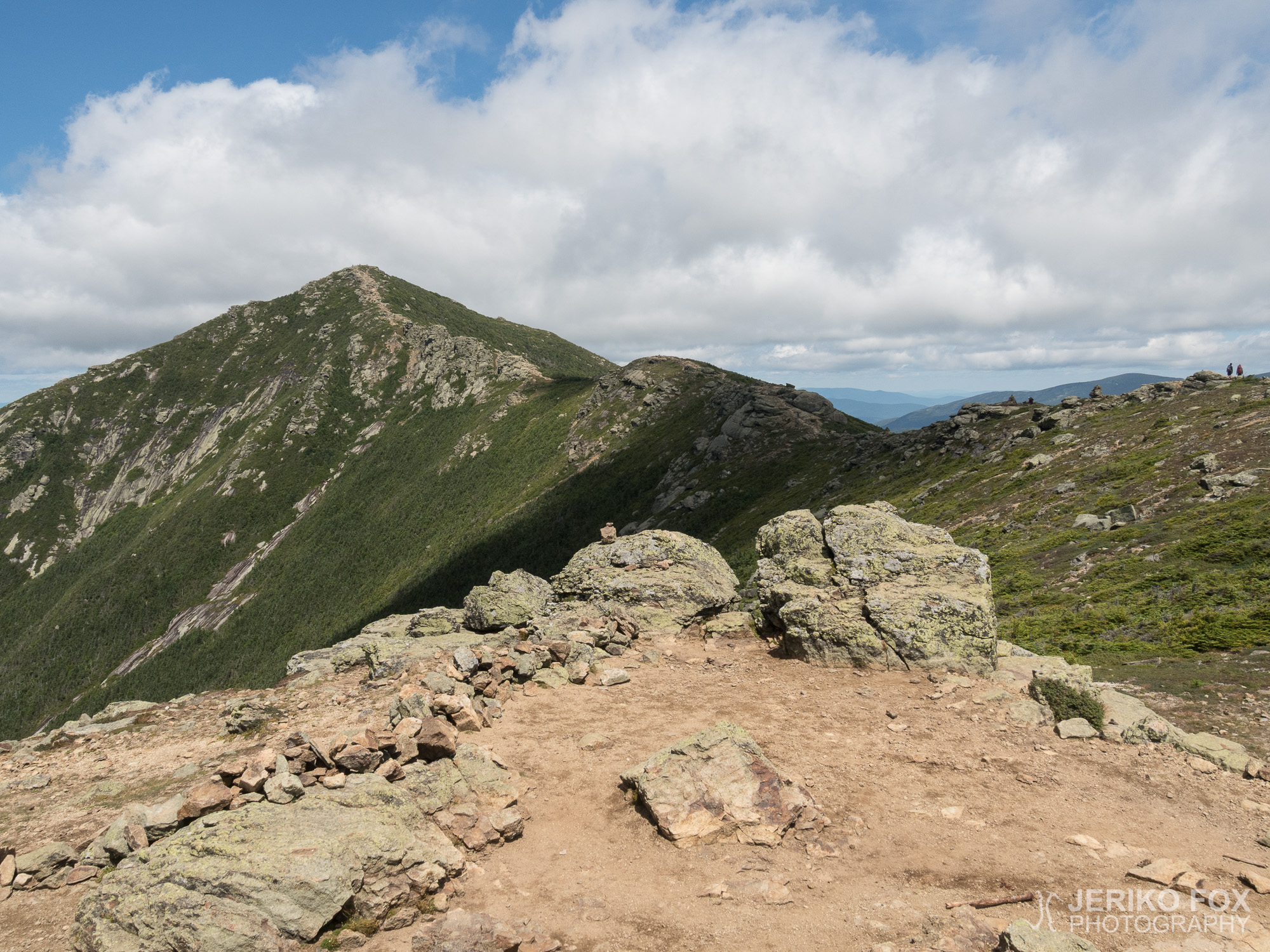
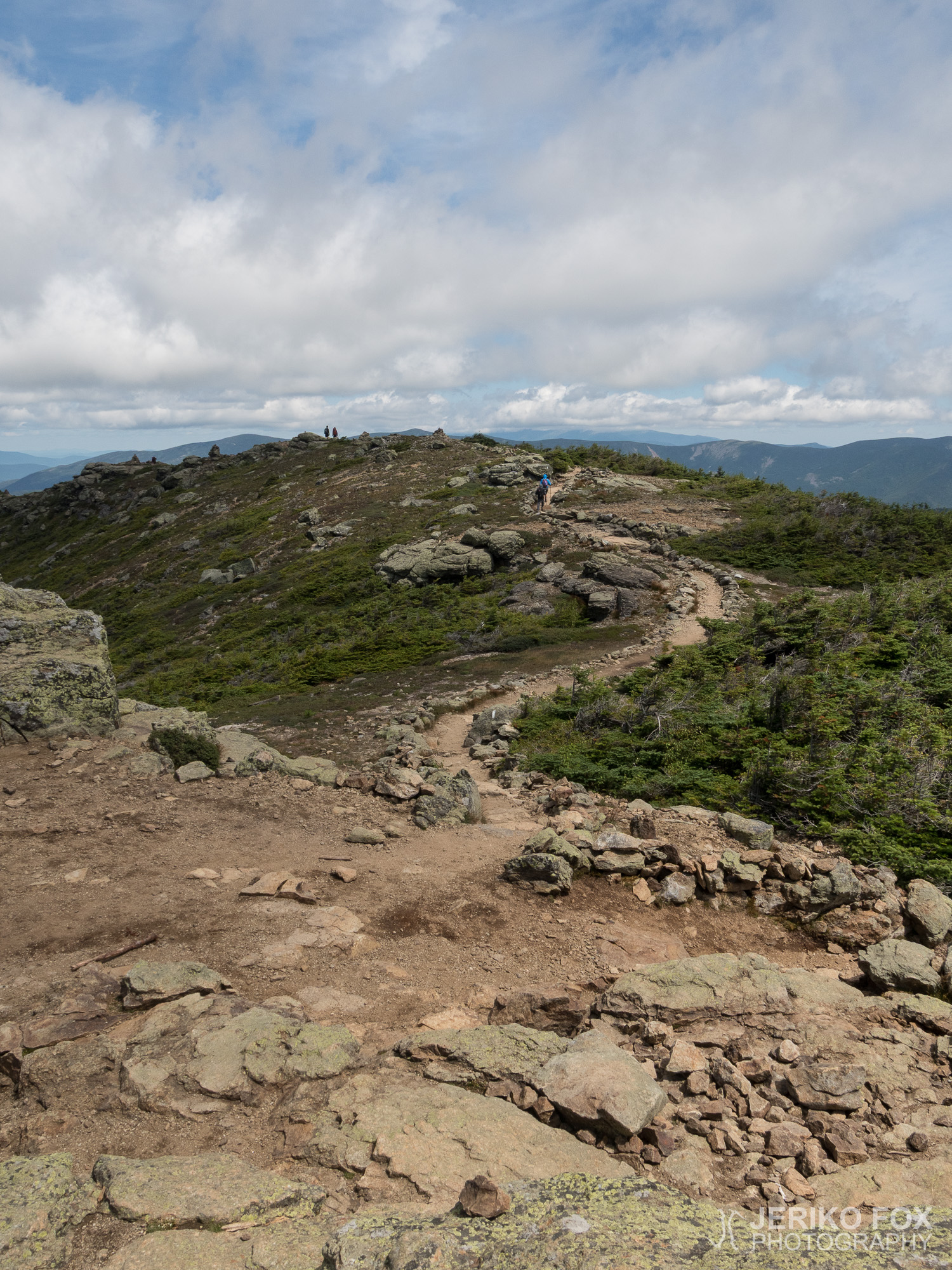
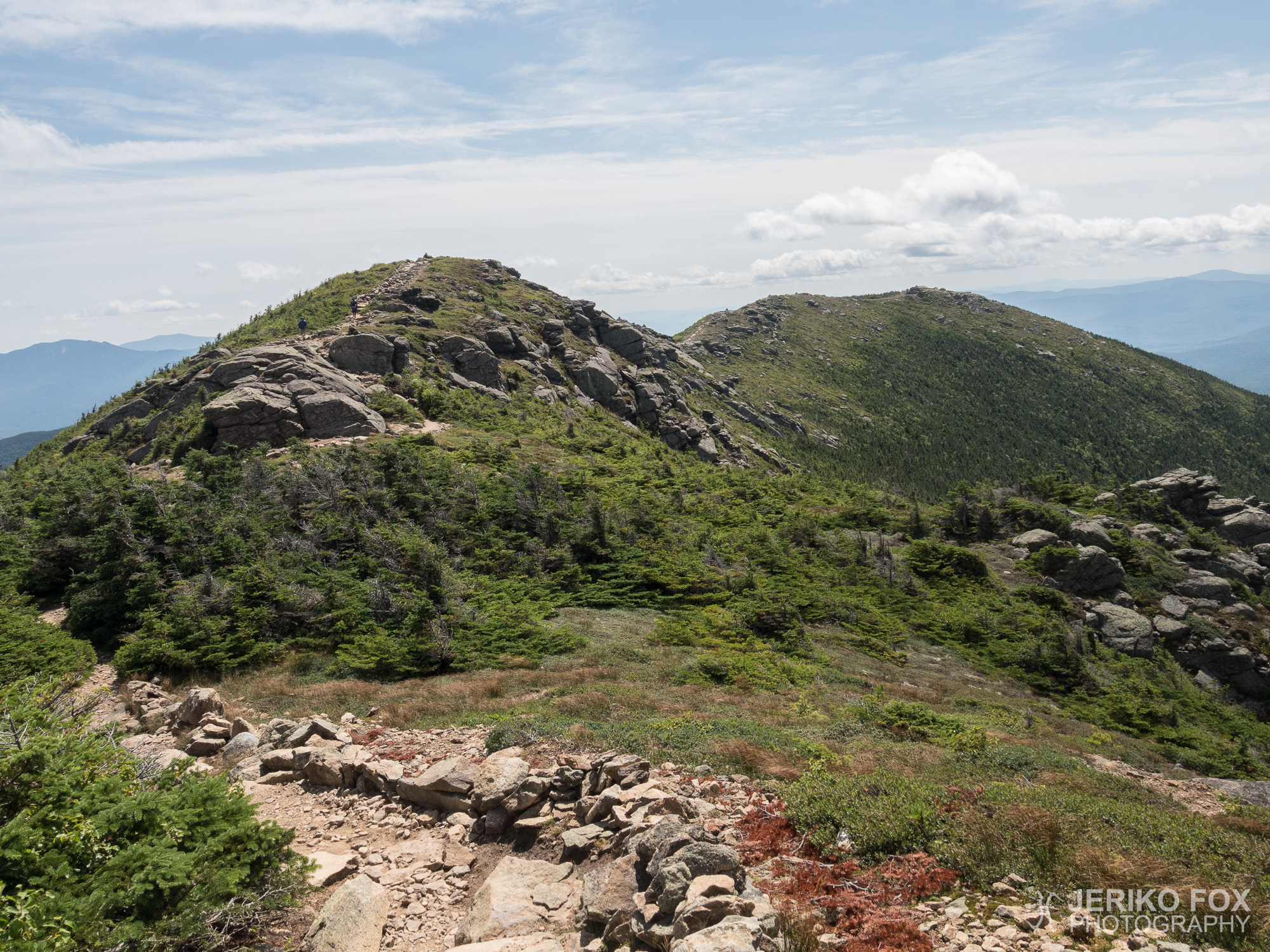
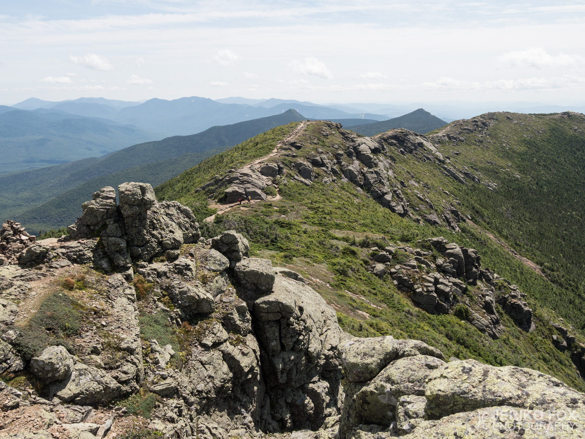
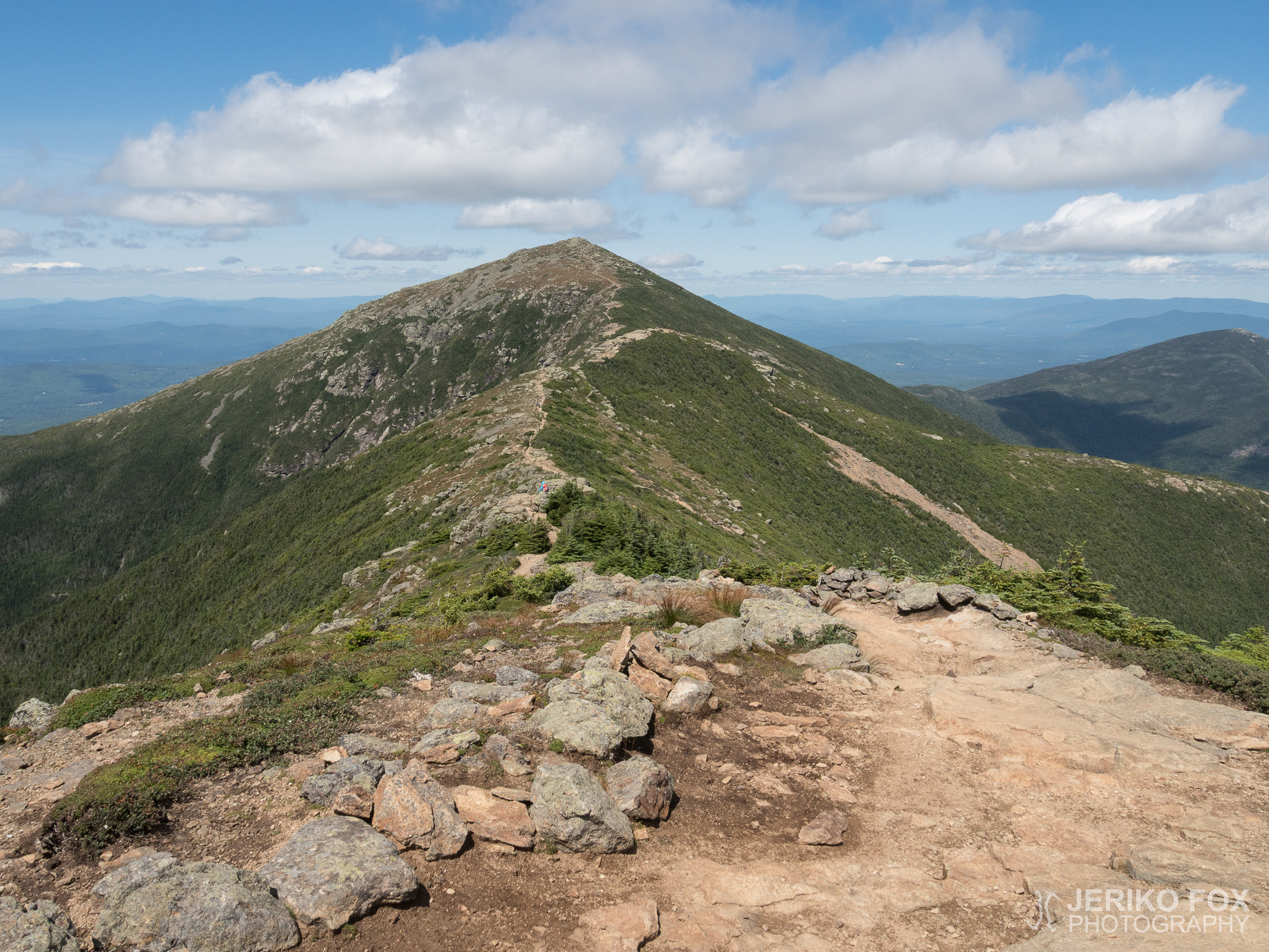
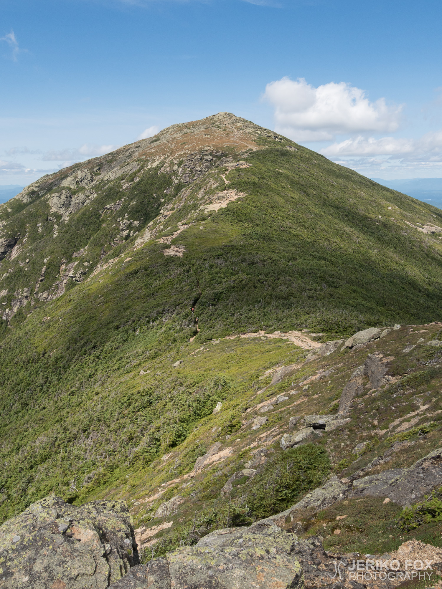
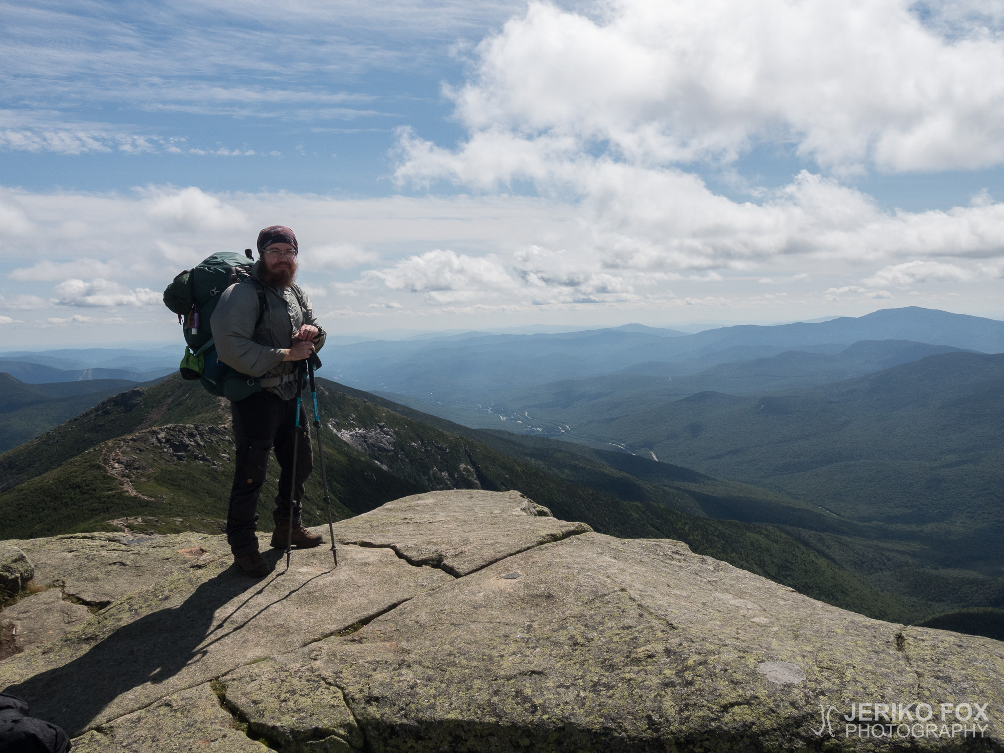
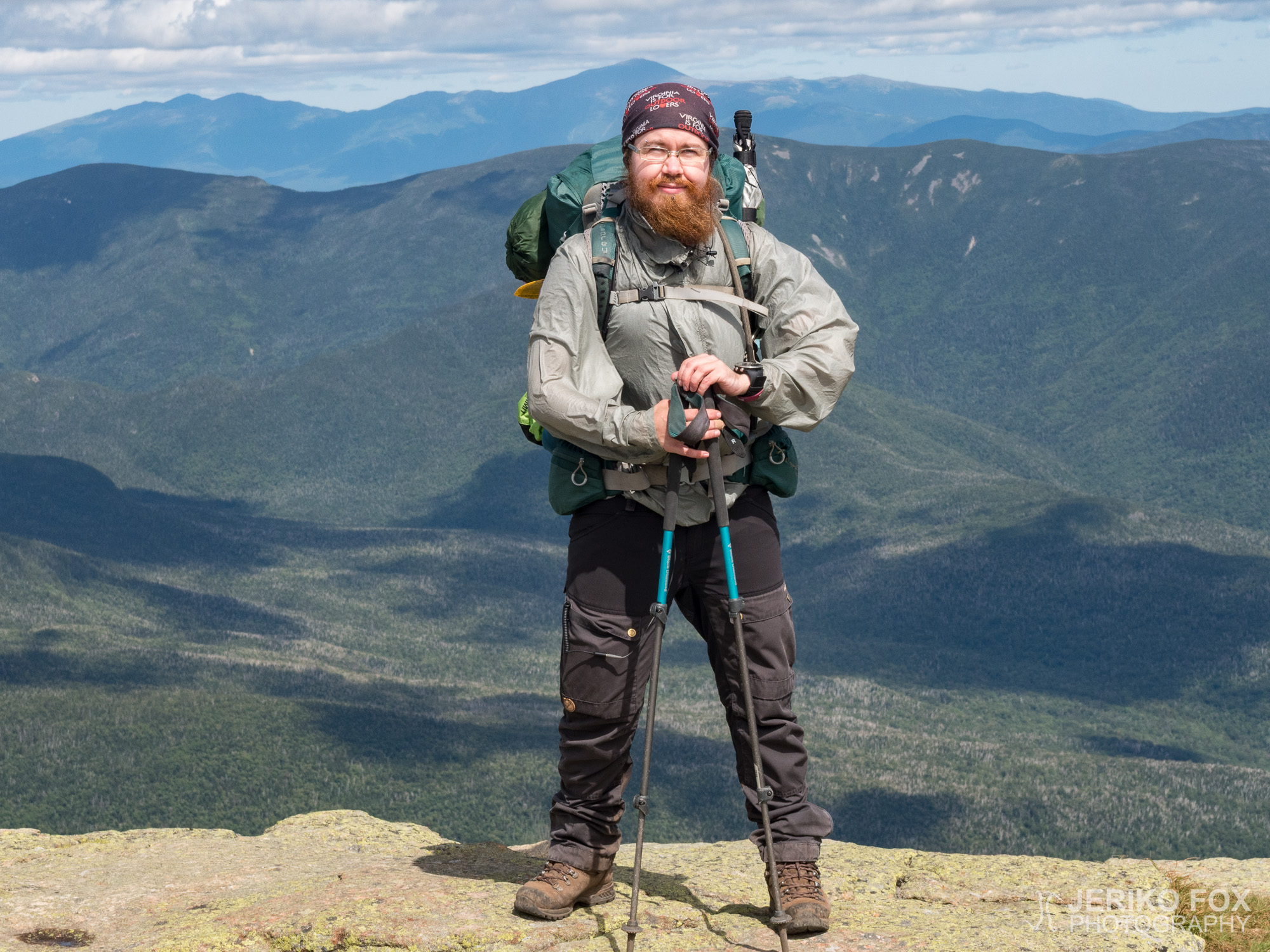
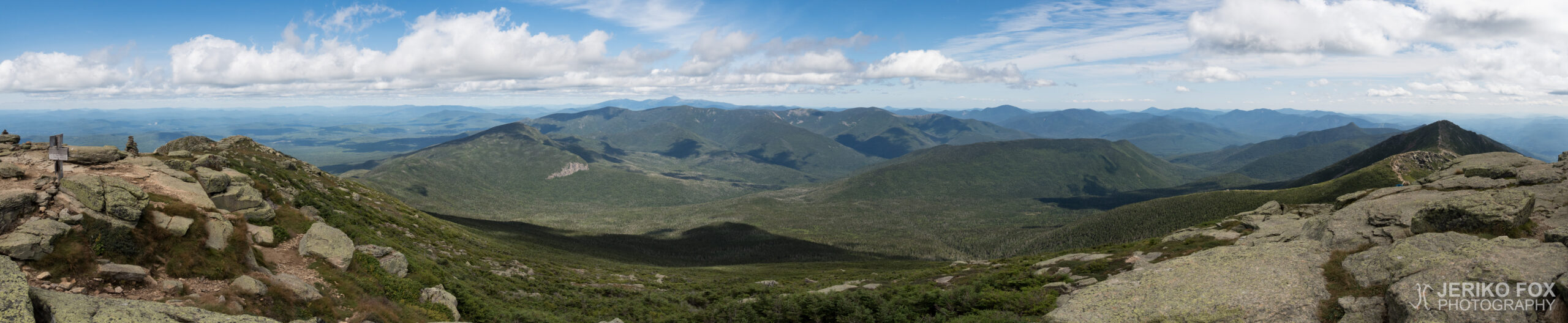
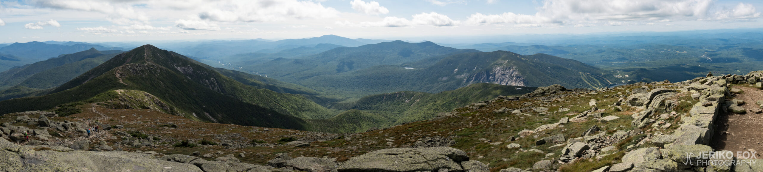
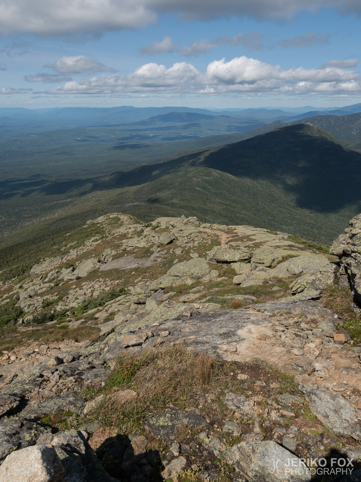
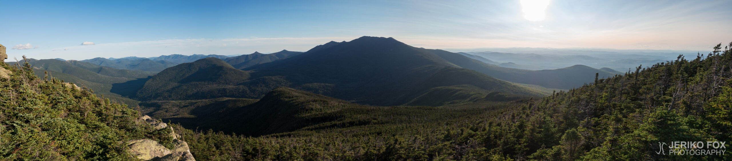
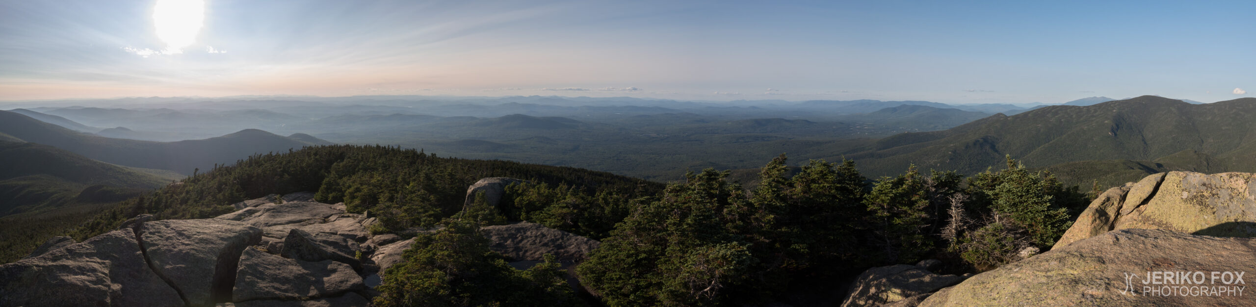
After ascending more than 1000 vertical meters (3300 ft) I reached the first summit of the day, Little Haystack Mountain. From there started the Franconia Ridge that traversed over the Mount Lincoln and Mount Lafayette above the treeline. The clouds were gone and the views on the ridge were great. The AT follows the ups and downs of the ridge and climbs to the more than 1600 m (5200 ft) high summit of Mount Lafayette.
When the ridge offered some cover from the wind the weather felt actually quite hot, but mostly there was a strong wind. The views were quite certainly the most astounding on the AT and I got to enjoy the beautiful scenery the whole traverse. It reminded me of my many great experiences on ridge climbing in the Alps: the summit ridge of Grossglockner, the Watzmann traverse, climbing to Hoher Göll and especially traversing the Jubiläumsgrat. The Franconia Ridge was not technically difficult like these ones, but still a scenic ridge anyway.
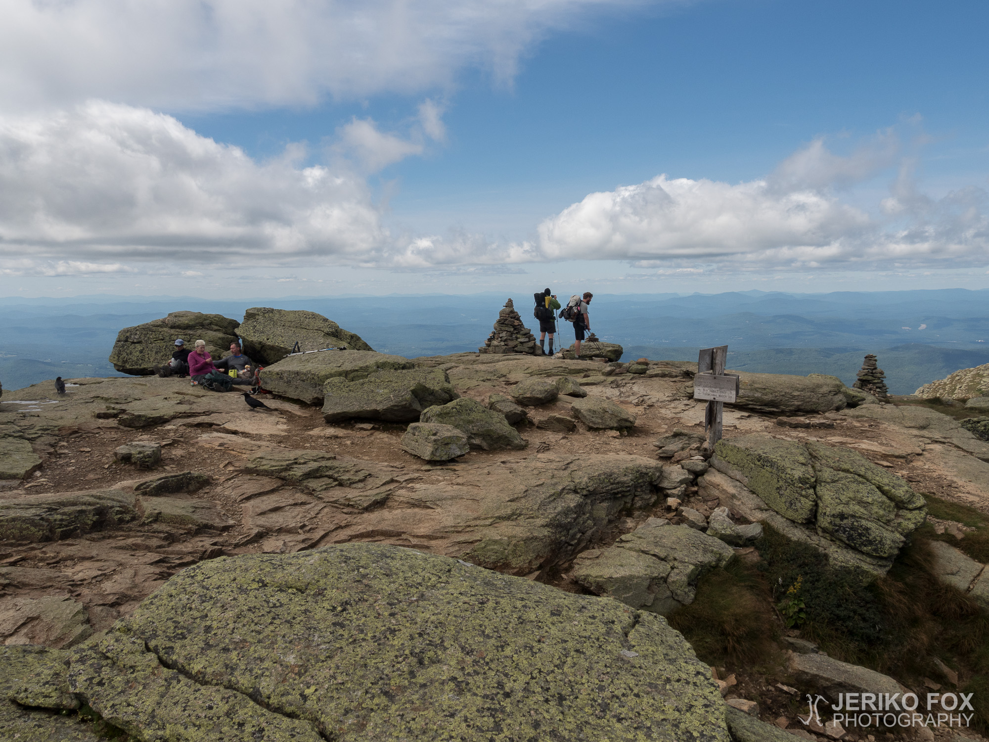
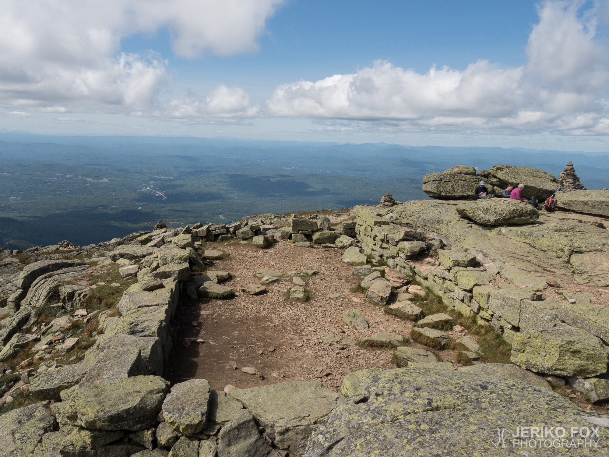
Arriving to the summit of Mount Lafayette I met my friend Mojo. We spent a while together until he started to descend and stayed to have my lunch break on the summit.
Mojo had told me that he was heading to the shelter that was on the north side of Mount Garfield. My initial goal was to reach a pond that was on the south side of the mountain, but I was thinking that if I had enough time I could go over the mountain, too.
While I was descending from the Mount Lafayette two women wearing day hiking gear passed me. In my mind I was wondering where they were going, because as far as I knew there was really nothing ahead of us. Considerably later I reached these women when they were just about to turn back after reaching two thru-hikers. These men told me that the women were heading to Mount Lafayette and had ended up going the wrong direction. We were thinking that they had no possibility whatsoever to get down from the mountain before dark. And we didn’t know if they had a head torch with them. It was likely that they had cell phones anyway. When I went on I couldn’t stop thinking that I should have asked their plans already when we first met. Or I could have offered them my head torch and ask them to mail it back to me to Gorham. I could have done without it for a while. Why all the good ideas always come too late? I hope that these women literally got out of the woods safely.
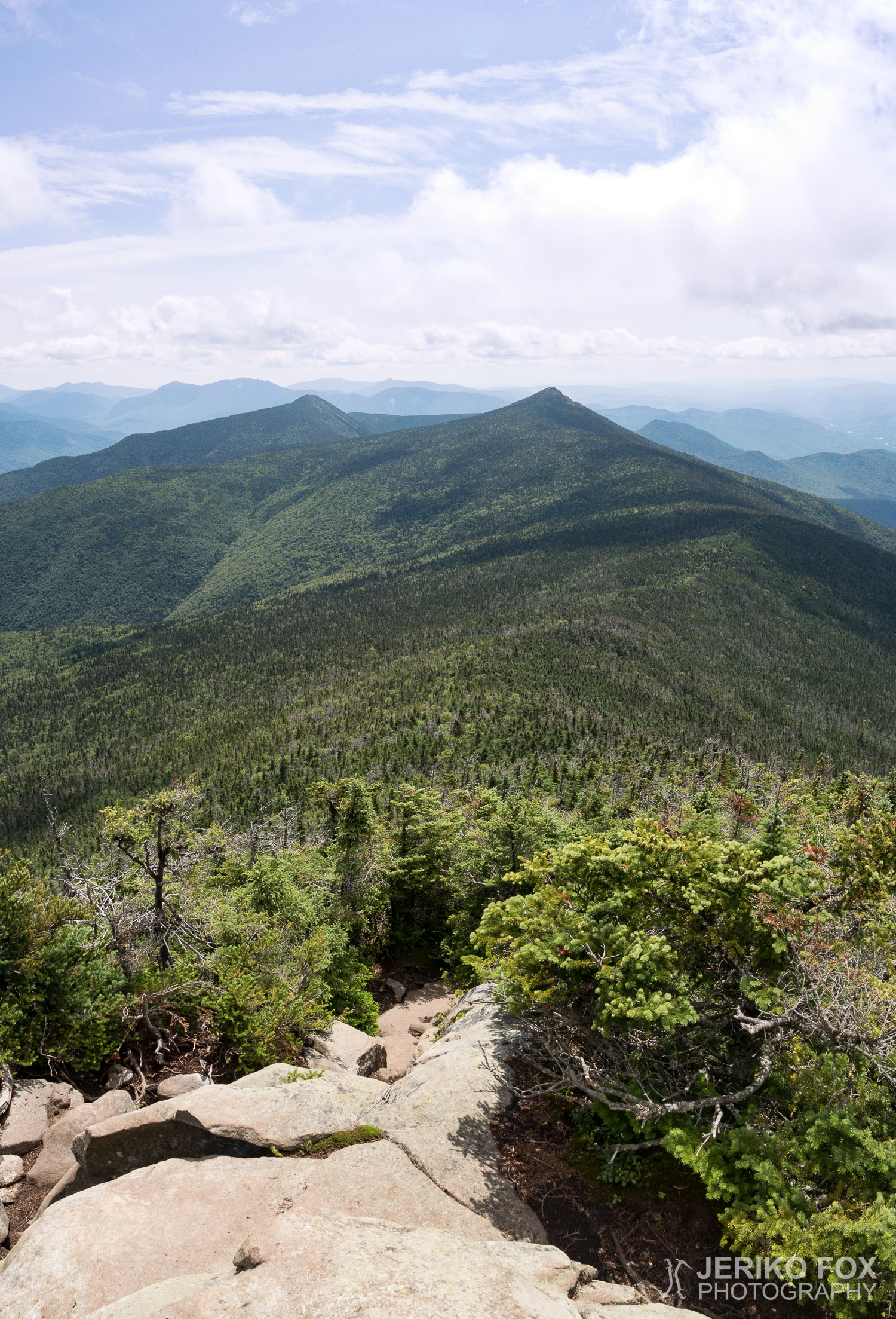
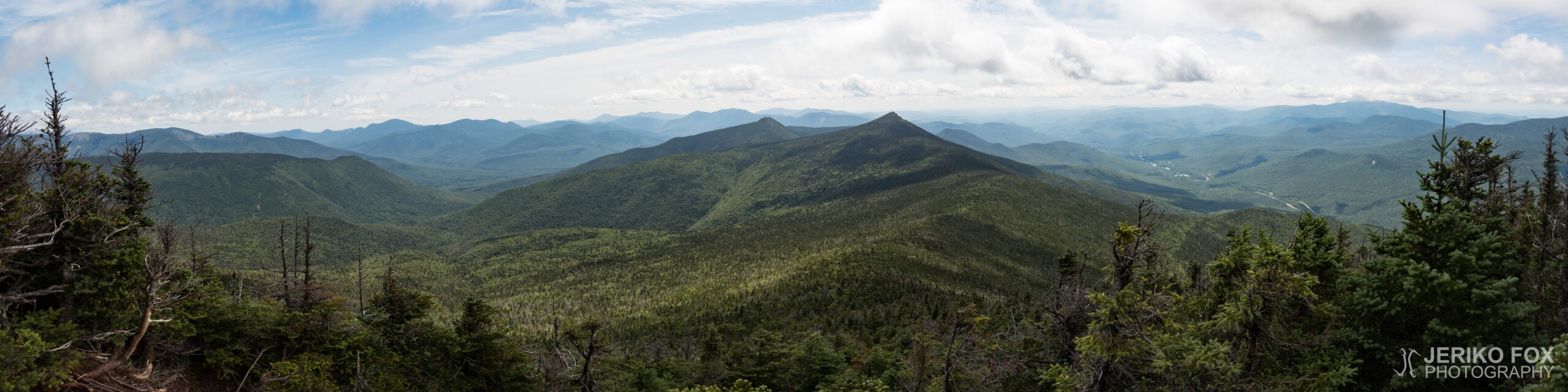
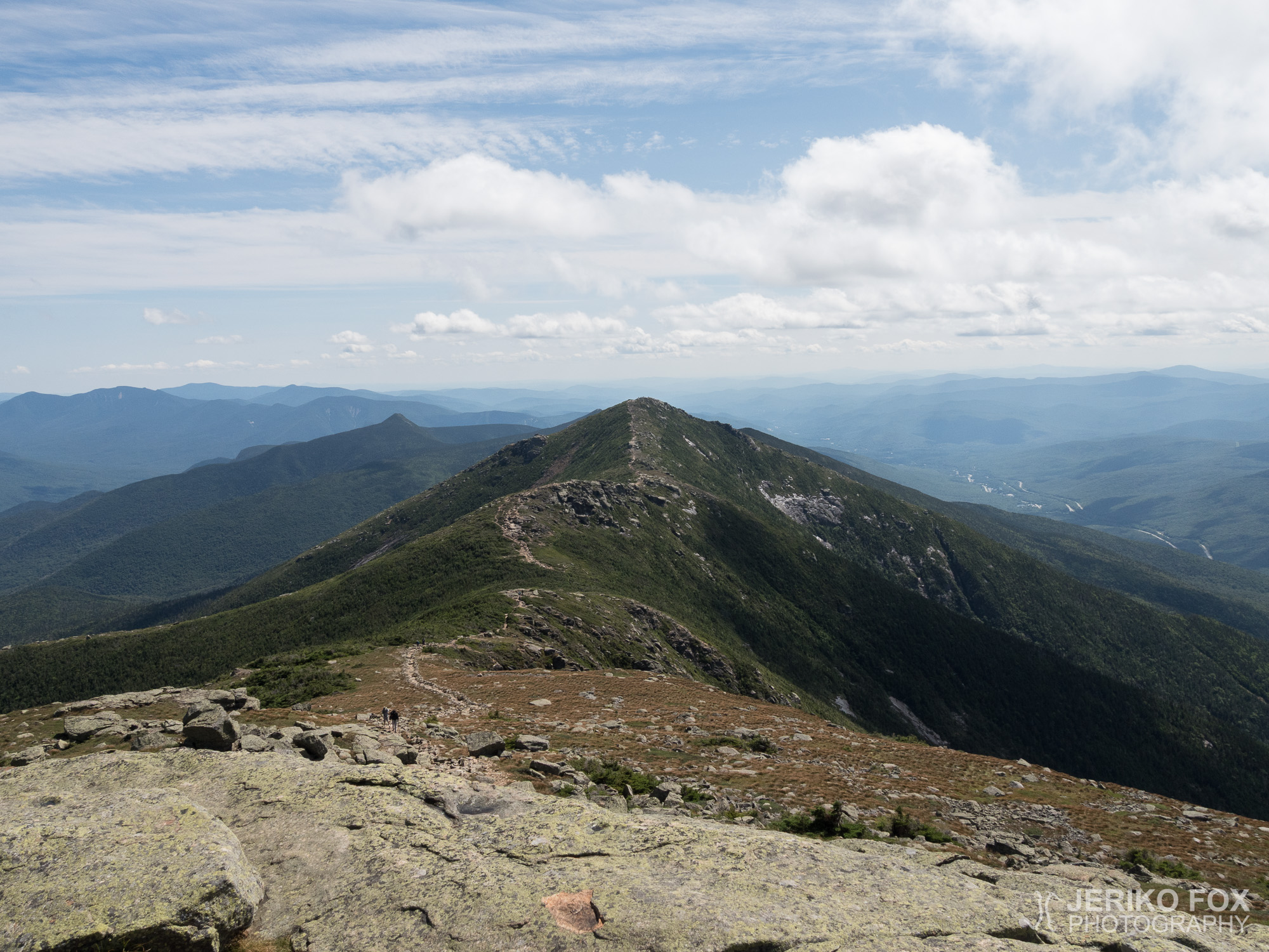
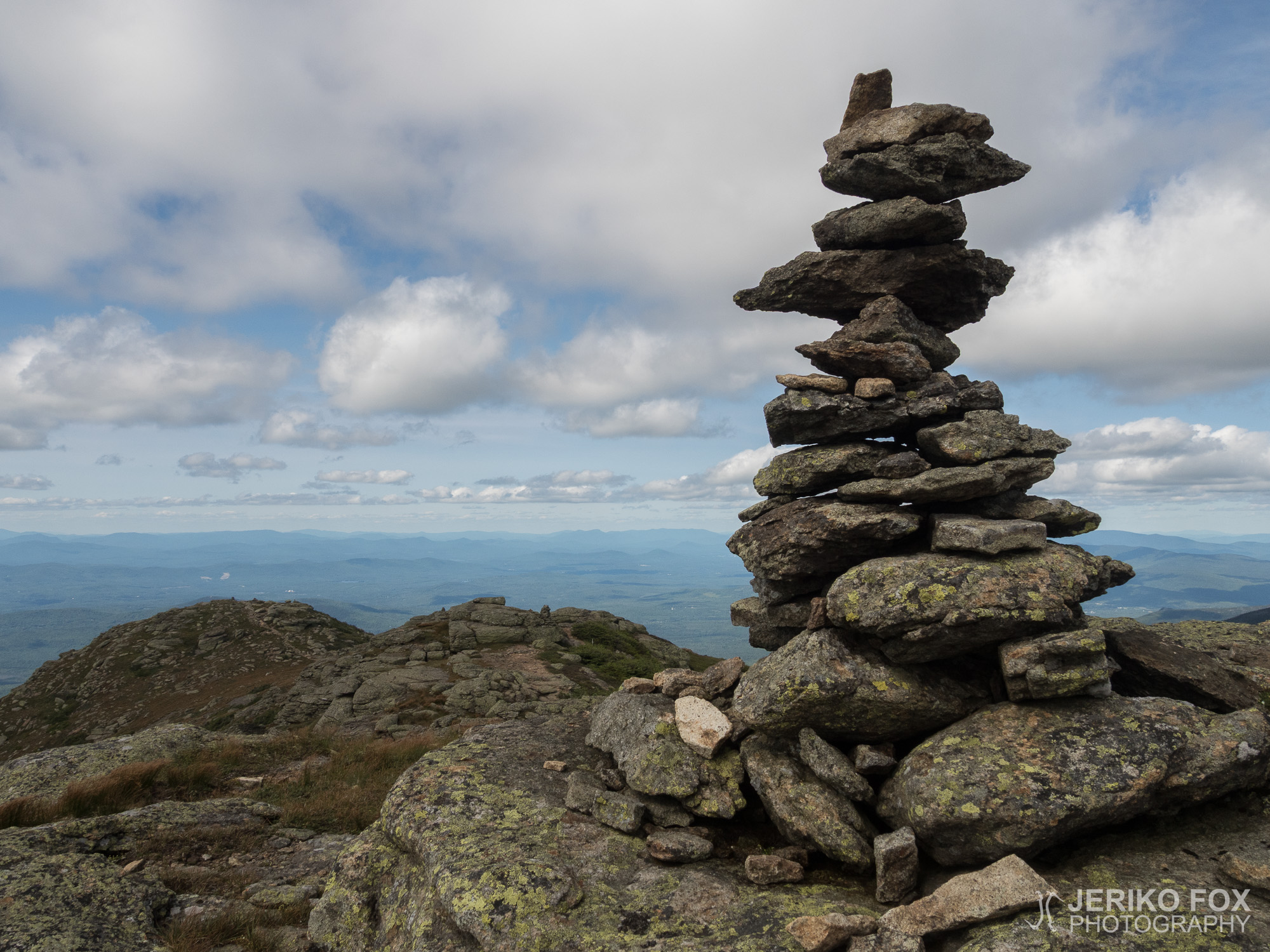
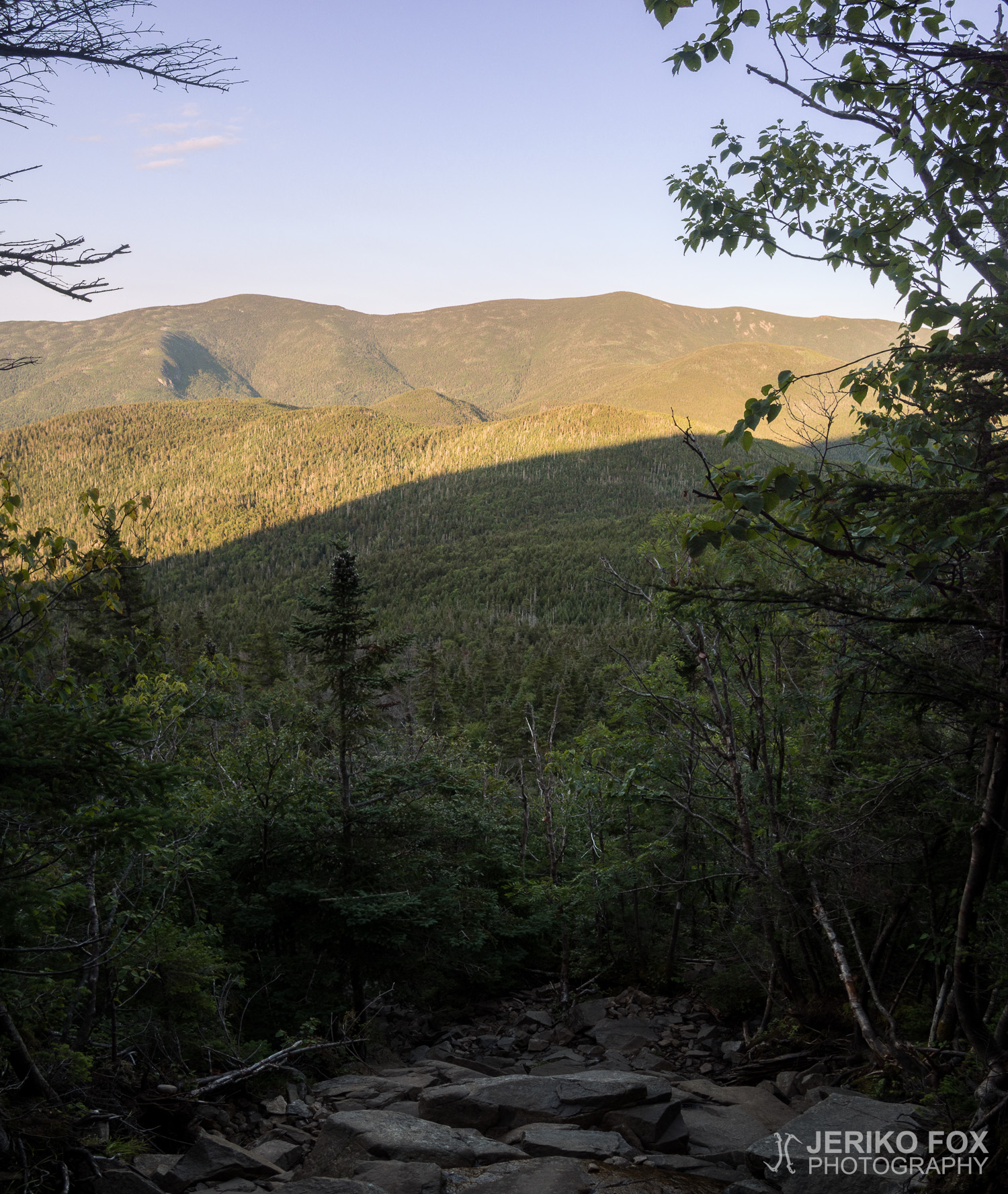
I reached the Garfield Pond before six and decided to throw myself over the Garfield Mountain. It was only 250 vertical meters (820 ft) of climbing, but the both sides of the hill were steep. Now the uphills have once again started to go better, so while listening to the Tuntematon Sotilas (The Unknown Soldier by Väinö Linna) I kept on hauling myself up. From the summit of Mount Garfield there was a breathtaking view to the Franconia Ridge. It felt quite unbelievable that I had walked that distance in one day. All the formations of the terrain was somehow setting to the right scale as I could clearly see my route.
I passed the north side shelter while I was going downhill. I could have stayed there, but I rather wanted to have the downhill done and find my own tent spot. Many of the shelters and campsites on the White Mountains have a fee. And the problem is not the €10 fee, but I preferred to have some peace and quiet.
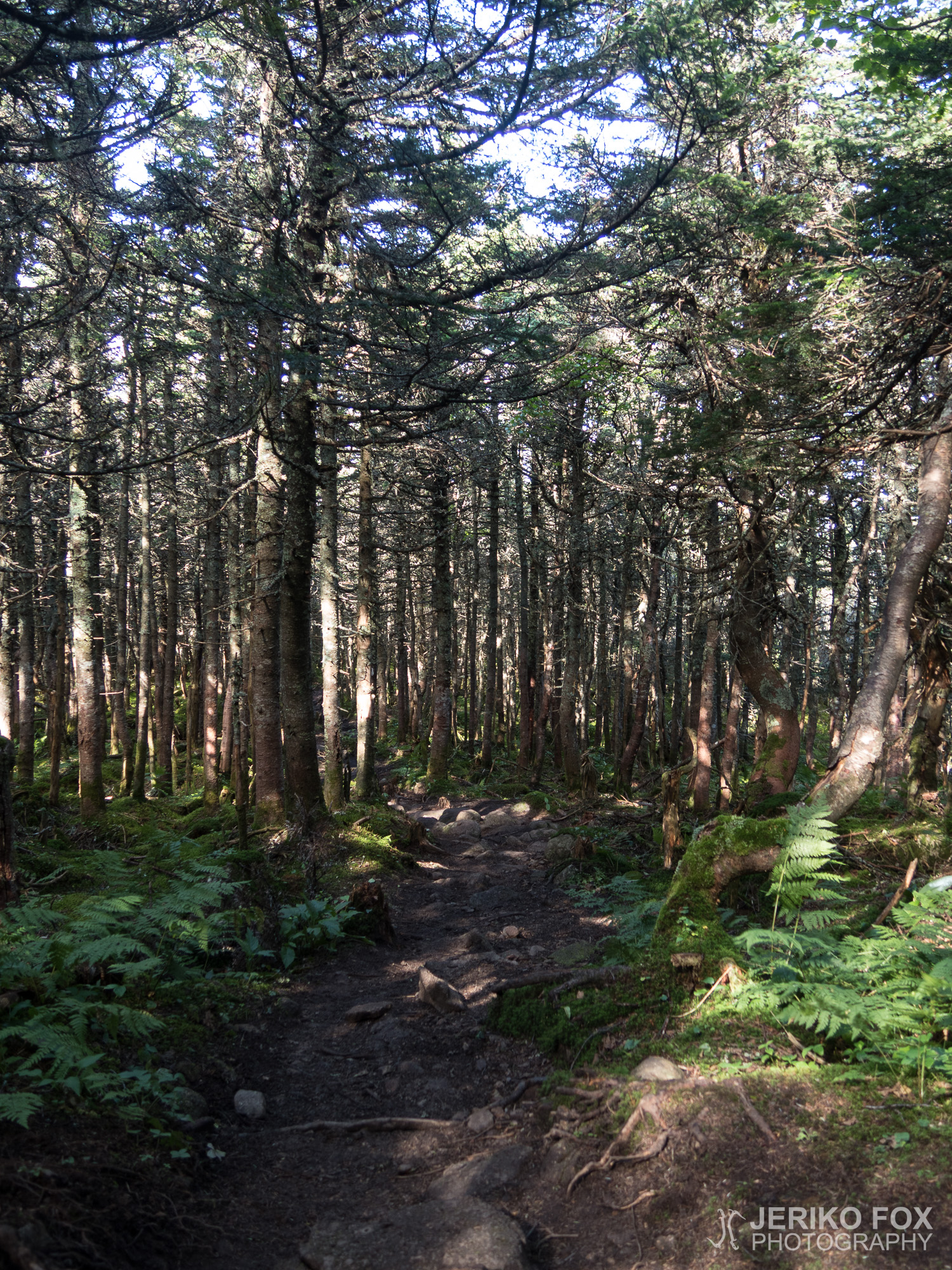
The downhill was very rocky and steep. And the AT was going along a small stream. Or the other way around – depends how you want to see it. Anyway the water made the rocks slippery and I had to descend very carefully. On the bottom there was a flat section where I had planned to look for a tent spot. I was able to find one just where I had thought. I was happy with my achievements of today even though my feet were sore after the long descent. For the first time in a long while I put on a long sleeve shirt for the night, because it was getting a bit chilly. I had been sleeping in long johns and thicker socks already for a while now. When the darkness fell it was easy to answer the sweet call of my warm sleeping bag.
White Mountainsilla on kaksi kohdetta, jonne erityisesti toivoisi hyvää säätä: Franconia Ridge ja Mount Washington. Molemmat ovat tietysti maisemallisempia aurinkoisena päivänä, mutta molemmat voivat olla vaarallisia paikkoja huonolla säällä.
Toiveeni näytti toteutuvan Franconia Ridgen osalta. Herätessäni levottomasti nukutun yön jälkeen olivat vuoret aamulla pilvessä, mutta sääennuste lupasi selkenevää. Matkustin muutaman muun vaeltajan kanssa The Notch Hostellilta aamun shuttle-kyydillä takaisin AT:lle ja lähdin nousemaan pitkää ylämäkeä.
Istuessani kivellä pitämässä pientä taukoa käveli ohitseni päivävaeltaja. Mies pysähtyi kohdalleni ja kysyi olinko läpivaeltamassa. Hän sanoi haluavansa tehdä trail magicia, mutta hänellä ei ollut ruokaa tarjota. Niinpä hän suureksi yllätyksekseni kaivoi esiin lompakkonsa ja lykkäsi käteeni $20 setelin. Ihmeissäni kiitin miestä ja päätin käyttää rahan trail magicin hengessä ruokaan.
Noustuani reilut 1000 m vertikaalia tulin päivän ensinmäiselle huipulle, Little Haystack Mountainille. Sieltä alkoi puurajan yläpuolella kulkeva Franconia Ridge Mount Lincolnin yli Mount Lafayettelle. Aamun pilvet olivat väistyneet ja näkyvyys harjanteella oli hyvä. AT kulkee harjanteen muotoja noudattaen ylös ja alas, päätyen reilun 1600 m korkeuteen Mount Lafayetten huipulla.
Suojaisissa paikoissa oli jopa kuuma, mutta muuten harjanteella puhalsi voimakas tuuli. Näköalat olivat varmasti näyttävimmät tähän mennessä koko AT:lla ja niitä sai ihailla koko harjanteen poikkikulun ajan. Mieleeni muistui monta hienoa harjannekiipeilykokemusta alpeilla: Grossglocknerin huippuharjanne, Watzmannin poikkikulku, Hoher Göllin nousu ja ennen kaikkea Jubiläumsgratin kiipeäminen. Franconia Ridge ei toki ollut näiden tapaan kiipeilyllisesti haastava, mutta näyttävä harjanne se on silti.
Saapuessani Mount Lafayetten huipulle tapasin ystäväni Mojon. Vietimme hetken aikaa yhdessä huipulla, kunnes hän lähti laskeutumaan minun jäädessä vielä pitämään lounastaukoa.
Mojo oli sanonut aikovansa Mount Garfieldin pohjoispuolella olevalle shelterille. Oma alkuperäinen tavoitteeni oli mennä vähintään kyseisen vuoren eteläpuolella olevalle lammelle, mutta ajattelin ehkä ajan salliessa mennä koko vuoren yli.
Laskeutuessani Mount Lafayettelta ohitseni kulki kaksi päivävaellusvarusteissa olevaa nuorta naista. Ihmettelin mielessäni heidän mentyä ohi, että minneköhän olivat suuntaamassa, kun edessä ei tietääkseni ollut niin sanotusti mitään. Huomattavasti myöhemmin saavutin naiset juuri kun he olivat kääntymässä kaksi muuta läpivaeltajaa tavattuaan takaisinpäin. Sain kuulla näiltä miehiltä naisten kai olleen matkalla Mount Lafayettelle ja menneen jossain väärään suuntaan. Mietimme yhdessä, että naiset eivät kyllä ehtisi alas vuorelta ennen pimeää mitenkään. Emmekä tienneet oliko heillä otsalamppujakaan. Kännykät toivottavasti olivat. Jatkaessani eteenpäin pyöri mielessäni, että olisi pitänyt tiedustella naisten päämäärää jo ensikohtaamisella tai toisaalta olisin voinut lainata heille otsalampun ja pyytää postittamaan sen Gorhamiin. Itse pärjäisin sen aikaa ilmankin. Miksi hyvät ideat tulevat aina myöhässä? Toivottavasti nämä naiset löysivät turvallisesti perille.
Tulin Garfield Pondille ennen kuutta ja päätin heittää itseni vielä Mount Garfieldin yli. Nousua oli vain noin 250 m vertikaalia, mutta rinne oli jyrkkä molemmin puolin. Ylämäet ovat kuitenkin alkaneet sujua, joten Tuntematonta sotilasta kuunnellen tahkosin ylös päin. Mount Garfieldin laelta avautui upea näkymä Franconia Ridgelle. Tuntui aivan uskomattomalta, että olin kulkenut koko näkemäni matkan yhdessä päivässä. Maaston muodot asettuivat jotenkin oikeaan skaalaan, kun näki selkeästi oman reittinsä.
Laskeutuessani kuljin pohjoispuolella olevan shelterin ohi. Olisin toki voinut jäädä sinnekin yöksi, mutta halusin mielummin saada alamäen tehdyksi ja etsiä oman telttapaikan. Monet White Mountainsin sheltereistä ja teltta-alueista ovat maksullisia. Ongelma ei niinkään ollut se, ettenkö olisi voinut yöpymisestä maksaa sen $10, mutta halusin olla omassa rauhassa.
Alamäki olikin todella jyrkkää kivikkoa ja osittain AT kulki pientä puroa pitkin. Tai toisinpäin – miten sen nyt haluaa ajatella. Joka tapauksessa vesi teki kivet liukkaiksi ja yritin laskeutua varovaisesti. Päästyäni alamäen loppuun tulin hieman tasaisemmalle alueelle, josta olin ajatellut etsiä telttapaikkaa. Löysinkin aivan mainion paikan juuri suunnittelemastani kohtaa. Päivän saavutukset tuntuivat hyvältä vaikka jalkaterät olivat hellänä pitkän laskeutumisrupeaman jäljiltä. Puin ensimmäistä kertaa pitkästä aikaa yöksi päälle pitkähihaisen paidan, koska ilta oli selvästi viileä. Pitkät kalsarit ja paksut sukat olin ottanut jo jonkin aikaa sitten yökäyttöön. Pimeän tullen lämpimän makuupussin lempeään kutsuun oli helppo vastata.
Max elevation: 1605 m
Total time: 11:07:01