
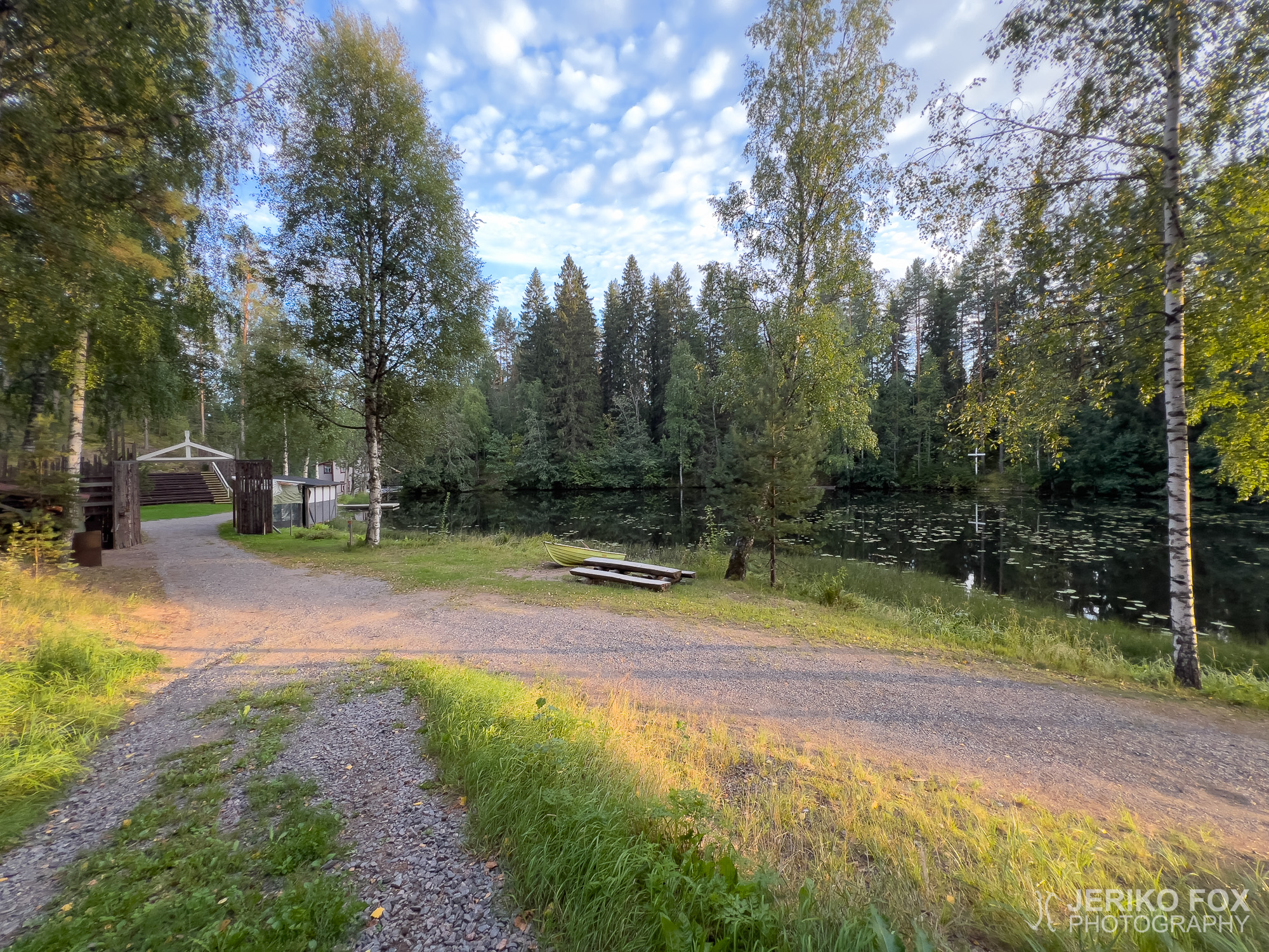
After hiking the Harjujen reitistö trail in Parikkala, I headed for an even more remote area — Oronmylly in Särkisalmi. From the yard of this Christian convention center, two different trails depart, so I had planned to walk them both while I was already here. The wide yard of Oronmylly was completely deserted, so I parked my car behind the buildings, thinking it wouldn’t bother anyone there.
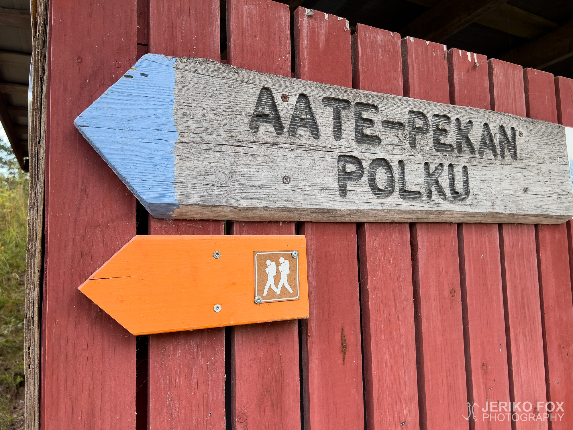
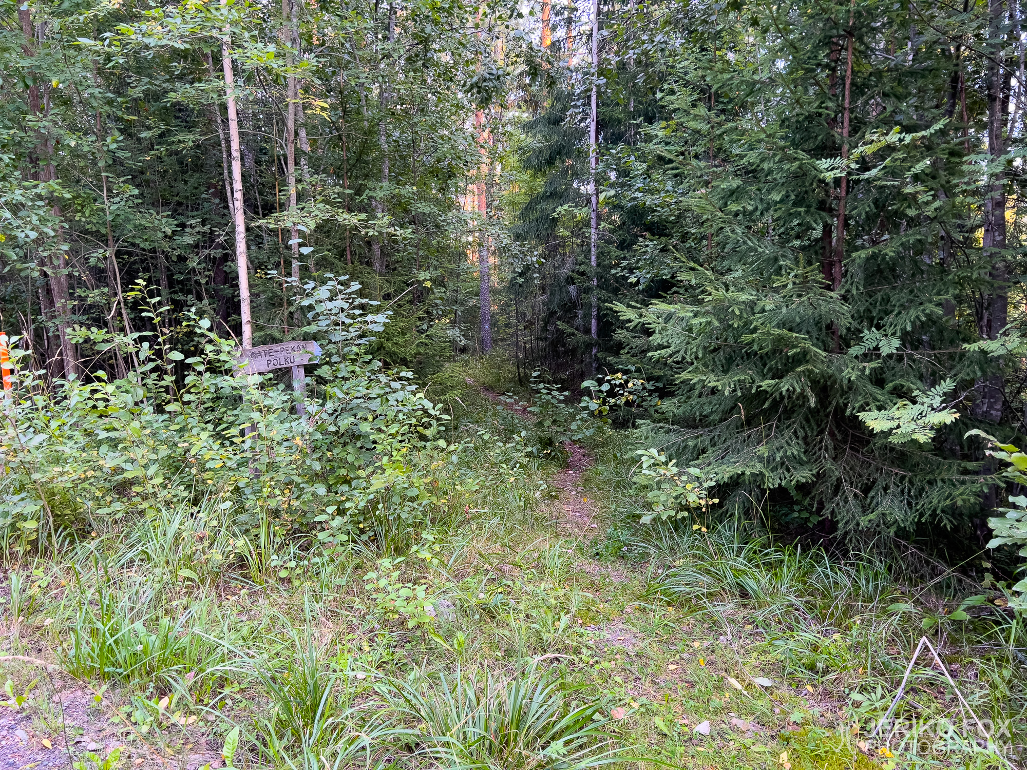
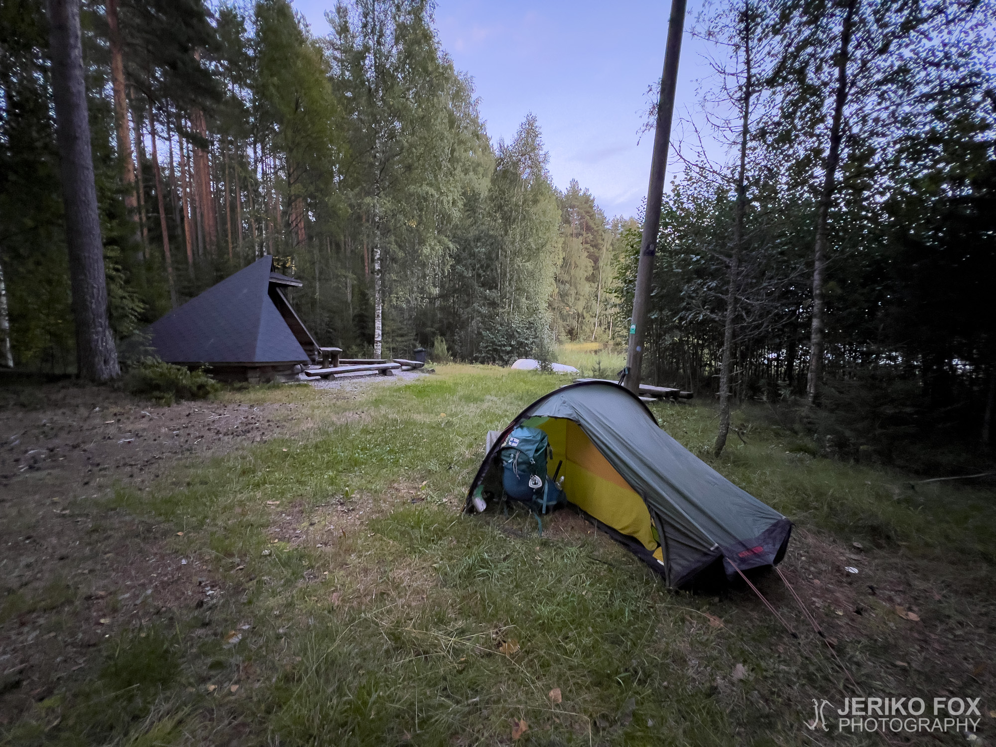
Evening was already falling as I set out along the roughly 3.2 km (2 mi) Aate-Pekka Trail. It’s not a hike that in itself requires an overnight stay, but I had prepared to sleep in my tent so I could hike the other trail tomorrow — the Kyynärpäänjoki Trail.
I found very little information about who exactly Aate-Pekka was, the man after whom the trail is named. What I did discover is that Aate-Pekka Anttonen was a farmer who once owned Oronmylly and later donated it to the Finnish Bible Institute (Kansan Raamattuseura) for Christian work. But whether his name really was “Aate-Pekka” or if that was a nickname remained unclear.
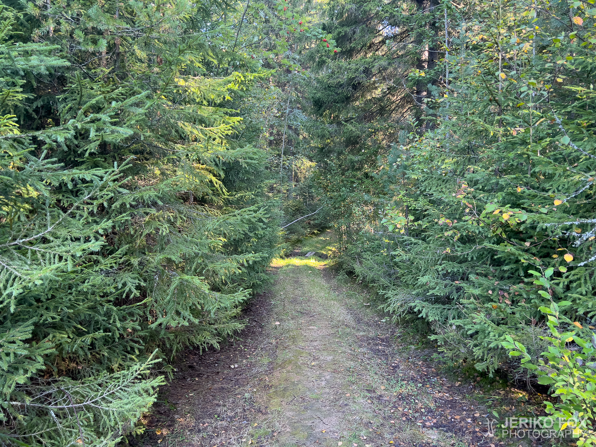
Once past the Oronmylly grounds, the trail was clearly marked but somewhat overgrown. I had read that the path included a broken bridge and rotten stairs, so I was prepared that this wouldn’t exactly be the crown jewel of trail maintenance.
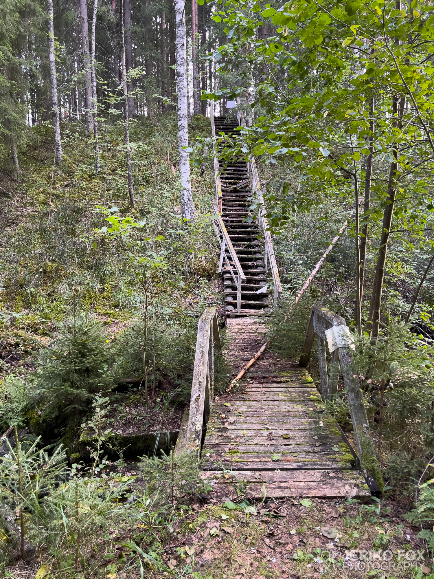
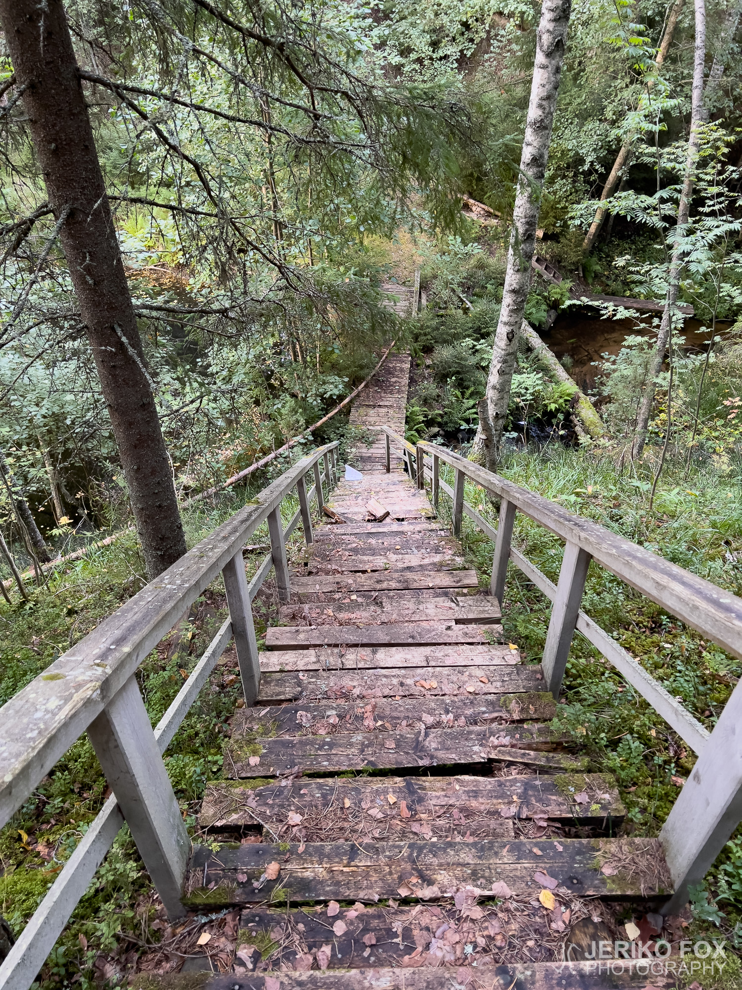
Pushing my way through a dense spruce thicket, I came to the shore of the stream or wetland connecting two ponds, Niskalampi and Tarvaslampi. Rising before me were obstacles worthy of a medieval ballad’s adynaton — the impossible mission — the uncrossable bridge and the unclimbable stairs. Well, in theory at least.
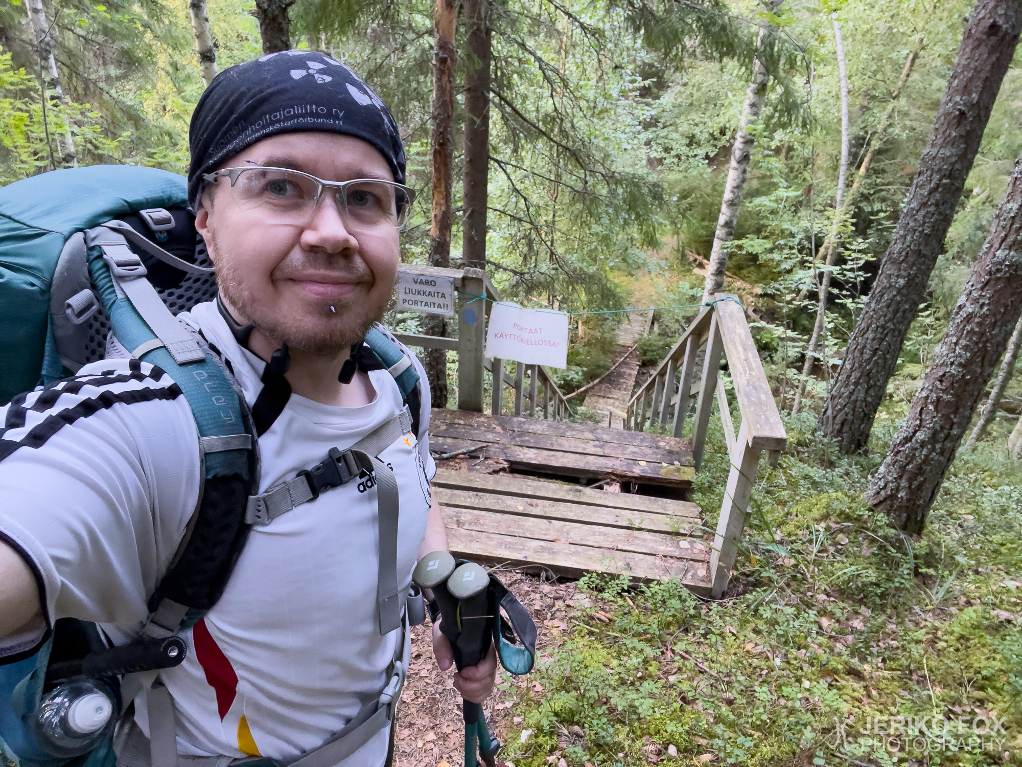
The bridge was rotten and a thin tree trunk had fallen across it, but it was easy enough to step over the broken planks. The stairs, however, were another matter. Many steps were completely broken and rotted away, and even the ones that looked intact were questionable at best. Even with my light weight, I had to watch every step carefully. Ropes and warning signs had been strung up to block access, but at the bottom those just dangled uselessly on the ground. At the top, I had to climb over a rope to continue.
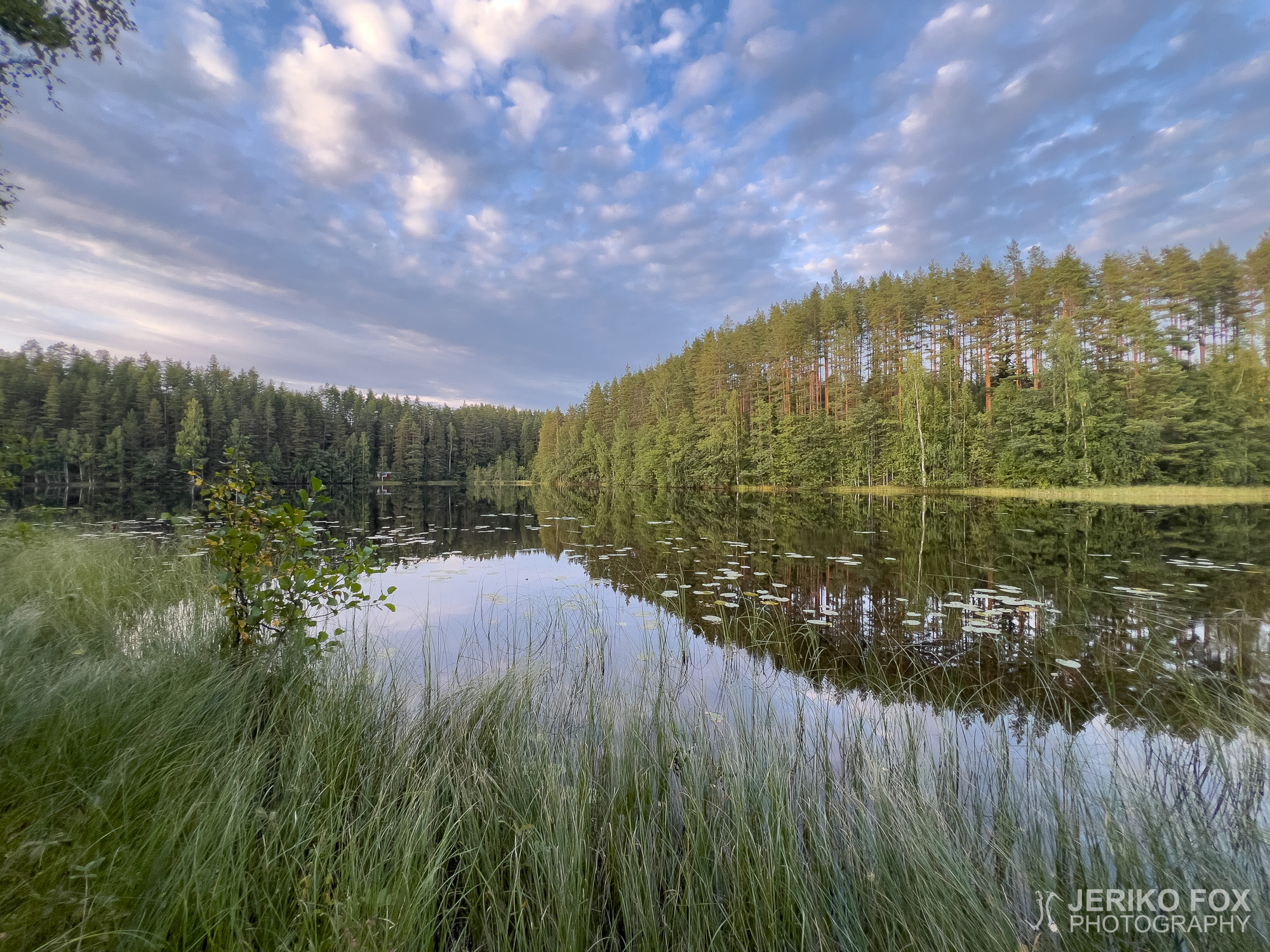
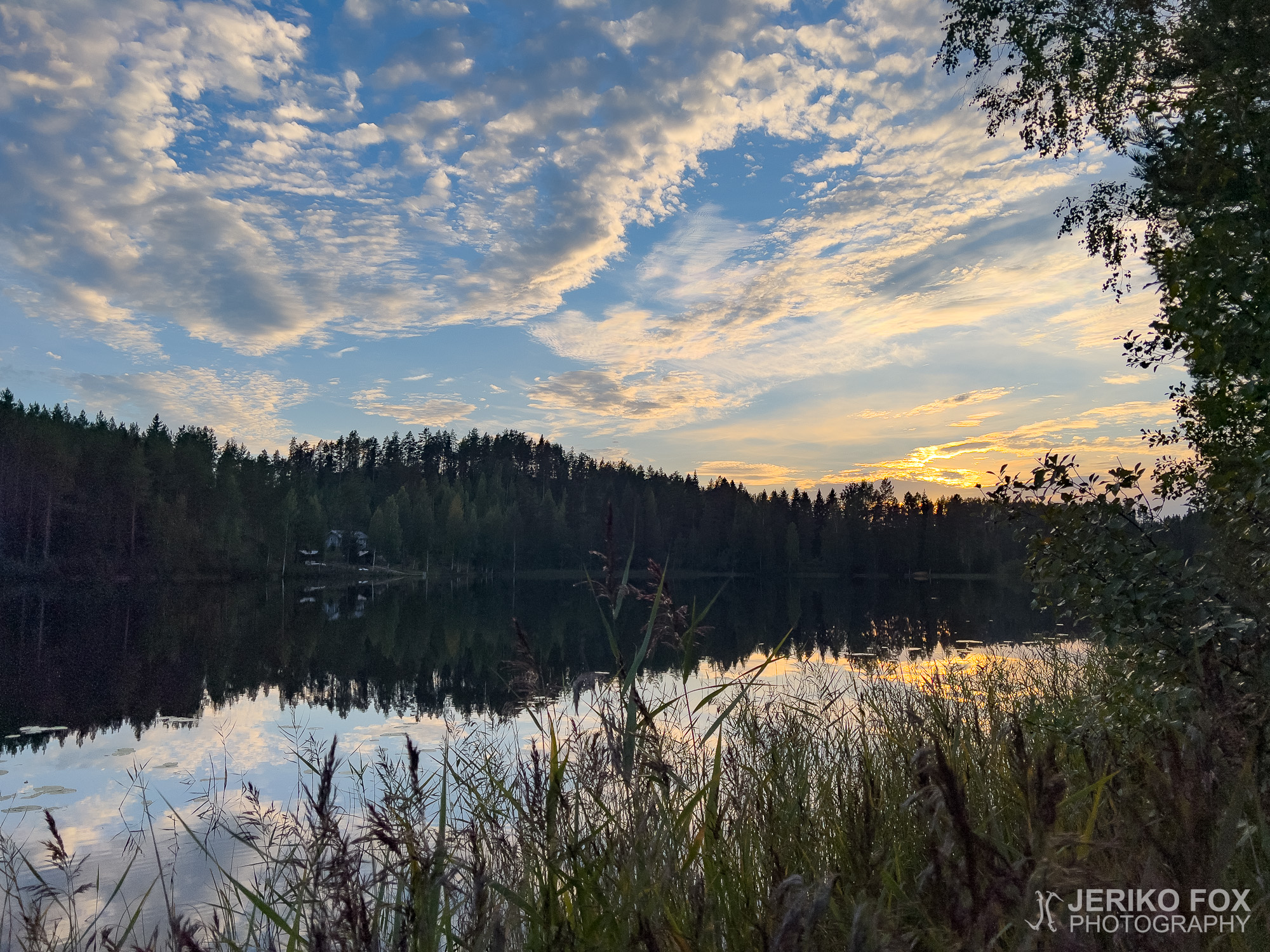
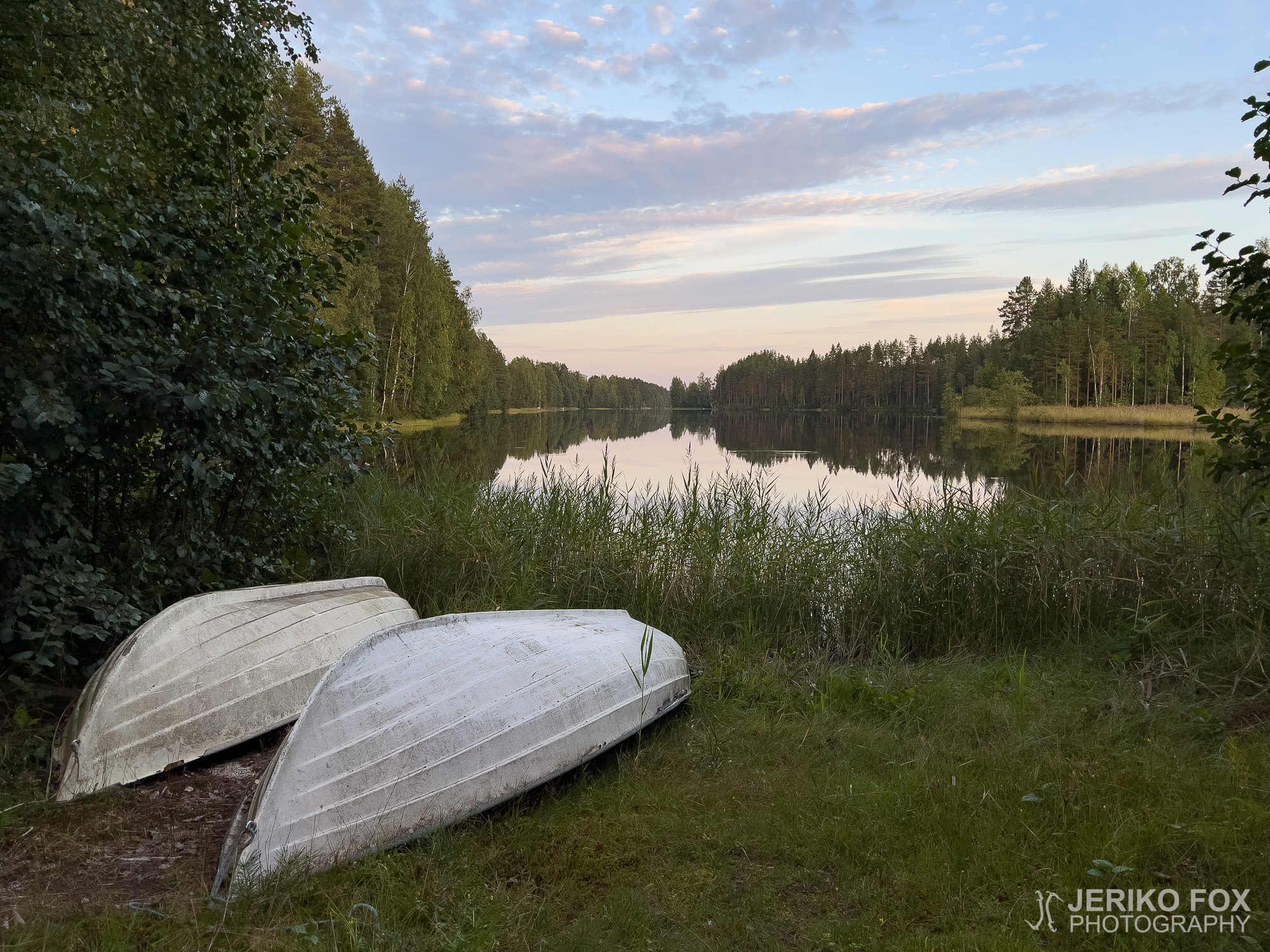
After these obstacles, the trail led to the very beautiful Katiskaniemi peninsula, which in theory could have been a place to pitch my tent, though I couldn’t find a flat enough spot. I kept going a little further and arrived at the Vironperä shelter, hoping there might be space nearby for camping. This hope proved true, and the shelter at the end of the bay turned out to be in quite a scenic location.
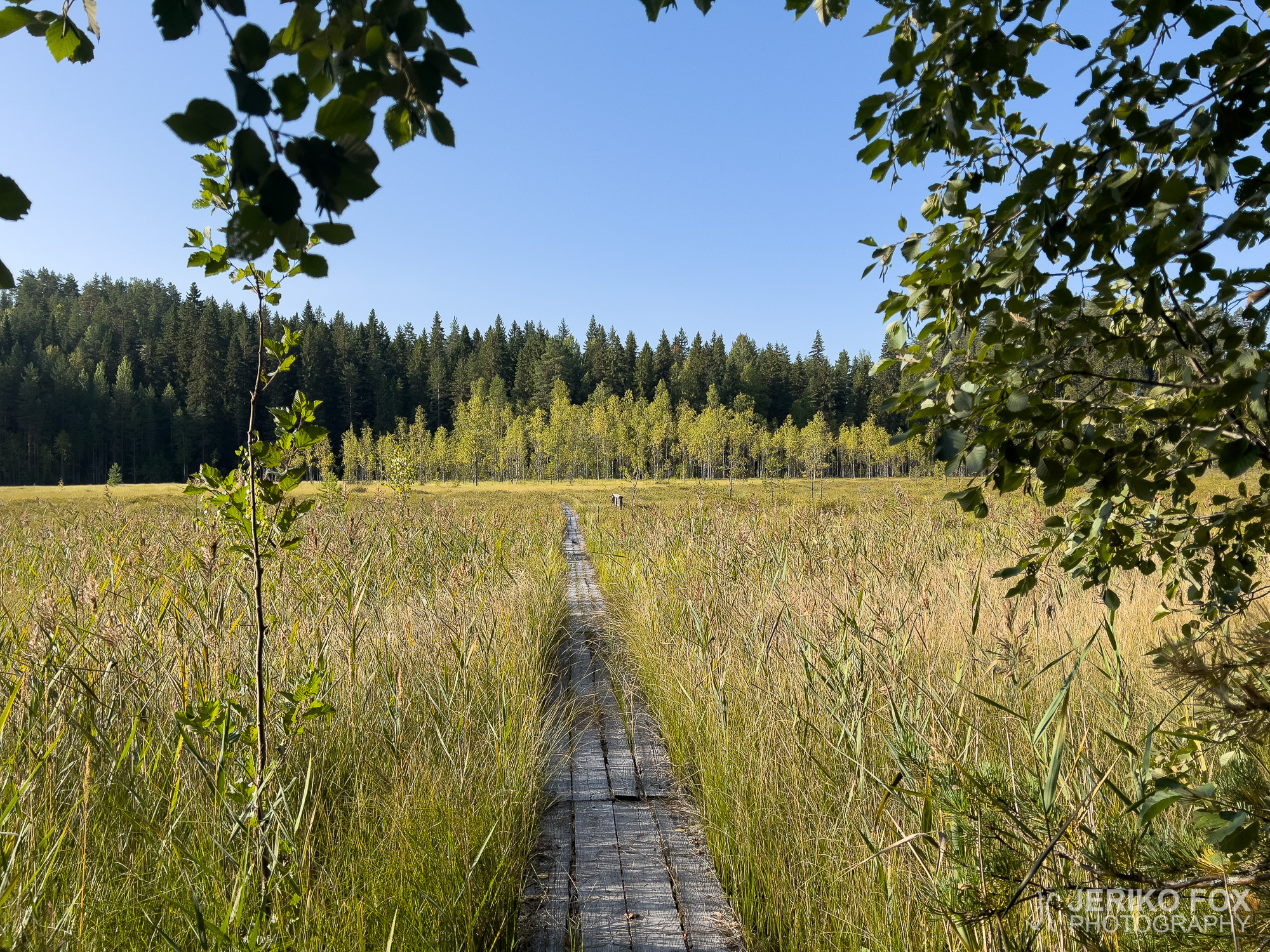
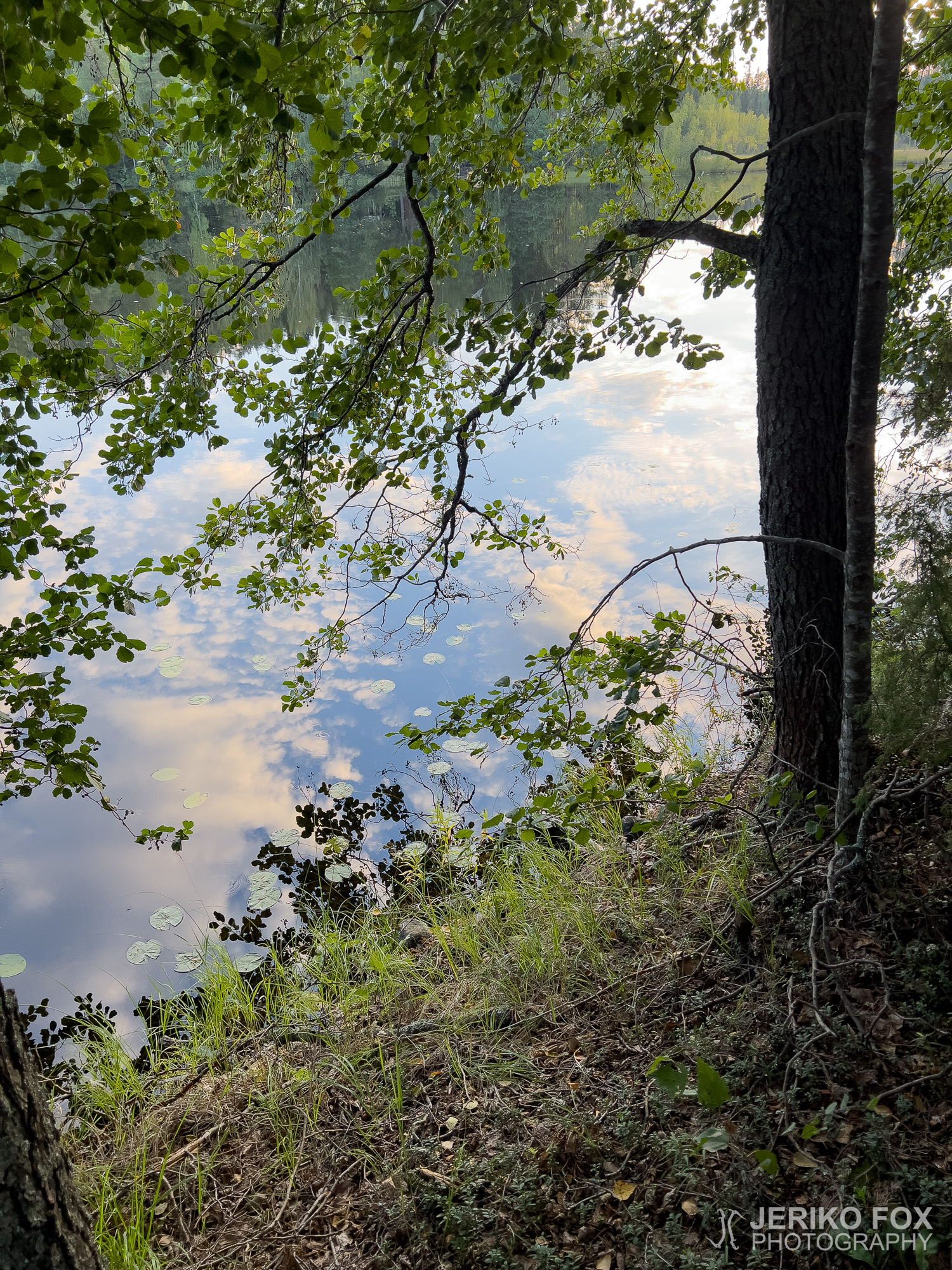
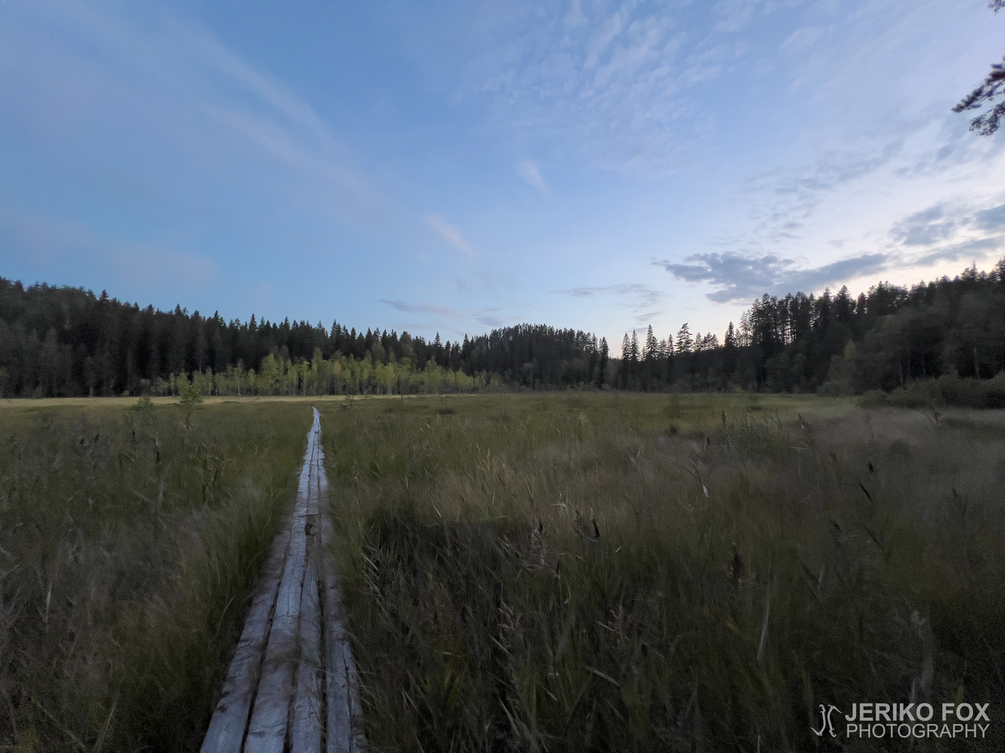
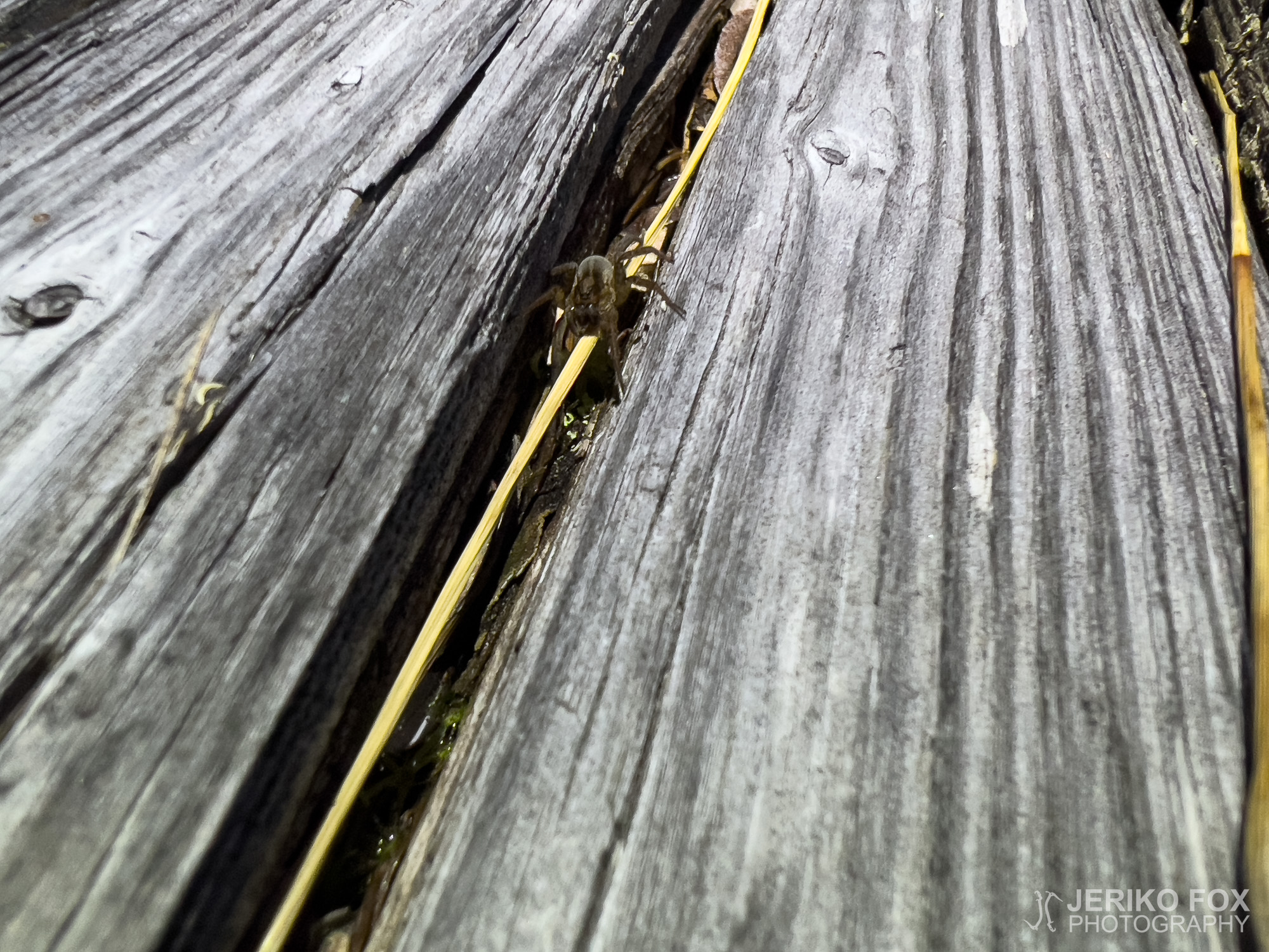
As dusk fell, I went to admire the boardwalk crossing Vuorensuo bog. In the beam of my headlamp, something glittered on the planks, so I went closer to see what it was. I’ve often seen animals’ eyes shining back in the dark when a light hits them, but you can imagine my surprise when this little spark turned out to be… an itsy-bitsy spider.
My night in the tent went fine overall, except that once darkness fully settled in, a strange racket began. It was clearly a machine of some sort, and in the quiet of the night the noise carried disturbingly well. I couldn’t figure out exactly what it was. Being in such a remote area, I was rather surprised by this noisy twist to the night.
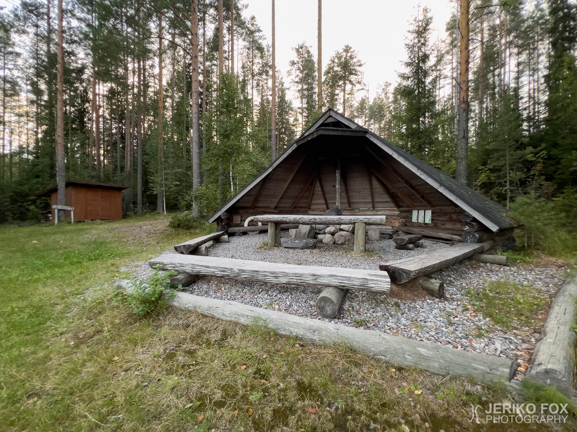
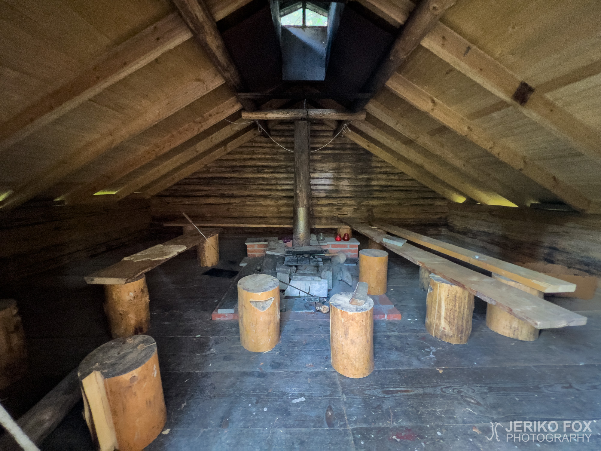
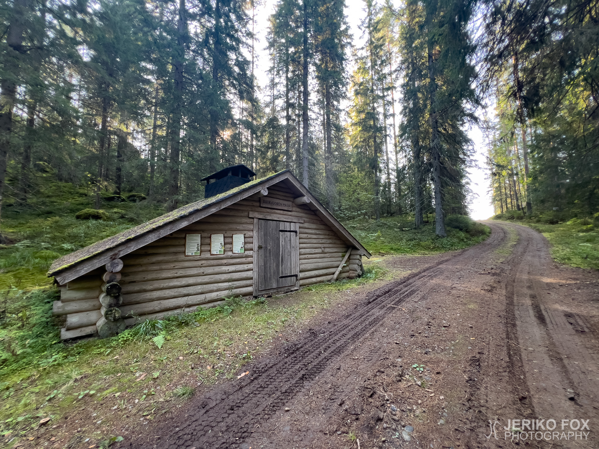
In the morning, the first leg was the Vuorensuo boardwalk itself, which brought me near Suurvuori (lit. Great Mountain) — both words, of course, shameless hyperbole. I had thought the Suurvuori shelter would be on top of the hill, but in reality it was just a rather uninviting little hut beside the slope.
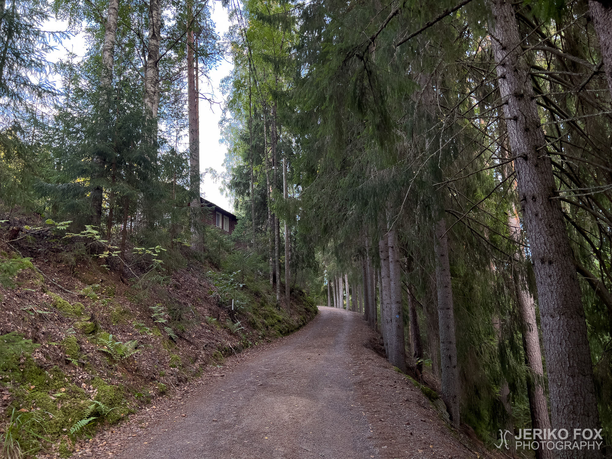
From the hut I followed a gravel road for a while back toward Oronmylly, and along the way I discovered the source of last night’s noise. Coming toward me was a fully loaded timber truck, which had apparently been collecting its haul under cover of darkness.
The final stretch of the trail followed a very beautiful esker ridge near Niskalampi before turning back toward the Oronmylly yard. A detail I found especially interesting: at this point the trail intersects with the European long-distance hiking trail E10, which runs along Finland’s eastern border before continuing south through northern Germany all the way to the Mediterranean coast in Nice.
The Aate-Pekka Trail is exceptionally diverse for being so short. It’s a pity that in terms of maintenance it has been left in such poor condition, especially considering that Oronmylly seems to have plenty of volunteer activity and active people around. But if you don’t mind a bit of post-apocalyptic atmosphere, the Aate-Pekka Trail is an excellent hike in Southeast Finland.
Edit: The Aate-Pekka Trail stairs and bridge were rebuilt in May 2025, so the route is once again in good condition! Also, the Friends of Oronmylly newsletter 2/2025 (pp. 8–9, in Finnish) includes more details about Aate-Pekka, in honor of the 100th anniversary of his birth.
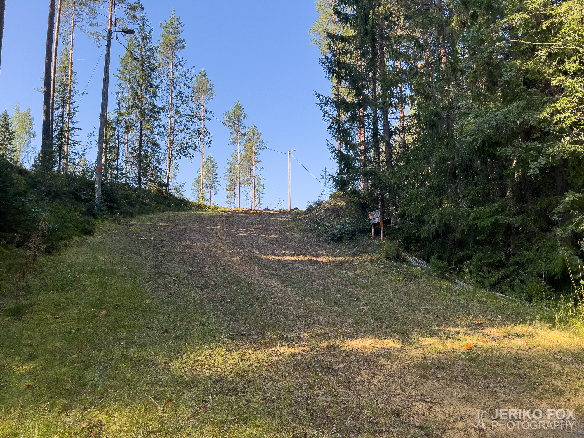
Vaellettuani Harjujen reitistön Parikkalassa suuntasin vielä syrjäisemmille alueille – Särkisalmen Oronmyllylle. Tämän kristillisen leirikeskuksen pihasta lähtee kaksikin vaellusreittiä, joten olin ajatellut kiertää ne samalla, kun tänne asti olin tullut. Oronmyllyn laaja piha-alue oli täysin autio, joten parkkeerasin autoni talojen taakse ajatellen, ettei se olisi siellä kenellekään häiriöksi.
Ilta oli jo laskeutumassa lähtiessäni kulkemaan noin 3,2 km pituista Aate-Pekan polkua. Kyseessä ei siis sinällään ole mikään yöpymistä edellyttävä retki, mutta olin itse valmistautunut nukkumaan teltassa, jotta voisin huomenna kiertää alueen toisenkin reitin, Kyynärpäänjoen polun.
Löysin hyvin vähän tietoa siitä kuka on Aate-Pekka, jonka mukaan polku on nimetty. Sen verran selvisi, että Aate-Pekka Anttonen oli maanviljelijä, joka aikanaan omisti Oronmyllyn ja lahjoitti sen Kansan Raamattuseuralle kristilliseen työhön. Mutta oliko hänen nimensä todella Aate-Pekka vai oliko kyseessä lempinimi, jäi epäselväksi.
Oronmyllyn piha-alueen jäätyä taakse reitti oli selkeästi merkitty, mutta hieman umpeen kasvanut. Olin lukenut, että polulla on huonokuntoinen silta ja lahonneet portaat, joten osasin varautua ettei kyseessä olisi varsinainen reittien ylläpidon helmi.
Tungettuani tiheän kuusikon läpi tulin Niskalammen ja Tarvaslammen yhdistävän joen tai kosteikon rantaan. Edessäni nousivat kuin keskiaikaisten balladien adynaton – mahdoton tehtävä – pahamaineisina silta, jota ei voi ylittää ja portaat, joita ei voi nousta. No, teoriassa ainakin.
Silta oli laho ja sen päälle oli kaatunut ohut puun runko, mutta katkenneiden lautojen yli saattoi helposti astua. Portaat olivatkin sitten vähän toinen juttu. Täysin katkenneita ja lahonneita askelmia oli paljon ja ehjätkin olivat vähintään kyseenalaisia. Minunkin kevyellä painollani piti askeleitaan katsoa tarkkaan. Portaisiin oli laitettu narut ja kieltomerkit esteeksi, mutta alapäässä tämä kokonaisuus roikkui maassa. Portaiden yläpäässä jouduin kiipeämään vielä narun yli.
Näiden esteiden jälkeen reitti suuntaa hyvin kauniiseen Katiskaniemeen, jossa periaatteessa voisi olla mahdollisuus telttailla, mutta tarpeeksi tasaista kohtaa ei löytynyt. Jatkoin matkaa hieman saapuakseni Vironperän laavulle, jonka lähettyvillä toivoin olevan tilaa teltan pystyttämiseen. Tämä toive kävikin toteen ja lahden pohjukassa sijaitseva laavu on varsin maisemallisella paikalla.
Hämärän laskeutuessa kävin ihailemassa Vuorensuon ylittäviä pitkospuita. Otsalamppuni valossa jokin kimalti pitkospuilla, joten menin katsomaan mitä siellä oli. Olen usein nähnyt eläinten silmien kiiltävän pimeässä, kun valo osuu niihin, mutta voitte kuvitella yllättykseni, kun tämä kimaltaja olikin pieni hämähäkki.
Yöni teltassa sujui muuten hyvin, mutta pimeän tultua alkoi kuulua ihmeellinen mekkala. Selvästi jonkin koneen aiheuttama ääni kantautui yön hiljaisuudessa hyvin häiritsevästi, mutta en ottanut selvää mistä oli kyse. Olin kuitenkin varsin syrjäisellä alueella, joten olin vähän yllättynyt tästä yön meluisesta käänteestä.
Aamulla ensimmäisenä oli edessä juurikin nuo Vuorensuon pitkospuut, jotka toivat minut lähelle Suurvuorta (molemmat sanat häpeilemätöntä hyberbolea). Olin ajatellut Suurvuoren kodan olevan tuon mäen päällä, mutta itseasiassa kyseessä oli ei aivan erityisen kutsuva matala tönö mäen vieressä.
Kodalta seurasin hetken soratietä takaisin Oronmyllylle päin ja samalla selvisi yöllisen metelin aiheuttaja. Vastaan tuli täydessä puulastissa oleva rekka, joka oli ilmeisesti käynyt keräämässä saaliinsa pimeän aikaan.
Reitin loppuosio seurasi todella kaunista harjua pitkin lähellä Niskalampea kääntyäkseen sitten takaisin Oronmyllyn pihaan. Minua kiinnostavana yksityiskohtana pitää mainita, että tässä kohtaa reitti risteää Euroopan kaukovaellusreitti E10:n kanssa, joka kulkee pitkin Suomen itärajaa jatkuakseen sitten Saksan pohjoisosista kohti etelää aina Välimeren rannalle Nizzaan asti.
Aate-Pekan polku on harvinaislaatuisen monipuolinen reitti ollakseen niin lyhyt. On harmillista, että se on jätetty kuitenkin ylläpidon osalta näin heikkoon kuntoon, ottaen huomioon että Oronmyllyllä on ymmärtääkseni paljon vapaaehtoistoimintaa ja aktiivista väkeä. Jos ei pelkää post-apokalyptista tunnelmaa, Aate-Pekan polku on erinomainen vaellusreitti Kaakkois-Suomessa.
Edit: Aate-Pekan polun portaat ja silta uusittiin toukokuussa 2025, joten nyt reitillä on jälleen hyvä kulkea! Lisäksi Oronmyllyn ystävien jäsenlehdessä 2/2025 (s. 8-9) kerrotaan tarkemmin Aate-Pekasta hänen syntymänsä 100-vuotisjuhlan kunniaksi.
Day 1
Max elevation: 109 m
Total time: 00:38:00
Day 2
Max elevation: 104 m
Total time: 00:33:27